The Narrows
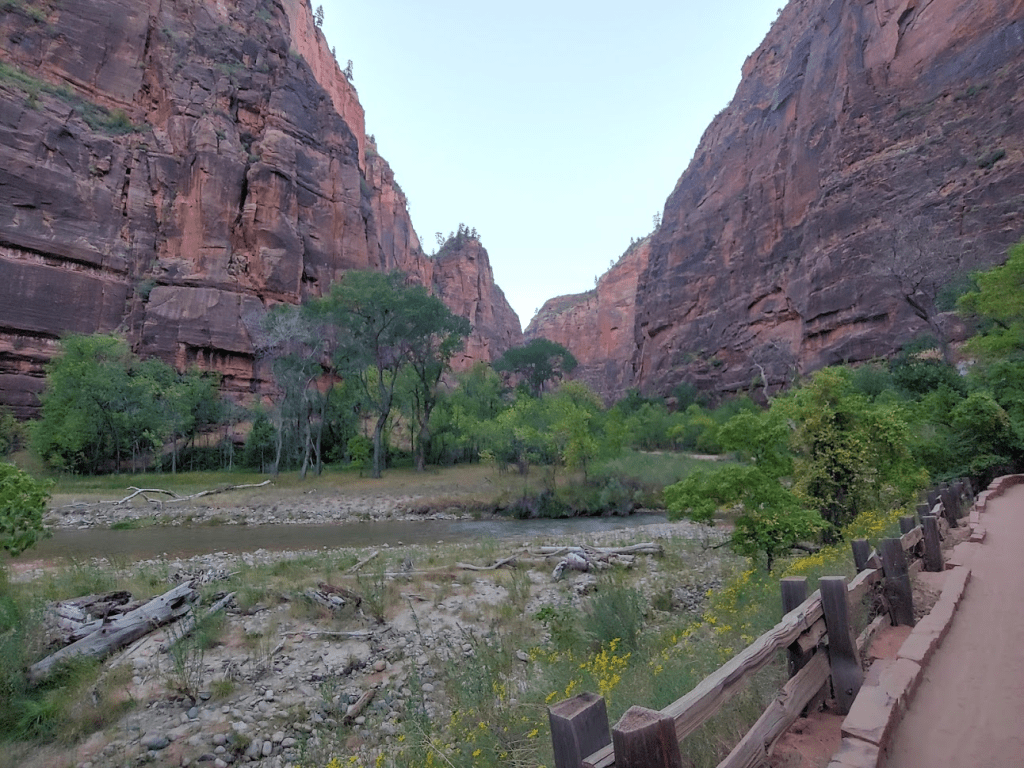
My plan for my first day in Zion was to hike The Narrows, which is one of the most iconic hikes in the American Southwest. The hike goes through the narrowest section of Zion Canyon, with walls on either side of the narrow gorge rising 1000 feet or more. The hike involves actually getting wet and hiking in the Virgin River. I had made a reservation for some rental gear a few weeks prior, so the night before I drove to Springdale to pick up waterproof boots and socks, dry pants, and a walking stick. It cost $57 to rent all of it for one day from Zion Adventure Company, one of the local outfitters. The gear all worked great, and $57 isn’t a bad price, so I would recommend. I woke up at 5:15am and drove to the Zion National Park visitor center where I waited to catch the shuttle bus up the canyon. No private vehicles are allowed within the canyon, so shuttle bus is the only way to reach the trailhead for the Narrows. I had to buy a $1 shuttle ticket from the National Park Service a few weeks prior to my trip. I’ve never been to Zion, so not sure what the system was before, but I think the whole $1 ticket thing is because of decreased capacity on the busses due to Covid. Anyway, I got on the first shuttle into the canyon at 7am. It was still very dark out, but gradually started to get lighter as the bus made its way up the canyon. I got off at the last shuttle stop – the Temple of Sinawawa and started my hike at 7:33am.
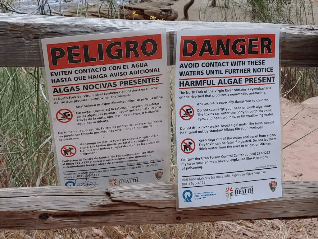
The trail follows a paved path alongside the Virgin River for the first mile or so. There were signs everywhere warning of harmful cyanobacteria in the water. I was aware of this ahead of time – from what I read online there’s no worry as long as you don’t drink the water or submerge your head. I also figured if there was really a serious risk the Park Service would just close off the trail.
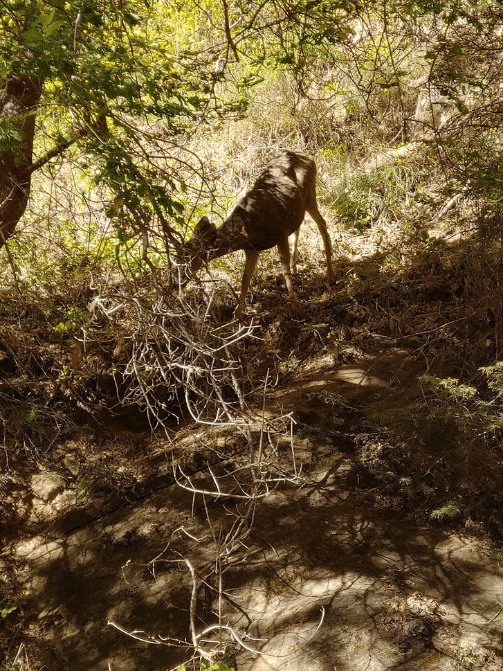
I saw some deer off to the side nibbling on some grass. They were so accustomed to human presence they didn’t even flinch when hikers were walking by.

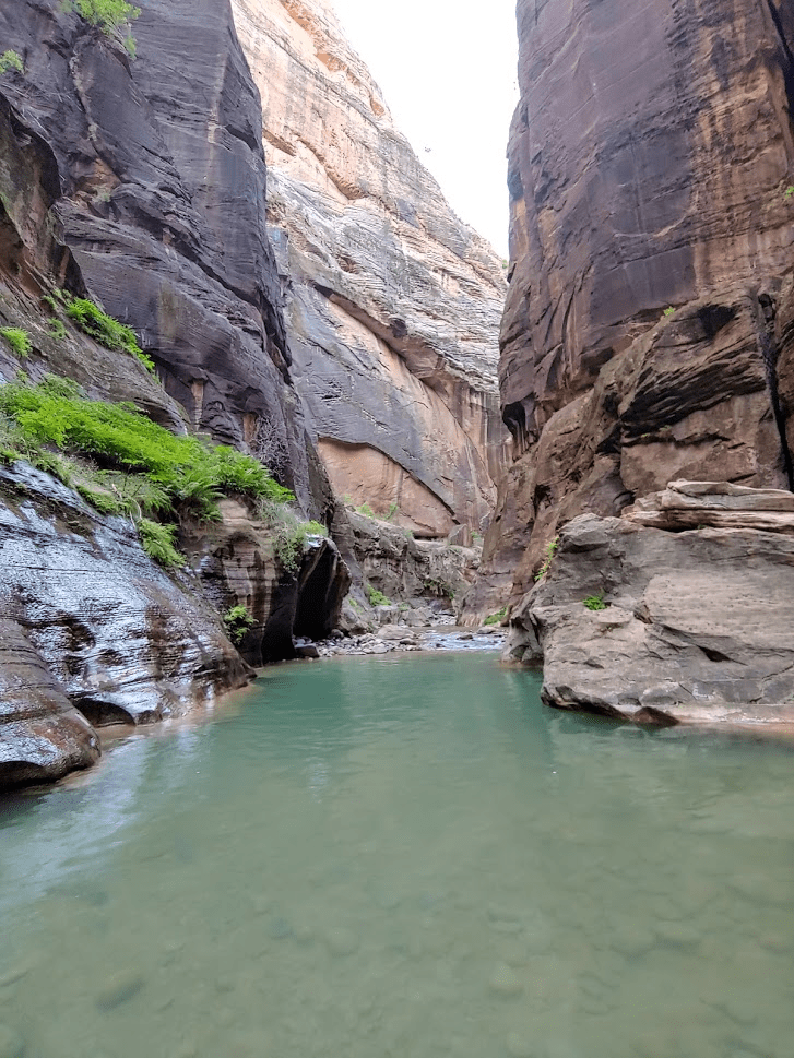
At 1.2 miles the trail ended, the walls narrowed, and I stepped into the river for the first time!
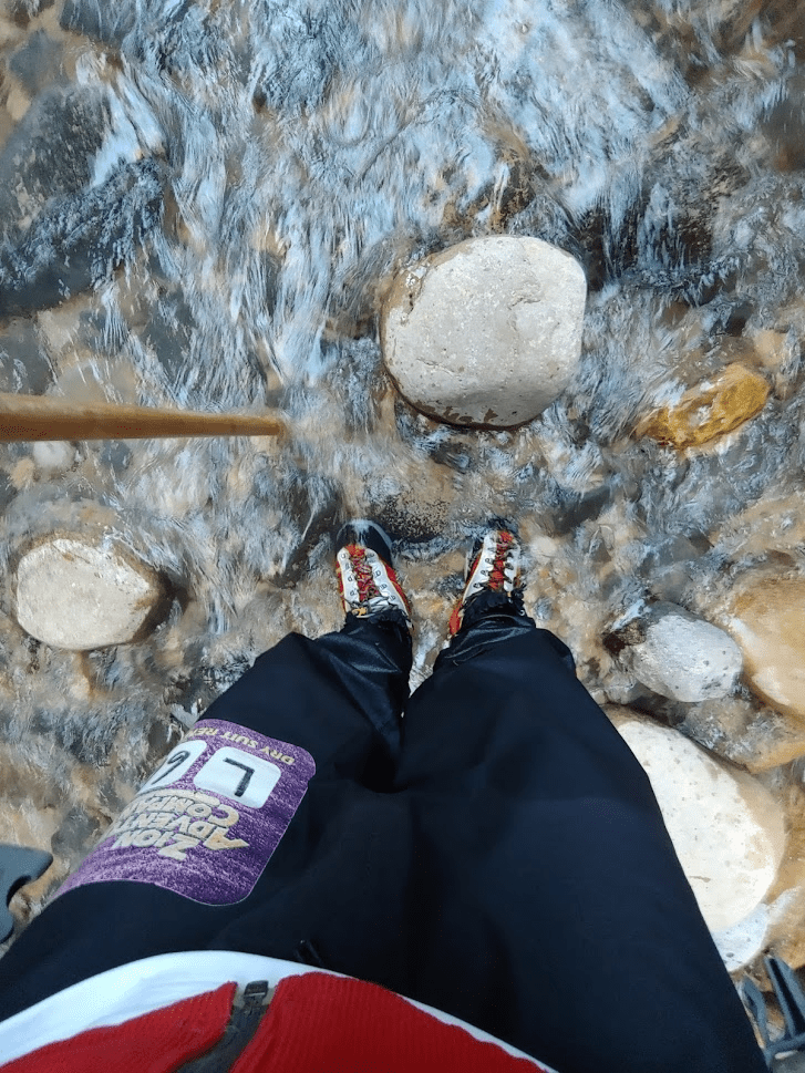
It was initially a bit weird hiking in the river. The water was only about ankle deep, so it was fairly easy to walk through once I got used to it, but it was much slower than walking on dry land.
The entire “Narrows” section of the Virgin River is about 16 miles long. Hikers can be dropped off upriver and hike the entire thing “Top-down” as either an overnight or long day trip. However, this requires a backcountry permit that the Park currently isn’t issuing due to Covid. The other option is to hike it “bottom-up” starting at the Temple of Sinawawa shuttle stop (this is what I was doing). Bottom-up hikers are limited to only the first 5 miles of the Narrows (4 miles from the end of the paved trail). I was hoping to hike all 5 miles of this route which ends at Big Spring for a total hike of 10 miles.
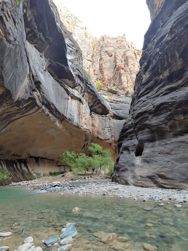
The route alternated between sections of rocks and sand on the edge of the gorge and hiking in the river itself.
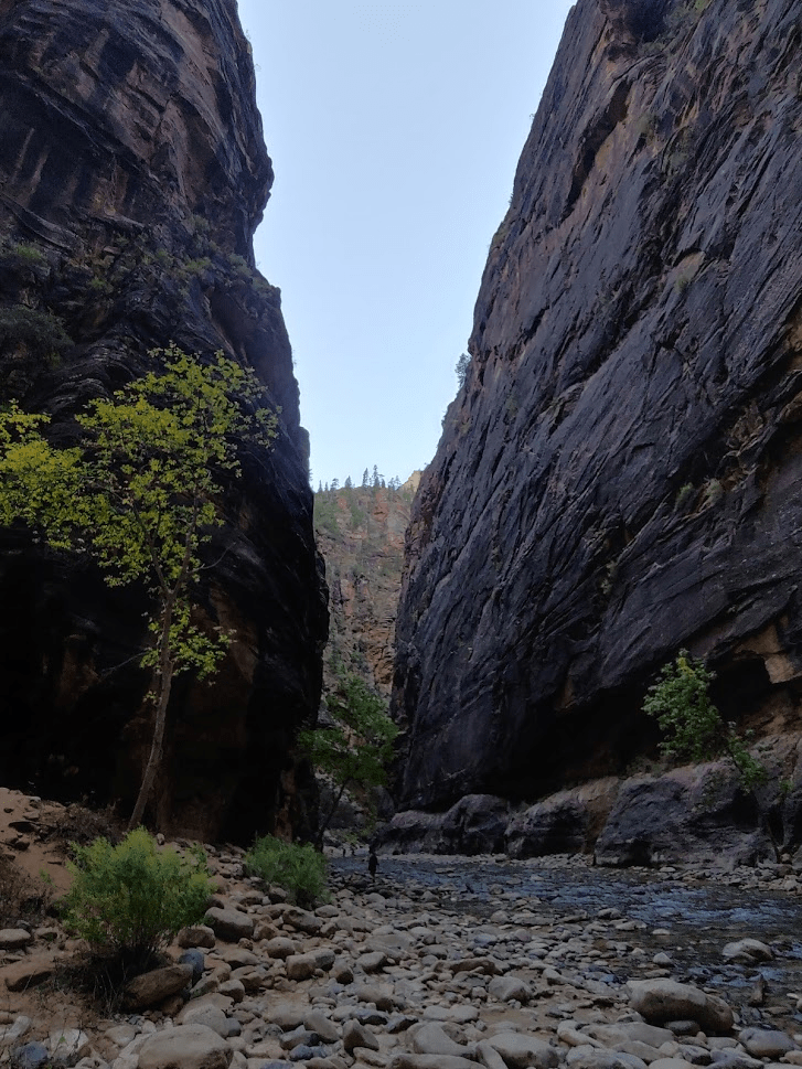
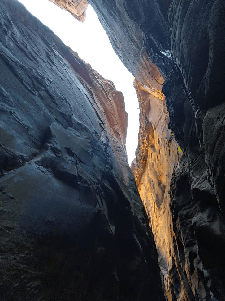
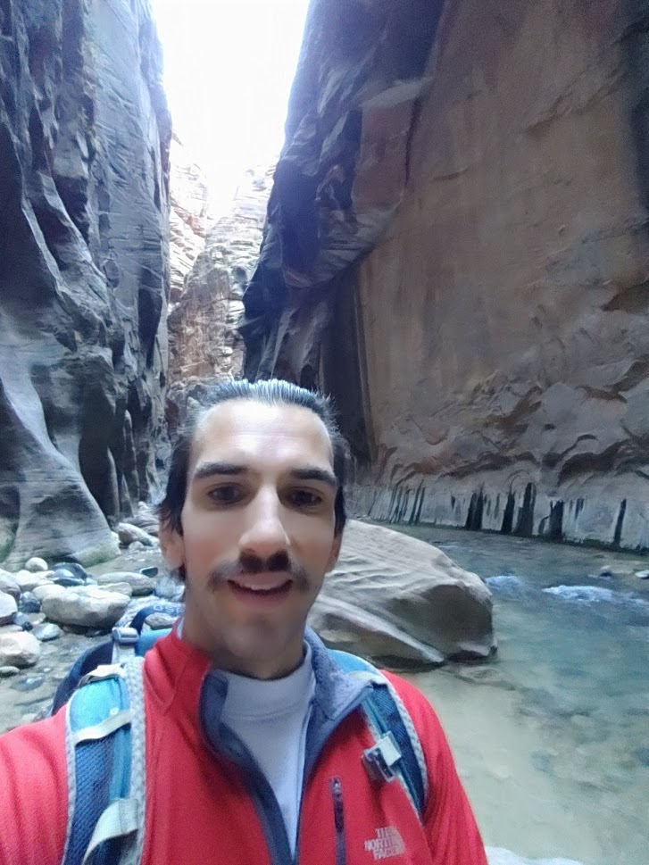
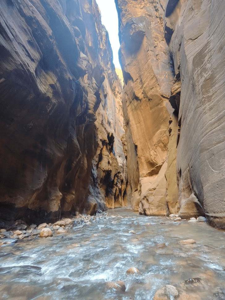
The hike had started out fairly crowded as I was initially surrounded by other hikers from the first few shuttle busses up the canyon. However, I was hiking faster than most so after a mile or two it was just me and few other small groups. After about 3 miles, I reached a fork in the canyon. The main canyon continues left (north), while Orderville Canyon went off to the right (east). Hikers sometimes also hike the length of Orderville Canyon top-down. It’s supposed to be darker and even narrower, so I hoped to explore it a bit on my way back. After passing Orderville Canyon, I entered Wall Street, which is the narrowest section of the hike where the walls are highest.
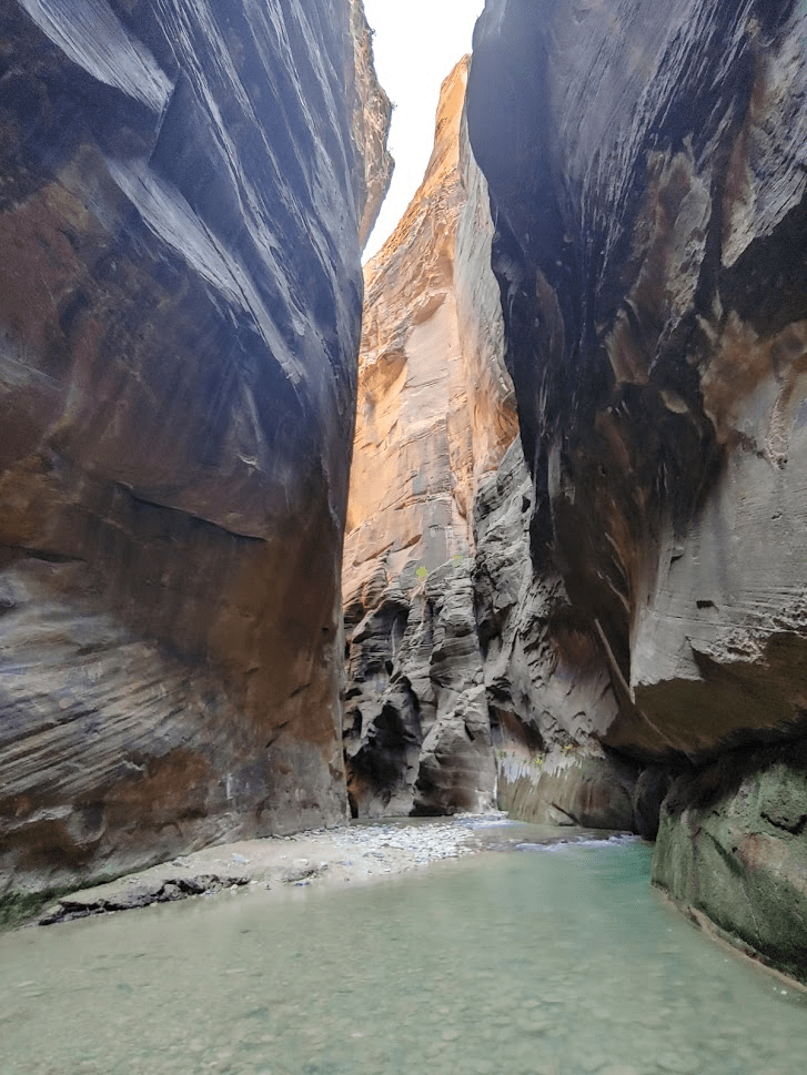
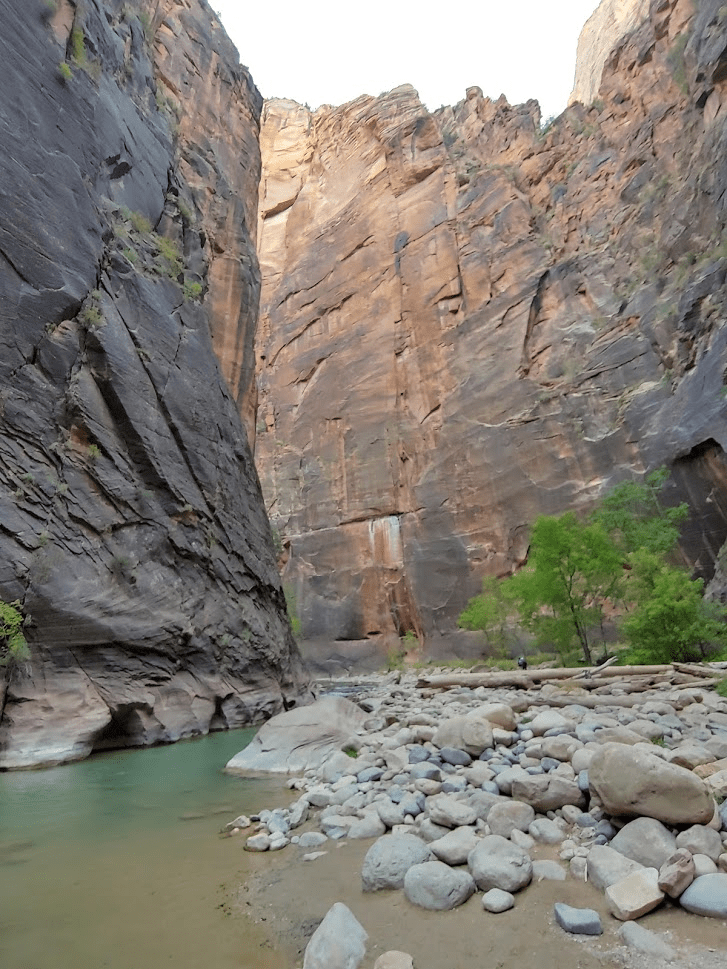
The high walls were really spectacular.
The hiking was getting more difficult at this point. The water was up to my waist at times. I really didn’t want to get more wet than that since I didn’t have a waterproof bag. It was also very cold as no sunlight was getting through. I was still dressed in layers. Unfortunately, the pictures don’t really do justice to how amazing the scenery was. My phone just couldn’t capture the size of the walls. The videos I took are a little better.

After maybe a mile since the junction with Orderville Canyon, Wall Street ended and the canyon opened up a bit more. My GPS wasn’t really working at all in the narrow canyon, so I wasn’t 100% sure how far I was.
At some point I reached a very deep section of the river. I actually took off my jacket and shirt and went in as far as I could go. I made it up to my chest until it became clear I would have to swim to go any further. Unfortunately, any swimming would get my backpack soaking wet and I just wasn’t prepared for that. I estimated I was about 4 miles from the trailhead so about 1 mile from Big Spring (the limit for day hikers). I made the decision to turn around and start heading back.
I didn’t take the greatest notes during this hike, but I think I turned around at about 10am, which means it had taken 2.5 hours to reach this point. I was very cold, and I knew I had a long way to go back. I passed some of the other hikers on my way back as they continued to make their way upriver. When I got to the junction with Orderville Canyon, I decided to explore it a bit before heading back. Orderville was pretty spectacular as well.
I hiked for maybe a half mile before turning around and heading back. I turned my GPS off around here. It was draining my battery so fast looking for a GPS signal that I was already down to about 30%. I couldn’t let my phone die since my shuttle ticket was on it and I needed to show the ticket to get back on the bus out of the canyon. I saw a small buck in a little wooded section on the side of the gorge. It was only a 4 pointer (possibly 6).
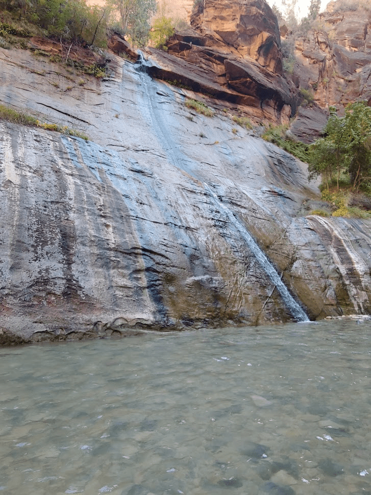
As I got closer to the trailhead, the river was starting to get extremely crowded. There were hundreds of other hikers in the river now. I was cold and wet, and annoyed by the crowds, so I was ready to be done. I was able to get a good picture of Mystery Falls on the way out.
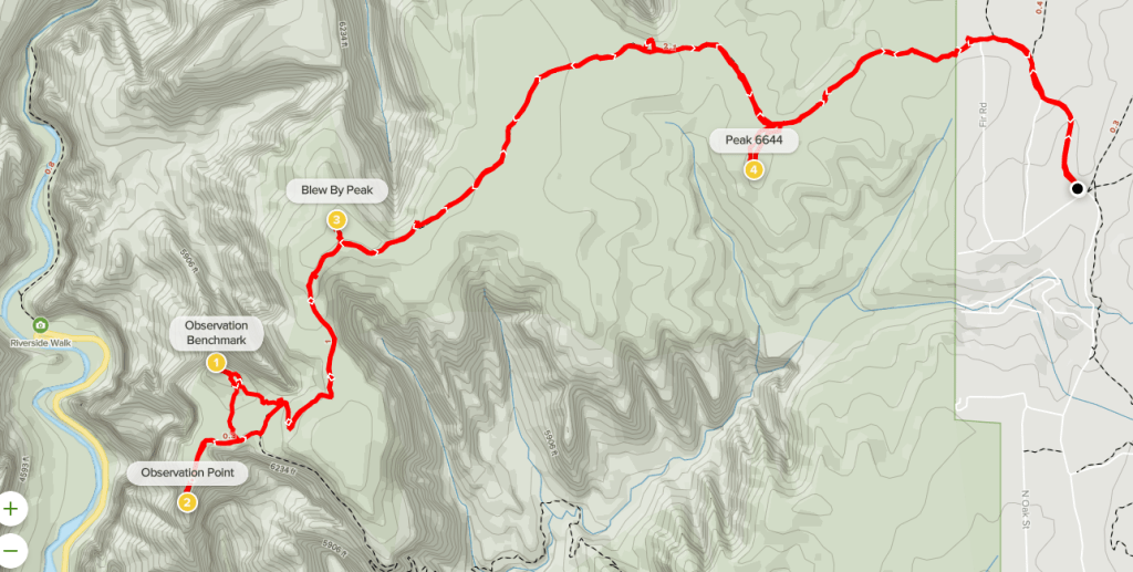
I reached the Temple of Sinawawa shuttle stop at 12:10pm. I think I hiked around 8 miles and was out for 4 hours and 40 minutes. I’ll post my GPS track below but it’s pretty useless. Keep in mind I turned it off with a couple miles to go. Also, the elevation gain it recorded is nonsense.

Observation Point
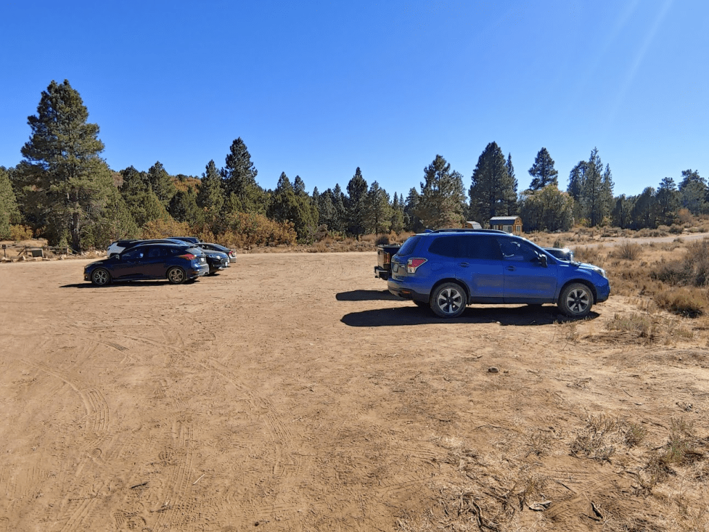
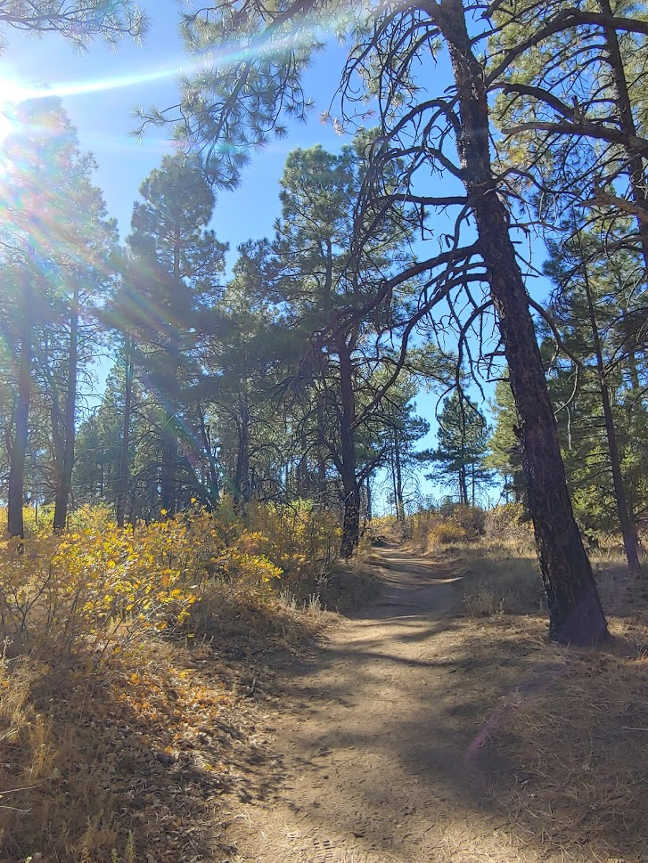
I got on the shuttle bus and rode it back to the visitor center. It felt so nice to change out of my wet clothes. I made the short drive to Springdale to return my river gear, and then headed for the East Mesa section of the park. My plan for the afternoon was to hike to Observation Point (6507 feet), which is one of the premier viewpoints of Zion Canyon. The most popular route to Observation Point starts in the canyon at the Weeping Rock shuttle stop and ascends over 2000 feet to the viewpoint. That would have been awesome, but unfortunately the trail from Weeping Rock was closed due to a rockslide in August. The other way to access Observation Point is from the East Mesa trailhead and involves a mostly flat hike through the forests on the eastern rim above the canyon. It took longer to drive there than I was hoping, as the traffic was pretty bad on State Route 9 through the park. The last half mile to the trailhead is on an okay dirt road, but I decided to park and start walking as I was really in the mood to hike on dry land. I began this hike at 3:04pm from 6501 feet.
I hiked up the road for a half mile until I reached the official trailhead.
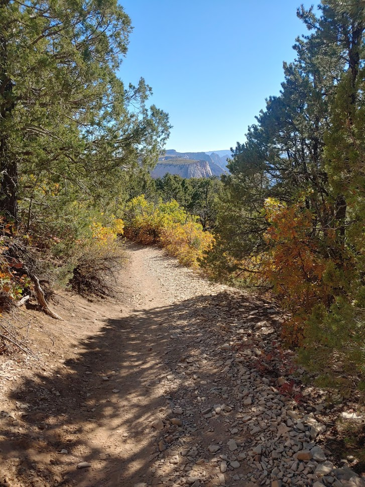
It was pretty warm out but not unbearable due to the elevation. The trail winded its way west through beautiful pine forest and chaparral.
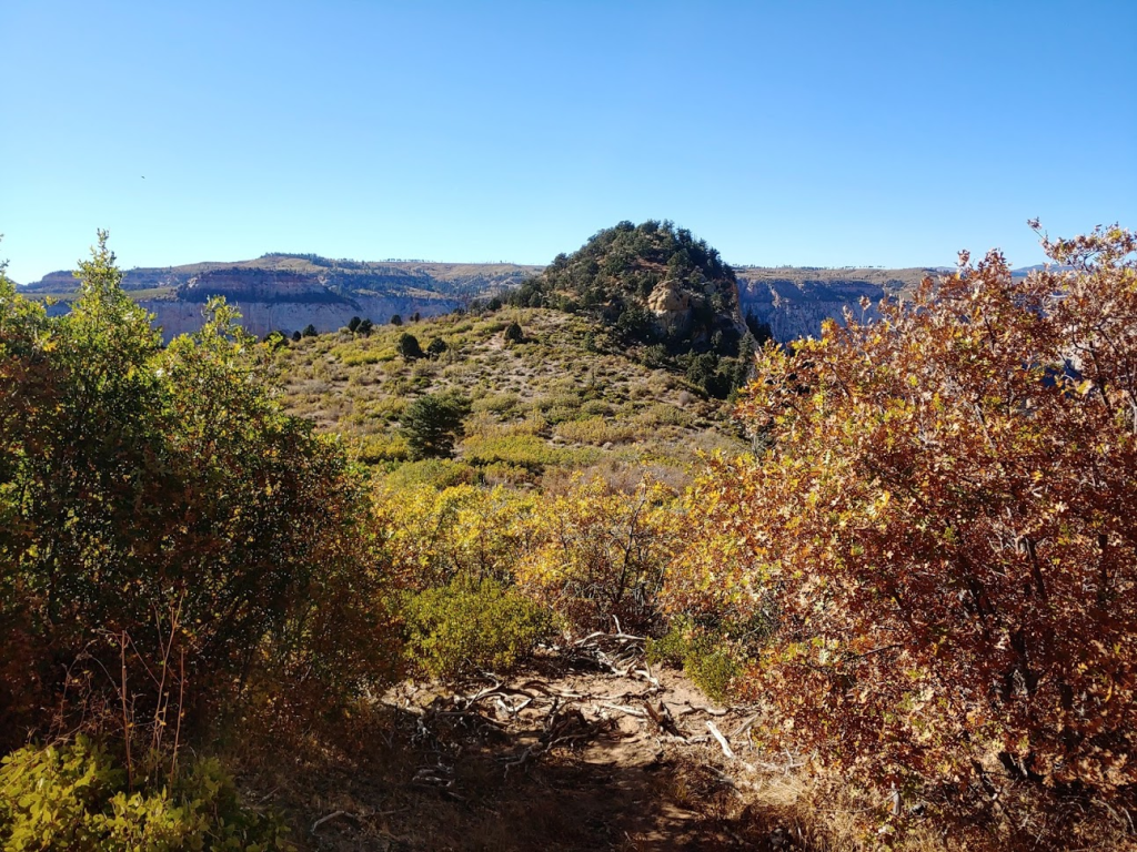
At 1.81 miles I went a short distance off trail to the north to check out a viewpoint. This is one of the side canyons in the park (not the main Zion Canyon).
The trail was easy as there were very few ups and downs. I stopped at 2 more nice viewpoints of side canyons to the north. The trail makes a final gradual descent as I got near Observation Point.
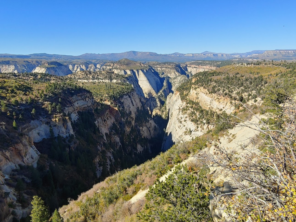
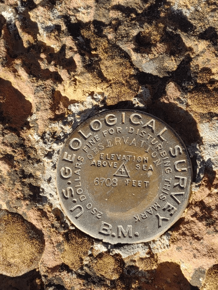
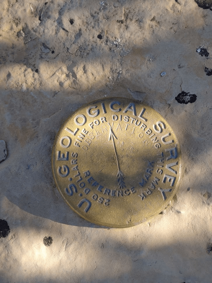
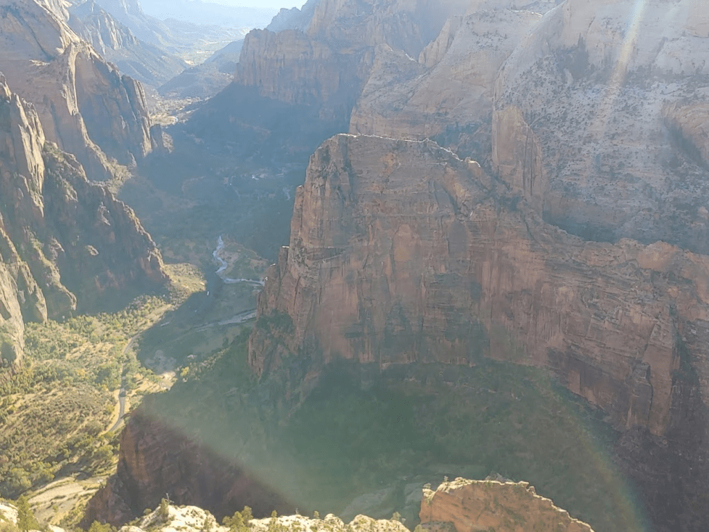
I decided to first climb nearby Observation Benchmark (6708 feet). The benchmark is on this little peak in the picture below. It required a short off-trail hike to reach. It’s at a higher elevation than Observation Point but the views are nowhere near as good.
I reached Observation Benchmark at 4:27pm at 4.08 miles. I found the benchmark and 1 reference marker.
The views were pretty good, but I was excited for Observation Point, so I didn’t stay long.
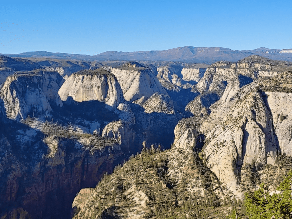
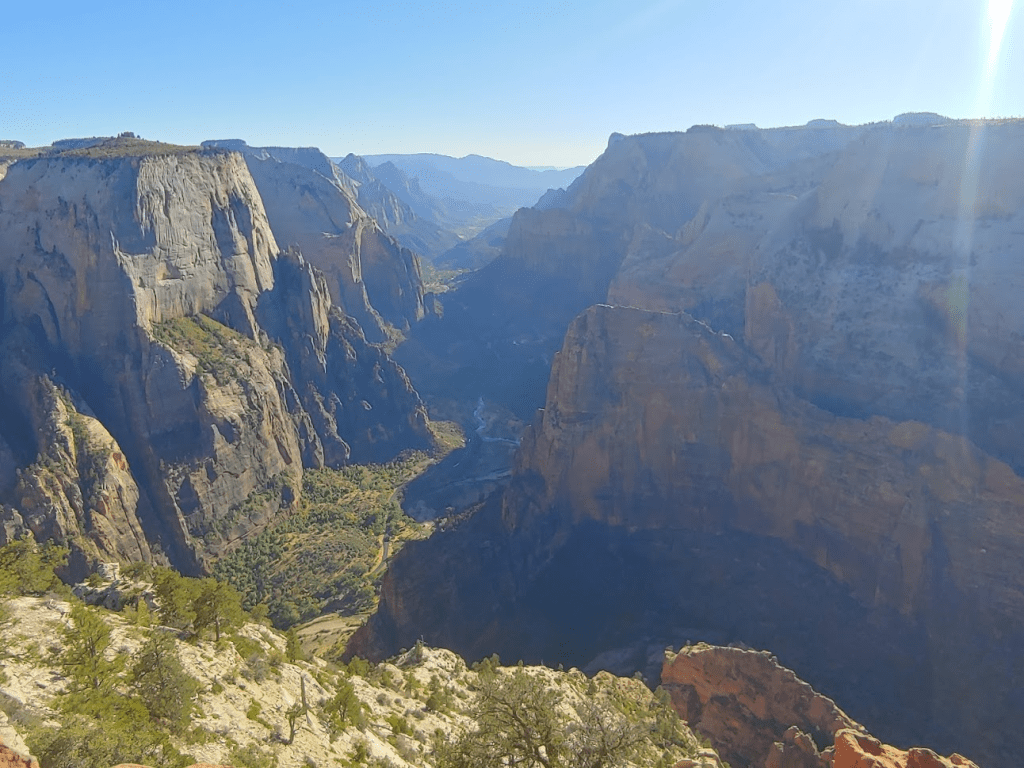
I hiked back down to the trail and continued towards Observation Point, which is the tip of land in the photo below.
I reached Observation Point at 4:54pm at 4.7 miles. All I can say is WOW.
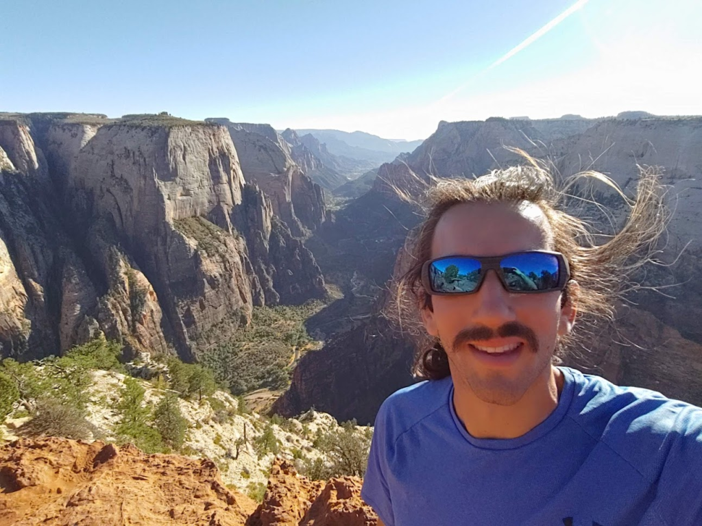
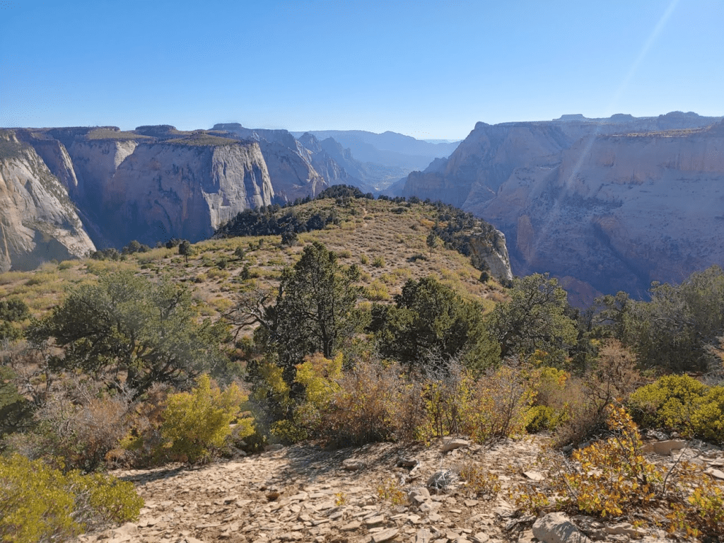
The view was spectacular. I could see all the way up to the mouth of the canyon. Down below, I could see the Virgin River, as well as the scenic drive with the shuttle busses going back and forth.
Angels Landing was directly below. I intended to climb Angels Landing the next day.
I had seen a few hikers on their way back on the hike so far, but I actually had the whole viewpoint to myself. I stayed a while to soak in the views and enjoy the solitude. On the way back, I climbed 2 more minor peaks just off the trail. I reached the car at 6:56pm. This hike totaled 9.67 miles, 1043 feet elevation gain, and 3:51:17 total time.

Rather than drive around looking for somewhere to park for the night, I decided the area was pretty quiet and high enough in elevation to stay cool during the night, so I decided to just sleep at the trailhead. I drove my car the final half mile to the real trailhead and had an excellent night of sleep.
To be continued…
