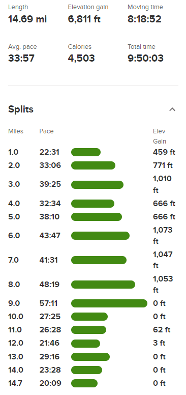
Voon Meng Leow Peak (10440 feet) is an unofficially named peak in the Inyo Mountains between Keynot Peak and New York Butte. I had been in the Lone Pine area the last two days climbing snowy Sierra peaks, but I would now turn my attention to the desert for the remainder of my trip. The Inyo Mountains rise 6000+ feet above the desert floor in this part of the Owens Valley, so all of the peaks are very strenuous hikes. I had climbed Keynot Peak, Mount Inyo, and New York Butte the previous February, but Voon Meng Leow Peak had evaded me. I had driven in the night before, so I was ready for an early start. From Highway 395, I went east on Lone Pine Narrow Gauge Road for a few miles, then north on Owenyo Lone Pine Road for a mile or 2. I then went northeast on a faint dirt track for about a half mile and then parked. This last road was pretty washed out and was deteriorating the further I drove. I began hiking at 6:08am from 3738 feet above sea level. It was a chilly 33 degrees in the early morning.
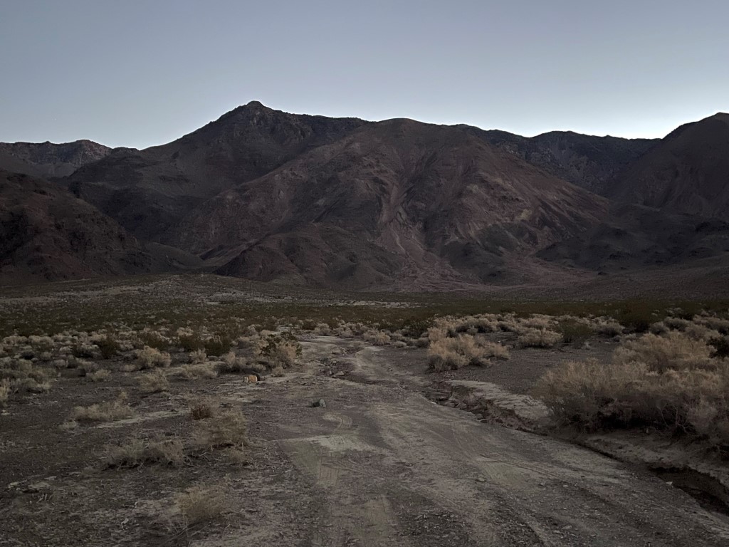
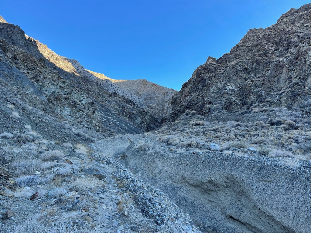
I hiked northeast up the road and encountered a severe washout very soon after I started hiking. Not long after that, the road disappeared altogether and then reappeared a bit further up. I had noted on the topo map that there were 2 parallel roads that led east towards French Spring. I had taken the southern road, so it’s possible the northern road would have been better (if it even exists). The road ended at 1.2 miles at a major washout. I dropped into the deep rut formed by the washout, climbed out the other side, and continued hiking up the canyon.
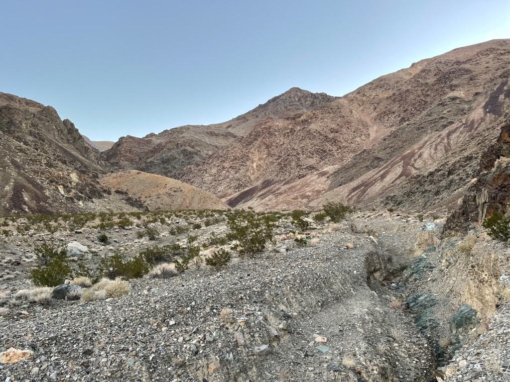
I was looking for an old miners trail which would lead me all the way up to Forgotten Pass just north of the peak. I wasn’t sure of the quality of the trail, but I knew others had taken it somewhat recently. I was having difficulty finding where it began, so at 1.9 miles I just started climbing north out of the canyon, knowing I would bump into it eventually. I did indeed find the trail switchbacking its way up the rocky slope not far above.

The trail made numerous switchbacks as it climbed north out of the canyon. Eventually it turned northeast up a broad slope.

The trail then made a minor descent back into the canyon.

I reached the canyon again at 4.2 miles at 6585 feet. I followed the trail as it stayed to the left of the deep rut in the middle.
The canyon soon forked, and I stayed on the trail following the right fork. The trail began to deteriorate and then disappeared altogether. I struggled to maintain my fast pace as I bushwacked along the left side of the canyon and then eventually dropped into the bottom of it. On the descent I figured out that the trail had actually crossed to the right side of the canyon much further back. I found some ice in the bottom of the canyon, which must have been frozen runoff from melting snow on the slopes above.

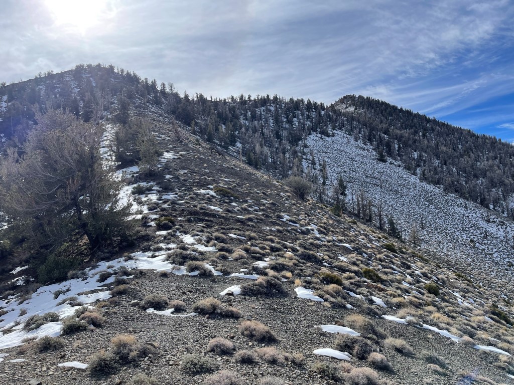
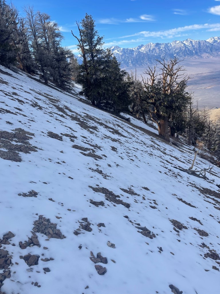
Eventually I found the trail on the right side of the canyon and continued the steep climb. I saw the first patches of snow around 7700 feet.

The canyon split again, and the trail took the right fork once more. As I went higher, the trail eventually climbed out of the canyon and made switchbacks up the steep slopes above.

My legs were feeling tired from all the elevation gain as I neared Forgotten Pass.

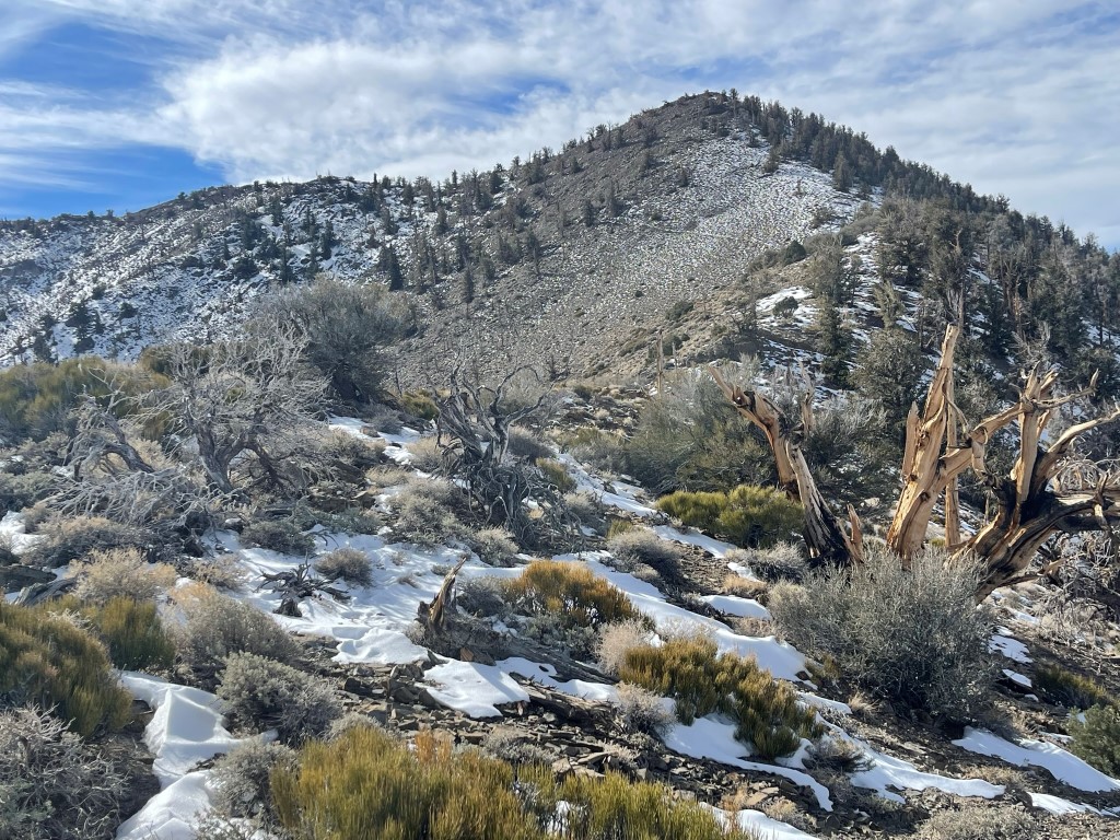
I reached Forgotten Pass at 7.2 miles at 9572 feet. Forgotten Pass is the low point along the Inyo Crest between Keynot Peak and Voon Meng Leow Peak. I turned south to climb the ridge for the final 900 feet to the summit. The north facing aspects were covered in a thin layer of snow.
I followed the ridge south and then southwest. I was surprised to see some fresh footprints in the snow on such an obscure peak.
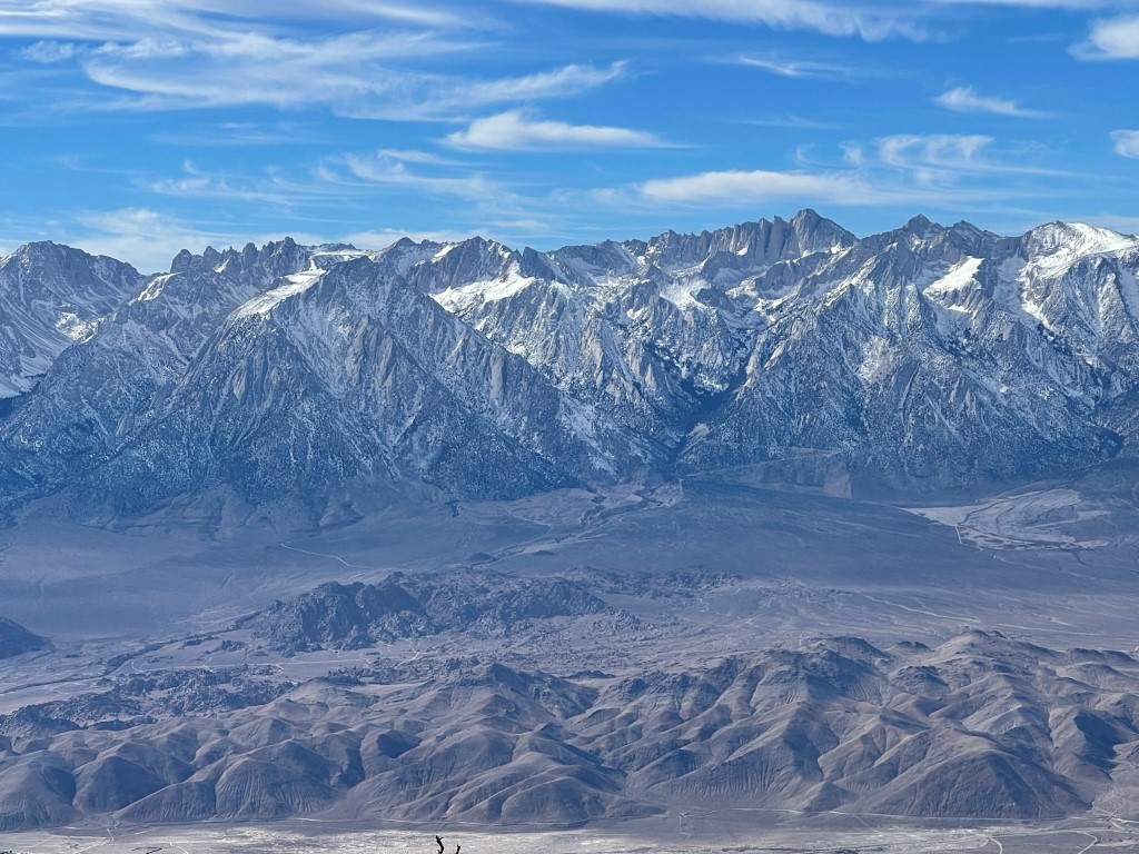
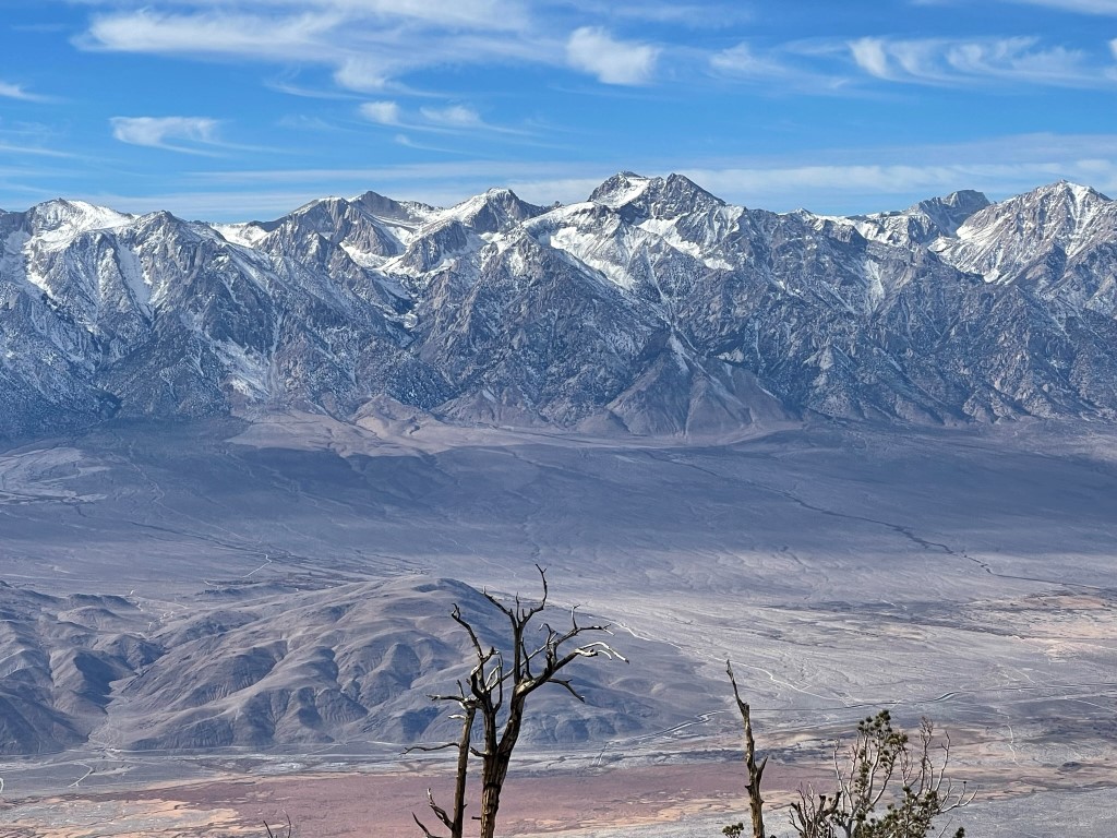
I reached the summit at 11:36am at 7.8 miles! I signed the register which had been placed in 1980. The most recent entry was from the previous day (which explained the footprints). The view of the Sierra was absolutely stunning. Mount Langley, Mount LeConte, Mount Mallory, Mount Whitney, and Mount Russell:
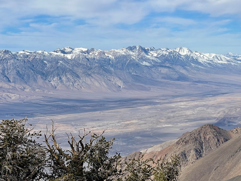
Mount Barnard, Trojan Peak, Mount Williamson, Junction Peak, and Mount Keith:
Mount Pinchot, Split Mountain, and Birch Mountain:
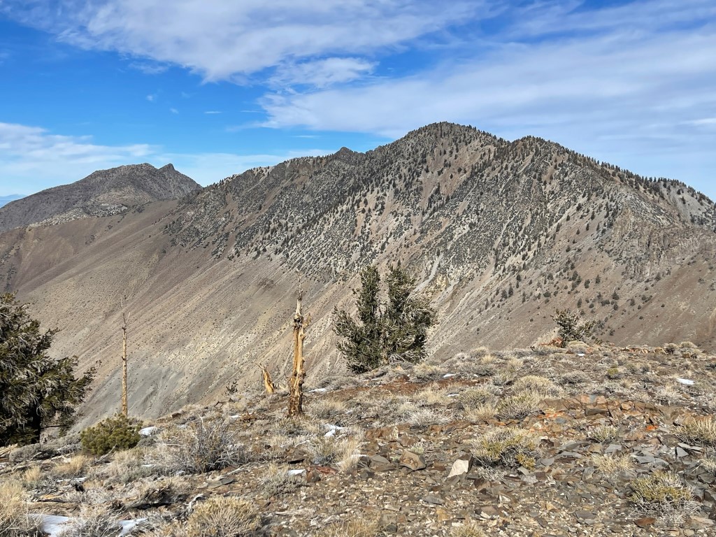
Mount Inyo and Keynot Peak along the Inyo Crest to the north:
I began descending after a nice break. Rather than take the ridge back to Forgotten Pass, I decided to descend directly down the northern slopes back into the canyon.

It was very steep, and the snow made it slippery. The slope was also composed of large scree which you can’t really scree surf down.
I reached the trail at 8.7 miles. From there, it was a long descent back to the car. As mentioned previously, I was able to follow the trail on the correct side of the canyon which prevented any unnecessary bushwacking on the descent. I reached the car at 3:58pm. Stats for this hike were 14.69 miles, 6811 feet elevation gain, and 9:50:03 total time.