Pleasant Point and Cerro Gordo Peak
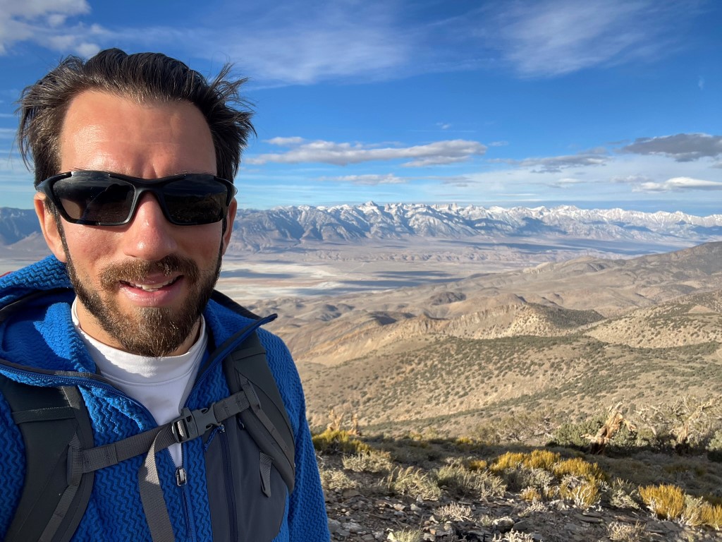
Pleasant Point (9690 feet) and Cerro Gordo Peak (9188 feet) are 2 peaks in the southern part of the Inyo Mountains. They are both found in Andy Zdon’s book and Pleasant Point is a DPS peak. They are most often climbed from Cerro Gordo ghost town, which is an old mining town found in the Inyo Mountains. From Highway 136 in Keeler, I took well graded Cerro Gordo Road up to the town site. This road is in excellent condition and should be drivable for most cars. I drove through the town and parked at a saddle on the Inyo crest. I began hiking at 6:06am from 8181 feet above sea level. It was 39 degrees as I got started.
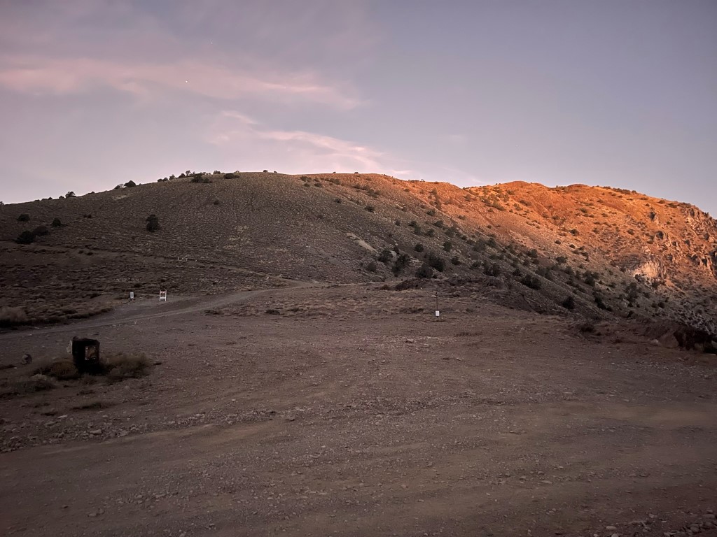
The ghost town is a popular tourist attraction and there is a volunteer caretaker who lives up there and gives tours. There were signs that said all visitors must check in with the caretaker, but I figured it was too early for anyone to be awake. I was a bit concerned about hiking on their land without permission, but I set off anyway. I hiked up the dirt road to the north with a good view of the town below.
I encountered a locked gate with a no trespassing sign on the road. I had expected this, so I dropped down to a parallel road below. This is the infamous Swansea Salt Tram Road. I passed an open mine shaft on the right.

I passed a sign indicated I was now on public land. I hiked north on the road and then made a right turn at 1.2 miles.

The road then turned into a single track trail. At 2 miles I left the trail and climbed directly north up the slope to the Inyo Crest.

I climbed up 700 feet and reached the Inyo Crest at 2.3 miles / 9021 feet. I hiked directly north along the crest and climbed 2 “pinnacles” along the way. The southern pinnacle was 9615 feet and the northern pinnacle was 9600 feet.
They were both simple class 2 climbs.
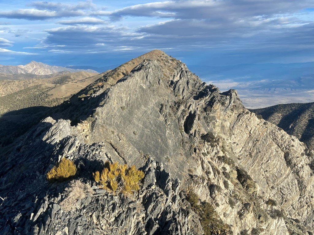
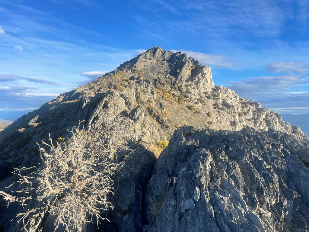
I continued north after the 2nd pinnacle and climbed down some optional class 3 (possibly class 4) rock to regain the gentle terrain just left of the crest. From there, it was an easy hike to the summit on a use trail that faded in and out.

I reached the summit at 8:09am at 3.3 miles
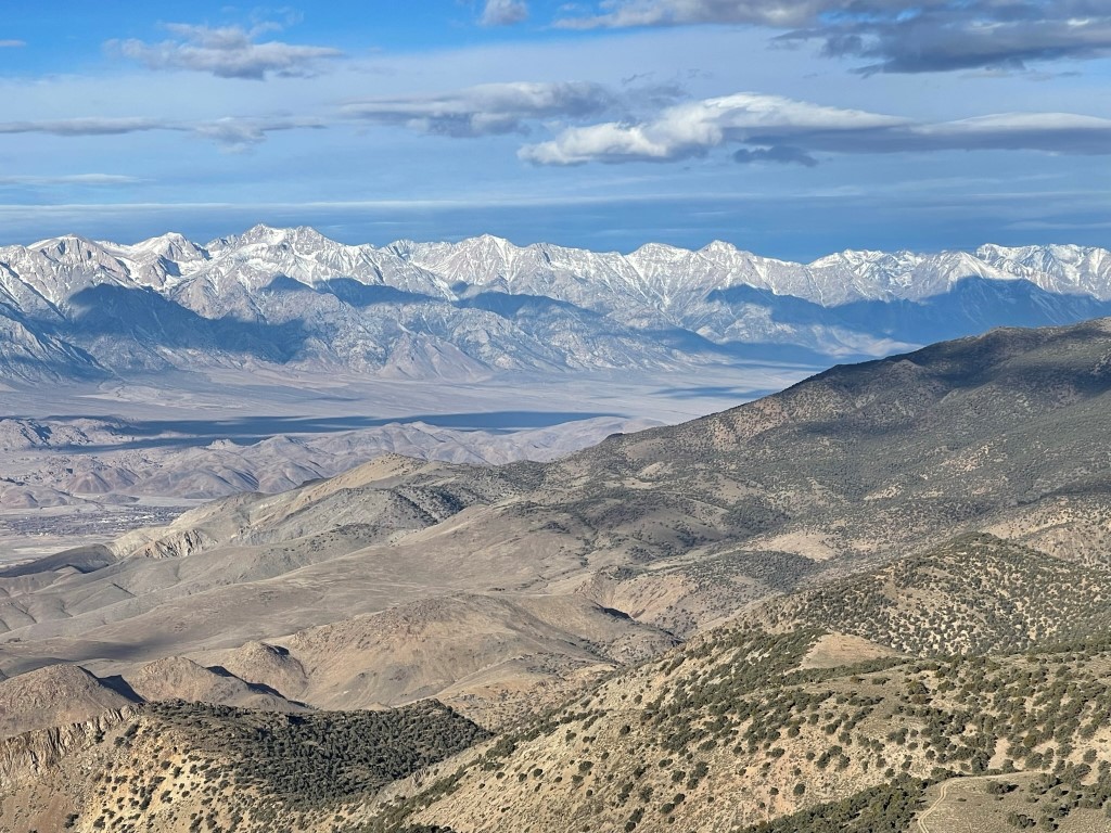
I signed the register which dated all the way back to 1974. The most recent entry was from November 11. It was quite dark to the north in the direction of New York Butte and Keynot Peak:

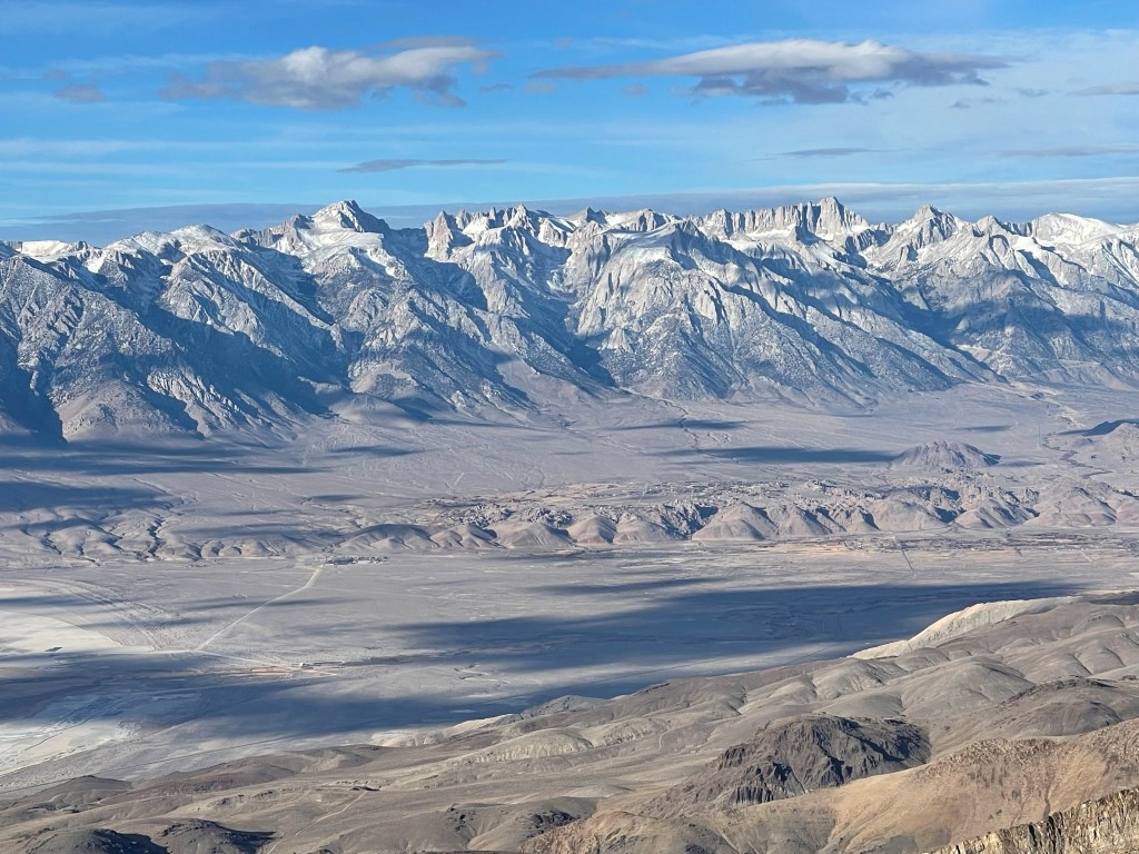
Trojan Peak, Mount Williamson, Mount Keith, Mount Bradley, and University Peak:
Mount Langley, Mount LeConte, Mount Mallory, Mount Whitney, and Mount Russell:
I took a nice break and then made my way back to the south.

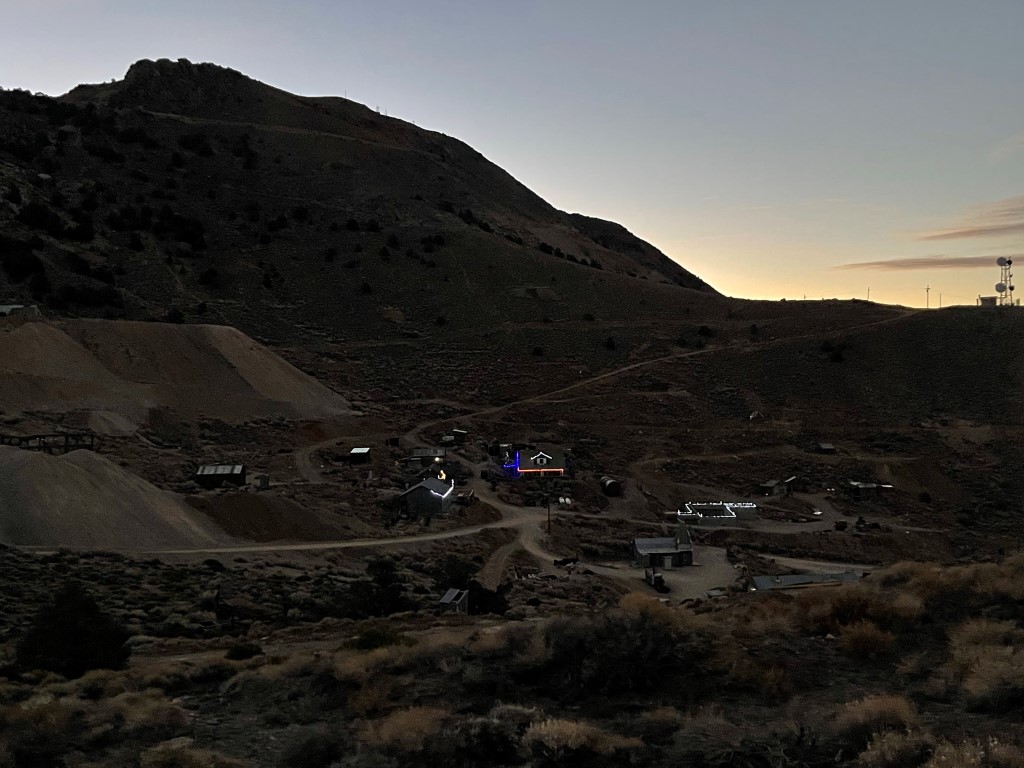
I continued south past the point where I had initially climbed up to the crest in the hopes of climbing 2 additional minor peaks. I reached Point 9054 (which was really just a tiny bump along the crest) at 4.7 miles. I then climbed up Peak 9220 and reached it at 5.1 miles. Peak 9220 has radio towers and was a steep scramble from the north side. I knew this peak was on the private property owned by Cerro Gordo, so I did not hang out on the summit very long. I then hiked down the northwest side and descended all the way back to the Salt Tram Road, which is on public land. I had an excellent view of Cerro Gordo Peak as I neared the town again.
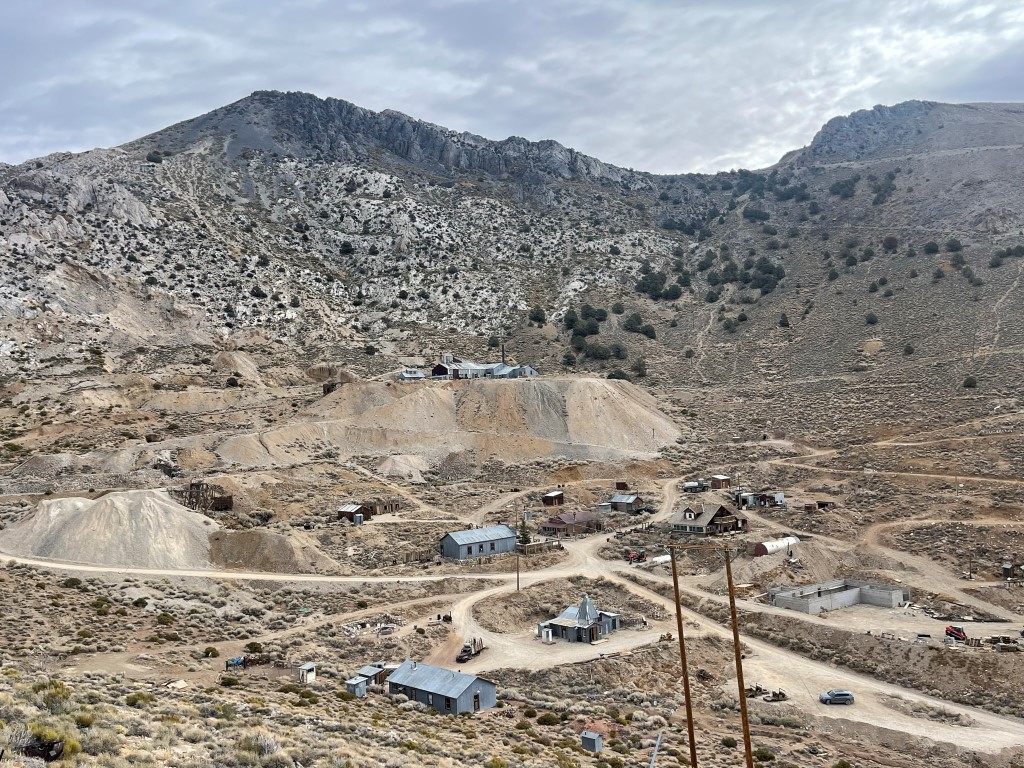
I reached the town at 7.2 miles and noted a few tourists walking around. I entered the town and met the caretaker who was the nicest guy I ever met. I told him I intended to climb Cerro Gordo Peak which got him very excited. He suggested I scramble directly up the peak rather than take the boring dirt road which heads up behind the town. This sounded like a great idea to me, so I began scrambling up the rocky slope above the eastern side of the town.

It was a steep 1000 foot scramble from the town. I passed a false summit and continued a short distance to the real summit.

I reached the summit at 10:54am at 7.8 miles! I signed the register which had been placed in 2017. The most recent entry was from November 16. I located a benchmark.

Pleasant Point to the north, with New York Butte and Keynot Peak in the distance:

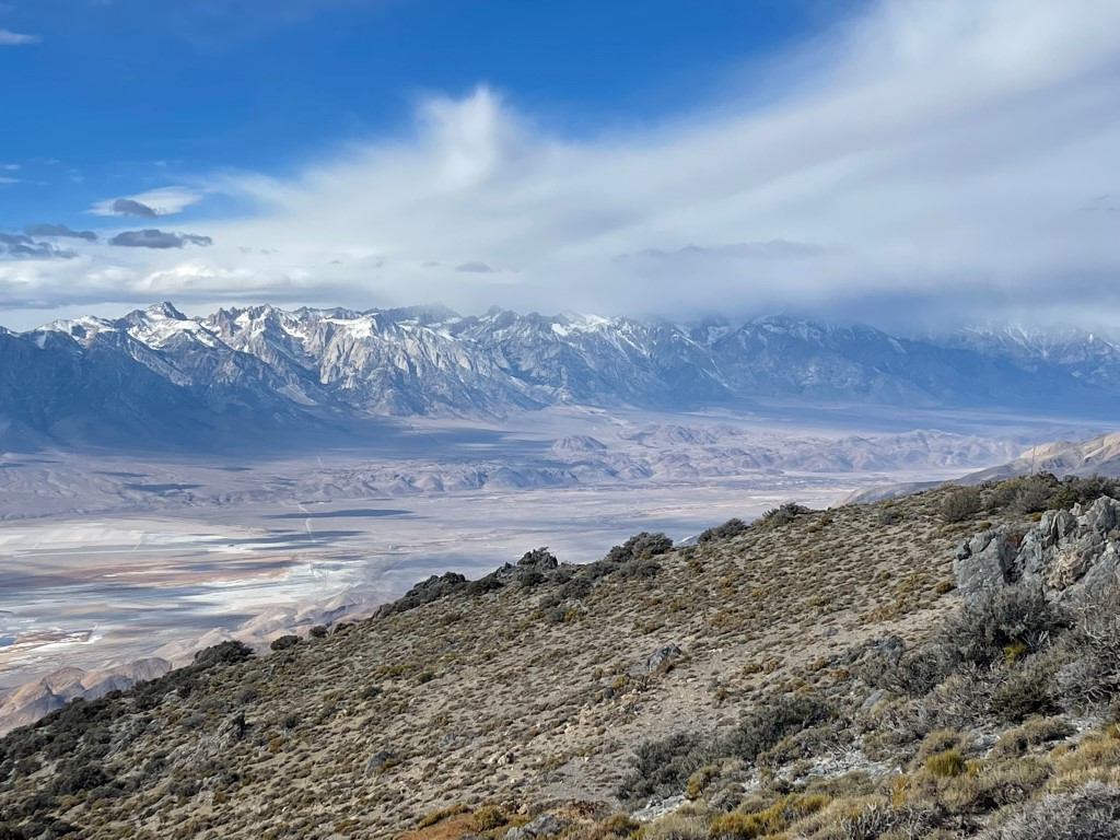
A cloud layer had moved in over the Sierra:
I then climbed Buena Vista Peak (9120 feet) real quick before descending. Buena Vista Peak contains radio towers and was a short 300 feet scramble from the saddle between the peaks.

I then descended directly down the steep slope from Buena Vista Peak. I noticed some llamas or alpacas in a pen as I entered the town again. I was entertained for a few minutes by the 2 black ones playing with each other.

I spoke to the caretaker again before I left. He was very excited to hear about how my hike went. The town was getting super busy now with tourists, so I was glad to get out of there. I reached the car at 11:53am. Stats for this hike were 9.36 miles, 3432 feet elevation gain, and 5:46:55 total time.

Malpais Mesa
For the afternoon I decided to climb Malpais Mesa (7731 feet), another Zdon peak located further south in the Inyos. From Highway 190, I went north on Saline Valley Road, turned left on Santa Rosa Road, drove a few miles, and then parked. Saline Valley Road is passable for any vehicle, while Santa Rosa Road is suitable for high clearance vehicles. Santa Rosa road starts off okay and then rapidly deteriorates. I began this hike at 1:33pm from 6036 feet above sea level.
I hiked west along the road which got worse and worse as it went along. It became impassable not far from where I parked.

I soon reached the Santa Rosa Mine and then found the wilderness sign at 1.1 miles.
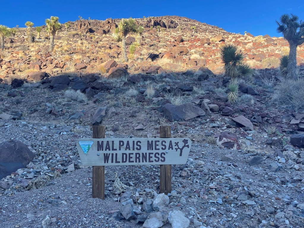
I continued on an extremely rough road past the wilderness sign and then left the road at 1.5 miles to climb up the slope above.

I reached the mesa at 1.8 miles / 7302 feet. From there I walked north through a pleasant field dotted with Joshua trees.

After a mile or so I climbed up a small prominence which marks the high point of the mesa.

I reached the summit at 3:20pm at 3.6 miles! I signed the register which was placed in 1989 by Andy Zdon himself. The most recent entry was from May 6 (meaning I was the first one up here this season). I located the “Rosa” benchmark and 2 reference markers.

Telescope Peak to the southeast:

I took a nice break and then retraced my steps to the car, which I reached just before it got dark at 5pm. Stats for this hike were 7.4 miles, 1798 feet elevation gain, and 3:26:52 total time.


