Thor Peak is a 12306 foot peak located just east of Mount Whitney. It is a large mountain that dominates the view when driving to Whitney Portal from Lone Pine. It’s proximity to the Mount Whitney Trailhead makes it an easy day hike most of the year, but I was expecting a difficult hike due to the recent snowstorm. I had driven to Lone Pine on Tuesday night and suffered through some awful traffic with it being Thanksgiving Week. I camped in the desert east of Lone Pine, then woke up early Wednesday morning and made the drive up to Whitney Portal. I found the road mostly dry, but the last portion was covered in hard packed snow. I began hiking at 6:44am from 8357 feet above sea level.
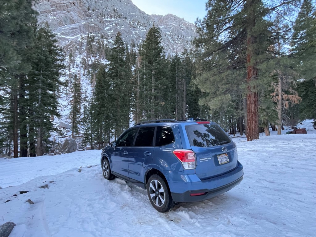
Whitney Portal was mostly dead – the café, store, and campground were all closed, and there were only a few other cars. I passed by all the warning signs at the trailhead, picked up my wag bag, and hit the trail. Thor Peak (left center) was visible to the west, although I don’t believe I could see the whole thing due to the flattish plateau that makes up the summit area.
I hiked up the Mount Whitney Trail, which was very well established through the snow. This wasn’t surprising since it had been a few weeks since the first big snowfall of the year. At 0.9 mile I reached the turnoff for the North Fork Lone Pine Creek Trail, which I took.

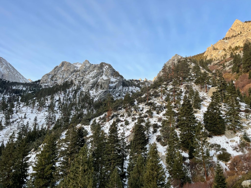
I proceeded east up the North Fork Lone Pine Creek Trail, which was narrower and much steeper than the Mount Whitney Trail. I had expected to be trudging through snow after leaving the Whitney Trail, but to my surprise, there was an existing bootpack on this trail as well. The North Fork Lone Pine Creek Trail leads to the Mount Whitney Mountaineers Route and also other peaks north of Whitney like Russell and Carillon.

I crossed the creek a couple times and saw a cool frozen waterfall.

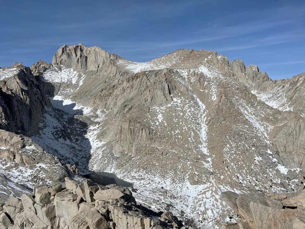
At one point the trail doubled back and climbed onto a rocky ledge. It then turned once again to the west and continued climbing up the broad gully formed by the creek. Eventually I reached Lower Boy Scout Lake (completely frozen) and got a good look at the north face of Thor Peak.
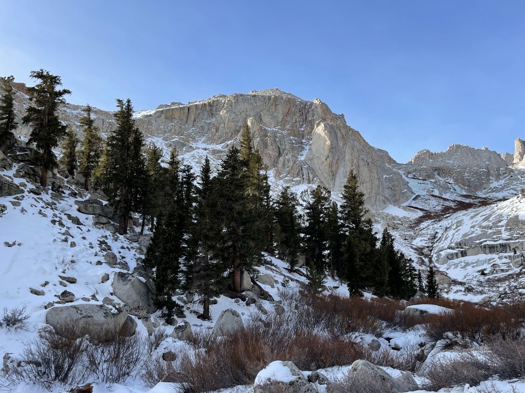
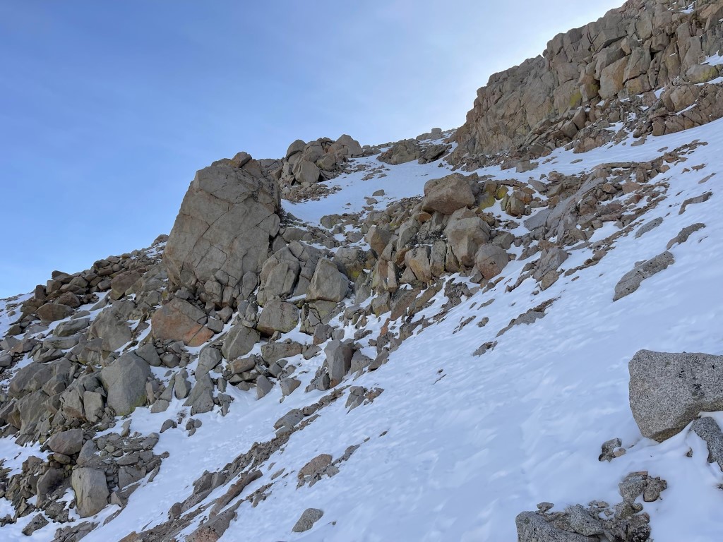
I passed by the small lake and crossed the creek for a 3rd time. I left the trail at 2.5 miles still 2000 feet below the summit. I began climbing southwest up the broad slope.
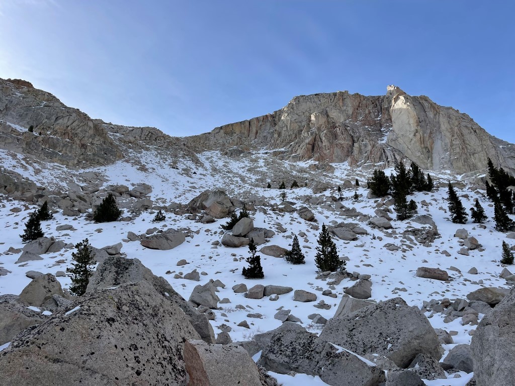
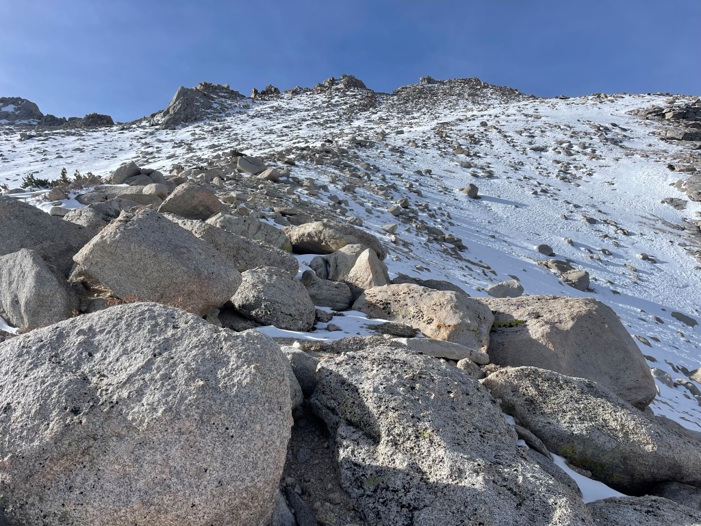
The snow was very dry and sugary which made this part tough. I tried snowshoes briefly, but they were of no help. Thankfully, the snow wasn’t very deep so there was still a lot of exposed talus. I tried to boulder hop my way up the mountain as much as I could. Every time I had to step through the snow, I sank to my shins. Eventually I turned southeast as I neared the plateau and climbed up through a small notch.
I reached the summit plateau at 3 miles / 11520 feet.
I turned southwest once more towards the summit. It wasn’t very steep, so I made good progress even where I had to trudge through the snow.

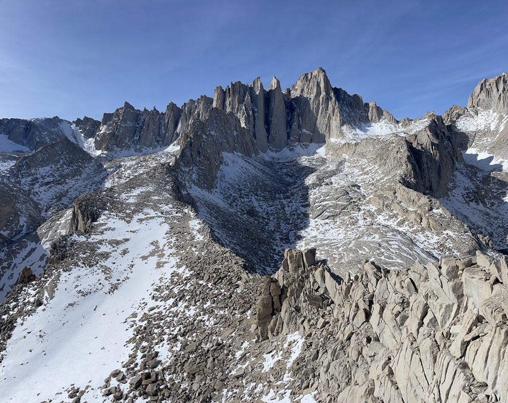
I reached the summit at 11:37am at 3.5 miles! I signed the register which had been placed the previous June by my friend Bill. The most recent entry was from October 23. Thor Peak isn’t particularly high, so it didn’t have the grand view that many of the Sierra peaks have. However, it is surrounded by some of the highest peaks in the range, and they all looked majestic covered in snow. Lone Pine Peak to the southeast:
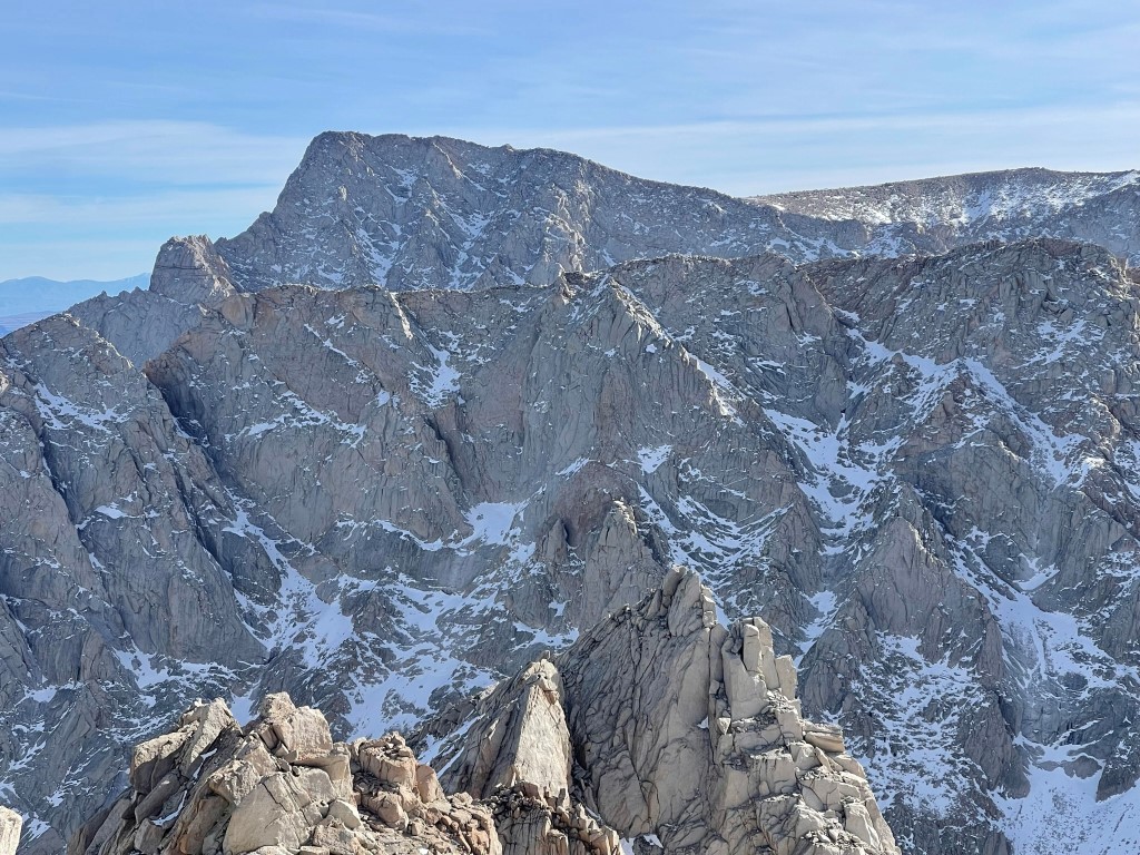
Mount Mallory and Mount McAdie above Consultation Lake to the south:

Mount Whitney to the west:
Mount Russell and Mount Carillon to the northwest:
I spent a while soaking in the views before starting the descent.

I made good time reversing my ascent route. The straps on both of my gaiters broke, so unfortunately I had to deal with cold soggy feet for the rest of the hike. I reached the trailhead once more at 3:26pm. Stats for this hike were 6.8 miles, 3970 feet elevation gain, and 8:41:13 total time.


Mobius Arch
I still had a little daylight left so I decided to do a quick hike to Mobius Arch in the Alabama Hills. The Alabama Hills is a very scenic area in the desert between Lone Pine and the Sierra foothills that contains many striking rock formations. The trailhead is located along Movie Road just a couple miles from Whitney Portal Road. Movie Road is an excellent dirt road and is suitable for any vehicle. I began this hike at 4:19pm from 4639 feet above sea level.
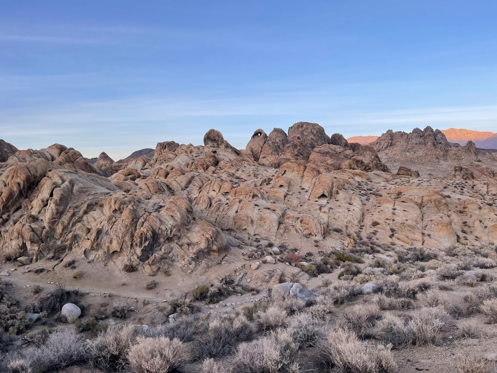
I did the loop trail counterclockwise. There were numerous other hikers on the trail, including a guy who was wandering around searching for his lost car keys. The long shadows of the late afternoon were very pretty against all of the rock formations.

I reached Mobius Arch about ¾ of the way through the loop. I took a cool picture of Lone Pine Peak inside the arch.

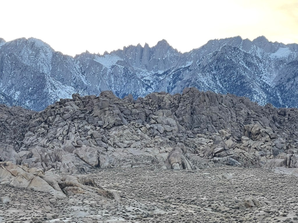
Mount Whitney looked impressive 10000 feet above.
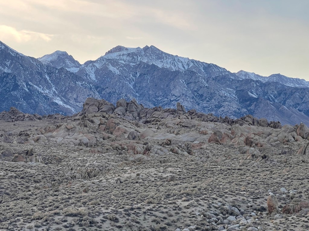
Mount Williamson:
Zoomed out view:

I reached the car at 4:50pm. Stats for this hike were 0.8 mile, 49 feet elevation gain, and 31:08 total time.
