A fellow peakbagger named Michael had contacted me about joining up to climb Square Top, a 4649 peak on the San Diego 100 Peaks List. After our first attempt got delayed due to some knee pain I was experiencing, we were able to reschedule a few weeks later for this Saturday. I left Friday night around 6:30pm to make the 1.5 hour drive out to the Ranchita area just west of Anza Borrego Desert State Park. I drove a mile or so south along the Jasper Trail and found a nice dead end to park for the night.
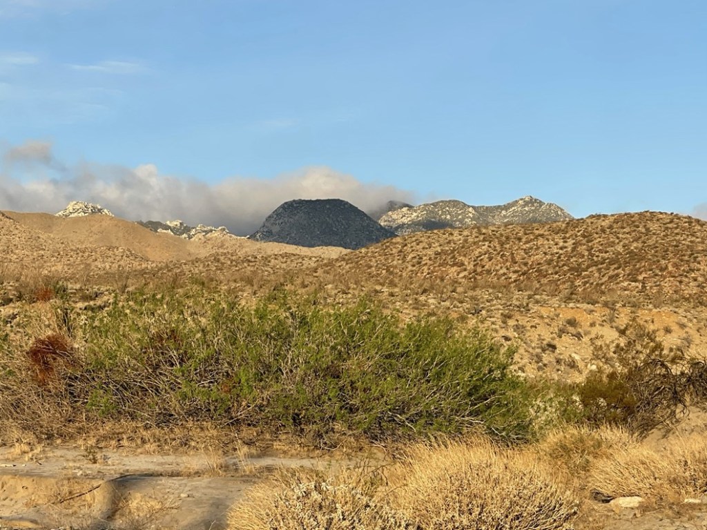
I woke up the next day and made the 30 minute drive down into Borrego Springs. I picked up Michael outside the Natural History Center and then we drove to the north end of town on Digiorgio Road. Eventually the pavement ends at the state park boundary and turns into Coyote Canyon Road. We made it about 5 miles before deciding to park. We began hiking at 7:13am from 1078 feet above sea level. Square Top was visible due west from our starting point.
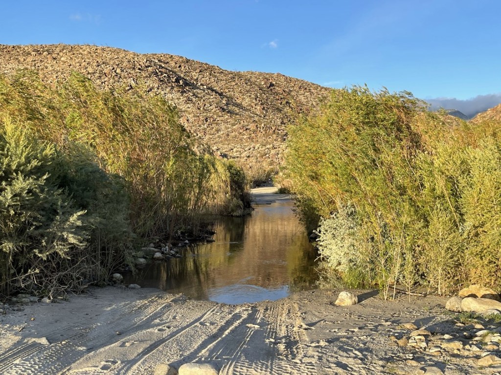
We knew we had a lot of road walking ahead of us, so we started out at a good pace. At 0.7 miles we reached a creek crossing. We took off our shoes and socks and waded across. I decided the water was probably too deep for my Subaru, so this was probably as far as we could have made it. Indeed, we only saw vehicles with a lot of ground clearance past this point.
The next section of road, referred to as “Boulder Alley”, gets steep and rocky for a short distance.
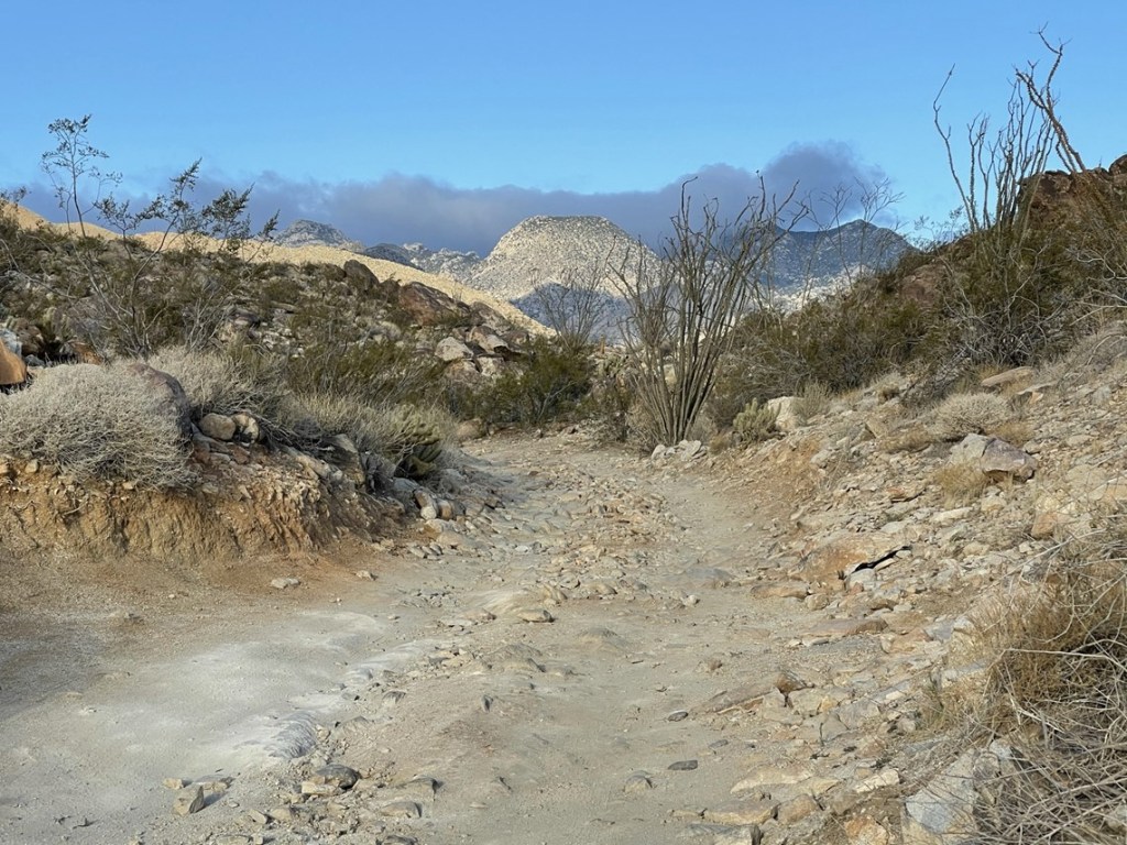
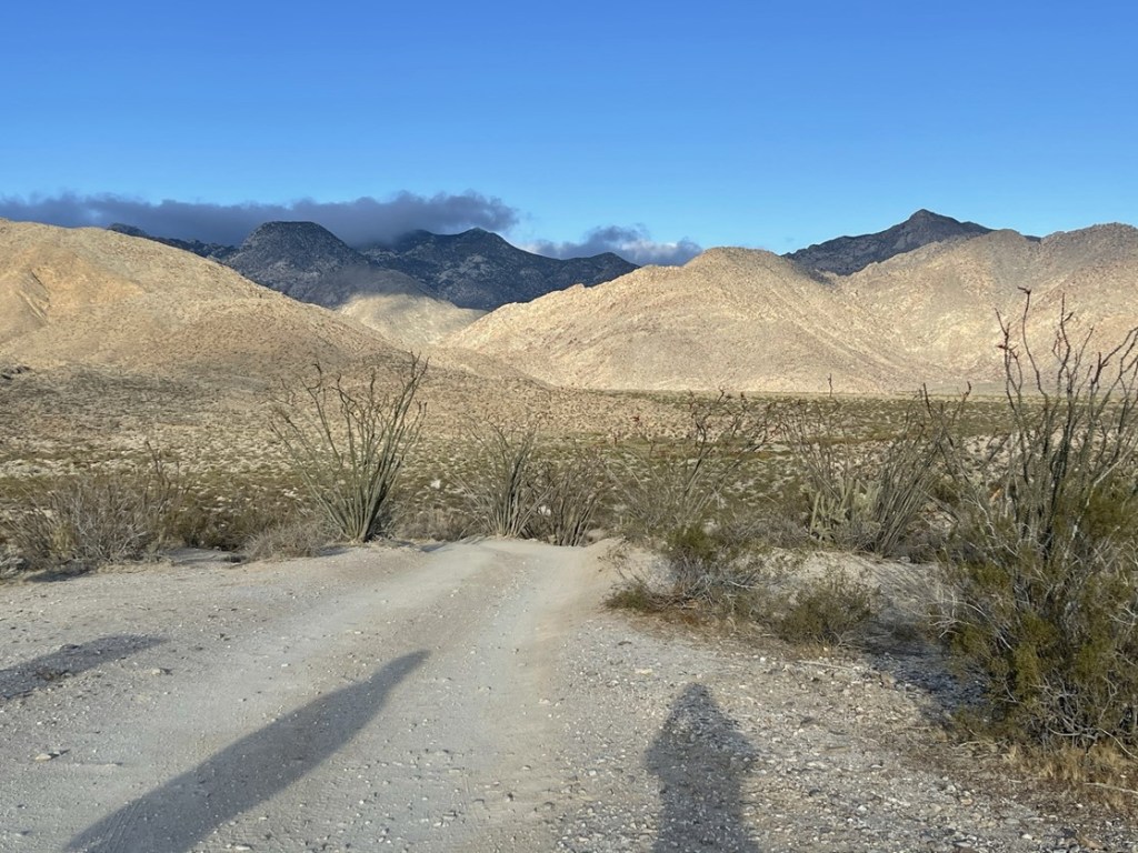
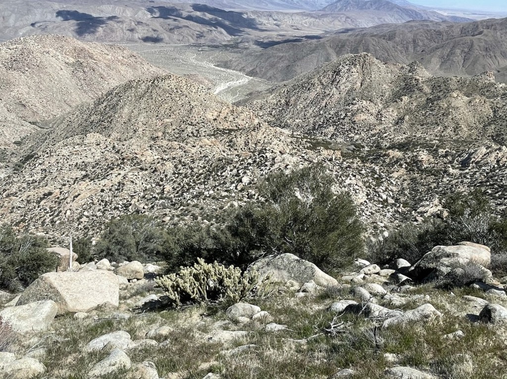
We soon reached the top of Boulder Alley and could now see the vast expanse of Collins Valley ahead of us. Square Top is left center.
At 2.4 miles we turned left onto the Sheep Canyon Trail. We could have continued on the road, but the trail takes a slightly more direct route to Sheep Canyon.

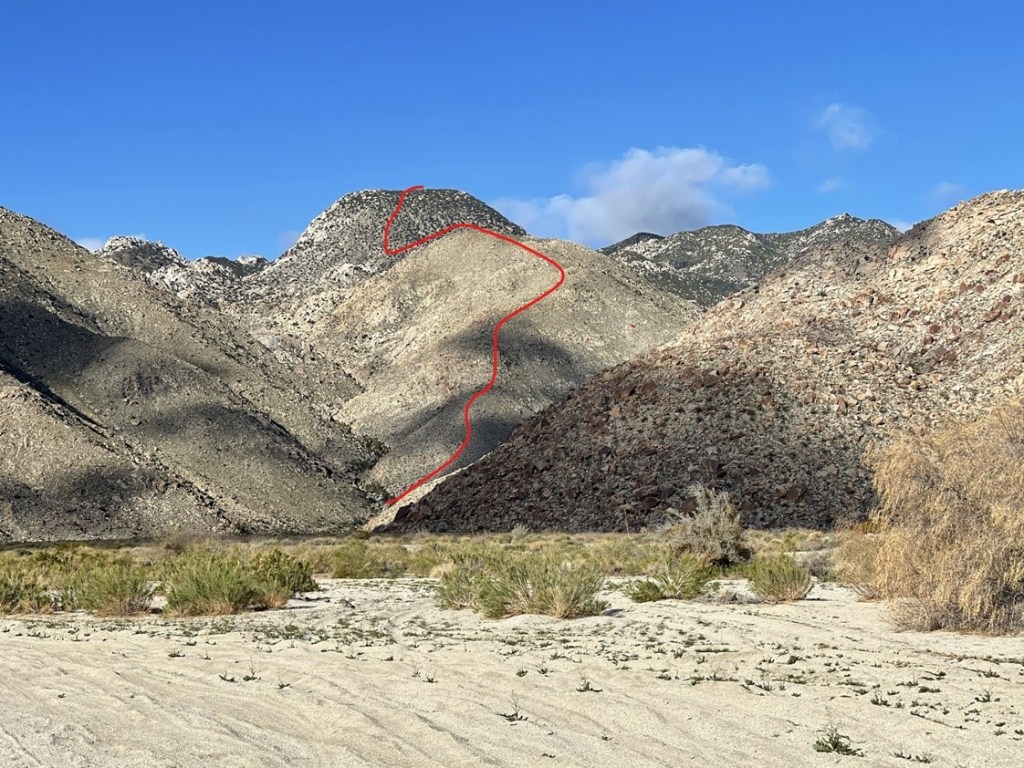
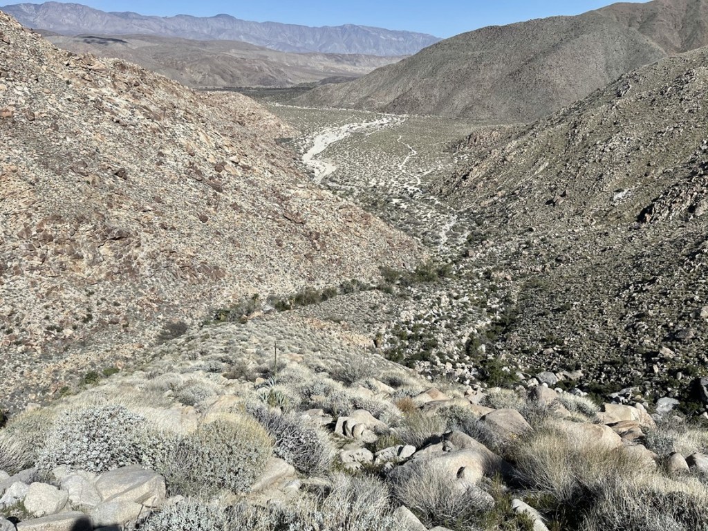
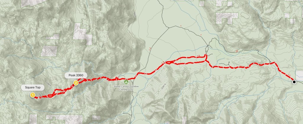
The trail was narrow and sandy but easy to follow. We reached the road again about a mile later. We could clearly see our route up Square Top in front of us. Our plan was to ascend the ridge in the center to the subpeak (Peak 3360), descend a few hundred feet down the other side, and then go straight up the steep east slope of Square Top.
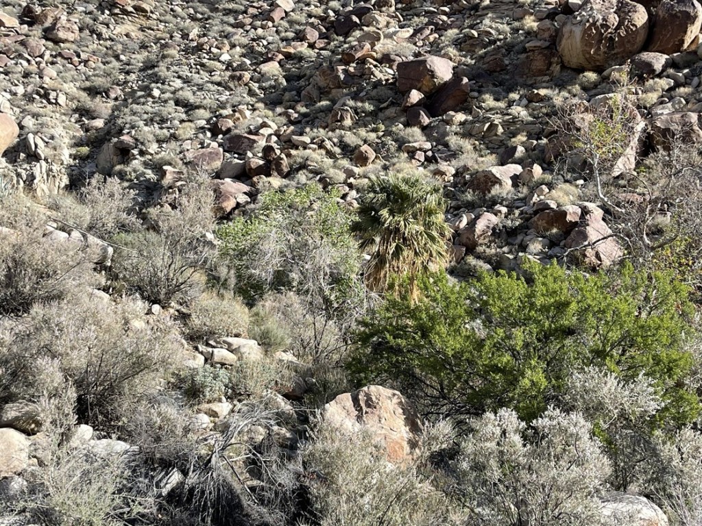
We reached Sheep Canyon Campground at 4.5 miles. The campground was pretty full, so we waved at a lot of people as we passed through. We kept hiking past the end of the road and into Sheep Canyon itself. Here the canyon splits into north and south forks. The ridge up to Peak 3360 divides the 2 forks of the canyon. There was plenty of water running through the creek bed and we could see palm trees in both forks of the canyon.
At one point we noticed an awful smell and found a dead animal laying in the brush. It had a bushy tail so I think it was a gray fox. We reached the base of the ridge at the 5 mile mark. We had only gained about 700 feet up to this point, so we were both ready to do some actual climbing.

The ridge was steep, but the footing was solid, so we didn’t have too much trouble. I think these western areas of Anza Borrego get enough rain for grass to grow on the slopes which is much easier to hike on than loose rock.
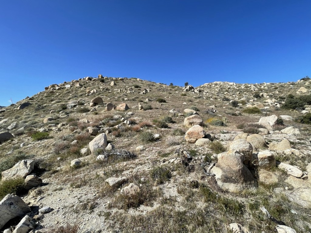
We reached Peak 3360 at 10:10am at the 5.9 mile mark. We located a register which had been placed in 2018. The previous ascent was from March 7th. Square Top looked close now, despite being over 1000 feet above us still (with a few hundred foot drop in between).
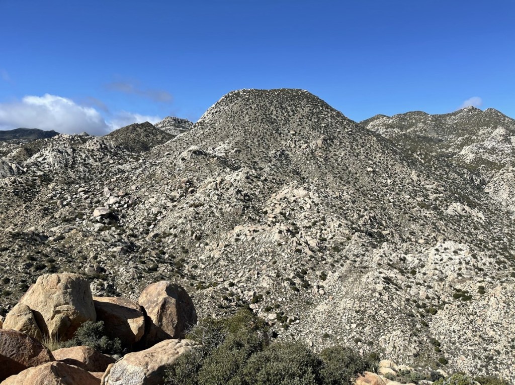
After a quick break we descended down the western side of Peak 3360. We reached a saddle at 6.1 miles around 3000 feet. From here, we would need to ascend over 1500 feet in about 1.2 miles!
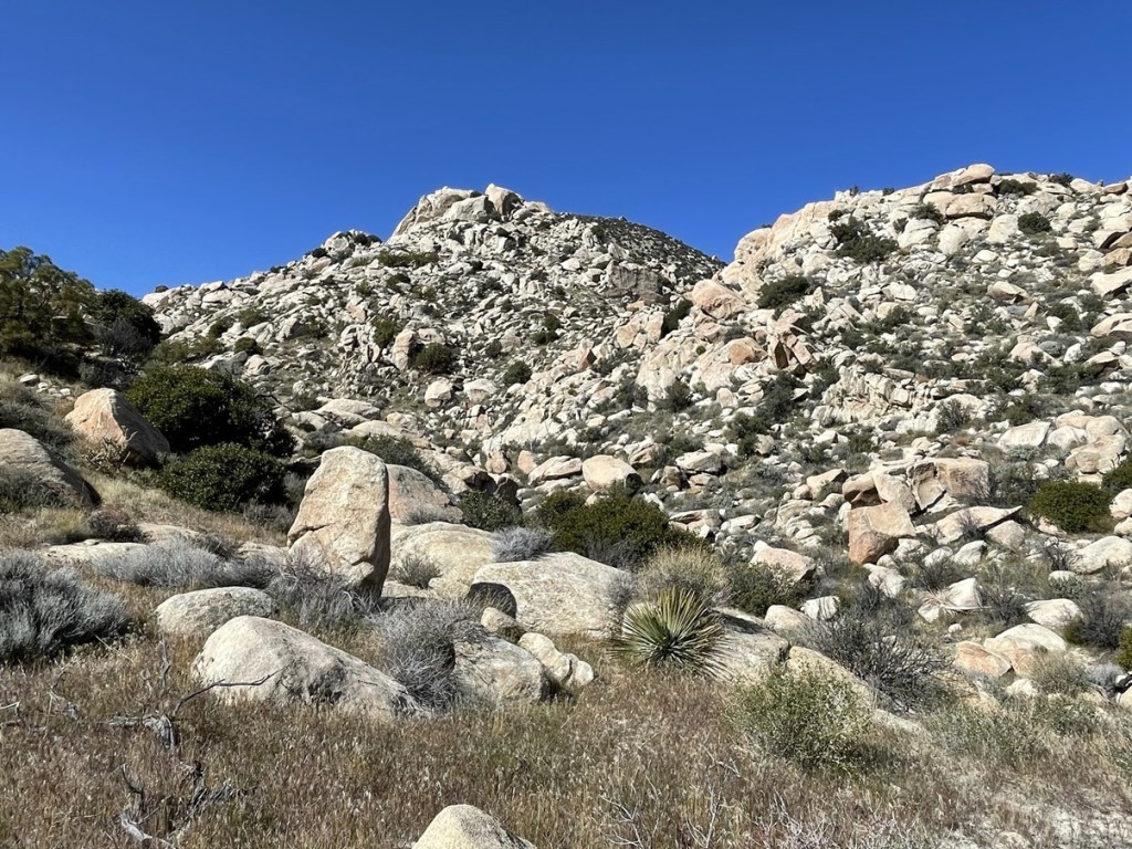
Large boulders slowed us down a bit as we had to wind our way around a few minor hills. We eventually found our way onto the east face. It would be straight up from here!
This was definitely the hardest part of the hike. The angle approached 45 degrees at times!

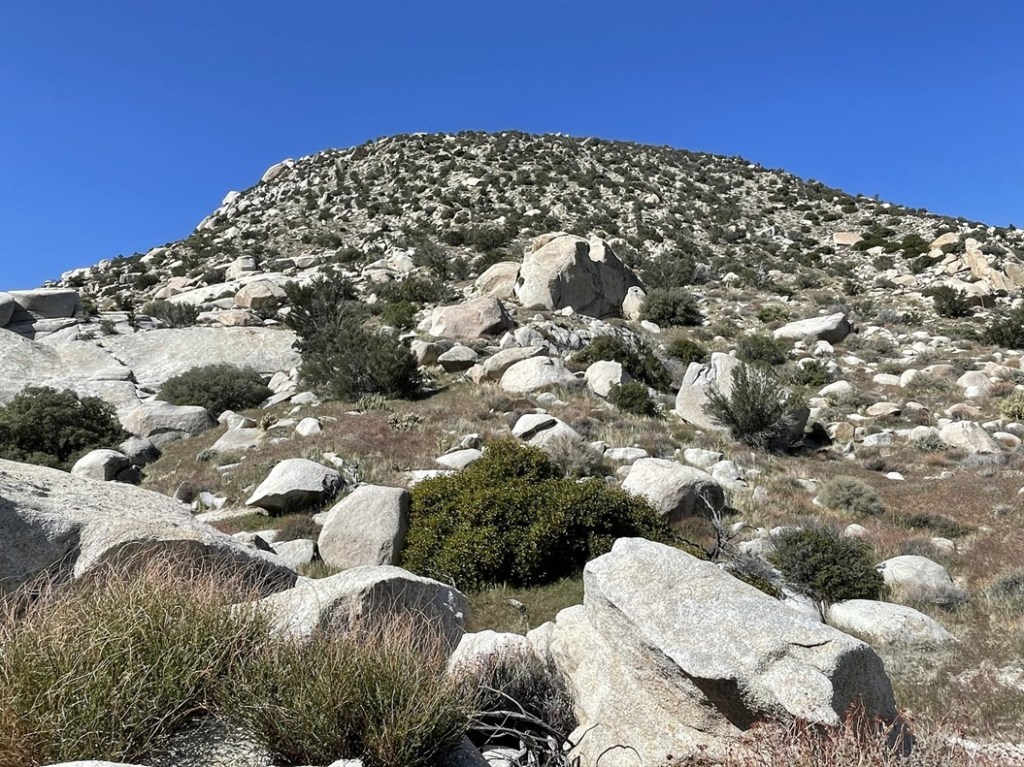
We eventually reached the flat summit area. The brush was actually kind of thick on top which was annoying. We angled to the north and reached the summit block at 11:40am at 7.3 miles. We found the register at the base of the summit block and both signed it. The previous ascent was from March 7th (same party that signed on Peak 3360). The fun was just beginning though as the class 4 summit block was still in front of us. The boulder is about 20-25 feet high and is vertical on 3 sides.
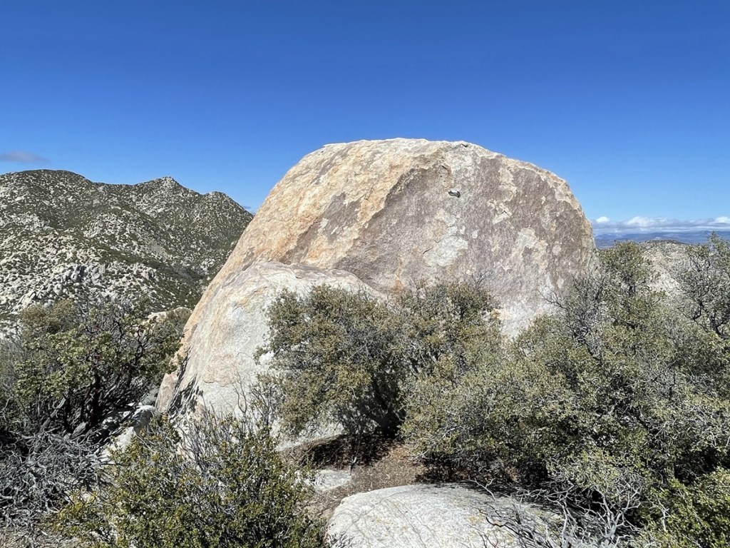
The boulder is easiest to climb from the west side. Michael had brought a rope with him to help us get to the top. His plan was to throw the rope over the top of the boulder and then have one person anchor the rope by wearing a harness while the other person climbed. Unfortunately, it was super windy which was going to make the throw difficult. My first throw made it over the top but went too far to one side. My second throw got caught by a huge gust of wind which sent it in the complete opposite direction into some shrubs. After retrieving the rope, we decided the wind was just too strong for this to work. Michael had also brought rock shoes, so plan B was for him to climb up without the rope. The bottom part of the rock is the most vertical, so he was able to use my hands as a foothold to get up that section. Once he got above the initial section, he was able to climb up the rest of the way unassisted. Success!

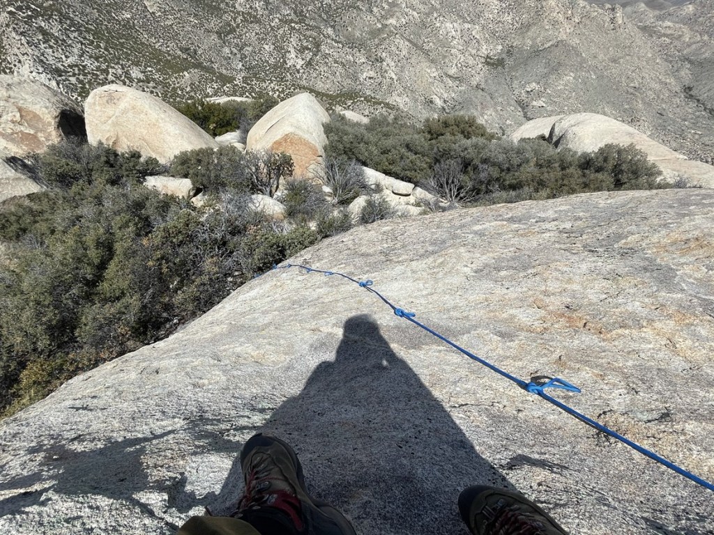
Now that he was on top, we decided to give the rope another go. I managed to throw the rope up to him and he caught it and dropped it down the other side. He then climbed back down, put on the harness, and attached the rope. Now it was my turn!

He had previously tied knots in the rope, so I was able to grab onto those while friction climbing up the rock. Another success!

It was my first ever rope assisted climb, so I was pretty excited about that. The wind was insane which added a little spiciness to the situation. I enjoyed the views for a few minutes while trying not to get blown off the summit. I could see Pike and Cody Benchmarks (two more San Diego 100 peaks) a few miles south.

To the north, Toro Peak was hidden behind the clouds.

A thicker cloud layer blocked most of then higher peaks to the west.

After I was done taking pictures, I climbed back down the rope.
We were pretty satisfied that we were both able to reach the top. We began descending after spending about an hour and a half at the summit area.
We descended back down the steep eastern slope. We were slightly south of our ascent route, so the terrain looked a little unfamiliar. We reached the saddle and then climbed back up to Peak 3360. We took a short break and then descended down the ridge back into Sheep Canyon.
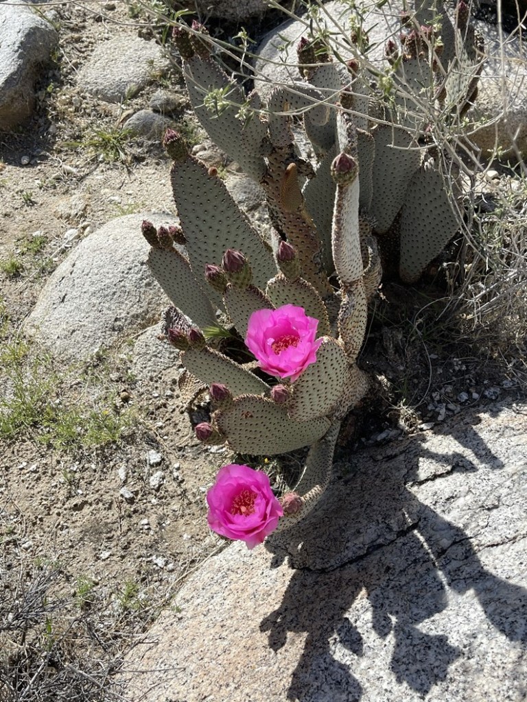
We found a beavertail in full bloom!
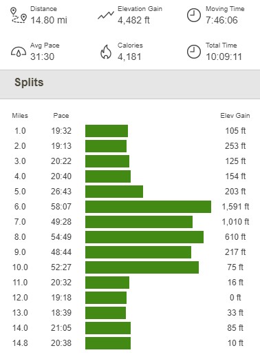
We reached Sheep Canyon Campground again at 10 miles. The long walk along the road back to the car was a bit tedious. We passed many jeeps and other 4WD vehicles on the way. We finally reached the car again at 5:22pm. This hike totaled 14.8 miles, 4482 feet elevation gain, and 10:09:11 total time.
We drove back to Borrego Springs where I dropped Michael off at his car. After saying our goodbyes, I turned around and drove back to Coyote Canyon Road. I was planning to climb a few more peaks in the area on Sunday, so I drove a few miles up the road and found a nice turnout to park and spend the night.
