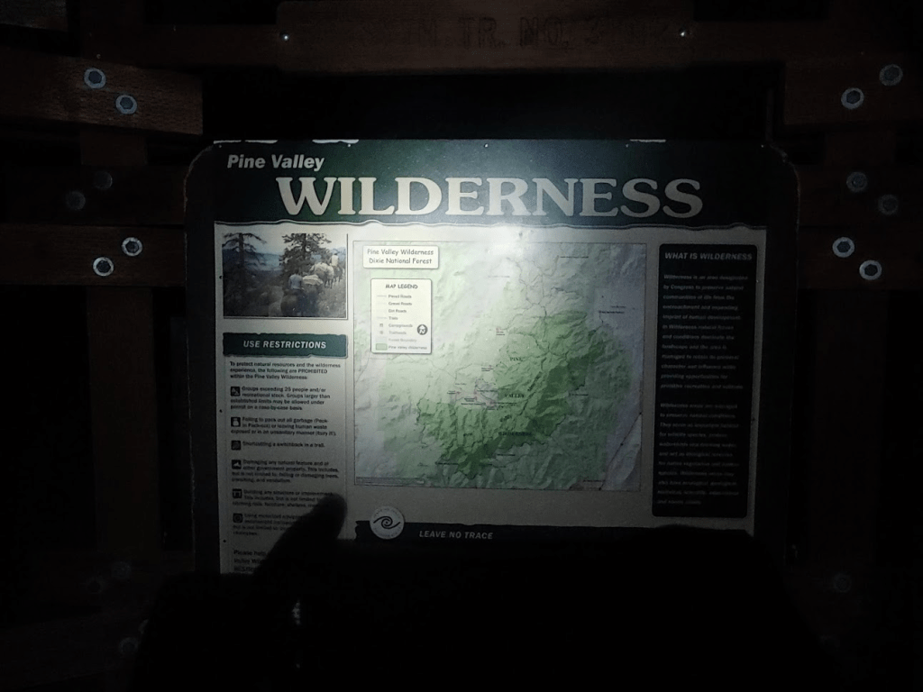
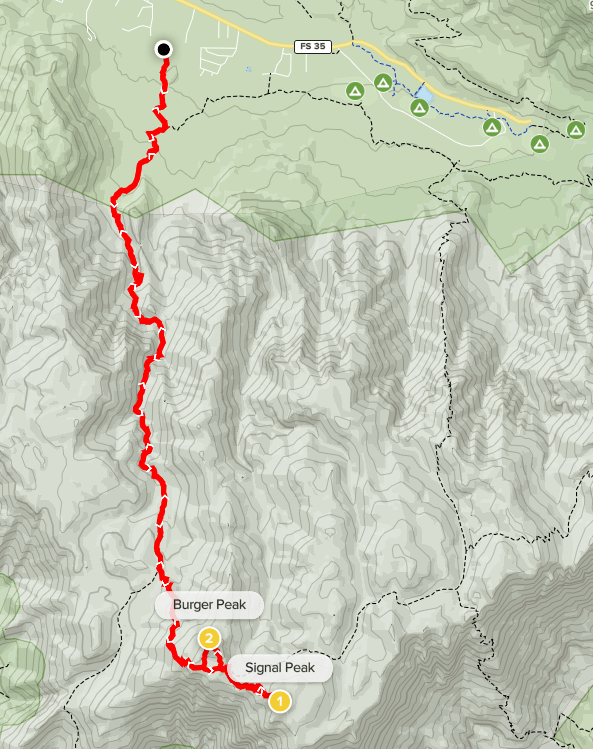
Signal Peak and Burger Peak
My plan for day 3 of the road trip was to climb Signal Peak in southwestern Utah, just north of St George. Signal Peak rises to 10,365 feet and has over 4000 feet of prominence (it is the 12th most prominent peak in the state). It is the high point of the Pine Valley Wilderness within Dixie National Forest. I had an excellent perspective of it as I drove into St George the previous day, as it dominates the view north of the city. I also planned to climb 10,321 foot Burger Peak, which is a subpeak of Signal less than a mile away. The shortest route to approach the peaks is from the east, but I started from the north at the Forsyth Trailhead in the small community of Pine Valley. I began hiking in the dark at 6:19am from 6548 feet.
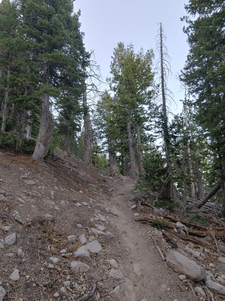
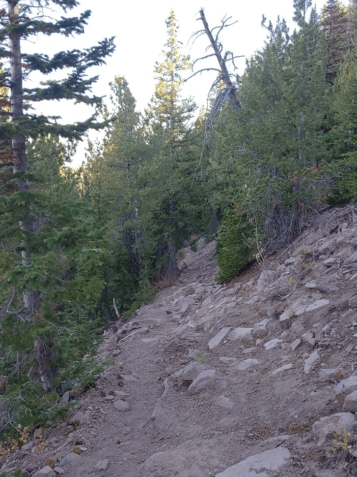
The trail gradually starts to gain elevation as it heads south into the wilderness. It was still pitch black out, which was a bit of a shock to me. I realized that since I was on the very western edge of the Mountain Time Zone, the sun would rise and set much later than in California. This would be something I would have to get used to all week. Less than a mile into the hike I got spooked by a set of tiny lights in the distance. I counted 4 tiny lights and they were moving in pairs which made me realize it was 2 sets of eyes. My first panicked thought was mountain lion, but I quickly calmed myself down with the realization that they were most likely deer. Besides, I think mountain lions are usually solitary. The same thing happened again a bit further up the trail. At 1.3 miles I noticed a few tents and hammocks off to the side of the trail, which didn’t surprise me since there had been 2 other cars in the trailhead parking lot overnight. I hiked over 2 miles before I finally turned off my headlamp at 7:15am.
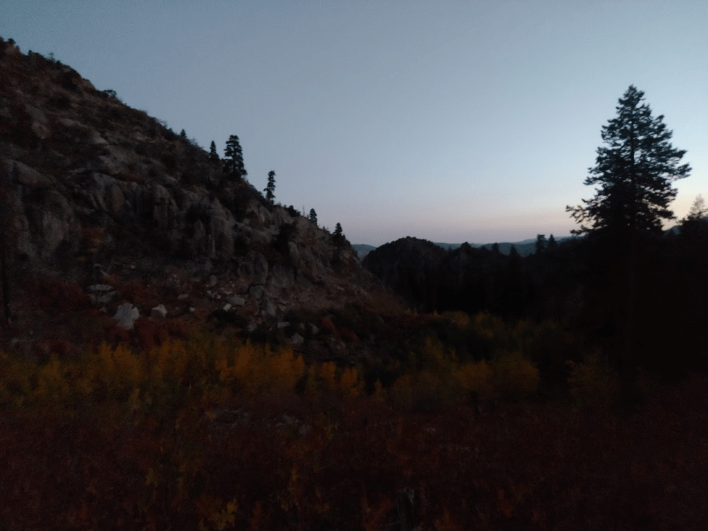
I continued to make my way south as the trail ascends Forsyth Canyon. I could already tell the fall colors were spectacular here in the early morning light.


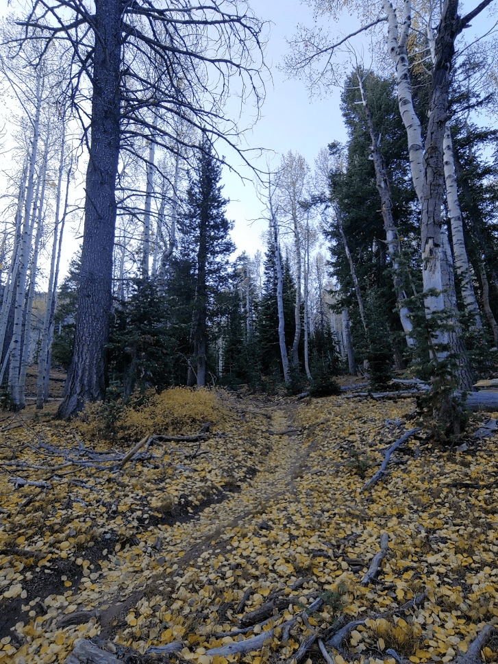
As I climbed higher, I entered a forest of beautiful aspen trees. Yellow leaves covered every inch of the ground. This definitely made me feel far away from home – I don’t think aspens grow in southern California. The closest place I’ve seen them is on Mount Charleston near Las Vegas.
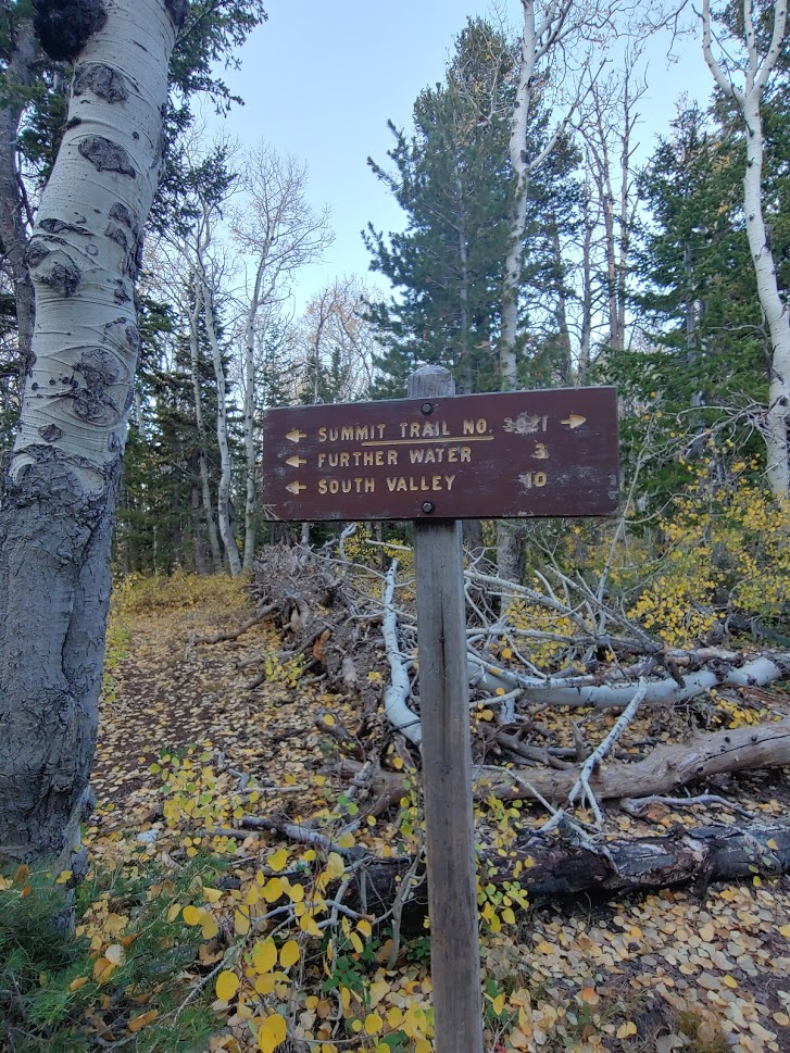
Over the next couple miles, I saw 3 solitary deer in different places. This reinforced my belief that it was deer I had seen in the dark earlier. At 4.75 miles, I reached a junction and went left on the Summit Trail.
I soon reached 10,000 feet as I got near Burger Peak. I decided to continue past Burger to climb Signal first. Signal, despite being higher, reportedly offers no views due to tree cover. Because of this, I wanted to save Burger Peak for 2nd so I could take a longer break and enjoy some views. The aspens disappeared as I neared the summit.
The Summit Trail does not go all the way to either peak, so a little cross country hiking would be required. I left the trail at 6.06 miles to climb southeast towards Signal.

I reached the summit at 9:21am at 6.56 miles! As expected, the views were minimal due to extensive tree cover.
Despite the lack of views, I was pretty excited since this was my first ever ascent of a Utah peak! There were a few register books, so I signed the newest one. I noted the previous ascent had been the day before. After a 15 minute break, I began descending towards the Summit Trail.

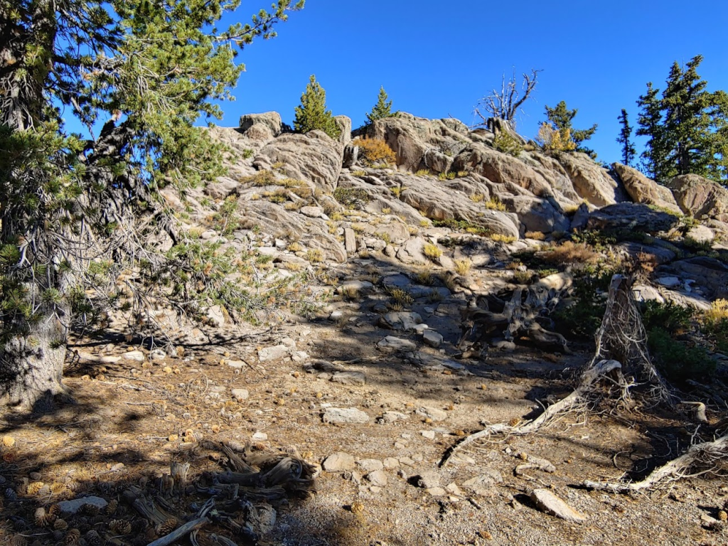
I reached the trail at 7.25 miles but crossed right over it and continued northwest towards Burger Peak. The off-trail ascent to Burger was a bit shorter than to Signal. As I neared the summit, I noticed another hiker approaching from the southwest (I was approaching from the southeast). The summit area was a medium sized rock outcropping (this is what gave it better views than Signal).
I reached the summit at 10:05am at 7.52 miles!
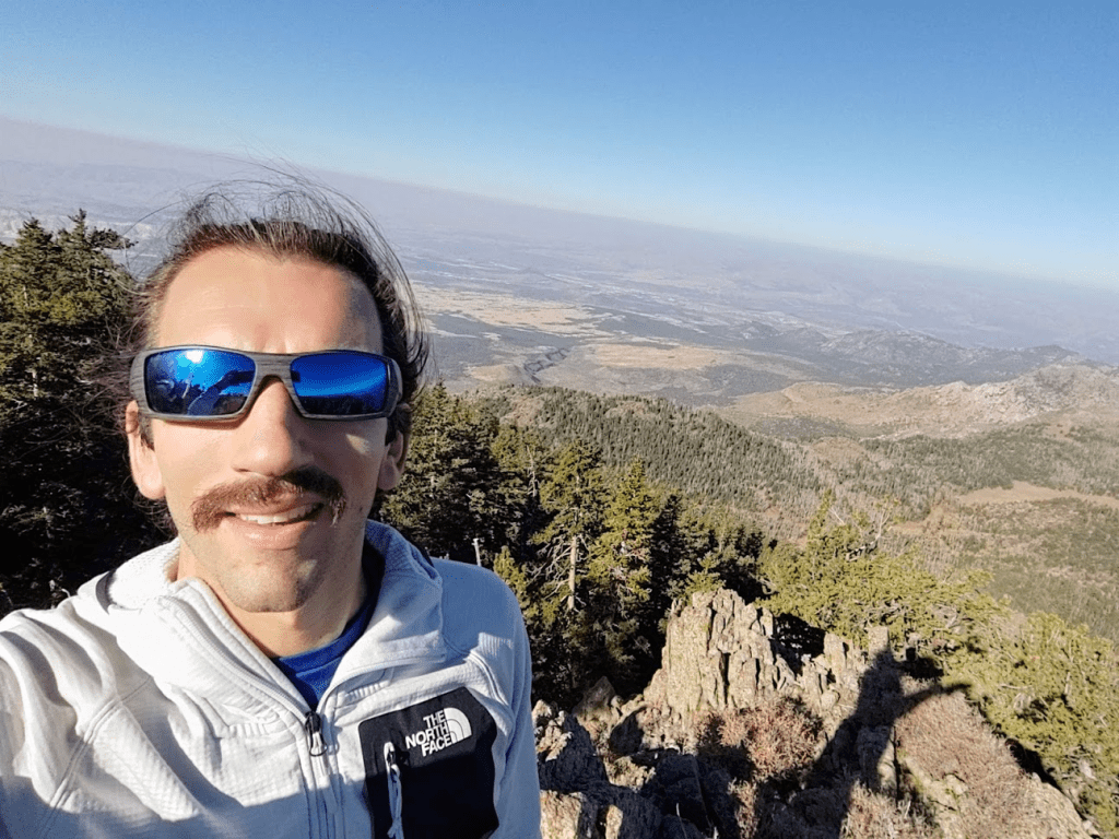
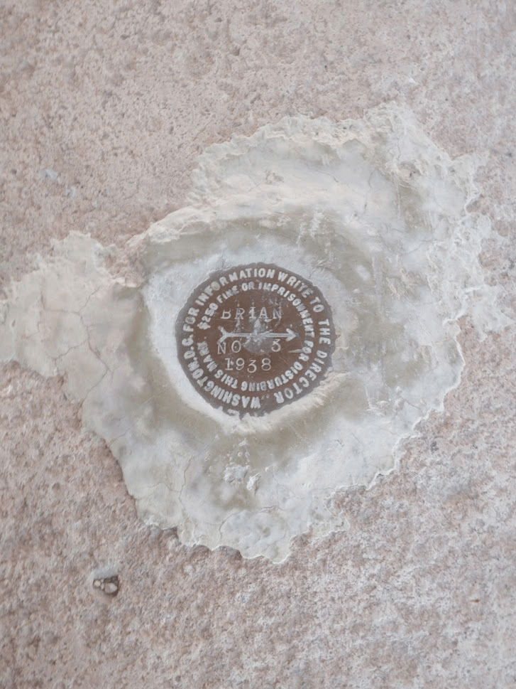
I signed the register which had last been signed 2 days before. The other hiker joined me on top moments after I summitted. He mentioned having come up the same trail I did, but he wasn’t continuing to Signal. I located the benchmark and 2 reference markers. Strangely, reference marker no. 1 was pointing the wrong way, like exactly 180 degrees the wrong way. Not sure I had ever seen that before!


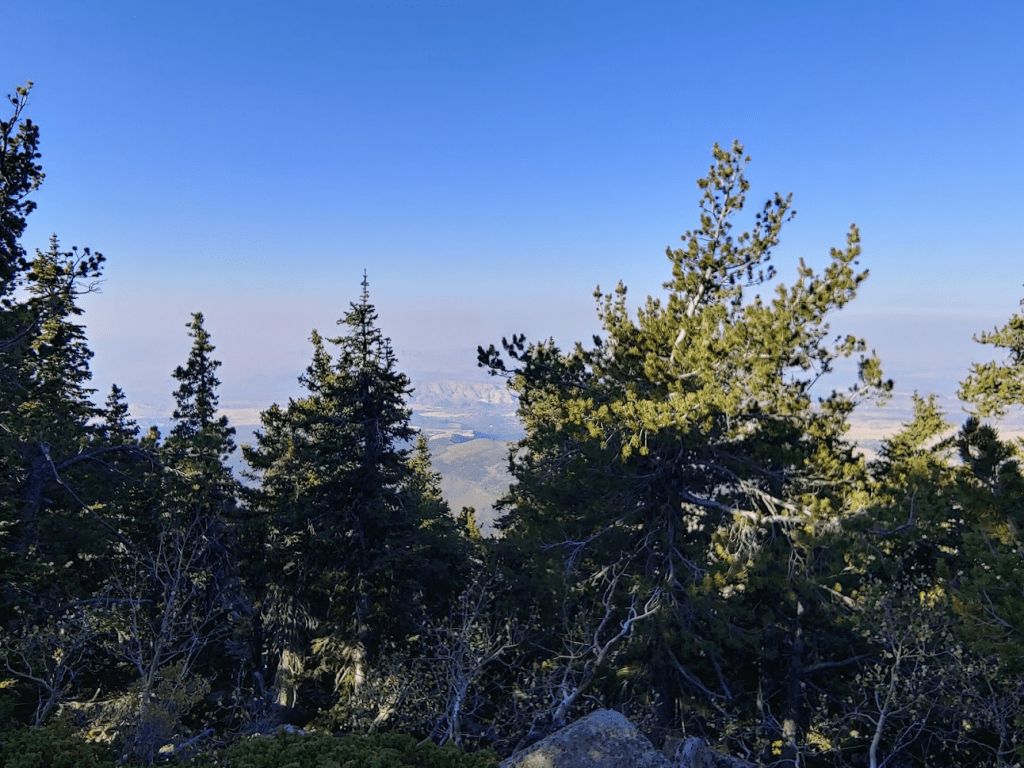
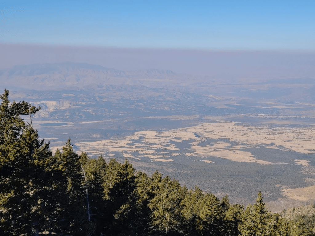
As expected, the views were much better than on Signal. There was still some haze/smoke, but I could see pretty far to the west (the slightly higher Signal Peak blocked much of the view to the south and east).

The weather was pretty nice, even up above 10,000 feet. I took off my jacket and didn’t need it the entire way down. I began the descent after a 30 minute break on Burger. I soon reached the trail again at 7.8 miles.
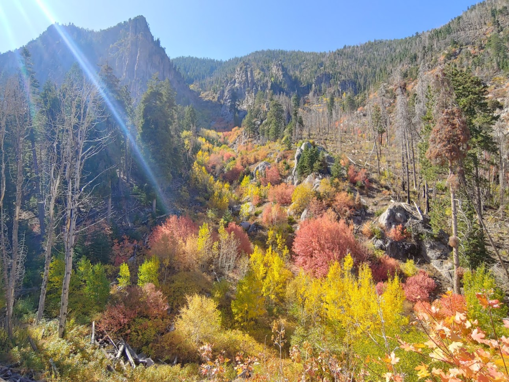
From there, I simply retraced my steps back to the trailhead. The aspens were really spectacular now in the sunlight.

The fall colors in Forsyth Canyon were really amazing. I had to stop many times to admire the scenery.

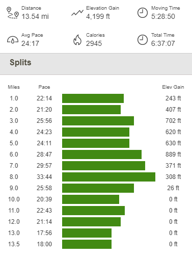
I saw another group of 2-3 deer on the way down. Counting the deer I saw in the dark early in the morning, I saw about 10 deer across 6 different sightings throughout the hike. I started to run into some other hikers closer to the trailhead. Most seemed just out and about to enjoy the fall colors, and not to ascend all the way to the peaks. It was pretty warm when I got back to the trailhead. I reached the car once more at 12:56pm. This hike totaled 13.54 miles, 4199 feet elevation gain, and 6:37:07 total time.
I had a lot of time left in the day, so I needed something to fill up the afternoon. I was planning to be in Zion National Park the following day, which is only about a 1.5 hour drive from where I was. I considered heading to Snow Canyon State Park, which is about 30 minutes away and would be en route towards Zion. I decided instead to head up to Brian Head, which is a ski resort town about an hour and a half away. It would be more driving than Snow Canyon, but there were some shorter hikes I could do there, and I really was trying to save my legs for the remainder of the week. Brian Head is also adjacent to Cedar Breaks National Monument, which I was very interested in checking out. I quickly packed up my car and took State Routes 18 and 56 back to I-15, and then State Route 143 from Parowan up to Brian Head. Brian Head looked like a very cool resort town with many lodges and ski resorts. Most of the area is above 10,000 feet so the weather was very nice. I decided to drive up to Brian Head Peak, which at 11,307 feet is the highest point within Dixie National Forest. A smooth gravel road leads from Highway 143 about 3 miles to a parking lot at the summit. Of course, I felt very lame driving up to the peak, but it was definitely a nice way to spend time after having had a pretty strenuous morning.

I walked up to the structure and looked around. Brian Head Peak has over 3000 feet of prominence, so the views were tremendous. I tried to pick out some of the surrounding peaks, but obviously the view was unfamiliar to me so much of it was guesswork. I was able to pick out Signal Peak to the southwest. I thought I could perhaps see the rim of Bryce Canyon to the east, as well as Delano Peak and Mount Dutton to the north.
Closer by, I could see many of the resorts and ski lifts and whatnot.

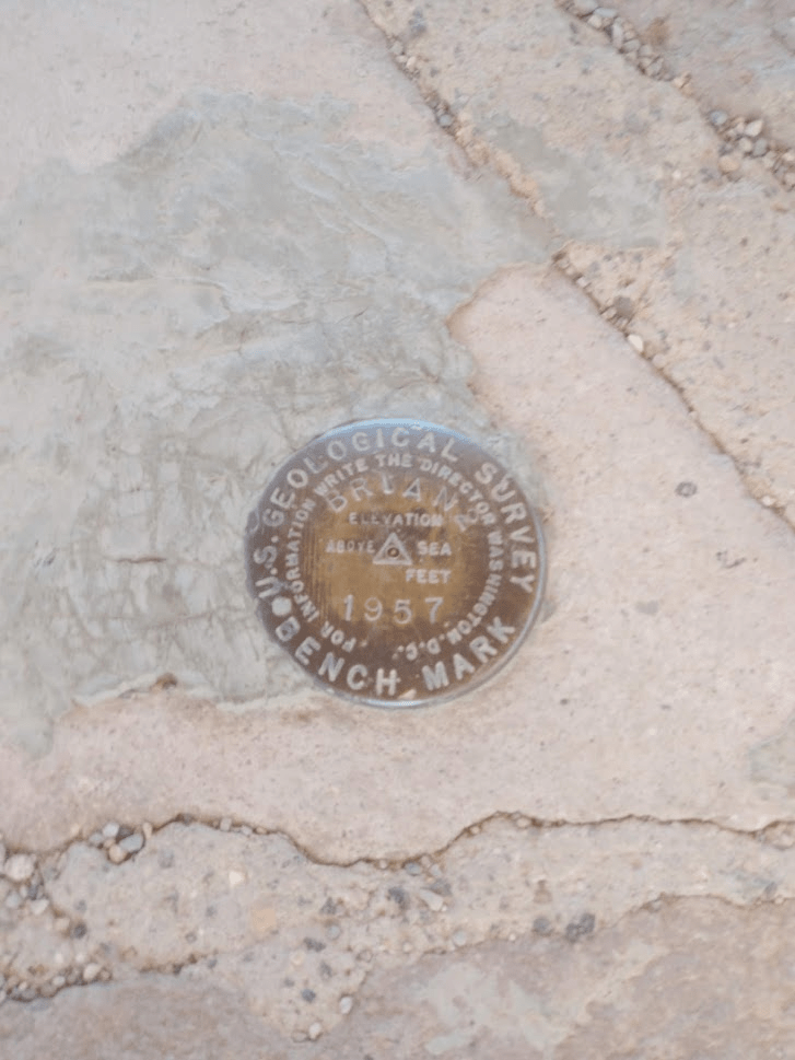
I located the benchmark, which was in the center of the summit structure. I also managed to locate reference marker no. 3
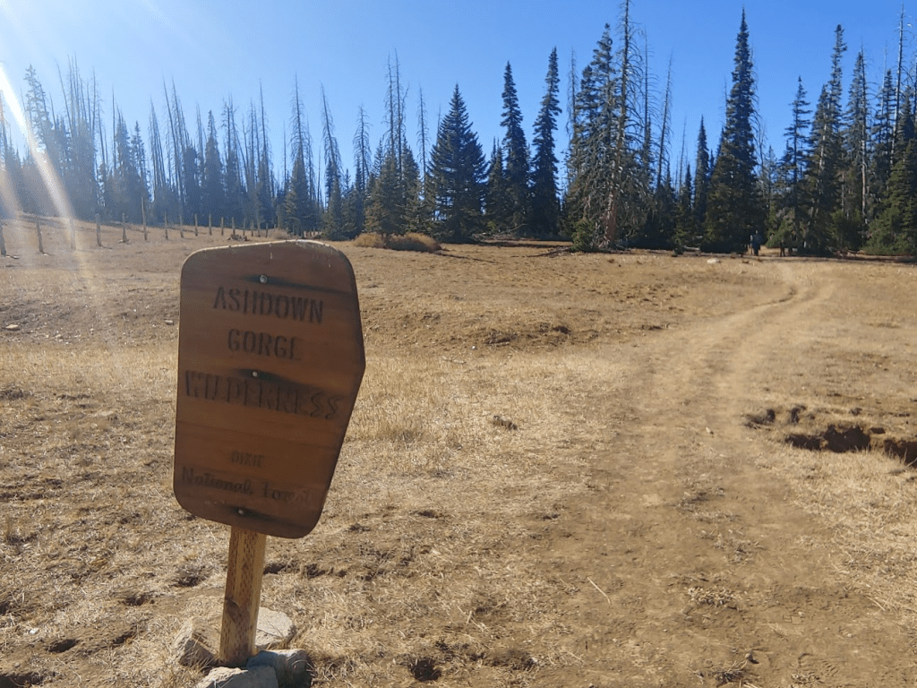
Ashdown Gorge Wilderness High Point
Once I was done on the peak, I drove back to Highway 143 and then a short distance south to the Rattlesnake Creek Trailhead. A trail here leads west into the Ashdown Gorge Wilderness and eventually down into the Cedar Breaks amphitheater. My plan was to a quick hike hitting the wilderness high point (10,440 feet) and then to a nice overlook of the amphitheater. I started this hike at 3:33pm from 10,254 feet.
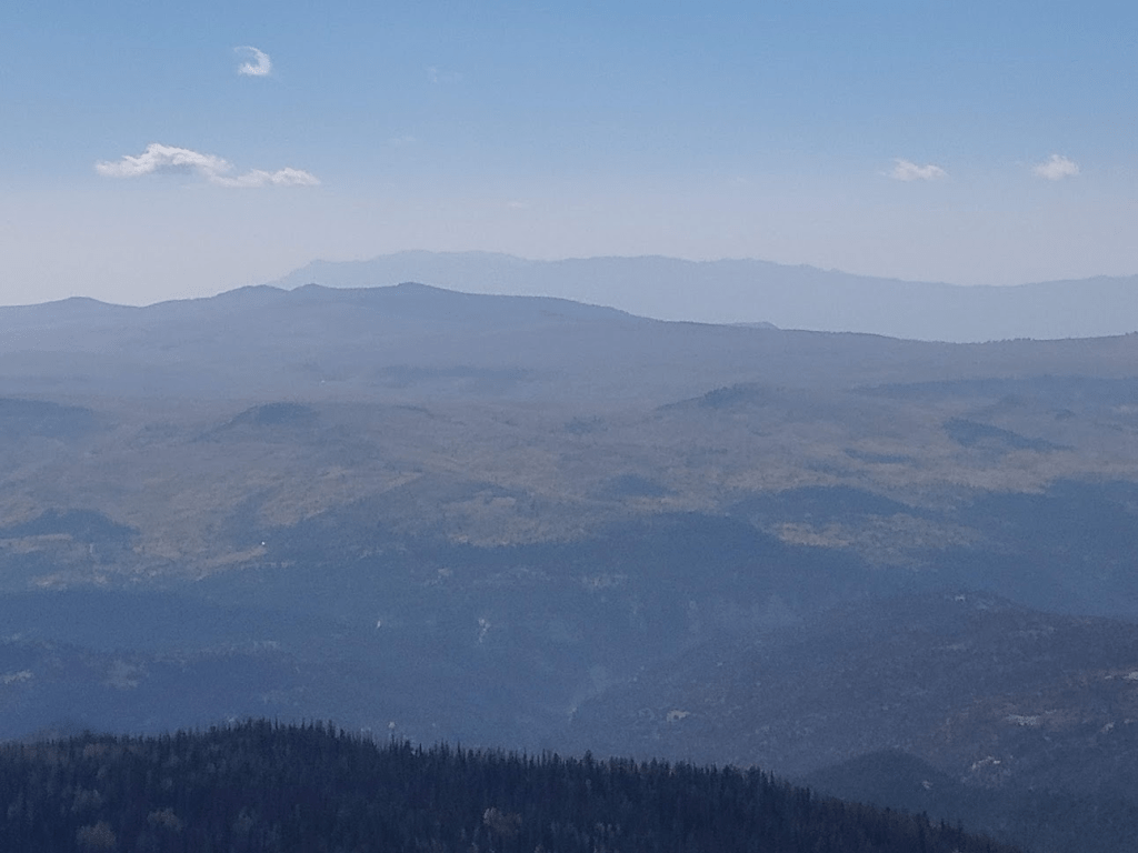
I had a great view of Brian Head Peak behind me. The summit road can be seen in the below photo.

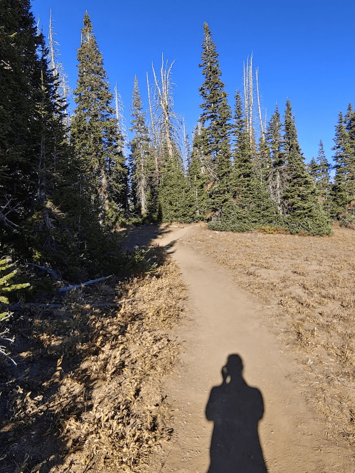
The trail passes the wilderness sign and then enters a grove of bristlecone pines, the oldest living tree species on Earth (these are also found near White Mountain Peak in eastern California). At 0.5 mile I reached the wilderness high point. The trail actually goes right over the high point. It’s a completely arbitrary point and isn’t even marked by a cairn or register. I continued on for another quarter mile and reached an excellent viewpoint of the Cedar Breaks amphitheater.

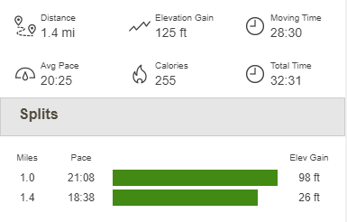
Cedar Breaks was gorgeous, and I was excited to explore more with my remaining time this afternoon. Cedar Breaks is very similar to Bryce Canyon, with reddish pink cliffs and many hoodoos (bulbous rock spires created by erosion). After enjoying the view, I turned around and hiked back to the car. This hike totaled 1.4 miles, 125 feet elevation gain, and 32:31 total time.

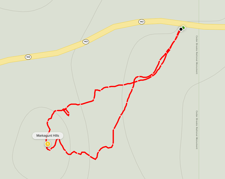
Markagunt Hills
I got back in the car and drove south into Cedar Breaks National Monument. I stopped quick at the North View Lookout to check out the views. Amazing! I then turned left (east) to stay on Highway 143 and parked at a turnout after a mile or 2. I was going to do a quick climb of the Markagunt Hills, whose high point happens to be the highest elevation within the National Monument at 10,661 feet. Of course, this was kind of a lame high point, since Cedar Breaks is known for the large canyon and not for high mountain peaks. However, I was in the area and it would be easy, so I decided to do it real quick. I hiked through a field and then into some trees. I saw another deer as I was ascending (I was getting frustrated by my inability to photograph them at this point).

I had to navigate through some brush but eventually found the high point with a register. The previous signature was on 11/2/18 so this “peak” was not climbed very often. I signed it quick and then made my way back to the car. This hike was a quick 0.47 mile, 98 feet elevation gain, and 15:23 total time.

Chessman Ridge Overlook and Alpine Pond
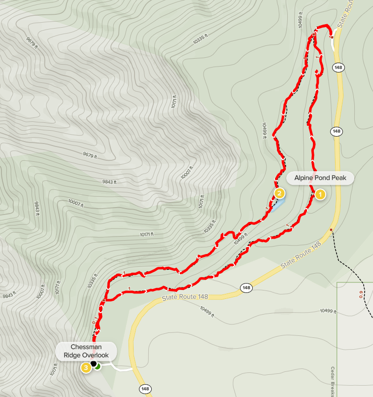
Now that I was done with that nonsense, I drove back to Highway 148, which is the main road through the National Monument. I drove south a few miles and then parked at the Chessman Ridge Overlook. There was a short 2 miles trail I could do here that would be near the rim of the amphitheater and take me near a small pond called Alpine Pond. I started this hike at 4:45pm. There is an upper and lower trail that both lead to the Alpine Pond parking area. I decided to combine them for a nice 2 mile loop. I took the upper trail first.
The trail went north through a beautiful pine forest. At 0.9 mile I climbed up to a minor Peakbagger peak called Alpine Pond Peak. I reached the other parking lot at 1.36 miles and then turned around to head back on the lower trail. At 1.85 miles I reached the actual pond.

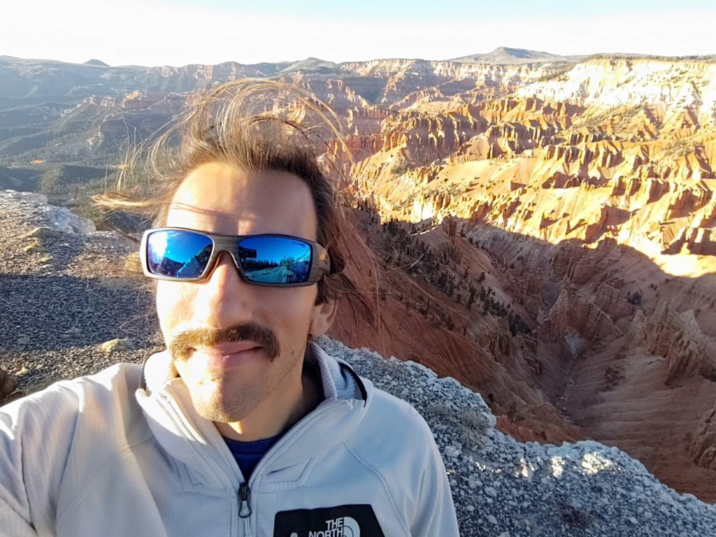
Apparently, the Park Service used to stock fish in the pond for fishing but then stopped because the fish would eat the native amphibians. I continued on back to the Chessman Ridge Overlook. I was a bit disappointed by the lack of views – I had expected more along the lower half of the trail. As I reached the parking lot again, I spent some time admiring the view at the Chessman Ridge Overlook. The cliffs were really spectacular!
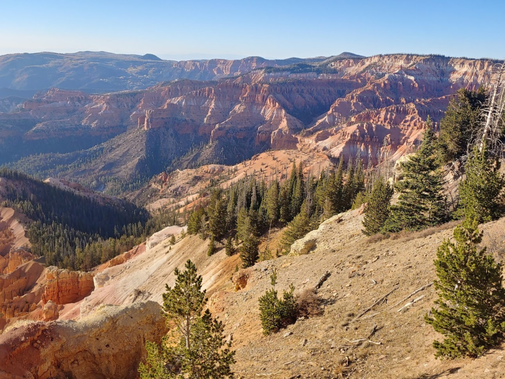
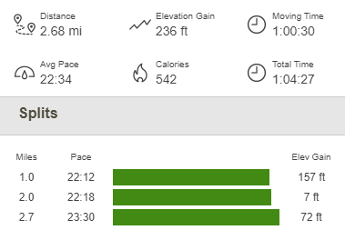
I got back to the car at 5:50pm. This hike totaled 2.68 miles, 236 feet elevation gain, and 1:04:27 total time.
Before heading back down to the lowlands, I stopped quick at Point Supreme. Point Supreme is where the visitor center and campground are located, as well as a few more trails. I just got out of the car and took a few more pictures. The low angle of the sun was casting some very cool shadows across the canyon. Brian Head Peak can be seen below sticking up above the rim.
I quickly packed up my car and started driving to Springdale, just outside of Zion National Park. I was planning to hike the Narrows the next day, and I had a reservation for waterproof boots, socks, and pants that I needed to pick up from one of the local outfitters in town before they closed at 8. It was about a 1.5 hour drive, so I made it just in time. Once I had the gear, I drove east a few miles on State Route 9 and camped just off Kolob Terrace Road near Virgin. This spot is a popular dispersed camping area so was a bit noisy, plus it was kind of warm at only 3500 feet, so I didn’t have the best night of sleep.
To be continued…
