Conglomerate Mesa
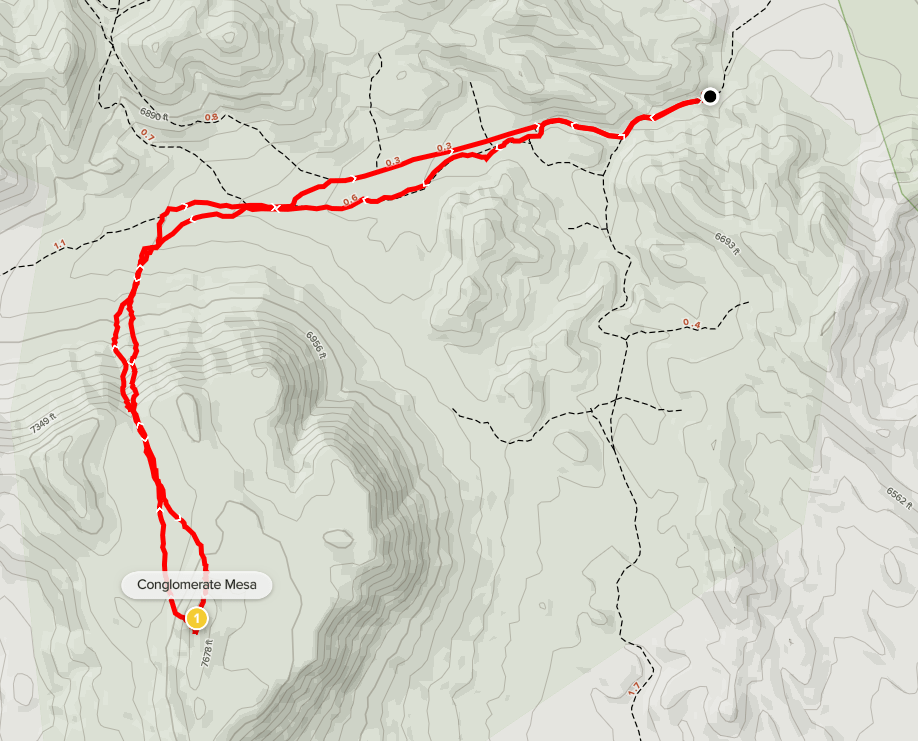
My plan for the final day of my 5 day road trip was to climb 3 more Zdon peaks in the southern end of the Inyo Mountains (and the surrounding desert). First up was 7724 foot Conglomerate Mesa. I had driven to the trailhead the night before after climbing nearby Malpais Mesa. From Highway 190, I followed Zdon’s directions by driving north on Saline Valley Road for 8 miles, then left on White Mountain Talc Road. Both of these roads are drivable for almost any car, but they are badly washboarded so be prepared for a bumpy ride. I drove a few miles on White Mountain Talc Road and then turned left onto a small spur road, drove about a mile, then parked. When I woke up the next morning it was 24 degrees, so I turned the car on for a few minutes to warm myself up before starting. I began this hike at 5:49am at 6266 feet above sea level.
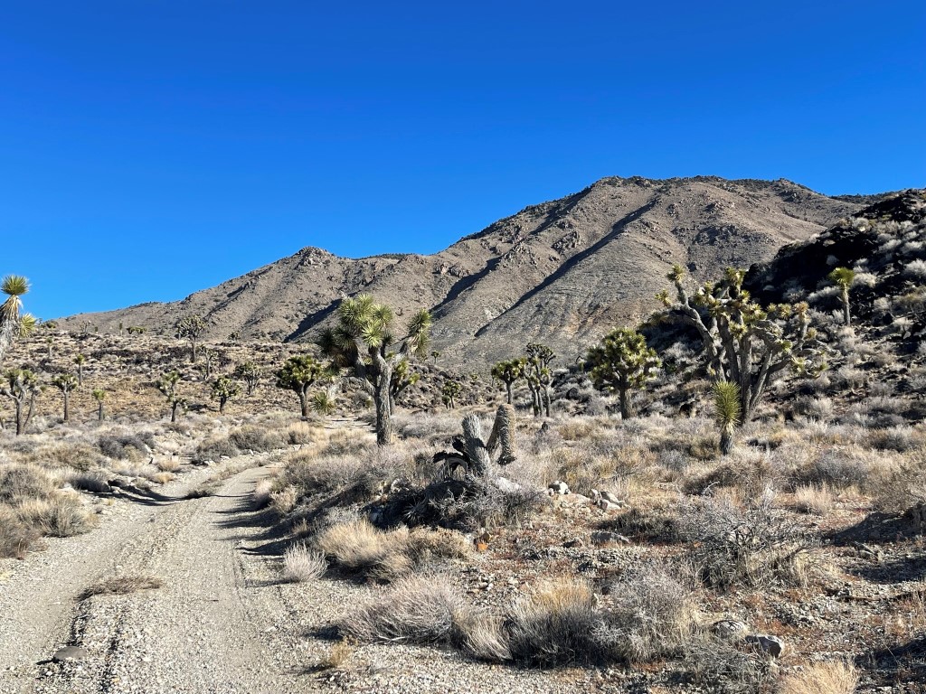
I hiked west down the dirt road. Before long, the tire tracks disappeared, and the road became impassable to vehicles. I realized on the way back that a severe washout blocked the actual road, and I had unknowingly diverted onto another road. Long story short, it does not seem currently possible to drive much further than I did. At 1.7 miles I left the “road” or whatever I was on and hiked south towards the mesa.
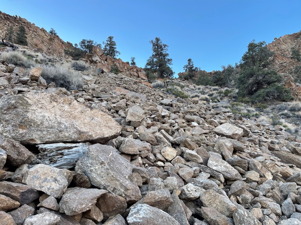
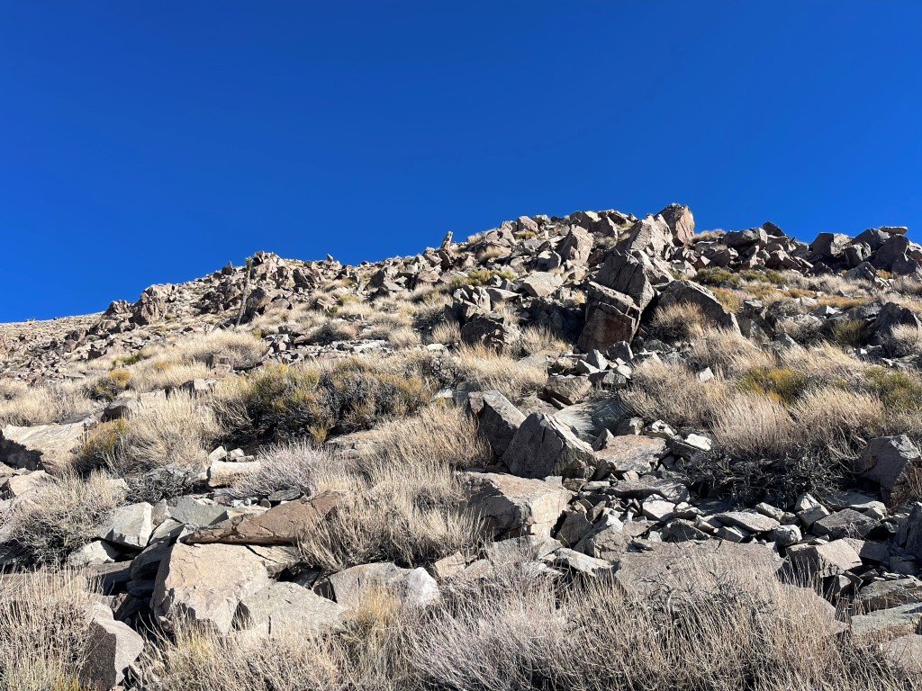
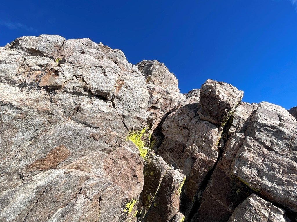
I reached the base of the mesa and climbed up the steep rocky slope.
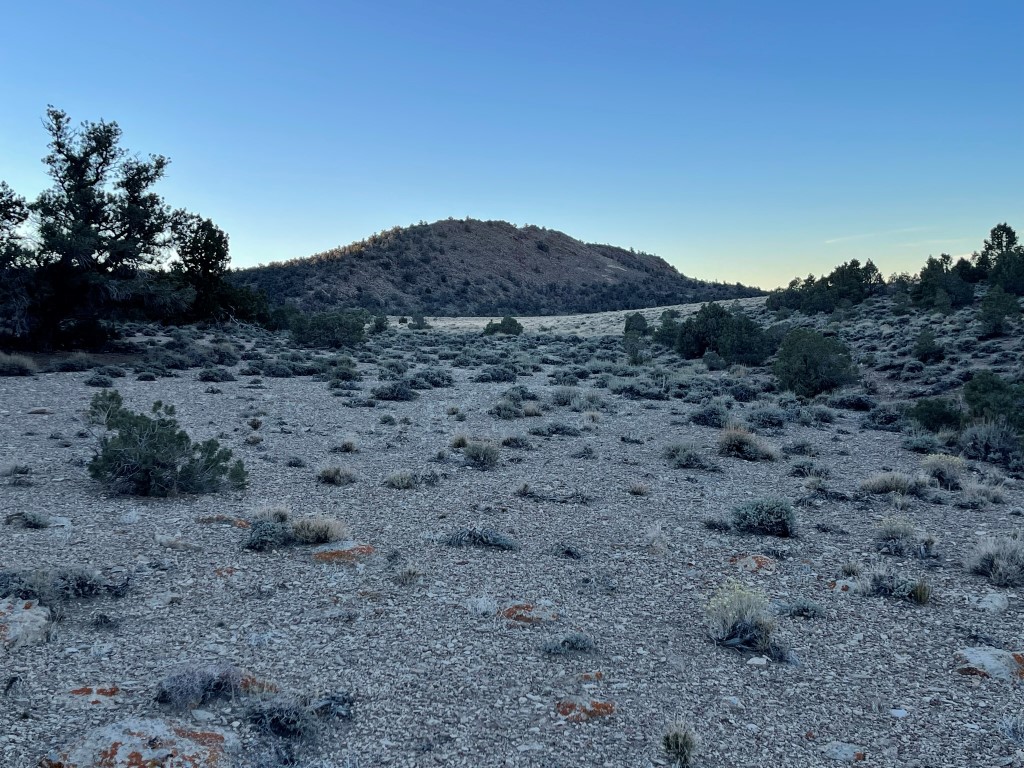
I reached the mesa at 2.2 miles / 7429 feet. I walked south across the mesa and climbed up the small hill that marked the high point.
I reached the summit at 7:19am at 2.8 miles!
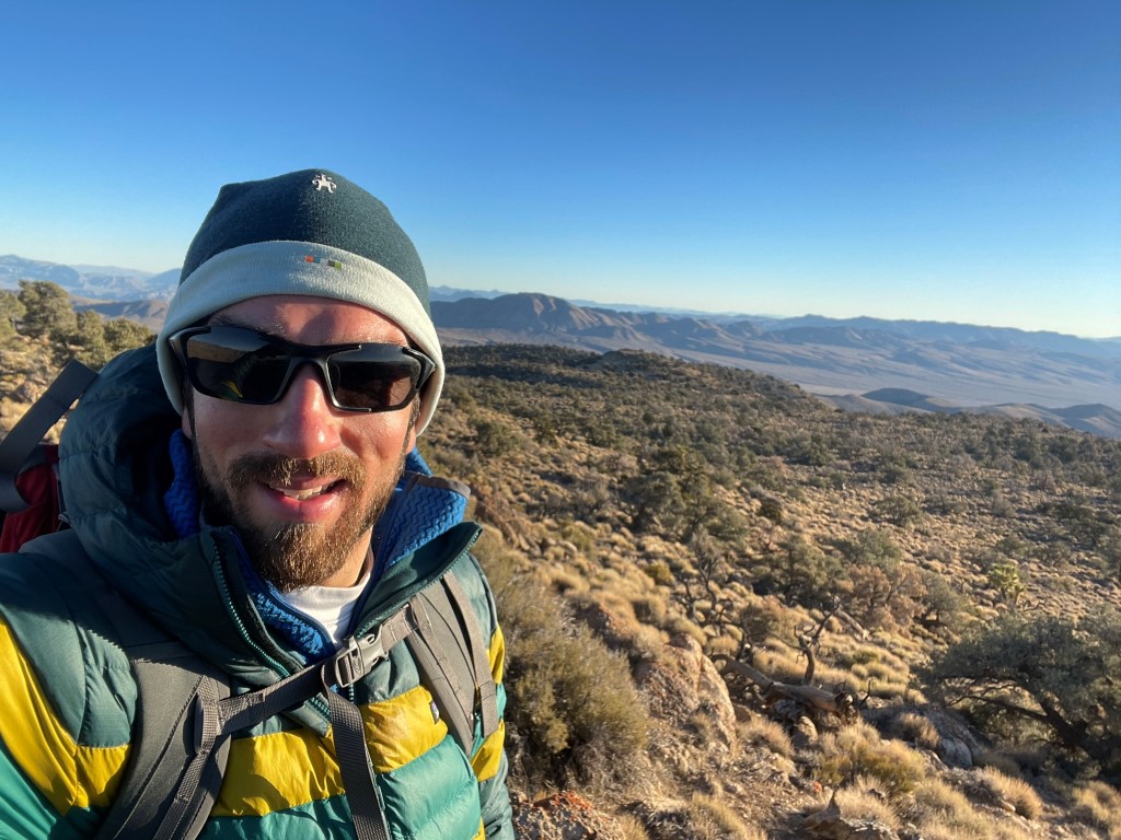
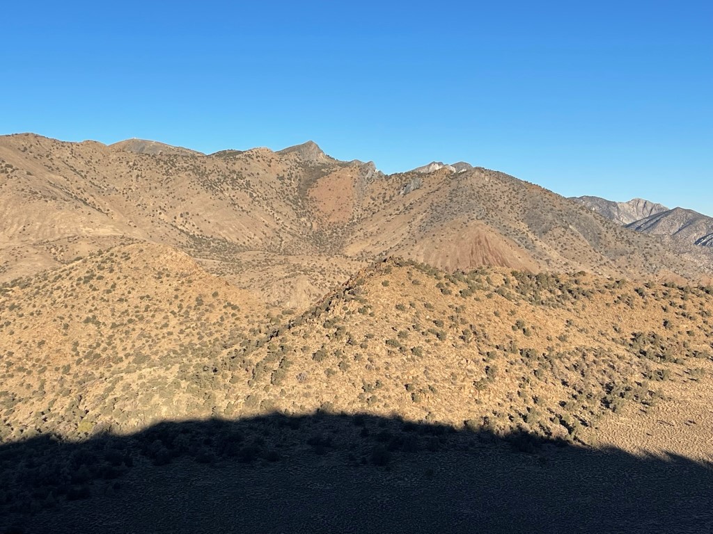
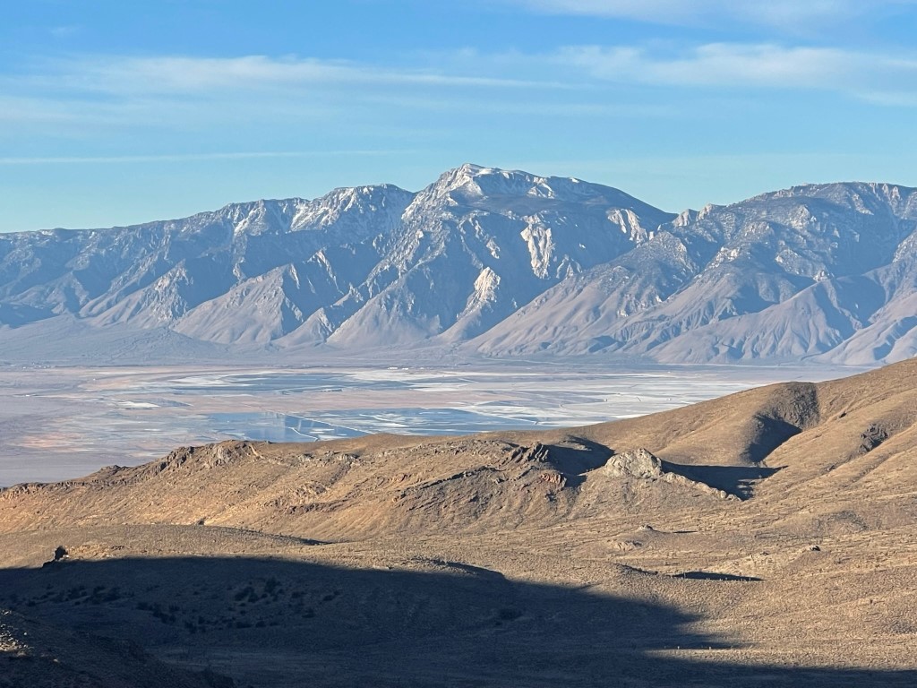
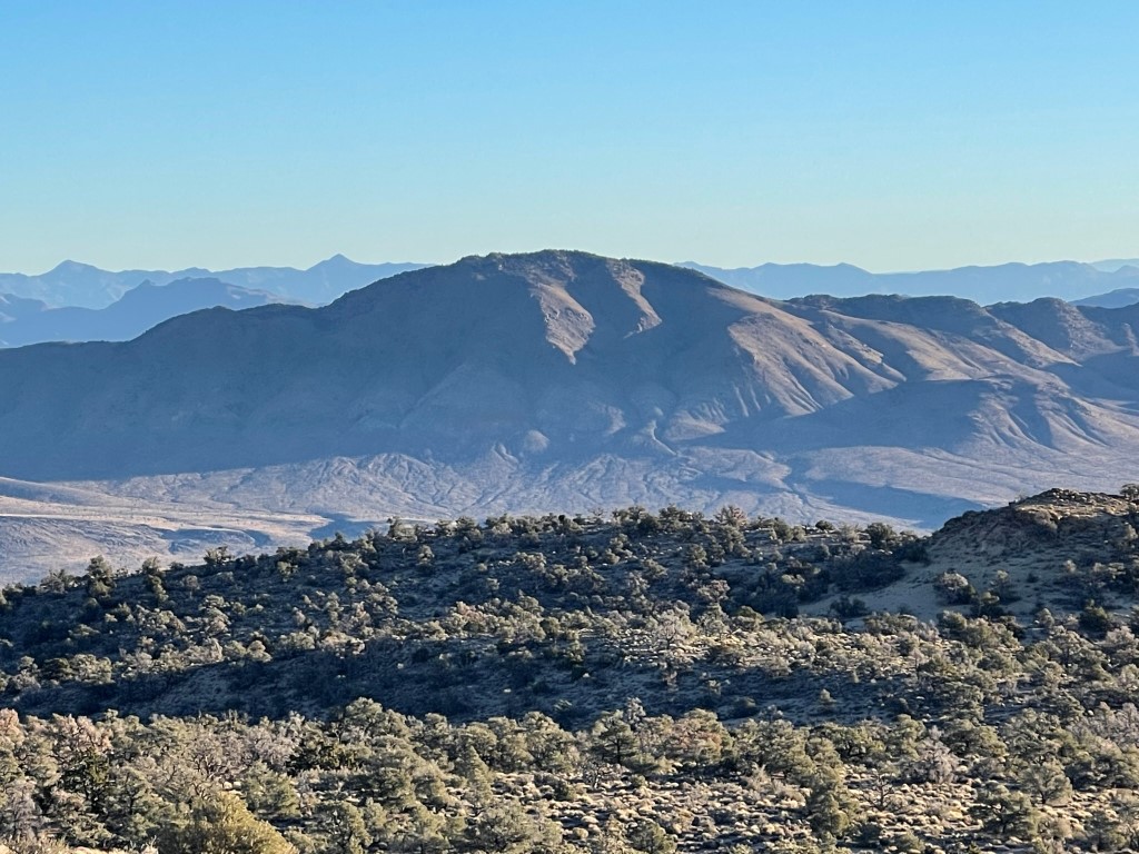
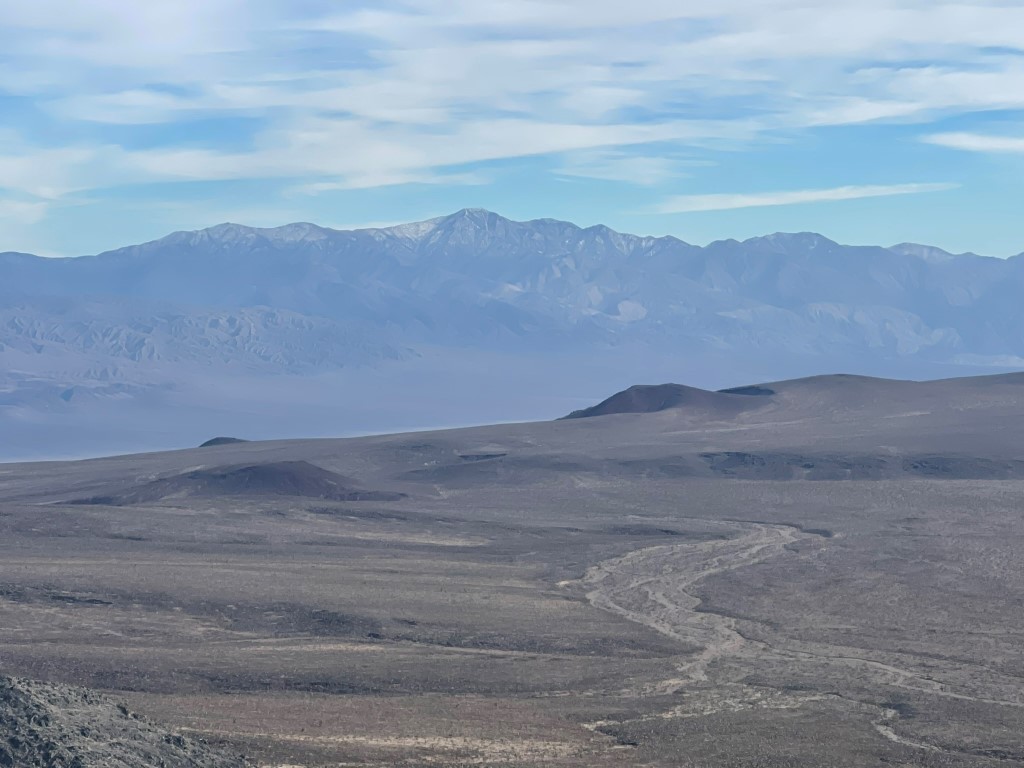
I signed the register which had been placed in 1981. The most recent entry was from May 6. I had a good view of Cerro Gordo Peak to the northwest:
Olancha Peak to the southwest:
The Nelson Range (my next objective) to the northeast:
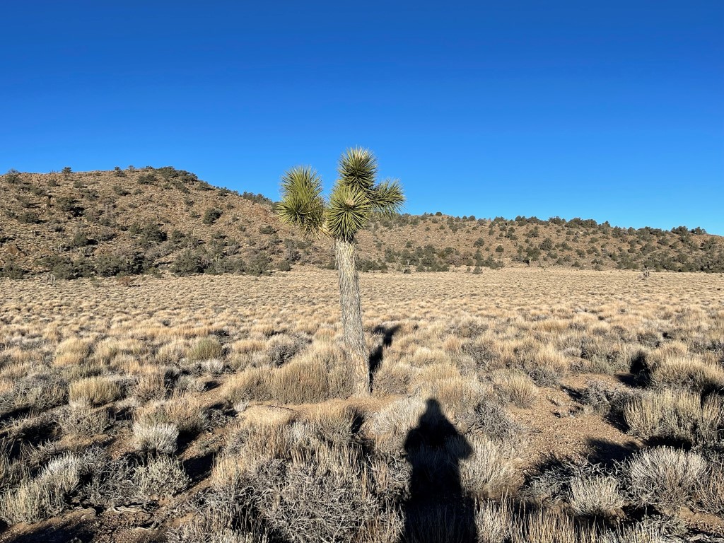
I took a short break and then retraced my route to the car. I spotted a single Joshua tree on the mesa.
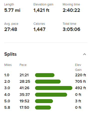
I reached the car at 8:54am. Stats for this hike were 5.77 miles, 1421 feet elevation gain, and 3:05:06 total time.
Nelson Range High Point
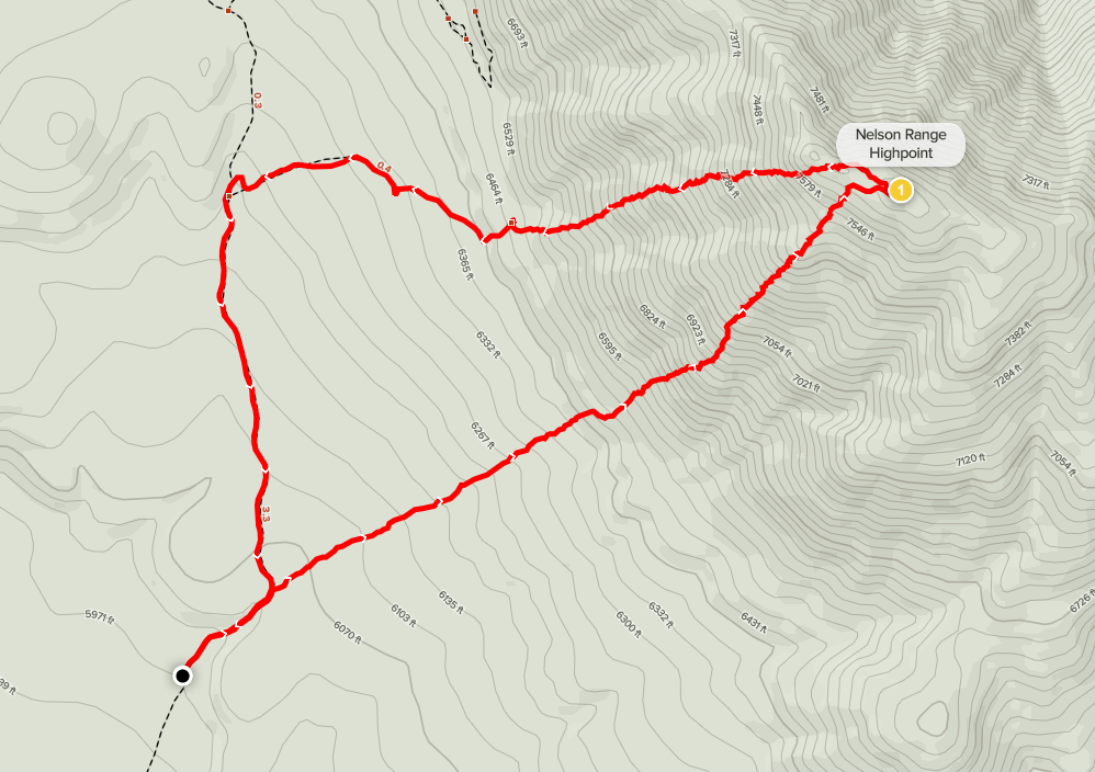
Next up was Nelson Range High Point (7696 feet). The Nelson Range is a tiny little mountain range separated from the Inyos by Lee Flat. Nelson is a DPS peak as well as a Zdon peak, so it was the primary goal for the day. I drove east on White Mountain Talc Road and then went north for a few miles on a dirt road heading for the mountain. Note that there are 2 separate dirt roads that go north from White Mountain Talc Road – I took the left (western) one. This road started off very good but got rougher as it went north. I started hiking at 9:39am from 5952 feet. It was now 39 degrees.
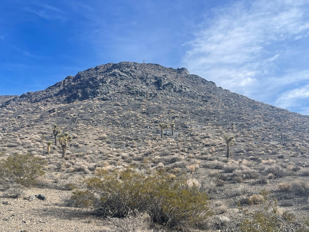
I left the road shortly after starting and hiked directly northeast towards the peak. The mountain is made up of a series of broad ridges that all looked climbable. I chose one that looked good and started up the steep slope.
I reached a gendarme on the ridge and climbed up some fun, optional class 3 rock.
At 1.1 miles / 7465 feet I reached a small dip and found myself in a pinyon/juniper woodland.

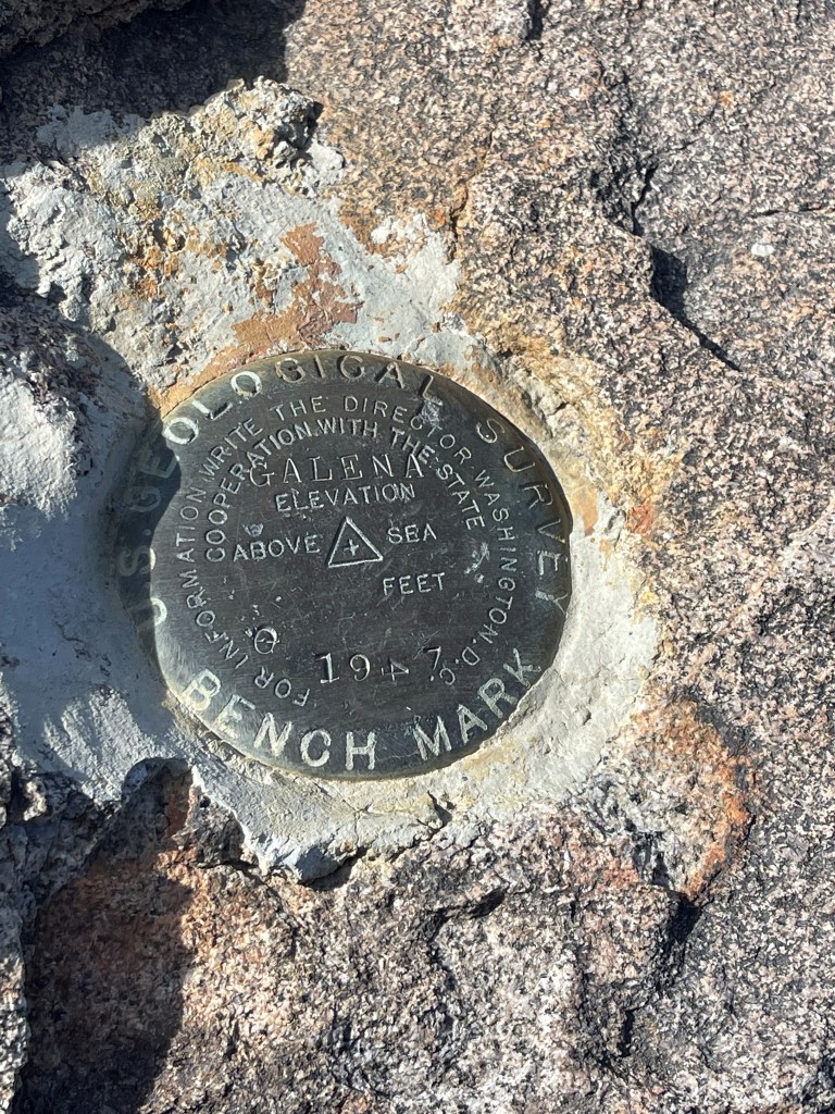
It was a short hike to the top from there. I reached the summit at 10:52am at 1.3 miles! I signed the register which had been placed in 1999. The most recent entry was from June 9. I located a benchmark and 2 reference markers.
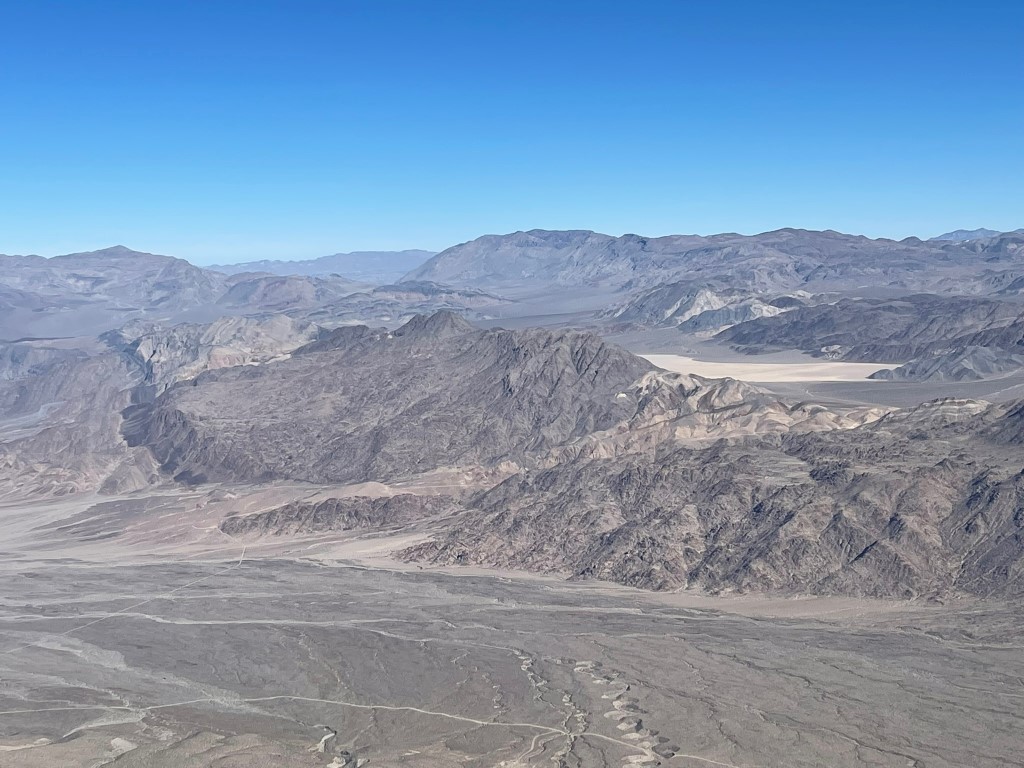
I really enjoyed the views on this summit – it was a different perspective than I was used to of all the Death Valley mountain ranges. To the northeast I had a good view of Tin Mountain and Dry Mountain, with the Racetrack Playa in between.
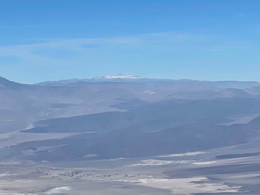
I could see all the way to White Mountain Peak to the north:
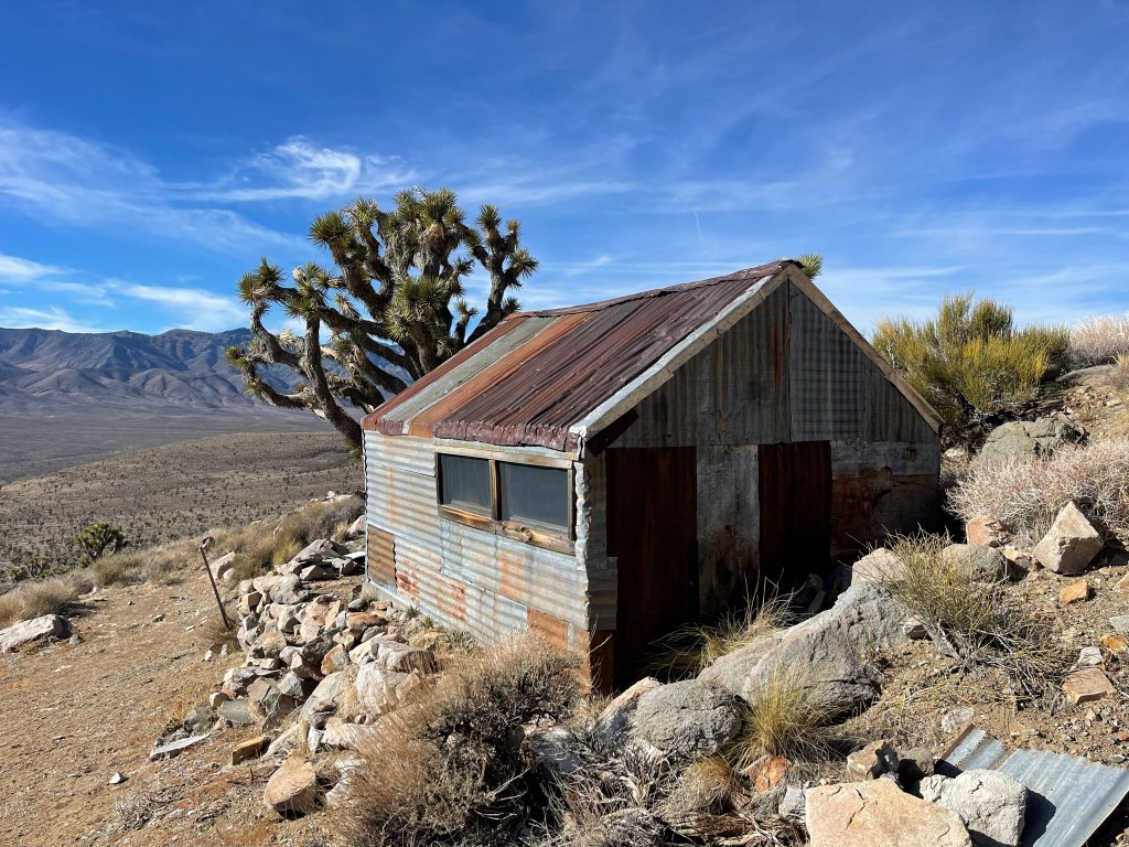
I descended once I was done enjoying the views. I chose a different ridge to descend, slightly north of my ascent route. Similar to the other ridge, this ridge also had a gendarme in which I climbed down some optional class 3. I reached an old cabin at the bottom.
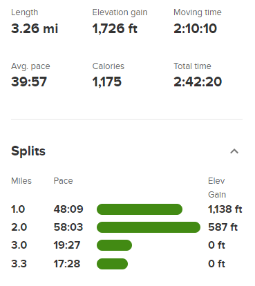
From there I followed a spur road west to the road I had driven in on, then hiked south back to the car. I reached the car at 12:22pm. Stats for this hike were 3.26 miles, 1726 feet elevation gain, and 2:42:20 total time.
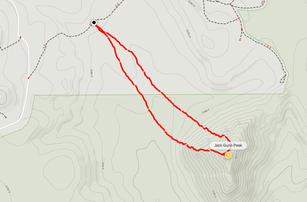
Jack Gunn Peak
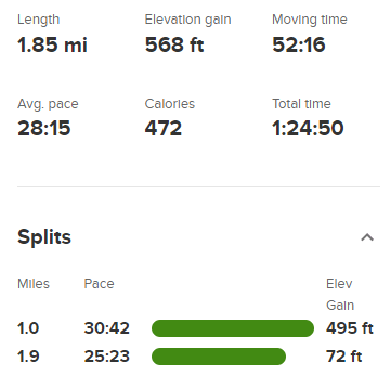
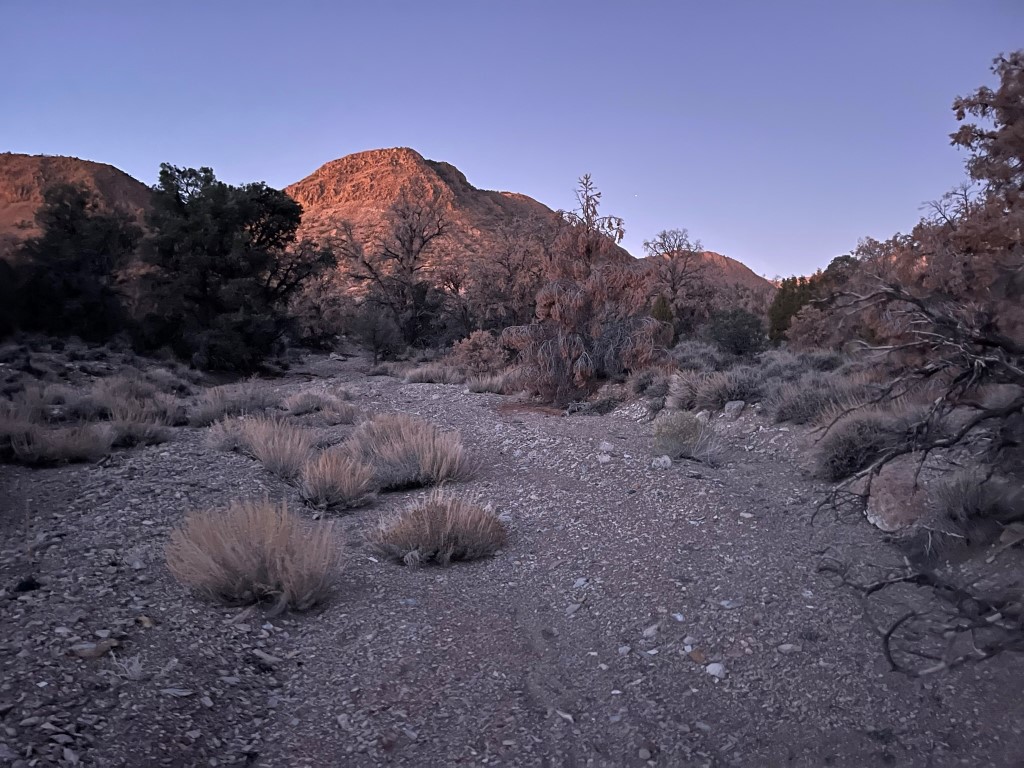
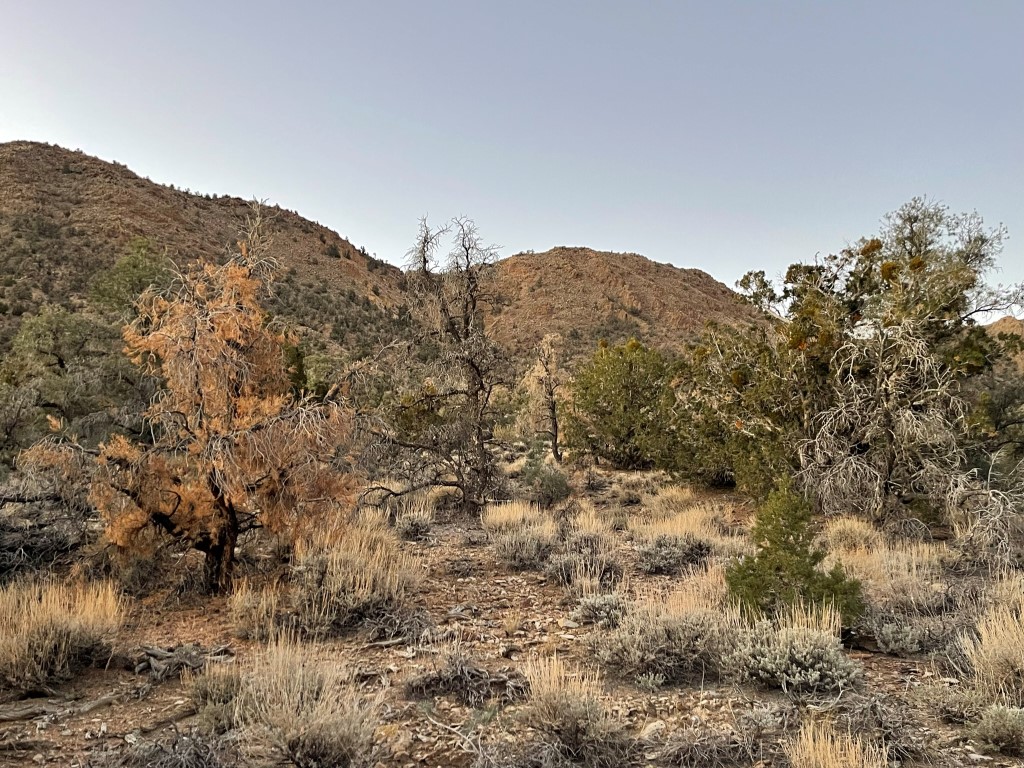
The final peak of the day was Jack Gunn Peak (5603 feet), a small hill a few miles south of the Nelson Range. I drove south on White Mountain Talc Road back to Saline Valley Road, then went east on a spur road for a short way and then parked. The spur road had a short downhill that you may need 4WD/AWD to get back up, but you could just start this hike from Saline Valley Road if needed. I started hiking at 1:16pm from 5173 feet above sea level.

Similar to the Nelson Range, any of the ridges looked climbable. I chose one and made the steep 500 foot climb to the summit.
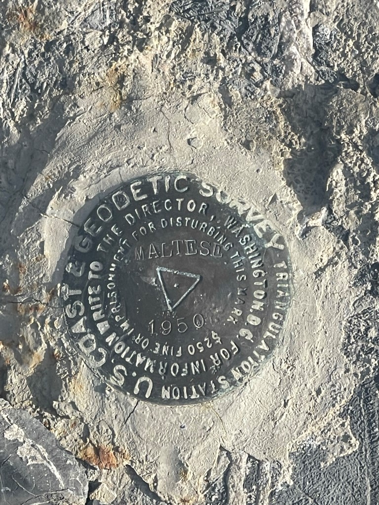
I reached the summit at 1:43pm at 0.9 mile! I signed the register which had been placed in 2007. The most recent entry was from May 6. I located the “Maltese” benchmark and 2 reference markers.
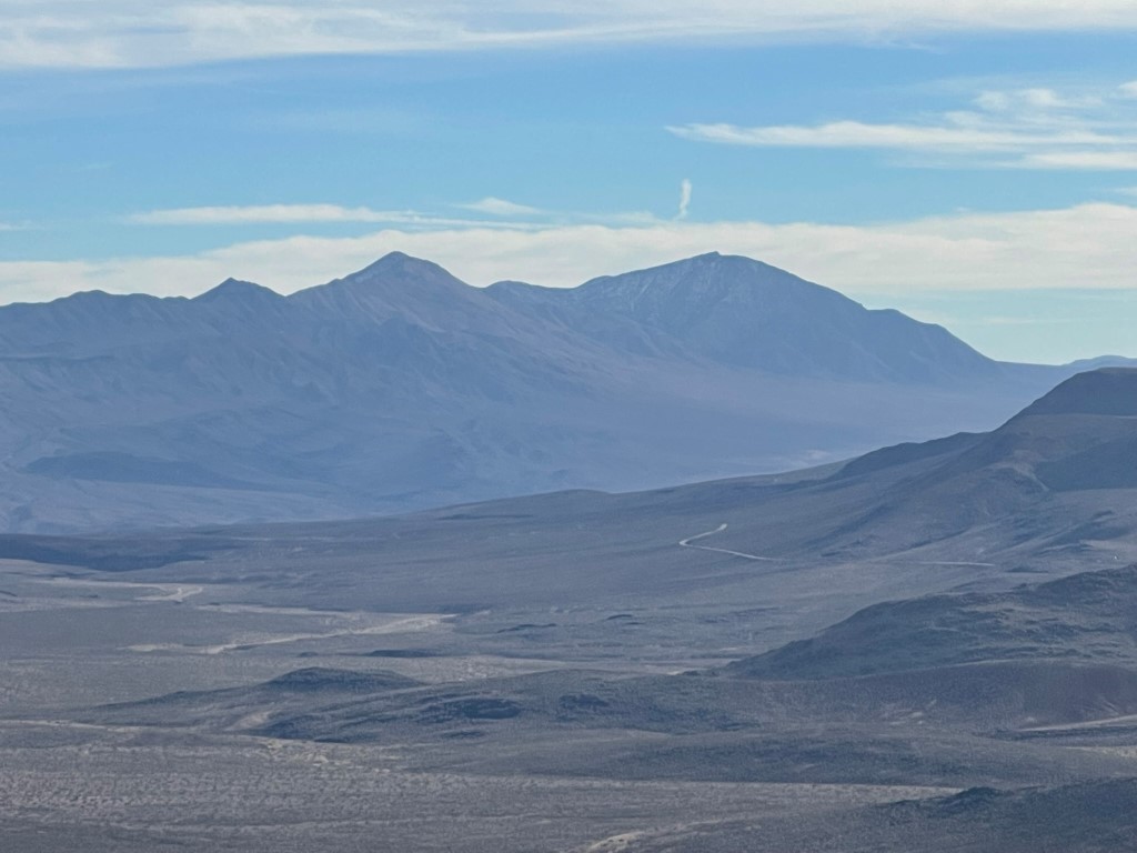
Telescope Peak to the southeast:
Maturango Peak to the southwest:
I took a different ridge on the descent, this one slightly north of the ascent route. I reached the car at 2:30pm. Stats for this hike were 1.85 miles, 568 feet elevation gain, and 1:24:50 total time.