Petrified Forest is a national park in Northeastern Arizona known for containing large amounts of petrified wood. I had never visited it before, so I decided to make a stop there on a 4 day road trip through the state. I left Thursday night after work and drove over 6 hours to Tonto National Forest northeast of Phoenix and spent the night camped just off Highway 87. The next morning, I got up early and made it to the south entrance of the park right at 8am when the gates opened. My plan for the day was to drive the entire park road from south to north and do as many short hikes along the way as I could.
Giant Logs
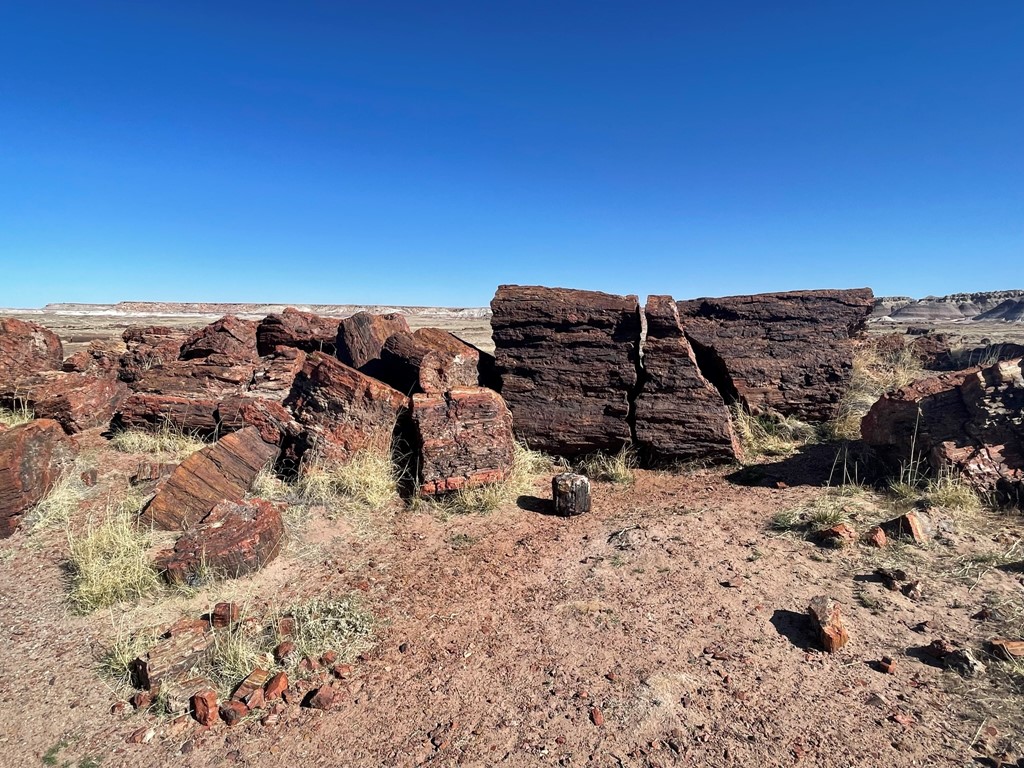
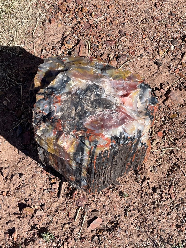
First up was the Giant Logs Trail, which starts at the Rainbow Forest Museum. The Giant Logs Trail is a self-guided interpretive trail which includes a lot of interesting information on the formation of petrified wood. It was my first time seeing petrified wood, so I was very interested to see the various shapes and colors.
The main attraction of this trail is a 35 foot petrified log known as “Old Faithful”. The trail guide indicated that one of the early park superintendent’s wives remarked that this log was to Petrified Forest what Old Faithful geyser is to Yellowstone (and the name stuck).

This hike was 0.75 mile and took 25 minutes.
Long Logs and Agate House
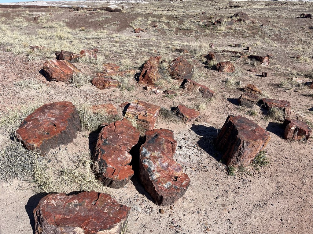
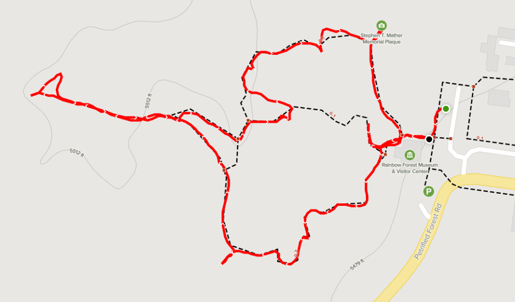
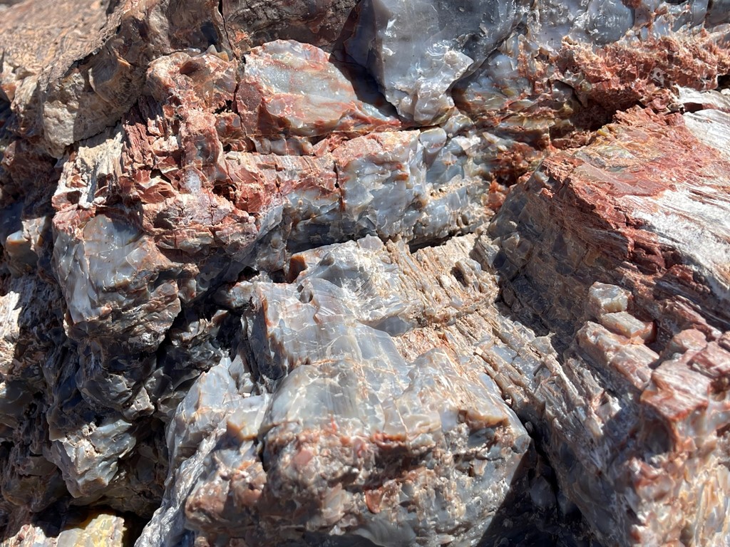
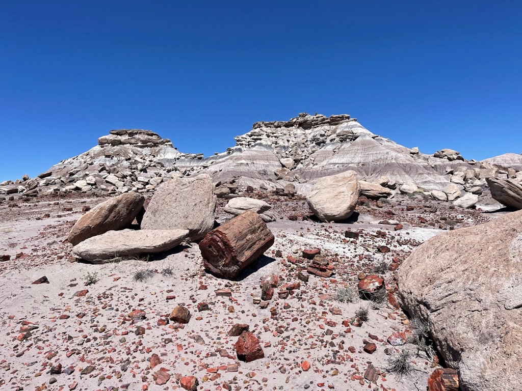
Next up was the Long Logs and Agate House Loop Trail, which also starts from the Rainbow Forest Museum. As the name suggests, the Long Logs Trail contained some of the longest pieces of petrified wood in the park.
I observed some brilliant colors along this trail.
At the end of the trail is the Agate House, a 1934 reconstruction of a house made of petrified wood inhabited by a Pueblo family. A signpost near the house indicated that such a reconstruction would not be done today (the present attitude to leave archaeological sites undisturbed).

This hike was 2.62 miles and took 58 minutes.

I checked out the Rainbow Forest Museum before continuing. The museum had some cool displays on petrified wood formation as well as the plants and animals that used to inhabit the park.
Marthas Butte
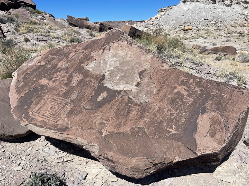
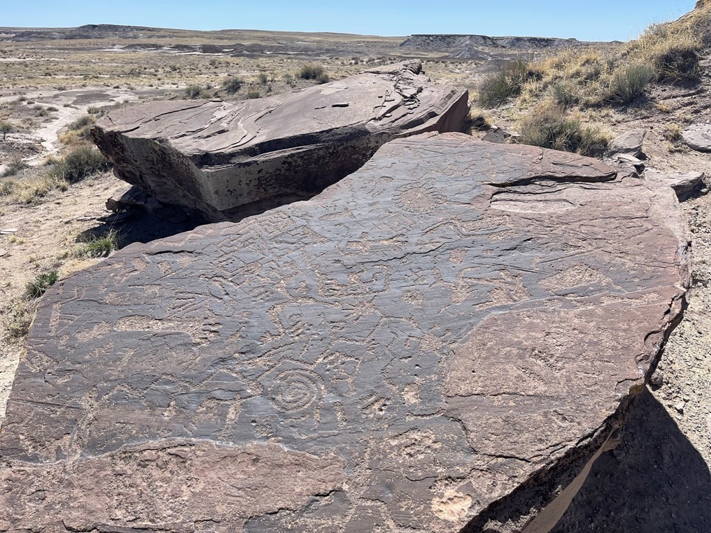
My third hike for the day was Marthas Butte, which is an off trail hike to a petroglyph site about a mile west of the park road. I parked on the side of the road and began hiking across the desert to Marthas Butte, which is the distinctively shaped feature below.
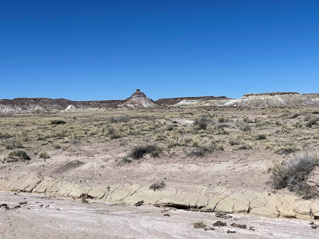
I reached the butte and located a number of petroglyphs. I had no idea there were so many, it was very cool!

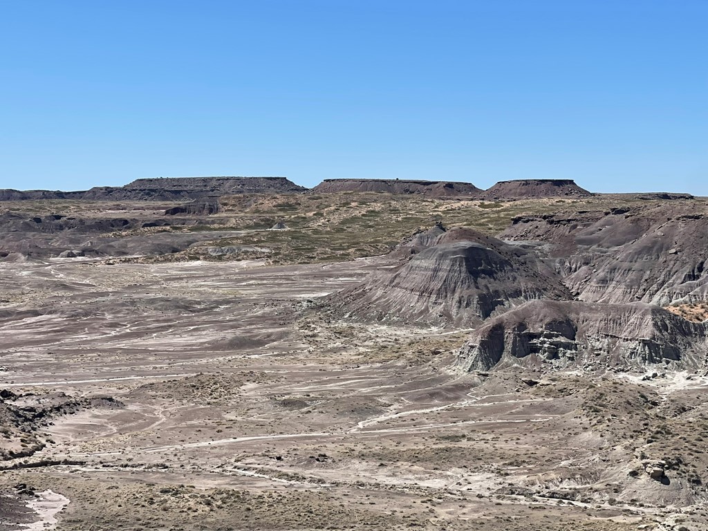
When I was done viewing the petroglyphs, I decided to climb to the top of the butte before heading back. It was rather difficult since the butte was made of a crumbly clay material, and I also had a make a low class 3 move onto the summit block. I enjoyed the views for a few minutes before heading down.
I spotted a coyote on the way back.

This hike was 2.23 miles and took 1 hour 5 minutes.
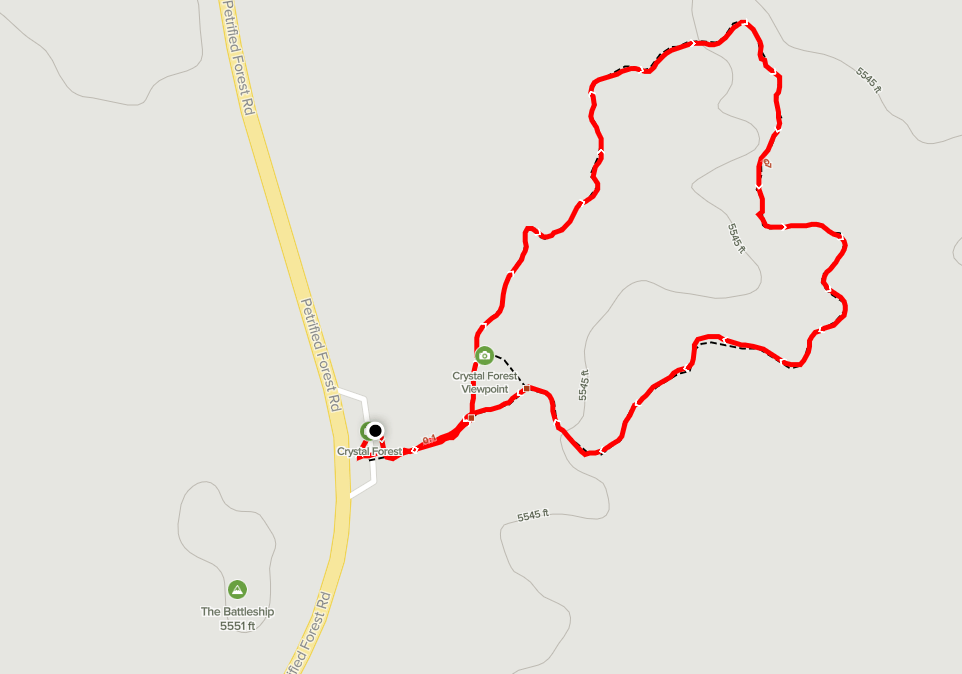
Crystal Forest
Next stop was Crystal Forest, another popular hike that’s less than a mile. This short loop contained some pretty large logs as well.

And more beautiful colors!
There is a large formation known as “The Battleship” across the road from the Crystal Forest trailhead.

This hike was 0.9 mile and took 22 minutes.
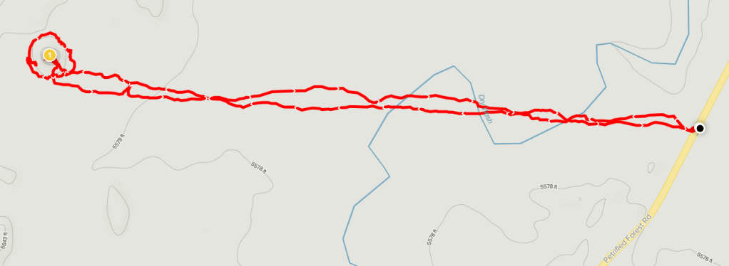
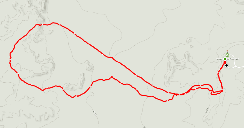
Jasper Forest
I then made my way up to the Jasper Forest Overlook and decided to do an off trail hike through the area. There actually was a use trail for the first half mile or so that descended from the overlook down into the badlands.
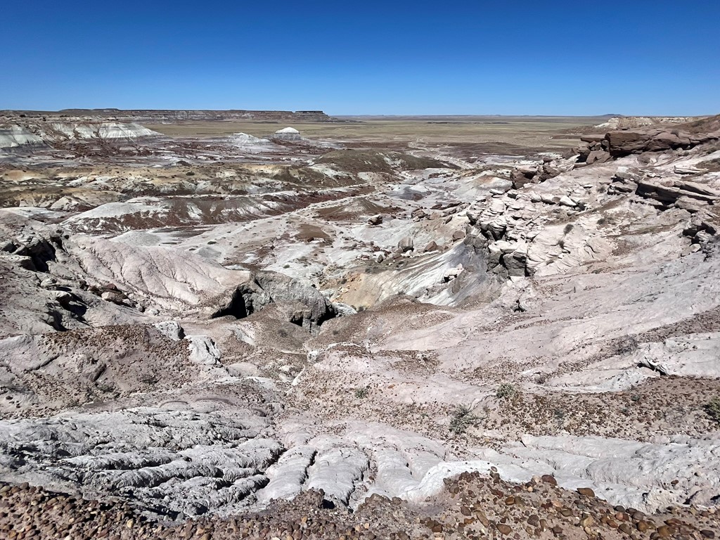
There was lots of petrified wood here too.
I hiked up to the top of a small mesa and had a nice view of the area.
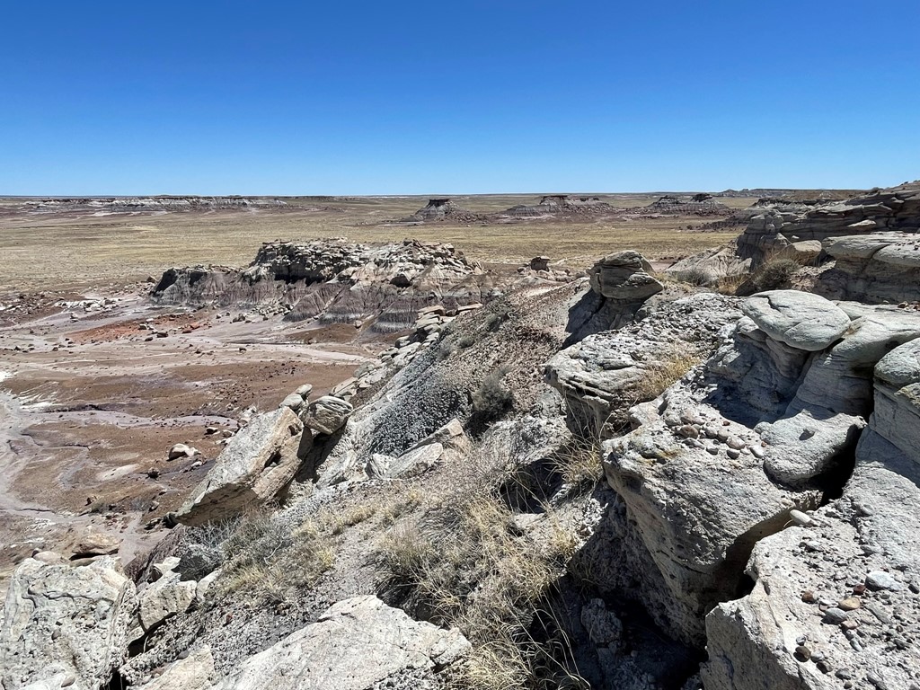
This was the longest hike of the day, totaling 4.21 miles and 1 hour 39 minutes.
Agate Bridge
I then made a quick stop to check out the Agate Bridge, which is a petrified log where the ground beneath it eroded away. A concrete span was added underneath the log in 1917 to stabilize it.

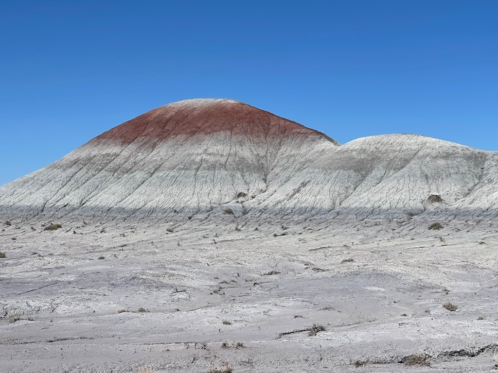
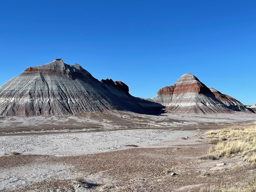
Blue Mesa
Next up was Blue Mesa, which is a series of badlands with a distinctive blue layer. The popular Blue Mesa Trail makes a short loop through the area.

The colors were very cool.
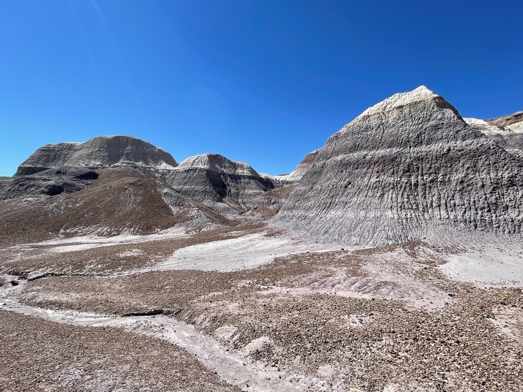
This hike was 1.03 mile and took 27 minutes.
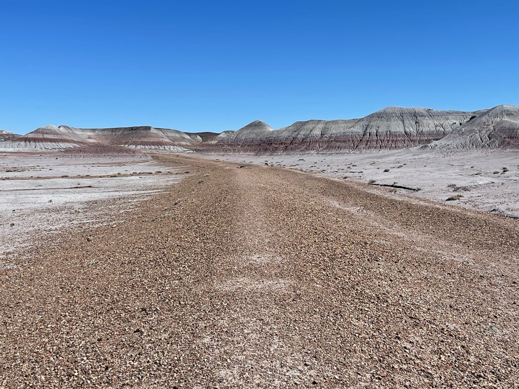
Blue Forest
After that I drove to the Blue Forest Trail, which is in the same Blue Mesa area. I hiked east on an old road into the badlands.
There was some really cool red, white, and blue striping.
I passed some interesting rock formations.
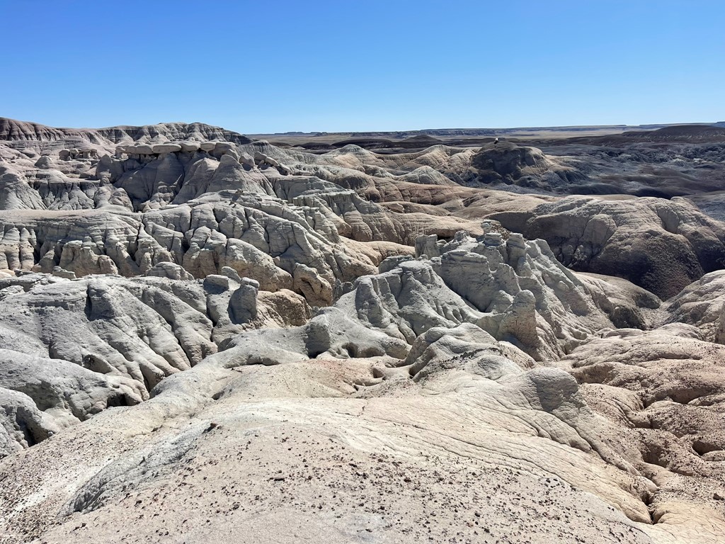
As the road petered out, I followed a use trail up to the top of the mesa. I had an excellent view of the area. The paved Blue Mesa Trail can be seen in the center below.

This hike was 2.38 miles and took 57 minutes.

Billings Gap
I drove back to the Blue Mesa Overlook area to do a quick hike to Billings Gap. I followed a vague use trail east of the overlook along the edge of the mesa.
After a mile I reached Billings Gap, which turned out to be a large valley between 2 mesas. I saw some hoodoos there which reminded me of Bryce Canyon.

This hike was 2.06 miles and took 49 minutes.
The Teepees
I made a quick stop on the side of the road to photograph The Teepees, which is possibly the most iconic feature in the park.
Newspaper Rock
I made another quick stop just past The Teepees at Newspaper Rock. Newspaper Rock is a huge rock containing a large number of petroglyphs. They don’t let you get anywhere near the rock – you must view it from an overlook above.

Puerco Pueblo
My 2nd to last hike of the day would be Puerco Pueblo, the ruins of an old Pueblo village. The hike was a short walk through the ruins. The structure apparently contained over 100 rooms centered around a large courtyard.

There were also some more petroglyphs you can view from above.


There was also a very cool “calendar petroglyph”, which involved a crack in which light would only shine through onto a symbol for a few days each year around the summer solstice. This hike was 0.39 miles and took 16 minutes.

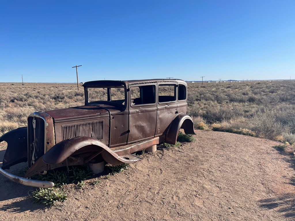
Route 66 Monument
I continued north on the park road as it crossed I-40. I made a quick stop to check out an old 1932 Studebaker which marks where Route 66 used to cross through the park (the modern I-40 mostly follows the same route through Northern Arizona).
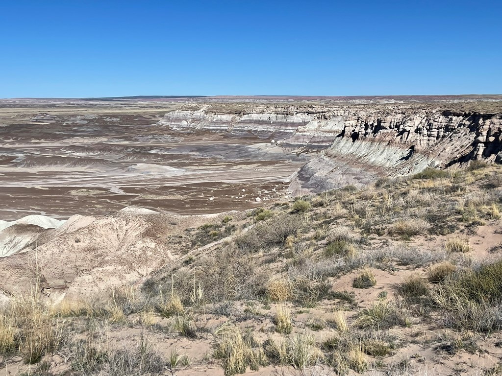
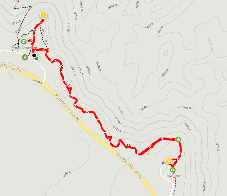
Painted Desert Rim
Last but not least was the Painted Desert Rim Trail. This part of the park road follows the edge of a large mesa which overlooks the Painted Desert. The Rim Trail goes from Kachina Point to Tawa Point. It was nearly 6pm so the sun was casting long shadows across the buttes and mesas. I found the red color of the desert to be very beautiful – so different than the dull brown color of the deserts in California.
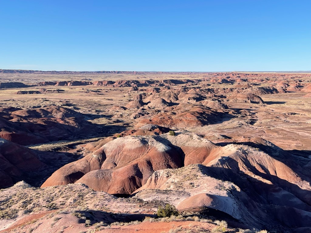
I spotted Pilot Rock about 8 miles to the north across the wilderness. Pilot Rock, which is the national park highpoint, would be my destination for tomorrow.

This hike was 1.37 miles and took 42 minutes.
I ended up spending the night parked at the Hopi Travel Plaza about 20 miles to the west. Sleeping at a truck stop is not my first choice, but I couldn’t find any suitable public land to park for the night nearby. I was tired enough that I actually slept very well.
