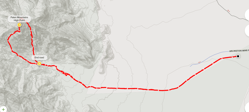
Palen Mountains High Point
Winter had finally arrived, so it was time to head back into the low deserts of southeastern California. Rain and snow were forecasted for San Diego and the surrounding coastal areas, so I planned to climb some desert peaks near Blythe, California. I had recently been to the area in February to climb Black Butte, Chuckwalla Mountain, and Big Maria Mountains High Point. This time, I was hoping to knock off a few more peaks on the Sierra Club Desert Peaks Section (DPS) list. I left Friday after work and drove for a few hours before parking on a dirt road just off State Route 78 near Palo Verde.
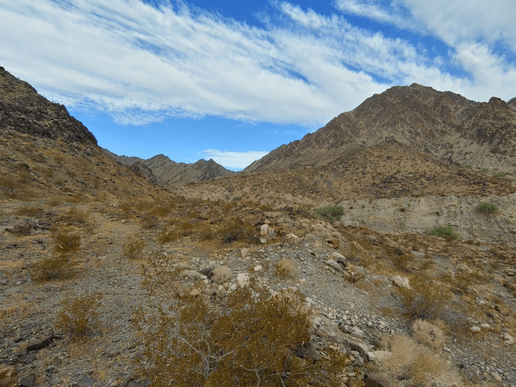
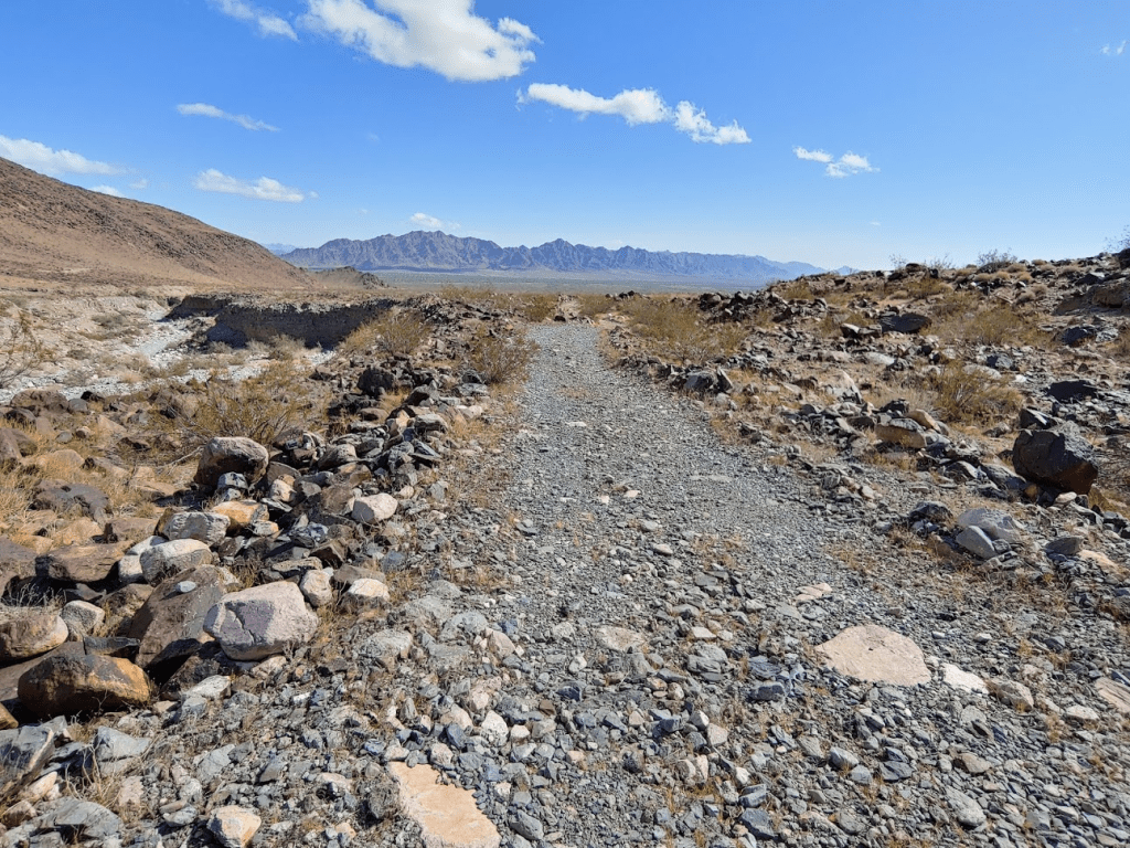
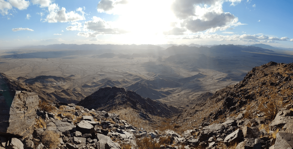
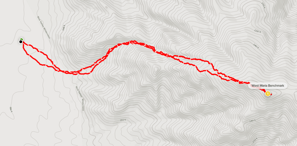
I woke up the next day at 4:15am and continued driving. I was planning to climb Palen Mountains High Point (3848 feet). The Palen Mountains are a remote desert range about 30 miles northwest of Blythe. The high point of the range is a 2k prominence peak and is on the DPS list as well as Andy Zdon’s list of desert summits. There are western and eastern routes up to the top, both involving long, rough approaches on dirt roads. I was doubtful that either approach was suitable for my Forester, but the eastern approach appeared to be in good shape until the last few miles, so I figured I could simply walk the extra distance. Plus, the eastern approach would put me closer to other peaks I was hoping to do this weekend. I took Lovekin Blvd north out of Blythe where it eventually turns into Midland Road. I then turned left onto Arlington Mine Road which I took west for about 13 miles and then parked. There is an active mine in the area so most of this road is graded. The first 7 miles is very wide and smooth so you can drive 40 mph on it. The next 5 miles are a little rougher but still passable for any car. The last mile until where I parked got pretty sandy and bumpy. This road continues for another 5ish miles to the base of the Palen Mountains, but I parked here and started hiking at 6:17am from 919 feet.

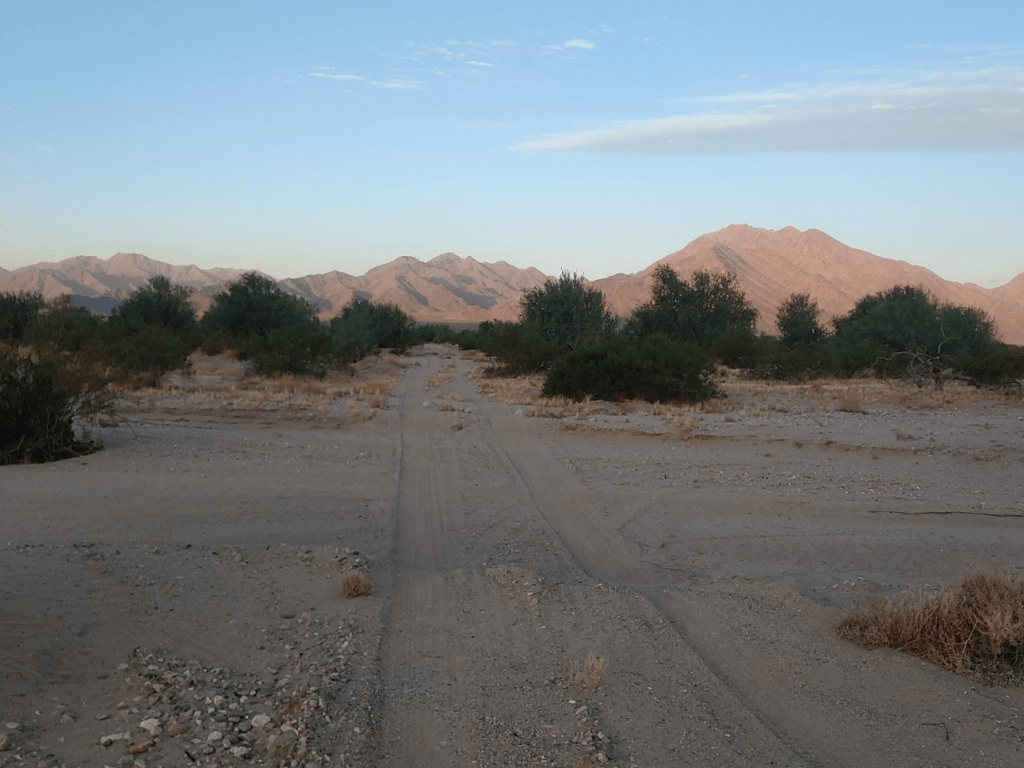
I began walking west towards the mountains along the road. The road was very sandy.
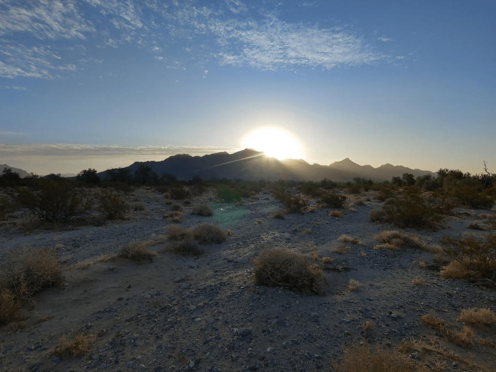
It was rather cold and windy as I got started. After a mile or so the sun began to rise behind me above the McCoy Mountains.
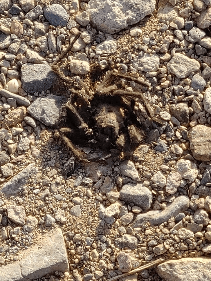
At 1.74 miles 4 trucks passed me heading the other direction. Of course, they were all surprised to see someone hiking alone in the middle of the desert. It was a little annoying having to explain to each one what I was doing. I continued on and came across a dead tarantula in the middle of the road. It appeared to have been squished by a passing vehicle, possibly one of the trucks that had just driven by.
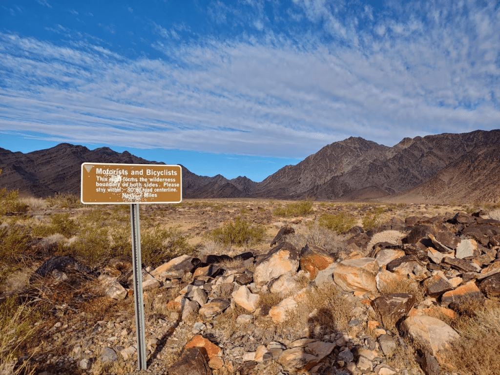
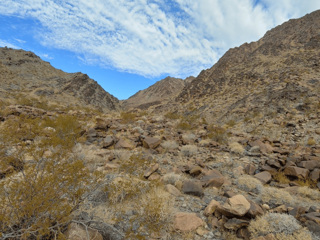
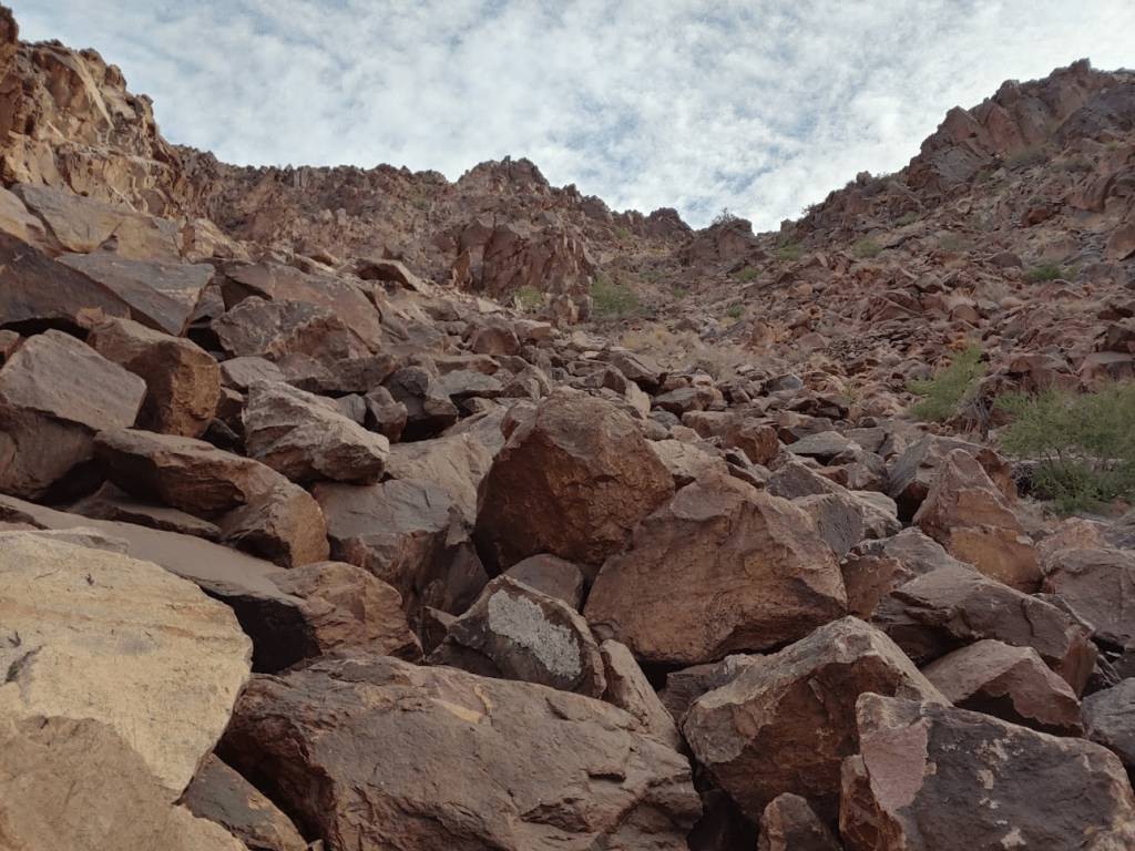
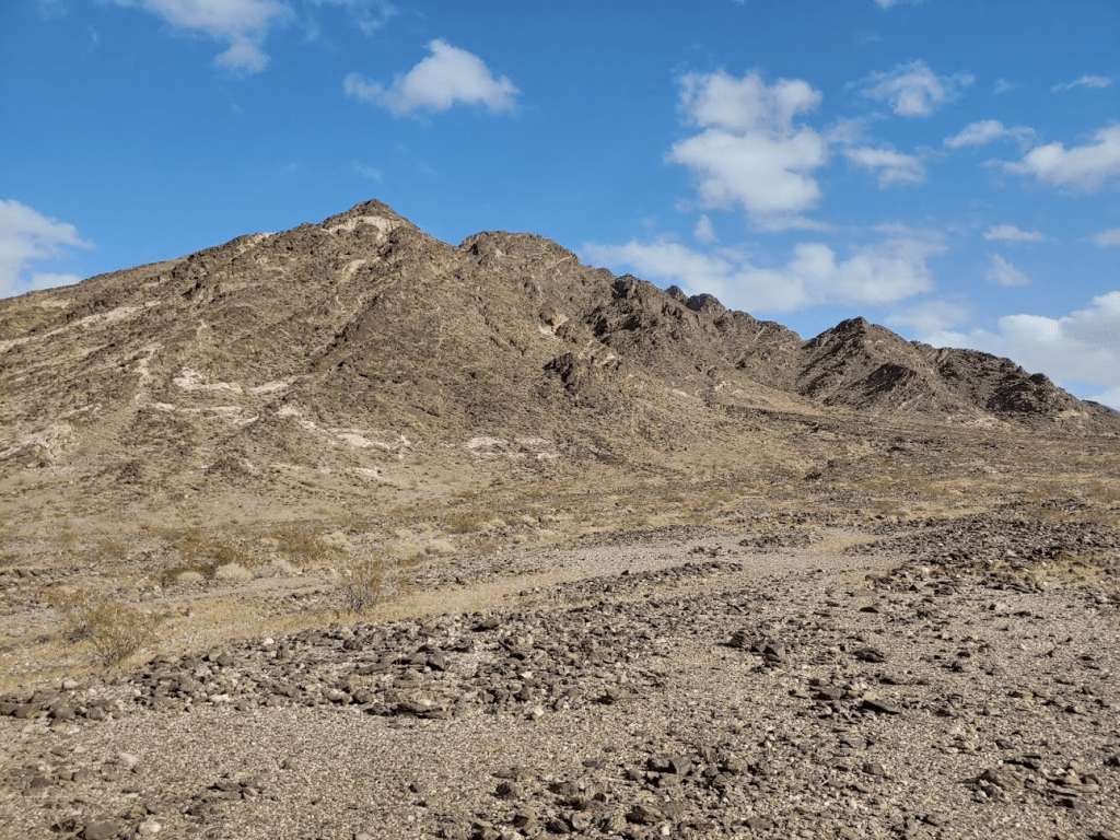
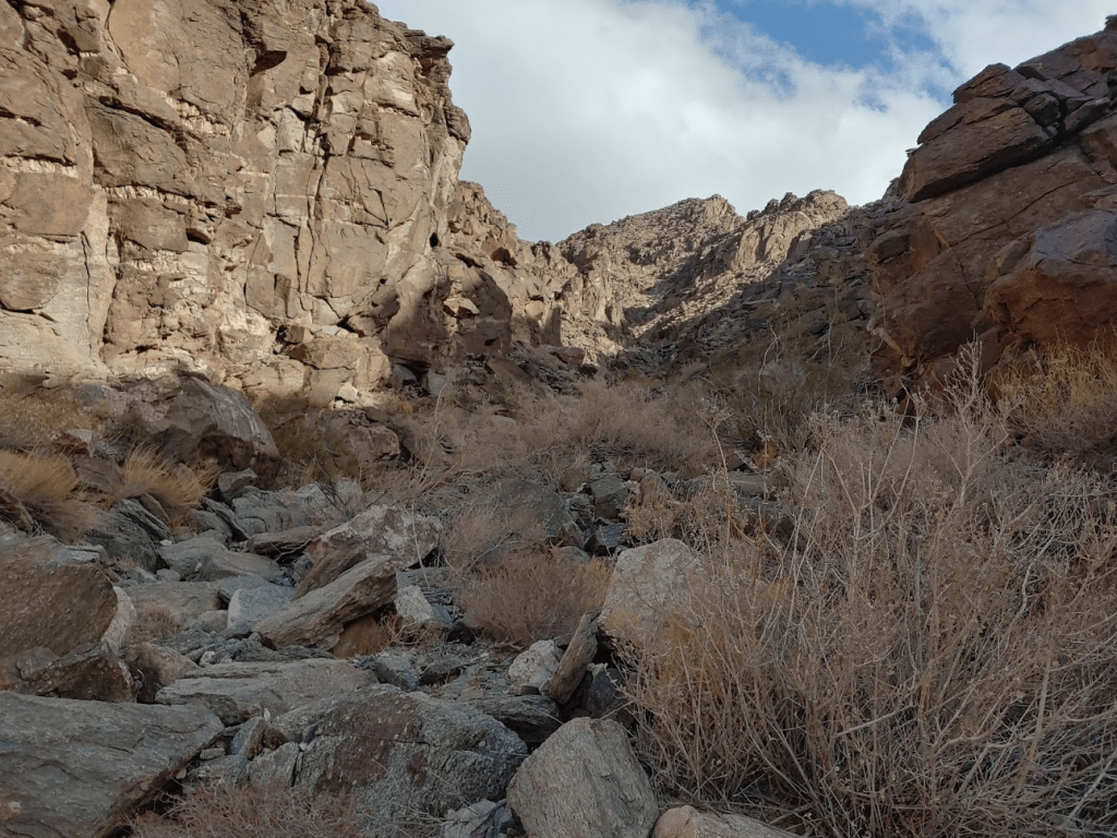
The road deteriorated as I continued west. I certainly could have driven another mile or mile and a half, but after that point the road turned from sandy to extremely rocky. At 3.54 miles I reached a fork and went left. There were signs indicating the wilderness boundary begins 30 feet from the edge of the road.
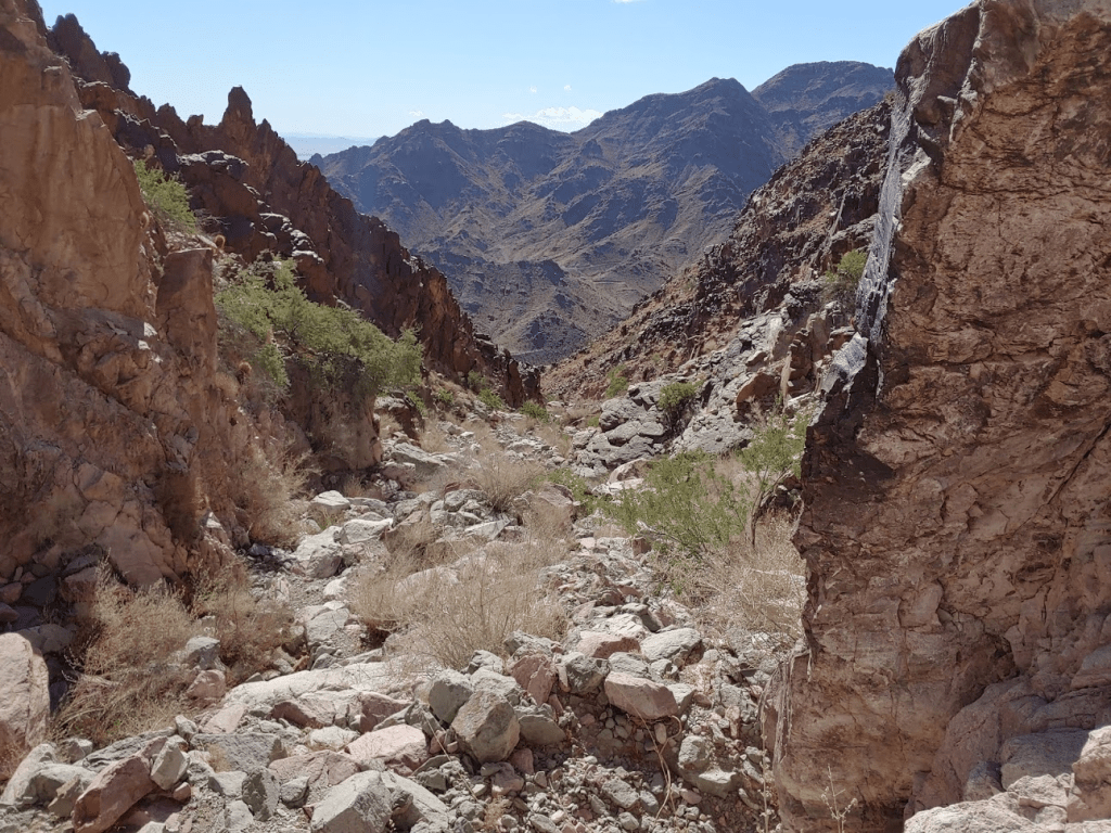
The road disappeared around 4.5 miles but then I picked up another track and followed that until about 5.2 miles. This appeared to be the official DPS trailhead, meaning that my extra walking would add over 10 miles to the hike. I was at 1589 feet, so still well over 2000 feet to ascend.
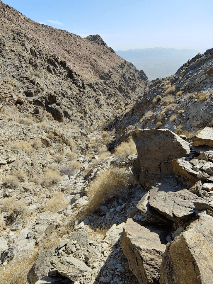
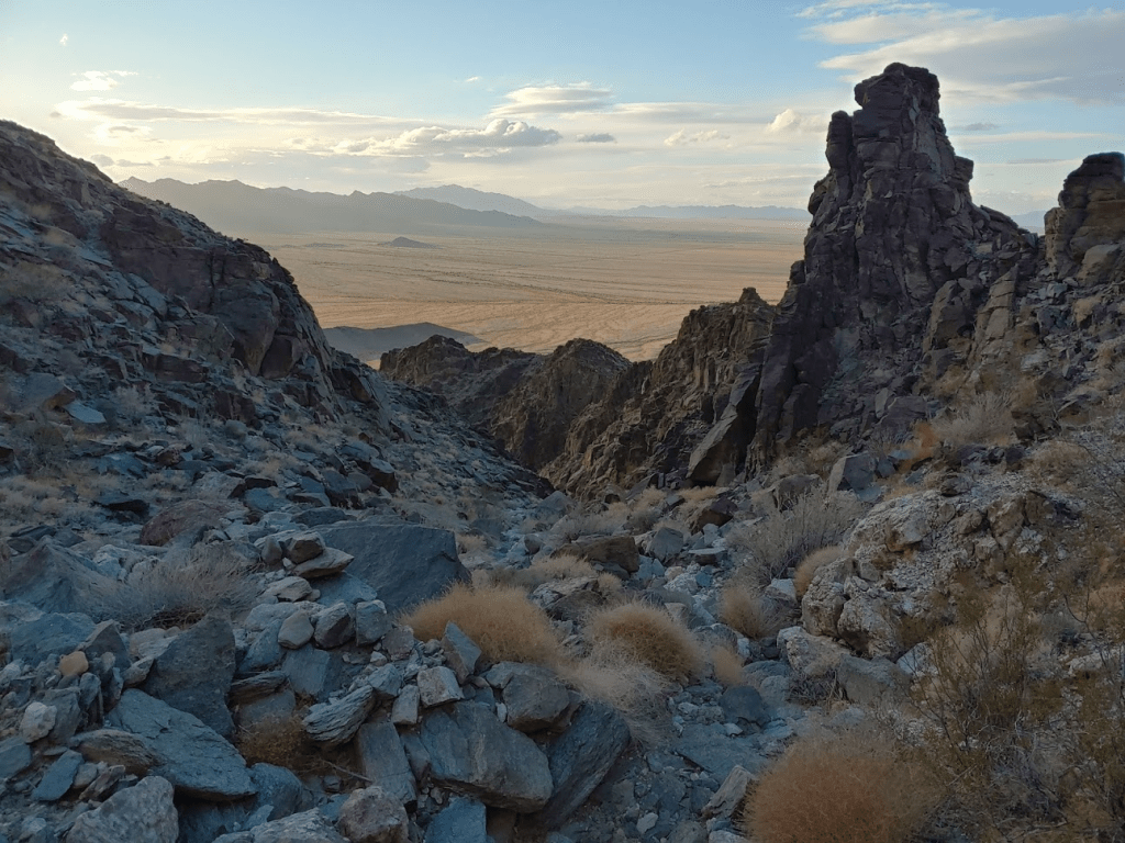
There are 2 established routes up the mountain from this side. I chose to ascend via Route B, which involves climbing up a canyon on the southwest side. I started by climbing up a wide wash.
Eventually I left the main wash and started climbing up the canyon to the north.
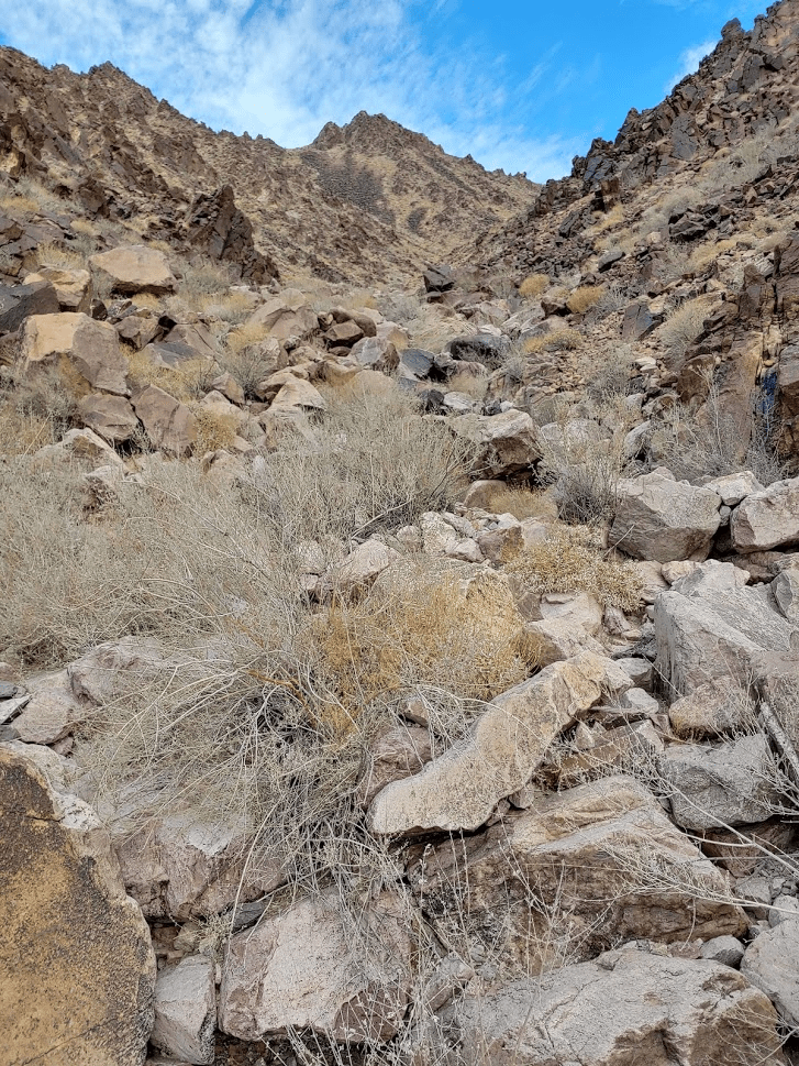
It got steeper as I climbed higher. I eventually turned to the northeast as I got closer to the summit.
The terrain here was solid class 2.
As I neared the top of the canyon, I climbed up a rocky slope to the east.
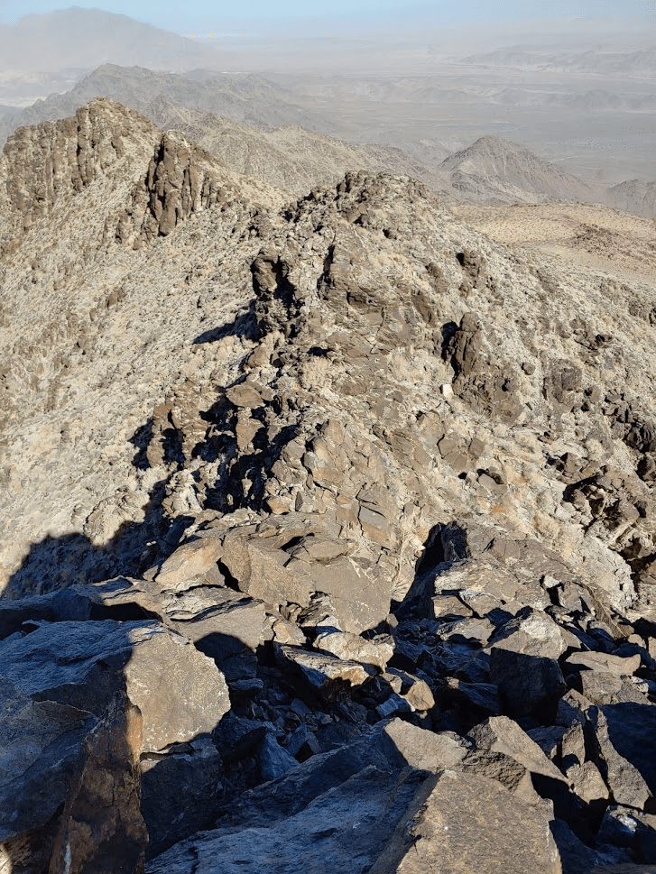
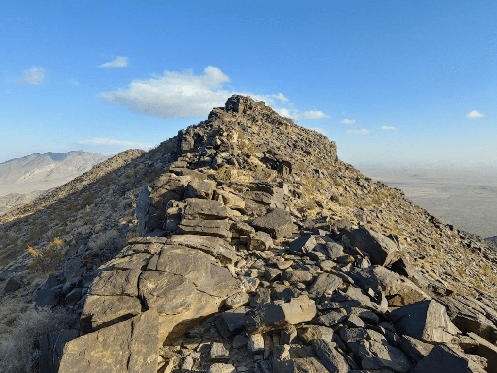
I climbed to the top of the slope and gained a ridge just south of the summit at 6.9 miles. I was close now!
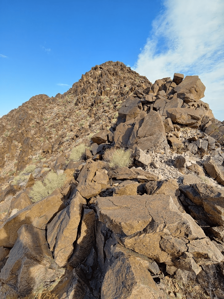
I realized I was actually off the standard route, which approaches the summit from the west. The ridge was dicier than I was expecting, as I had to make a few easy class 3 moves to climb over a few obstacles. Eventually I reached a false summit. The true summit was very close now.
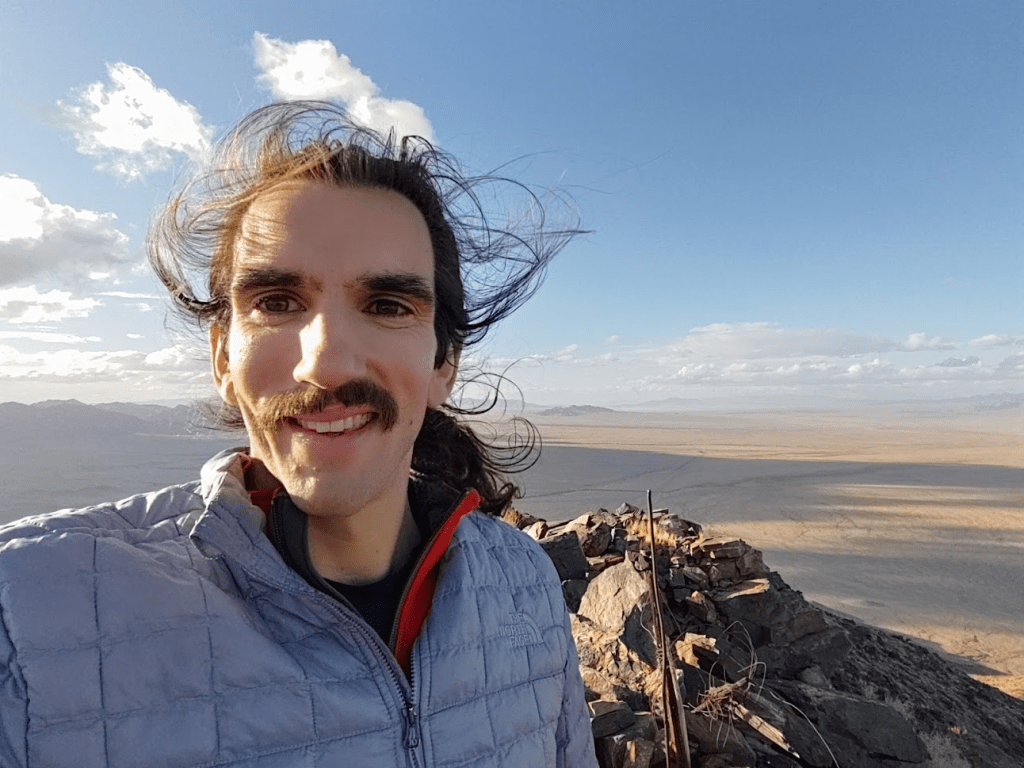
I reached the summit at 9:25am at 7.09 miles!

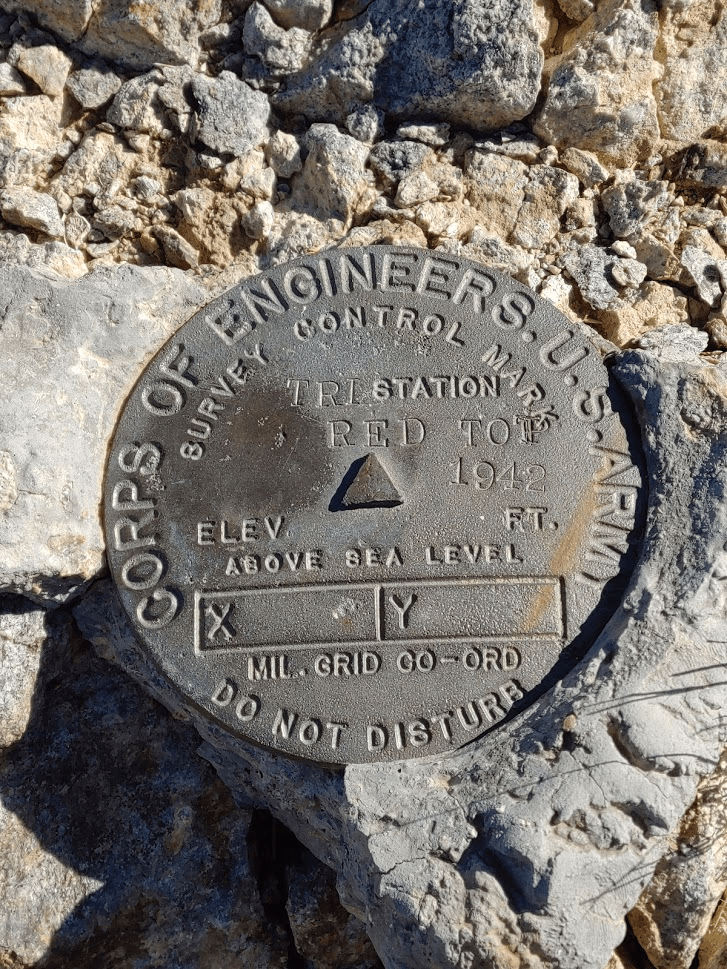
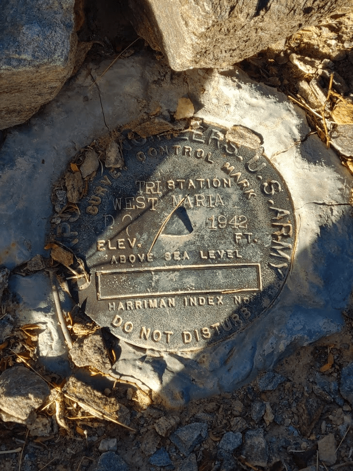
It was very windy on the summit, so I bundled up to stay warm. I signed the register and noted I was the first person to summit since December 2019, nearly 1 year ago! I located the “Red Top” benchmark and 2 reference markers.


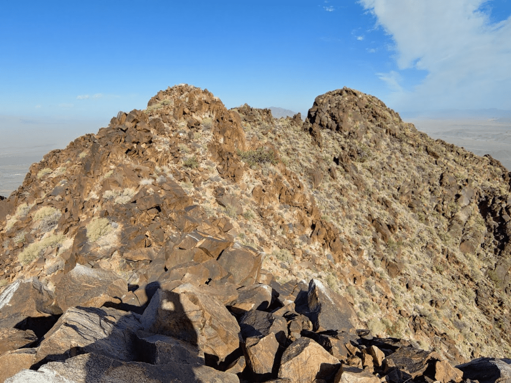
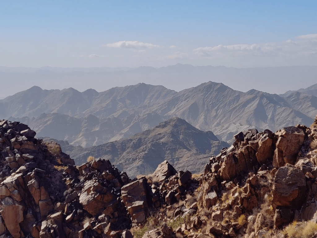
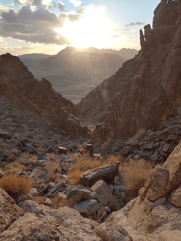
It was very hazy, so the views were a bit disappointing. I could see the tomorrow’s destination, the Granite Mountains, just a few miles to the north.

I could barely make it Black Butte to the southwest (the faintly visible peak in the background).
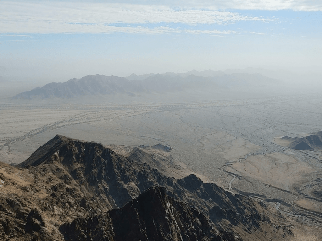
This is looking back the way I came from (McCoy Mountains in the background):
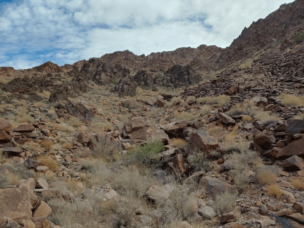
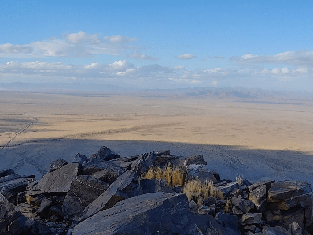
I could make out a number of other desert ranges, but they didn’t show up very well in my pictures. Oh well. I began the descent after a 30 minute break. I chose to climb down via DPS route C, which involves a canyon on the southeast side. I first descended the ridge north of the summit.
I then entered the canyon and began climbing down.
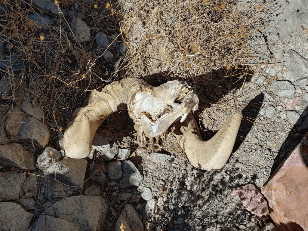
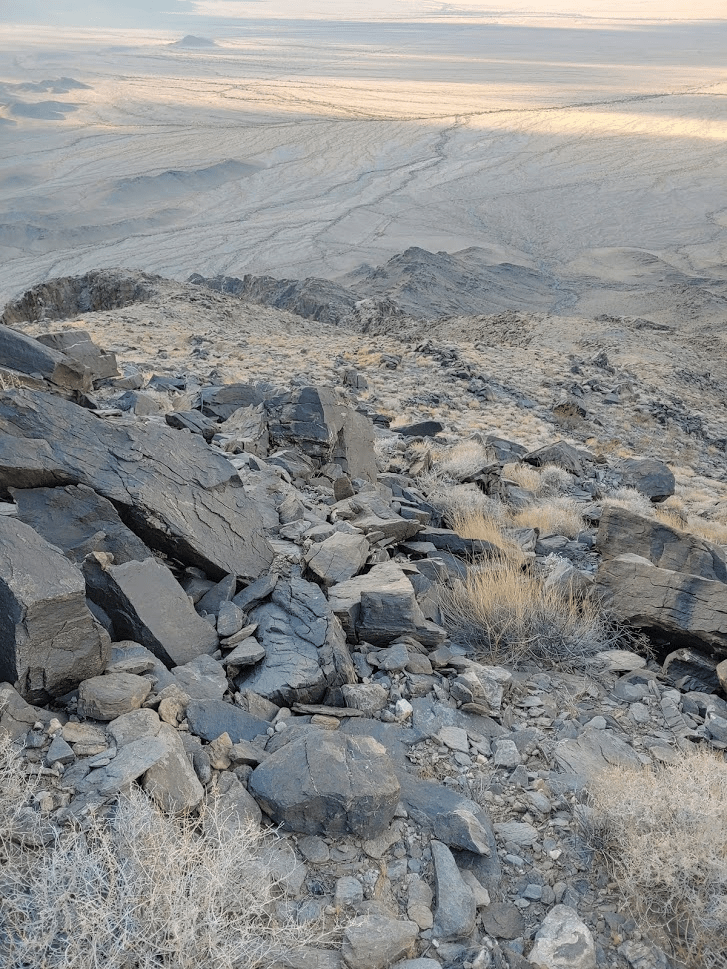
This canyon was pretty much the same level of difficulty as the ascent canyon. It was fairly steep, but I still was able to make good progress. At 7.61 miles I found a big horn sheep skull. The horns were still intact. The rest of the skeleton was a few feet away.
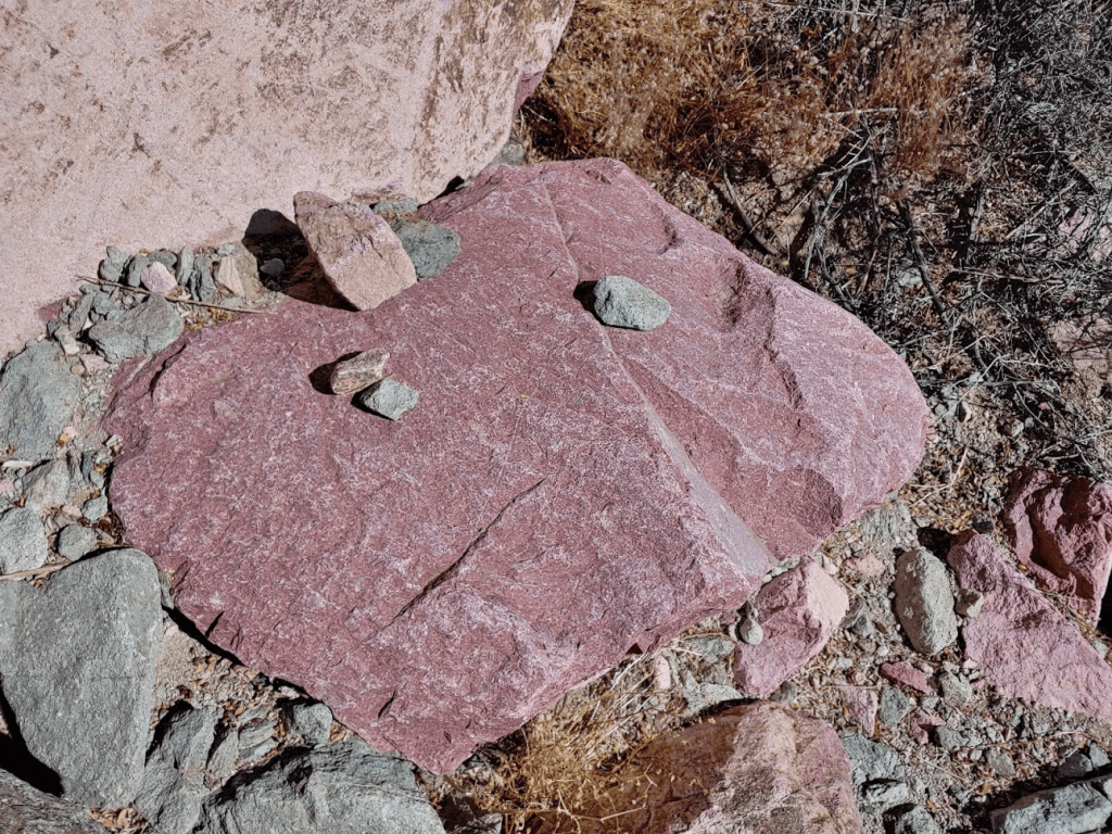
It was much warmer now, so I shed all my layers. I noticed that many of the rocks had a remarkable reddish pink color. This is no doubt why the name “Red Top” appears on the benchmark at the summit.
The grade became much more gradual as the canyon widened near the bottom.
I reached the road once more at 8.86 miles.
The hard part was over, but it was still 5 more miles back to the car. I made good time and reached the car again at 12:51pm. This hike totaled 14.22 miles, 3107 feet elevation gain, and 6:33:38 total time.
West Maria Benchmark
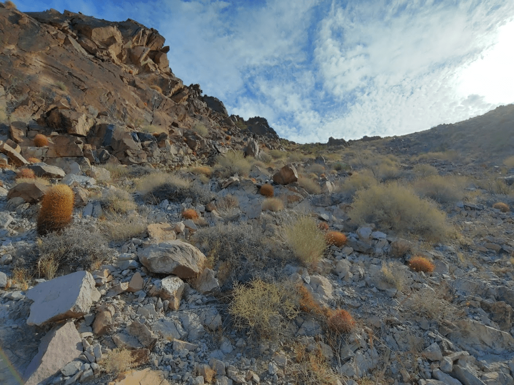
Daylight hours are limited this time of year, but I still had time for one more short hike in the afternoon. I decided to do West Maria Benchmark (2887 feet), which (as the name suggests) is on the western end of the Big Maria Mountains. West Maria Benchmark is not on any list but is the high point of the Rice Valley Wilderness, as well as 1000 foot prominence peak. I drove back out to Midland Road and then went a few miles north as the pavement ends. I turned right onto a decent dirt road and went a mile or 2 north before parking. This road actually appears to be an old railroad bed. It is labeled “Atchison Topeka and Santa Fe” on the topo map. It’s in pretty good shape but it was a little difficult to turn around and park, so I wouldn’t recommend any long vehicles. I began this hike at 1:55pm from 1059 feet.
This is very seldom climbed peak, so I didn’t have much information on it. The reports I could find indicated a relatively easy ascent up a canyon on the western side. I made my way across the open desert and started climbing.

It was very windy in the canyon. The terrain was similar to Palen this morning, so I made good time. At 0.7 mile I came across a tiny little snake in the rocks. I’m not sure if it was a baby or just a very small kind of snake. I wasn’t able to get a picture of it before it slithered out of sight.
As usual, the canyon narrowed and got steeper as I climbed higher.

Eventually I emerged on the ridge just east of the summit. It was an easy climb to the top from here.
I reached the summit at 2:49 pm at 1.36 miles!
I signed the register which had been placed by a Sierra club group in 1986. There were only a few entries over the years indicating this is a very rarely climbed summit. The previous ascent was April 2020. I also located the benchmark, but no reference markers.
The view west was pretty remarkable with the sun getting low in the sky. The McCoy, Palen, Little Maria, and Granite Mountains were visible.
The Big Maria Mountains were just a few miles east.

To the north were the Old Woman Mountains and the Turtle Mountains.
I took a fairly long break on the summit since I knew I didn’t have time for any more peaks once I got down. I started descending at 3:27pm.
I hiked back down the ridge, which was easy enough. I entered the canyon slightly north of where I had ascended.
The descent down the canyon was easy. The desert was very pretty in the fading light.
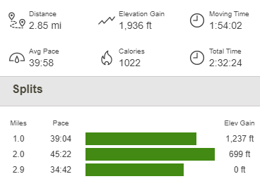
I reached the car again at 4:28pm. This hike totaled 2.85 miles, 1936 feet elevation gain, and 2:32:24 total time.
My plan for the next day was to climb nearby Granite Mountains High Point. The trailhead is in the same area as the Palen Mountains, so I had to backtrack to Midland Road and then drive west on Arlington Mine Road yet again. At 12 miles from pavement, I turned right onto Palen Pass Road instead of continuing west down the rough road towards Palen. Palen Pass Road was pretty sandy in parts and there were a few washes to cross near the end, but it was no problem for my Forester. At some point there is supposed to be a spur road that branches off to the right towards the Granite Mountains, but I was unable to find it in the dark. I ended up parking in a wide spot just off Palen Pass Road and spent the night there. This area is very remote – I didn’t see or hear any other vehicles the entire night. It was extremely windy, so I was glad to be sheltered inside my car.
To be continued…
Granite Mountains (Riverside County) and Well Benchmark 11/08/2020
