Day 1
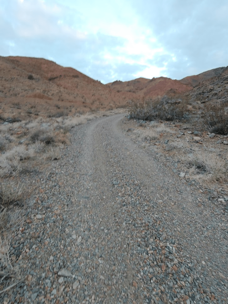
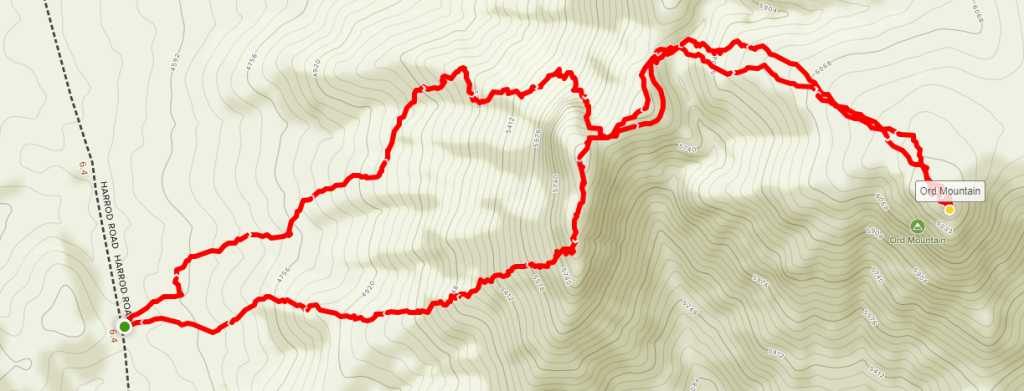
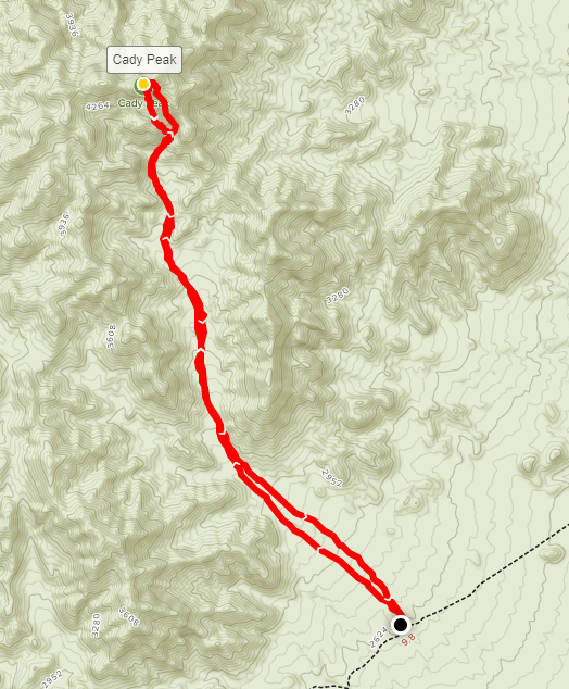
It had been a couple weeks since I went on an extended trip, so I decided to head out to the desert to climb some more peaks. Earlier in the week, I was originally planning to head to Death Valley National Park to climb some DPS peaks there, but there was rain/snow in the forecast for Sunday, and I decided Death Valley is too long of a drive for just one day of hiking. I decided instead to head to the southwest corner of the Mojave Desert and climb a few obscure desert peaks near Barstow, CA. I was planning to get in a full day of hiking on Saturday, and then had a few more lower elevation peaks (to avoid snow) in mind for Sunday if the weather held out. Getting to Barstow requires a long haul north up I-15 and I-215 through northern San Diego County and the Inland Empire. Traffic heading that direction can be awful on Friday afternoons, especially near Temecula and through Cajon Pass. I decided to wait until 6:15pm to leave, which ended up being a smart decision and I was able to avoid the worst of the traffic. My plan for Saturday was to climb the 3 main peaks in the Ord Mountains southeast of Barstow. They are simply called East Ord, Ord, and West Ord. East Ord is on the Sierra Club Desert Peaks Section (DPS) list so that was the peak I as most interested in. All 3 are included in Andy Zdon’s list of desert summits. My plan was to start with East Ord and then work my way to Ord and West Ord. I knew I would have time for the first two, but wasn’t 100% sure I would make it to West Ord. Since I would be trying to cram a lot in one day, I wanted to get as close as I could to the trailhead for East Ord so I could get an early start. I took Highway 18 from Victorville to Lucerne Valley, and then went east on Highway 247 to paved Camp Rock Road. I went 4 miles on Camp Rock Road and then turned right at a fork to remain on Camp Rock Road. After a mile or 2 it turns into a smooth dirt road (like 40 mph smooth). After about 9 miles from the fork, I turned left onto a small dirt road heading northwest. Following Andy Zdon’s directions, I went under some power lines, turned right at a junction, and then continued for a mile or so where I parked for the night.
Day 2
I woke up 5:15am on Saturday and quickly got ready. I realized I had missed a turn the night before and was supposed to turn right at another fork which led to the trailhead. I backtracked a short way and found the correct road which I took to the trailhead at about 4100 feet. High clearance definitely is required for this part. I started hiking at 6:20am.
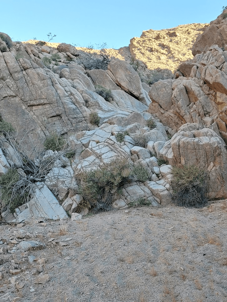
I walked up the remainder of the road which continued up the canyon a short way. The road was passable beyond where I parked but I didn’t see a great place to park.
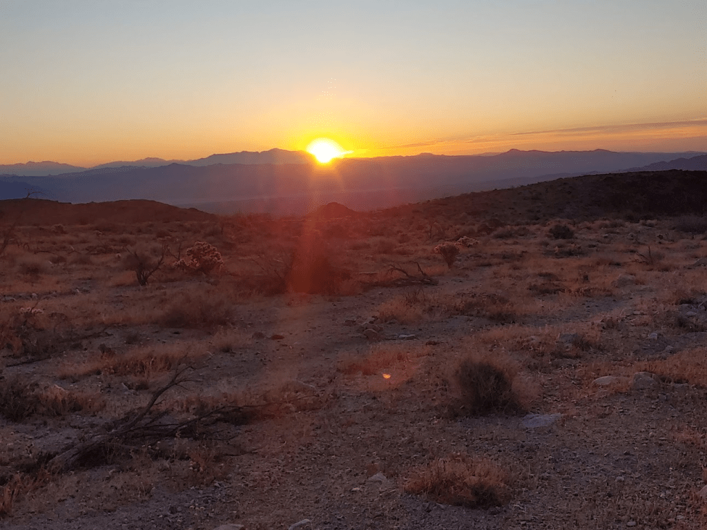
The sun was just peaking up over the hills behind me to the east.
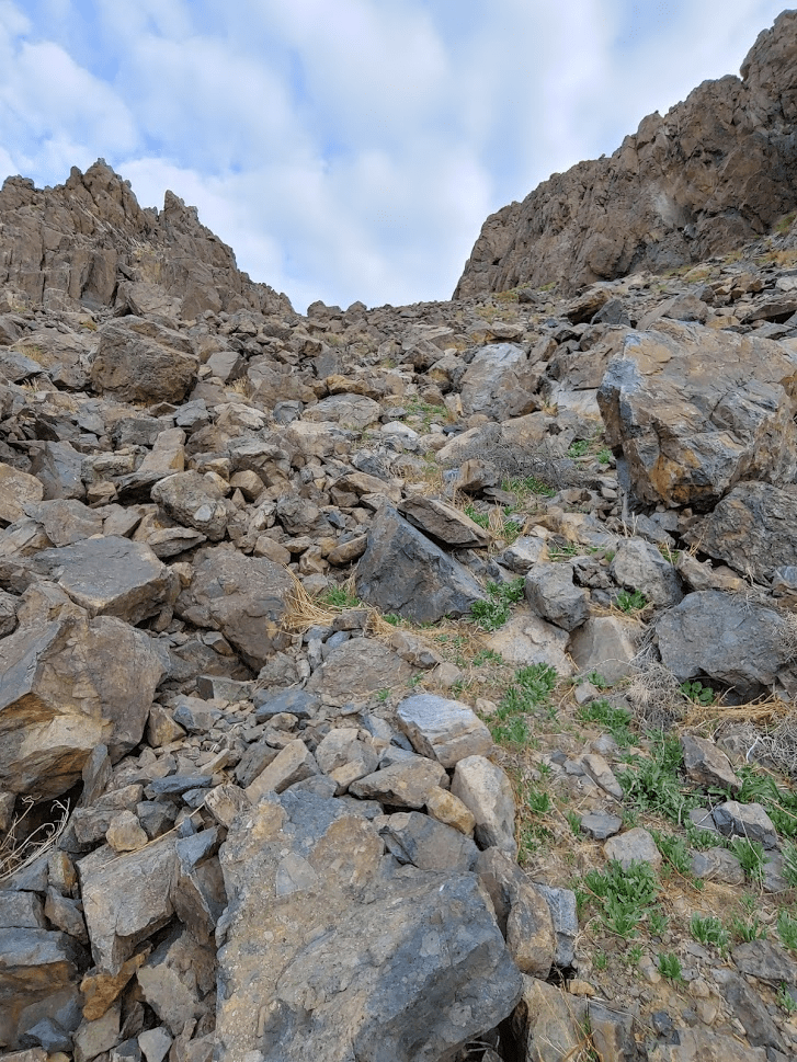
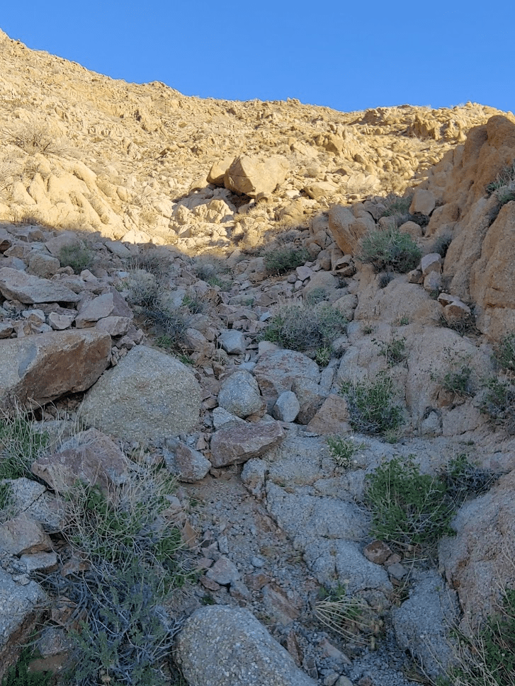
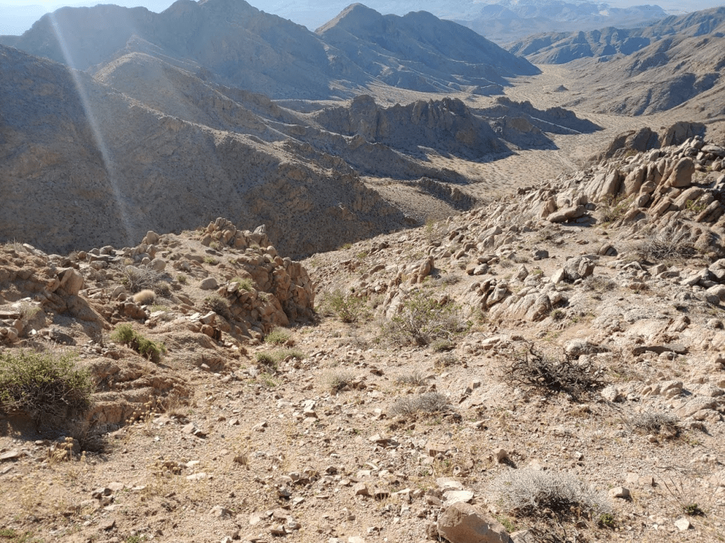
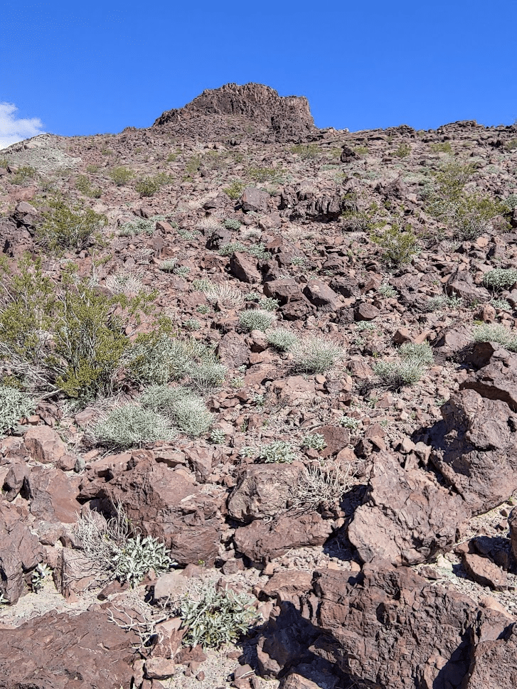
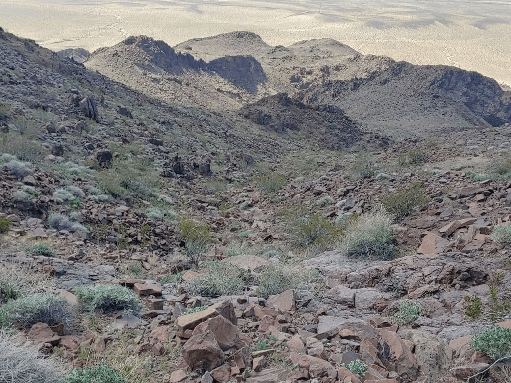
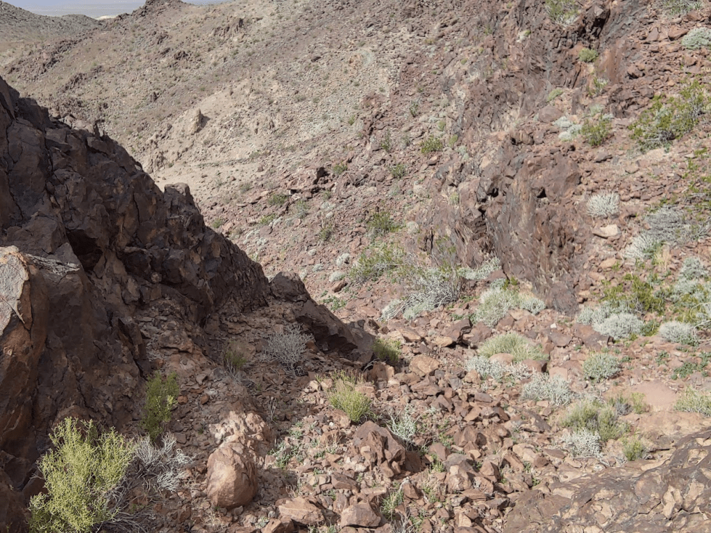
I left the road and began hiking up a steep, narrow wash northwest towards the peak.

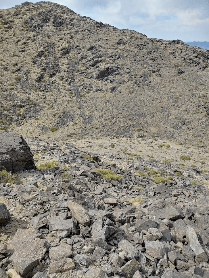
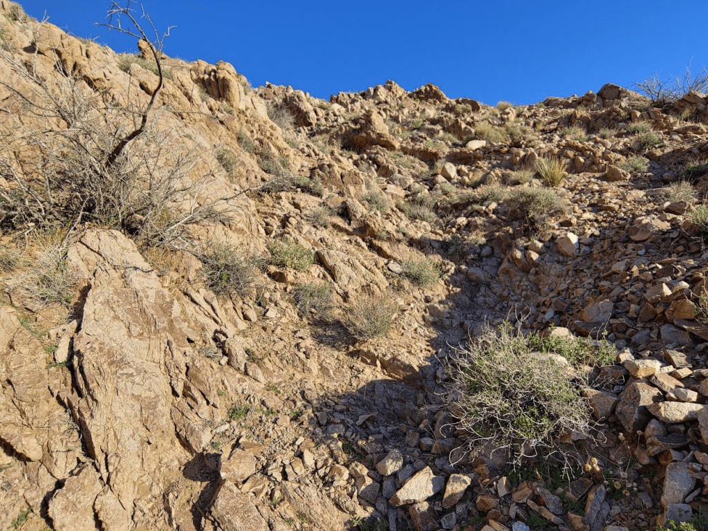
The wash was rocky, but the vegetation was very sparse which made things easier.
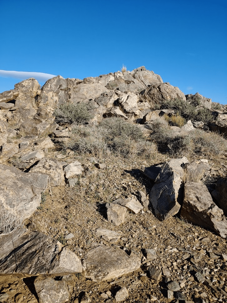
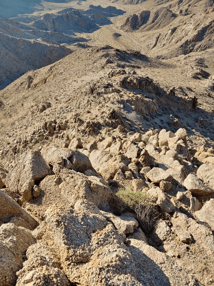
I made pretty good time up the wash as I neared the top. The summit rocks are visible on the right.
I reached the top of the wash just below the summit. The below picture is a shot looking back down the wash I just ascended.

From there, it was a short scramble up to the summit.
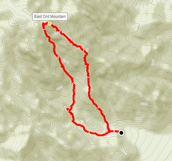
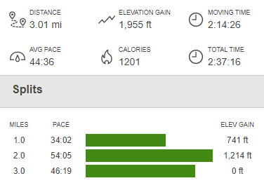
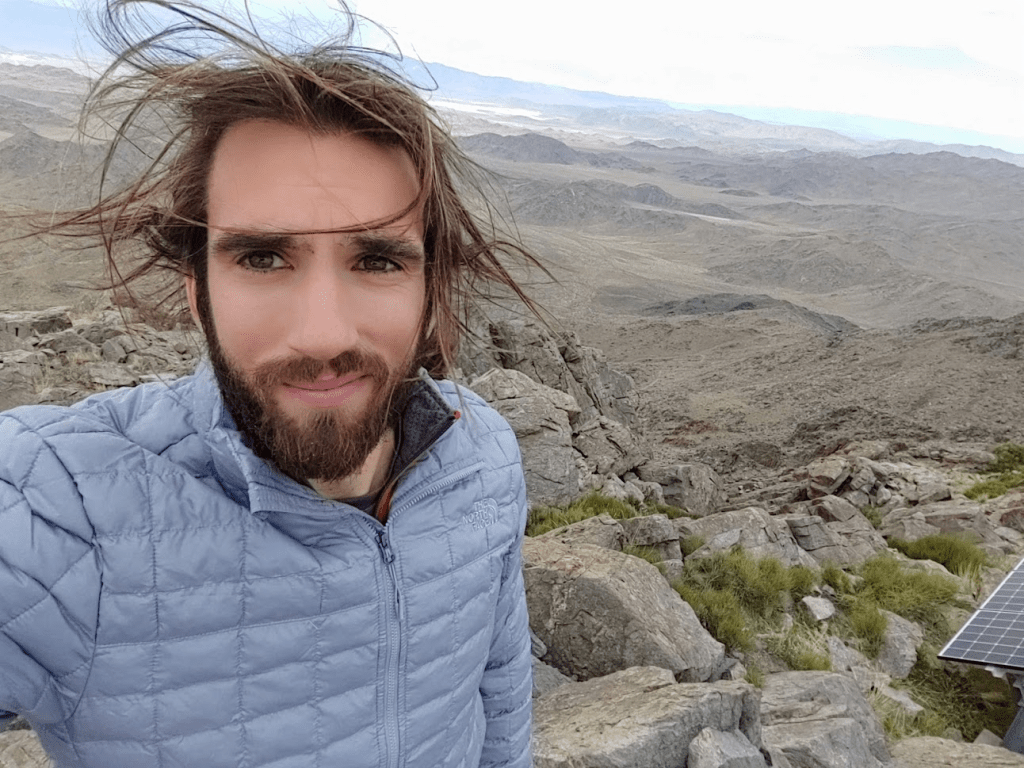
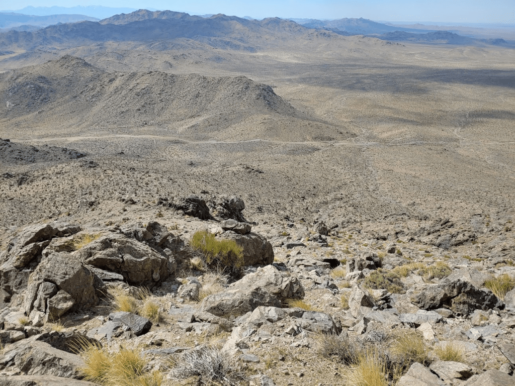
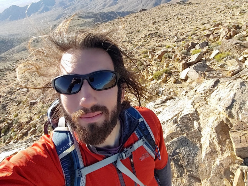
I reached the summit of East Ord at 7:33am after 1.57 miles of hiking. East Ord is 6168 feet above sea level, so it was about 2000 feet of elevation gain. It was cold and windy on the summit, so I bundled up as I took a break and enjoyed the views. Especially striking were the snow covered San Bernardino Mountains to the south. San Gorgonio is the highest summit in the San Bernardinos.
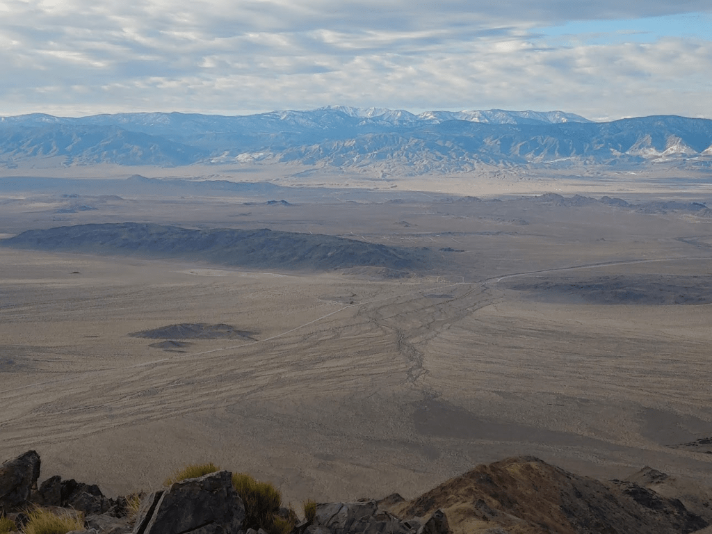
I could also see the snow covered San Gabriels in Los Angeles County to the southwest. Mount Baldy is the high point of that range at just over 10,000 feet.

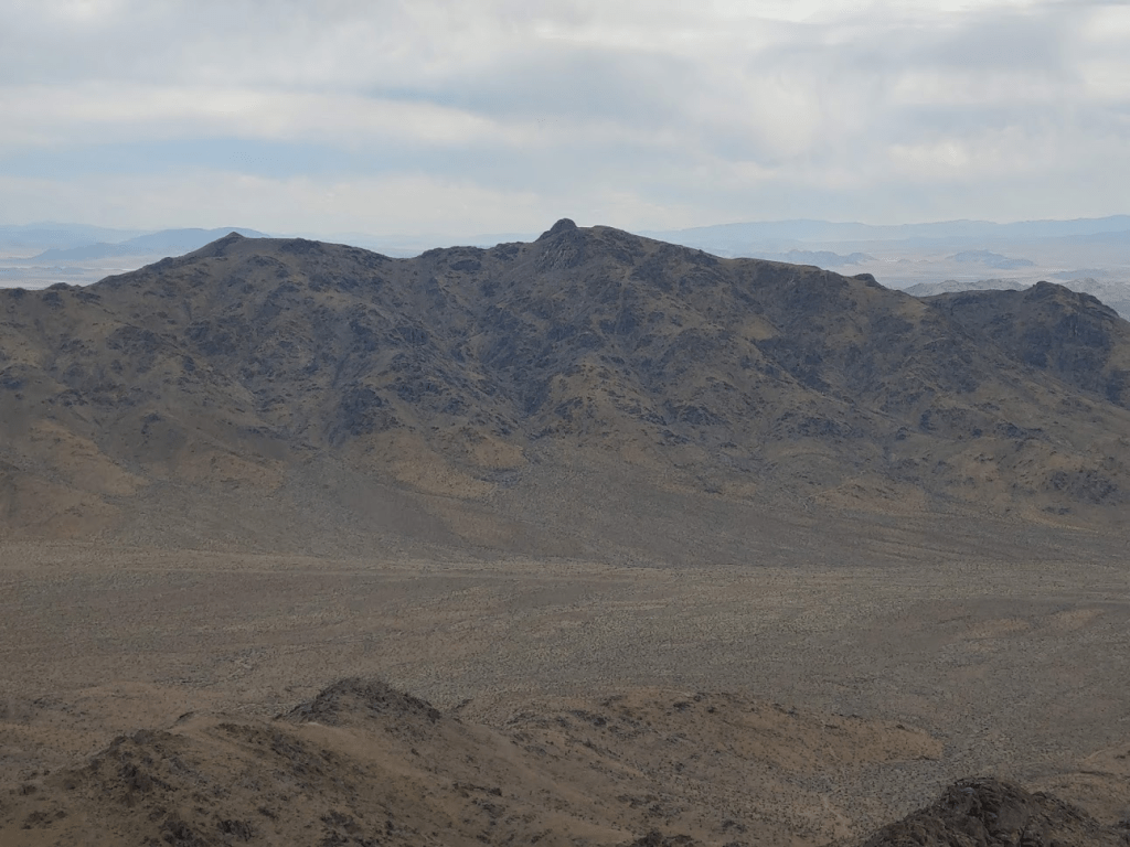
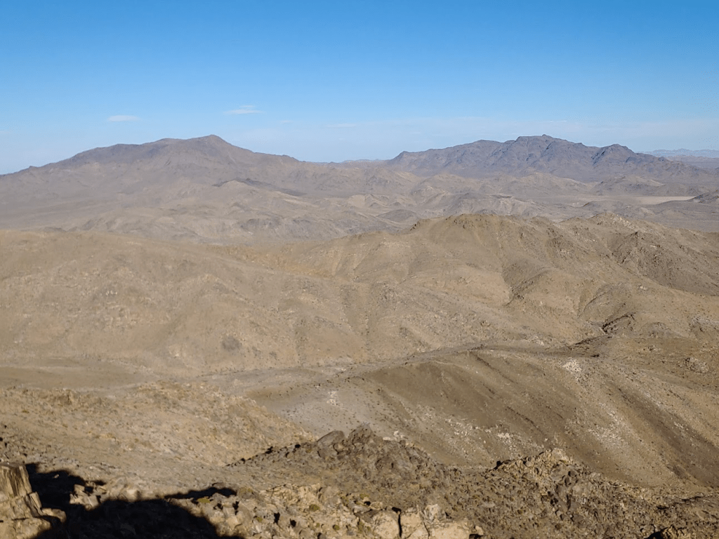
Ord Mountain was visible just a few miles west. It is about 200 feet higher than East Ord. I could make out the radio towers on its summit.
I signed the register which was placed inside the usual DPS ammo container. The register had been placed in 1999 and I noted that the previous ascent was 4 weeks earlier on 1/31. After 20 minutes on the summit I started the descent. I took a different route than I came up, opting to descend a ridge on the north side of the wash I came up.

The footing was solid, and vegetation was very sparse, so I made quick time down the ridge.
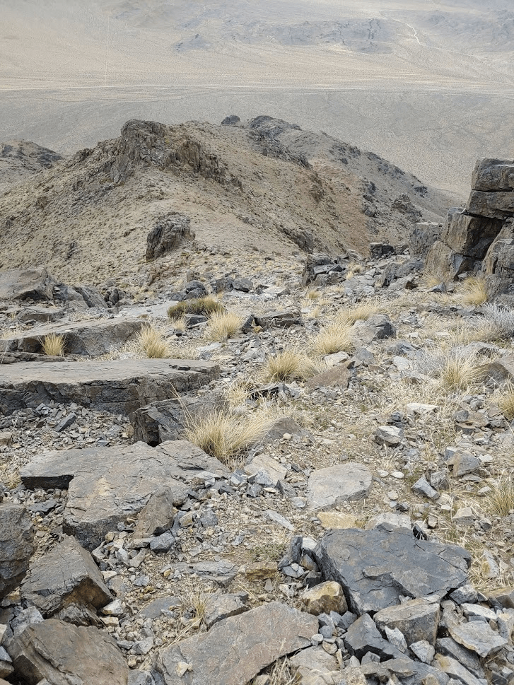
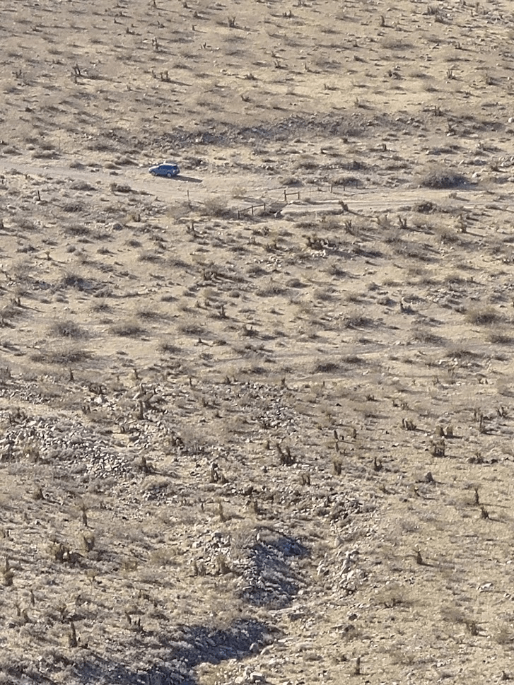
I spotted my car from above parked next to some junk.
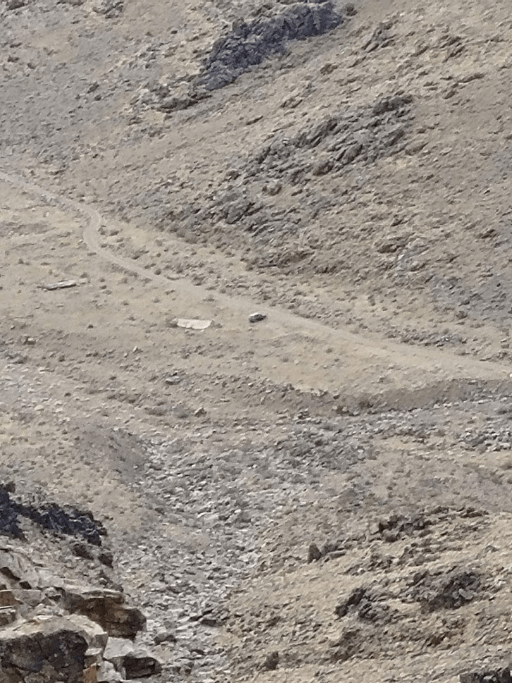
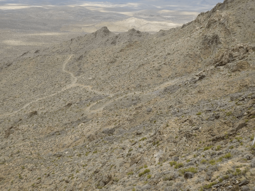
I noticed a bunch of old mining roads snaking their way through the lower reaches of the mountain.

I made it back to the car just before 9, taking just over an hour to descend. The hike totaled 3.01 miles, 1955 feet elevation gain, and 2:37:16 total time.
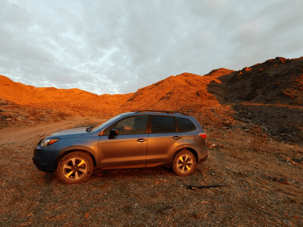
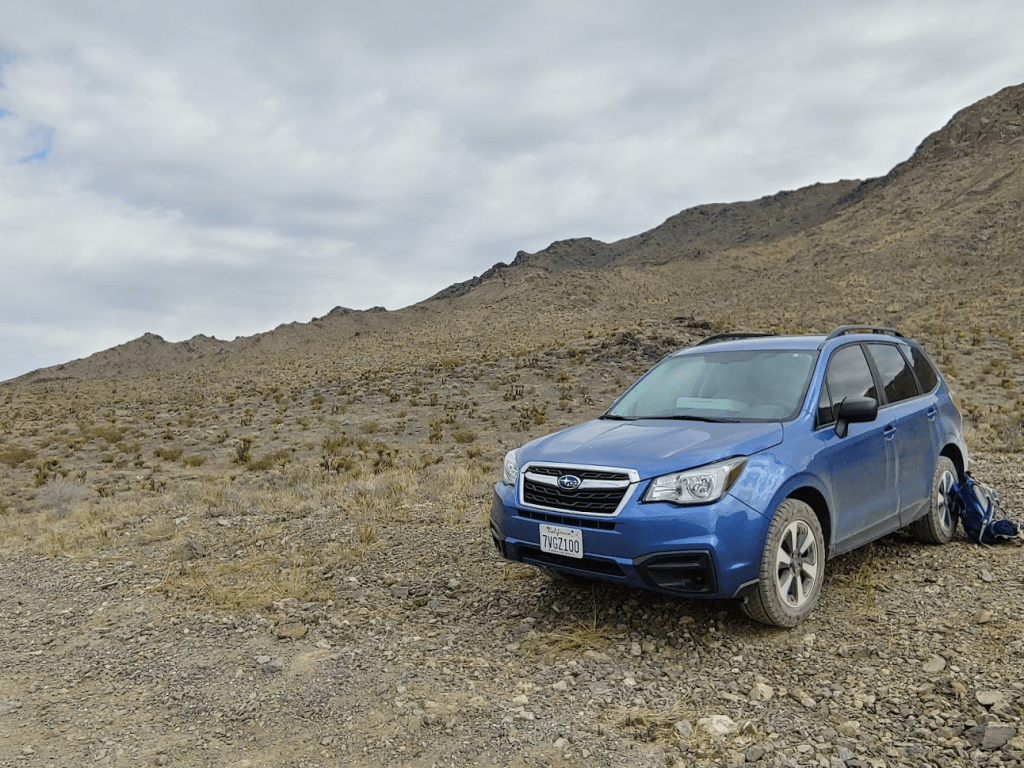
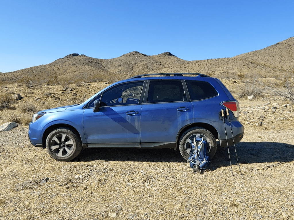
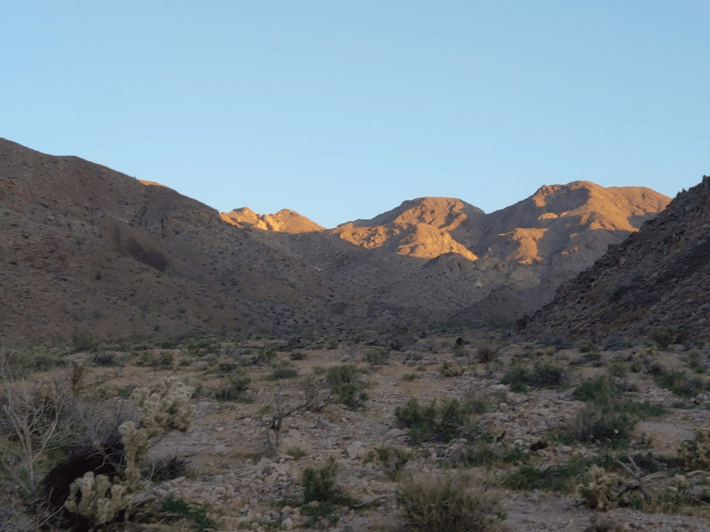
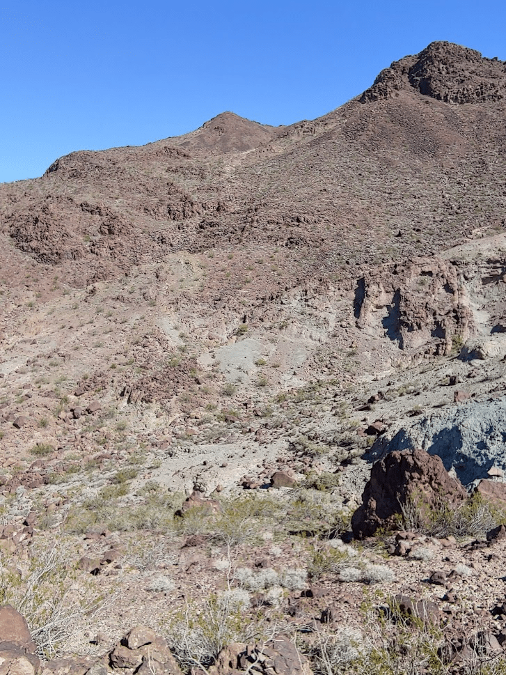
Next up was Ord Mountain. At 6309 feet, it is slightly higher than East Ord. However, Ord has radio towers on its summit and a road leading to the top which is why East Ord gets the nod on the Sierra club DPS list. Most people that climb Ord simply walk up the road from the north side. However, Zdon recommends a cross country route from the west side of the peak which sounded much more interesting to me. I drove back out to Camp Rock Road and went south to Northside Road which I took to Harrod Road. I went north on Harrod Road which starts out extremely smooth before deteriorating into a 4WD road. The last few miles to where I parked were pretty rough, but I made it just fine in my Subaru.
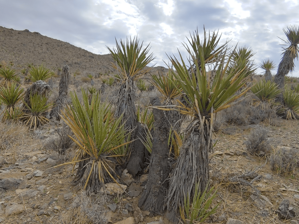
I started this hike at 10:16am. The route begins by crossing a short span of open desert to the base of the peak. I had to dodge around yuccas and pencil cholla, among other desert plants.

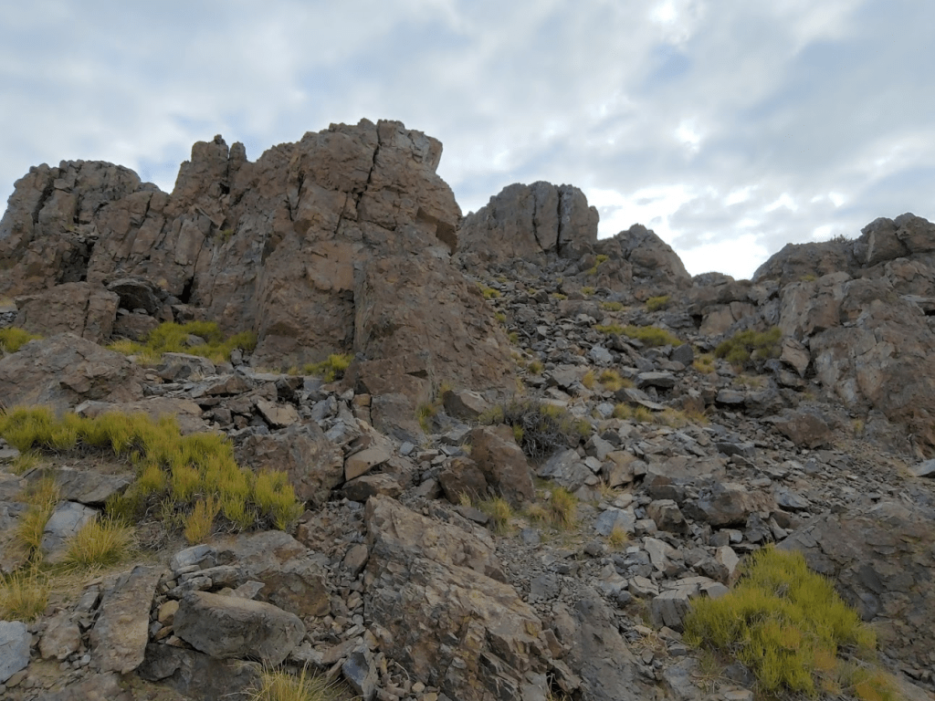
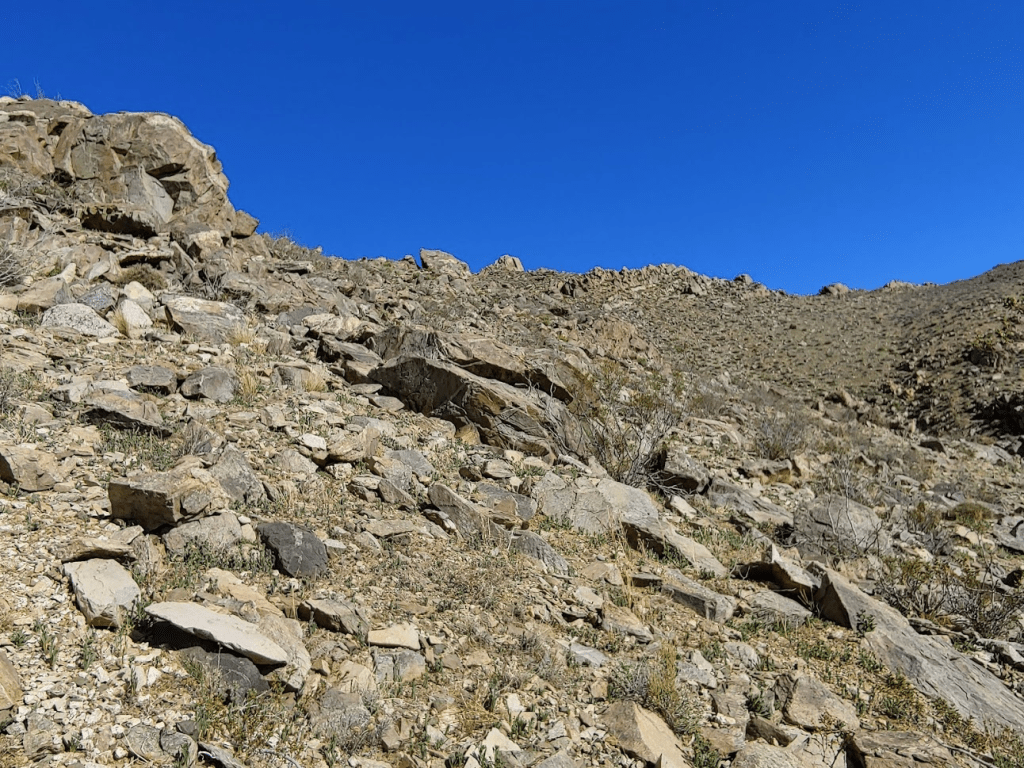
I started climbing up a steep slope.

Similar to East Ord, I saw random mining roads all over the mountain.
It started off pretty gradual but eventually gets very steep. The loose rock made it difficult.

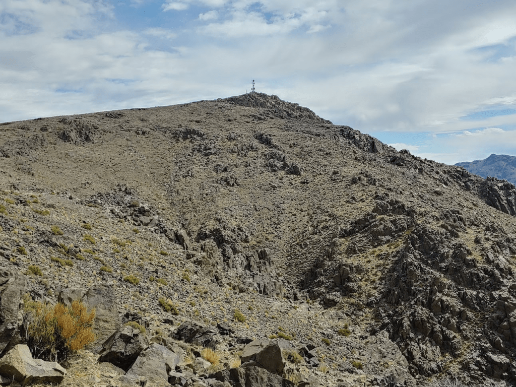
Eventually I topped out on a plateau just below the summit. I could see the summit towers pretty close now.
First, I had to descend a small depression.
From there, it was a short climb to the top.

I reached the top at 11:30am! It was exactly 2 miles from the car. Again, it was cold and windy.
The antennas and solar panels were definitely an eyesore.
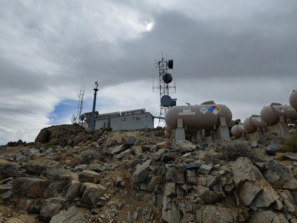
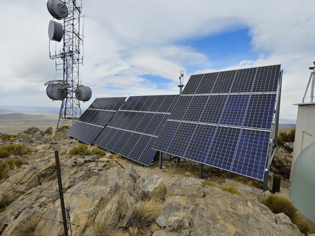
There was even a helipad!
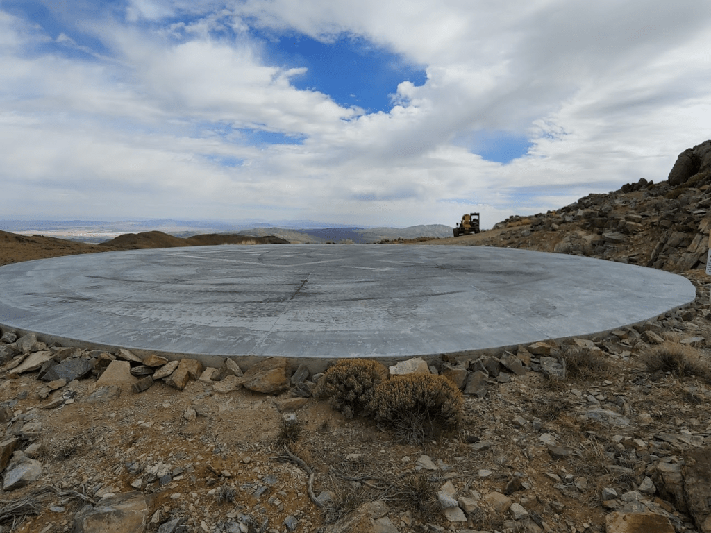

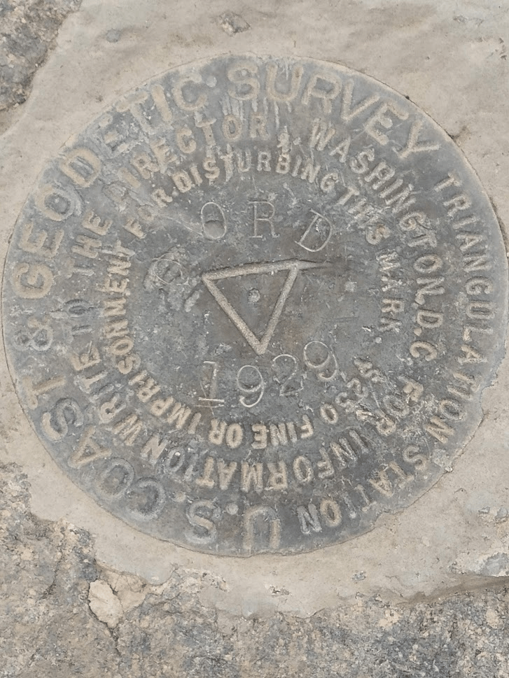
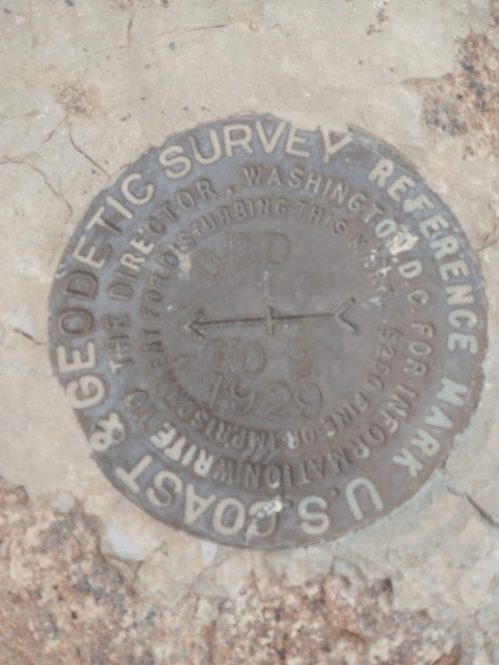
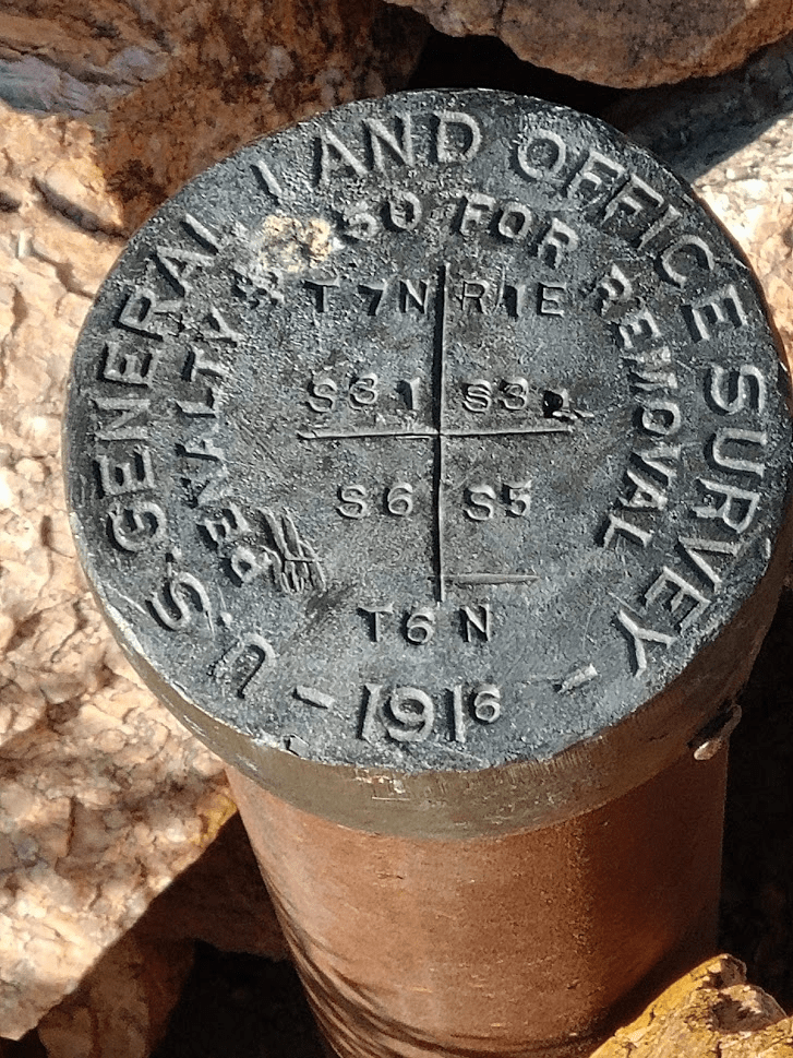
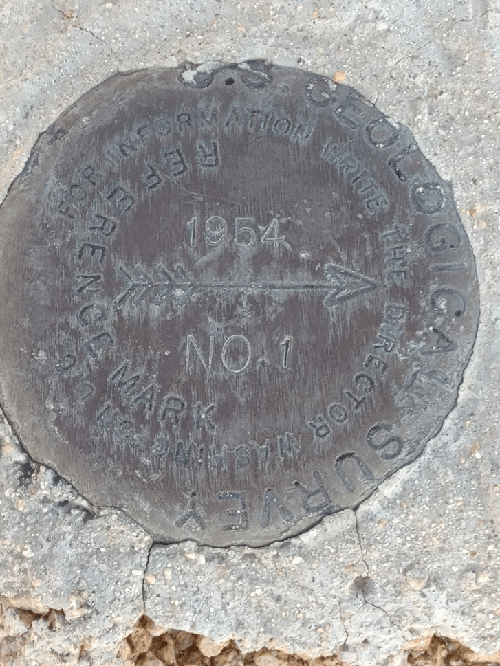
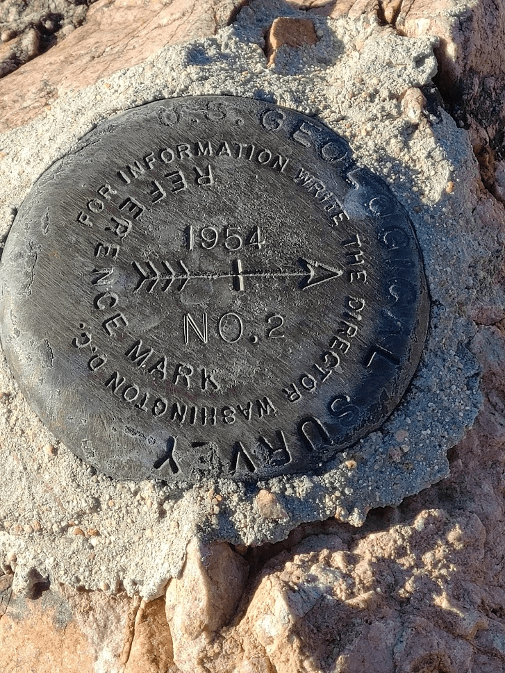
I located the benchmark and both reference markers.

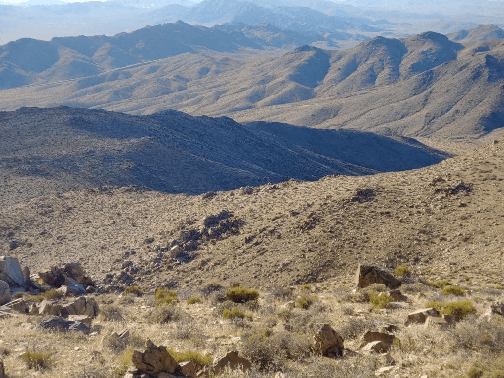
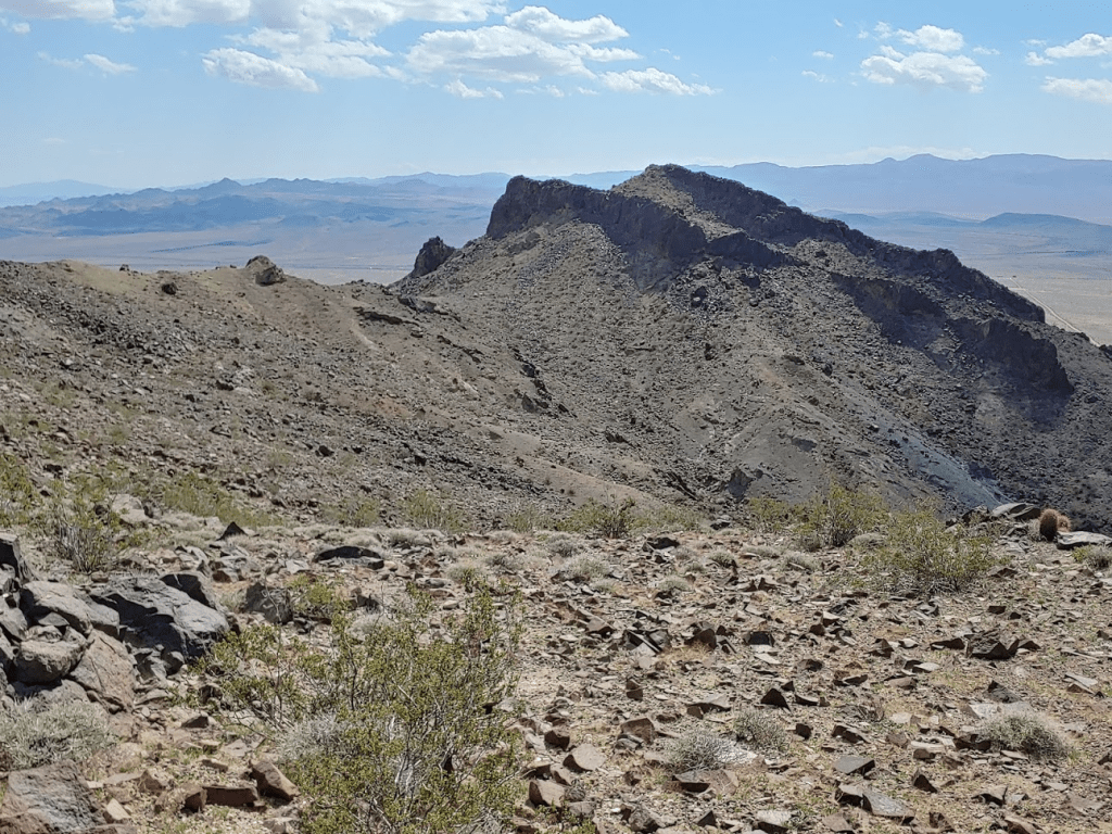
The views were similar to East Ord. I noticed some dark clouds forming over the San Bernardinos.
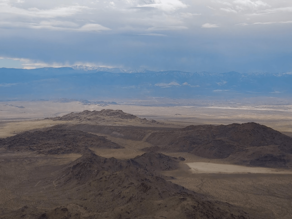
I had a good view of East Ord.
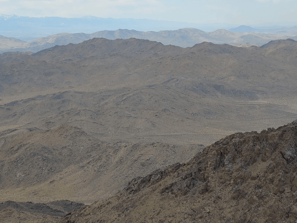
And West Ord:
I didn’t find a register. I rested for about 30 minutes before beginning the descent. I made it back to the western edge of the summit plateau. I decided to go south a short way along the ridge before descending the steep slope back to the car.
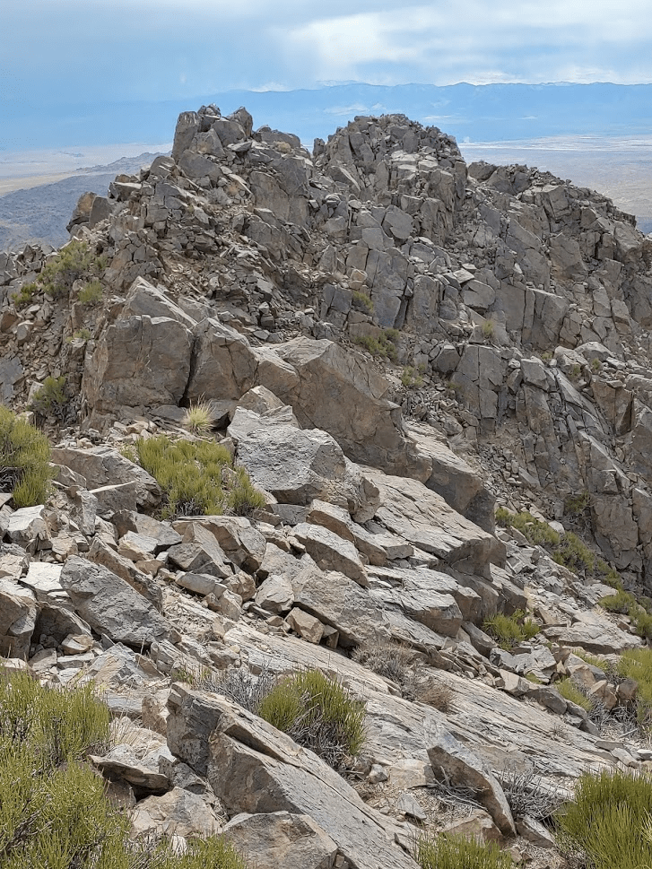
The ridge was very narrow and rocky, so I had to go slowly. It was a very steep drop off to the west, so I had to carefully choose a safe location to descend. Eventually, I found a ramp I could use.
From there, I proceeded slowly down the steep hillside. Like East Ord, vegetation was sparse which made things a little easier.
I made it back to the car at 1:07pm. I was very impressed with how quickly I had completed the first 2 hikes and knew I had more than enough time for West Ord. Totals for the hike were 3.93 miles, 1965 feet elevation gain, and 2:52:00 total time.

I proceeded a few miles north on Harrod Road and then turned left onto a pipeline road (Ord Mountain Road on Google Maps). This section of Harrod Road was smoother than before, and the pipeline road was in excellent shape. I got passed by probably 50 dirt bikes and ATVs in groups of various sizes on my way out. Most of them gave me a polite wave for pulling over to let them pass. This is definitely a very popular OHV area. The pipeline road eventually deposited me back onto Highway 247 where I went south for a few miles and then about a mile northeast on a decent dirt road to where I parked near a cattle guard.

At 5525 feet, West Ord is the lowest of the 3 Ords and is the easiest to climb. I started hiking at 2:26pm from about 4084 feet.

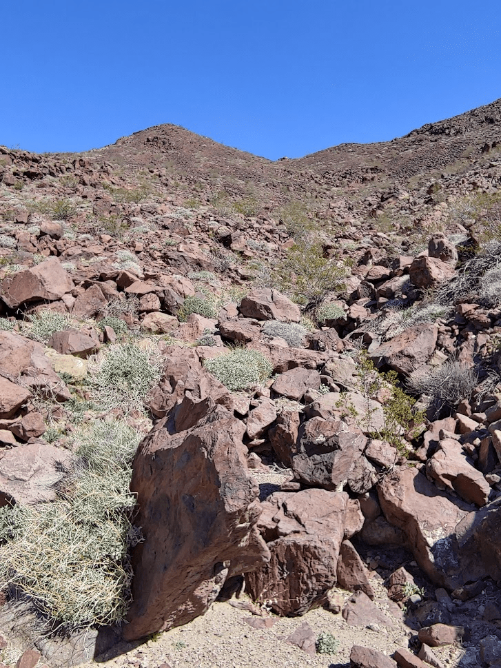
The slopes of West Ord consist of a bunch of gradual ridges that lead up to the peak. I began climbing a ridge northwest of the peak.
Like the first two peaks, the footing was solid and there wasn’t much unfriendly vegetation to deal with. These mountains are extremely dry. I’m used to seeing pinyon pines and juniper at these elevations, but there aren’t really any trees in this range. It took me an hour to cover the 1.91 miles to the summit.
The views were similar to the first 2 peaks, but not quite as good due to the lower elevation. The clouds had cleared up considerably throughout the day.

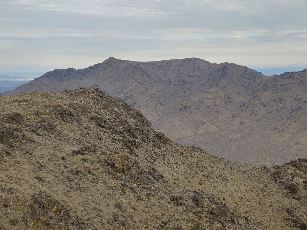
I had a great view of Ord (left) and East Ord (right). It was hard to believe I had been on both peaks earlier in the day. It crossed my mind that I was possibly the first person to climb all 3 in a day. I hadn’t read any reports that indicated this had been done before.
I was disappointed to not find a register. I enjoyed the views for 25 minutes and then started back down. I chose a different ridge to descend.
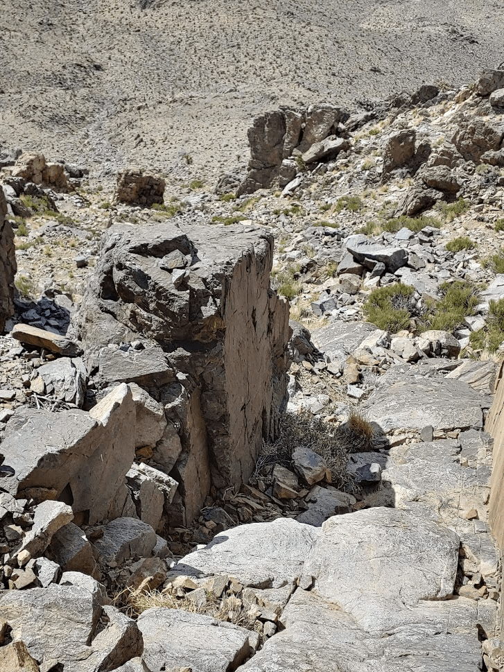
I randomly stumbled upon some kind of marker in the middle of the hillside. It reminded me of the “section markers” I had found on the approach to Diablo Benchmark in Anza Borrego the week before. It’s crazy the random things you’ll find in the desert!
I went over a small pile of rocks that was labeled on Peakbagger as West West Ord Mountain. It was really just a small bump with very little prominence, so I’m not sure why it’s labeled on the map.
From there, it was a pretty short walk back down to the car.
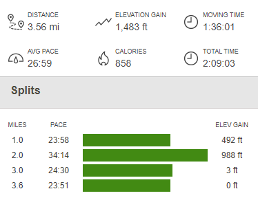
I reached the car at 4:37pm. This hike was 3.56 miles, 1483 feet elevation gain, and 2:09:03 total time.

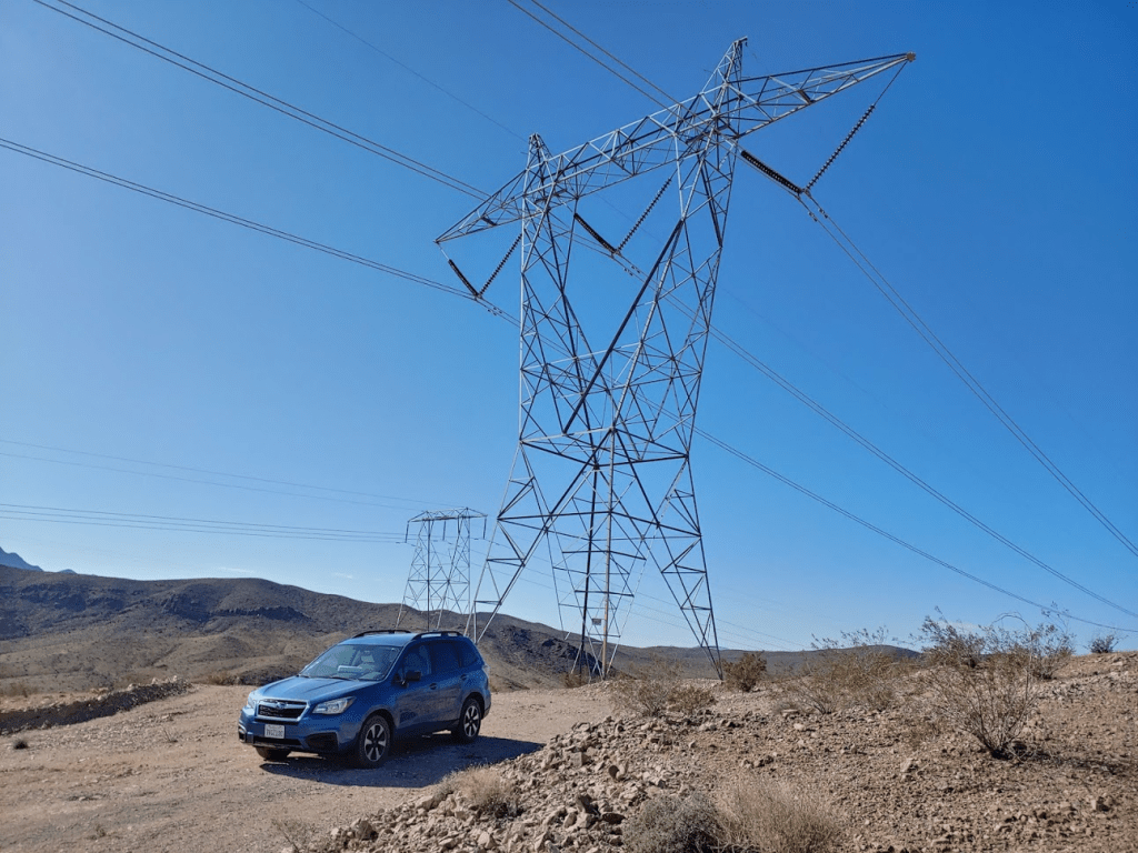
What a day! I was extremely happy to have summited all 3 Ords, and it wasn’t even 5 o’clock yet! I headed back out to Highway 247 and then went north until I hit Barstow. While Barstow is a just small town by most people’s standards, it actually is one of the largest cities in the Mojave Desert. At the intersection of I-15 and I-40, it gets a ton of freeway traffic, especially for those travelling between Los Angeles and Las Vegas. While in Barstow, I checked the forecast for the next day and it seemed like I would be okay to do some more hiking the next day, at least for the morning. I settled on doing 2 peaks east of Barstow along I-40, Cady Peak and Sleeping Beauty. I ate dinner at Chipotle and the took off down I-40 towards the trailhead for Cady Peak. I exited the freeway at Hector Road and then took an immediate left on the National Trails Highway, which is the remains of old Route 66. I followed this road east as it parallels I-40 for a few miles and then turned left onto Pisgah Crater Road. This road goes underneath I-40 and curves around to the west and parallels I-40 in the opposite direction for a mile where the pavement ends. I then turned right onto a power line road and drove for about 6 miles and parked underneath Tower 734. The road was smooth and probably passable for any car. I was asleep before 9.
Day 3
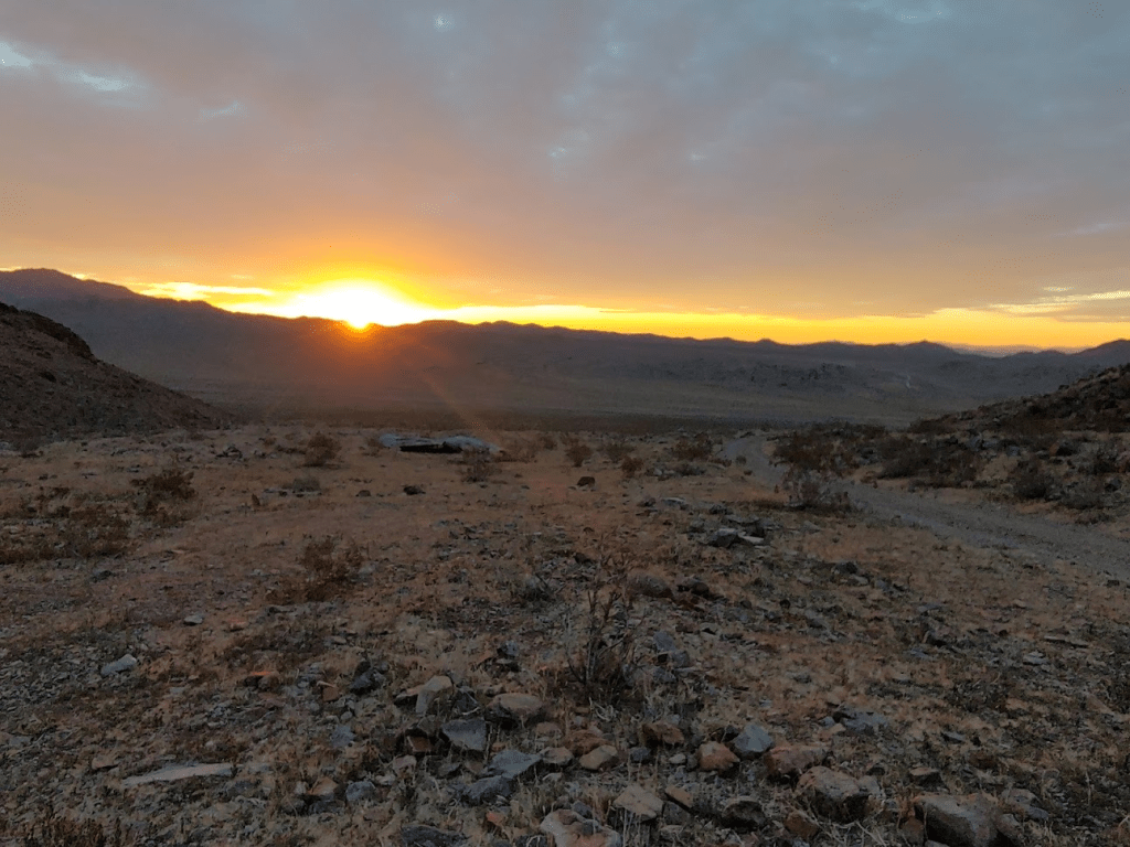
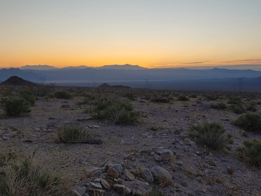
I woke at 5:15am after an okay night of sleep. Around 1am, the wind really picked up and woke me up a few times over the next hour or so. I was thankful the wind was no longer howling when I woke up, although it was much colder than the previous morning. At 4627 feet, Cady Peak is the high point of Mojave Trails National Monument. This National Monument was created under the Obama administration and protects a huge chunk of undeveloped land in the Mojave Desert. Curiously, Zdon doesn’t include Cady Peak in his book, despite it having over 2000 feet of prominence and being a range high point (National Monument status would have occurred after he wrote his book). The first signs of dawn were materializing behind me as I began hiking at 5:57am.

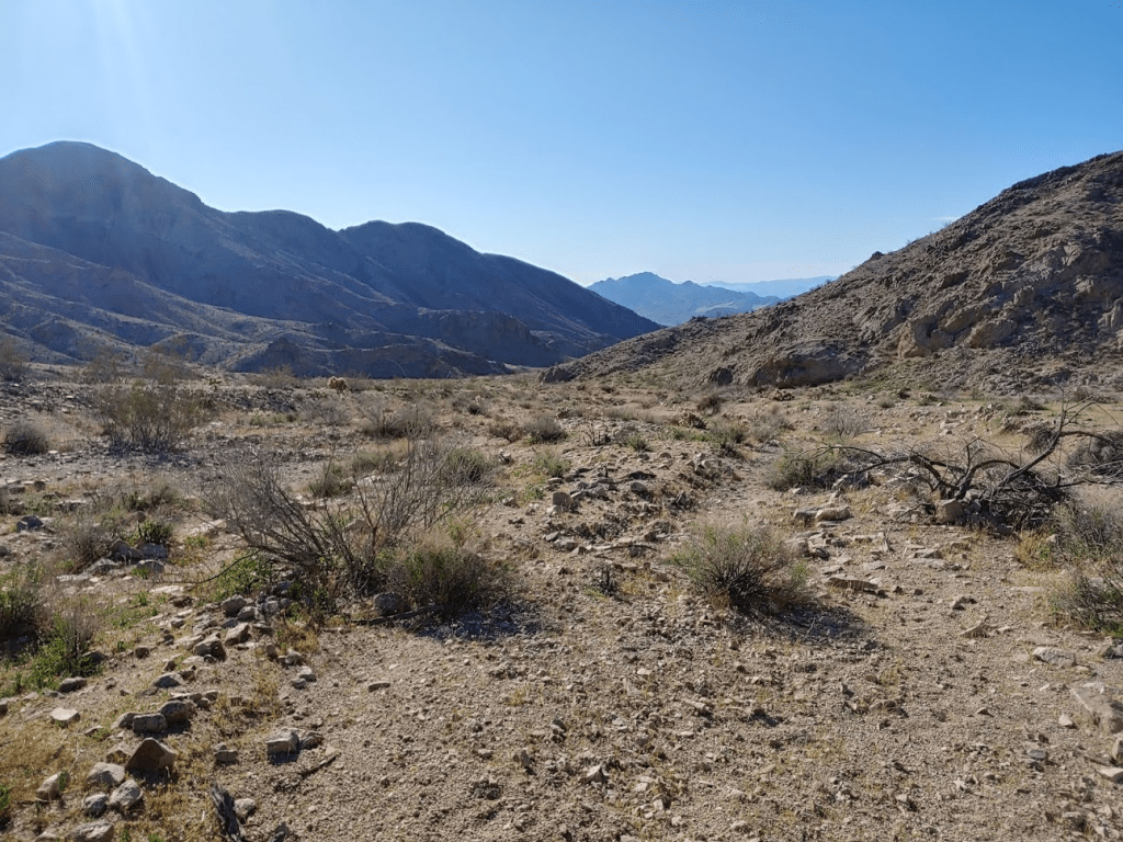
I started hiking across open desert towards Cady. The terrain was similar to the previous day.

The sun began to peak out above the Granite Mountains of Mojave National Preserve.
I was glad the weather looked nice so far. I started up a large sandy wash.
After turning a corner, I had my first view of the peak.

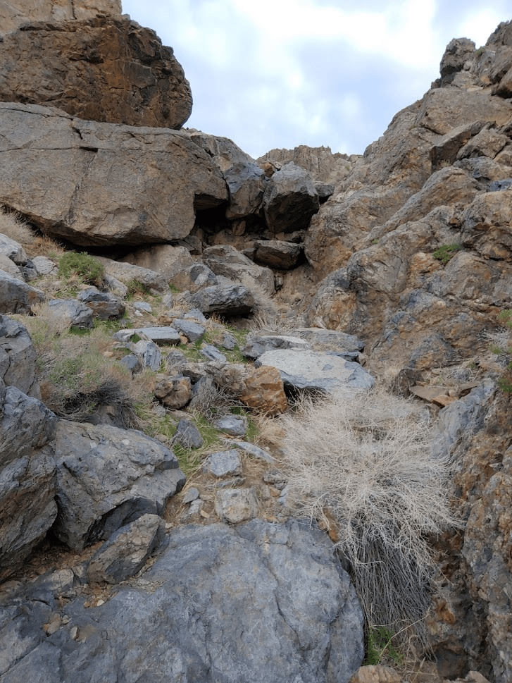
Around this time, I lost the contact in my left eye. It felt like it wasn’t in my eye correctly, so I had been messing with it and eventually it fell out of my eye. I still had one contact in, but this really hampered my vision for the rest of the hike, which was disappointing since the views were superb. I also depend on my vision on some of the more technical terrain. Thankfully, this hike was pretty tame up until the final 100 feet or so. Anyway, I continued up the sandy wash which was kind of like walking uphill at the beach. Eventually, I came to a dry fall at 2.62 miles. This was easily climbed up.
After the dry fall, the wash narrows and becomes much steeper. I still had nearly 1000 feet to climb.
It got extremely steep just below the summit.
Looking back down the way I came up:
Eventually I topped out on a ridge just below the summit.

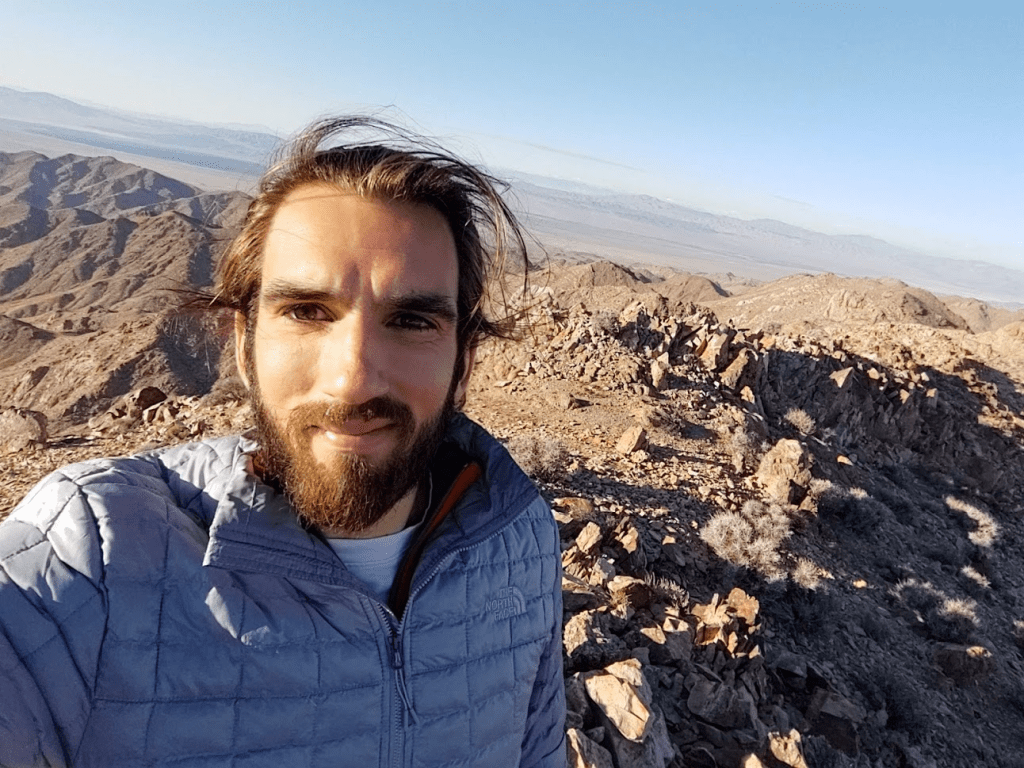
I scrambled up the final portion and was on top at 7:30am!
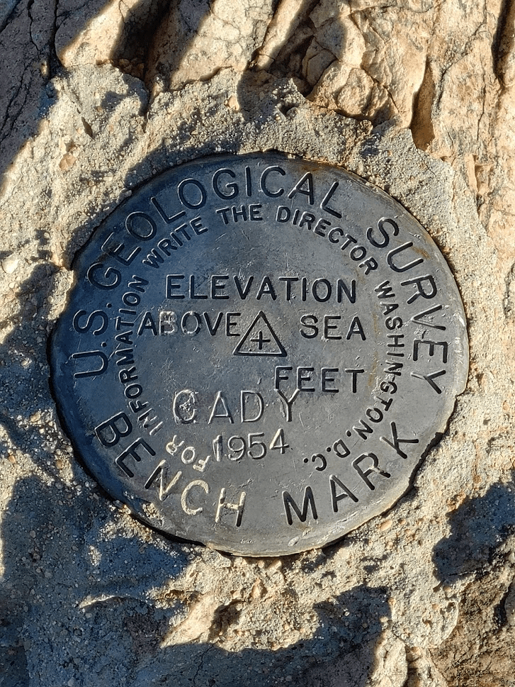
Once again, I did not find a register. I was able to locate the benchmark and 2 reference markers.
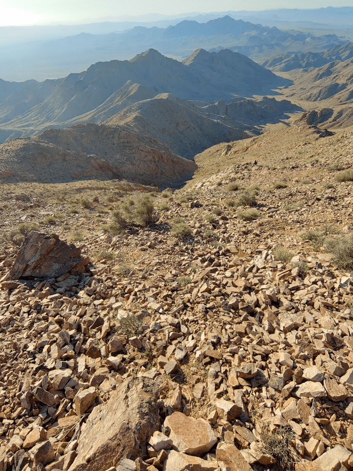
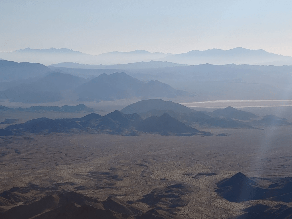
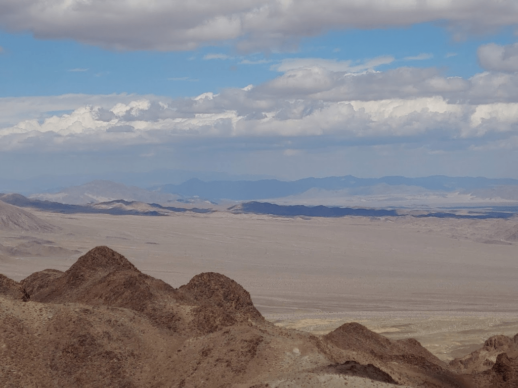
The views were amazing in the crisp morning light.

In the distance I had a great view of Mojave National Preserve to the east. The peak in the background on the right is Granite Mountain, which I climbed in December.
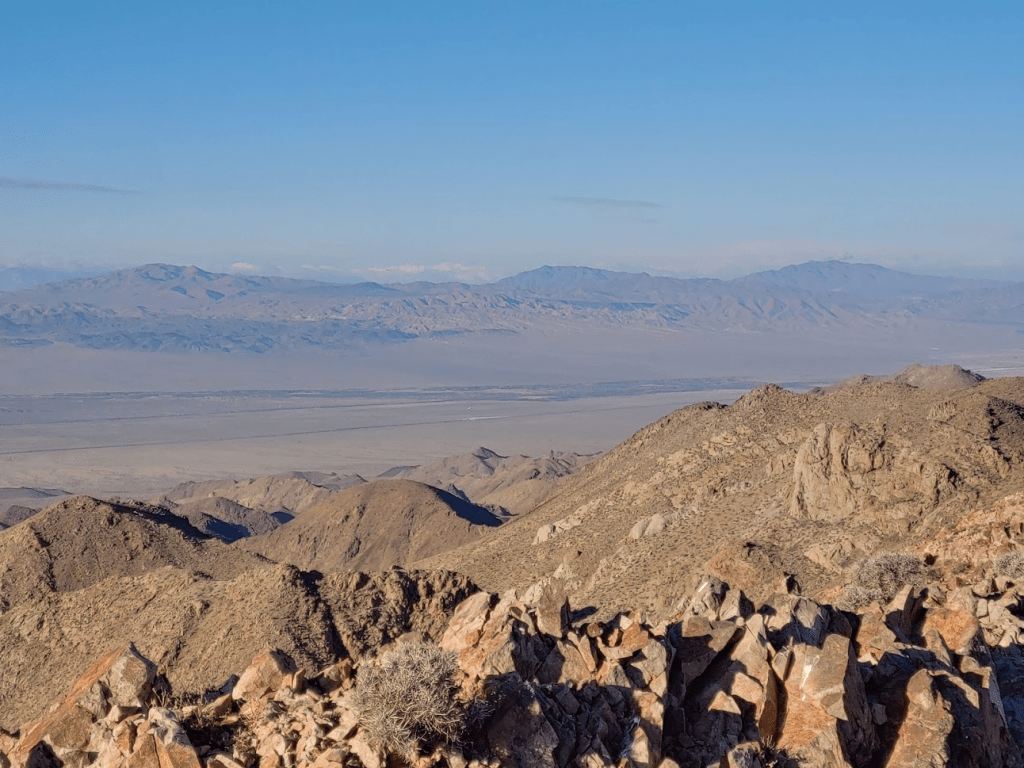
To the southwest I could see East Ord (middle), and Ord (right). West Ord was hidden behind Ord. Rodman Mountain is the peak on the left.
I rested for 30 minutes and began descending. I took a slightly different route down, starting by descending a ridge south off of the summit.
After climbing down the ridge a short way, I went left off the ridge back down towards the wash.
About 4/10 of a mile from the summit I rejoined my ascent route back in the wash.
In 5 minutes, I reached the dry fall once more. From there, it was about a 2.5 mile walk down the sandy wash back to the car.
I reached the car again at 9:19am.
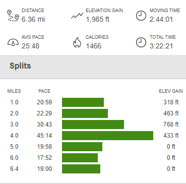
This hike totaled 6.36 miles, 1985 feet elevation gain, and 3:22:21 total time.
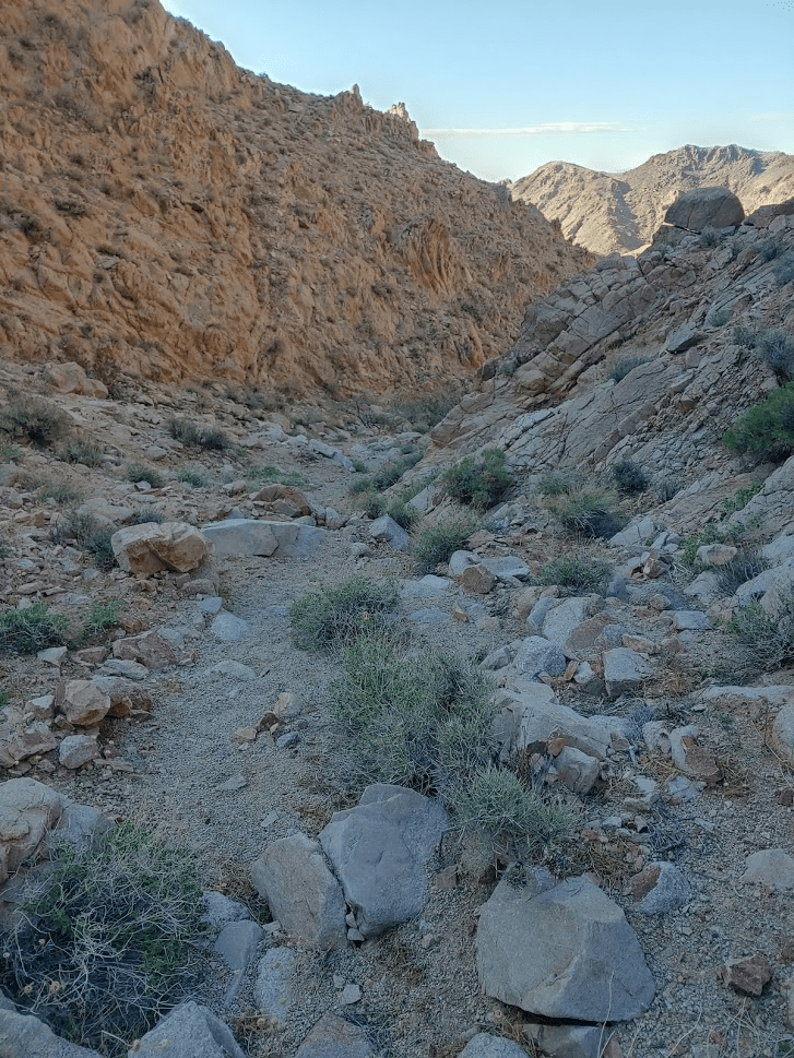
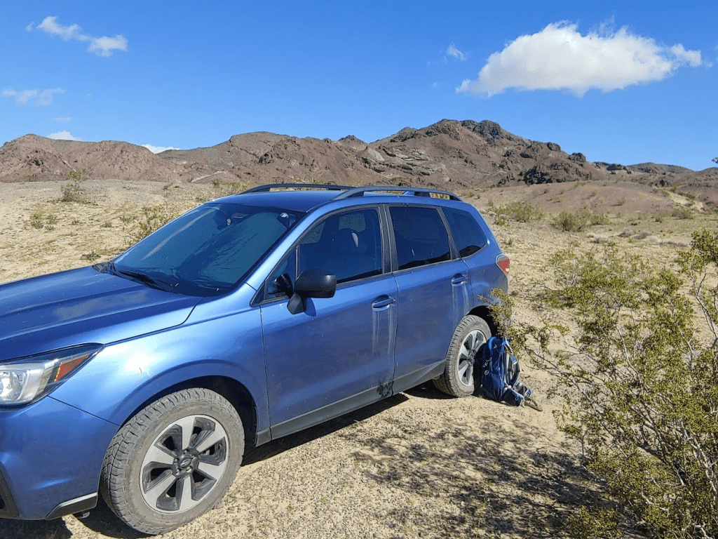
My final peak for the weekend would be Sleeping Beauty. Sleeping Beauty, which Zdon does include in his book, is on the southern end of the Cady Mountains and just a short drive away. I drove back south on the power line road to Pisgah Crater Road which took me back to the National Trails Highway (Route 66). I went east for a few miles to where it crosses underneath I-40 and then turned left on a dirt road which I drove north on for about 2 miles to the base of Sleeping Beauty. This road is drivable in your Prius. One could continue a few tenths of a mile further from where I parked if you have a jeep.
I started my final hike at 10:10am from about 2600 feet. Sleeping Beauty (3979 feet) is visible from the freeway and now loomed over me impressively. Its red color was distinctive. According to Zdon, Sleeping Beauty is separated from the rest of the Cady Mountains by a fault and is made up of much younger volcanic rock.

I started up a rocky wash.

Eventually the wash peters out and I started climbing up a steep slope of loose rock towards a false summit.
The false summit had sheer walls and it didn’t appear that it could be climbed from this side. I went around it to the west (left).

Once around the false summit, I could see the true summit ahead.

I had to descend into a small bowl first.
From there, the final climb to the summit was steep and rocky.
I reached the top at 11:20 after 1.68 miles of hiking.

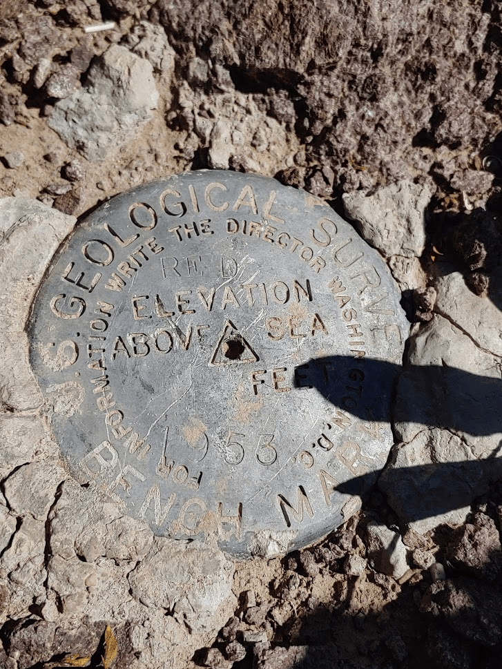
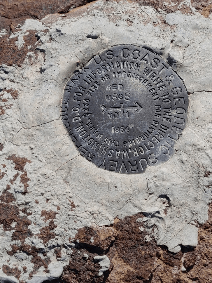
I located the benchmark marked “Red” as well as 2 reference markers.

The views were similar to my morning hike. Cady Peak was just a short distance away. I could even make out the route I used to climb it. The large sandy wash is visible in the middle of the picture below.

It was looking dark and cloudy to the north towards Death Valley. I was happy I decided against going there.
Again, I found no register. For the 5 peaks I climbed this weekend I only found a register on East Ord. This was surprising since there are usually registers even on very obscure peaks. After 30 minutes on the summit I began my descent.
I decided to try my luck going around the other side of the false summit. On the ascent I went around the west side (right). So, now I headed for the east side (left).

I worked my way around a narrow ledge.

Eventually I couldn’t go any further. However, I was able to scramble up the false summit using some steps that were eroded into the wall. There wasn’t a direct route off the south side of the false summit, but I was able to climb down the west side of it using a ramp. This put me near my ascent route.
I then scrambled down the rocky slope below the summit.

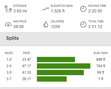
From there it was an easy hike down the wash back to the car. I finished up just after 1pm. Totals for this hike were 3.69 miles, 1526 feet elevation gain, and 2:51:12 total time.

What a weekend! All 5 peaks were enjoyable desert climbs with outstanding views and fun routes to climb. I didn’t see another soul on any of the peaks. I stopped for lunch at Panera in Barstow and then made it home safely to San Diego.
