Day 1
I finished up work a little early and left home around 3:45pm on Friday afternoon. I stopped quickly at 7-Eleven to get some ice and then hit the freeway. I would be headed up to Mojave National Preserve for the weekend. Mojave National Preserve is a large desert area which in general lies between I-15, I-40, and the Nevada state line. While not a National Park, it has been managed by the National Park Service since 1994. As far as I can tell, the main difference between a National Park and National Preserve is that certain things such as hunting, mining, and other resource extraction are allowed in national preserves. Also, the fact that it is not designated as a National Park means it gets much less visitors then nearby national parks such as Joshua Tree and Death Valley. In fact, Mojave National Preserve has a very similar feel to Joshua Tree National Park and even boasts the largest and densest Joshua tree forests in the world.
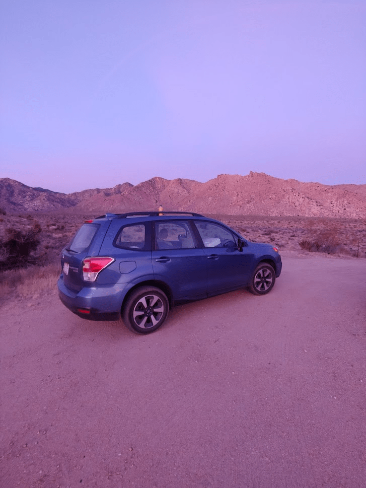
As Expected, traffic was a nightmare heading north on the 15 on a Friday evening. I exited the freeway near Murrieta and made my way northeast on state highways and other country roads until reaching I-10 near San Gorgonio Pass. I made my way up CA-62 before making a stop at Firehouse Subs in Yucca Valley around 7:45pm. Coincidentally, the TV in the restaurant was playing a Food Network special on the Mad Greek Restaurant in Baker, CA. The Mad Greek Restaurant is known as a popular stop along I-15 for travelers to and from Las Vegas, and I was planning to eat there the next night after my first day of hiking in the desert. I continued on through Twentynine Palms and went north through Amboy before finally crossing I-40 into the Preserve. I drove approximately 6 miles into the Preserve before finding a small dirt spur road where I parked for the night to sleep around 9:30. I was excited to try out my new car sleeping setup, as this was my first camping trip in my new Subaru Forester. I had purchased a small memory foam mattress which fit into the back with the rear seats folded down and a new 20 degree sleeping bag. The setup worked pretty well, and I had an okay night of sleep.
Day 2
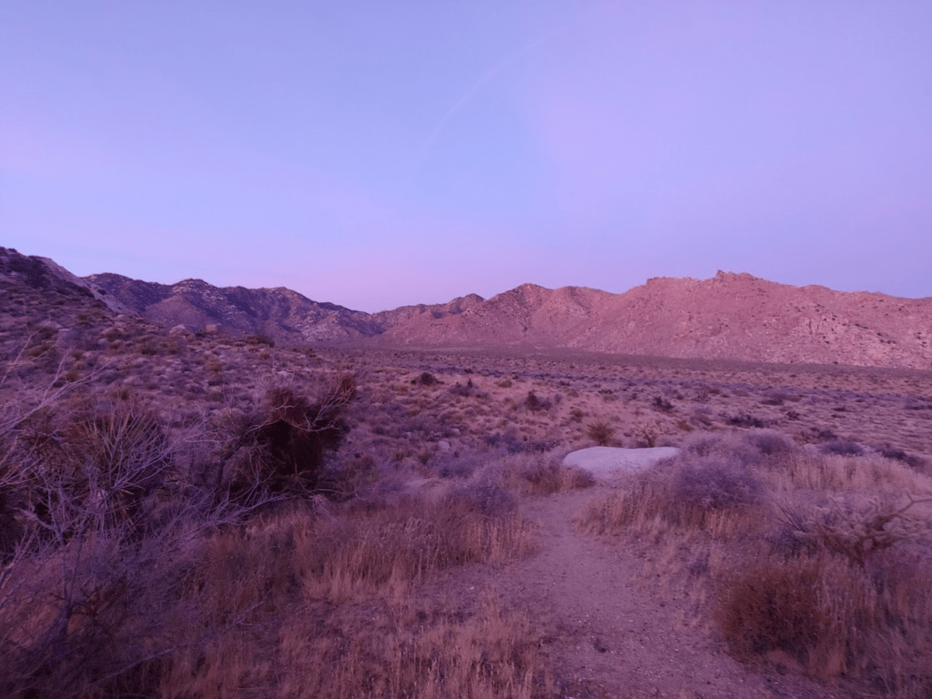
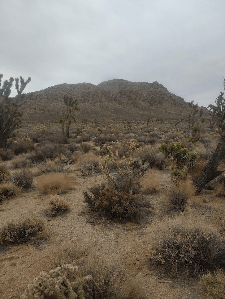
I woke around 5:30 and quickly got ready and prepared for my hike. As expected, it was very nice to not have to break down a tent in the dark and freezing cold. I drove just a few miles up Kelbaker Road, the main highway through the western side of the preserve. I found the dirt road on the left side I was looking for and proceeded down it for 2 miles before finding a decent sized parking area where I would begin my hike. The road was mostly in good shape but there were 2-3 spots where high clearance is definitely required.
I looked ahead at the Granite Mountains, a desert mountain range in the southwest corner of the preserve. My goal for the day would be the 2 highest peaks in the range, Granite Mountain and Silver Peak.
Granite Mountain is the highpoint of the range at 6762 feet. It is on the Sierra Club Desert Peaks Section list, which comprises 95 of the finest desert peaks in North America. I had climbed 18 of them up to this point. Silver Peak is slightly lower at 6365 feet. Both peaks are on Andy Zdon’s desert peaks list which is a much larger collection of 334 desert peaks in California and Nevada. My plan would be to take the standard route to Granite up Cottonwood Wash, then traverse the ridge over to Silver, then take the remains of an old mining road from Silver back down to the car. At 6:38am I began hiking as I crossed over the wilderness boundary.

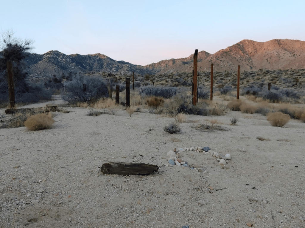
After just a few minutes I passed the remains of an old corral.
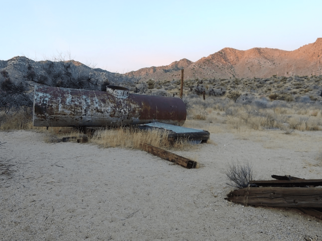
The route follows a sandy wash for a while. One could also begin by hiking on the old road which leads to Silver, but I opted to stay in the wash for now.

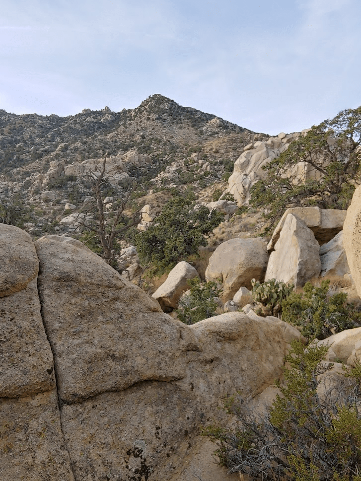
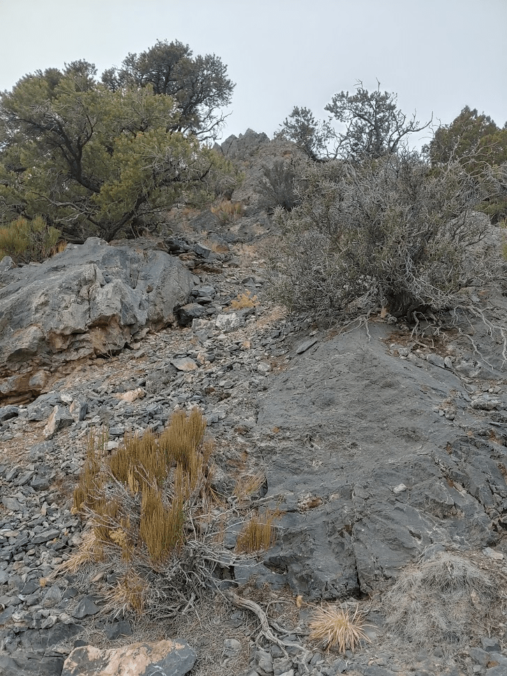
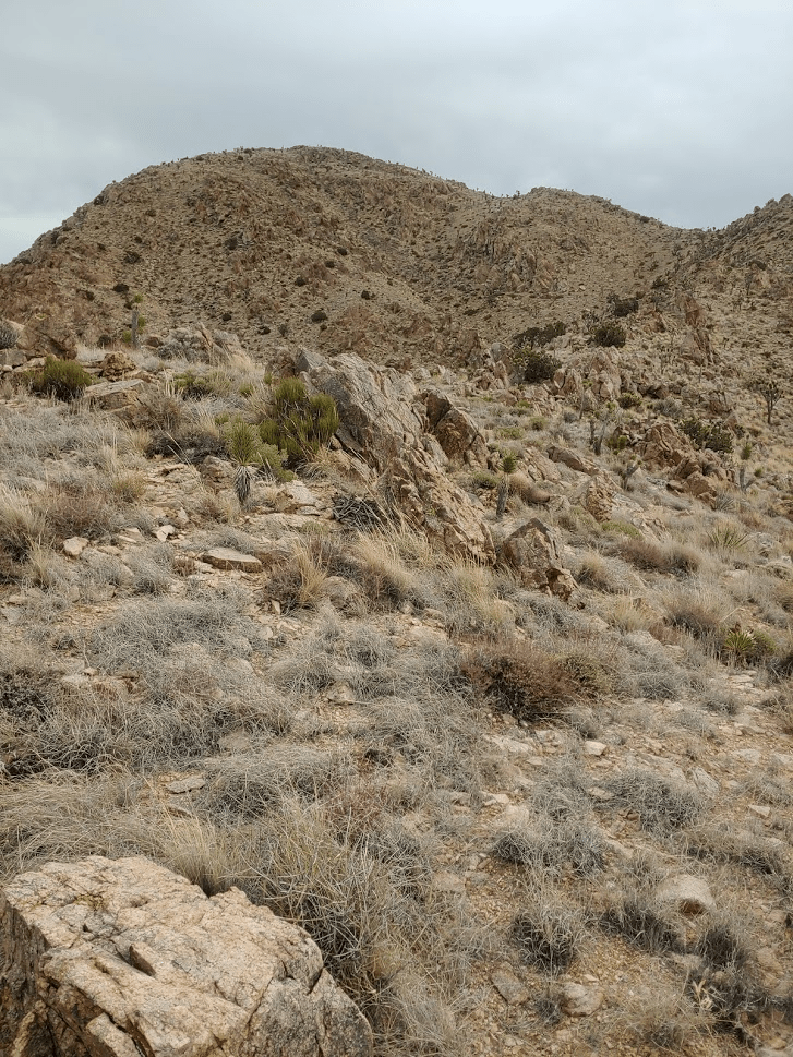
After about an hour of hiking and 2.5 miles covered, I reached the base of the peak.

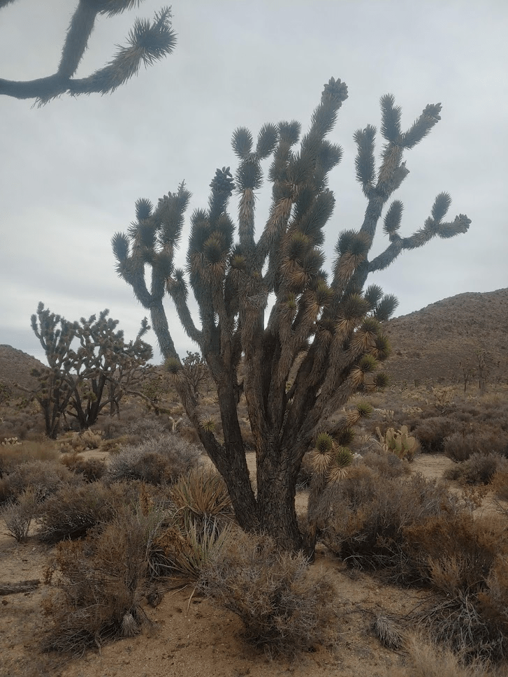
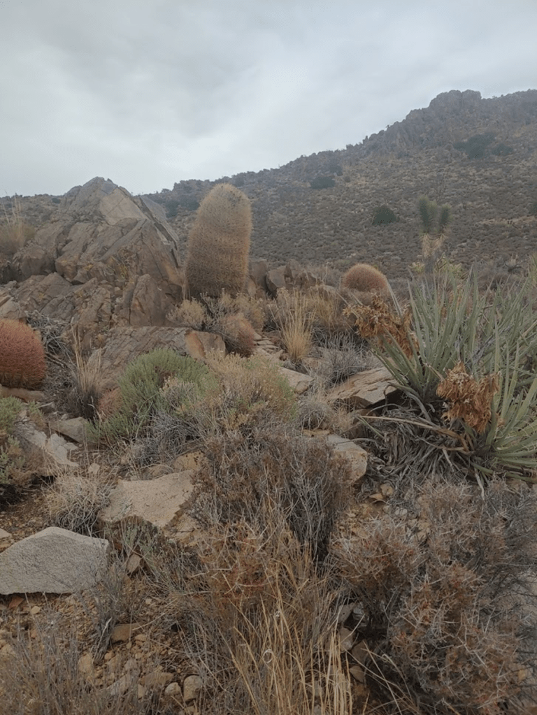
The slopes were steep and rocky, and the vegetation was somewhat dense.

Eventually I made it to the saddle between the 2 peaks, with Granite to the south and Silver to the north. The saddle is around 5700 feet, so I would need to gain around 1000 feet in 0.65 miles to the summit of Granite which is very steep.
This part was pretty slow, but I managed to reach the summit of Granite at 9:25am. I had been hiking for 4.5 miles up to this point.
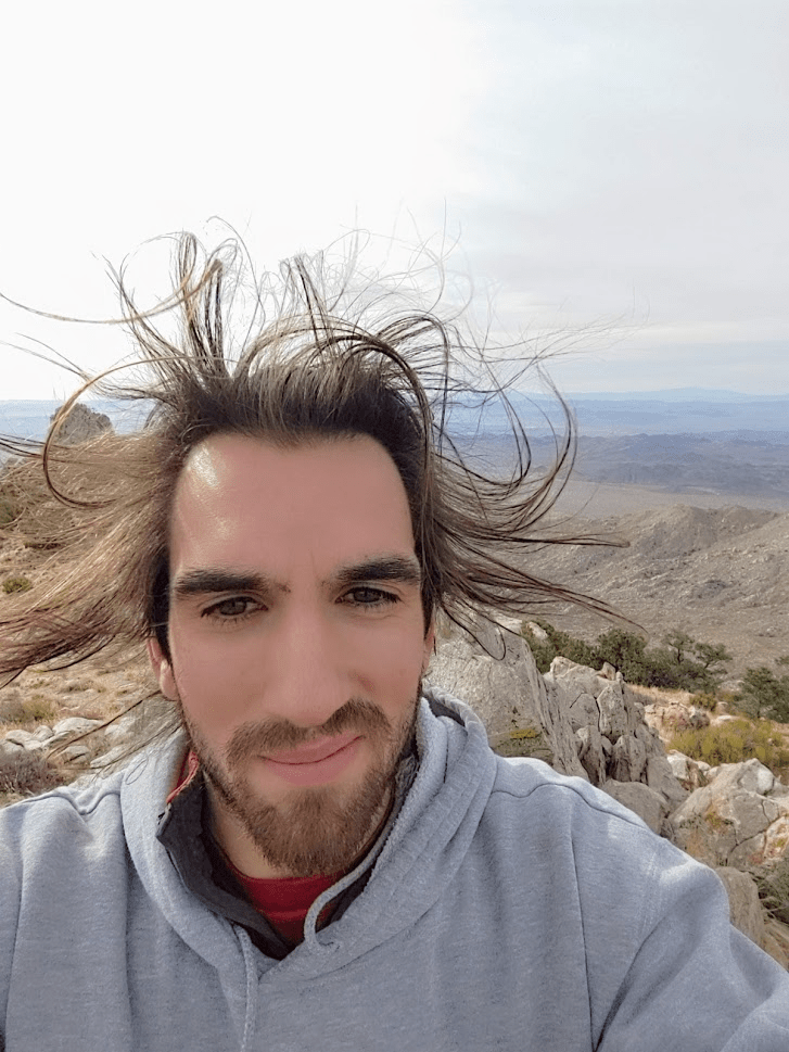
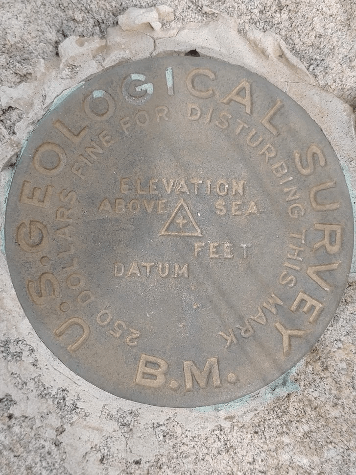
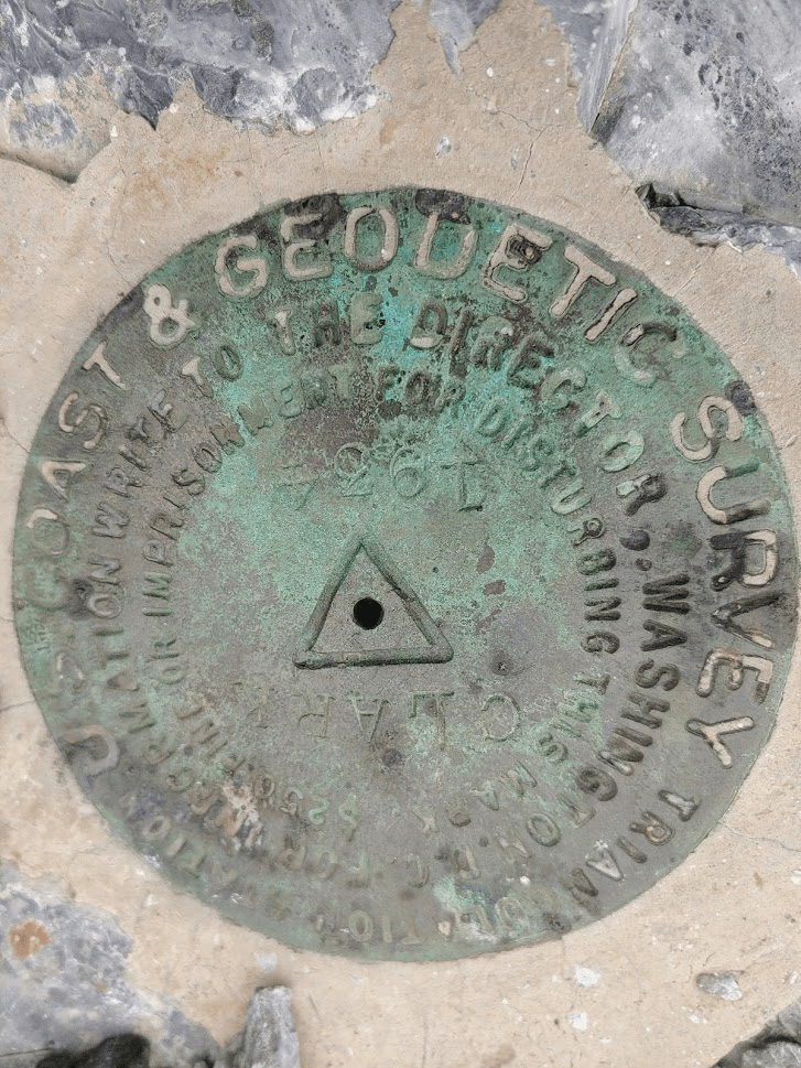
I found the triangulation benchmark but no reference markers.
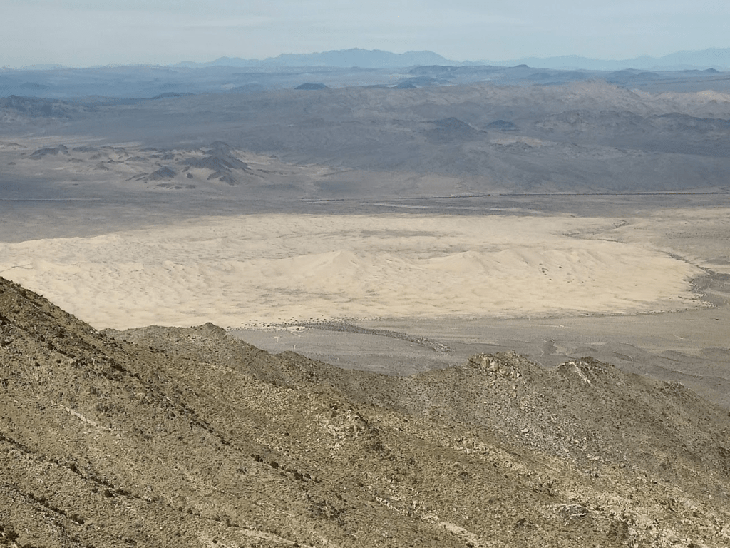
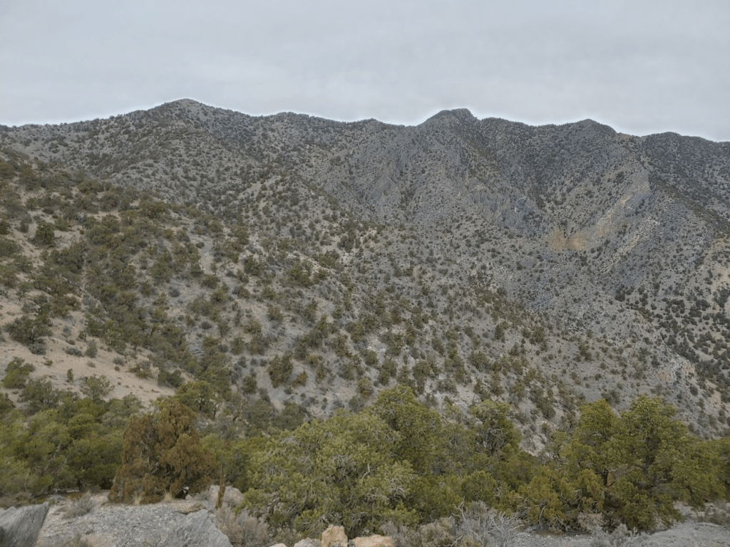
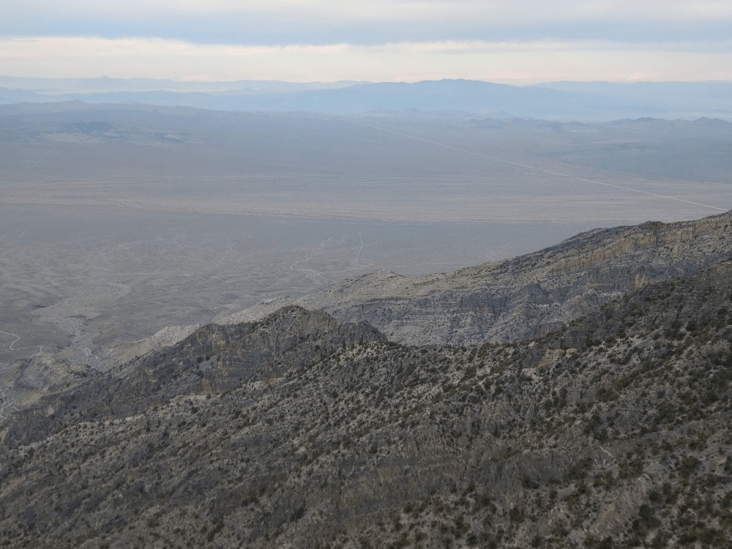
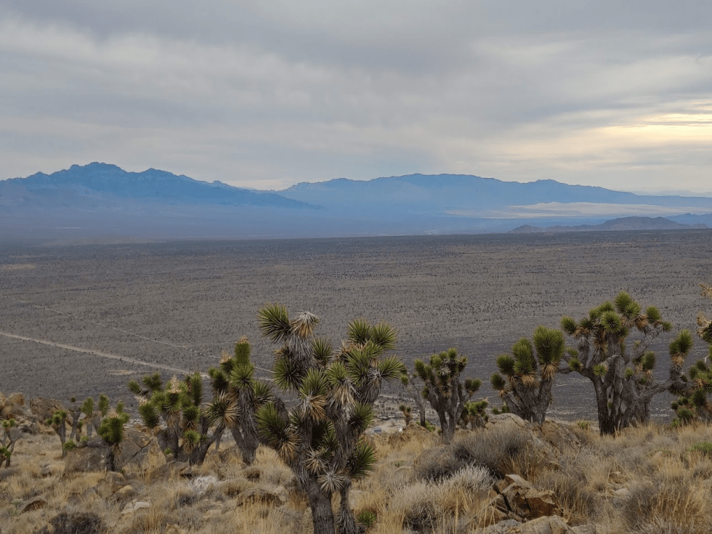
To the northeast I had an excellent view of the Providence Mountains, another range in the preserve just a short distance away. My car is parked in the center of the picture just to the left of the small hill.

Despite the clouds, I had an excellent view of countless desert ranges all around me.
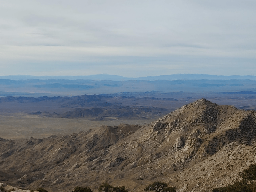
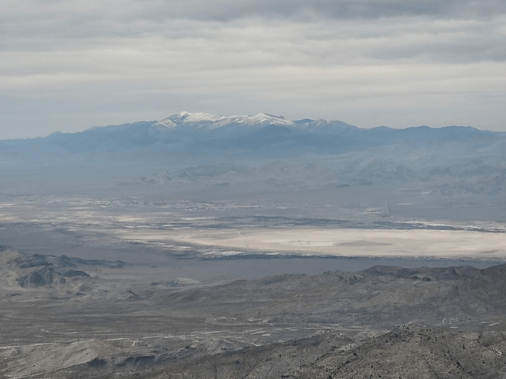
Among the more notable peaks I could see were San Jacinto, San Gorgonio, Telescope Peak, and Mount Charleston. These 4 were all snow-capped. To the north I could see Silver Peak just a couple miles away.

I rested for about 20 minutes and had a snack before descending back to the saddle which I reached just before 10:30. I knew it was about 1.5 miles from here to the summit of Silver, and only about 600 feet of vertical gain would be required. However, some large rocky areas along the ridge concerned me. This part of the hike was the biggest unknown for me, as I couldn’t find a ton of information online about the traverse. It seems that most people climb one peak or the other. The unknown factor was the reason I decided to do Granite first. Granite was the peak I was more interested in, so I wanted to do it first in case I had to turn around on the traverse between the 2 peaks.
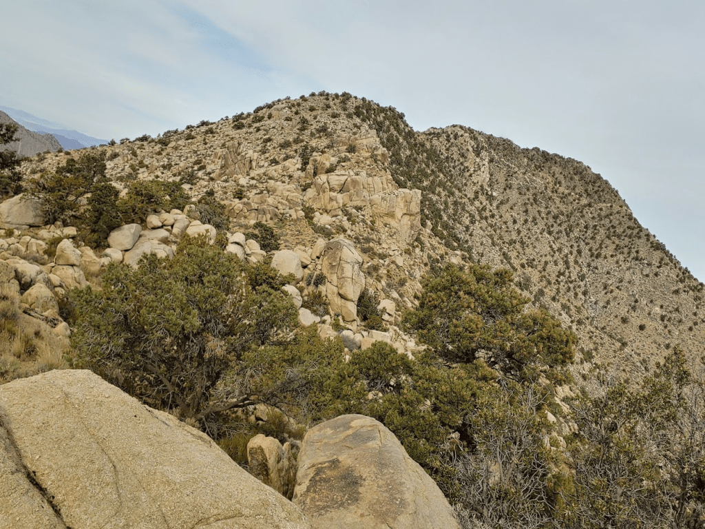
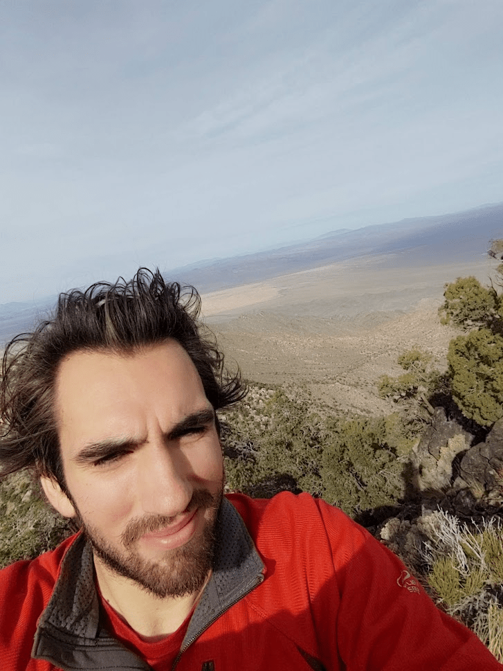
The ridge traverse wasn’t too bad, but I was right to be a little wary of it. There were about 3 places where route finding became very difficult due to the house sized boulders. At the 3rd impasse near the summit I heard voices above me I was searching for a way to proceed. I looked around and saw 2 guys above me and I called out to them. Turned out they were doing the same route as me but in reverse. They were also stuck on the same part as me and looking for a way down. This was comforting to me, since it was no longer just up to me to find a way through. Eventually they found a way on the other side of the ridge and showed me where it would be safe to proceed. I chatted with them for a few minutes and it turned out they were brothers from Santa Monica. I wasn’t too surprised to see other people in the mountains since it was a Saturday, but we all expressed mild surprise to see others on the traverse part of the route. After this it wasn’t too much further to the summit. I made it to the top finally at 12:15pm after 6.73 miles of hiking. I couldn’t believe it had taken me nearly 2 hours to ascend the 1.5 miles from the saddle to the summit of Silver.
There were no USGS markers on the summit. I did find a register which was damp, but I still managed to sign it. The views were pretty similar to that of Granite.
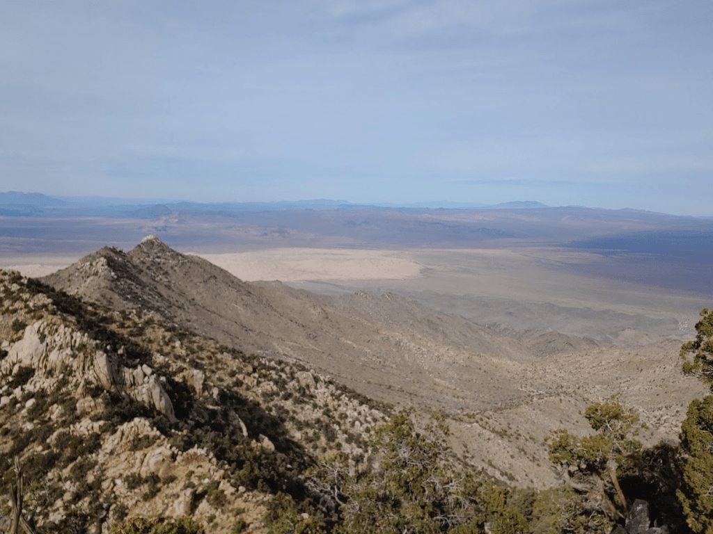
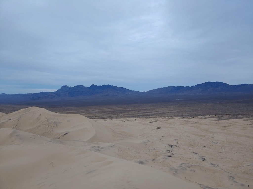
I had an excellent view of the Kelso Sand Dunes to the north.
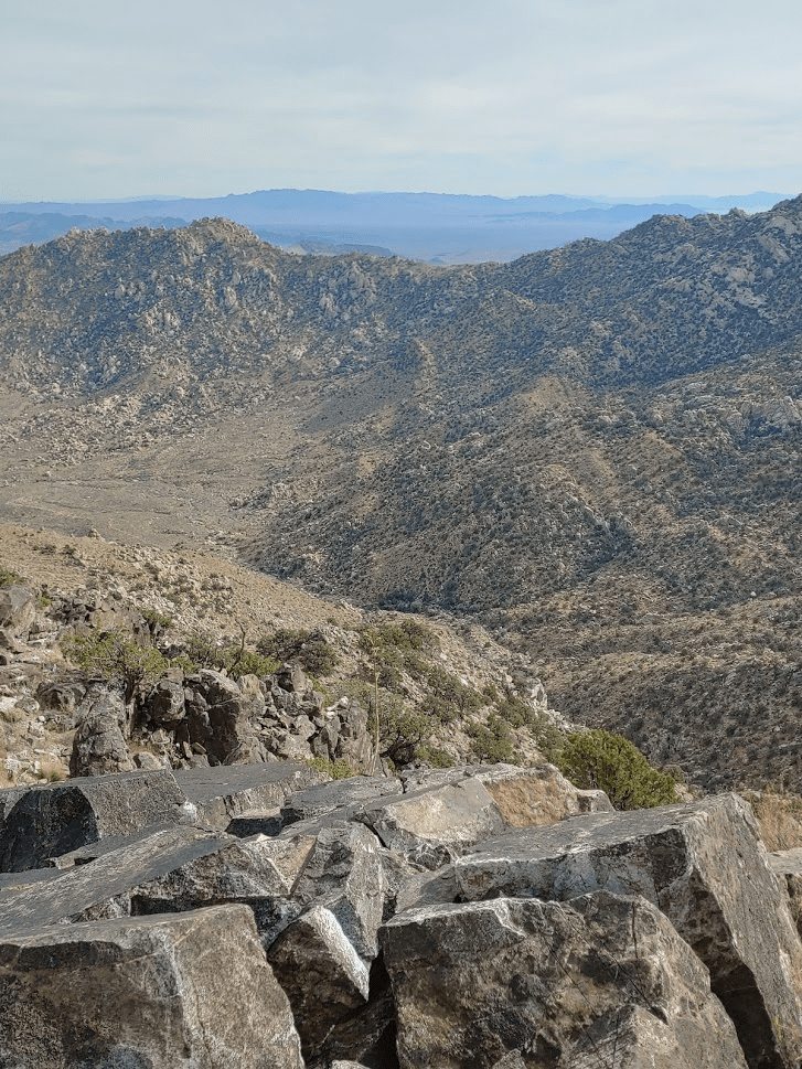
Looking back south along the ridge to Granite Mountain:

I took about a 20 minute break and had more snacks. When I was getting ready to leave I got up to put my backpack on, turned around and saw a bighorn sheep not 30 feet away from me! I couldn’t believe what I was seeing. The sheep hadn’t noticed me yet so I tried to get my phone out for a picture as fast as I could. However, a split second later the sheep saw me and dashed away. I was a little bummed about not getting a picture. but still felt very lucky to see such a majestic creature. I had been on the lookout for one since I had seen tons of sheep tracks and scat on the hike so far. This was only my second time seeing one in the wild. The first time was in February when I saw a herd of 5 while I was descending Pyramid Peak in Death Valley National Park. This one was much closer than the 5 I saw in Death Valley. I started down off the summit and about a minute later saw a couple on their way up. I chatted briefly with them and told them of my encounter with the bighorn sheep. I hiked for just a short distance north off the summit before finding the old mining road which is the usual route up to Silver Peak.
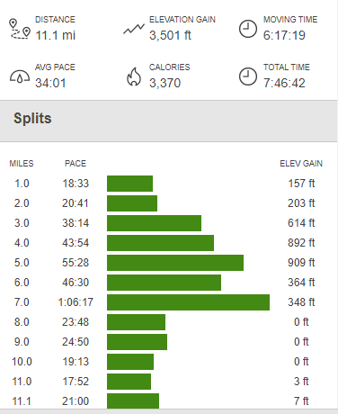
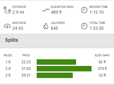
This road has obviously not been used for many years and in many places was difficult to follow. It had deteriorated into a single track trail along a good portion of it and sometimes disappeared altogether. The route down was uneventful and I finally reached the car again at 2:25pm. Stats for the hike were 11.1 miles, 3501 feet elevation gain, and 7:46 total time.

I knew I didn’t have much daylight left since it was quite literally the shortest day of the year. I drove north on Kelbaker Road and arrived at the visitor center. The visitor center is located at the Kelso Depot, which is a restored Spanish style building which originally opened in 1923 as a restaurant and hotel for railroad workers and travelers.


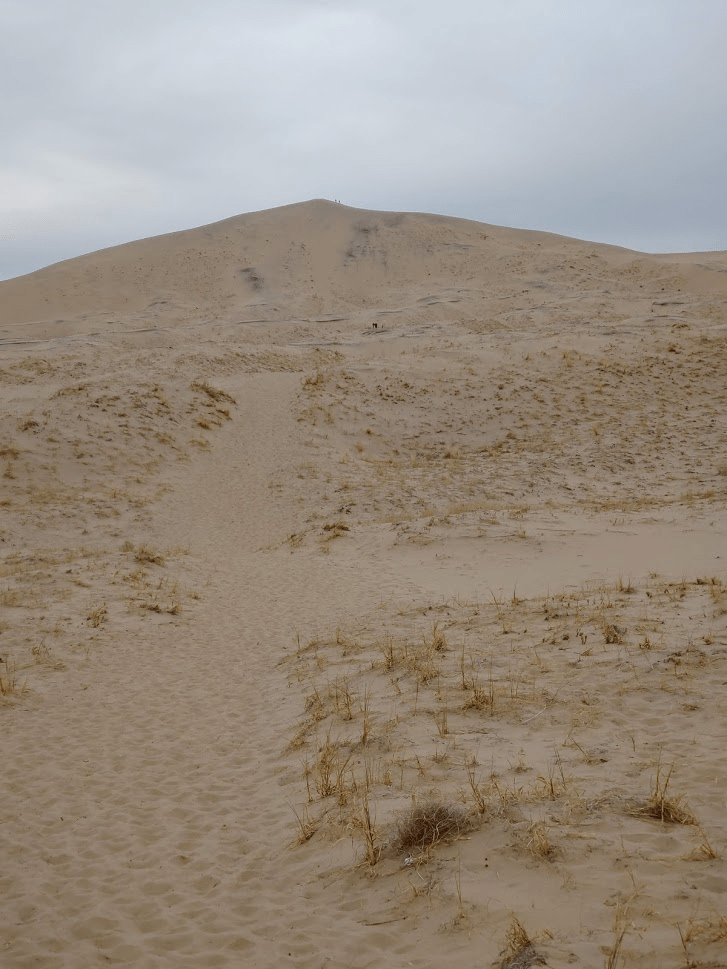
I looked around a little and then got back in the car. I drove back down Kelbaker Road about 10 miles south and then 3 miles west on a well graded road to the Kelso Sand Dunes which I had seen from the summit of Silver Peak. The Kelso Dunes are one of the main tourist attractions in Mojave National Preserve, and there were about a dozen other cars there when I arrived at 3:30. The tallest dune rises over 500 feet above the desert floor and my plan was to hike up there to catch the sunset.

It’s about 1.5 miles from the parking lot to the top of the highest dune. However, it is very slow hiking due to the ground being loose sand. The final stretch gets extremely steep and took forever to ascend. It was literally 3 steps forward 2 steps back!
When I reached the top, I spent about 10 minutes enjoying the beautiful surroundings. The clouds mostly obscured the setting sun.

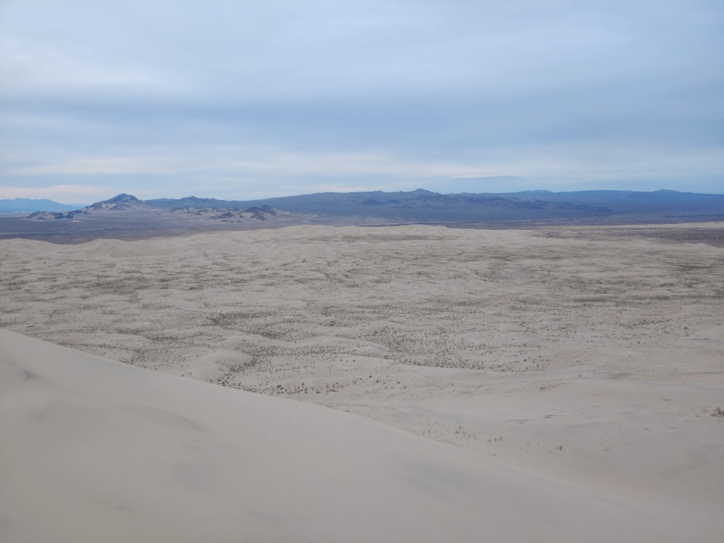
The Granite Mountains, where I had just been hiking for most of the day, were just a few miles to the south.

The desert really looked beautiful in the fading light.
I couldn’t believe how far the sand dunes stretched out for. The Kelso Dunes apparently cover 45 square miles!
Going down was literally 10 times easier, and I reached the parking lot just before 5.

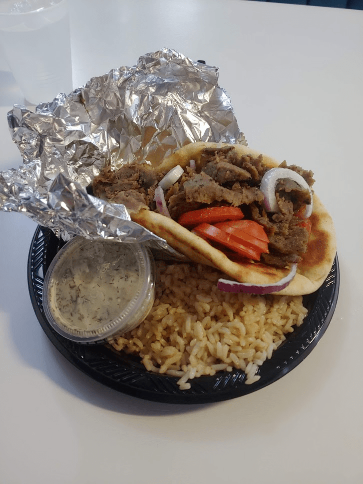
I was extremely exhausted by this point, having covered about 14 miles between the 2 hikes. Plus, my legs really burned now from walking up the loose sand. I drove north on Kelbaker Road once more and finally reached the small town of Baker. If you’ve heard of Baker you most likely just think of it as a stop on I-15 on the way to Las Vegas. It contains just a few restaurants and gas stations and is only notable for the 134 foot thermometer which is visible for miles. This is supposedly the world’s tallest thermometer and the 134 feet is an homage to the hottest temperature ever recorded on the Earth which was nearby in Death Valley. I went to the Mad Greek Restaurant where I had a delicious lamb gyro.
Before leaving town, I also got a sandwich from Jersey Mikes because I was still hungry and also filled up on gas. I drove northeast on I-15 and then re-entered the preserve at Cima Road, where I drove south for about 12 miles before finding a small picnic area just off the road where I would park and spend the night. My setup worked great the 2nd night, and I slept very soundly most likely due to how tired I was.
Day 3
I woke up at 5:15am, got ready, and hit the road again. My goal for the morning would be to climb Clark Mountain which lies in a small disconnected portion of Mojave National Preserve north of I-15. At 7933 feet, Clark Mountain is the highest point in the Preserve and one of the highest mountains in the deserts of Eastern California. Like Granite Mountain, it is also on the Sierra Club Desert Peaks Section list. The easiest route up Clark is just over 4 miles and gains about 2000 feet which is steep but not too hard of a hike. Part of the challenge would be the drive to the trailhead, and I was excited to really test out my new Forester. I drove north on Cima Road until I hit I-15. I drove for just about 8 miles northeast on I-15 until I exited at Bailey Road at a little community called Mountain Pass. Mountain Pass is the highest point on I-15 in California at 4730 feet, and is only about 15 miles from Primm, Nevada. After exiting the freeway, it was about 6-7 miles on steadily deteriorating dirt roads to a small picnic area at the base of the mountain. The drive began on well graded dirt roads as you wind through on public access lanes through a rare earth mine. A couple miles in I passed through a latched gate which was unlocked which said public access on it. I believe this is the entrance to the Preserve. The road continues through here and is still passable by any car for another mile or so. After a sharp bend, the road becomes very rocky and rutted and high clearance is definitely required the rest of the way. I went very slowly but my Forester had no issues. There was one small sandy section near the trailhead where the all-wheel drive engaged. Finally, I reached the picnic area at around 6000 feet after about 45 minutes of driving since exiting the freeway. I was extremely impressed with the capabilities of my Forester and was very happy to be reaching places that would be impossible in my old Honda Accord.

The picnic area consisted of 5-6 large picnic tables, a few trash cans, and a well.
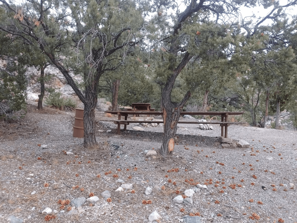
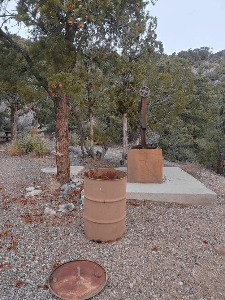
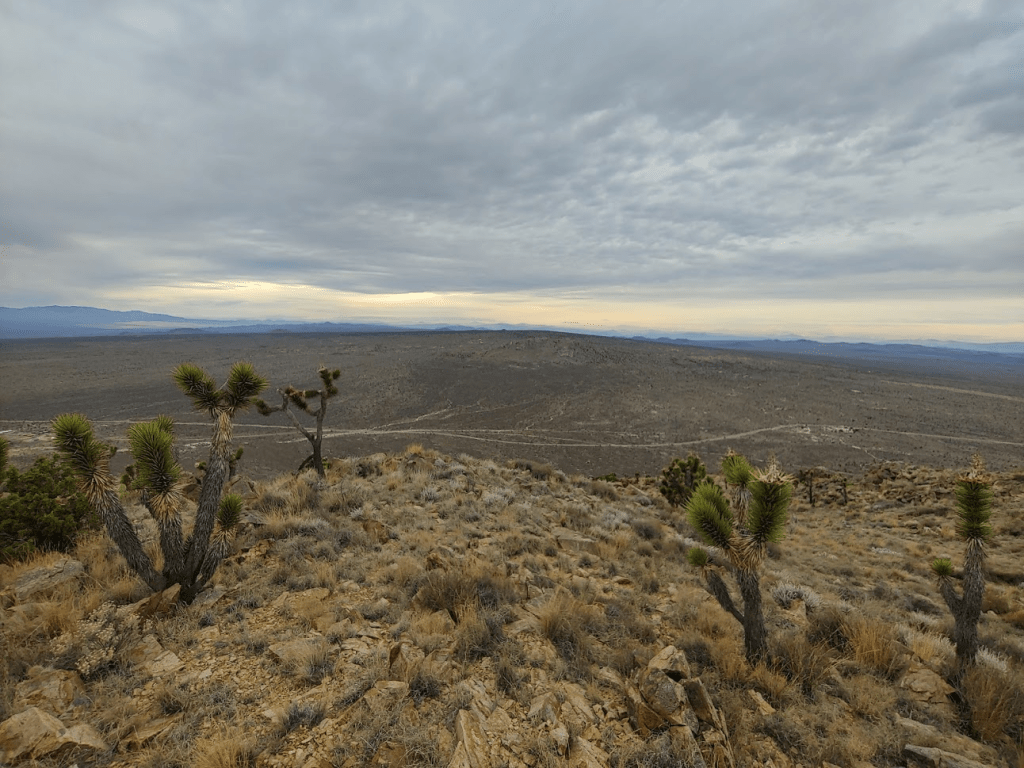
It seemed very odd to me that someone thought it was a good idea to haul this stuff up here. I can’t imagine anyone coming up here for a picnic so far from civilization in such a difficult to reach spot. It would have made a nice place to camp, but I didn’t want to drive up in total darkness the night before. I started hiking at 7:15am. The summit is visible from the start. It’s in the left center of the picture below.
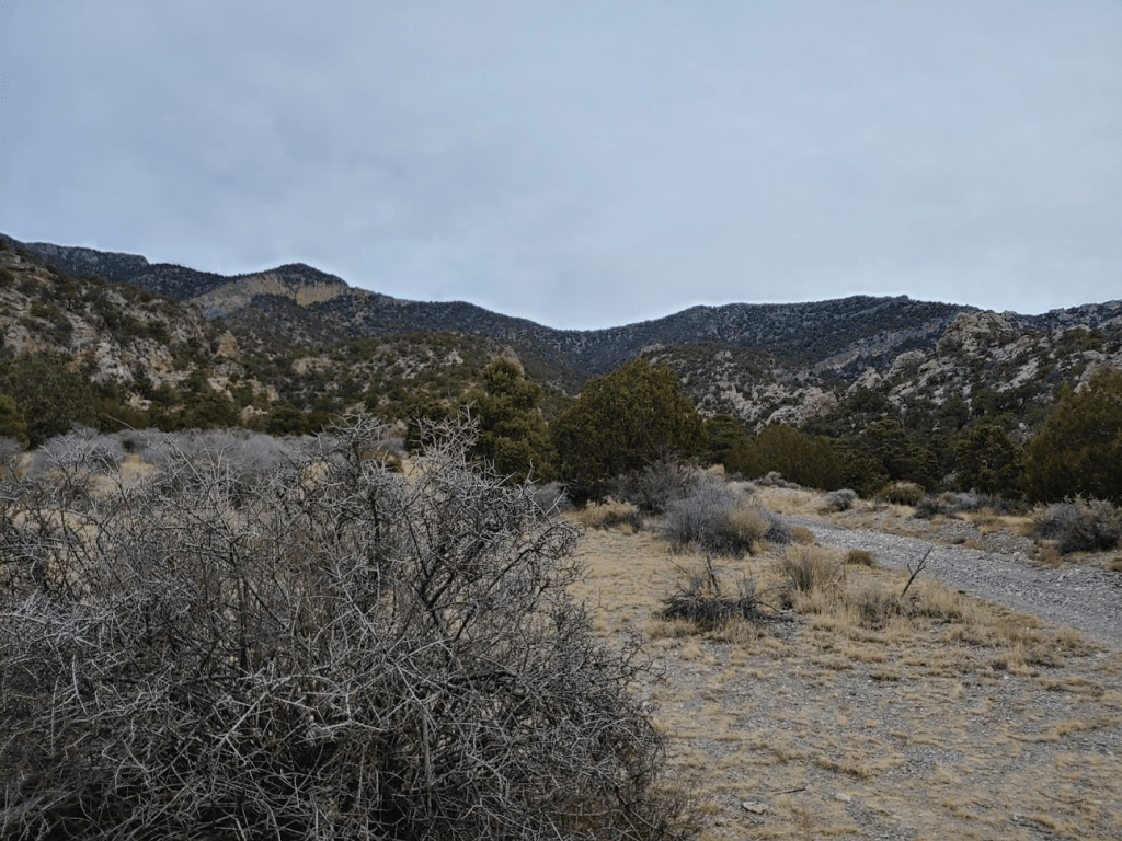
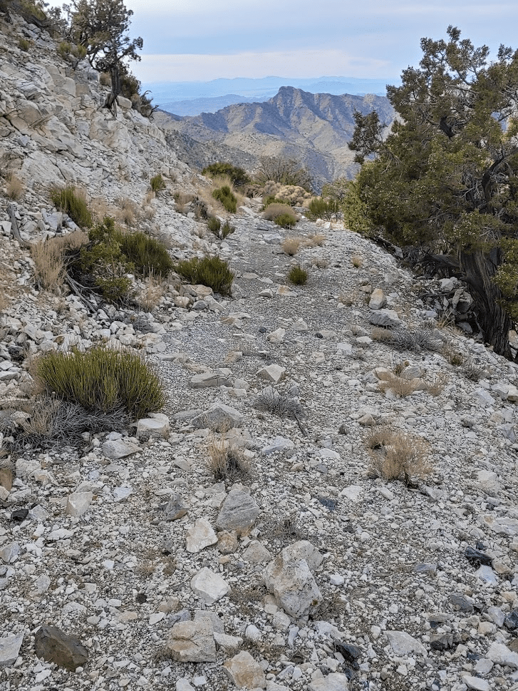
My plan was to go up the south ridge route, which is all class 2. Oddly, it seems this isn’t the standard route, which is class 3. It appears the south ridge route was discovered somewhat recently and has become popular since it avoids any class 3 sections. I started off by going a short way to the south before I began climbing up a ridge to the west.
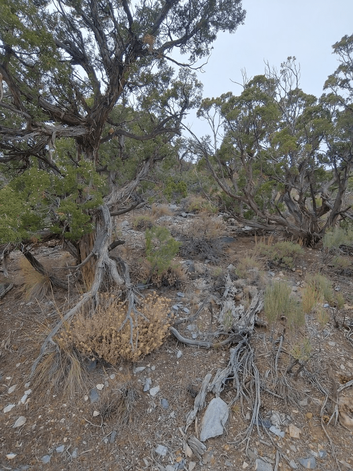
This was the steepest part of the route. There weren’t many large boulders to contend with, and the vegetation was dominated by juniper and pinyon pine.
The route basically follows the ridge all the way up and it tops out at minor bumps a few times as it curves gradually from west to north.

The summit was visible for large portions of the hike.
It was also extremely cold, and the wind got worse as I went higher. The ridge narrowed as I got closer to the summit. The ridge eventually became so sharp that I had to stay slightly below it on the sides of the slope to avoid any class 3-4 terrain. Finally, I reached the summit at 9:10am. It took me just under 2 hours to hike the 2.2 miles to the summit. I was relieved that I didn’t encounter any snow on the route, but some snow was visible on the north facing slopes while on the summit.

To the north, snow-capped Mount Charleston looked magnificent as it towers over southern Nevada.
I-15, the Mescal Mountains, and the New York Mountains were visible to the south. The New York Mountains are another tall mountain range within Mojave National Preserve.
With over 4000 feet of prominence, the views in every direction were amazing. Countless desert ranges sprawled out beneath me.

I signed the register and located the USGS benchmark.
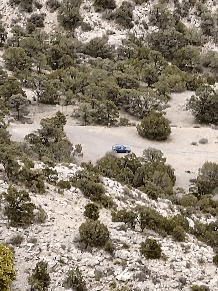
I rested for only about 20 minutes on the summit. I would have stayed longer but it was too cold at nearly 8000 feet in the middle of December. I took the same route down which was uneventful and took about the same amount of time. I was able to spot my car on the descent.
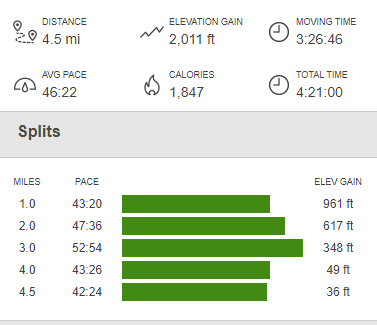
I finally reached my car just after 12:30pm. Totals for the hike were 4.5 miles, 2011 feet elevation gain, and 4:21:00 time.

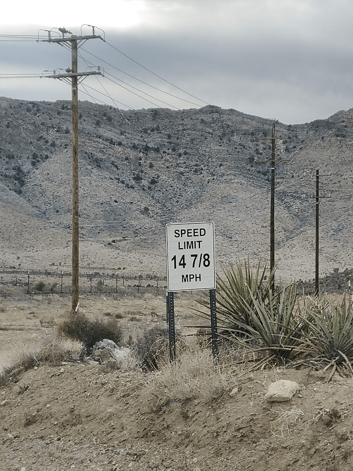
I had a small sandwich in my cooler which I had purchased the night before at the gas station, so I decided to sit at one of the picnic tables and eat it. It was much warmer at the picnic area and protected from the wind, but definitely still chilly at 6000 feet. Once I was done eating, I began the long tedious drive back to the freeway. I had to go extremely slow again but made it through the difficult parts without incident. Once I got back to the mining area, I made sure to follow the posted speed limit.
It was now after 1pm. I knew my daylight hours were limited, plus I had a long drive to get back home ahead of me. I settled on climbing nearby Kessler Peak which was near where I had camped the previous night. Like Silver Peak, Kessler is on Andy Zdon’s list of desert summits. I made my way back down I-15 and exited once more at Cima Road. I drove for about 12 miles where I turned left onto Kessler Peak Road. I continued for another mile or so where I found a nice turnout to park in. It was about 1:30pm now. The road up to this point would be passable for just about any vehicle. The turnout would be a nice spot to camp.

Kessler Peak is fairly small, but it does have just over 1000 feet of prominence. It looks somewhat impressive since it stands alone in the middle of the desert plain.
I was expecting a fairly easy climb. It would require crossing about a quarter mile of open desert, and then a steep mile up to the summit gaining about 1000 feet. Crossing the desert was a little tedious, as the vegetation was thicker than is typical for a desert plain. There were thousands of Joshua trees.
I began climbing southeast up the steep slopes of Kessler Peak.
Route finding was easy. I quickly gained the main ridge as it curves from south to east.

Once on the ridge there was a faint use trail which I managed to follow for most of the way. The summit was visible as I turned east.
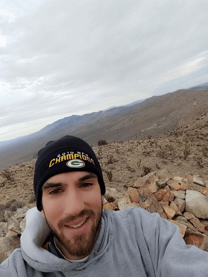
After 1.3 miles I reached the summit of Kessler Peak at 6165 feet.
The can holding the register was open, so the register was soaked all the way through. I did locate the benchmark and reference mark number 2.
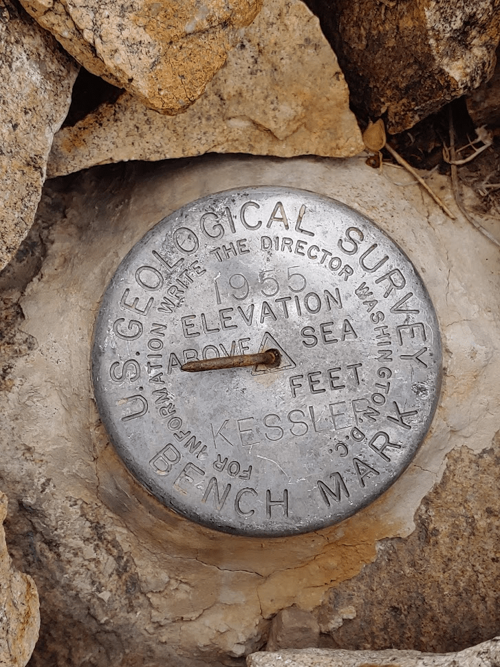

I also found a spot where it looked like another reference mark had possibly been removed.

Clark Mountain was visible to the north. It’s the mountain which appears highest on the left side of the picture. It was crazy to think I was up there just a few hours ago!
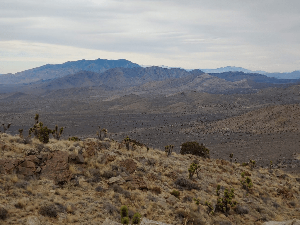
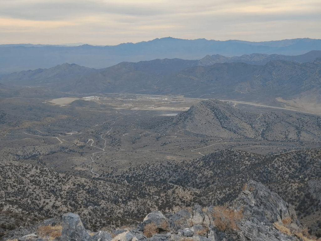
I could see the other major ranges of Mojave National Preserve. The Providence Mountains are on the left and the Granite Mountains are right center. The Kelso Sand Dunes are visible on the far right.
Kessler Peak’s greatest attribute is perhaps its view of the Cima Dome. The Cima Dome is a volcanic formation which was eroded into a dome shape over millions of years. It is extremely symmetrical, and almost doesn’t look like something that belongs in nature. It is so large I had to take a panorama to get the picture below.
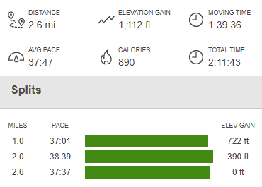
Once I was done marveling at the Cima Dome, I started back down the way I came. I reached my car around 3:30pm. Totals for the hike were 2.6 miles, 1112 feet elevation gain, and 2:11 time.

There wasn’t enough daylight to do anything else, so I decided to begin the long drive home. I drove through the Preserve on Cima Road, Kelso Cima Road, and Kelbaker Road to reach I-40. I took I-40 to Barstow and then took I-15 and I-215 all the way home.
