Manuel Peak, Cabezo Prieto, and Post Summit
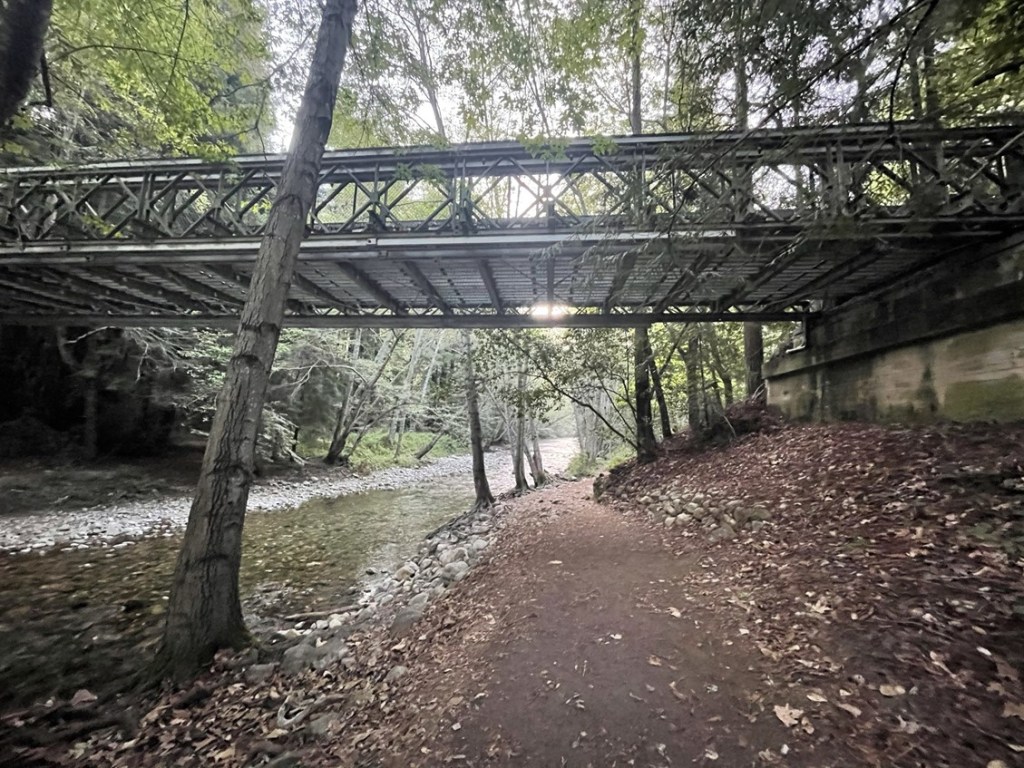
My plan for Friday was to climb 3 more peaks above the Big Sur Coastline: Manuel Peak (3520 feet), Cabezo Prieto (3560 feet), and Post Summit (3456 feet). The 3 peaks lie along the same ridge and can be accessed from the north via Andrew Molera State Park or from the south via Pfeiffer Big Sur State Park. I chose to take the southern route, so I woke up early from my campsite at WeatherTech Raceway and made the drive down to Big Sur. I felt like I had paid a lot of fees the last couple days, so I parked on the side of the highway right across the street from the park entrance (this is the same place I parked the day before for the Buzzards Roost Trail). This would add a little over a mile roundtrip to my hike. I started hiking at 6:55am from 210 feet above sea level. I walked down to the Big Sur River and crossed underneath Highway 1.
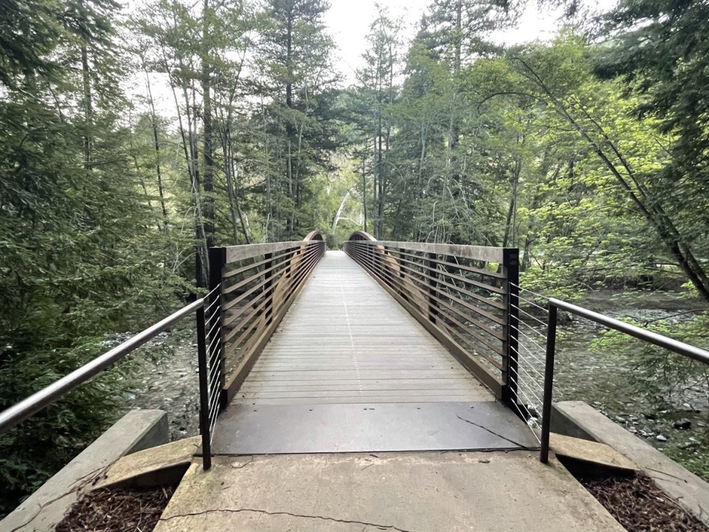
It was very cold as I got started. It was in the 40s which isn’t too bad, but I think the humid ocean air made it feel quite a bit colder. I hiked through the park and crossed the river near the main campground.
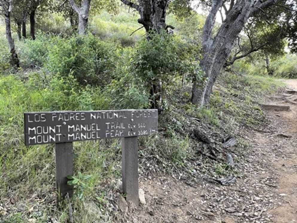
I reached the trailhead at 0.8 mile. The trail immediately started gaining elevation.
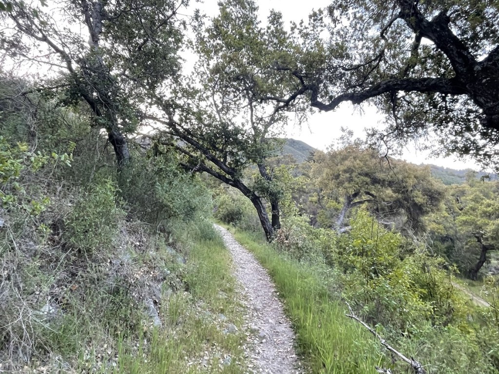
At 1 mile I reached a turnoff for a homestead but kept hiking. At 1.4 mile I passed into national forest land.
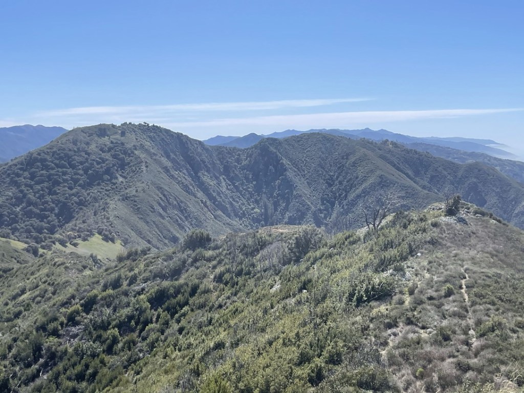
The trail made many switchbacks up the southern side of Manuel Peak.

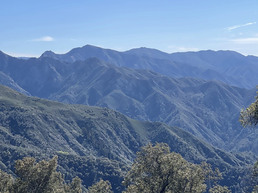
The sun began to rise over the distant mountains. I could see the trail continuing to gain elevation on the hillsides in front of me.

I turned a corner and found a few redwoods growing out of the canyon below.
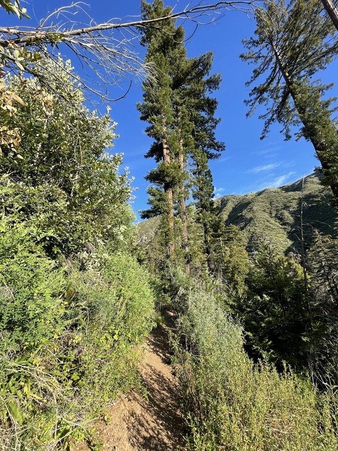
After a couple miles the trail began to narrow. There were some sections of brush to fight through.
The brush was so tall at points that it formed a canopy over the trail.

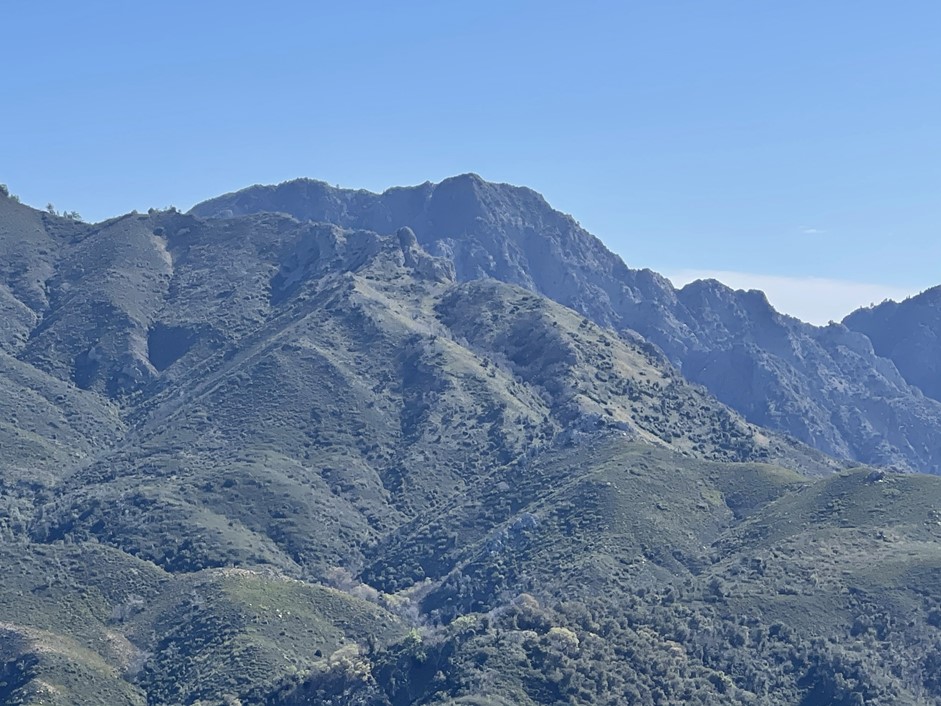
Soon I found myself just below Manuel Peak. The peak below is actually a false summit, but the actual peak isn’t far behind.

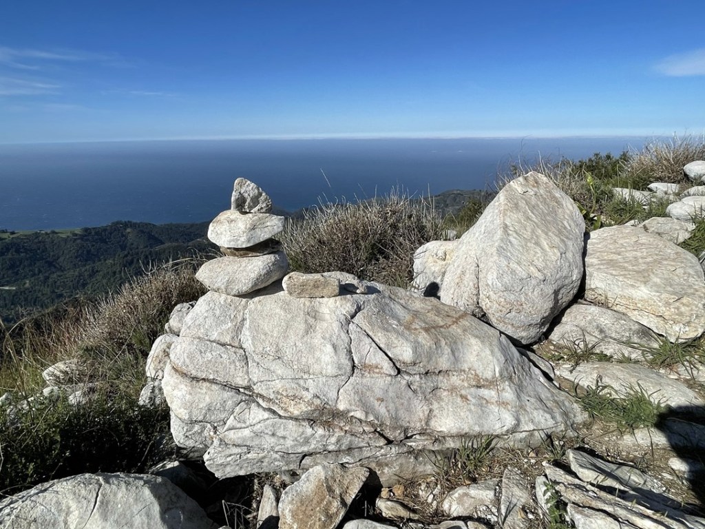
The climb up False Manuel was a steep one. Once I was near the top I had to backtrack slightly to the false summit, which I reached at 5.4 miles. A small cairn on top of a rock marked the spot.
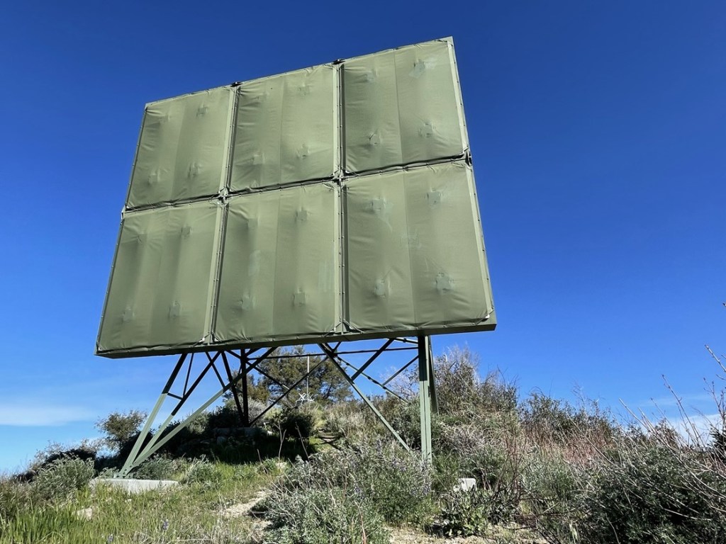
I admired the view for a second and then continued onward. I passed underneath some kind of structure shortly afterward.
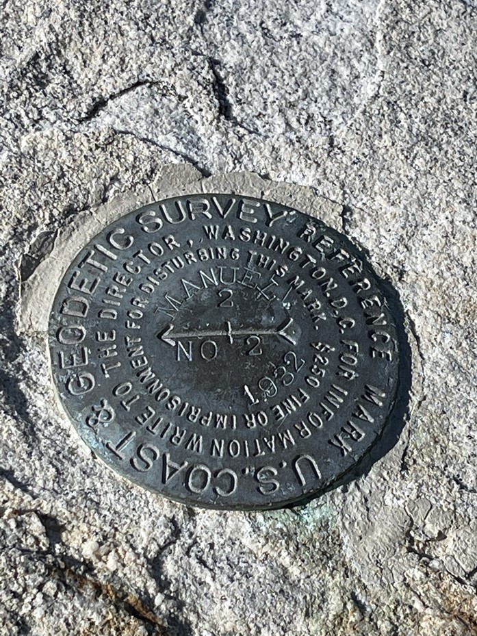
Right after the structure I made it to Manuel Benchmark. The benchmark is a separate location than the peak itself (they are very close though). I did not find the benchmark, but I did locate reference marker no. 2
I continued hiking north, following the ridgeline to Manuel Peak. There were a few minor ups and downs.

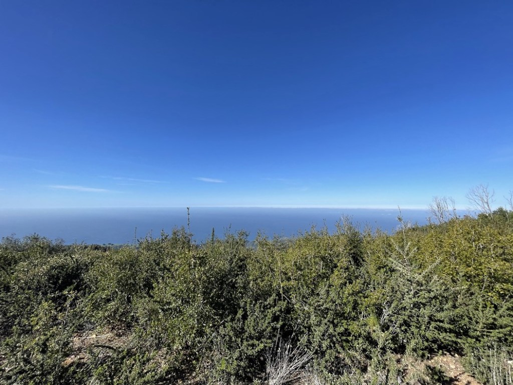
I reached Manuel Peak at 9:34am at 6.1 miles! The summit was very lame. It’s flat and the high point is not obvious (the trail appears to pass right over it). The brush also obscures the view in most directions. I was able to see the ocean to the west.
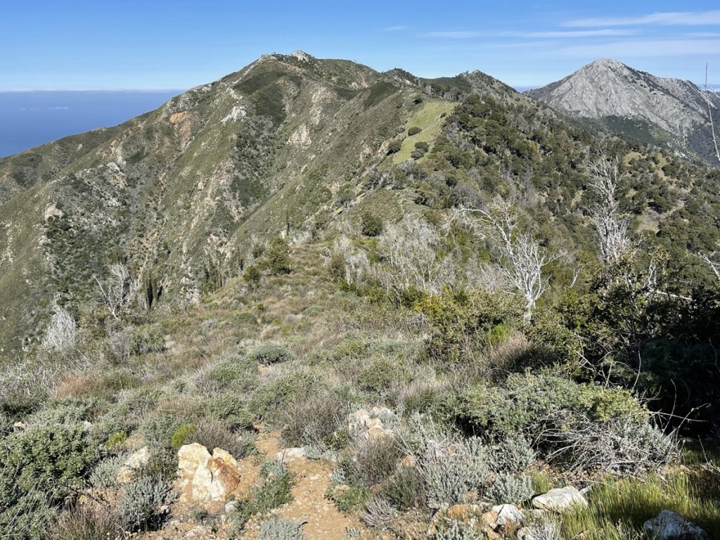
There were no register or survey markers. The summit was so anticlimactic that I kept hiking after not taking break. A short while later, the slightly higher Cabezo Prieto came into view.
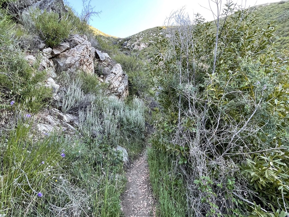
The trail was a little brushy here but not as bad as on the way to Manuel. I descended to the saddle and then began climbing again.

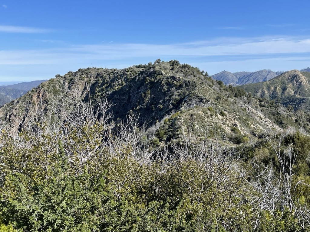
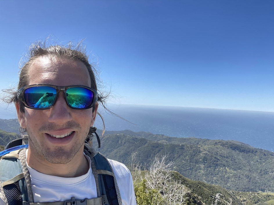
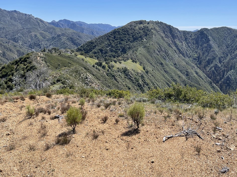
The high point was a very short distance from the trail. I reached the top at 9:53am at 6.1 miles! I found a register here among some rocks and signed it. The previous entry was just 2 days prior. The views were much better here. To the south I could see Cone Peak rising dramatically from the coast.
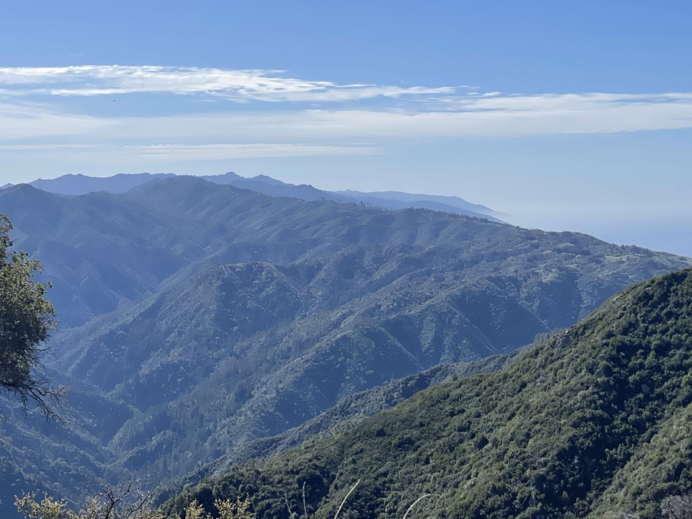
To the southeast I could see Ventana Cone (left center) and South Ventana Cone (right center).
Directly east I could see Ventana Double Cone (I’m not sure why all the peaks in this area have almost the same name). Despite how close it appeared, there is no easy way to get to Ventana Double Cone from the Manuel Peak Trail (unless you enjoy miles and miles of heavy bushwacking). The shortest route I’m aware of is over 30 miles from Bottchers Gap. Maybe someday I’ll get into backpacking and climb it over 2 days.
To the northwest I could see Post Summit (left center), my final goal for the hike.

I continued towards Post Summit after a short break. I descended to a minor saddle and then went up and over an unnamed peak of elevation 3554. I then made a very steep descent to the saddle between Peak 3554 and Post Summit. It was so steep that I was dreading the return. I reached the bottom of the saddle at around 3000 feet.
The trail was a bit hard to follow here but was still in decent shape. At one point I hiked through some brush and found a dozen or so ticks crawling on my arms and legs. Thankfully I was wearing long pants and long sleeves! I brushed them all off, and then I tucked in my shirt and tucked my pants into my socks before proceeding. I encountered a couple more ticks throughout the day, but that section was the worst.

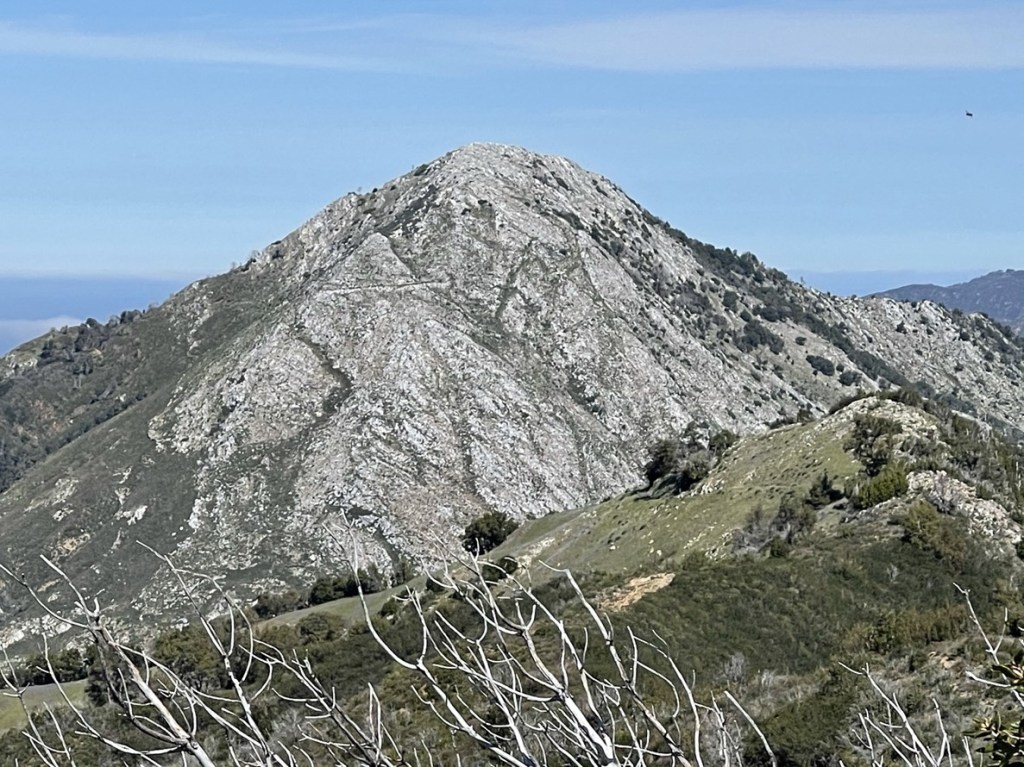
The very top of Post Summit was made of white rock, very similar to Pico Blanco, which I had climbed the day before.

The final push was a minor scramble.

I reached the top at 10:46am at 8.1 miles!
I did not locate a register on the summit. The views here as excellent as well. It made me wonder why Manuel Peak is on the California Coastal Peaks List and the other two are not. Cabezo Prieto and Post Summit both have better views and much more interesting summits (and Cabezo Prieto is the highest and most prominent). To the south I could see the 2 peaks I had just climbed. Cabezo Prieto is on the left and Manuel Peak is on the right. Cone Peak can be seen far in the distance to the right of Manuel.
To the northwest I could see Pico Blanco.
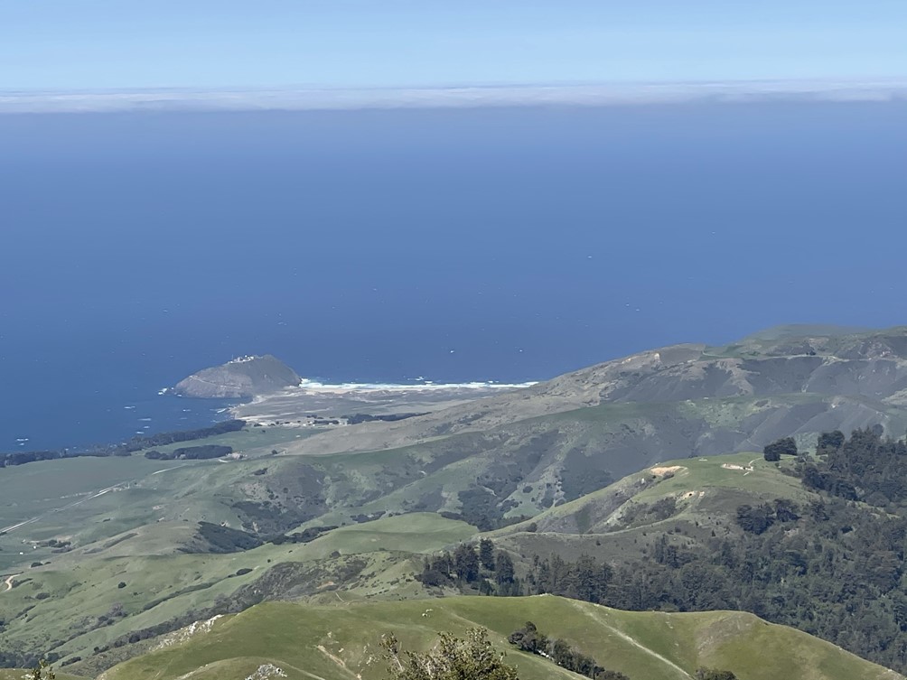
Down below I could see Point Sur.
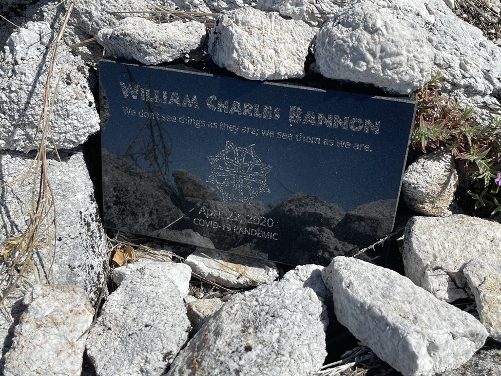
I also found this plaque on the summit.
I took a longer break since this was my turnaround point for the day. I began my return along the ridge just after 11:15.
I encountered much fewer ticks through the section where I had picked up so many. I think I had been slightly off trail on my way up. The steep ascent to Peak 3554 was pretty brutal but it was mercifully short.

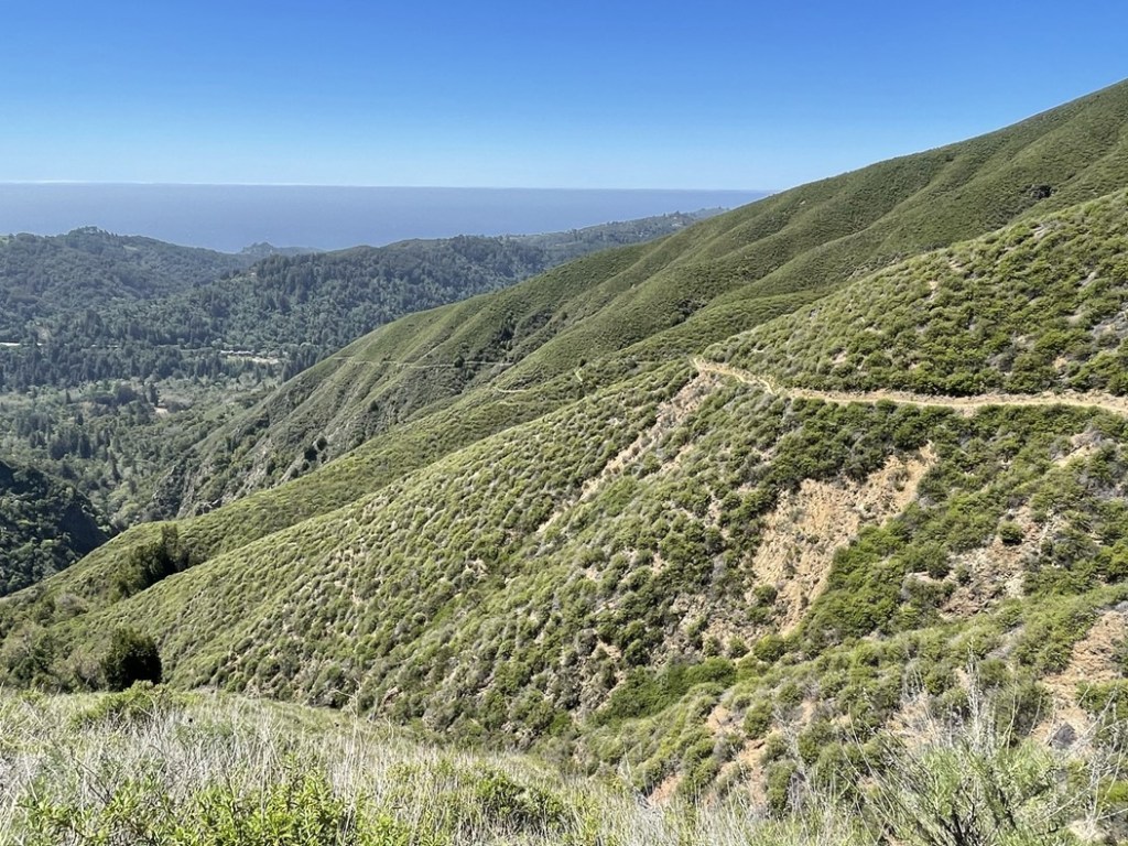
I hiked back over Cabezo Prieto and Manuel and made good time back to the trailhead.
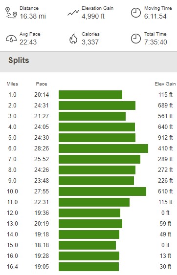
I reached the car once more at 2:31pm. This hike totaled 16.38 miles, 4990 feet elevation gain, and 7:35:40 total time.

Point Lobos State Natural Reserve
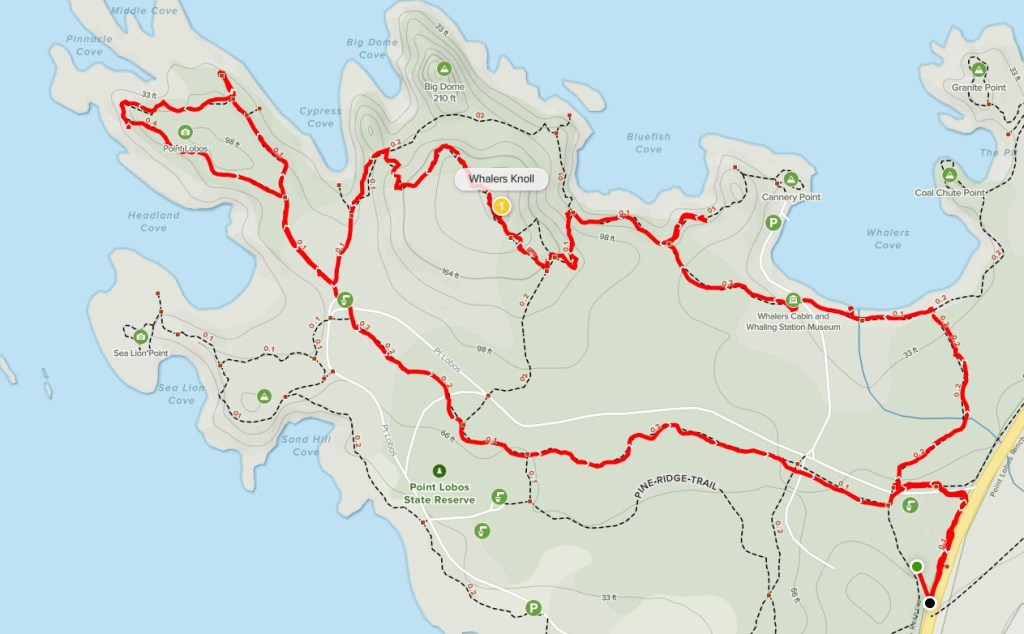
I packed up and started heading north on Highway 1 again. I drove about 25 miles and parked on the side of the highway near the entrance to Point Lobos State Natural Reserve. There were signs indicating that the parking lots were full, but I found ample roadside parking just outside the gate. Point Lobos is a small peninsula on the north end of the Big Sur Coast, and is one of the more popular tourist destinations in the area. I was pretty tired from my morning hike, so I thought this would be a good spot to spend the afternoon and get in a few more leisurely miles. I started hiking at 3:24pm from 85 feet above sea level. I hiked into the reserve and went past the entrance gate. There were tons of people out and about which was no surprise. I turned right onto the Carmelo Meadow Trail at 0.3 mile.
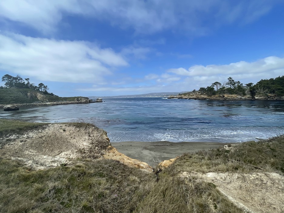
At 0.5 mile I turned left onto the Granite Point Trail. I had a great view of Whalers Cove to my right.
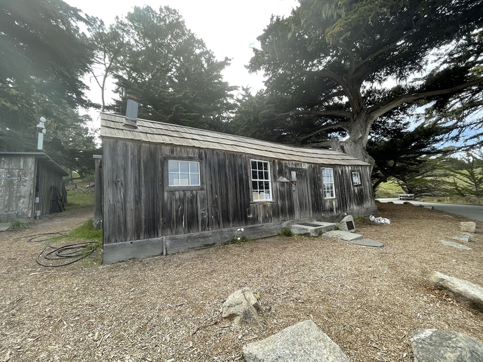
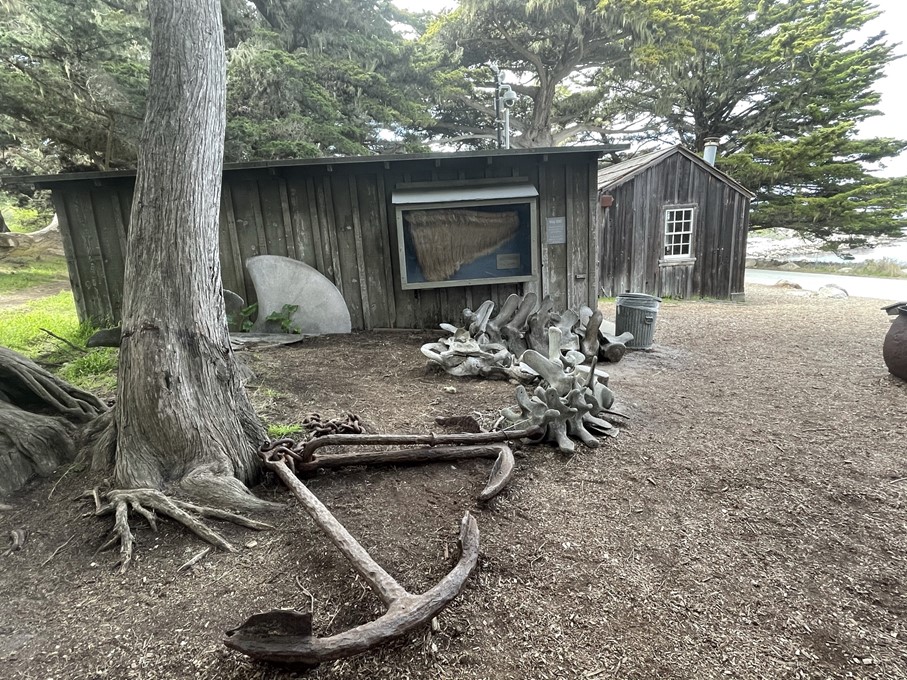
At 0.7 mile I reached an old whaler’s cabin. The cabin is now a small museum, but it appeared to be closed temporarily due to Covid.
There were actual whale bones scattered about. Very cool!
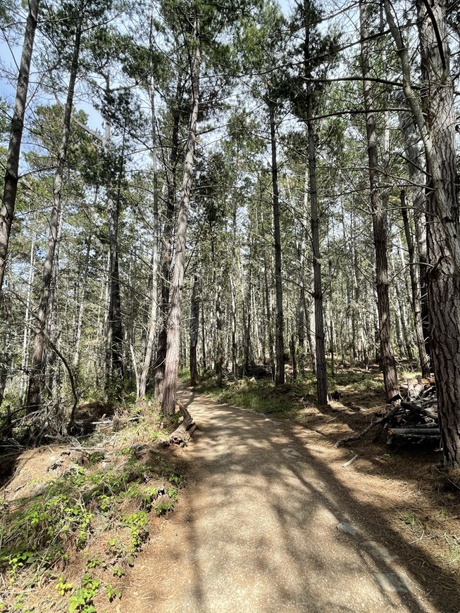
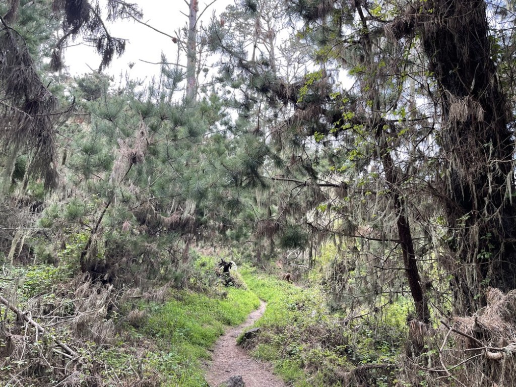
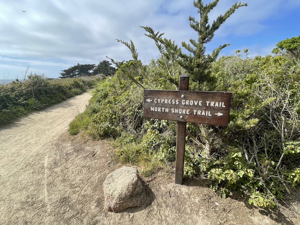
I went west on the Cabin Trail and then continued onto the North Shore Trail. The whole area was very lush – I’m really not used to seeing trees grow at such low elevations!
At 1.2 miles I turned left onto the Whaler’s Knoll Trail. Whalers Knoll is a small hill in the middle of the peninsula and is the high point of the preserve at 240 feet. I had to do a short bushwack to get the minor summit, which I reached at 1.4 miles.

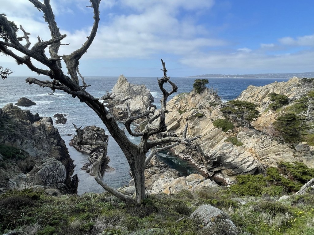
I took a few pictures and then continued. I reached the North Shore Trail again at 1.7 miles and turned left. At 1.9 miles I turned right onto the Cypress Grove Trail, which makes a small loop around the very tip of the point.
I stopped at a couple viewpoints on the trail to take some pictures. The views were amazing!

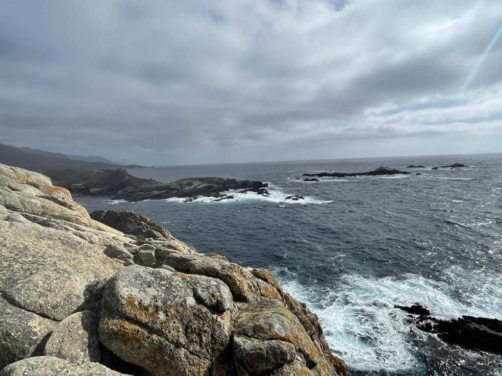
I completed the loop and then got on the Lace Lichen Trail which would take me straight back to the entrance.

I reached the car again at 4:57pm. This hike was just 3.76 miles, 364 feet elevation gain, and 1:33:30 total time.

Despite being a small park with easy trails, Point Lobos was definitely worth the visit. The scenery was amazing and so different that what I’m used to in Southern California. My plan for the following day was to hike in Pinnacles National Park, and I had researched some nearby BLM land southeast of the park off Coalinga Road where I thought I could spend the night. I took the 68 to the 101 to King City, and then Bitterwater Road to the 25 to Coalinga Road. I ended up parking at a trailhead in Laguna Mountain Recreation Area which seemed like a good place to camp, but unfortunately, I had an awful night of sleep due to some funny noises going on outside. There were these light thuds on the top of my car all night which kept waking me up. I puzzled over what it was the rest of the trip, but I really have no idea (rodents, bats, owls?). I even tried moving my car down the road in the middle of the night which didn’t help.
