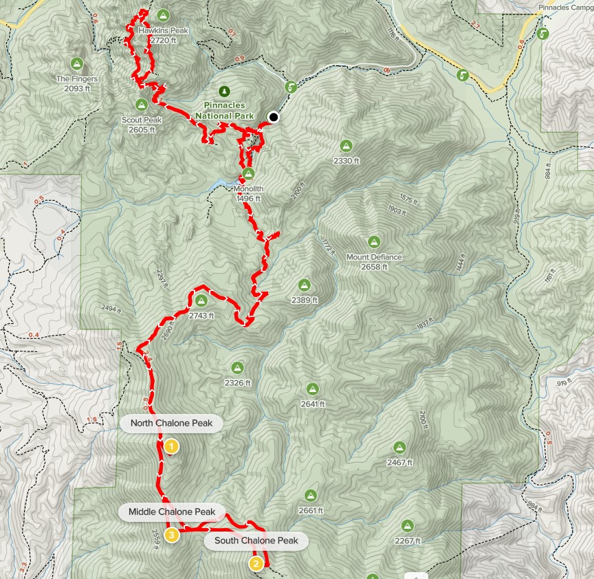
North and South Chalone Peaks and High Peaks Trail
I woke up early Saturday morning and drove from my campsite on Coalinga Road to Pinnacles National Park. Pinnacles was the only national park in California that I hadn’t been to, so I was very excited to check it out. I saw a gray fox just inside the park boundary as I was driving in. It was the 2nd gray fox I had seen on this trip (the other was also early in the morning while driving). Foxes are nocturnal so they are very rarely seen. My plan today was to climb North Chalone Peak (3304 feet) and South Chalone Peak (3269 feet), and then do a loop through the main part of the park on the High Peaks Trail. I parked at the Bear Gulch Picnic Area and began hiking at 6:51am from 1303 feet above sea level.
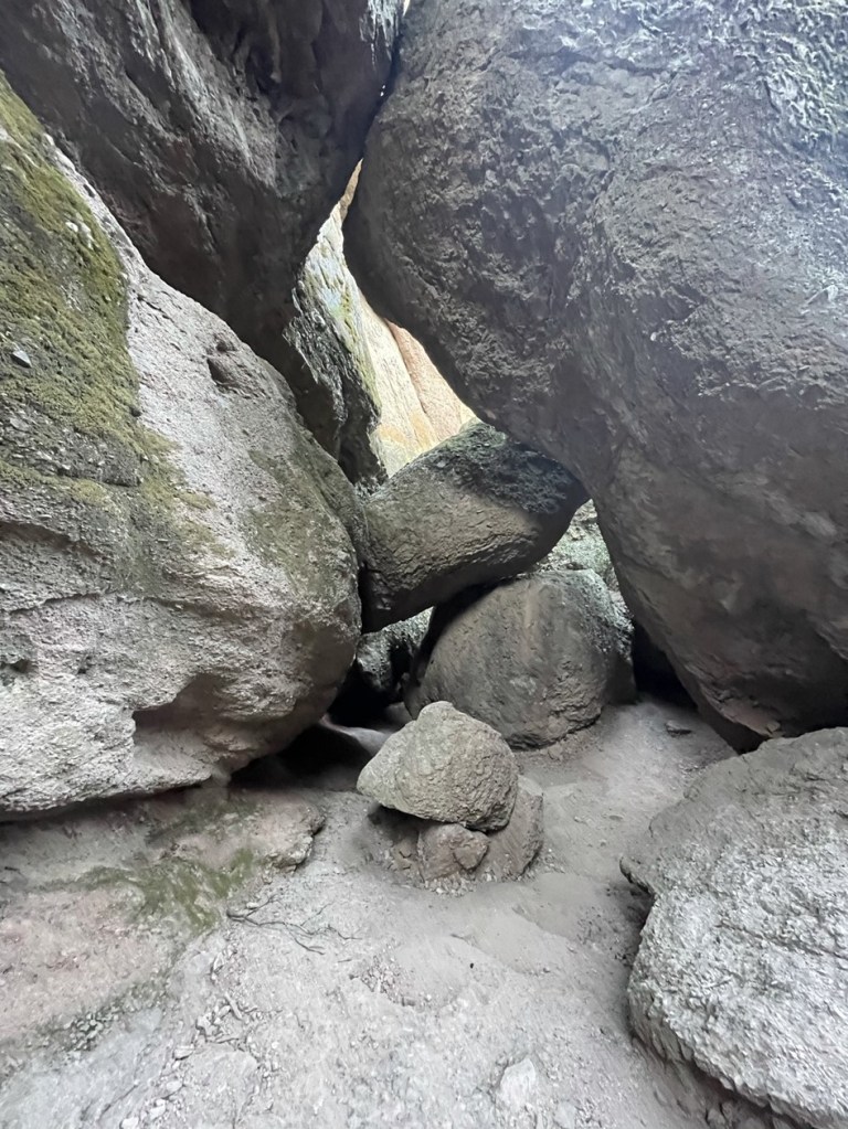
At 0.1 mile I turned left to go south on the Moses Spring Trail. I passed through a cool hole in the rock.

At 0.4 mile I passed a turnoff for Bear Gulch Cave. Unfortunately, the cave was closed due to Covid, so I remained on the Moses Spring Trail.
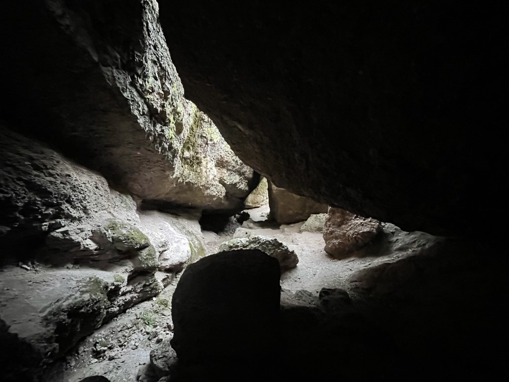
A short while later I entered Bear Gulch Lower Cave, which is really just a talus cave. It was still pretty cool though. The trail passes right through it.
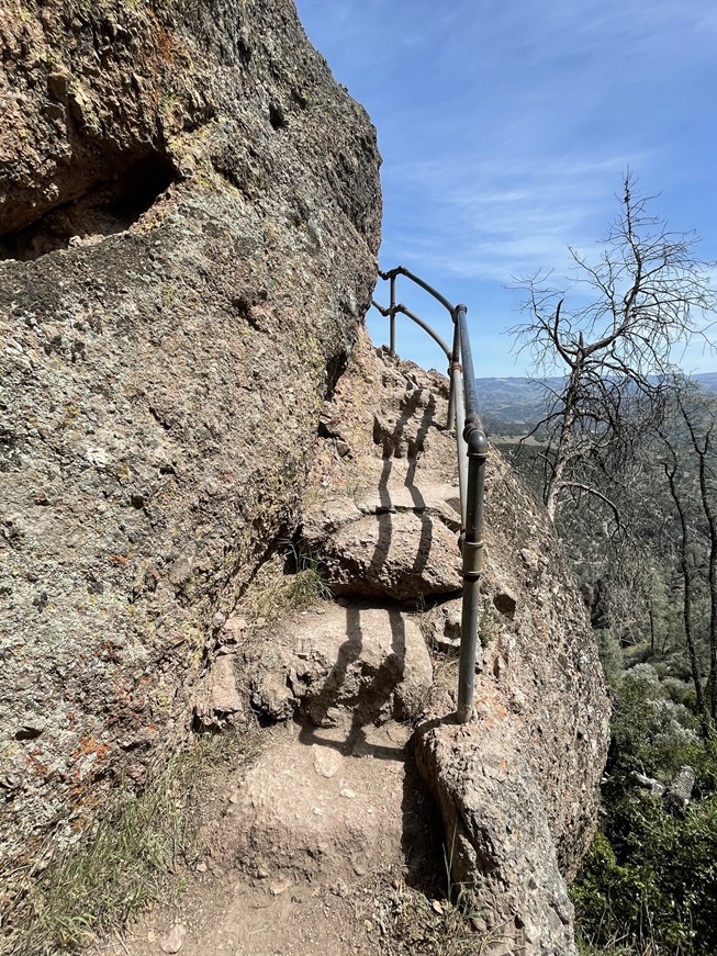
I then climbed a narrow set of stairs.

At 0.8 mile I reached Bear Gulch Reservoir.
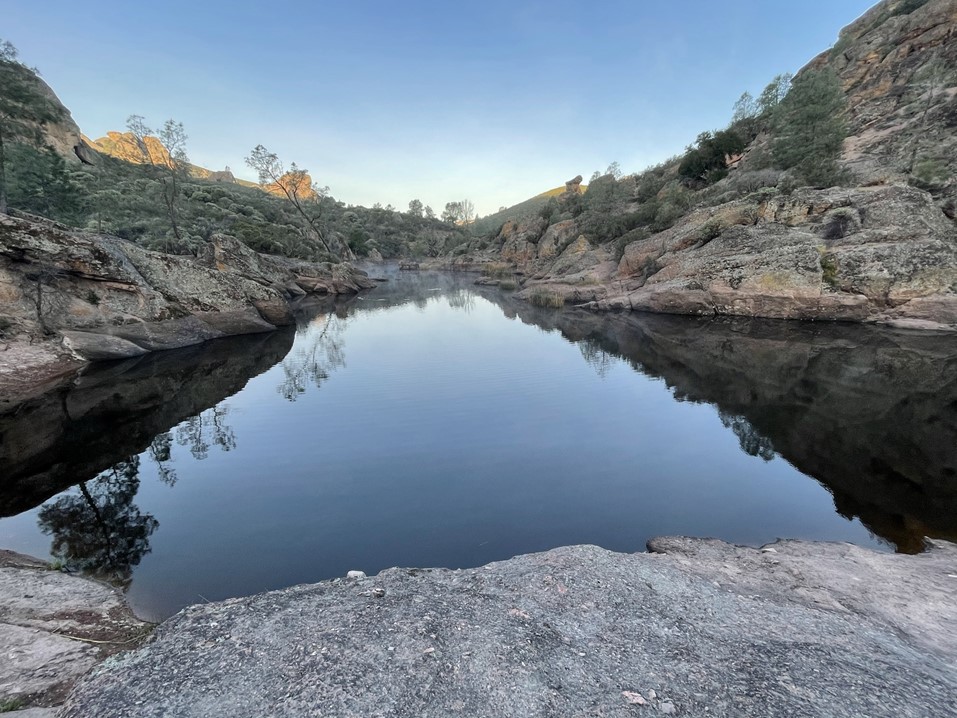
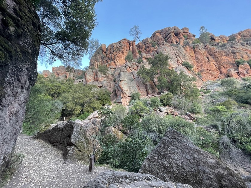
I went around the left side of the reservoir and turned left onto the Chalone Peak Trail. The sun began to peak out above Mount Defiance to the east. Mount Defiance is another peak I wanted to climb, so I briefly considered attempting a cross country route from the Chalone Peak Trail. However, the terrain looked extremely brushy from this side and I knew that there is a use trail on the other side of the mountain, so I decided to save it for later in the trip.
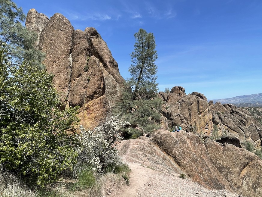
The trail then started to climb towards the Chalone Peaks. North Chalone is on the right and South Chalone is on the left.

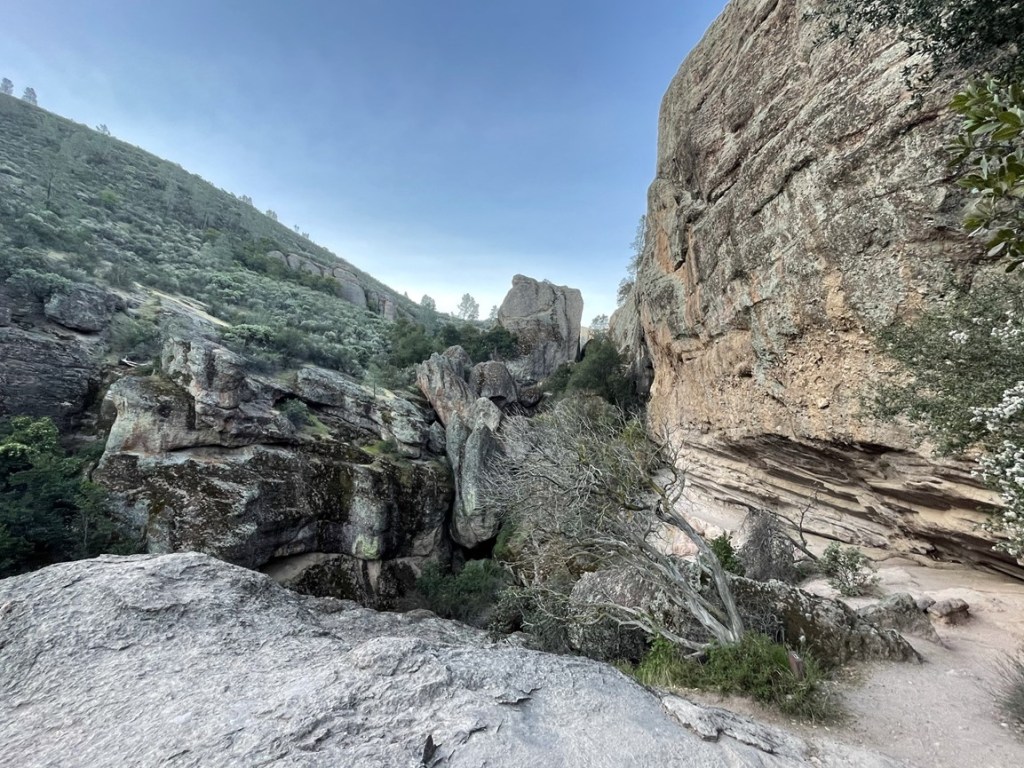
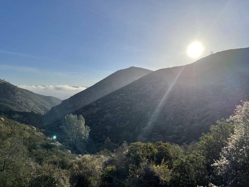
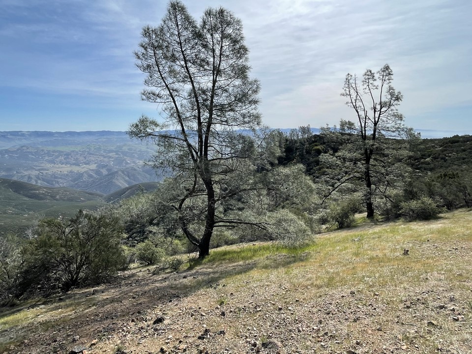
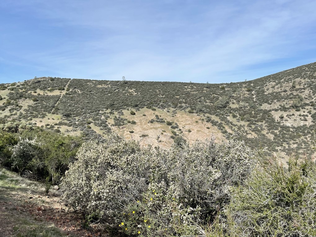
The trail steadily gained elevation for the next few miles. I met a hiker on his way down and stopped to chat briefly with him. He mentioned that there was a locked gate about a half mile ahead, so he had turned around. I wasn’t aware of any trail closures here, so I figured he had missed something. I stopped to take a few pictures of the High Peaks area down below.
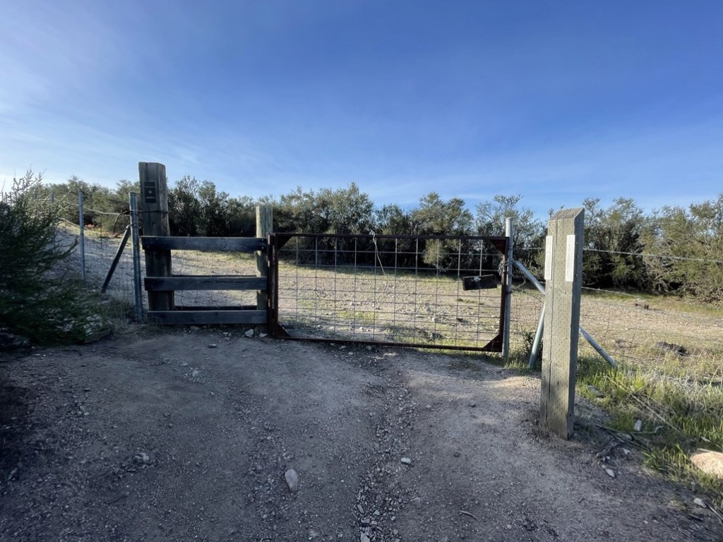
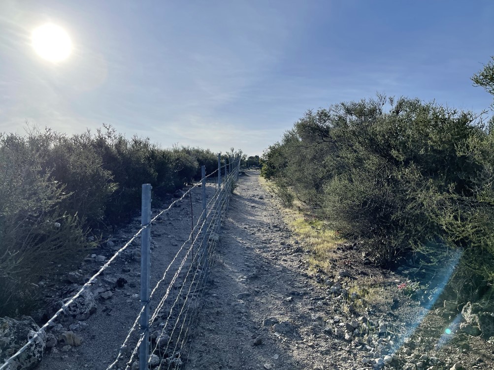
At 3.5 miles I reached the locked gate. There were wood panels on the left side that made it easy to climb over. There was even a sign right above it instructing hikers to do so. I’m not sure how the hiker had missed that.
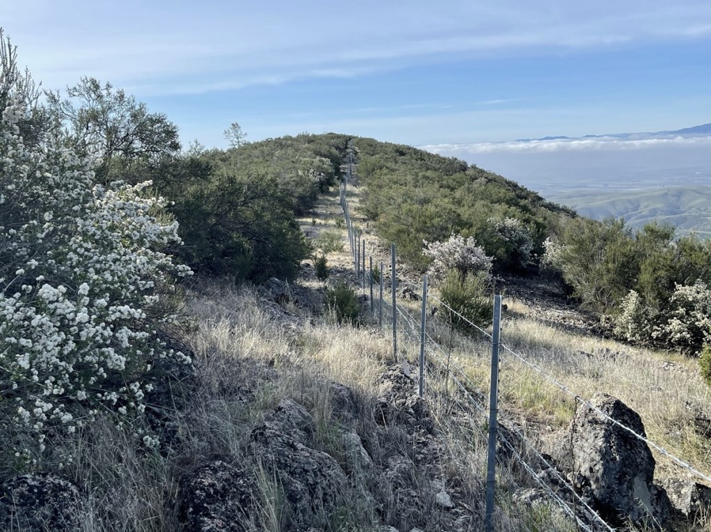
Once on the other side, the trail followed the fence for a short way.
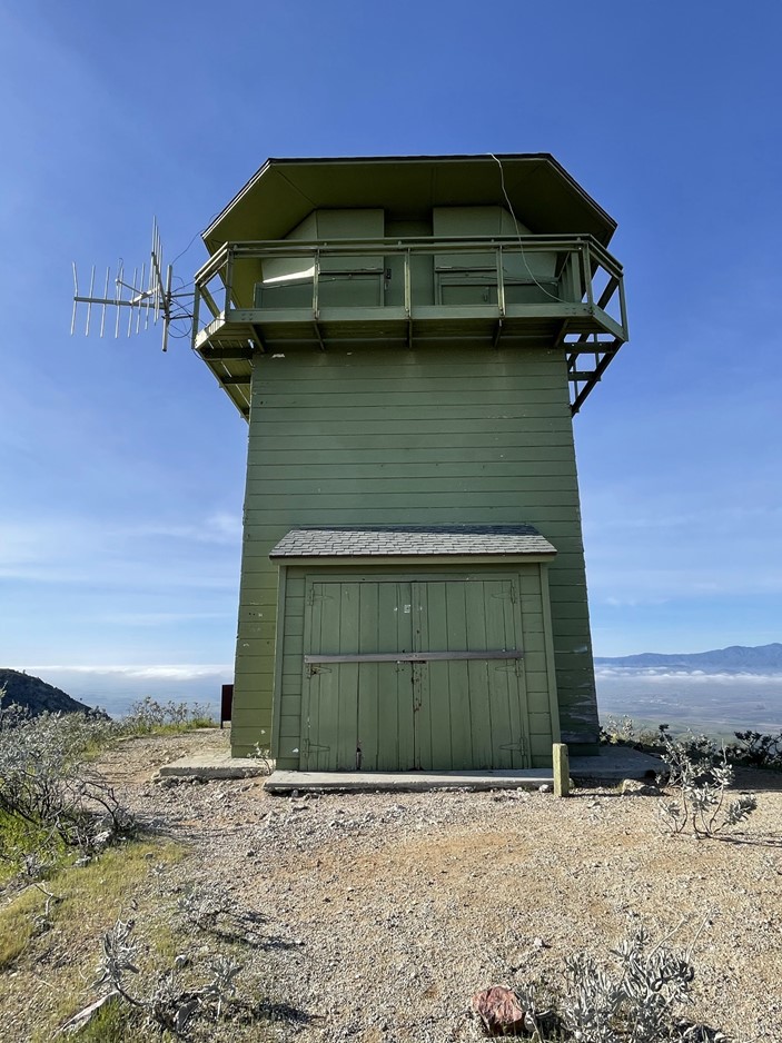
At 3.7 miles the trail ends at a road that leads to the peak. I could see the fire lookout on the summit.
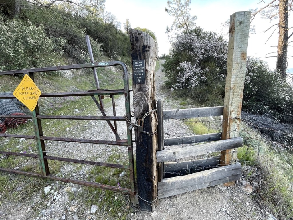
At 4.2 miles I reached another locked gate with the same mechanism (stile) to climb over it.
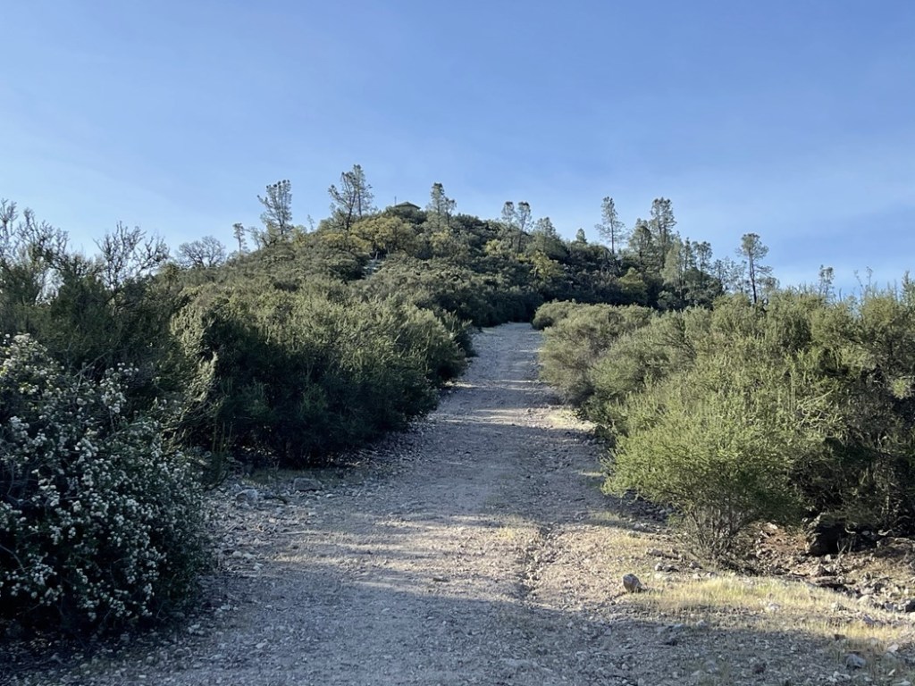
From there it was a short hike up to the top. I reached the summit at 8:38am at 4.4 miles! North Chalone Peak is the highest point in Pinnacles National Park, good enough for my 8th national park high point (out of 63). The fire lookout was closed (not sure if it’s in use at all anymore).
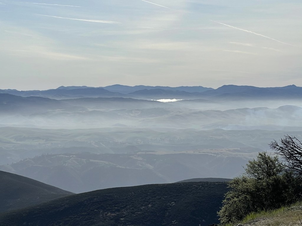
The views were pretty good despite some low clouds. I could see Junipero Serra Peak to the southwest.
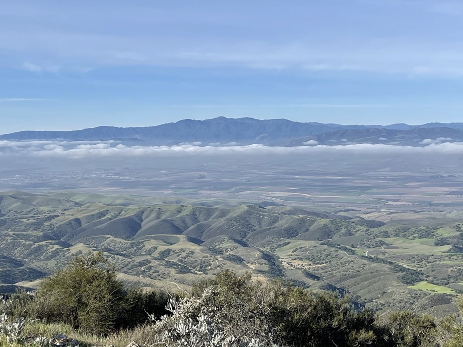
To the east I could see San Benito Mountain (left center). I was planning to climb San Benito Mountain the next day (but I actually ended up climbing it later that afternoon).
South Chalone Peak was very close.
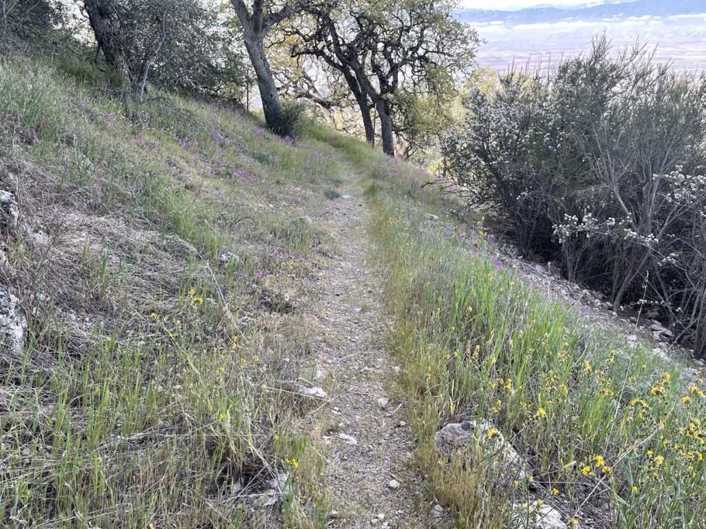
2 other hikers joined me on the summit. I took a 15 minute break and then continued. I hiked back down the road a short way and then turned left onto the South Chalone Peak Trail right before the 2nd locked gate. There were some pretty wildflowers on the side of the trail.
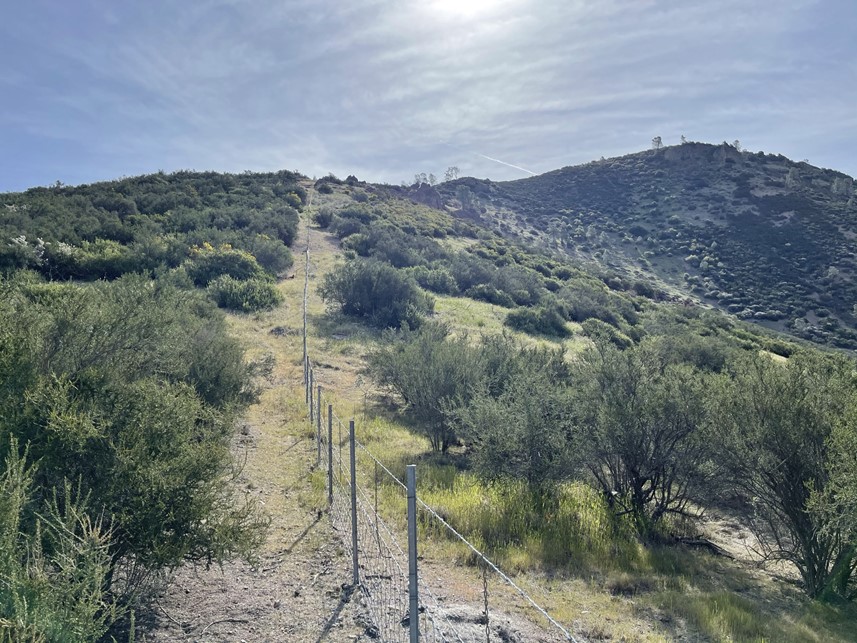
Before heading to South Chalone, I first wanted to climb a minor bump called Middle Chalone Peak (2904 feet). I left the trail at 5.1 miles and hiked along the fence break towards the small peak.
I was thankful that this fence existed or else it would have been almost impossible to fight through the brush. The fence went directly south and then made a 90 degree turn east near the summit. I had to hop the fence to reach the summit, but fortunately there was a spot with some rocks piled high enough to make it easy.

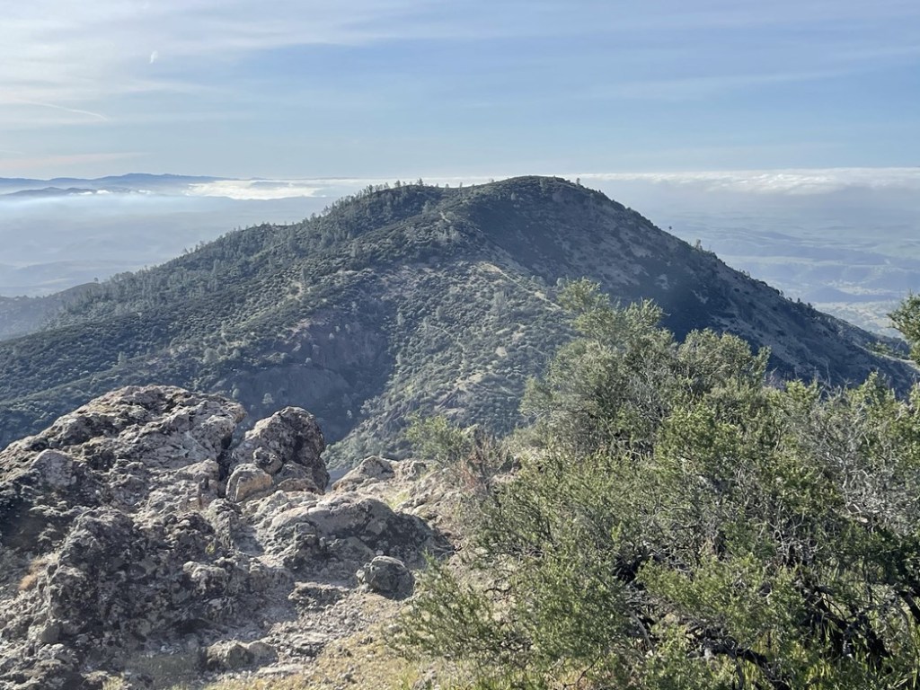
I reached Middle Chalone at 5.3 miles. South Chalone was now close. I could see the fence continuing up the side of South Chalone.
I climbed back over the fence and went east following the break in the brush. I could have rejoined the trail at the saddle, but I decided to continue along the fence.
I followed the fence as it bent to the south. I had to bushwack a short way to reach the summit. I was on top at 9:40am at 6.1 miles! South Chalone Peak is the high point of the Hain Wilderness, which is the Pinnacles National Park wilderness. North Chalone is excluded from the wilderness area due to the road and fire lookout on top. Unfortunately, there were no views due to the thick brush. The register was super wet, but I still managed to sign it. There was a lot of old junk on the summit.

I took just a short break and then hiked down the grassy eastern slope back to the actual trail.
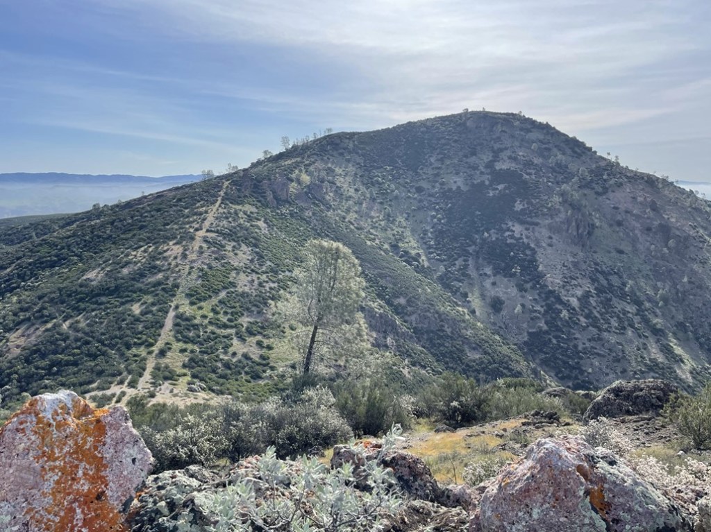
I hiked back around Middle Chalone towards North Chalone. In the below picture, the fence break can be seen going straight up on the left side and the trail can be seen heading up and to the right across the middle.
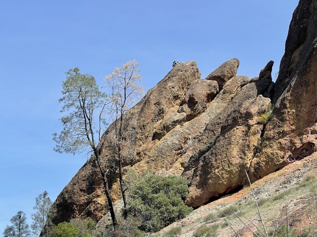
I went over the locked gates again and started descending towards the central part of the park. I passed more groups of hikers on their way up. It was getting warmer but there was still a thin cloud layer that blocked the sun’s full intensity. I noticed a few rock climbers on some of the bigger rocks. Pinnacles is an extremely popular area for rock climbers. I imagine it is a good winter climbing spot for when Yosemite is snowed in.
I made it to the reservoir again at 10.7 miles. It was pretty crowded now, with lots of people enjoying the sunshine and nice views. I then got on the Rim Trail and hiked north away from the reservoir. At 11.2 miles I reached the High Peaks Trail and turned left.
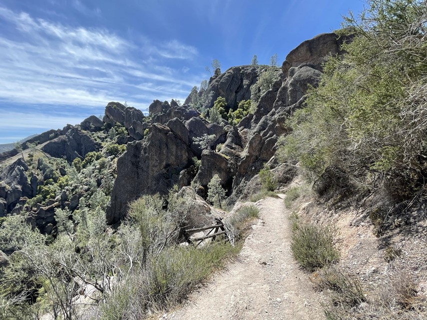
The trail started to gain elevation as I approached the High Peaks area of the park.
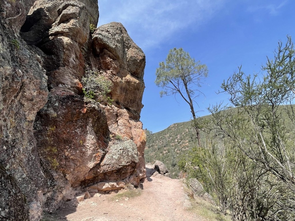
I passed through another hole in the rock.

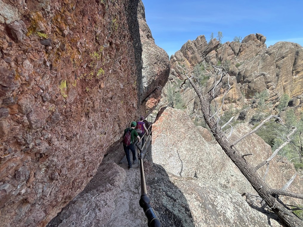
At 12.6 miles I reached another trail junction and turned right to stay on the High Peaks Trail. There were some very steep and narrow sections of trail.
Parts of the trail had steps carved into the stone.


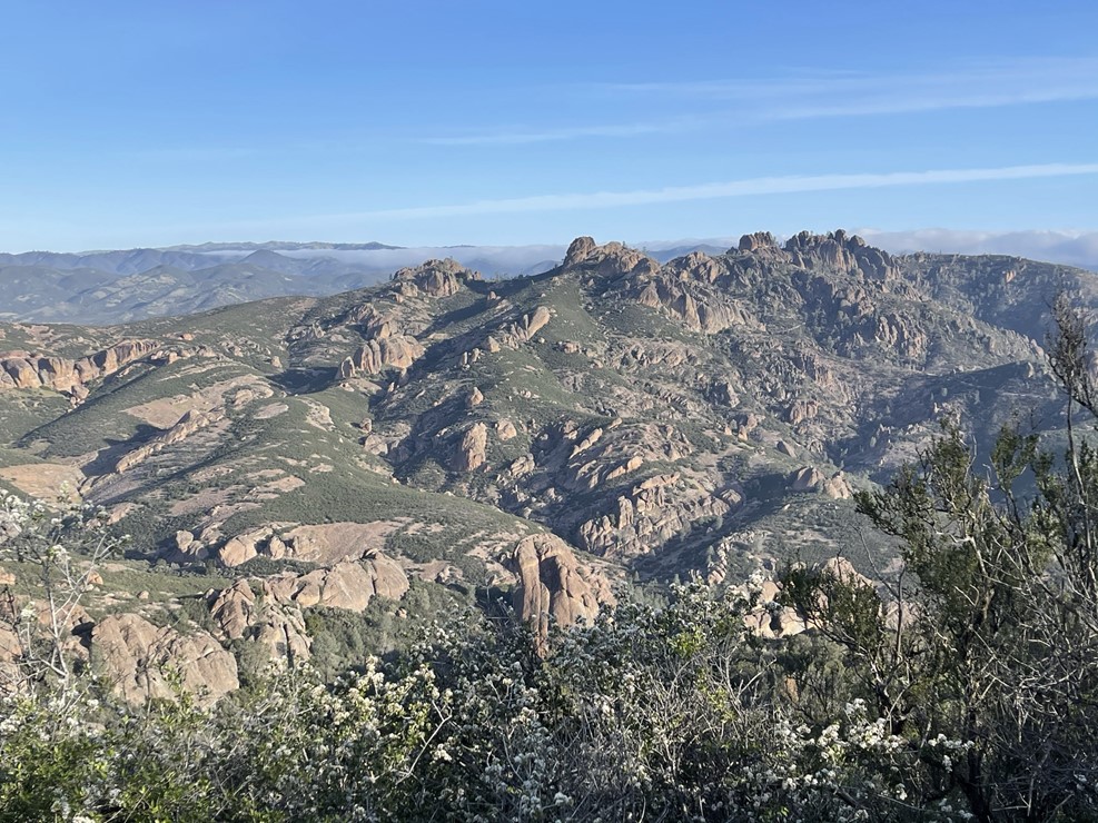
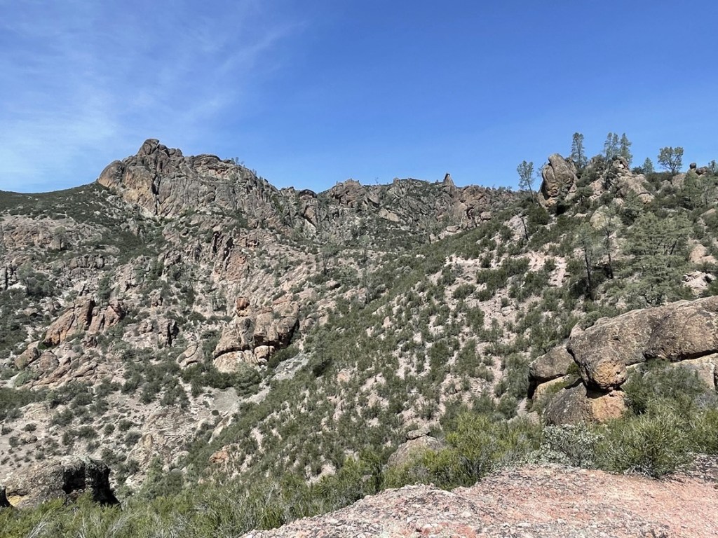
I soon reached the top of the High Peaks Trail. The scenery was spectacular. There were quite a few people hanging out and enjoying the views.
I could definitely see where the name Pinnacles comes from!

I was on the lookout for California condors since they are commonly sighted in the park. Unfortunately, all I could see were crows, ravens, and vultures. I started descending down the other side of the trail after a short break. There were steep and narrow sections here too which caused a few bottlenecks.
At 13.3 miles I reached a junction and turned left onto the Tunnel Trail. This trail descended around the backside of the High Peaks area.

I soon passed through a long tunnel. It was quite a big longer than the few I had already been through.

At 14 miles I reached another junction and turned left onto the Juniper Canyon Trail. Turning right here would take me down to the Chaparral parking area on the western side of the park. The east and west side parking areas are only a few miles apart, but no roads connect them so the only way to get from one side of the park to the other is by hiking.
At 14.6 miles I reached the High Peaks trail again. I took the trail all the way back down to the parking lot. I reached the car at 2:07pm. This hike totaled 16.65 miles, 4826 feet elevation gain, and 7:15:21 total time.

San Benito Mountain and San Carlos Peak
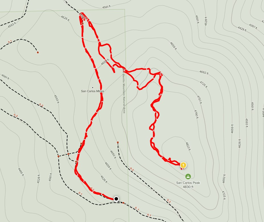
I packed up the car and exited the park. I had been planning to climb Mount Defiance, but this required parking in a different area. It was a Saturday in a national park, so I didn’t want to deal with trying to find parking in mid-afternoon. Instead, I decided to drive out to the Clear Creek Management Area to climb San Benito Mountain, which I had originally been planning to do on Sunday. At 5241 feet, San Benito Mountain is the high point of San Benito County. The mountain lies within Clear Creek Management Area, which is managed by the BLM. Clear Creek contains one of the largest asbestos deposits in the world. Due to health concerns related to asbestos exposure, you must get a permit to enter the area and each individual is limited to 5 permits/year. You must also get a vehicle permit to enter and the 2 permits combined cost $17. One of the permits has the gate code combination on it, and it sounds like the BLM does change this regularly (so I won’t post it here). I don’t believe there is a daily quota on permits, so they are easy to get on online (recreation.gov). I exited the park and took Highway 25 south to Coalinga Road. I drove about 16 miles and then turned left onto Clear Creek Road, which is a dirt road. I drove about a mile or 2 up the road, went past Oak Flat Campground, and then opened the locked gate with the combination code I had printed out. From the gate, it is about 16 miles on decent dirt road to the top of San Benito Mountain. There are tons of old mining roads in the area but thankfully I had downloaded a GPS track of the drive up so I wouldn’t get lost. The roads were in okay shape, but I’d recommend moderate ground clearance and at least AWD for some steep sections in the middle. I wish I had taken some pictures of the drive because this was one of the most bizarre areas I had ever been to. It had an almost otherworldly appearance. Entire hillsides were completely devoid of vegetation and there was an orange tint to everything. There were some forested areas as well at higher elevations. I passed one large group on the way up who seemed to just be hanging out for the day. At about 12 miles I parked to climb a minor peak before heading the rest of the way up: 4845 foot San Carlos Peak. I started this hike at 4:23pm from 4561 feet. I started by hiking up an old mining road.

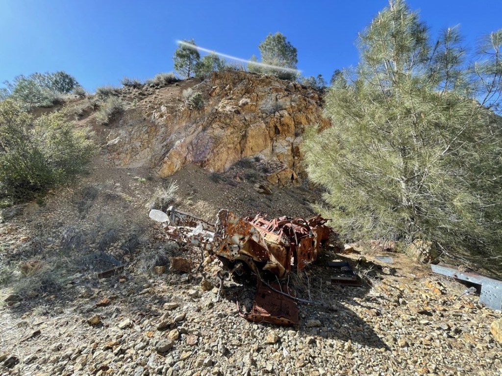
I hiked north on this road and soon came upon the wreckage of an old motorcycle and car.

The car had hundreds of bullet holes in it.
I followed a narrow trail up past the car and saw a mine shaft in one of the hillsides.

I made a sharp turn to the right and continued up the narrow track. Soon the trail disappeared, and I hiked cross county towards the peak.

I reached the summit at 4:39pm at 0.7 mile. I could see San Benito Mountain just a few miles to the southeast. The road can be seen in the foreground.

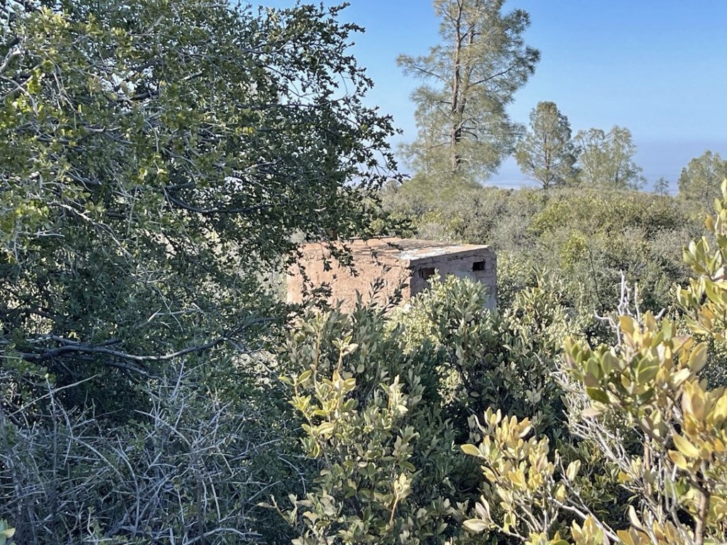
I did not find a register. I did observe an old stone structure near the summit. There was some thick brush between me and the structure though, so I didn’t investigate it further.
I hiked back down the same way I came up. I reached the car at 4:54pm. This hike was a short 1.32 miles, 400 feet elevation gain, and 31:10 total time.

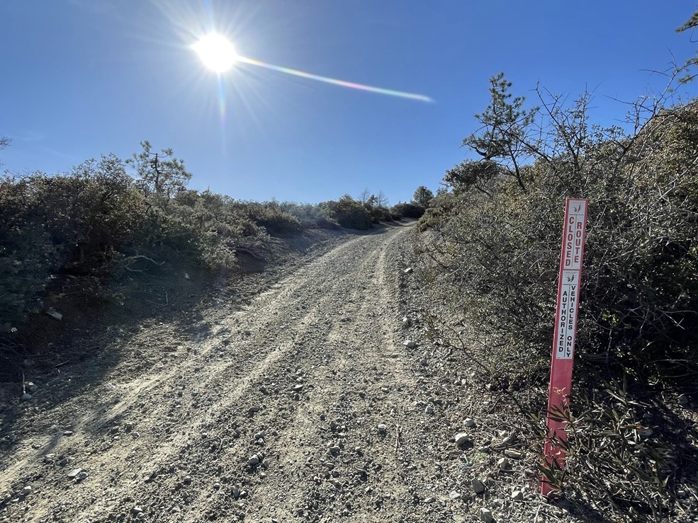
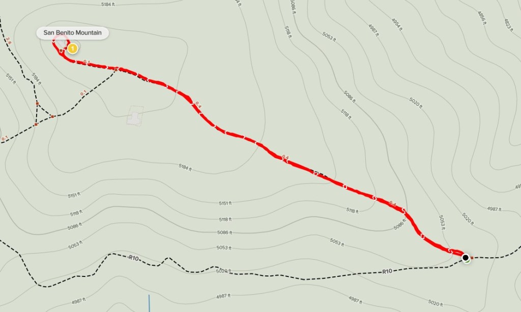
I got back in the car and drove the final few miles to San Benito Mountain. The summit road was marked closed, so I parked about a half mile below the top. I could have easily driven the rest of the way, but I wanted to get a little more hiking in. I started this hike at 5:15pm from 5020 feet.
It took about 10 minutes to reach the top. A 10 foot high pile of rocks marked the true summit.

I climbed up and was on the summit at 5:25pm after just 0.5 mile. There are a few communication towers on the summit.
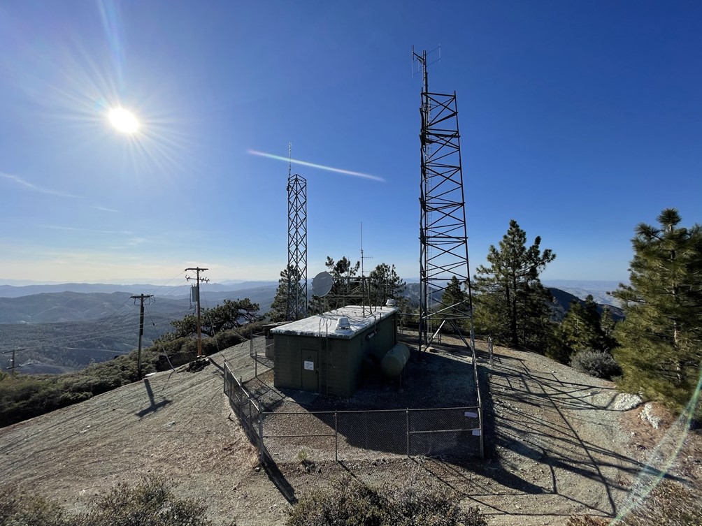
I signed the register which was placed in 2018. The previous entry was from April 7th, just 3 days prior. The views were okay but not as good as I had hoped for on a peak with over 3000 feet of prominence. I could see Junipero Serra Peak far to the southwest.

To the northwest I could see North and South Chalone Peaks (center).

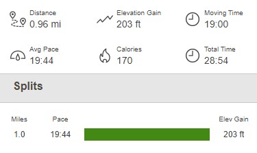
I could barely make out the white tops of the Sierra far to the east, but unfortunately it was too hazy to see them clearly. I started hiking back down and reached the car again at 5:43pm. This hike was just 0.96 mile, 203 feet elevation gain, and 28:54 total time.
I packed up and made the long drive back down. It took about an hour to reach the locked gate again. I did pass another truck while on the descent. It was pretty late in the day, so I found an open spot at Oak Flat Campground and spent the night there. For the second night in a row, I barely slept due to some light thuds I kept hearing on top of my car. I had the same problem the previous night a few miles up Coalinga Road. Whatever was going on, this whole area seemed to be affected (unless it was something wrong with my car, which is a possibility). I’ve been trying to figure out what it was ever since (small animals or birds), but I really have no idea.
