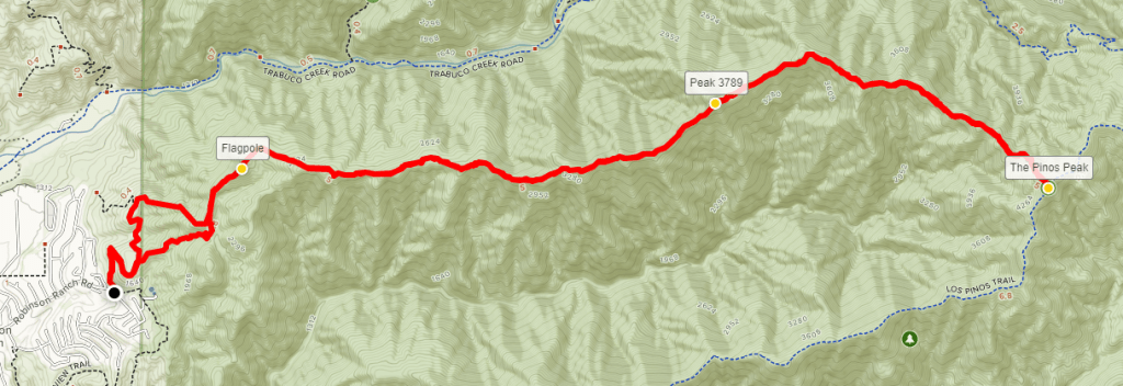
I woke up at 5am and I was out the door by 5:30 heading north towards Orange County. After spending the last few weekends hiking in the desert, I decided to mix things up and do some hiking in the Santa Ana Mountains. The Santa Anas are a small mountain range that divides Orange County from Riverside County. The relatively low elevation of the range makes it good for this time of year (and horrible for summer). The range tops out at Santiago Peak, which is 5689 feet above sea level, but most of the peaks are between 3000 and 5000 feet. My destination today would be Los Pinos Peak, which is 4513 feet above sea level. Los Pinos is on the Sierra Club Lower Peaks Committee List, which is a list of 84 peaks in Southern California below 5000 feet. Up to this point I had completed 20/84 peaks on the list, the most recent being Morton and Cram Peaks in the foothills of the San Bernardino Mountains. The standard route to Los Pinos starts near Blue Jay Campground and is about 6 miles round trip. However, I had read reports of a route that starts from the Orange County lowlands and climbs up a steep ridge all the way to the summit. This route would be nearly 14 miles and would require over 4000 feet of elevation gain. The net elevation between the trailhead and the summit is only about 3000 feet but there are many ups and downs along the ridge which add to the cumulative elevation gain. I was up for the challenge, so I chose this route over the standard route. It took me about 1 hour 20 minutes to drive to the trailhead, which is in a suburban neighborhood in Rancho Santa Margarita. I was expecting to have the trail mostly to myself this morning, so I was a little confused to find about 30 cars parked on the side of Robinson Ranch Road when I arrived. There aren’t any homes in the immediate vicinity, so I was a little worried there was a huge group on the trail above me already. At 6:54am I began hiking from the trailhead at 1461 feet.


The trail starts out very wide. As I started hiking, I could hear voices on trail ahead of me. They were far away still but it sounded like a large group.
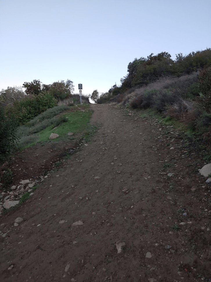
I quickly started to rise above the suburban town of Rancho Santa Margarita.

The trail switchbacks twice, and then I reached a fork. The main trail continues to the left while a single track trail goes off to the right. The trails eventually meet again, so I took the shortcut trail to the right.

I turned a corner and saw the large group I had been hearing. They were climbing up to a small peak along the ridge with an American flag on its summit.
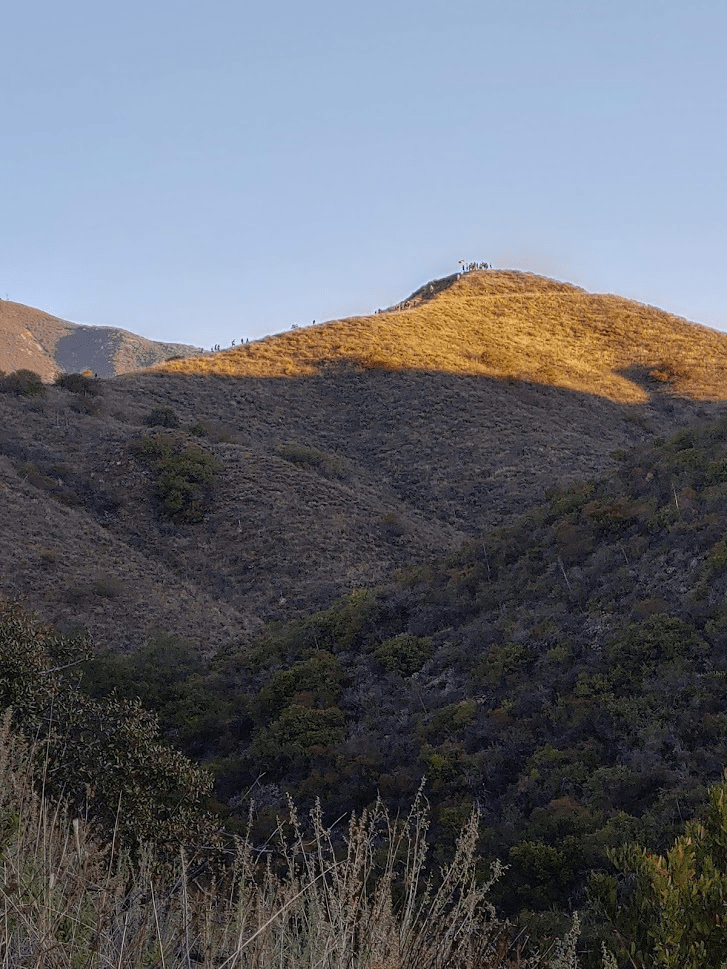
I rejoined the main trail and started climbing towards the flagpole summit. I started to pass small groups of people as I climbed. I think they were all part of the same group, but I wasn’t sure. Most of the large group had huddled up on the summit and did some kind of cheer and then started to proceed up the trail. I had been hoping they would turn around at the flagpole. By the time I reached the flagpole, I had the small summit all to myself. I had been hiking for 26 minutes and had hiked 1.52 miles. The flagpole summit is 2544 feet above sea level, so I had already climbed over 1000 feet.

I had an excellent view of Santiago Peak from here.

Separating the ridge I was on from Santiago Peak is Trabuco Canyon. I could see the beginning of the trail I had used to climb Santiago Peak last June.

I continued on past the flagpole summit after a short break. The sun was still low in the sky.

I started to pass small sections of the large group of people. They seemed to mostly be high school kids, with a few adults mixed in. I finally passed the last of them at 7:45am, 2.23 miles into the trail.

The trail started to get very steep at times.
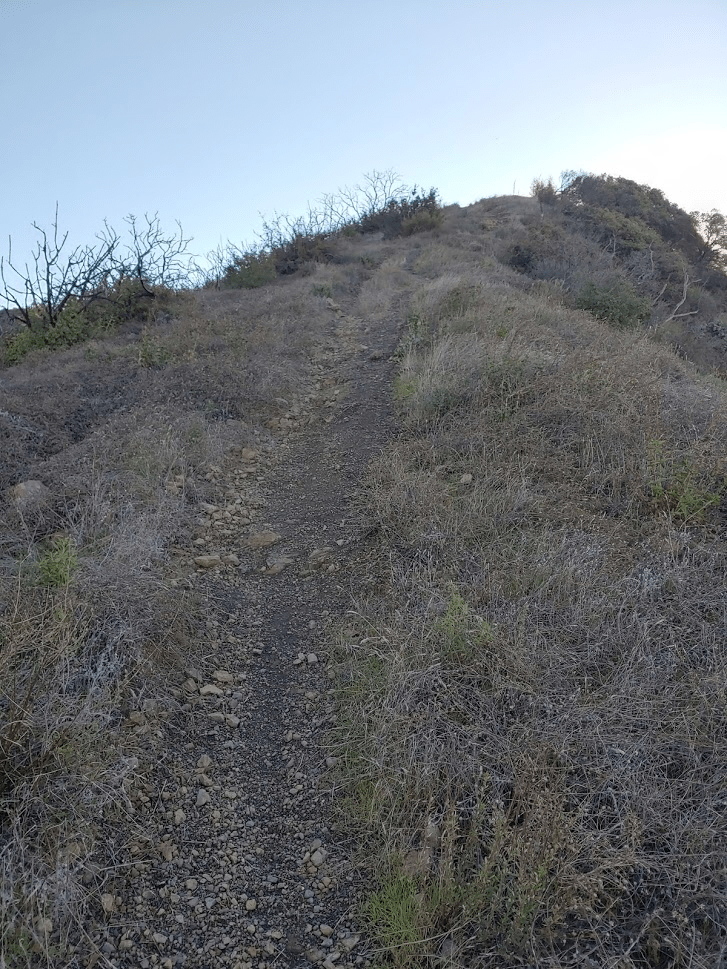
At 8:47am I reached a small peak at 3789 feet. I had been hiking for 4.5 miles. From here I got my first good views of Los Pinos.

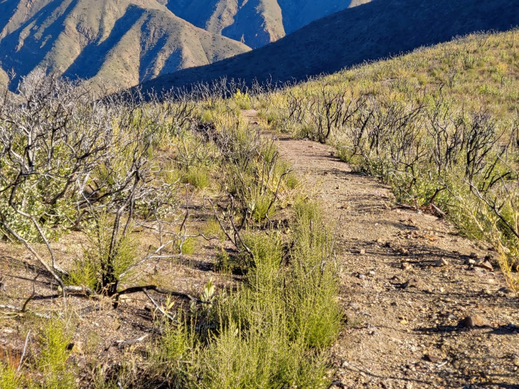
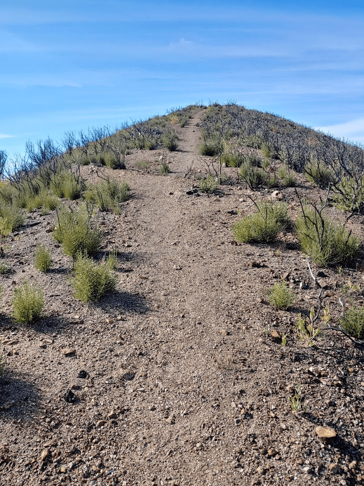
The area past this point had been burned pretty bad in the Holy Fire from August 2018. Lots of fire damage was apparent along the trail.

As I got closer to the summit, there were many sections of downhill that had to be reclimbed.

More fire damage:
As I got near the top, the trail began to deteriorate. It was difficult to follow at times.

There were also some small wooded sections that had been spared from the fire.

The ground became muddy and there were even some small patches of ice.

I finally reached the summit at 9:58am. I had been hiking for 6.75 miles and it taken me just over 3 hours. The weather was beautiful with clear skies all around. It was fairly warm for January, but I needed a jacket on the summit.
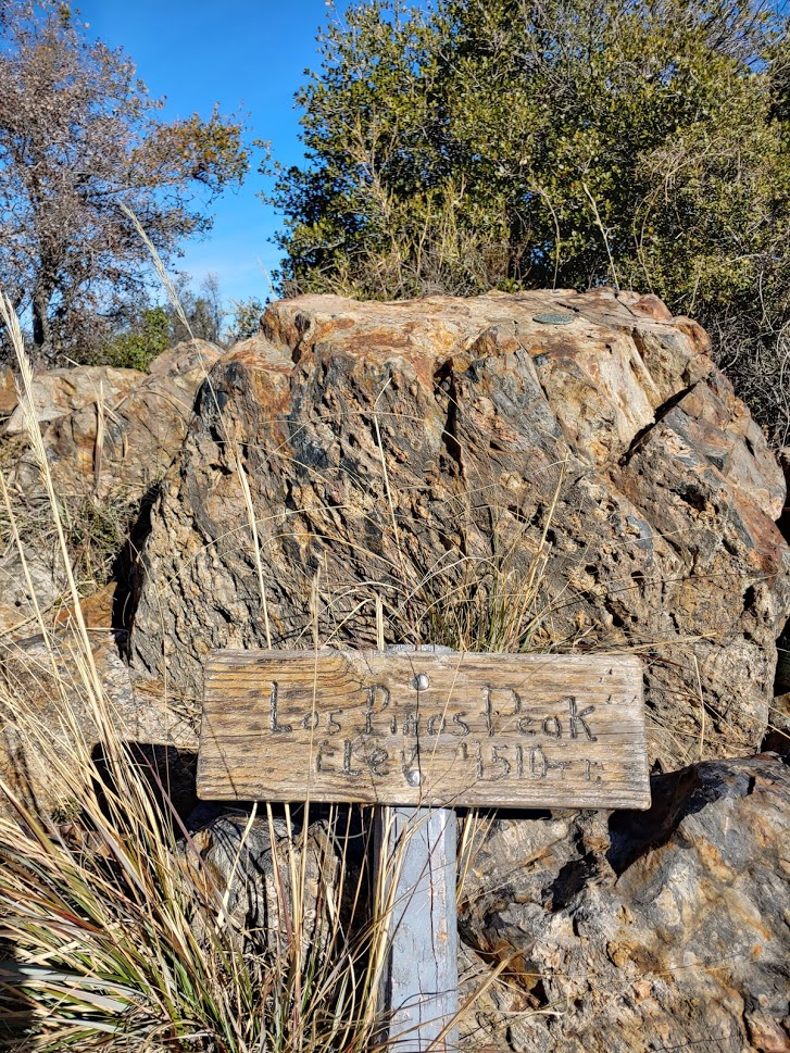
I found the benchmark and reference marker No. 1


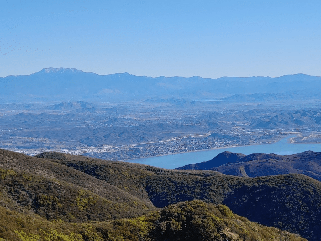
To the east I had a nice view of Lake Elsinore with San Jacinto in the background.
To the east I could see the sprawl of Orange County as well as Catalina Island in the Pacific Ocean.

Snow-capped San Gorgonio was visible to the northeast.

Santiago Peak blocked much of the view to the north. The radio installations on the summit were visible.

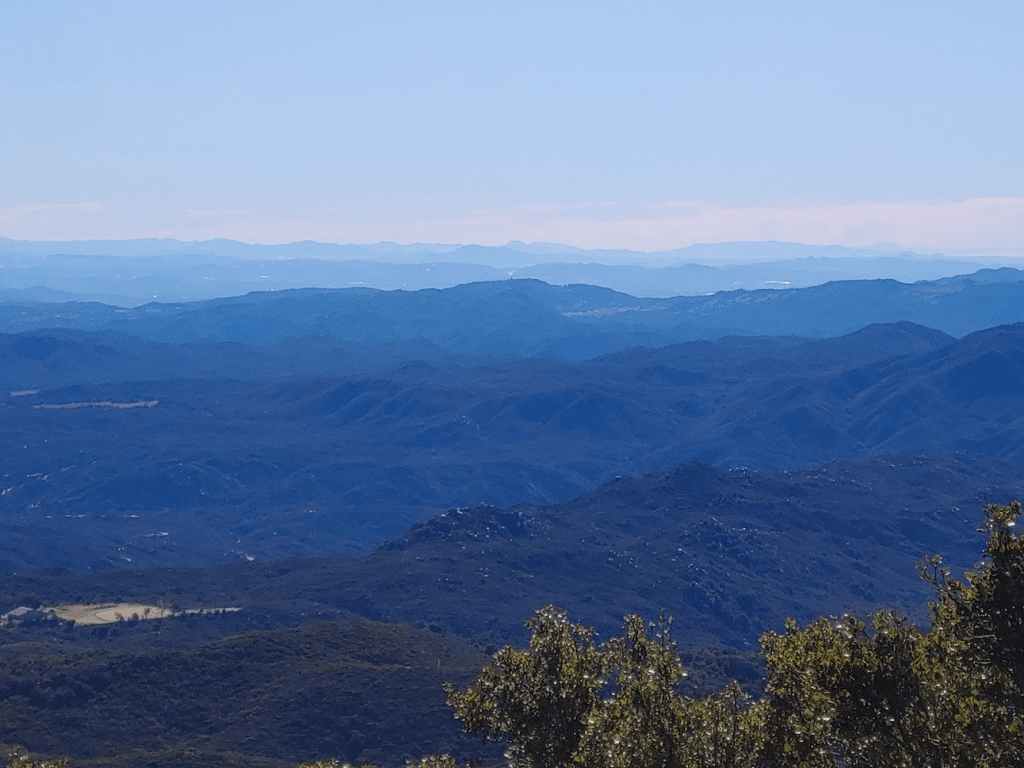
To the south I could see many of the small mountain ranges in San Diego County.
I rested for about 45 minutes before I began my descent.

The many uphill portions on the return trip were brutal. It really was starting to get warm too.

Near the summit I passed a group of 5-6 people making their way up. It took me about an hour to reach Peak 3789 once more.

The views on the way down were nice, with Trabuco Canyon on the right and Bell Canyon on the left. It took about another hour to reach the flagpole summit again.


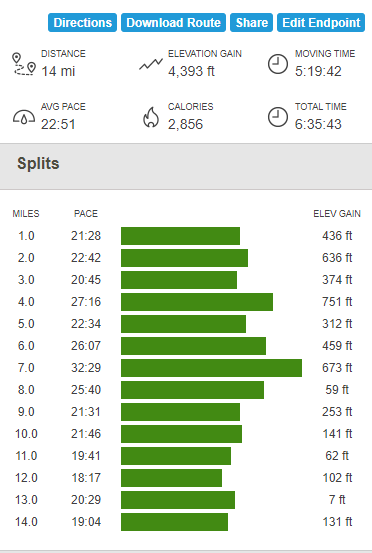
The rest of the trip was uneventful. I passed a few more groups of people heading up, most of them likely just stopping at the flagpole summit. I stayed on the main trail instead of taking the shortcut I used earlier. I finally reached the car again at about 1:30pm. Totals for the hike were 14 miles, 4393 feet elevation gain, and 6:35:43 total time

I’m really enjoying your website and your peak bagging. I found your website from a link on the peakbagger website. I started the So Cal Six Pack of Peaks in 2022 and while waiting for snow to melt on some of the higher elevation peaks, I found other mountains to climb like the one you mention here – Los Pinos Peak. I, too, found the return trip sort of brutal with the uphills.
LikeLike