Indianhead
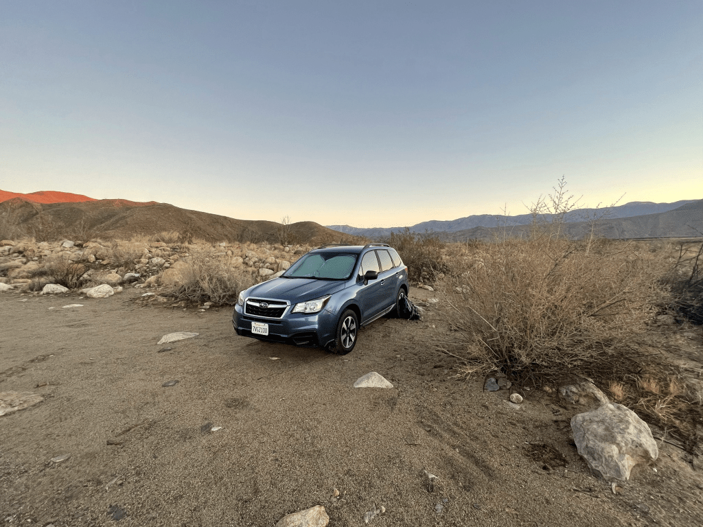
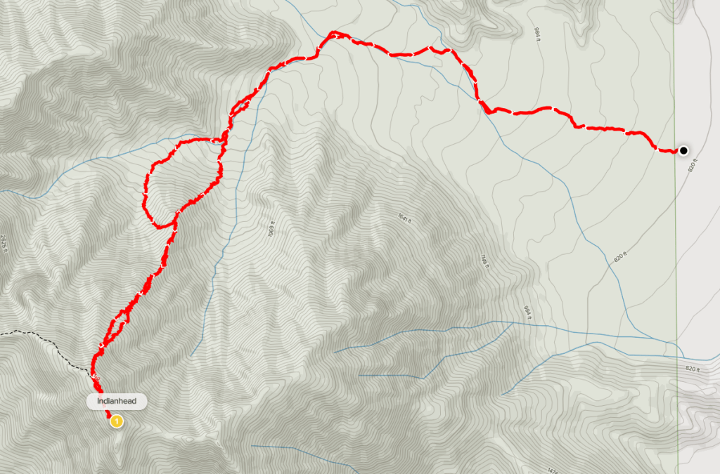
I finally got over my recent bout with Covid, so I was excited to return to the desert to climb some more peaks. I hadn’t been on a multi-day trip since early November when I climbed Palen and Granite. Since then, I spent a few weeks recovering from Lasik and then I struggled with Covid symptoms for more than a month. I was finally feeling like myself again, so I planned a short weekend trip to Anza Borrego Desert State Park. I’ve been to Anza Borrego probably more than 20 times over the past few years, but I still had some unfinished business there. First up was Indianhead, a 3960 foot peak that I had failed on in December 2018. Indianhead is a DPS peak, and probably the only such peak anywhere near San Diego that I had yet to climb. It is also on the San Diego County 100 Peaks List and in Andy Zdon’s Desert Summits book. I had attempted to climb it in 2018 from the standard route through Palm Canyon but turned around due to difficulty. I probably only made it a few hundred feet up the ridge. It was one of the first desert peaks I had ever attempted so I was very inexperienced at the time and definitely not in as good of shape as I am now. The peak had been on my mind for the last year or so, but a repeat attempt was made complicated by a recent fire which burned through the canyon just over a year ago. The fire, which I believe was determined to be arson, scorched many palm trees that grow within the canyon. The area is now reopened, but only up to the first palm grove. Because of all this, I researched alternate routes and found a few trip reports describing a northern approach from Henderson Canyon. The route was reported to be class 2 all the way up, so I decided to try that way. I left San Diego around 4:30am on Saturday morning and made the 2 hour drive to Borrego Springs. From Christmas Circle in the center of town, I drove north on Borrego Springs Road for a few miles until it makes a sharp bend to the east near the Galleta Meadows jeep sculpture. I then drove west on a good dirt road for about a mile and parked. I began hiking at 6:43am from 834 feet above sea level.
The sun crested the horizon behind me right as I began my hike.

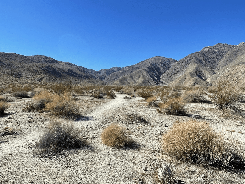
After admiring the sunrise, I hiked west across the desert into Henderson Canyon. I was surprised to find a decent use trail.

At 0.7 mile I entered a large wash. I turned right into the wash and followed it to the northwest.

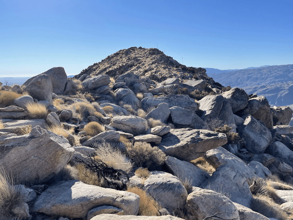
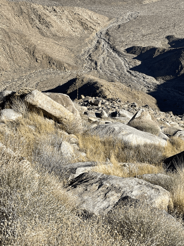
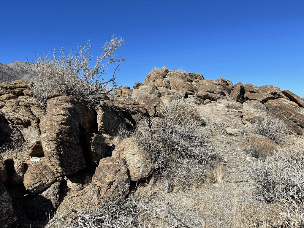
At 1.3 miles I reached a fork in the wash. I went left into the smaller wash to the southwest. The North Ridge of Indianhead is in the center of the picture below (it appears smaller than the ridge on the left).

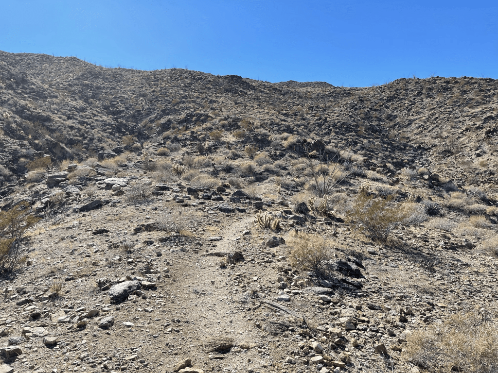
The wash became steeper and rockier as I neared the base of the mountain. I aimed towards the right side of the ridge, hoping to ascend it initially from that side.

I noticed the ground was a little soggy from the recent storms. At 2.2 miles I reached the base of the ridge. I had covered about 2/3 of the mileage to the summit, but only 1/3 of the elevation gain. I climbed up from the right side and soon reached the spine of the ridge at 2.4 miles.
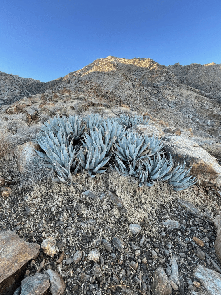
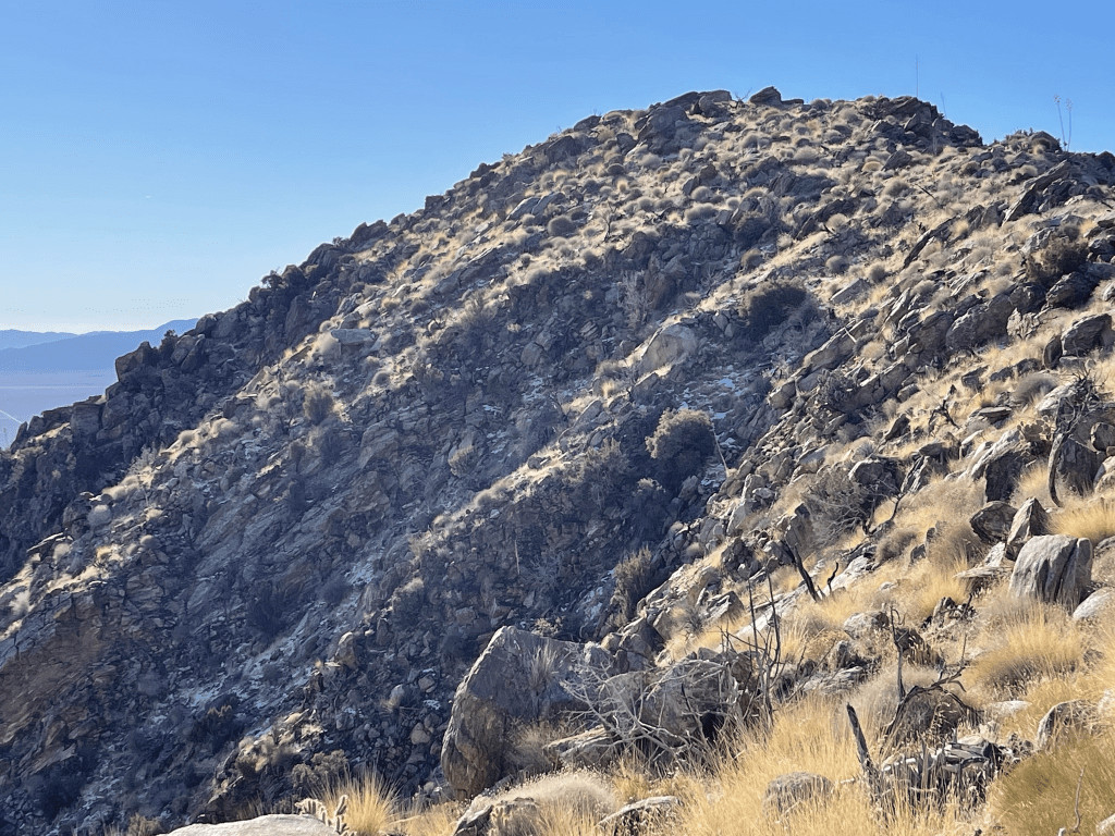
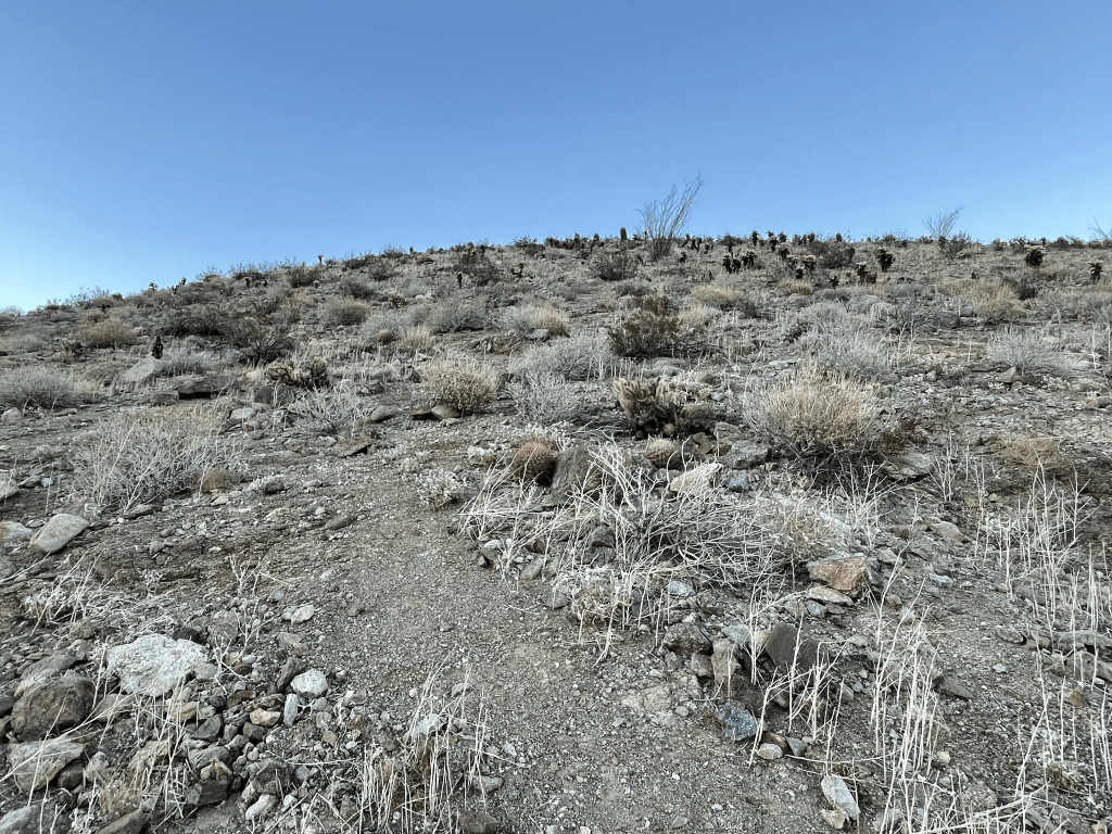
The climb would be very steep the rest of the way. Thankfully, the footing was very solid as there seemed to be enough soil/grass to hold the loose rock in place. The brush was also minimal, so it was actually a very pleasant ascent.
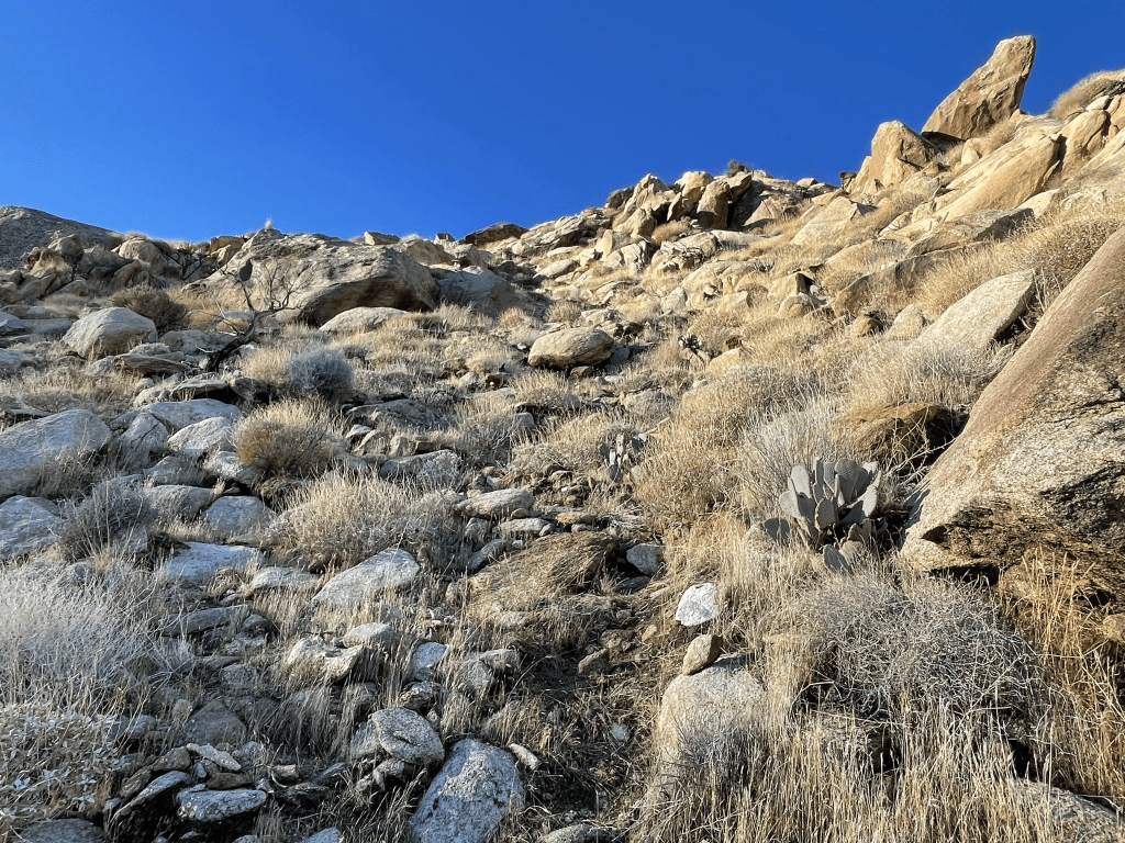
I really started to warm up as I climbed so I was comfortable in short sleeves the rest of the way up. Larger boulders near the top made for some fun scrambling.
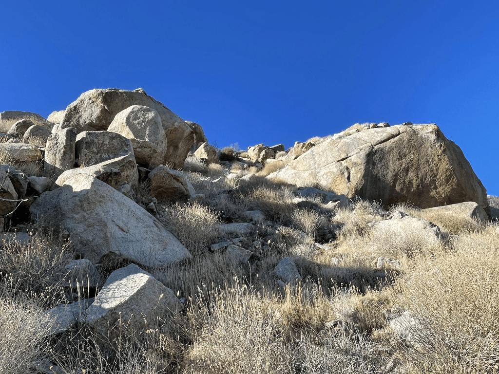
I started to see small patches of snow around 3300 feet. I was a bit surprised to find snow at such a low elevation, especially in the desert! After some tough climbing, I eventually reached the top of the main ridge just northwest of the summit.
As I neared the top, I noticed more snow on the shaded north slope just below the summit.
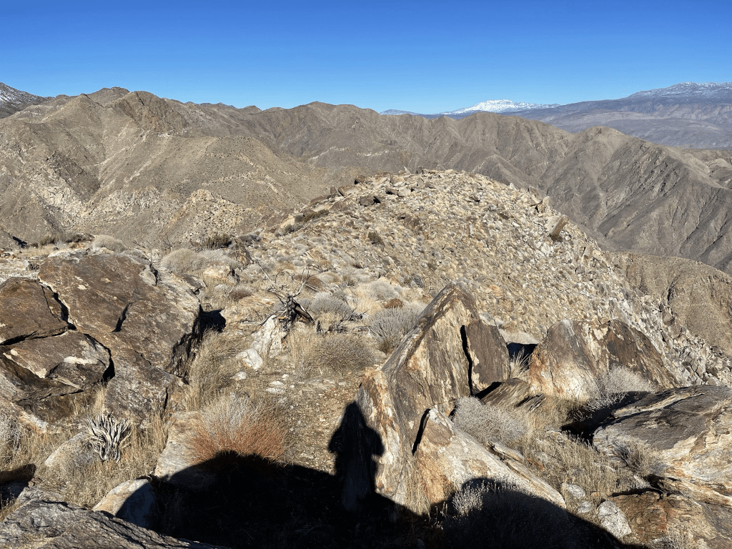
The hike across the top of the ridge was easy compared to what I had just ascended. I reached the summit at 8:54am at 3.2 miles!
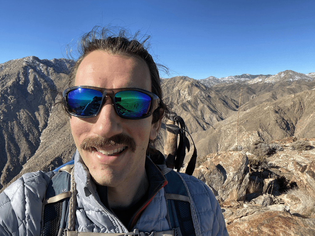
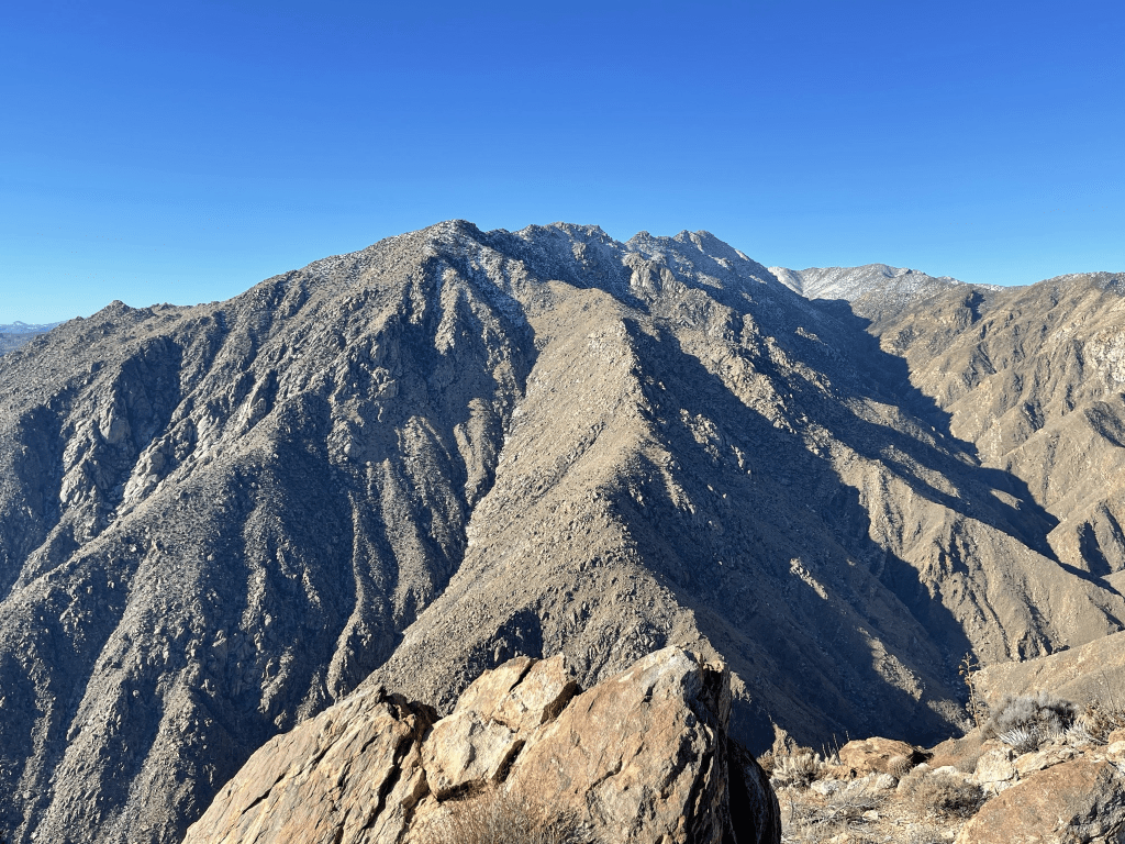
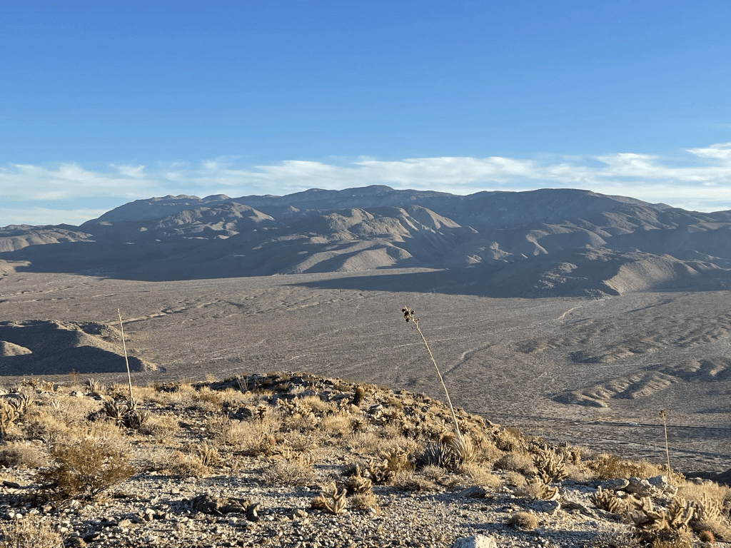
It was a stunningly clear day. In Southern California, the clearest it will ever get is a winter day after it rains. Directly south I could see the long ridge of San Ysidro Mountain. I intended to climb its East Summit the next day.
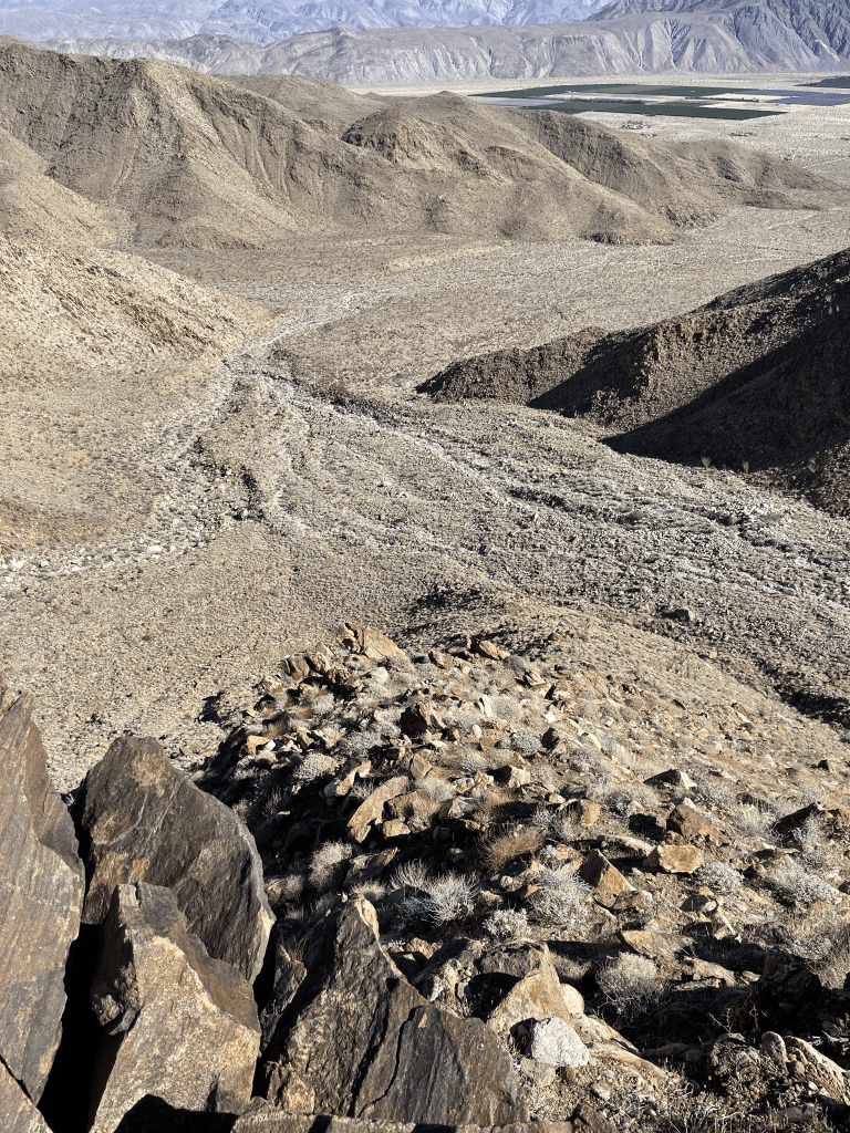
To the southeast I could see the town of Borrego Springs, as well as Whale Peak, Sunset Mountain, and the Fish Creek Mountains in the distance.
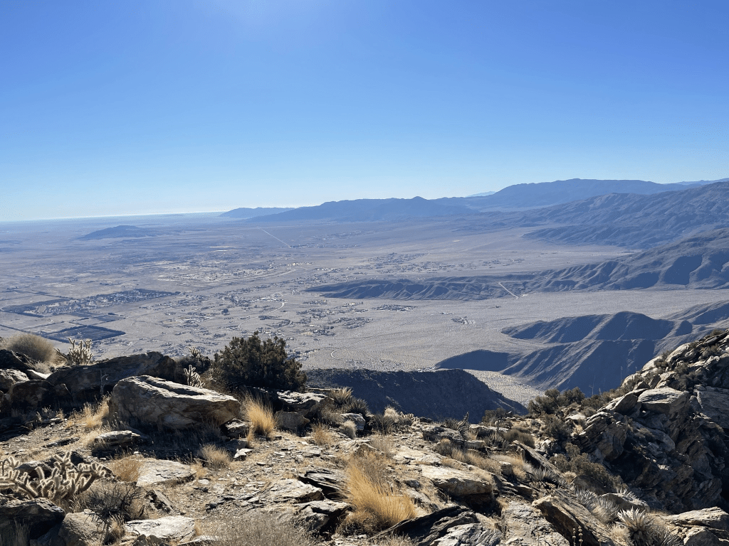
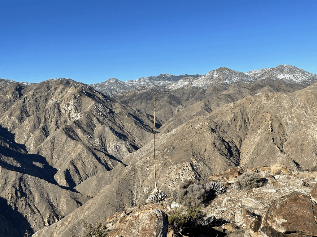
To the northeast I could see some of the main peaks of the Santa Rosa Mountains: Rosa Point, Mile High Mountain, Villager Peak, and Rabbit Peak. Coyote Mountain is the smaller mountain in the foreground.

San Jacinto looked spectacular covered in snow to the north. Toro Peak (right) also had a dusting of snow on its summit.
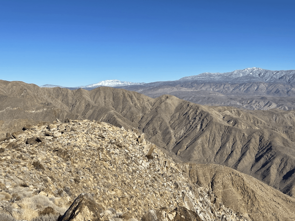
Directly east were higher desert summits with snow eventually leading all the way to Hot Springs Mountain, the high point of San Diego County.
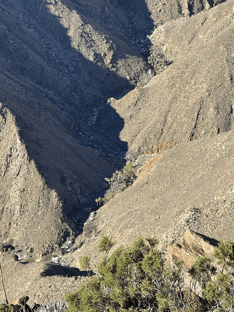
Far below I could make out some of the palm groves in Palm Canyon.
This is a fairly popular peak for being in the desert so there were a quite a few register books. I signed the newest one which wasn’t even a year old. I noted most of the entries in the last year ascended the same route as me or took the southeast ridge (a very difficult but more direct route from Palm Canyon). I took a lengthy break and then began descending the same route I came up.
I made sure to go slowly down the very steep ridge.
I took a slightly different route towards the bottom of the ridge. Rather than bailing to the left and climbing down the same side I came up, I continued straight down to the “toe” of the ridge. This way was slightly more direct and only a little steeper.
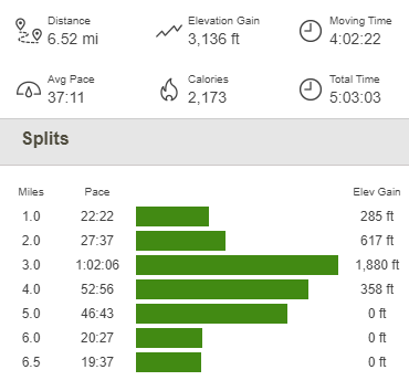
Once I reached the desert floor it was an easy hike back to the car. This hike totaled 6.52 miles, 3136 feet elevation gain, and 5:03:03 total time.
Rass Benchmark
I was pleasantly surprised at how quickly I climbed Indianhead and got back down. It was just before noon, so I still had the whole afternoon left. I decided to climb Rass Benchmark, a relatively minor 1877 foot peak that used to be on the San Diego 100 Peaks List but was delisted (not sure why). I drove back through town and parked at the Hellhole Canyon Trailhead, which is where the popular hike to Maidenhair Falls begins. I was a little perturbed to find that they now charge $10 to park there, but I guess it goes to a good purpose. I started this hike at 12:27pm from 888 feet above sea level.
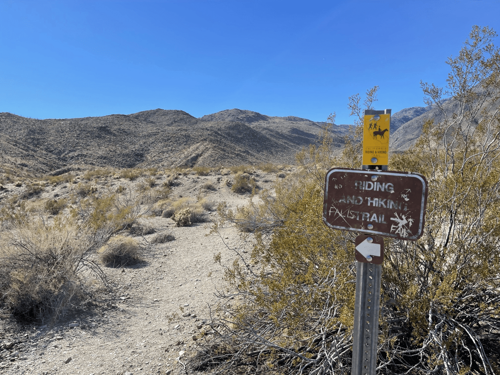
I started by heading west on the Hellhole Canyon Trail. At 0.2 mile, I reached a fork and turned left on the California Riding and Hiking Trail.
The trail began to gradually gain elevation as it winds its way up the hillside to the southwest. It was now in the mid 60s, so it felt very hot in the afternoon sun.
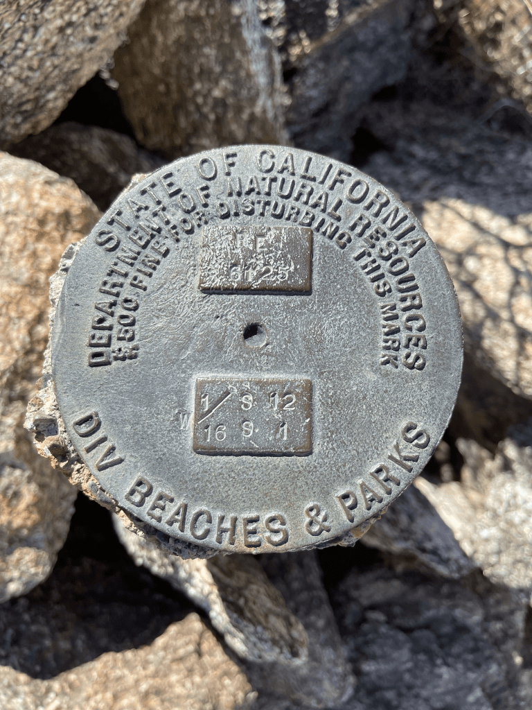
At 0.7 mile I found a random marker on the left side of the trail. It was some kind of benchmark placed by the Division of Beaches and Parks.
At 1.4 miles, I left the trail and made the short scramble to the “summit.”
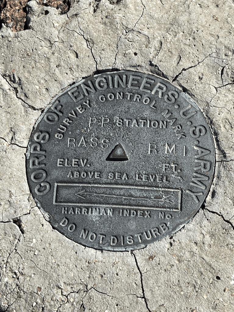
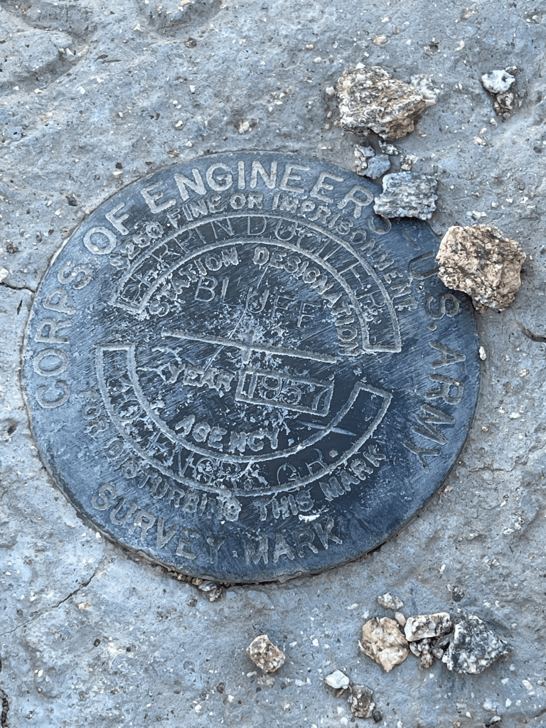
I climbed up the pile of rocks and reached the top at 1:06pm! I located the benchmark and reference marker number 1.

There were 2 different register cans at the top. One of them held 2 different books, both completely full. I signed the other one which dated to 2016. The previous entry was from January 19th. The views were excellent, but obviously not quite as good as Indianhead considering I was over 2000 feet lower. Speaking of Indianhead, Rass is only a few miles south of it so I had a great view of the mountain.

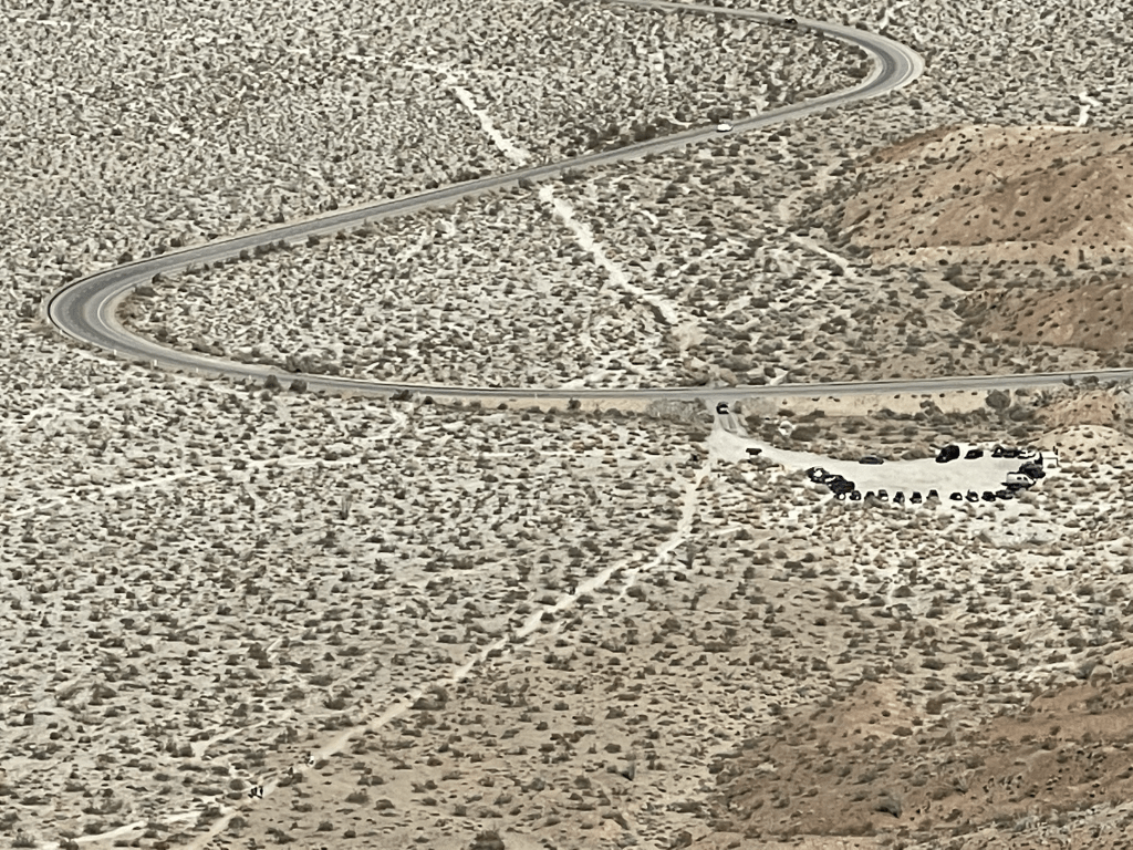
I could see all the cars at the trailhead as well as hikers on the Hellhole Canyon trail.
After another lengthy break I began the descent. I passed a couple on the way down and then a few more groups of hikers once on the Hellhole Canyon trail again.

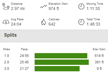
I reached the car at 2:15pm. This hike totaled 2.97 miles, 974 feet elevation gain, and 1:48:33 total time.
Perpendicular Bluff, Yaqui Ridge, and Ship Benchmark
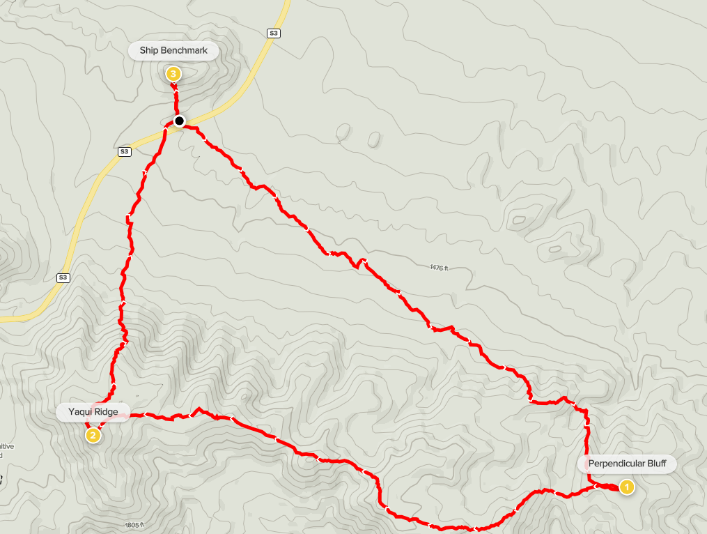
I still had time for another hike, so I turned my attention to another delisted SD County peak in the area: Perpendicular Bluff (1741 feet). Perpendicular Bluff is typically climbed from the south where it can be reached via short but steep climb from Highway 78. However, I had enough time in the day that I decided to combine it with 2 other minor peaks for a nice loop hike beginning from Highway S3: Yaqui Ridge (2040 feet) and Ship Benchmark (1616 feet). I parked at a large turnout on the north side of the road very close to Ship Benchmark. I started this hike at 2:42pm from 1438 feet.

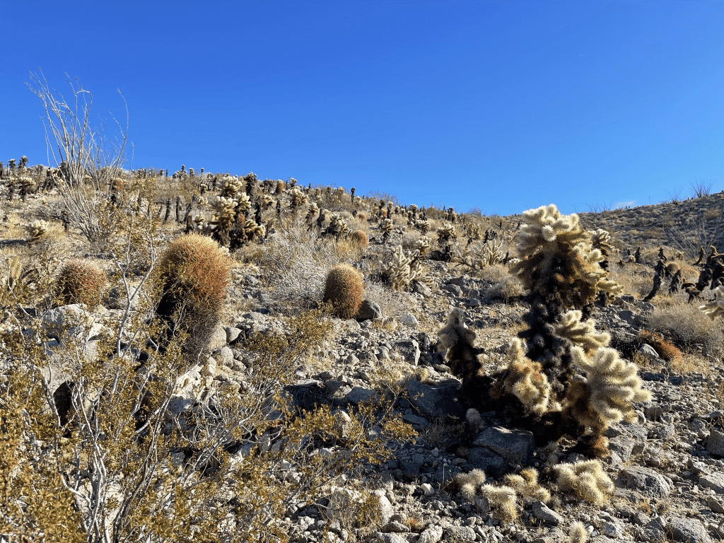
I intended to climb Perpendicular Bluff first, so I aimed at the low hills across the desert plain to the southeast. The terrain looked easy at the beginning, but I soon learned otherwise. The plain was cut by dozens of washes oriented in the opposite direction that I was walking. While most of them were pretty shallow, the many ups and downs added up after a mile or so. As I got near the low hills, I encountered another enemy of mine – teddy bear cholla!
I proceeded up the hill very carefully to avoid getting poked. As I reached the top of the hill, I was disappointed to find out that Perpendicular Bluff was separated from the hill I was on by a pretty deep wash.

I hiked down into the wash and then climbed up to the summit of Perpendicular Bluff. I reached the top at 3:27pm at 1.8 miles!
This peak was much less popular than the previous ones today. The register dated all the way back to 1995 and the most recent entry was last May. I had a great view of Sunset Mountain to the southeast.

After a short break I continued towards Yaqui Ridge. The terrain was much easier compared to the neverending washes I had crossed at the beginning of this hike. I was able to follow the crest of the low hills I was on directly west.

There were a few dips, but they were gentle. I reached the summit of Yaqui Ridge at 4:25pm at 3.4 miles! The register, which dated back to 2018, consisted of just a few scraps of paper stapled together. The views were pretty much the same as Perpendicular Bluff. I could make out some snow on the upper slopes of Whale Peak to the south.
After another short break, I began descending north towards the car.

The terrain was much easier to cross this time since I was going in the same direction as the washes. At 4.4 miles I crossed the road again. I walked past my car and climbed up the small hill that Ship Benchmark is located on. There was a vague use trail to the top
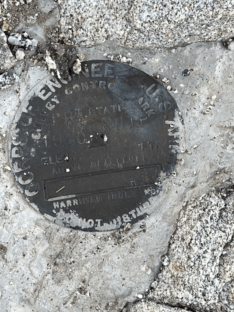
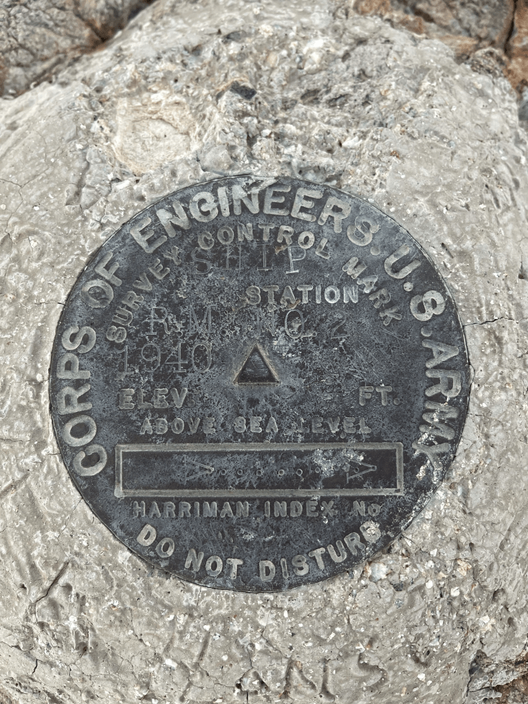
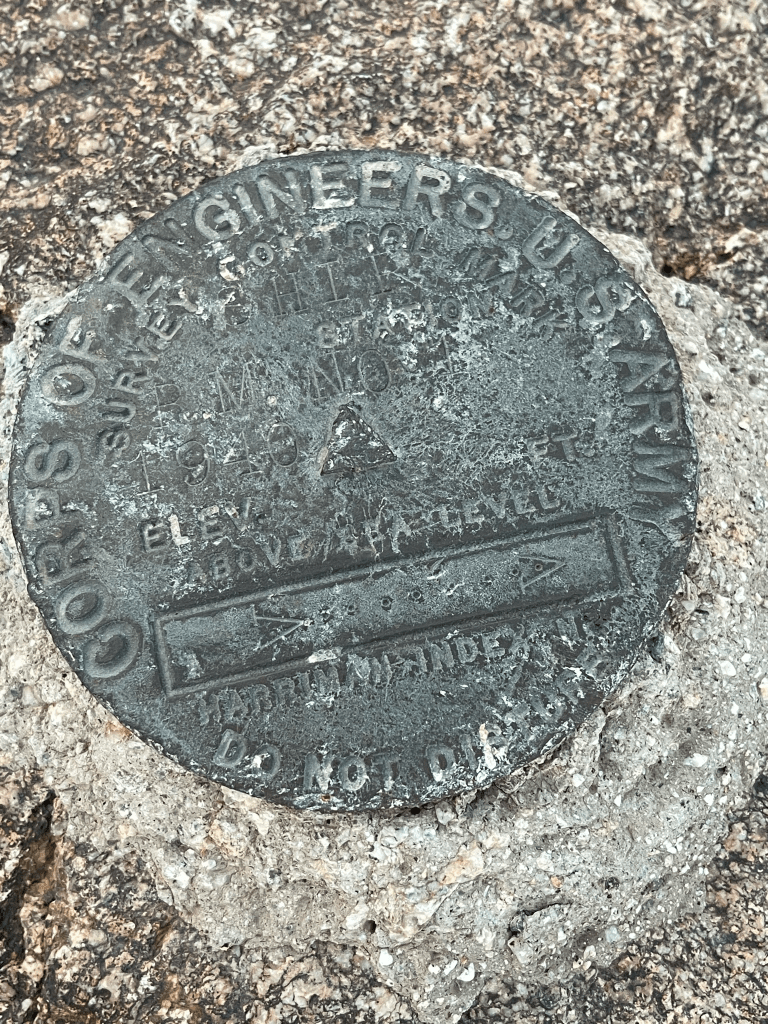
I reached the top at 5:05pm at 4.5 miles! I located the benchmark, a reset benchmark, and 2 reference markers.

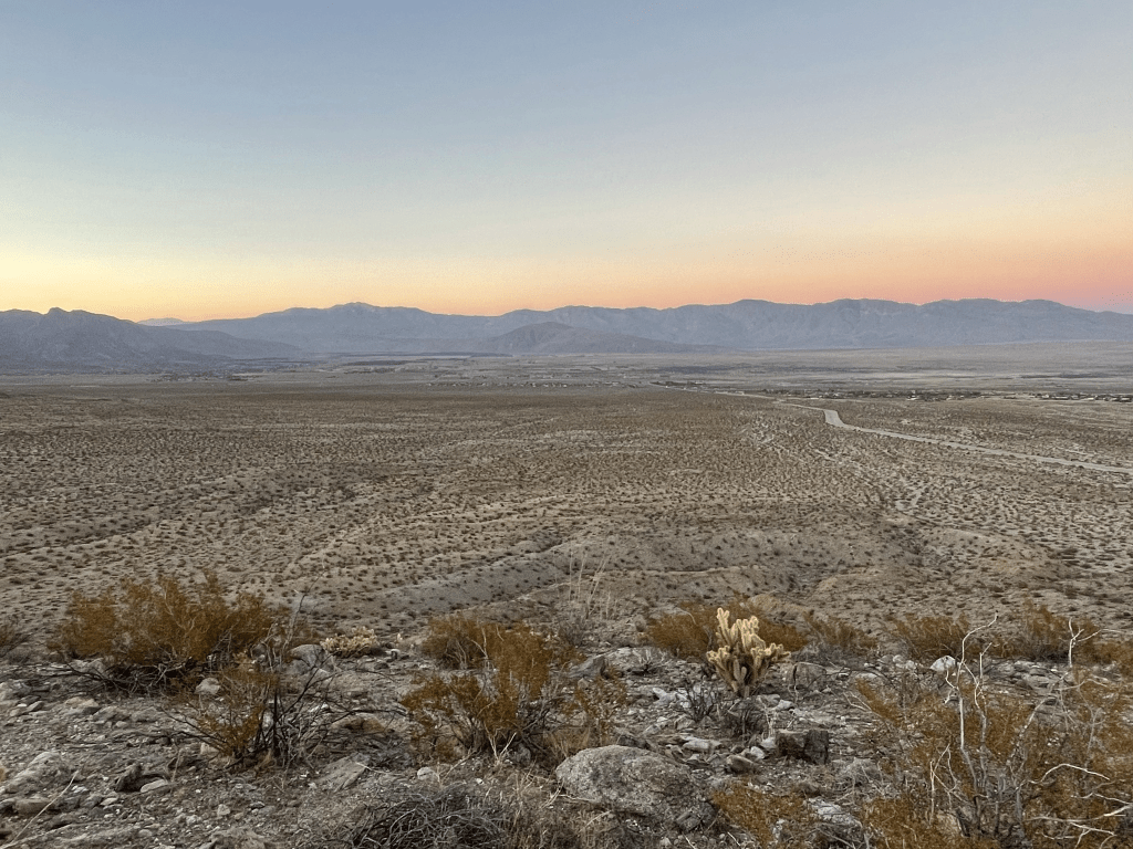
It was a great viewpoint for such an easy climb.
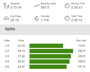
The descent took less than 5 minutes. I reached the car just before 5:30. This hike totaled 4.75 miles, 997 feet elevation gain, and 2:45:12 total time.
I had been debating about where to spend the night but ended up choosing to drive back to the trailhead from the morning for Indianhead. It was close and I figured it would be dark and quiet. I arrived at 6:30 and spent some time relaxing before falling asleep early.
