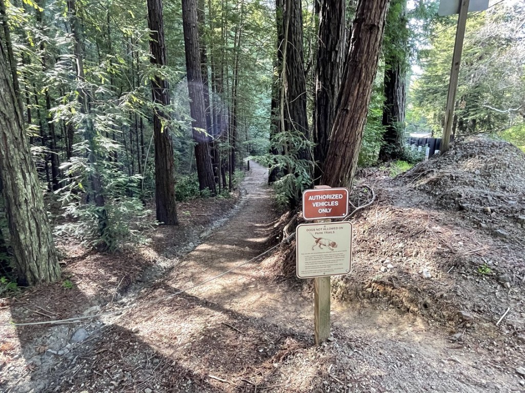
El Chamisal and Fort Ord National Monument High Point
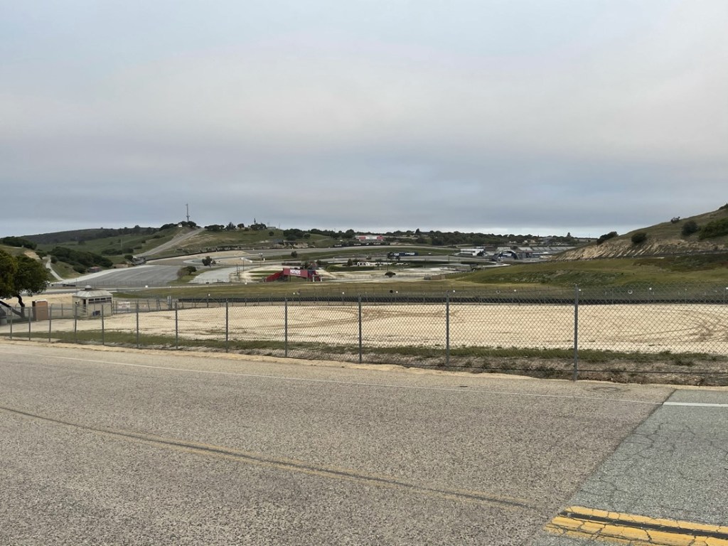
I woke up on Thursday morning at 5am to continue my journey north. My first stop of the day would be a quick visit to Fort Ord National Monument, located just east of Monterey on Highway 68. This small monument is managed by the BLM and protects a former US Army post. The 920 foot high point is located on the southeast slope of a minor peak called El Chamisal (940 feet). The easiest access to El Chamisal is from the nearby WeatherTech Raceway. There is a large campground located at the racetrack with trailhead access to the national monument. They charge a day use fee (can’t remember how much), but there was no one at the entrance gate so I got in for free. It would be a very short hike so I figured I would be in and out before 8am. I parked at the bathrooms and started hiking at 7:09am from 817 feet above sea level. I had a good view of the racetrack as I began.
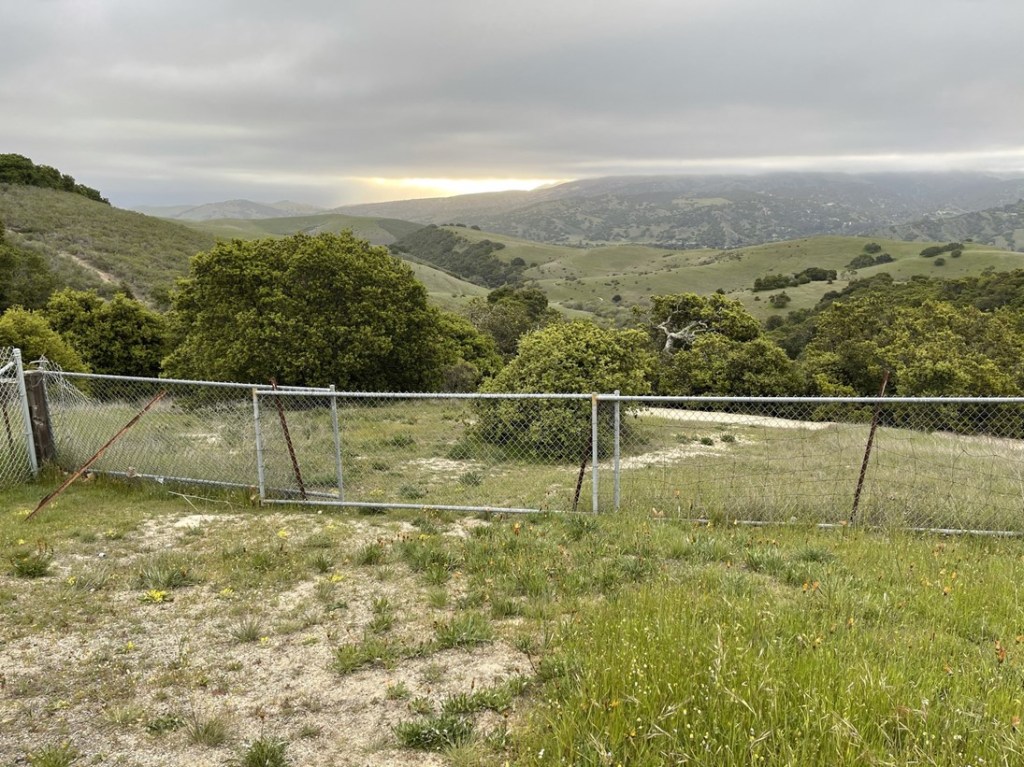
I walked a short way through the campground. It was pretty empty – there are hundreds of campsites and only a few seemed to be occupied. I thought this could potentially be a good place to spend the night if I couldn’t find any other options. I walked through site 113 and down a slope to the fence separating the racetrack from the national monument.
I found an easy spot to hop the fence. Note that there is an official trailhead in the campground further south where you don’t have to hop a fence, but the way I went is slightly more direct.
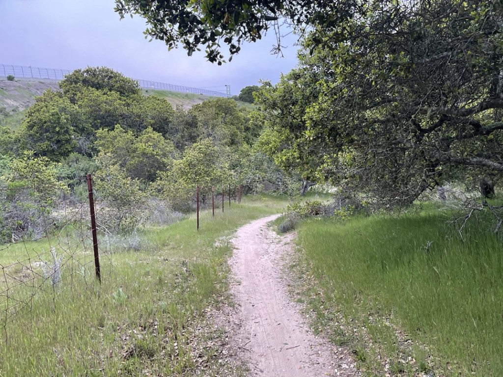
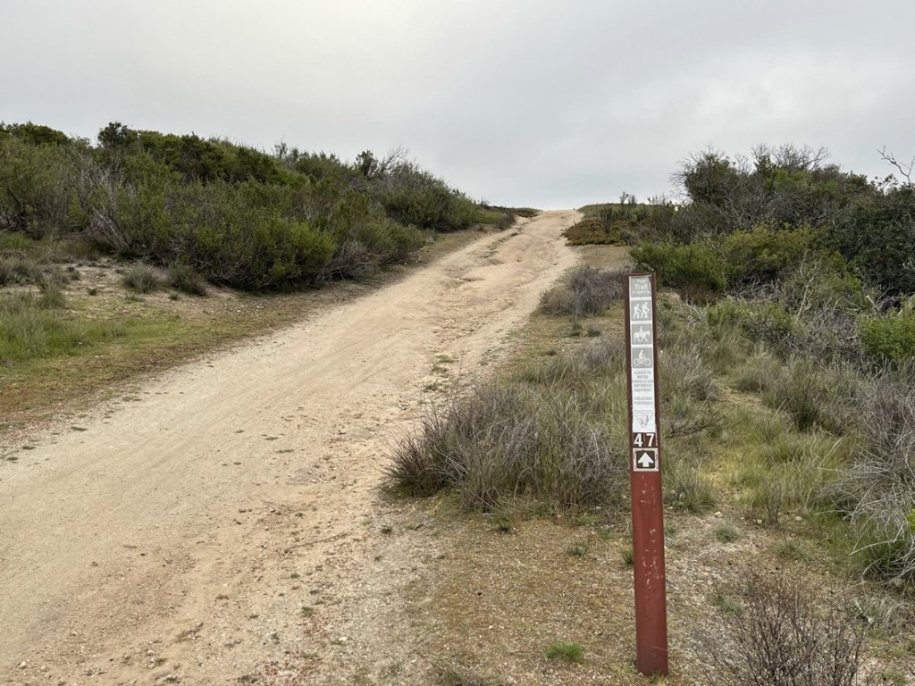
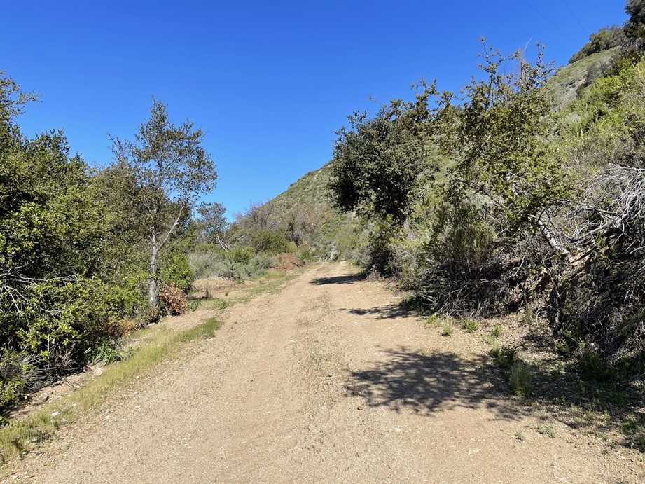
I hiked north on Trail 47 towards El Chamisal. The trail parallels the fence for a while.
At 0.6 mile I reached a trail junction and turned right to remain on Trail 47.
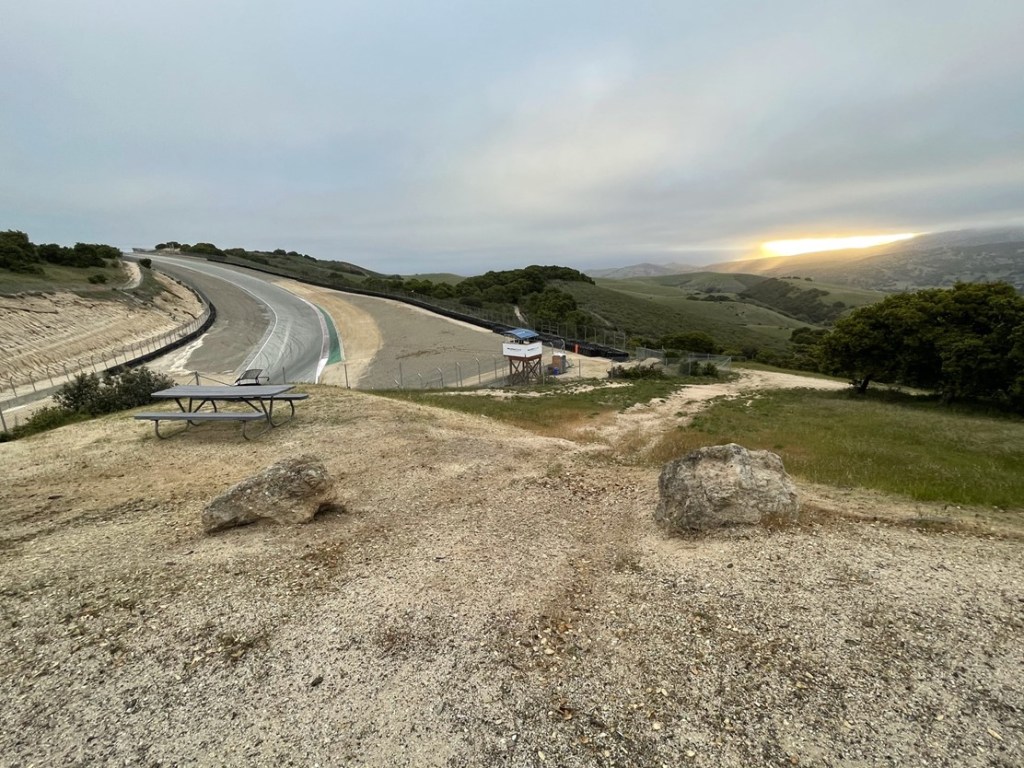
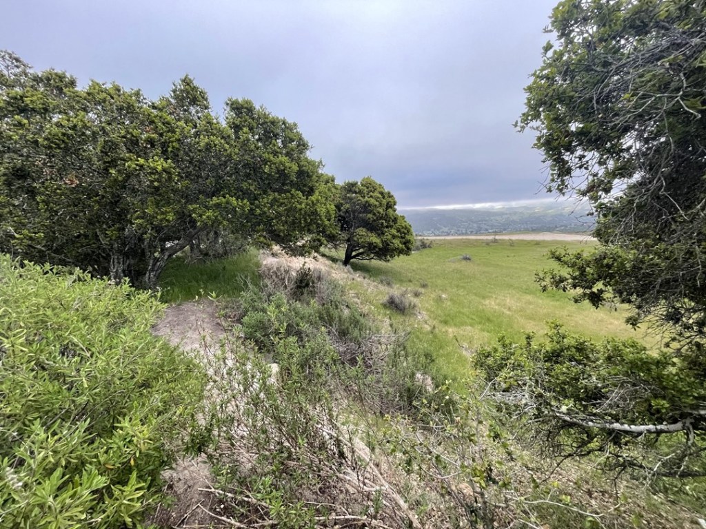
From there it was a short walk to the high point. In the picture below, I’m standing on the national monument high point. El Chamisal is the little hill with shrubs growing on it. It was unclear where the boundary between the monument and racetrack was, but El Chamisal itself is apparently on racetrack property.

I hiked through the grass to the top of El Chamisal, which I reached at 0.7 mile. There wasn’t much view to be had here.
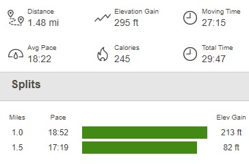
I then hiked back to the car, which I reached at 7:38am. This was definitely a lame hike, but it was short, and I considered it a nice warmup for the rest of the day. This hike was just 1.48 miles, 295 feet elevation gain, and 29:47 total time.

Pico Blanco
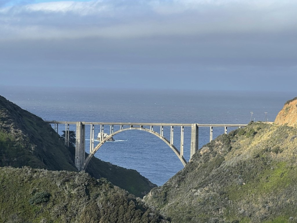
My primary goal for the day was to climb Pico Blanco, a 3709 foot peak that rises dramatically from the Big Sur Coastline. I went back to Highway 68 and drove south to the famous Highway 1, also known as the Pacific Coast Highway. Unfortunately, a large section of Highway 1 was closed south of Pfeiffer Big Sur State Park due to a massive mudslide that destroyed part of the road a few months ago. This was a bummer since I was unable to drive up the highway from the south, and it also prevented access to certain peaks I had interest in climbing (Cone Peak). I was still happy to be able to drive on part of it though. I made a quick stop at the famous Bixby Creek Bridge on my way to the trailhead.
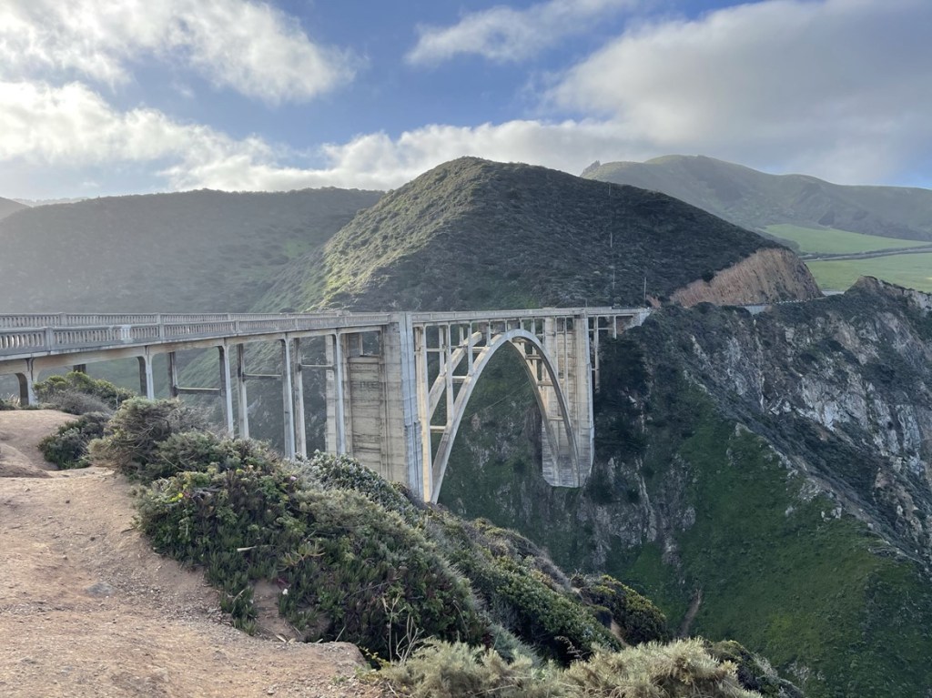
Instead of crossing the bridge, I turned left onto Coast Road, which is a dirt road that heads into the foothills and eventually rejoins Highway 1 about 10 miles south. I got another great look at the bridge from Coast Road.
I drove about 6 miles and then parked along the road near the trailhead. I was a bit surprised to find another Subaru parked. I started this hike at 9:05am from 309 feet. There were some warning signs at the beginning of the trail.
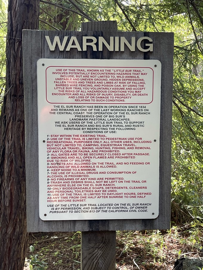
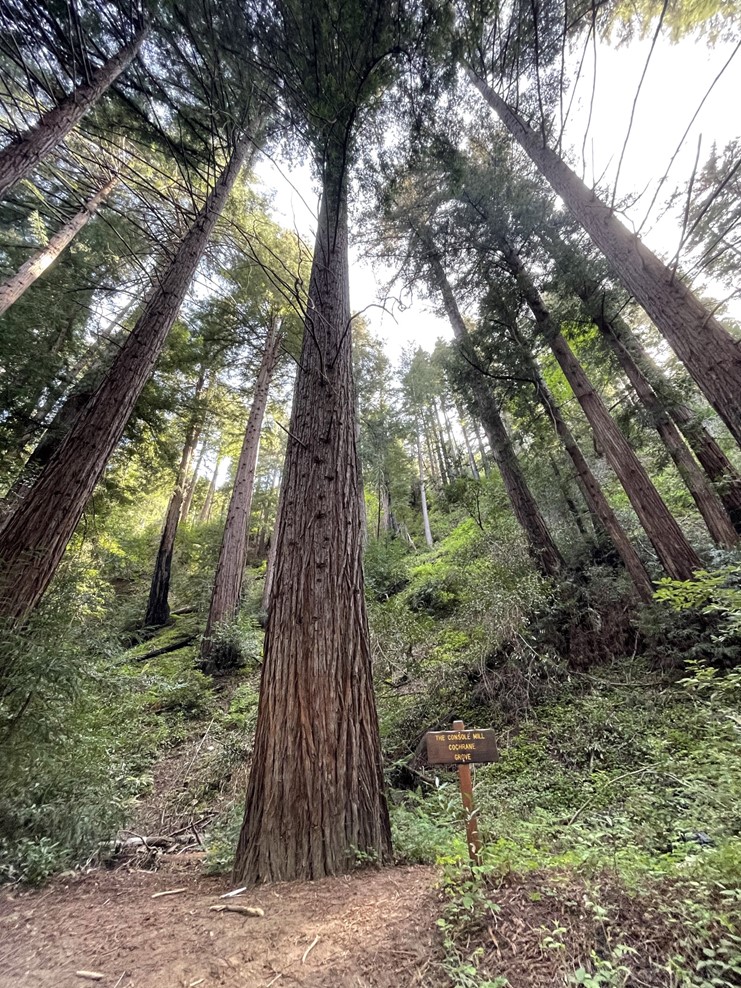
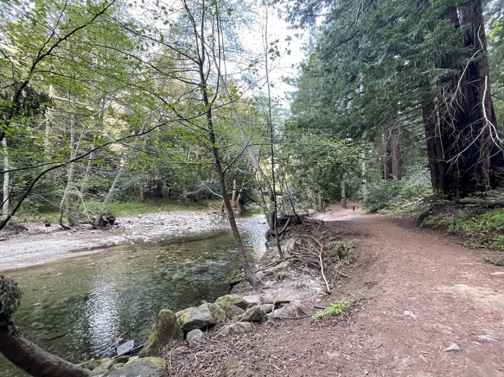
The first couple miles of the trail is a public easement through private property (the land is owned by the El Sur Ranch). I immediately entered a forest of magnificent redwoods.
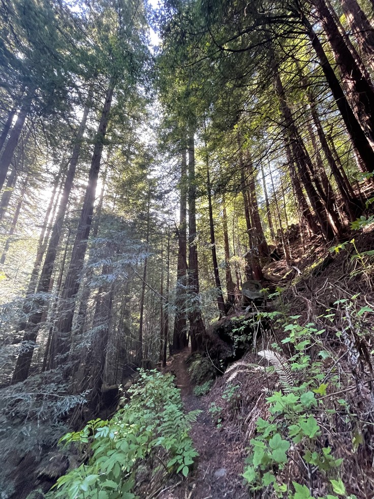
This was only my second time seeing redwoods (coast redwoods are related but different from the giant sequoias that grow in the Sierra). The first time was in Redwoods National Park on a long road trip I went on a few summers ago. The redwoods don’t grow quite as tall here as they do up north, but they were still a tremendous sight.
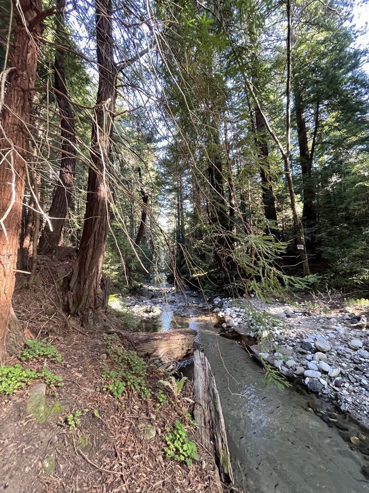
The trail I was on is called the Little Sur Trail. It parallels the Little Sur River for the first couple miles.

I was a little surprised to pass 2 trail runners heading the other way. There was some deadfall on the trail, which would make trail running difficult.

I noticed a slug crawling on the trail.

The trail crossed to the north side of the river at 1.8 miles. I couldn’t find a dry way to cross so I took off my shoes and socks and walked through.

After crossing the river, the trail began to ascend out of the canyon above the shade of the redwoods.

At 2.4 miles the trail ended at a T intersection with a road. I turned left here.
I had only gained about 400 feet of elevation up to this point so still had about 3000 to go. At 3 miles I reached a 4 way intersection and took a right.
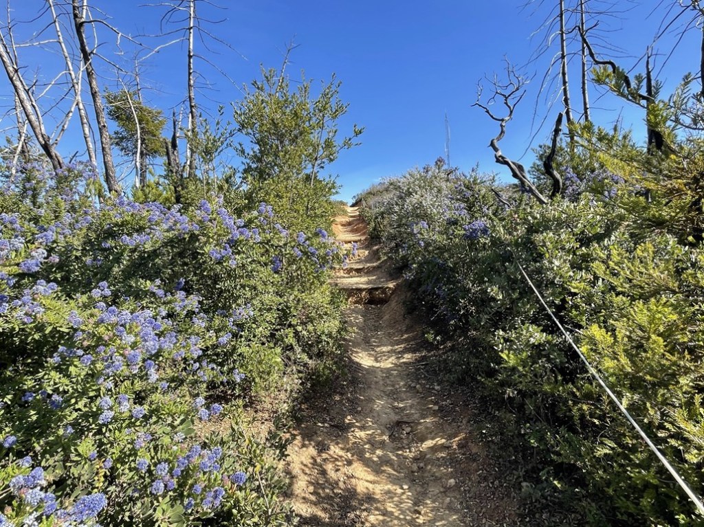
There were some pretty wildflowers on the side of the road.

At 4.7 miles I reached another intersection and turned left.
I got my first look at Pico Blanco, still almost 2000 feet above me. Pico Blanco is Spanish for White Peak, which certainly made sense when looking at the light colored rock the mountain is made of.

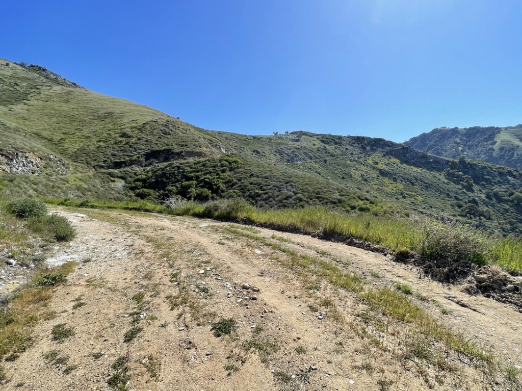
This road was much more overgrown than the previous one, and there were no recent tire tracks.

At 6.4 miles I passed 3 hikers on their way down. I’m guessing the other Subaru at the trailhead belonged to them. I don’t think this peak gets climbed very often, so I was surprised to meet other hikers. The hillsides consisted mostly of small shrubs and grasses with a few trees here and there.
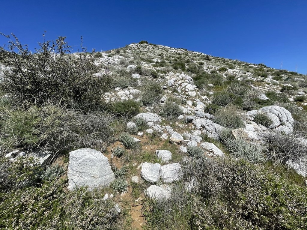
I passed a small rockslide near the top.

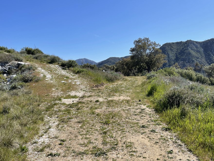
The road ended at a small weather station at 7.3 miles.

It was a 400 foot climb up a steep rocky slope from that point.
Almost there!
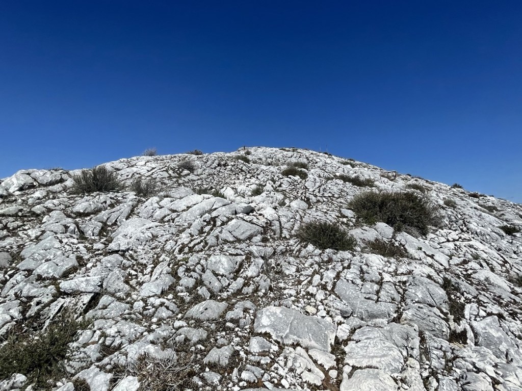
I climbed up and reached the summit at 11:52am at 7.5 miles!

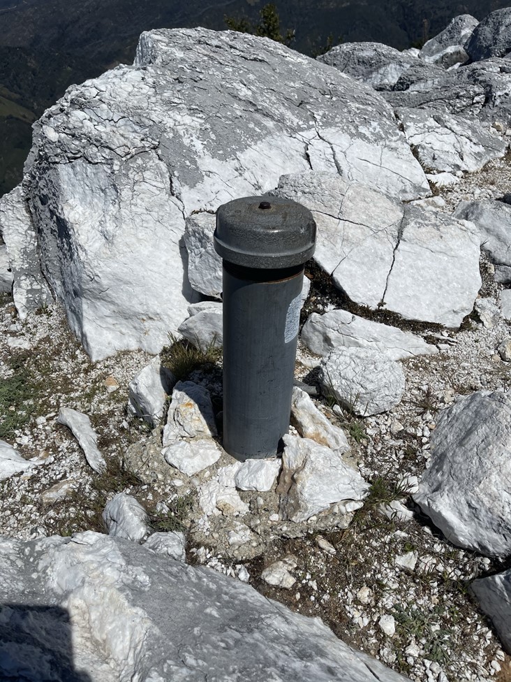
The register was wet, but I still was able to sign it. It dated back to 2015 and the previous ascent was December 20th. I wondered if the 3 hikers I saw had stopped where the road ended, or if they just simply hadn’t signed the register. The register was located inside this heavy duty metal tube which I’m pretty sure could survive an asteroid impact.
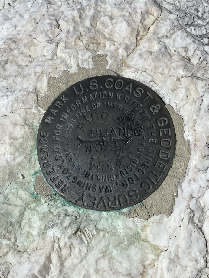
I located the benchmark and 2 reference marks.


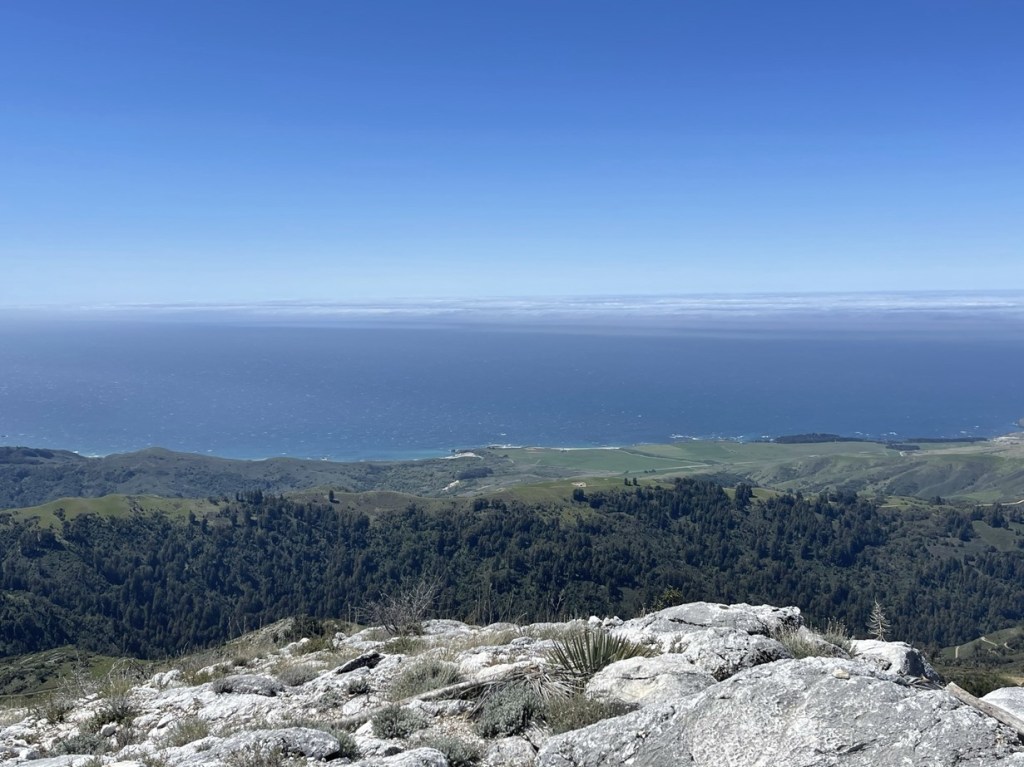
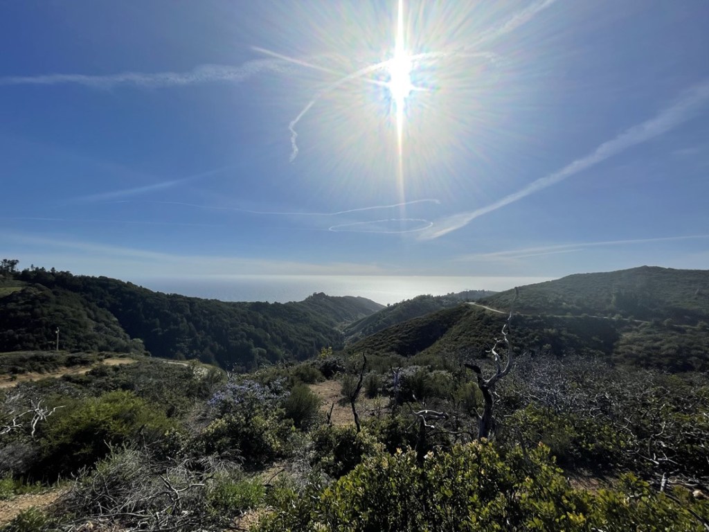
The view west was stunning:
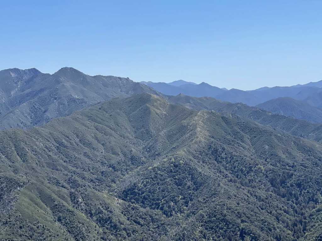
To the east I could see the peaks of the Ventana Wilderness. Unfortunately, many of those peaks were inaccessible due to closures from the Dolan Fire which burned through the area last August. Pictured below are Uncle Sam Mountain (left) and Ventana Double Cone (right).

To the southwest I could see Junipero Serra Peak. It’s the peak in the center way off in the distance. Junipero Serra Peak is the high point of Monterrey County and the Santa Lucia Mountains.
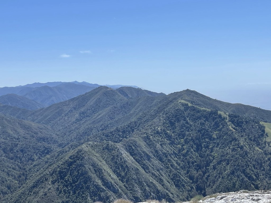
To the south I could see Manuel Peak, Cabezo Prieto, and Post Summit (I planned to climb all 3 peaks the next day). Cone Peak can be seen far in the distance.
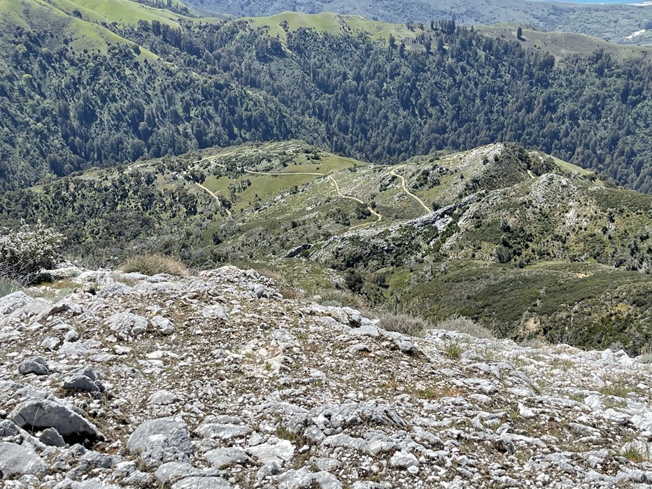
I began the descent just after 12:30. I could see the road down below.
I reached the road again at 7.8 miles. I spent some time photographing the flowers on my way down.

I followed the same route down and made good time. I tried to photograph the massive trees some more, but I found it very difficult to capture their size.

I reached the car at 3:17pm. This hike totaled 15.29 miles, 3822 feet elevation gain, and 6:12:09 total time.


Buzzards Roost
I still had time for one more hike, so I decided to do one of the popular trails in Pfeiffer Big Sur State Park – Buzzards Roost. I continued south on Coast Road until I reached Highway 1 again. It was just about 5 miles until I reached the state park. I was able to park for free at a turnout on the south side of the road near the park entrance. I started this hike at 4:07pm from 120 feet.
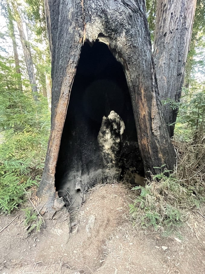
The trail descended away from the highway down to the Big Sur River. There were massive redwoods here as well.
One tree was hollowed out.
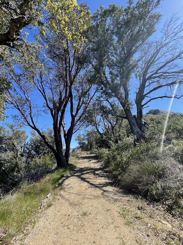
The trail made a switchback or 2 away from the river and began to gain elevation. At 0.8 mile I reached a T intersection. This was the beginning of the loop so I could have gone either way here. I chose to go right (counter-clockwise).
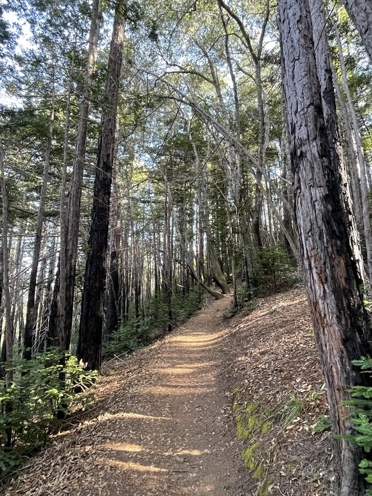
The trail was actually kind of steep which I wasn’t expecting. The trees thinned out as a got higher.
I reached a viewpoint about halfway through the loop at 1.4 miles. There were a few other groups of hikers hanging out.
I took a short break and then continued on. I completed the loop and hiked back down to the Big Sur River.
From there it was a short walk back to the car. This hike totaled 3.31 miles, 860 feet elevation gain, and 1:18:08 total time.


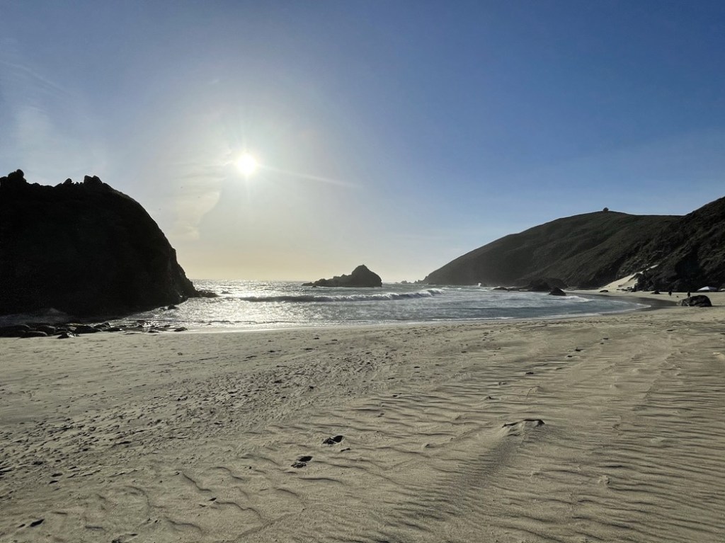
It was 5:30pm so I still had some daylight left. I wanted to save my legs for the rest of the week, so I decided I was done hiking for the day. Instead, I made the quick drive down to Pfeiffer Beach to enjoy the sand for a little while. I paid the $10 day use fee and walked out onto the beach.

The wind was insane, so it was very cold, and the sand was getting in my eyes. The beach was very beautiful though.
I packed up and started heading back north. I decided to return to the campground at the racetrack and spend the night there. I stopped at a turnout on Highway 1 along the way to enjoy the sunset.
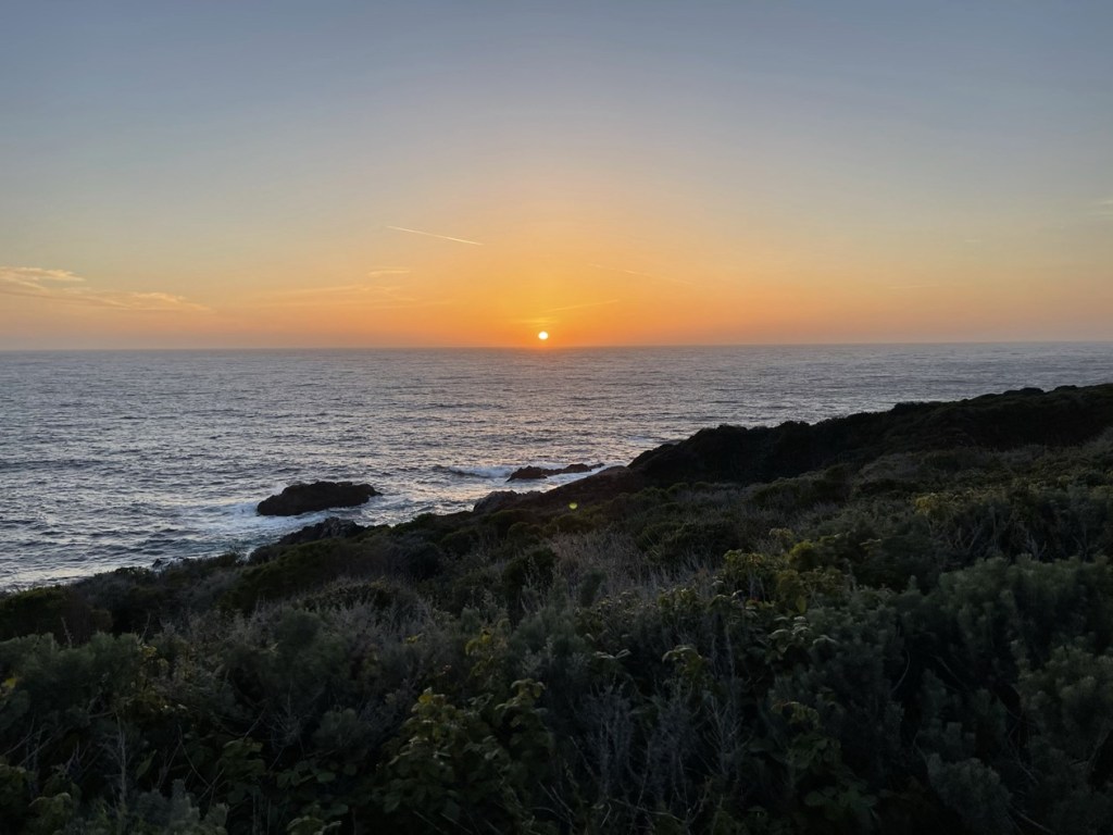
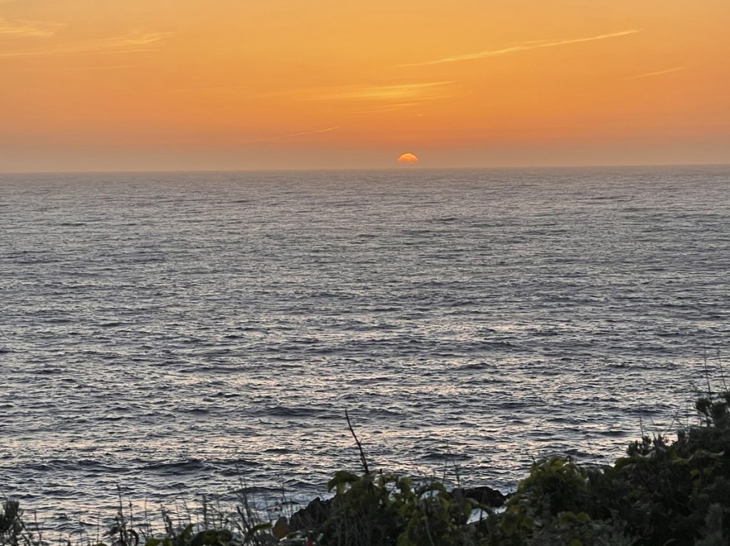
Driving on Highway 1 with the sun setting was a magical experience. I made it to the campground just after 8 and was surprised to find someone at the entrance gate. I paid $35 to spend the night there and had a great night of sleep.
