Dog Mountain (2948 ft) is a small hill overlooking the Columbia River about 50 miles east of Portland. I was in Washington for a week, with most of my time spent on a failed attempt of Mount Rainier. This was the second to last day of my trip, and unfortunately bad weather had caused me to abort an attempt on Mount Adams earlier in the morning. I had started around 2am, but extreme winds, blowing snow, bitter cold, and low visibility had caused me to turn around at 8700 feet.

I retreated back to the car which I reached around 6:30am. I took a lengthy nap and spent some time drying my clothing and gear. I was planning an attempt on Mount St Helens the following day, but I had a lot of time to kill so I decided to do a hike nearby to pass the afternoon. Thankfully, the weather improved throughout the day and also as I drove south towards the Oregon state line. I had driven by the Dog Mountain trailhead the previous day, and some quick research indicated that it would be the perfect hike to pass a few hours on my way to St Helens. The trailhead is a large dirt parking area on the north side of Washington State Highway 14. I began hiking at 11:12am from 125 feet above sea level.

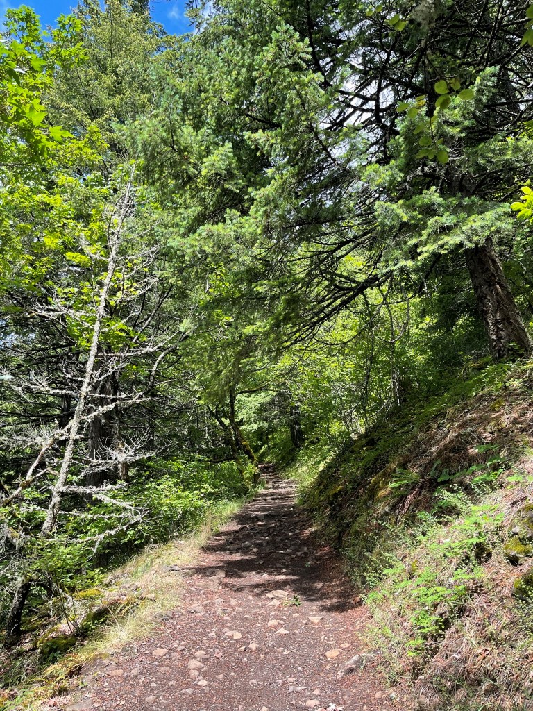
The trail made a few switchbacks as it ascended north away from the river.
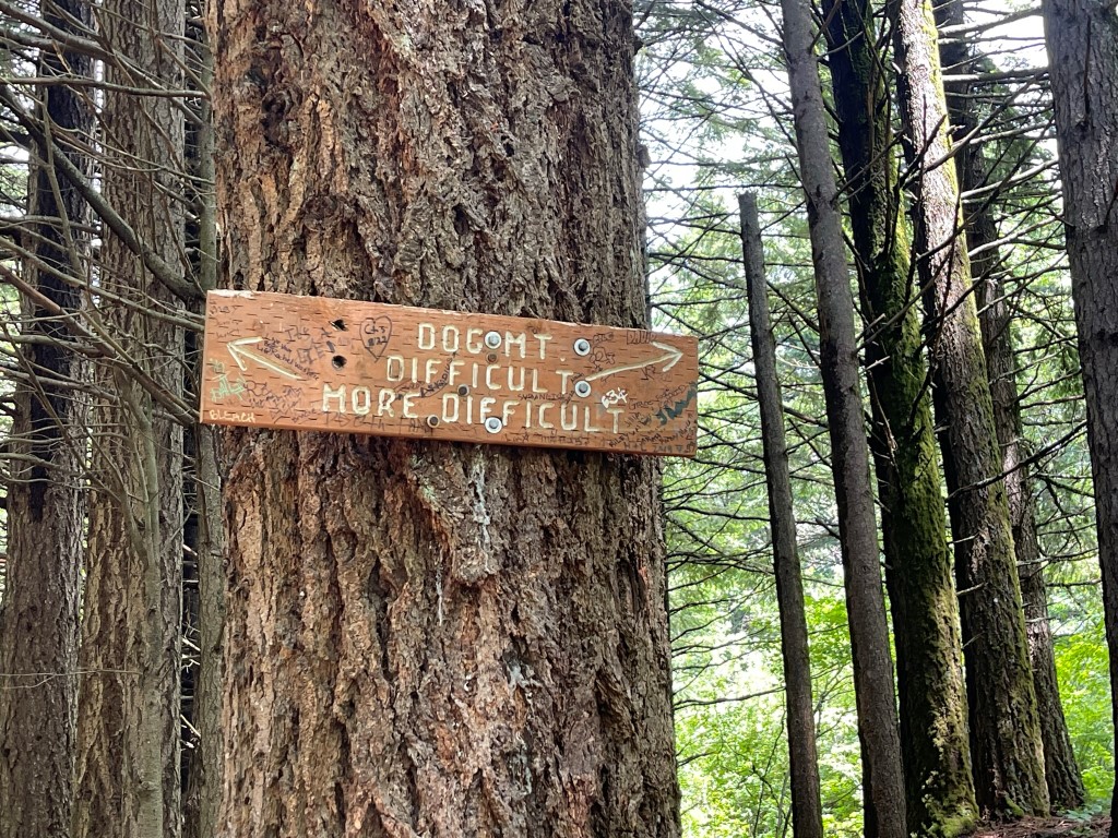
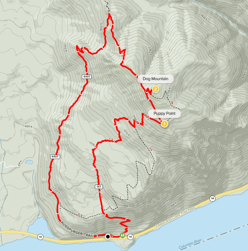
At 0.8 mile the trail split into a “difficult” option and a “more difficult” option. I went left to take the “more difficult” option. I think they are similar but the left one is a little shorter and steeper.
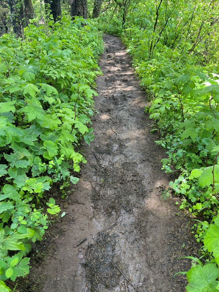
I continued north underneath tall pines. The trail was quite muddy from all the recent rain. It was also a little crowded even though it was a Tuesday. I thought the trail was surprisingly steep for such a popular area.

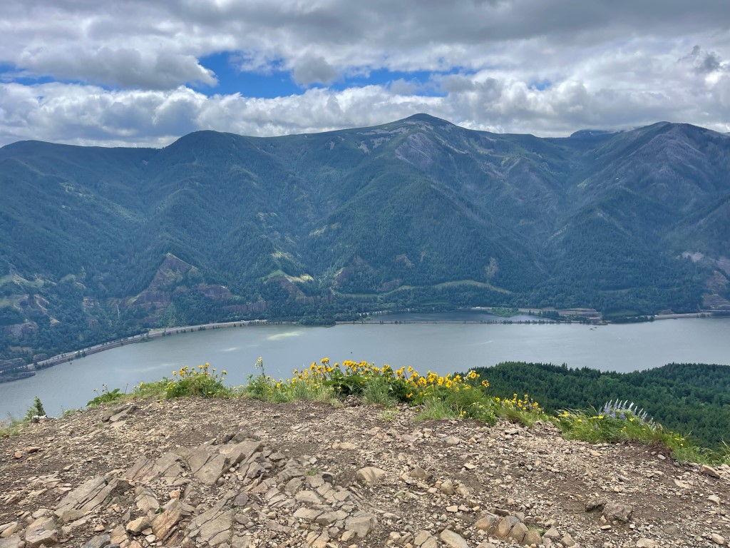
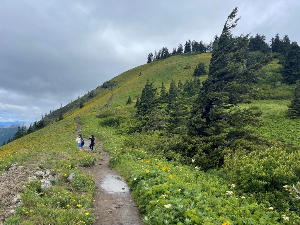
The trail veered to the east and made a few more switchbacks once I was above 1500 feet. At 2.1 miles the 2 trails joined back up into one. I passed some pretty sunflower fields as I emerged above the tree cover.

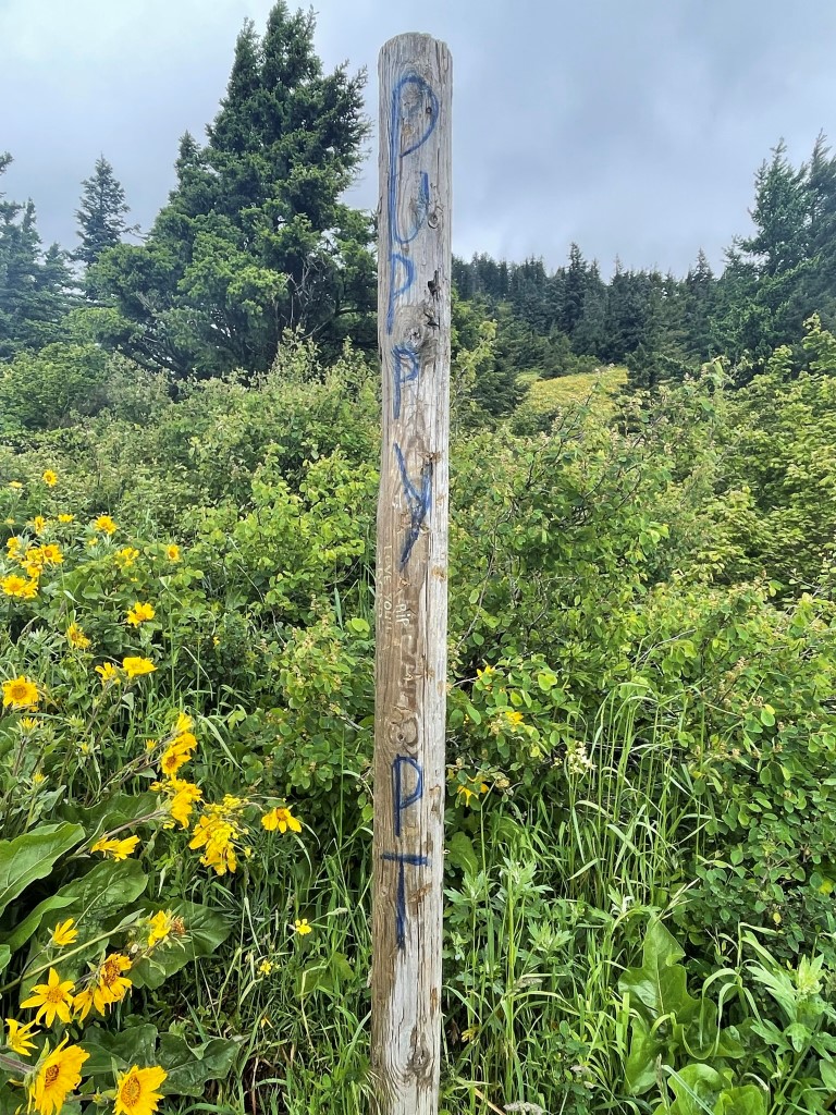
At 2.6 miles I reached a small lookout area called Puppy Point (2505 feet).
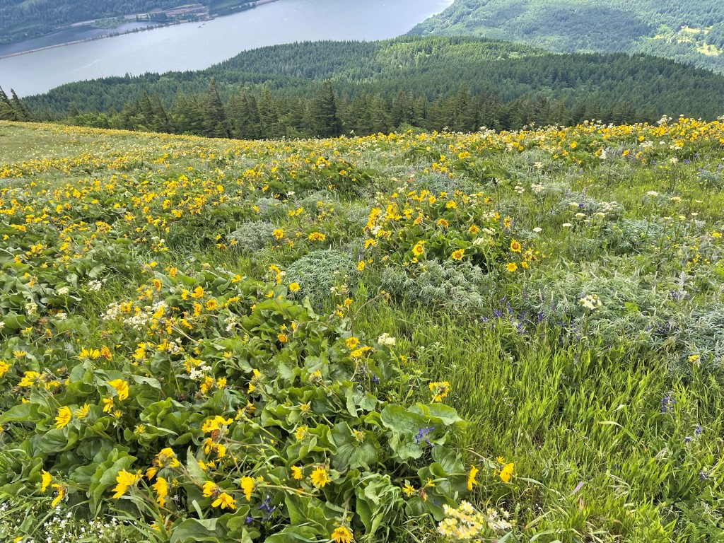
I had an excellent view of the Columbia River Gorge. The hills on the other side of the river are in Oregon.
It was very windy above the tree cover, so I put on an extra layer. I continued northwest towards the summit.
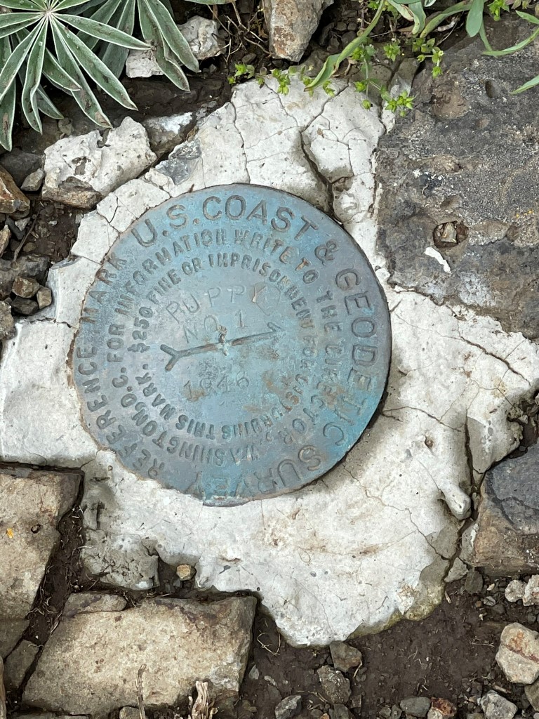
I found an oddly placed reference marker on the left side of the trail.
There were more pretty sunflower fields.
I turned right onto a little spur trail that went to the top. I reached the summit at 12:48pm at 3.2 miles. Unfortunately, the summit area was densely wooded so there were no views. It was also extremely muddy. I descended a short way and took a few more pictures.

I descended back to the main trail. Instead of going left and descending the way I came up, I went right onto the Augspurger Trail. The Augspurger Trail is slightly longer but would take me back to the trailhead. The upper part of this trail was so muddy I really had to be careful not to slip.
The rest of the hike was uneventful. I reached the car once more at 2:16pm. Stats for this hike were 7.22 miles, 2858 feet elevation gain, and 3:04:10 total time.

I packed up and made the 1.5 hour drive to Marble Mountain Sno-Park for my climb of Mount St Helens the following day.
