Day 1
I had originally been planning to take the weekend off from hiking. I had plans to attend the San Diego Gulls (minor league hockey) game with some friends, but the growing threat of the Coronavirus had recently shut down all sporting events (including the Big Ten Tournament which I had been planning to watch on TV). With no more plans for the weekend, I figured the safest place to be during this time of crisis was to be climbing remote peaks in the middle of the Mojave Desert. I decided to head to one of my all-time favorite places, Death Valley National Park, to climb a few Sierra Club Desert Peaks Section (DPS) peaks. I had tentatively been planning a trip out there 2 weeks prior but ended up changing plans due to weather concerns. I left San Diego right at 5pm. With so many events canceled and people afraid to travel, it was shocking to encounter such little traffic going north on I-15 and I-215 on a Friday evening. I wasn’t slowed down once as I made it through the Inland Empire and up Cajon pass. I took US-395 through Kramer Junction to Highway 178 through Searles Valley and Trona. I then got on Highway 190 where I entered Death Valley National Park from the west side. By 10:20pm I had already reached Emigrant Campground, where I planned to start my hike the next day. Finding the small campground full, I drove a short way up Emigrant Canyon Road and pulled off to the side of the road where I spent the night.
Day 2
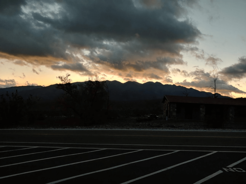
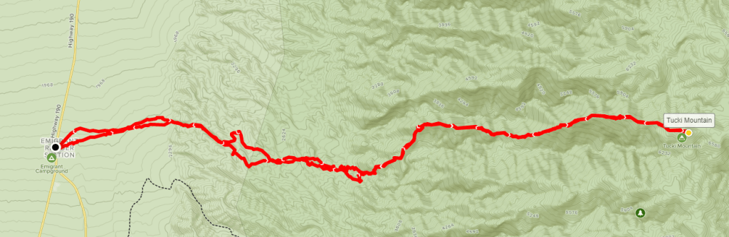
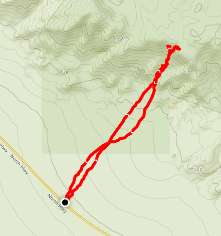
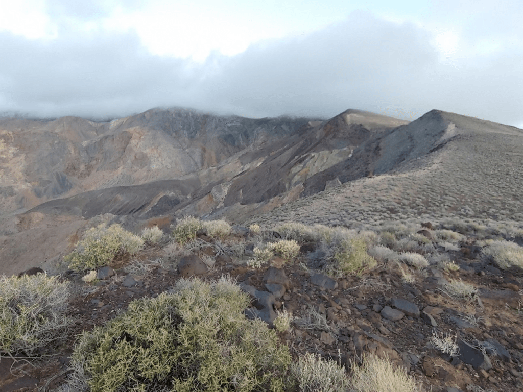
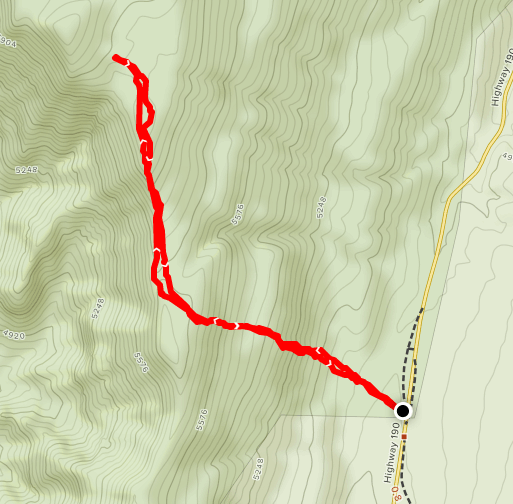
I woke up at 5:40am and drove the short distance back to Emigrant Campground. There is also a ranger station and a large day-use parking lot where I parked. My plan today would be to climb 6726 foot Tucki Mountain. The Panamint Range is the highest and most impressive mountain range within Death Valley National Park. The range tops out at 11,043 feet on the summit of Telescope Peak. Tucki Mountain is the highest peak at the north end of the range, and towers over the nearby village of Stovepipe Wells. Tucki Mountain is a massive mountain, and is extremely impressive when viewed from the east, north, or west. According to Andy Zdon, the mountain covers 140 square miles of land! However, it only has 1846 feet of prominence, as it is connected to the rest of the Panamints to the south by high ridges. The standard route to Tucki involves a long dirt road approach up into the mountain range before you begin hiking. This route is about 7.5 miles/3300 feet of elevation gain. Instead of this route, I intended to climb the mountain from its base on its western side from about 2000 feet, which would mean climbing nearly 5000 feet to reach the summit. I got started at 6:38am (which is later than I had been starting my hikes recently due to Daylight Savings).
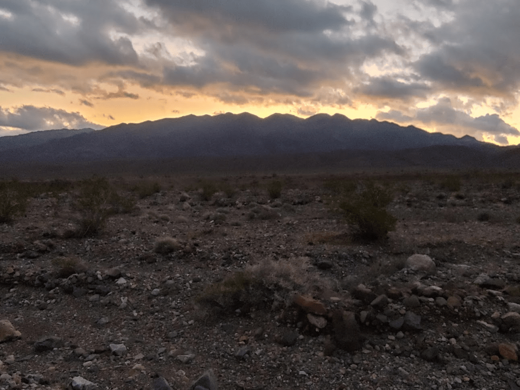
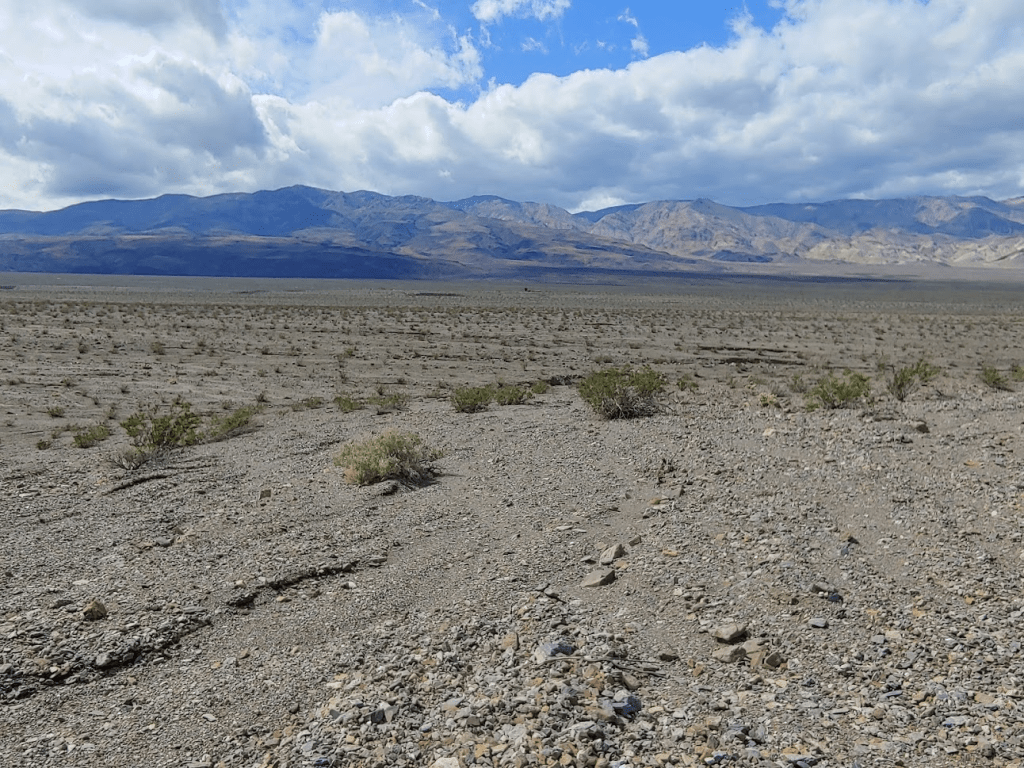
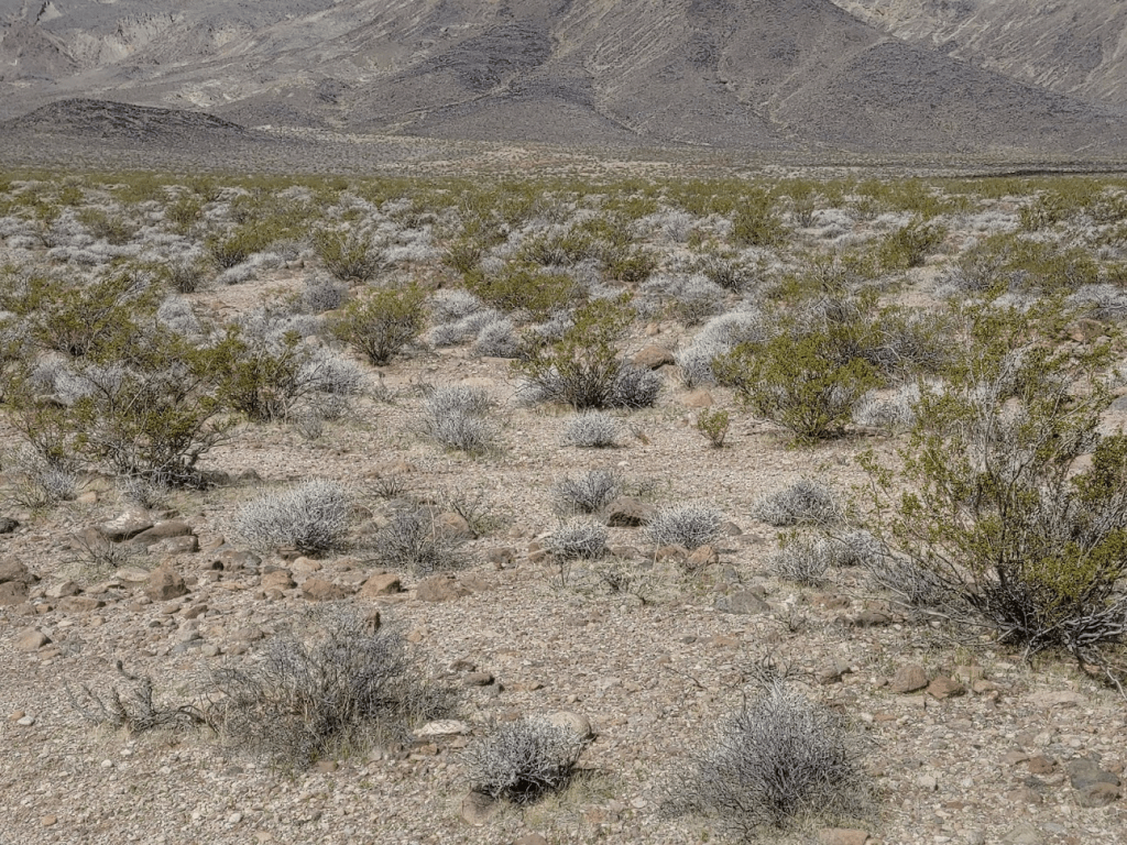
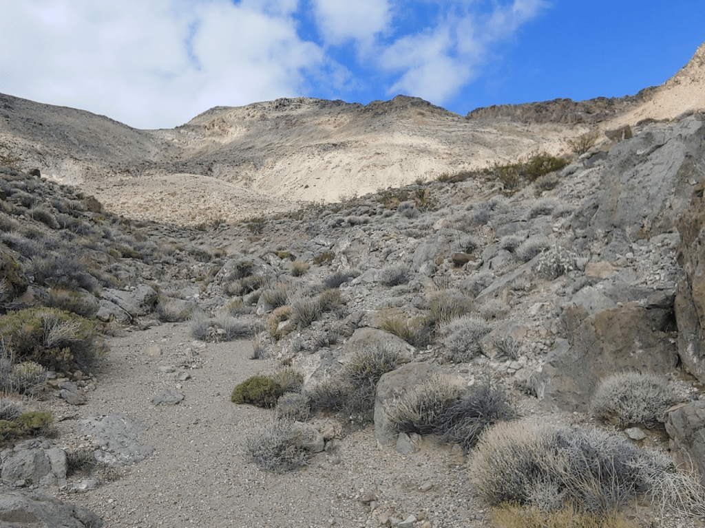
The first mile was fairly easy as I crossed open desert flats towards the mountain. I knew I had about 3.5 miles total from the highway to the base of the mountain, but unfortunately only the first mile would be easy.
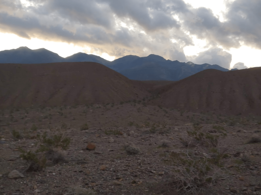
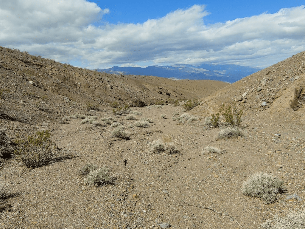
A series of washes cut across the desert at the base of the mountain for a few miles. Unfortunately, they flow down from the higher peaks to the south which means they cut perpendicularly across the base of Tucki. This would mean a lot of small ascents and descents before even reaching the mountain.
I was surprised at how steep the sides of the washes were. It made the going difficult.

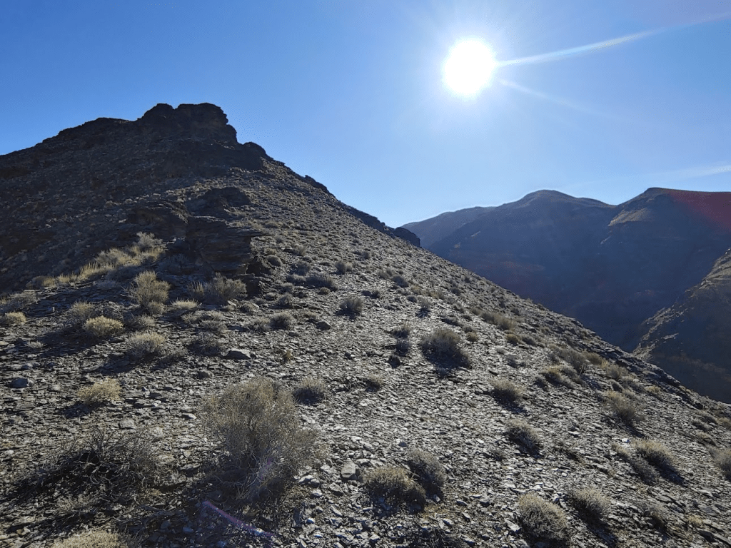
It began to get brighter even as Tucki blocked the rising sun.
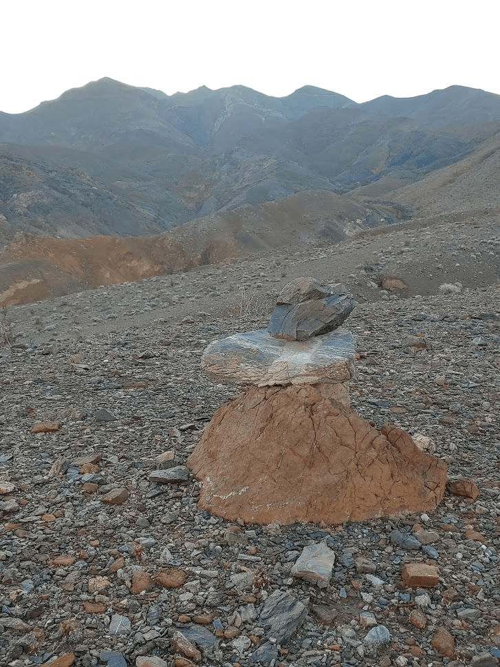
I found 3 random rock cairns at the 2.83 mile mark. They didn’t seem to lead anywhere or hold any other significance.
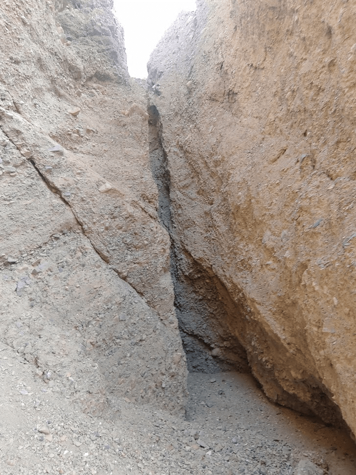
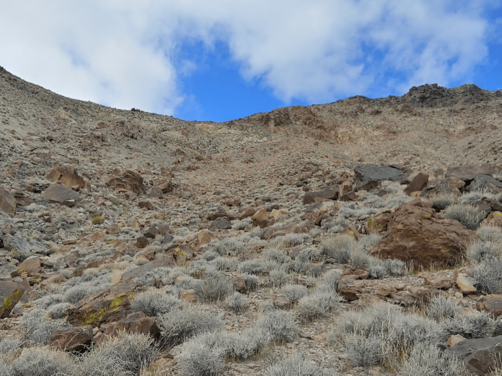
As I got near the mountain, the washes began to get narrow and steep.
I found a ramp to climb out of the wash I was currently in.
I finally was on the ridge! It had taken me about 1.5 hours to cover 3.57 miles so far. I had gained over 1000 feet already but still had about 3500 feet to gain (in about 3 miles).
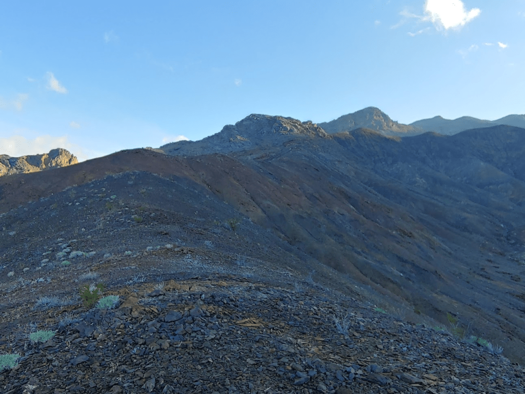
Many of the surrounding peaks were hidden by clouds.

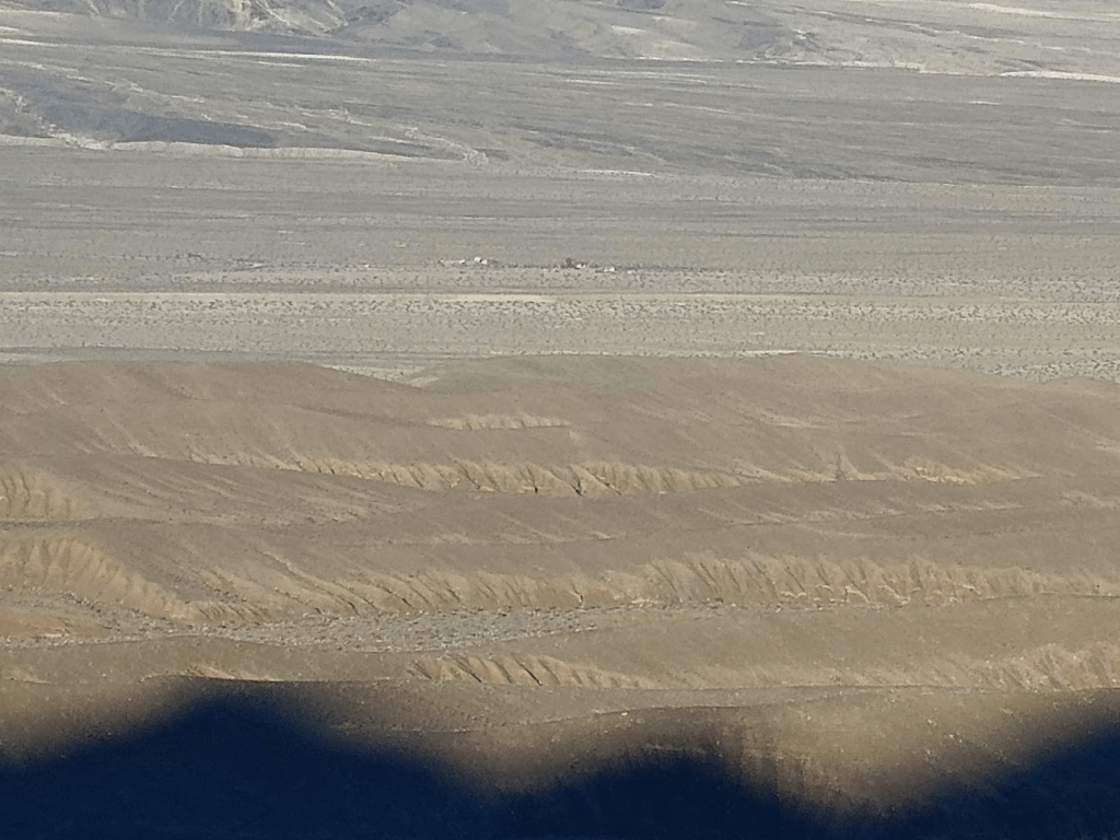
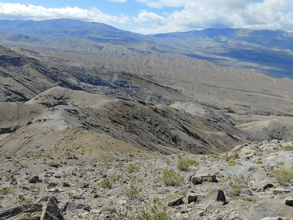
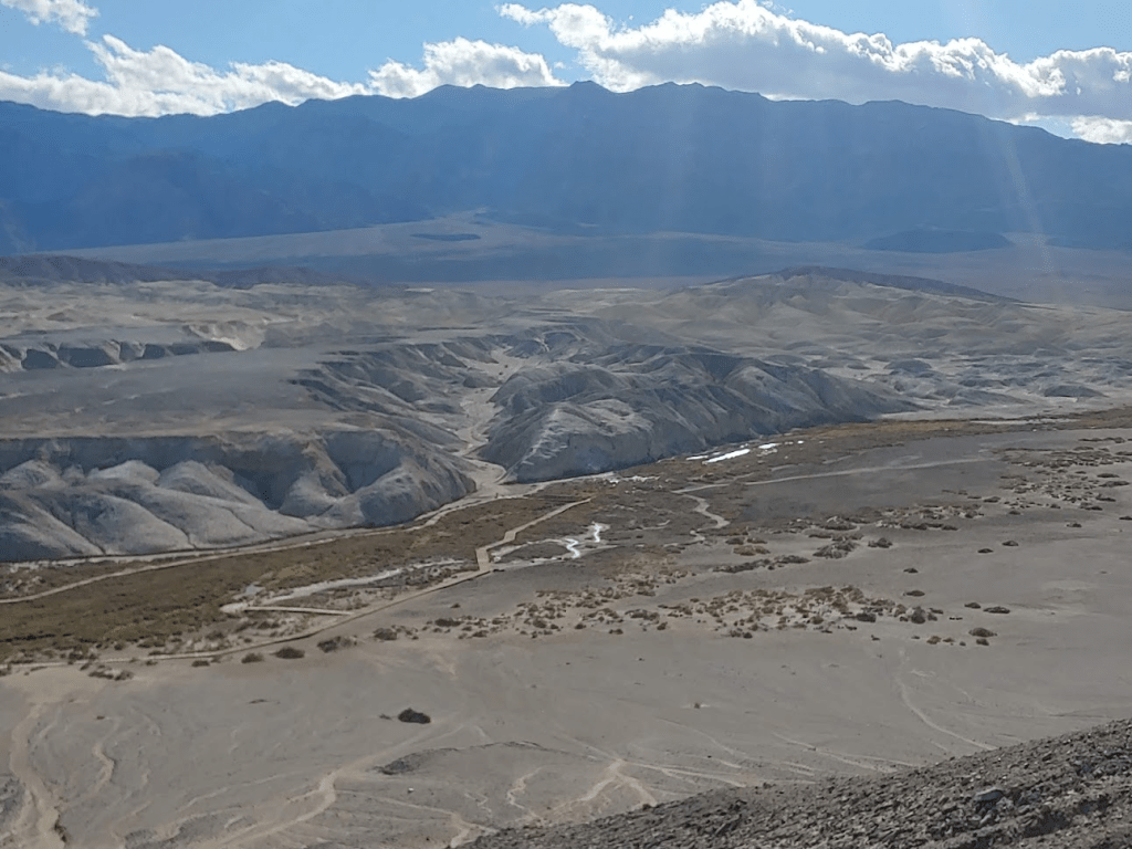
Looking behind me, I could see the route I had come up so far. The campground and ranger station are visible in the middle below, and the washes take up the entire lower half of the picture.
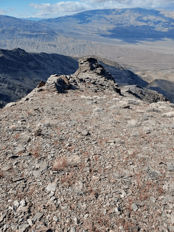
Shortly after starting up the ridge, I reached the first obstacle, a large rocky outcrop.
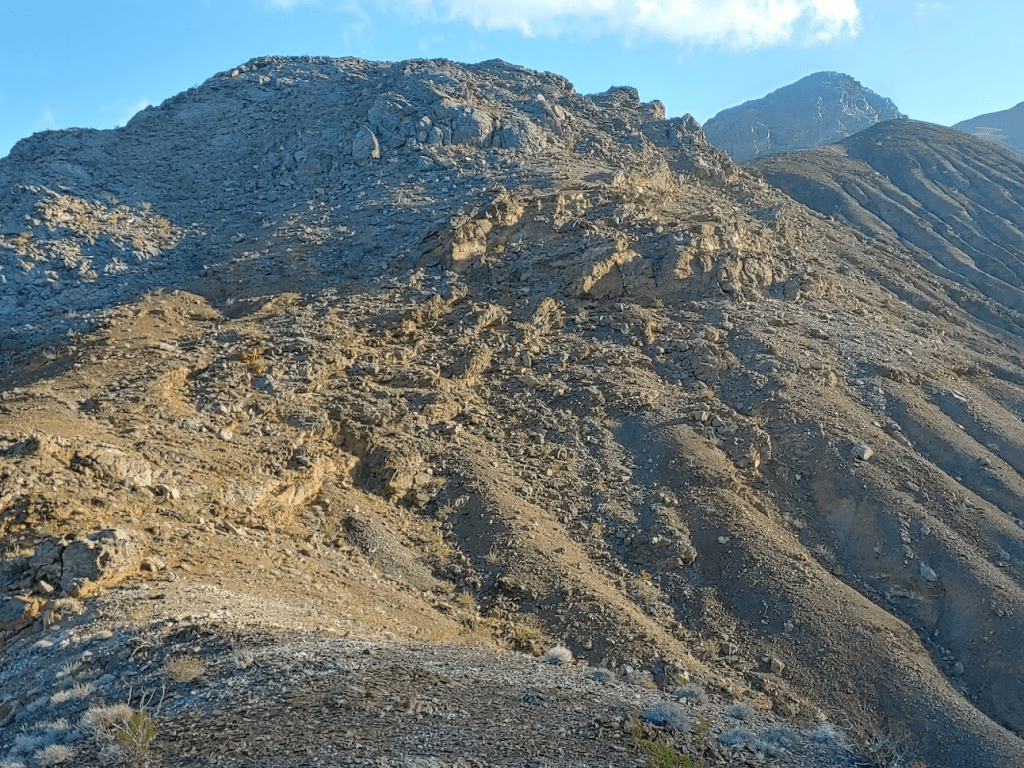
The approach to the outcrop was steep, and then I had to carefully scramble over it to reach the other side.
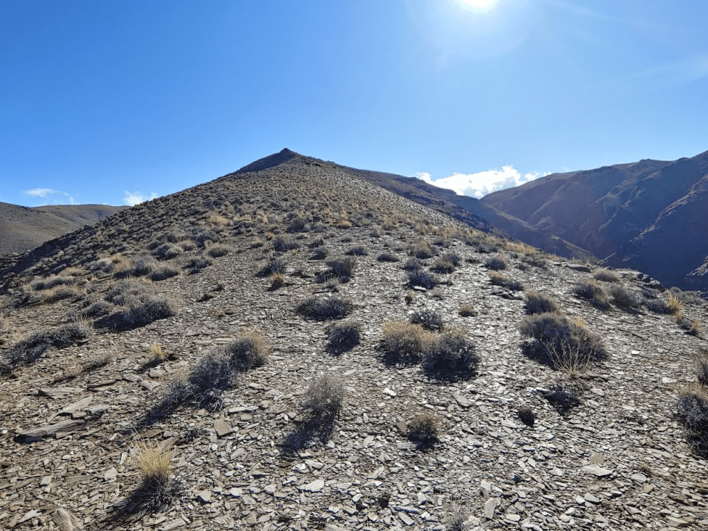
After clearing the rocky outcrop, I continued up the ridge. The sun was now peaking out above the summit of Tucki.

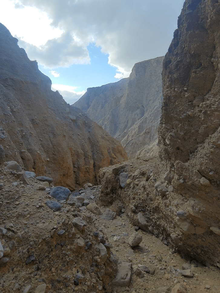
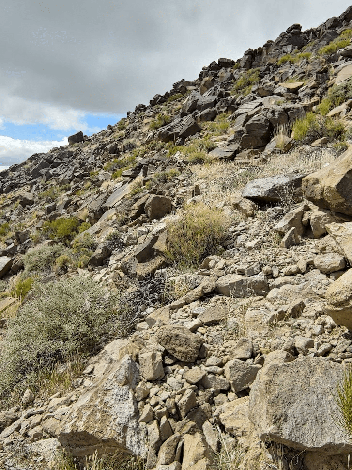
The ridge was separate by deep canyons on either side. Thankfully, the ridge itself was wide enough that I never felt unsafe.
At about 4.8 miles, the ridge gets very steep. I made slow progress up this part.

There was another rocky outcrop at the top of the steep segment.
I was able to find a way around the north (left) side. At 5.72 miles I reached the other side. I was now above 5800 feet, so just under 1000 feet to go.
The way forward from here was gentle compared to what I had ascended so far. I was much more exposed to the wind up this high, so I put on an extra layer.
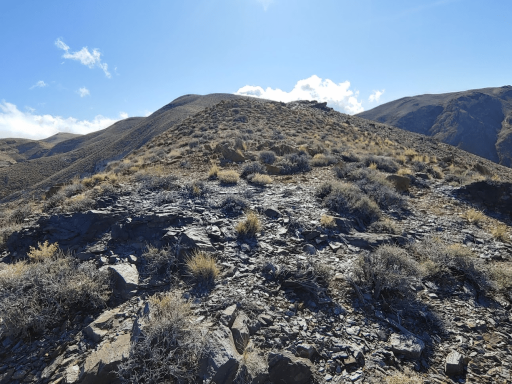
I pushed ahead to the rounded summit.

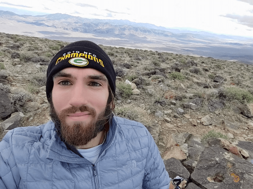
I finally reached the summit at 10:14am! I had clocked 6.8 miles so far.
The infamous “Death” benchmark is unfortunately missing, but I found reference markers 1 and 2.

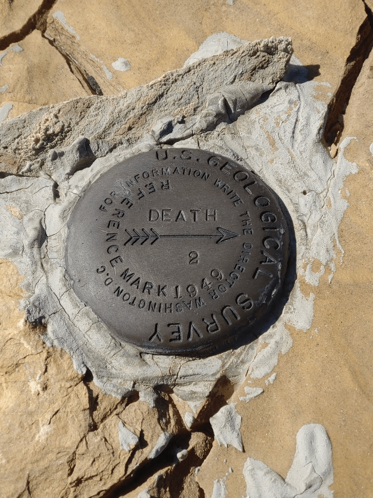
I signed the register which had been placed by the Sierra Club in 2013. I noted that the previous ascent was by a large Sierra Club party on January 19th.

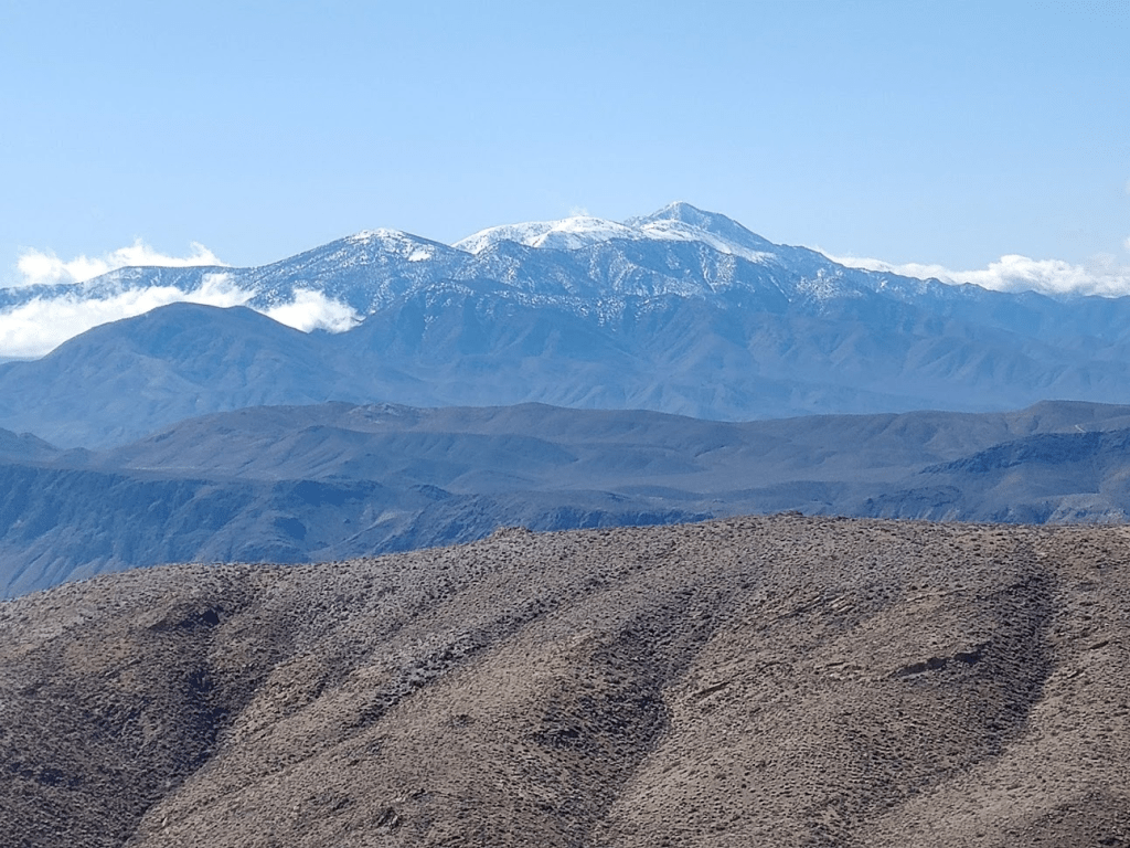
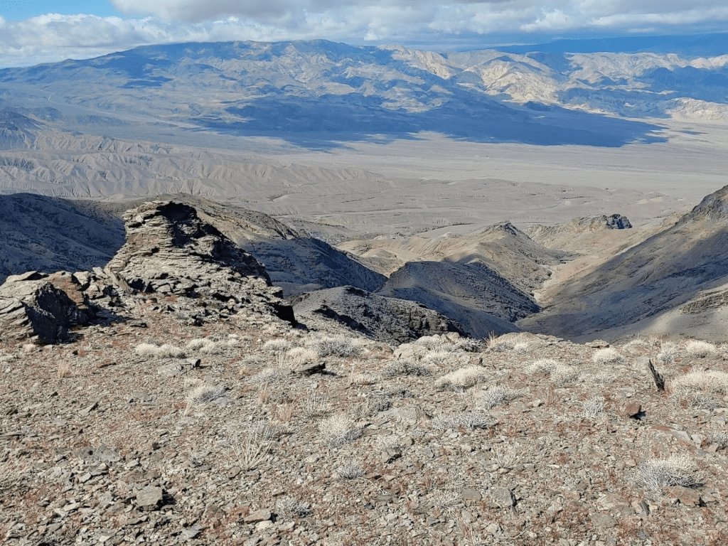
The views were nice but partially obscured by clouds in many directions. I had been hopeful to get a glimpse of the distant Sierra Nevadas and Mount Whitney, but unfortunately the cloud cover was too thick.

Fortunately, though, I had an excellent view of snow-capped Telescope Peak, the highest point within Death Valley National Park. I fondly recalled my ascent of Telescope the previous July.
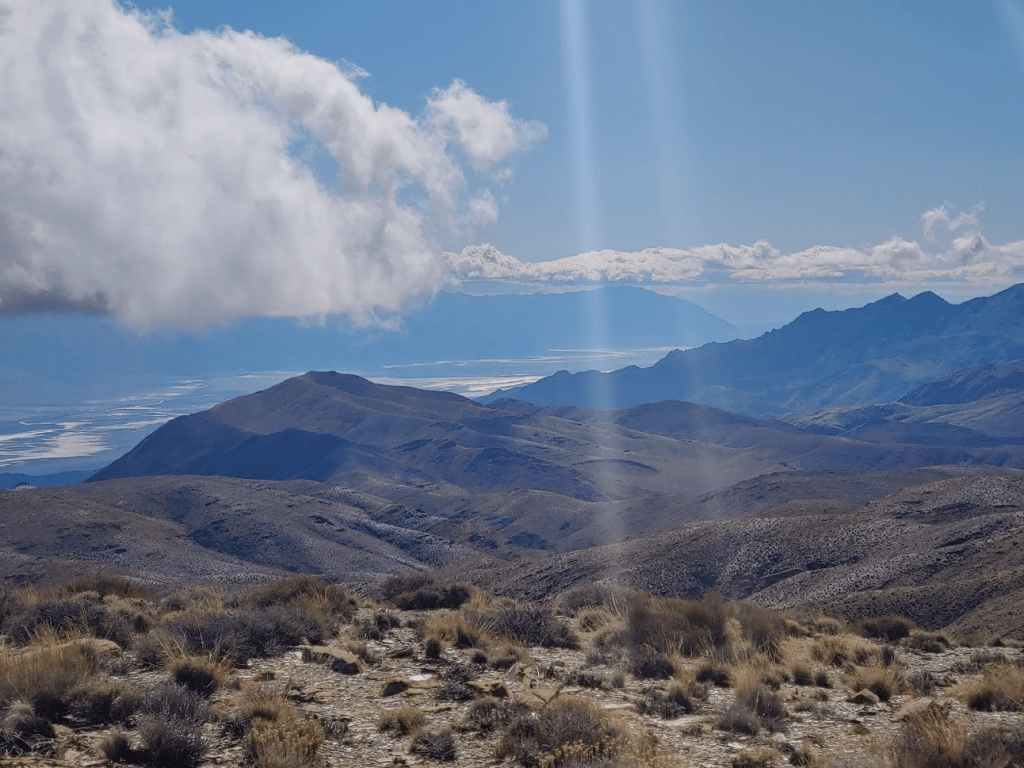
I also caught a glimpse of Badwater Basin, the lowest natural point in the northern and western hemispheres at -279 feet below sea level. Telescope Peak rises more than 2 vertical miles above the valley floor.
I stayed for nearly an hour on the summit relaxing and enjoying the views. At 11:08am, I began the descent.
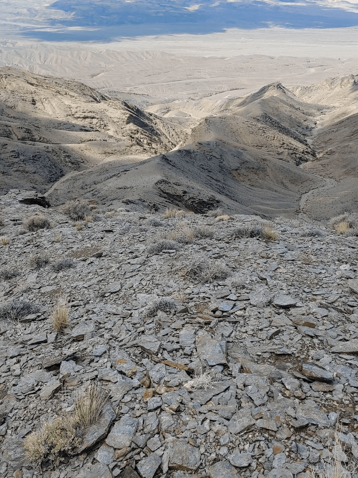
The relatively easy terrain allowed me to descend quickly. The almost complete lack of vegetation is striking, and makes for quick hiking, It felt like walking on the moon!
It took me about 50 minutes to reach the rocky outcrop above the steep section. I once again went slowly around it.
It was about another 50 minutes to get below the steep part. The wind was really starting to pick up now, even as I descended from the upper reaches of the mountain.
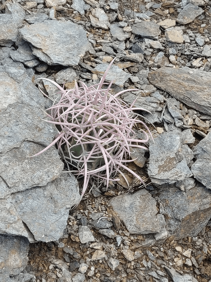
I noticed a tiny barrel cactus clinging for life on the rocky ridgeline.
At the 9.43 mile mark I reached the first rocky outcrop again.
Once around that, it didn’t take long to drop down off the ridge back into the washes.
At 12:55am I was back in the washes. I was off the mountain but still had about 3.5 miles to cover back to the car.

Going up and over each wash was much more painful now than it was earlier in the day when my legs were still fresh.
At 1:50pm I was glad to see open desert in front of me once more.
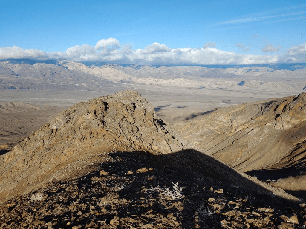
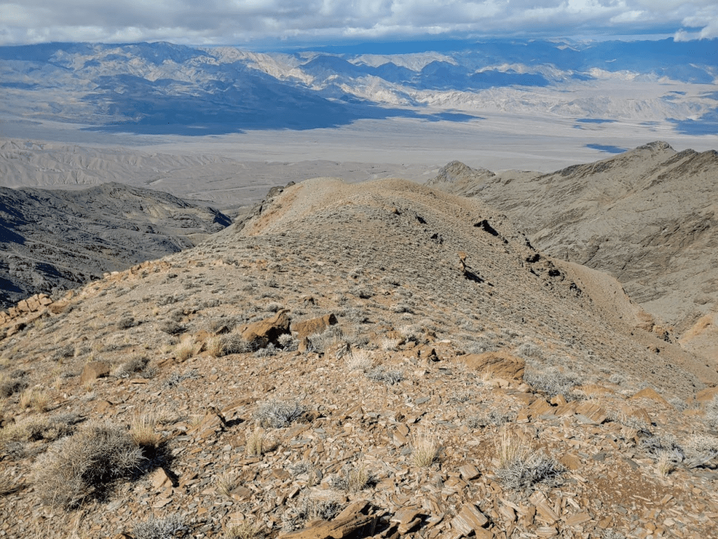
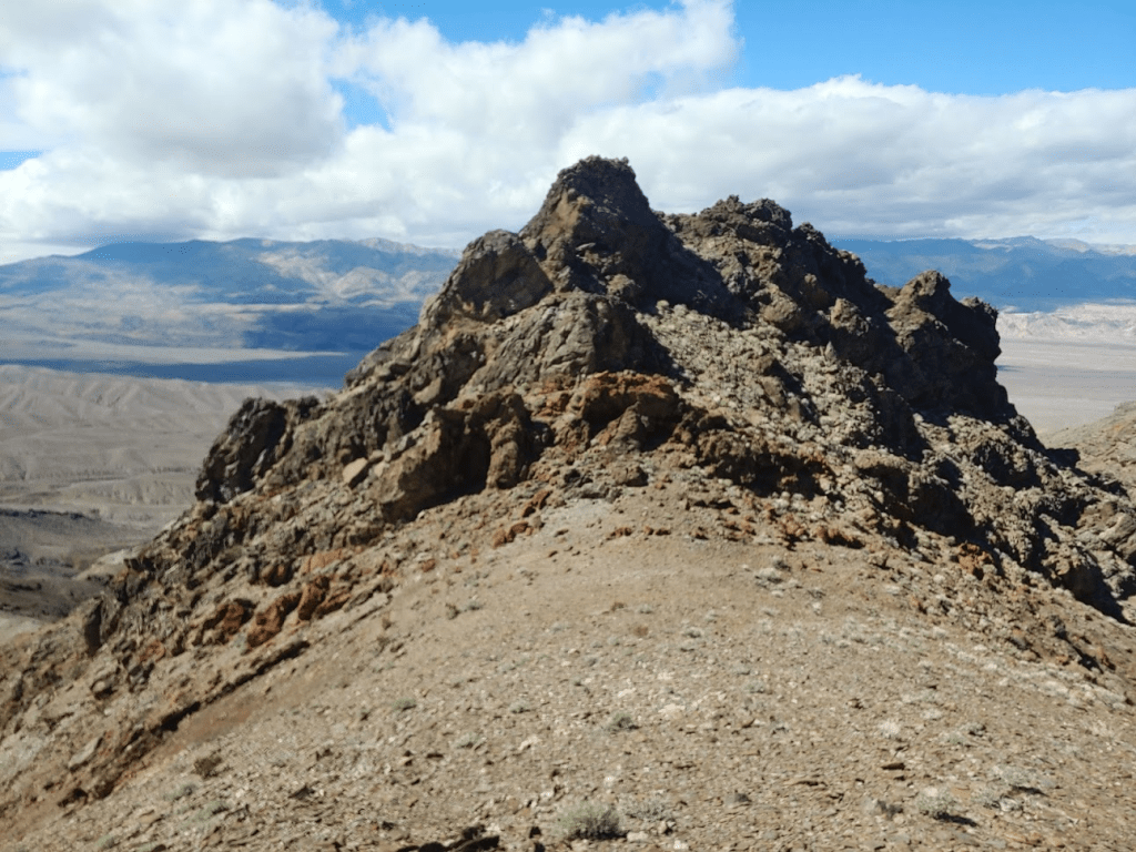
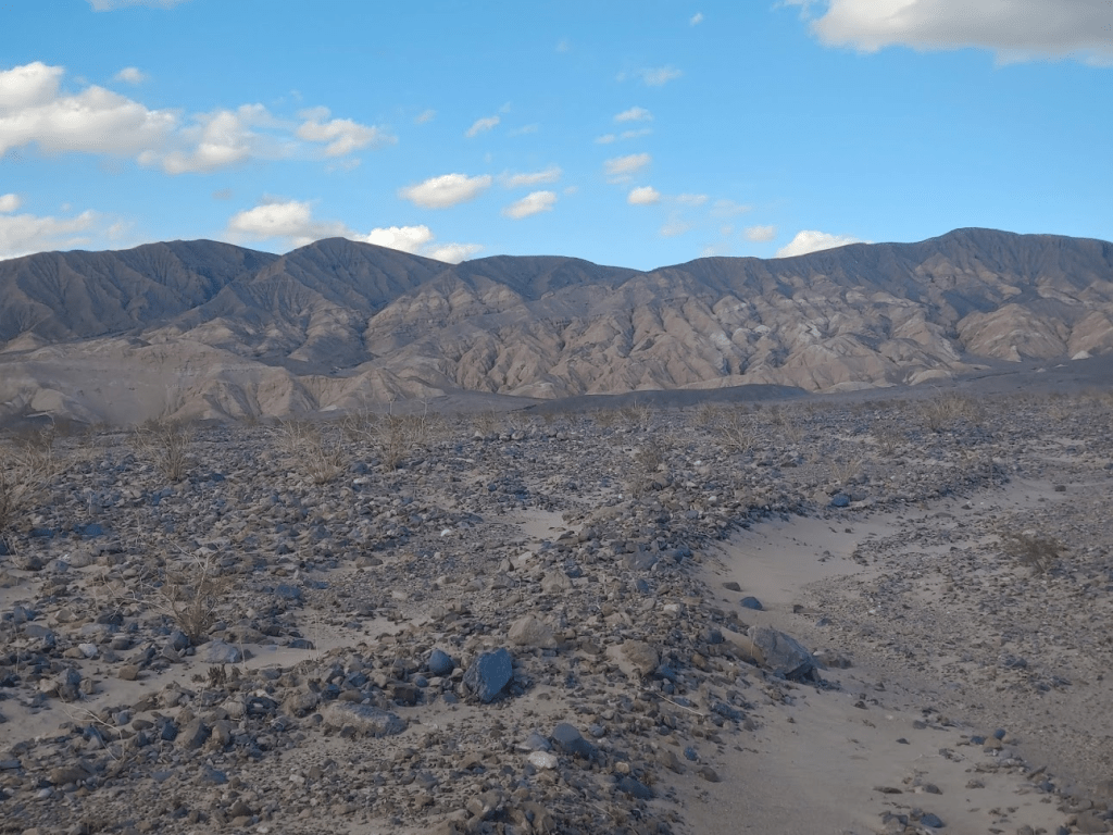
Before finishing I turned around to admire Tucki Mountain in the full light of day. What an impressive mountain! My route is the prominent ridge visible in the middle of the picture.

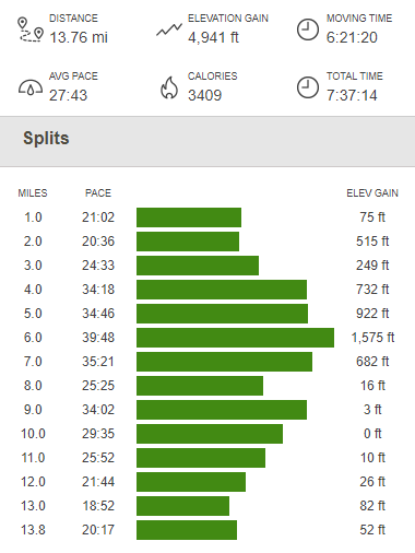
At 2:16pm I reached the car, exhausted but triumphant. I clocked 13.76 miles, 4941 feet elevation gain, and 7:37:14 total time.
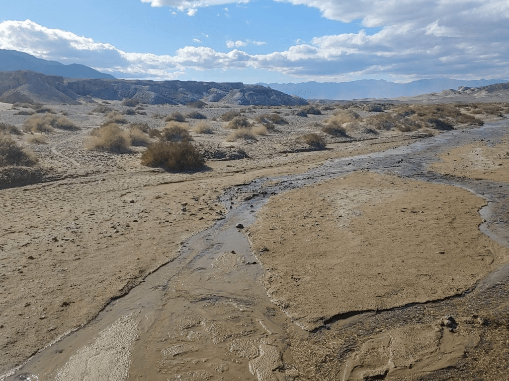
I still had a lot of daylight hours left, so plenty of time for more hiking. I didn’t want to do too much however, since I had ambitious plans for the next day as well. I decided to do the Salt Creek Trail, which is a short half mile loop with interpretative signs along the way. It was about a 20 mile drive on Highway 190 as it goes northeast through Stovepipe Wells and then turns southeast. I reached the parking area for Salt Creek around 3:45pm and saw about 6-7 other cars. I noted that I was -245 feet below sea level. Salt Creek is an actual creek that flows seasonally from a spring a few miles upstream of the trail. As the creek flows downstream, it loses water quickly due to evaporation and becomes increasingly salty. Amazingly, there is a species of fish called the Salt Creek pupfish that thrive here. The trail is on a raised boardwalk that meanders for a pleasant half mile loop through the area.
There was much more vegetation here than the surrounding plains.
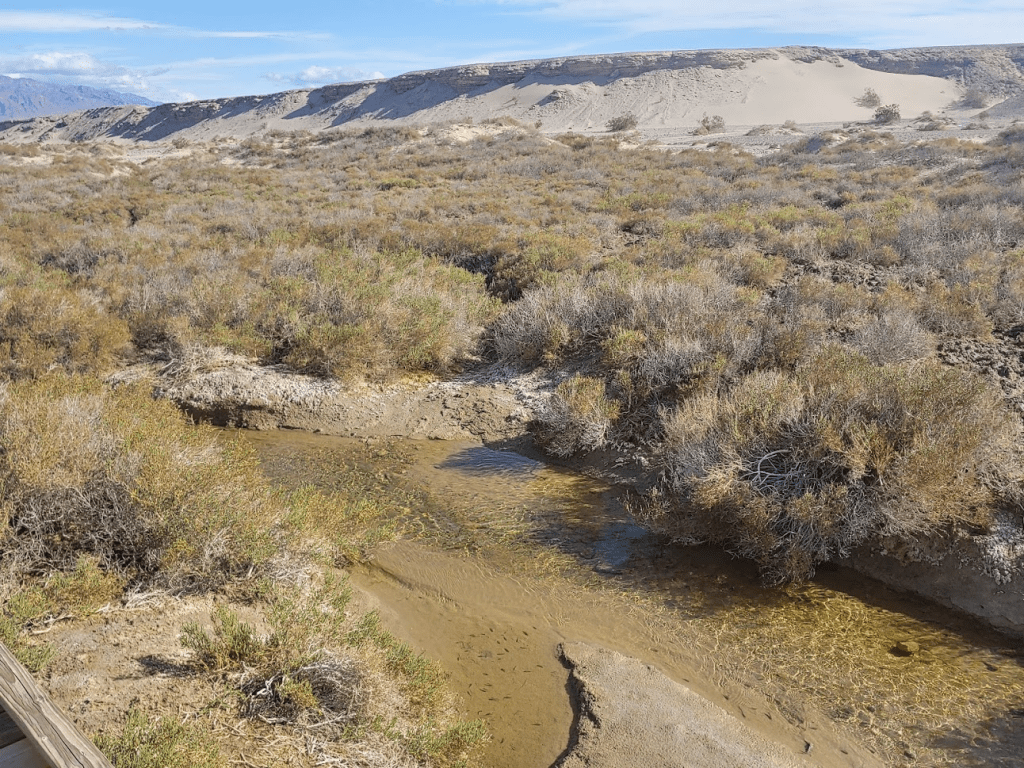
I saw hundreds of pupfish!

I decided to climb a small hill I saw on the map called Salt Creek Picnic Hill. The “summit” of this small hill is -40 feet below sea level. It was very weird climbing a “peak” with negative elevation. The view on top was nice. Salt Creek and the boardwalk looping through the area were visible below. Tucki Mountain loomed above the entire scene.
I also noted the impressive form of Corkscrew Peak to the north. I climbed Corkscrew during my February 2019 trip to Death Valley.
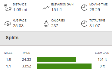
The wind was really getting strong now, and sand was blowing in my face, so I didn’t stay long. It was a quick scramble back down to the parking area. It was definitely an enjoyable hike. Sometimes I get so caught up with climbing peaks that I forget to check out the more popular tourist areas. This hike was a quick 1.06 miles, 151 feet elevation gain, and 31:07 total time.

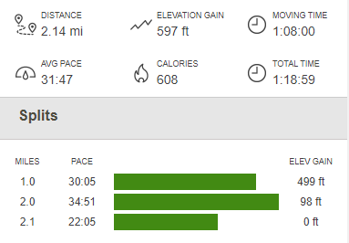
I had a little more time before I was ready to call it a day. I decided to climb to the peak of a small set of hills called the Kit Fox Hills. These hills don’t have any significance, but I thought it would be a nice hike to finish the day and watch the sun go down. I drove northwest on Highway 190 to Scotty’s Castle Road and continued a few more miles until I pulled off to the side and parked on the shoulder.
I walked across the desert flats for about a half mile. The hills actually looked very steep and appeared to be made of crumbly clay/mud material. As I got closer, I began to doubt whether I would be able to climb them. I started up a steep narrow wash.
Eventually the wash ended at a solid wall.
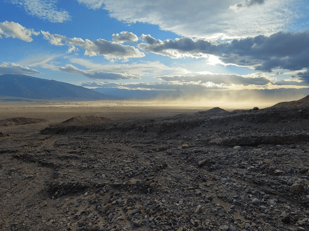
There were a few ramps I attempted to climb but was unable to reach the top due to the loose, crumbly nature of the rocks. I estimated I was only 10-20 feet below the summit, but unfortunately, I could not continue. If I had all day, I probably could have found a way up, but I was exhausted and I didn’t really care about this peak, so I just decided to head back to the car. As I walked back, the wind was now in full force. I had to shield my eyes against the blowing sand. The sand blowing off of the nearby Mesquite Sand Dunes made for a cool effect against the setting sun.
My failed attempt on the Kit Fox Hills totaled 2.14 miles, 597 feet elevation gain, and 1:18:59 total time.
It was getting late now, so it was time to find a place to camp. Since Death Valley is a national park, there are much stricter rules on where you are allowed to camp. It’s not like Anza Borrego where you can pretty much park your vehicle or pitch a tent anywhere. I decided to just bite the bullet and stay the night at Stovepipe Wells Campground. This is a large NPS campground with over 100 sites, but it is basically just a large dirt parking lot with the sites arranged like parking spaces. It generally doesn’t fill up though, even on spring weekends, so I was able to get a spot for $14. The campground was probably about half full, but it was noisy and still felt crowded. Furthermore, Stovepipe Wells sits at sea level, so the temps were still in the 70s as I tried to go to sleep. Thankfully, my exhaustion triumphed over all this and I had an excellent night of sleep.
Day 3
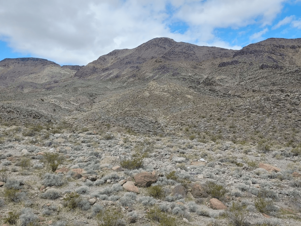
I woke up at 5:15am, trying to get an earlier start than the previous day due to the very long hike I had planned. My plan was climb Towne Peak and Panamint Butte from Highway 190. I was expecting something like 16 miles and 5000 feet of elevation gain. Towne Peak is named for Towne Pass, which is where Highway 190 crosses over the Panamint Range as it travels from Panamint Valley to Death Valley. I drove from sea level in Stovepipe Wells to 4951 feet at Towne Pass in about 17 miles. I noted the temperature went from 60 degrees on the valley floor to 38 degrees at the top of the pass. The wind was howling as I got out of my car, and I began to wonder if it would be too cold for this hike. I started up a rocky slope at 6:27am in near darkness. It took me a half hour to reach the top of the slope. I had already gained 800 feet in 0.7 miles. The route from here simply follows a ridge for about 2.5 miles to 7287 foot Towne Peak. However, I noticed that the summit and much of the route was covered in clouds.
As I started walking along the ridge, I came upon a survey marker. This very ridge used to be the park boundary when Death Valley was still a National Monument. When Death Valley was elevated to National Park status in 1994, land was added to the west, so the ridgeline is not longer the current boundary of the park. Apparently, there are many of these markers along the ridge still.

I proceeded for about a half mile until about the 6000 foot mark when I got into the clouds and could no longer see very far in front of me. I considered my options at this point. It was extremely windy and bitterly cold, and I was now faced with a very long hike with limited visibility. I made the tough decision to turn around. I was anticipating a 9-10 hour hike, and I just couldn’t justify continuing in such conditions. I got back down to the car just before 8am. I clocked 2.7 miles, 1102 feet elevation gain, and 1:29:22 total time on this failed attempt.

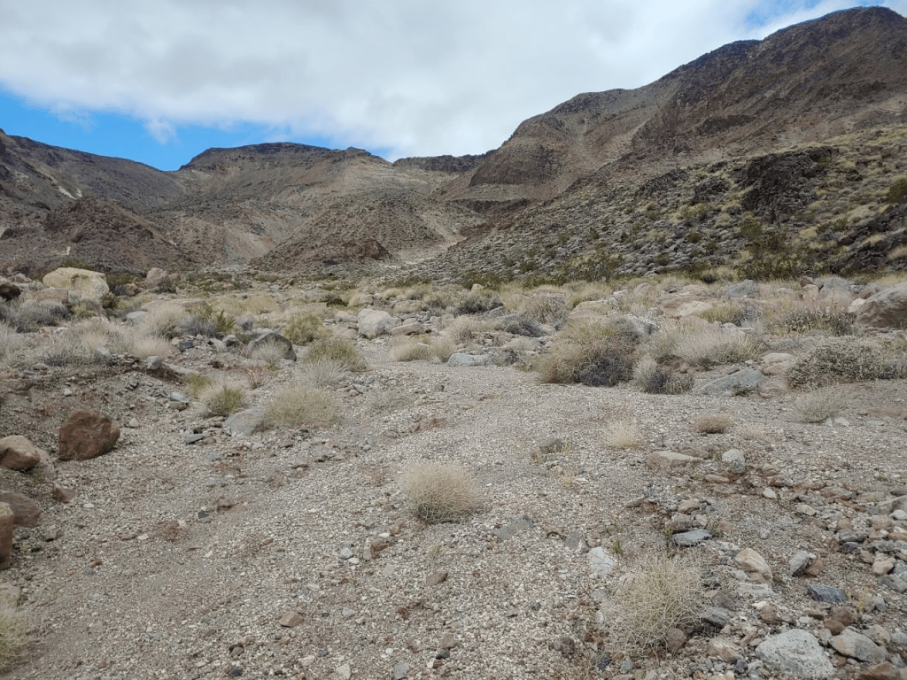
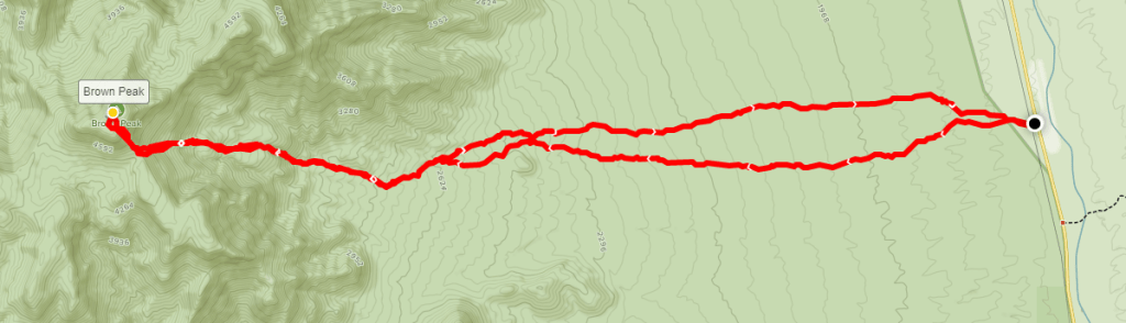
I was pretty discouraged at this point. I was chilled to the core, and I didn’t have a great idea for another hike to do off the top of my head. Thankfully, I typically download some offline information for nearby peaks in case I ever need a backup plan. I had info for a few other DPS peaks in Death Valley downloaded to my phone (as well as Zdon’s book), so I looked though what I had to determine my plan of action. Unfortunately. most of the peaks in Death Valley involve long, rough 4WD approaches, which I didn’t really have time for at this point, nor the patience. I also knew I needed to find a lower elevation peak to avoid hiking in the clouds. Finally, I discovered, an alternate route for a peak at the southeastern corner of the park called Brown Peak. The main route involved a long dirt road approach, but I read some information about another route that is quite a bit longer but starts from the side of a highway. It would still be a long drive to get there, but I was rejuvenated with the new plan I had come up with. I drove back down on Highway 190 through Stovepipe Wells, and then southeast through Furnace Creek all the way to Death Valley Junction. Here, I went south on Highway 127 a few miles before parking on the side of the road. The weather here was much nicer. I had a nice view of 4947 foot Brown Peak as I began hiking at 9:47am from 1813 feet.
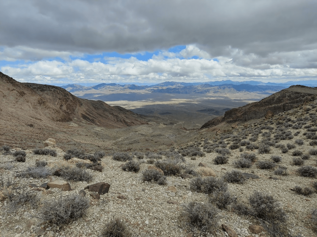
This route would involve a long walk across open desert before reaching the base of the mountain. The terrain started out very gentle, and there were no prickly plants to contend with.
The long walk across the desert was pretty flat, so I knew a lot of elevation gain was still to come.
At 3.33 miles I entered a large sandy wash that headed towards the peak.
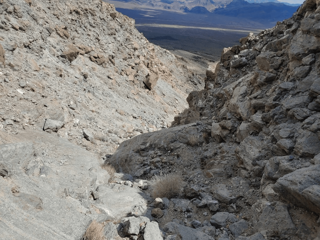
After a mile the wash narrows and gets very steep as it begins to climb. I was at the 3000 foot level. I knew I had nearly 2000 feet still to climb in a little over a mile.
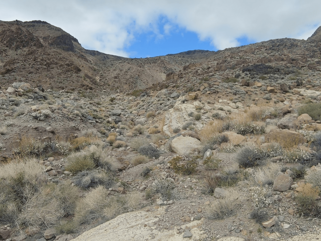
I reached the top of the wash at the 3400 foot level as it spilled out into a large bowl. I surrounded by steep walls on 3 sides with the summit directly ahead.
I reached the 3700 foot level below a steep slope made of extremely loose rock. This part was very difficult. It was 2 steps forward, 1 step back.

I reached the top of the slope around 4400 feet. I was now on the ridge just 500 feet below the summit. It was still a steep climb here, but the ground was much more solid, so it was a bit easier.

The last 100 feet were easy as I approached the rounded summit.

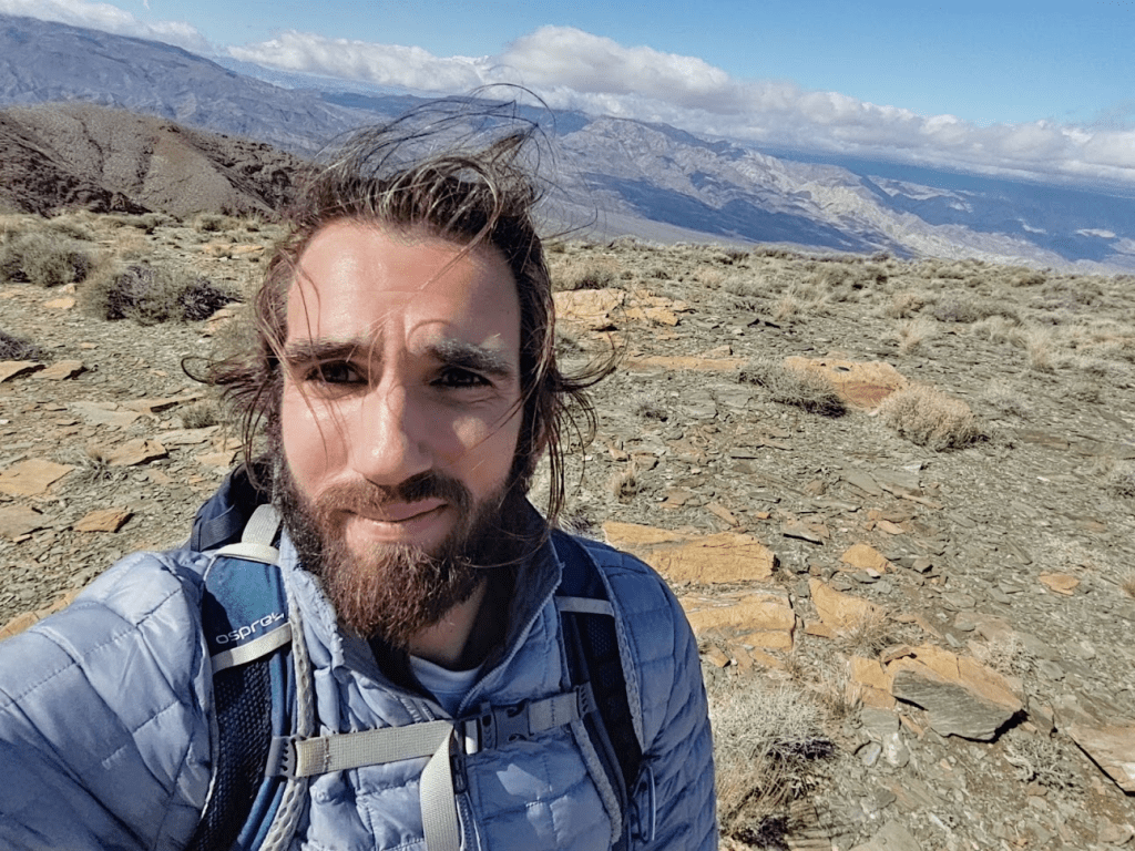
I finally reached the summit at 12:23pm after 5.52 miles of hiking. I had been pretty comfortable for most of the hike but was now exposed to the wind once more on the summit, so I bundled up as I relaxed and enjoyed the views.
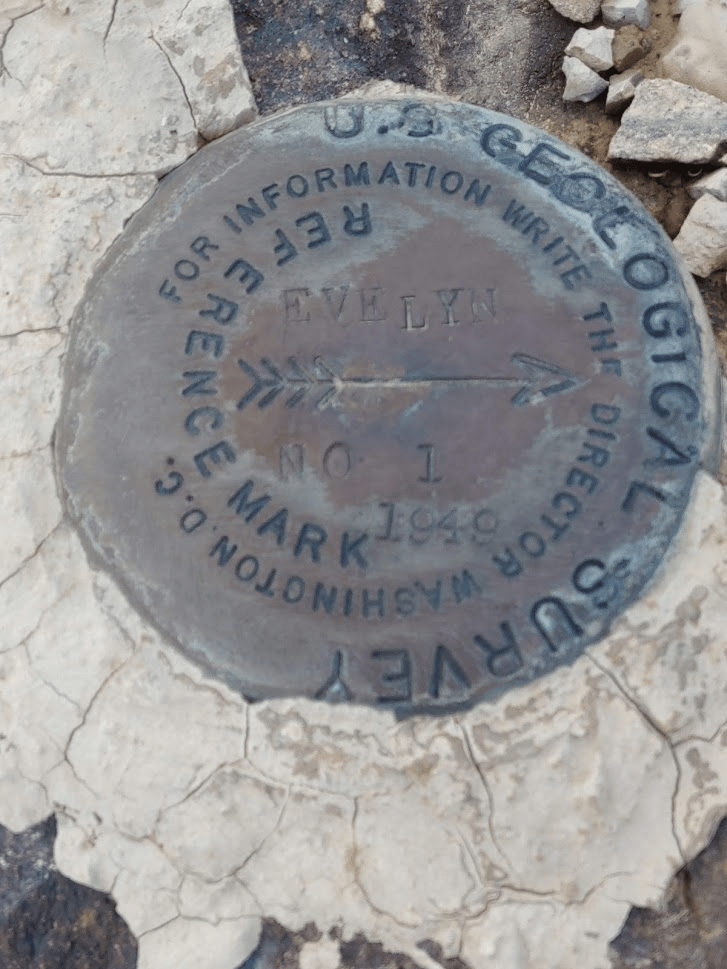
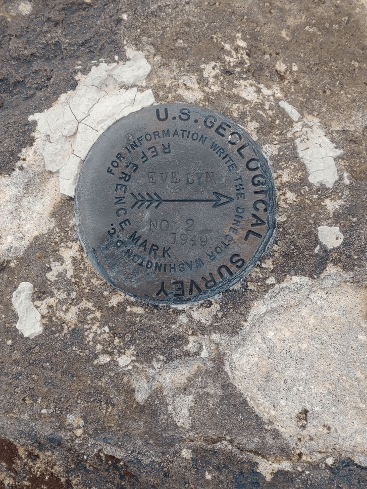
I found the “Evelyn” benchmark and 2 reference markers.

I was the 2nd person to sign the almost brand new summit register. I noted that the inside cover said Property of Death Valley National Park, which surprised me since most registers I find are placed by the Sierra Club or random climbers.

It was still pretty cloudy which ruined the views somewhat. I did have a pretty good view of Telescope and the other high peaks of the Panamint Range.
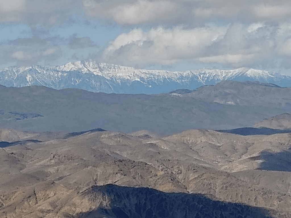
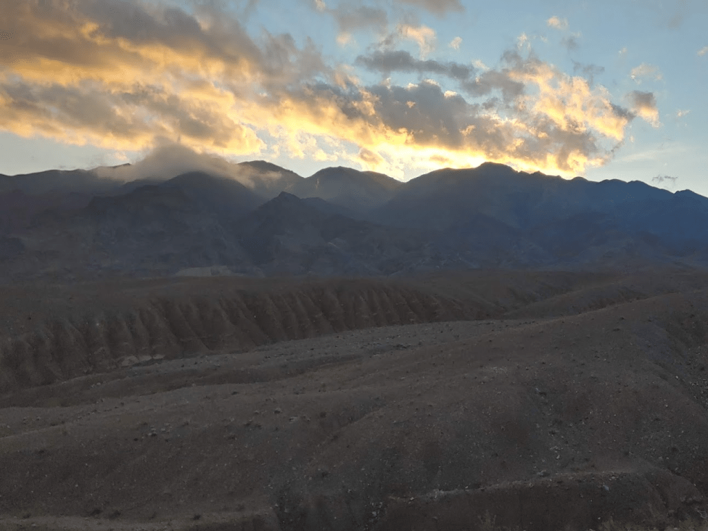
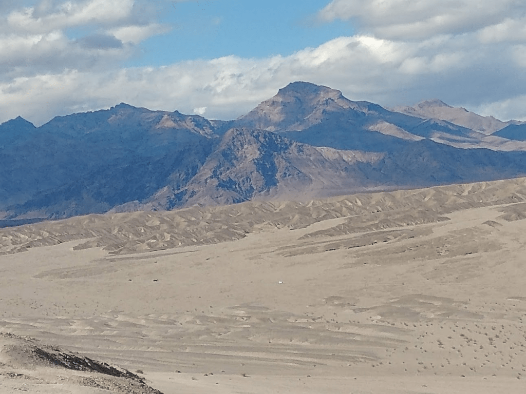
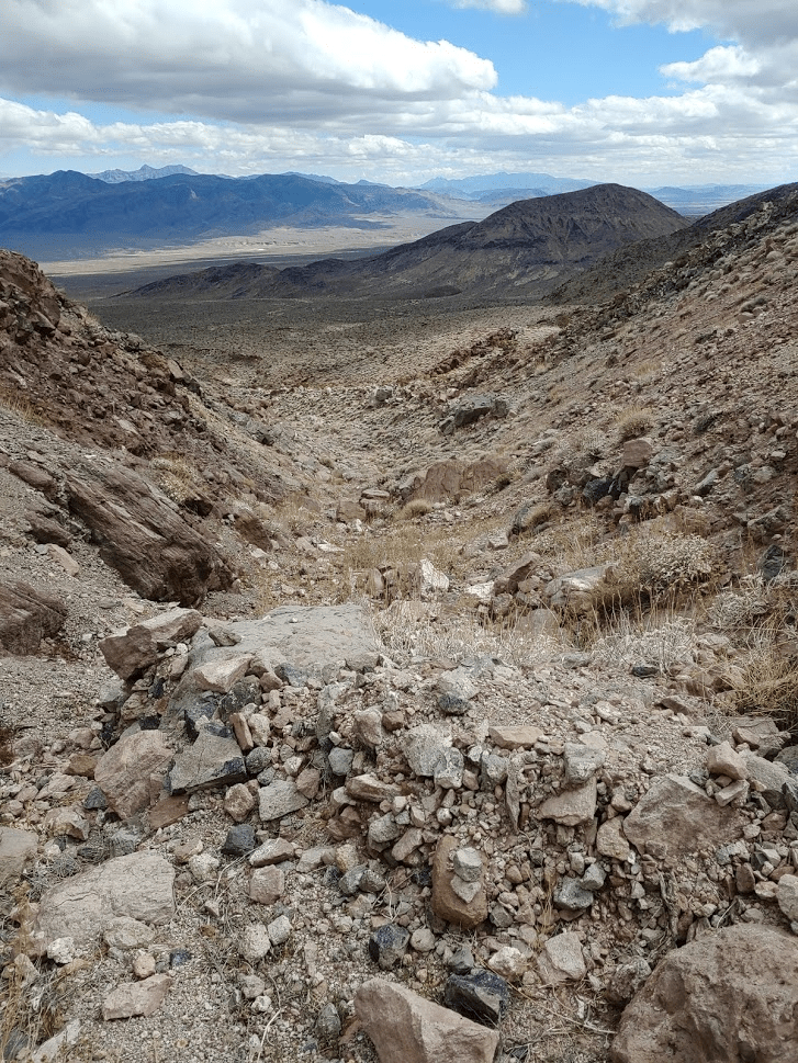
I was able to identify many other nearby DPS peaks, including Kingston Peak, Avawatz Peak, Stewart Point, Pahrump Point, and Pyramid Peak. I was a little disappointed to have no view of Mount Charleston just across the state line in Nevada. Pictured below is Nopah Range High Point.

I only remained on the summit for 30 minutes since that was all I could stand due to the wind and cold. It took me 15 minutes to descend the ridge back to the saddle.

I immediately warmed up once I was off the ridge and no longer exposed to the chilling wind. The steep slope of loose rock was 10x more fun to descend then ascend. I was able to “surf” down portions of it.
In 30 minutes, I had reached the top of the wash. I carefully negotiated the steeper parts of it.
It took about 15 minutes to get down to the base of the mountain.
From here, I still had well over 4 miles to the car, but it would be easy to walk across open desert after what I had just done.

I reached the car at 3:20pm. This hike covered 11.2 miles, 3087 feet elevation gain, and 5:28:20 total time.

I decided that Brown Peak was a very enjoyable climb, with a nice variety of terrain. It had it all – open desert, rocky wash, loose rocky slope, and steep ridge. It also had been a very nice backup after my initial plan fell through. It had really been a great weekend, and I was very happy to get out of the city away from all of the Coronavirus news and whatnot. I enjoyed the long drive back to San Diego feeling good about all of my accomplishments.
