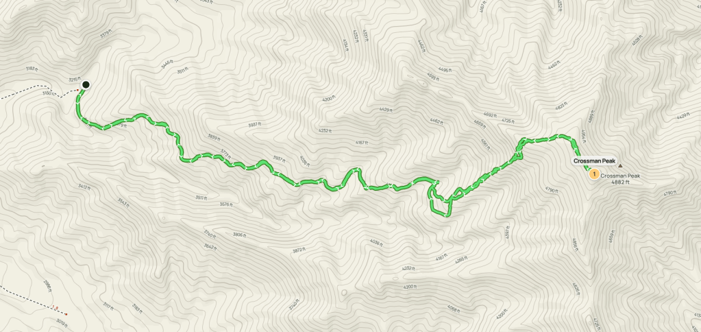
Crossman Peak
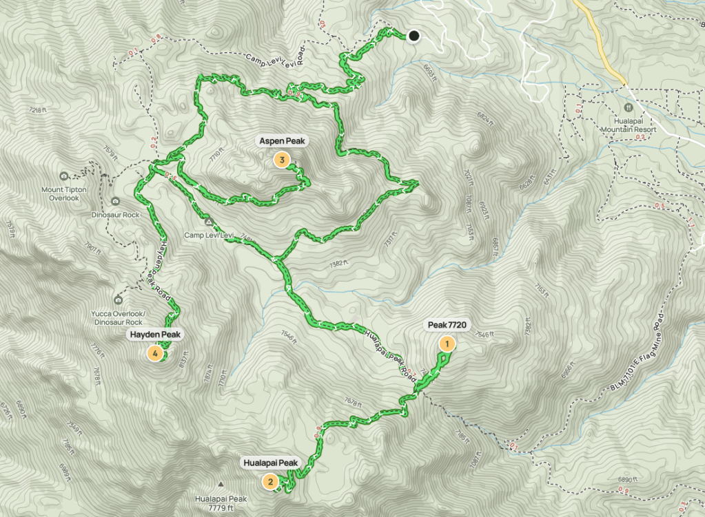
Crossman Peak is a 5100 foot peak located in western Arizona. Despite the low elevation, it has over 3000 feet of prominence and rises impressively above Lake Havasu. Crossman would be my first stop on a 3 day road trip to the area to climb some desert peaks. I had been staying in Palm Springs during the week with my family, so it was a quick and painless 3 hour drive to the trailhead. It was amazing to not have to sit in traffic for hours trying to get out of Southern California. From Bison Blvd on the east end of town, I drove northeast on dirt roads for a few miles and then parked at the final sharp turn before the locked gate. There are many dirt roads in this area, but I generally just stayed on the main one and didn’t have an issue staying on the right track. The road was bumpy and severely washboarded in places, but it was an easy drive in my Subaru. The parking area is flat and has space for a few cars. I woke up the next morning and began hiking at 6:41am from 3150 feet above sea level.
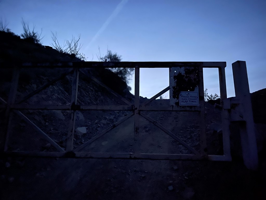
Even though it was nearly 7am, it was still pretty dark since I was on the western edge of the mountain time zone. I could see the crescent moon above a distant ridge.
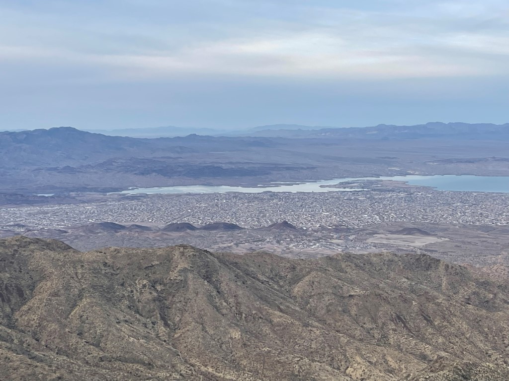
I could see the lights of Lake Havasu City behind me.

The dirt road continued past the locked gate. The road continues up to the radio towers seen below, which aren’t quite at the summit.

The road was boring so at 1.2 miles I climbed directly up a ridge.
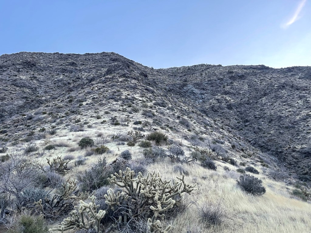
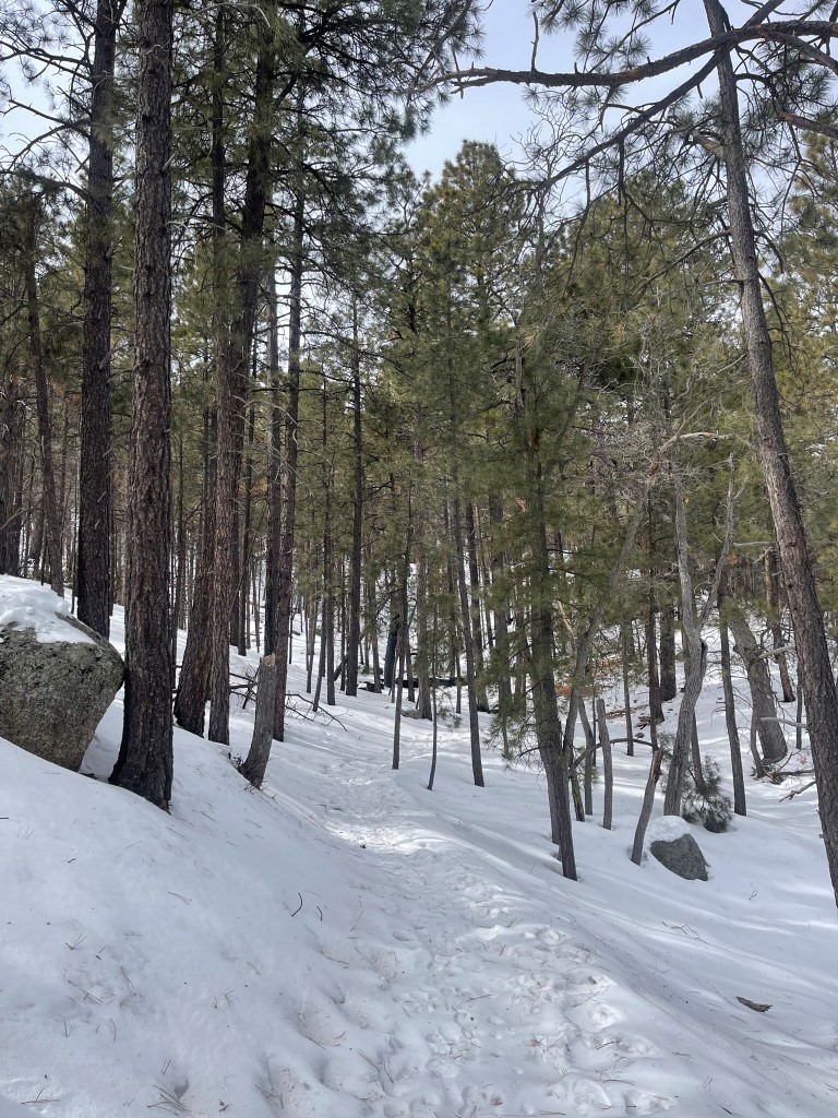
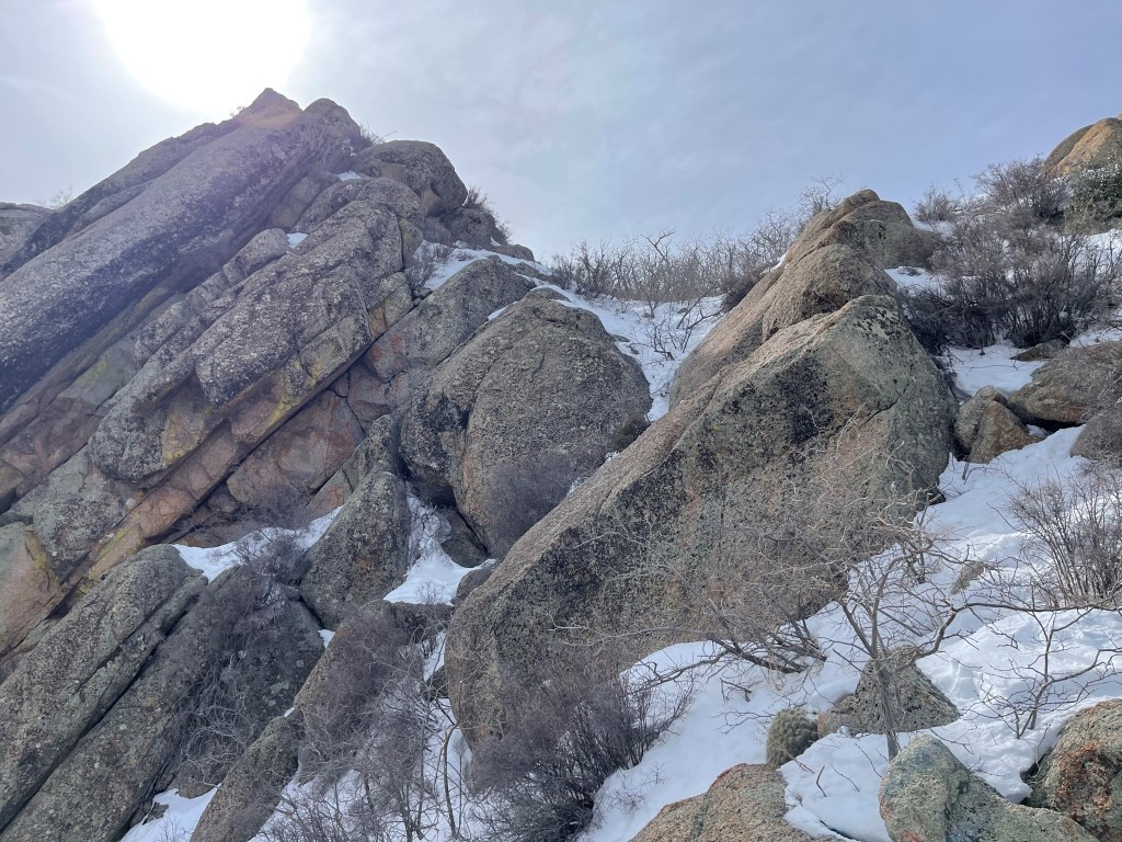
The cross country travel was easy on this peak. I soon reached the summit ridge and found the use trail that connects the road to the summit. I was surprised to see a few Joshua trees. I had no idea they grew outside of California.
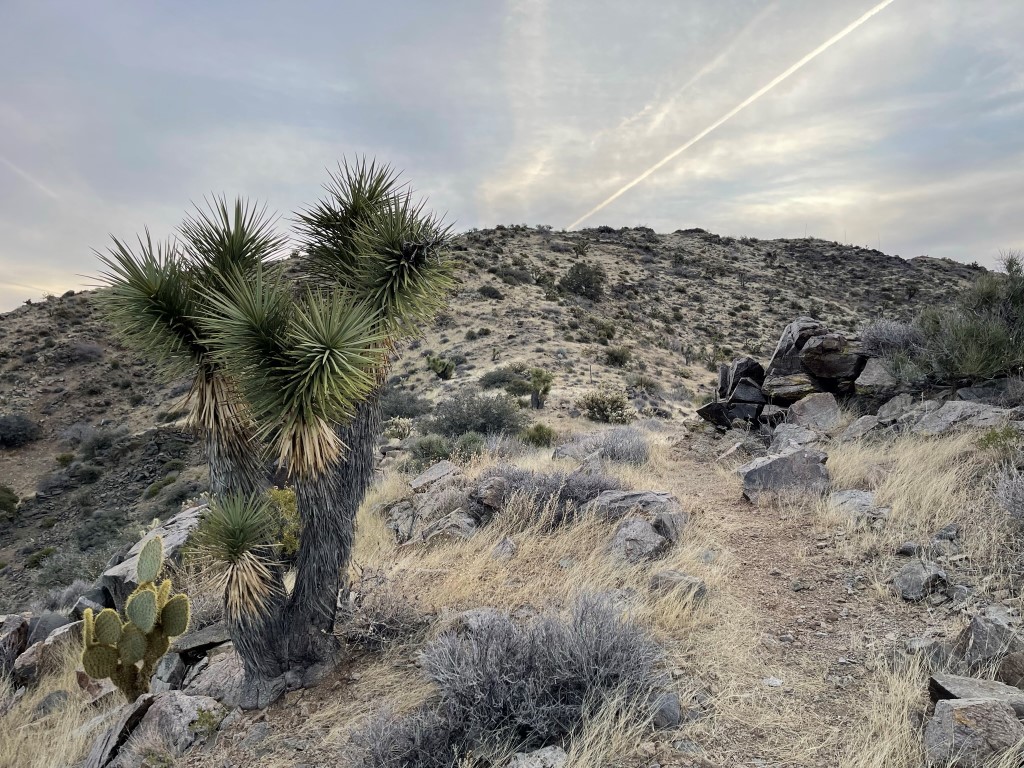
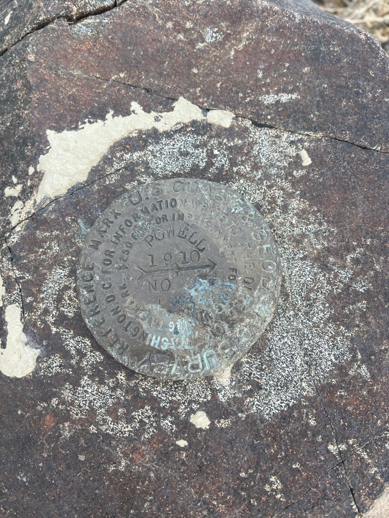
I reached the summit at 7:43am at 1.75 miles! I signed the register which was placed in 2017. The most recent entry was from January 23. I located one “Powell” reference marker.
The sunrise view was nice despite some cloud cover.

Lake Havasu to the west, with the Whipple Mountains on the left:
I retraced my steps back to the car. I passed one hiker on his way up. I also stopped quick to check out a mine just off the road.

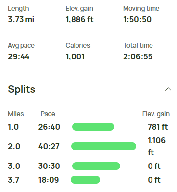
I reached the car at 8:49am. Stats for this hike were 3.73 miles, 1886 feet elevation gain, and 2:06:55 total time.
Hualapai Peak, Peak 7720, Hayden Peak, and Aspen Peak
Hualapai Peak is an 8417 foot peak located southeast of Kingman. It has over 4000 feet of prominence and is the highest mountain in northwest Arizona. From the town of Kingman on I-40, I drove about 12 miles on paved Hualapai Mountain Road to the trailhead. The area is a Mojave County Park, and it has a campground and cabins in addition to trails. I stopped at the entrance station and paid $10 to get in. The lady working there wouldn’t let me in unless I had microspikes or snowshoes. I began hiking at 11:13am from 6762 feet above sea level. It was 35 degrees.

I proceeded up the dirt road and then turned left onto the trail. The trail had a nice boot path so it was easy to follow.
The trail made a couple switchbacks as it steadily gained some elevation. At 0.9 mile I reached the Potato Patch Loop trail junction and went left (east).
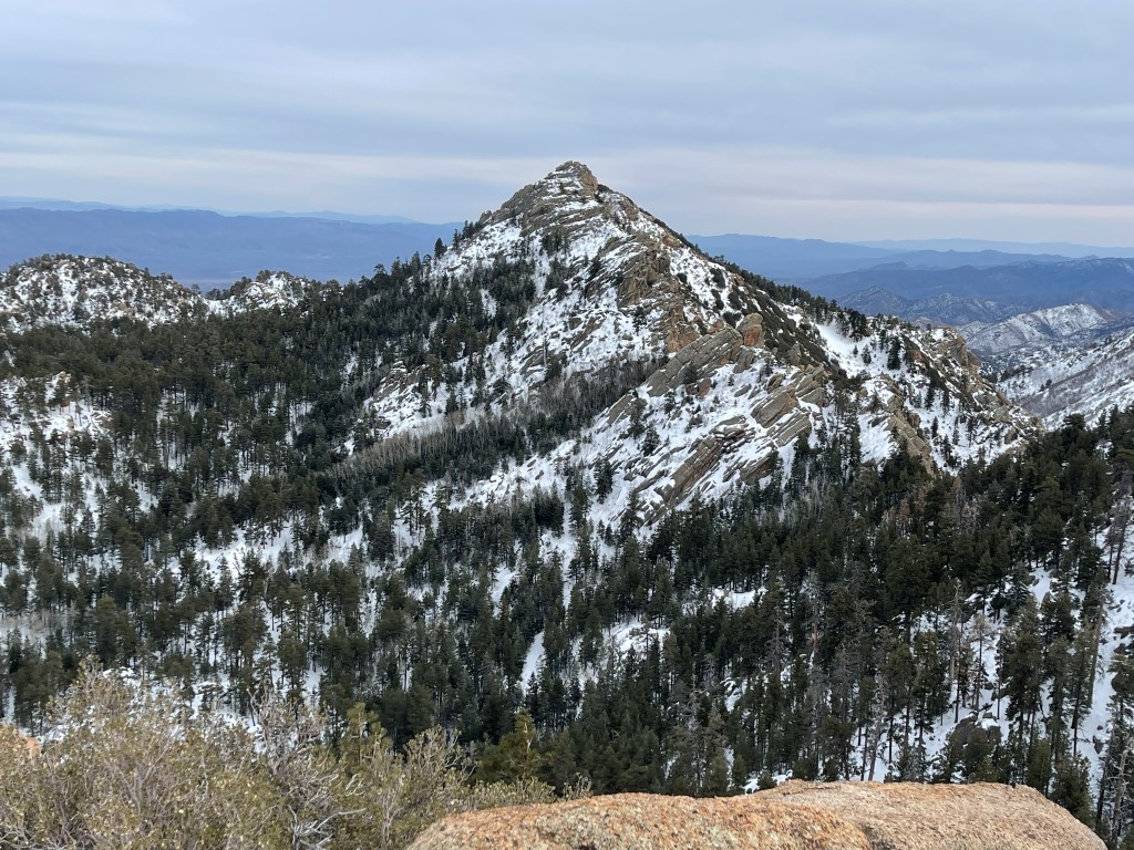
I followed the Potato Patch trail to the southeast and then southwest. The trail was much dryer on the section that crossed the southern slope of Aspen Peak. I got my first good look at Hualapai Peak.

At 2.3 miles I reached the Hualapai Peak trail, which is actually an old road. There were a few ups and downs as I crossed a few creeks.

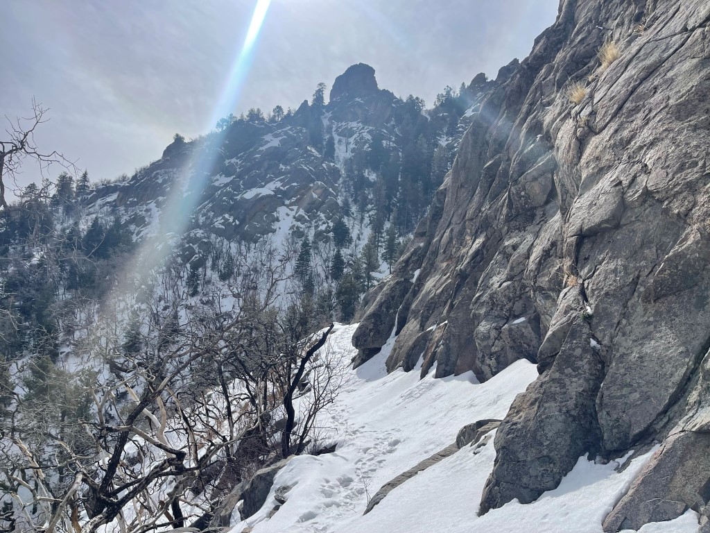
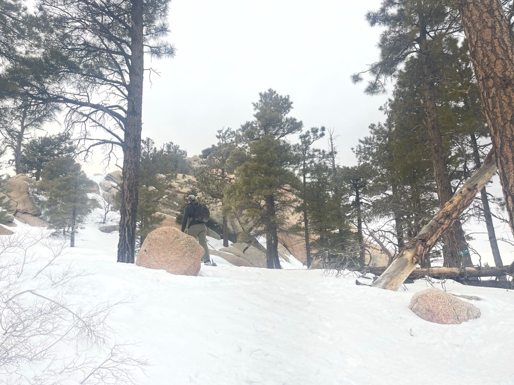
The snow was getting deeper as I climbed. There were no footprints to follow so I had to break trail the rest of the way up.

It was a bit tedious, but I made decent time to the base of the summit block where the road ended. I tried to climb it from the south but encountered a large crack that looked beyond my abilities, especially with so much ice present. I probably could have climbed it but was much less certain about the downclimb (and at this point I wasn’t sure there would be an easier way down on the other side). I then tried climbing it from the east which was much simpler.
I climbed up a series of boulders and made it to the top at 1:42pm at 4.21 miles! I did not locate a register, but I did find a benchmark and 1 reference marker.

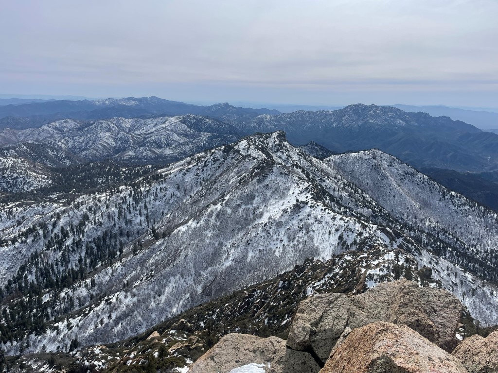
The views were excellent despite a hazy cloud layer. The rest of the Hualapai Mountains looked impressive covered in snow:
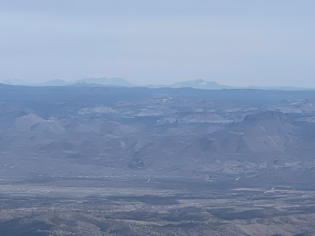
I could see all the way to Humphreys Peak near Flagstaff to the east:
To the north I could see Hayden Peak (8390 feet), the second highest peak in the Hualapai Mountains. The town of Kingman can be seen in the background.

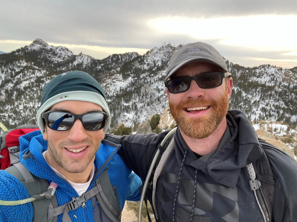
I then descended back down the road. 30 minutes or so from the summit I ran into my buddy Garret, who I was planning to meet for more desert peaks the next 2 days. He had gotten done with work early so was able to get up here with enough time for Hualapai. I then reached the spot where the road makes a sharp turn to the northwest. I left the road here to climb Peak 7720, which was 300 feet above the road. I climbed up the southwest facing slope, which was mostly dry.
I passed a false summit and then had to trudge through some snow to the top, which I reached at 2:47pm at 5.48 miles. There were a few boulders which appeared to be of similar height. I found the register at the 3rd one I visited. It was placed in 2020 and most recently signed in September of last year. There were very few entries, as expected. I had a great view of Hualapai and Hayden.

I climbed down the same way I came up and soon reached the road again. I reached the Potato Patch Loop trail junction and this time continued northwest. I hiked past a few picnic areas and shelters and then reached the Hayden Peak Trail at 7.1 miles.

The Hayden Peak Trail was also road, and this one actually had fresh tire tracks on it. The tire tracks were likely from someone servicing the radio towers on top. I reached the summit area and had to do some complicated climbing on the towers to reach the highest boulder. I was on top at 4:19pm at 8.1 miles! Hualapai Peak to the southeast:
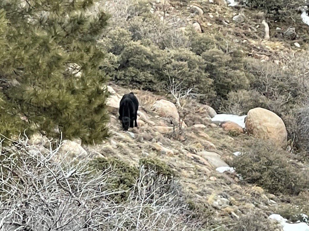
I hiked back down and reached the Potato Patch Loop Trail again. I decided I still had enough daylight left to climb Aspen Peak (8167 feet). I hiked north for a short way and then turned right onto the Aspen Peak Trail at 9.1 miles. About a third of the way up I saw Garret on his way down. He had a frantic look about him and said he had just seen a bear up ahead. We decided to check it out and discovered it was actually a cow! It seemed odd that a single cow was all the way up here, but it seemed content just walking around and eating grass.
We continued up the trail together. The trail wrapped around the south side of the peak and then ascended to the summit area from the east.
The summit block was a class 2 friction climb.

We reached the summit at 5:28pm at 10 miles!
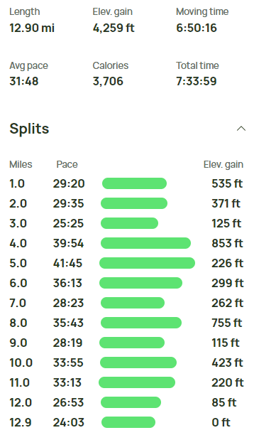
We did not locate a register or any survey markers. We descended the way we came up and saw the bear/cow again in the same spot. We reached the Potato Patch trail again and hiked north and then east back to the original junction to complete the loop. From there, we hiked back to the cars, which we reached at 6:47pm just before we needed headlamps. Stats for this hike were 12.9 miles, 4259 feet elevation gain, and 7:33:59 total time.