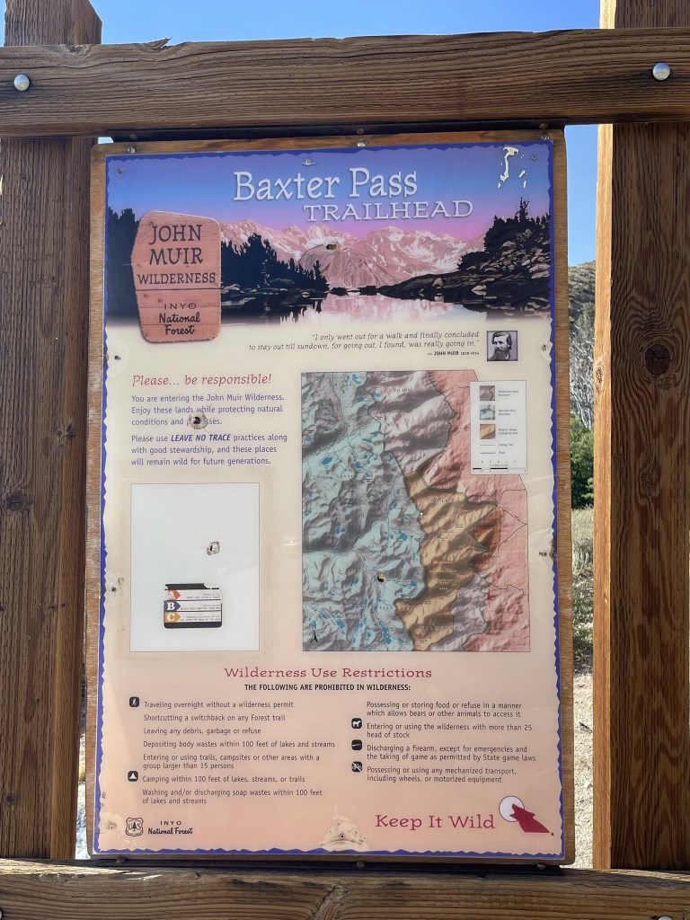
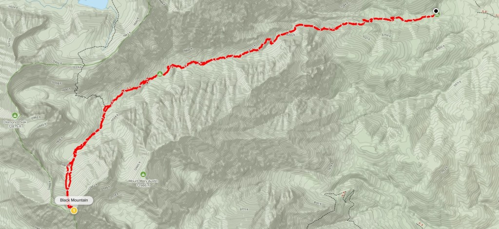
Black Mountain might be the most generic name for a mountain that someone could come up with. According to Wikipedia, there are over 100 peaks in California named Black Mountain (there are 2 in San Diego County alone). The Black Mountain I was after today is the highest of them all according to the Peakbagger database. At 13291 feet, Black Mountain lies on the Sierra Crest and towers nearly 10000 feet above the Owens Valley to the east. It is most commonly approached from the Baxter Pass Trailhead near the town of Independence. I left San Diego at 3:30am and made the 5 hour drive north. The trailhead lies at the end of N Oak Creek Road which is about 5.5 miles from Highway 395. The final 3 miles are well graded dirt and passable for any car. There were 7-8 other cars there when I arrived. I began hiking at 8:33am from 6061 feet above sea level.
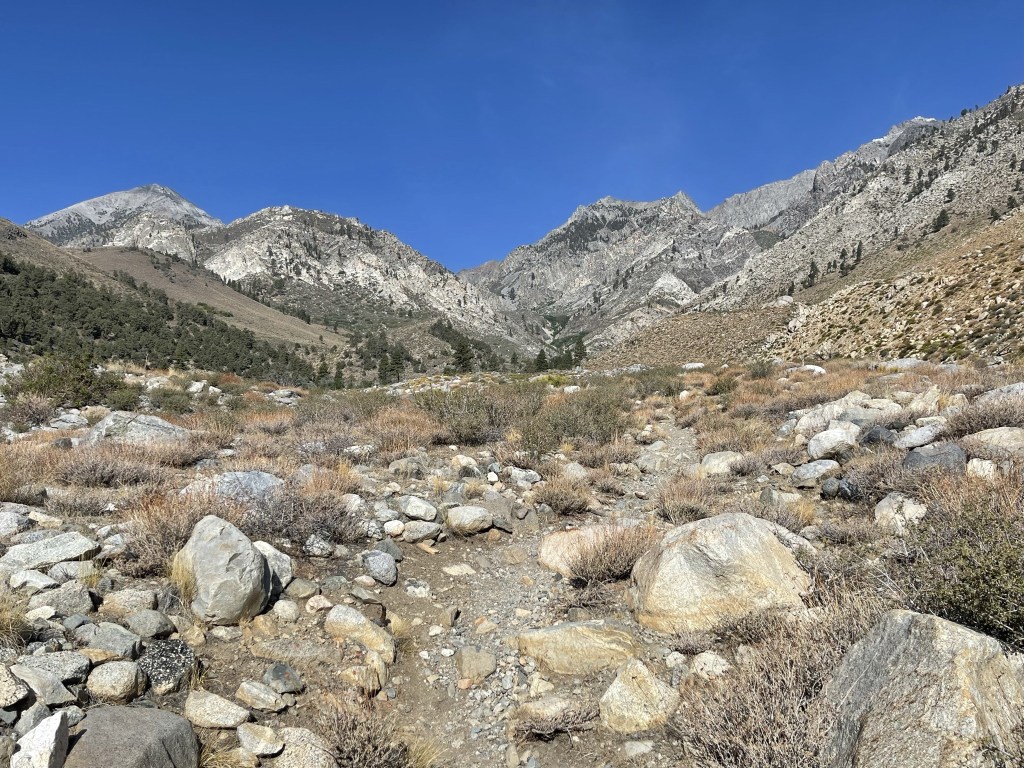
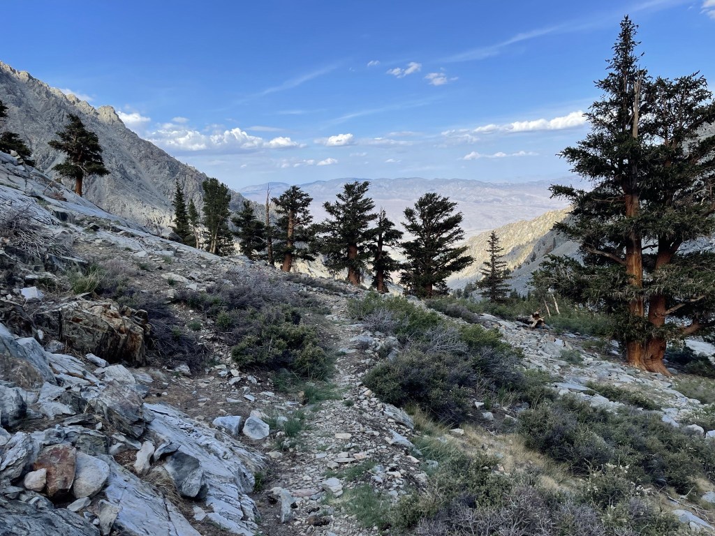
I hiked west as the trail began gaining elevation right away. The low elevation at the trailhead meant that the first few miles would be very hot. It was in the mid 80s already when I started.
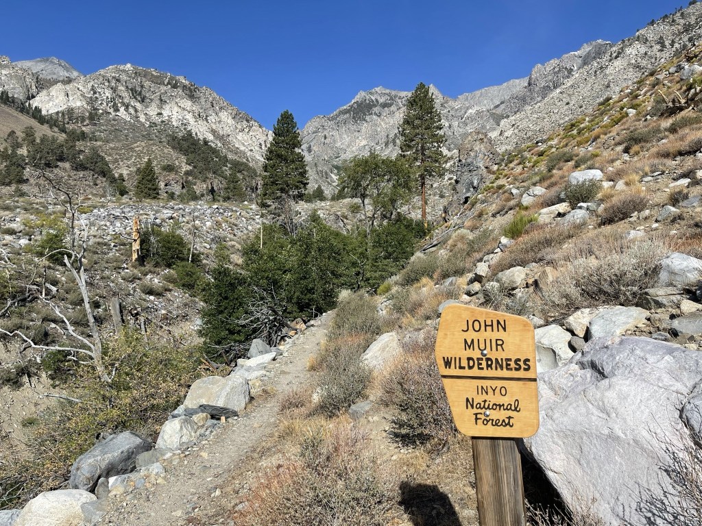
At 0.6 mile I entered the John Muir Wilderness.
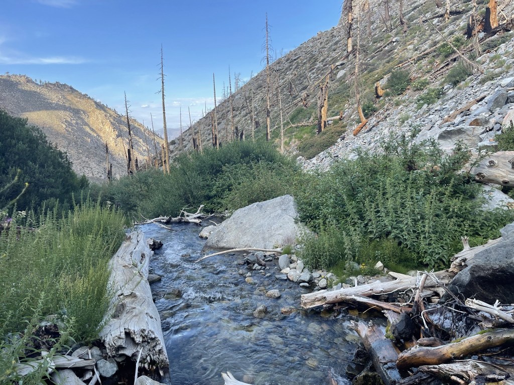
At 0.7 mile I crossed a small stream. I was able to hop across a few rocks to stay dry.

At 1 mile I crossed the North Fork of Oak Creek. I walked across a big log that spanned the length of the creek.

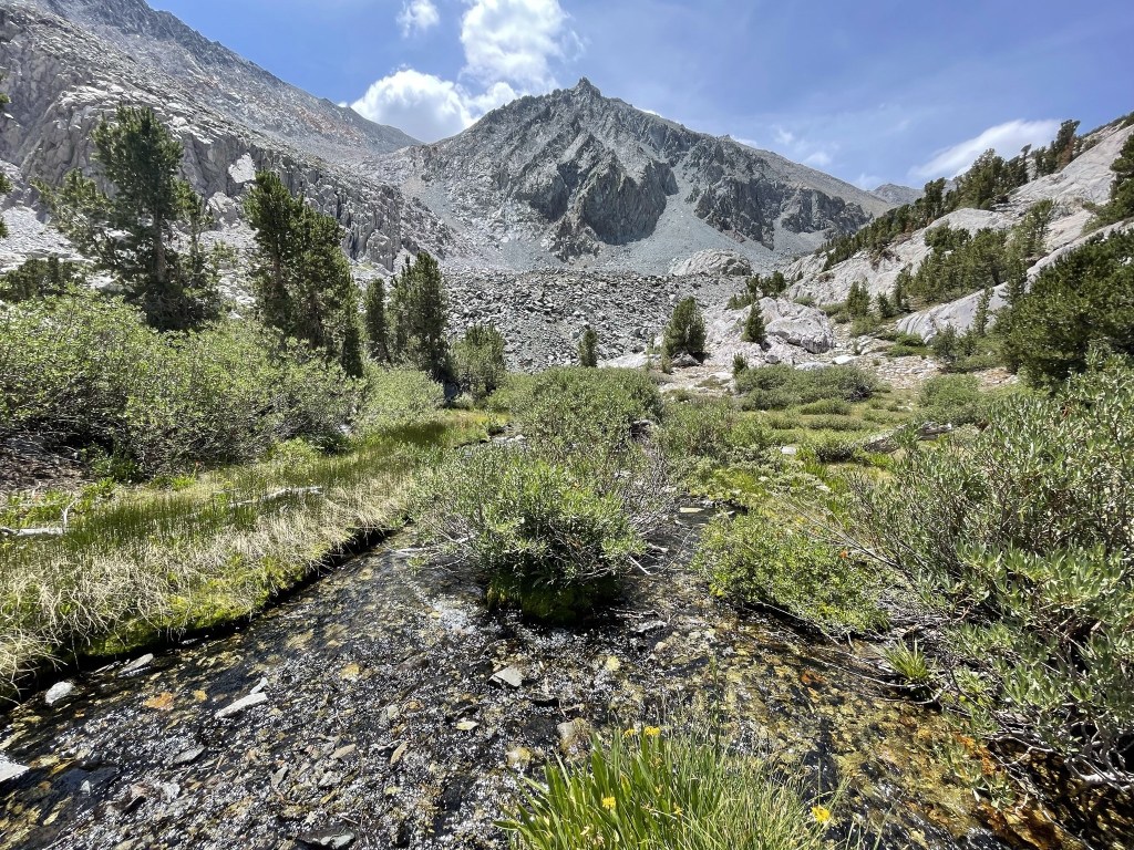
After crossing the creek, the trail went up the southern side of the large canyon that the creek flows down. The trail was steeper beyond the crossing.
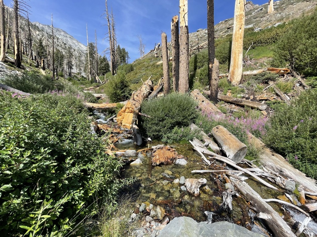
I could see the creek cascading down from higher elevations.

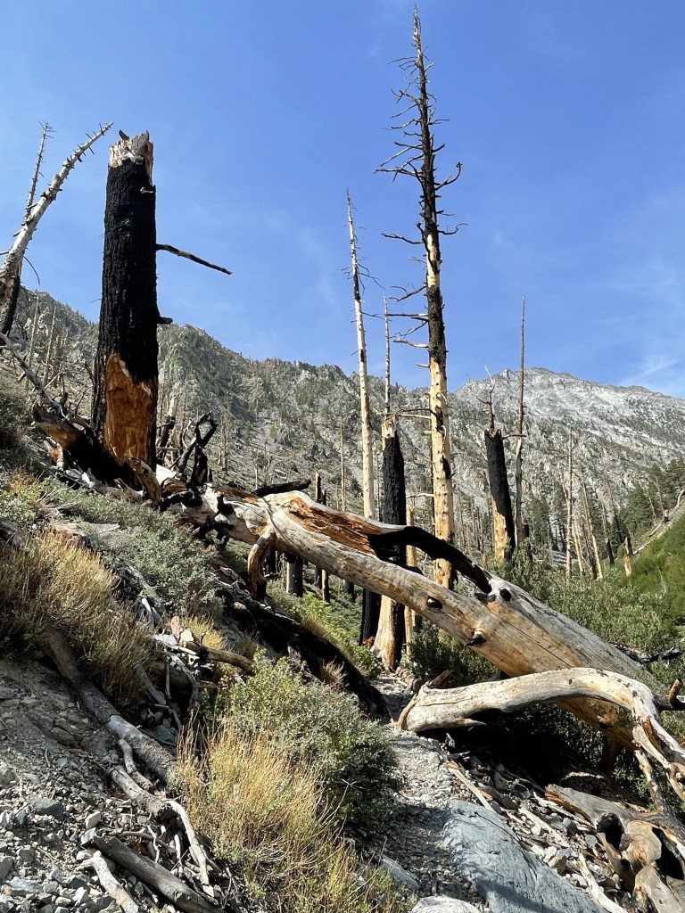
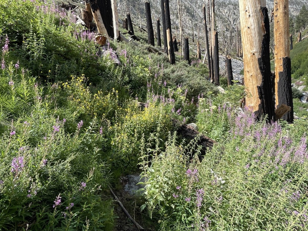
I passed through a recent burn area.
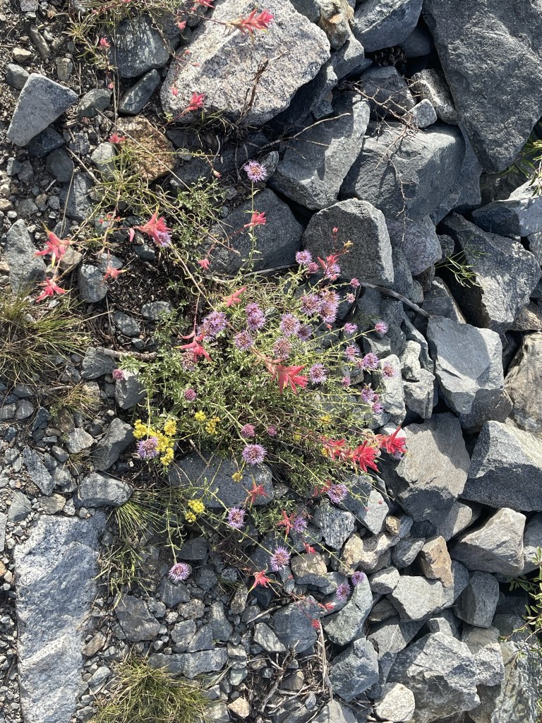
There were a lot of pretty purple flowers.
At 2.7 miles I crossed back to the other side of the creek. I had to take my shoes and socks off to wade across this time.
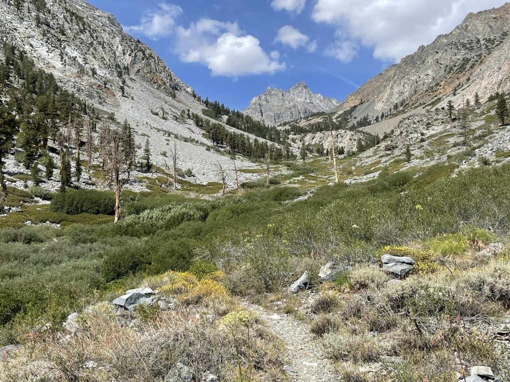
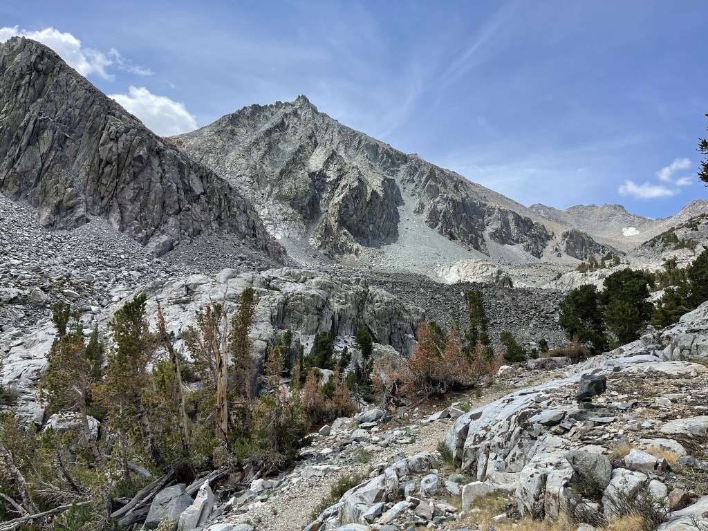
I continued west up the steep trail after the crossing. Diamond Peak, which lies about a mile northwest of Black Mountain, was visible directly ahead.
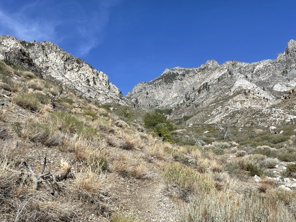
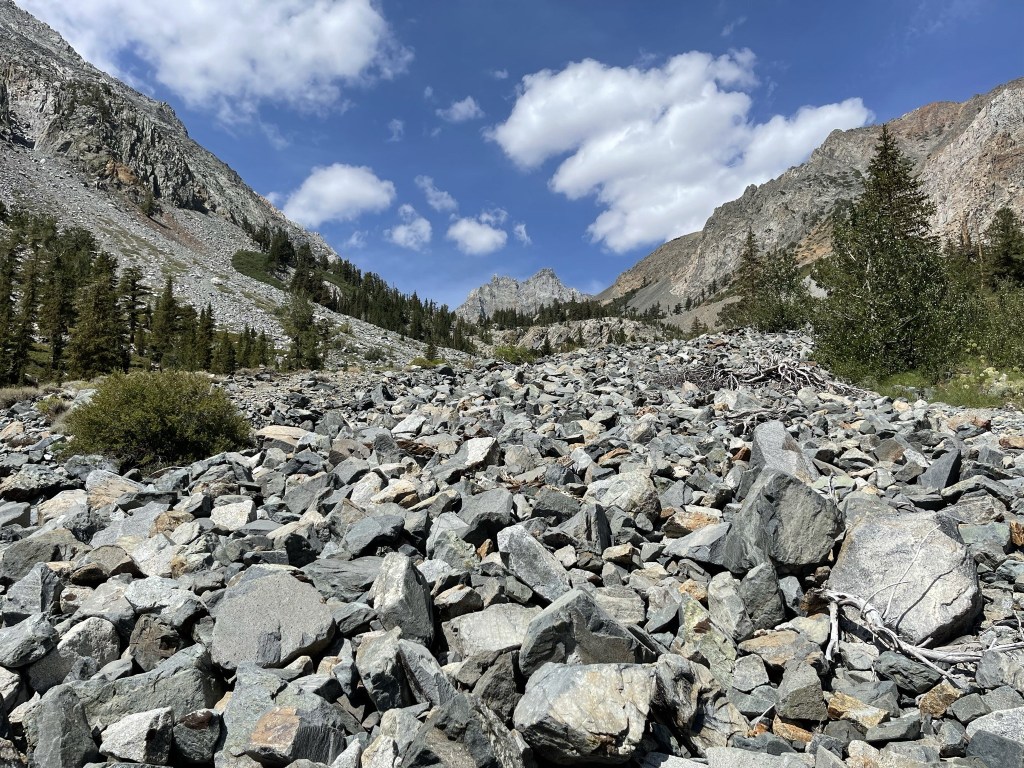
I passed a few groups of hikers and backpackers going both directions. I briefly chatted with 2 guys from Chicago and Tennessee who were on the first day of a 9 day backpacking trip. The trail disappeared briefly at a large talus field, but there were cairns to help guide the way.
The temperature cooled as I ascended higher.
Mount Mary Austin loomed above me to the south.
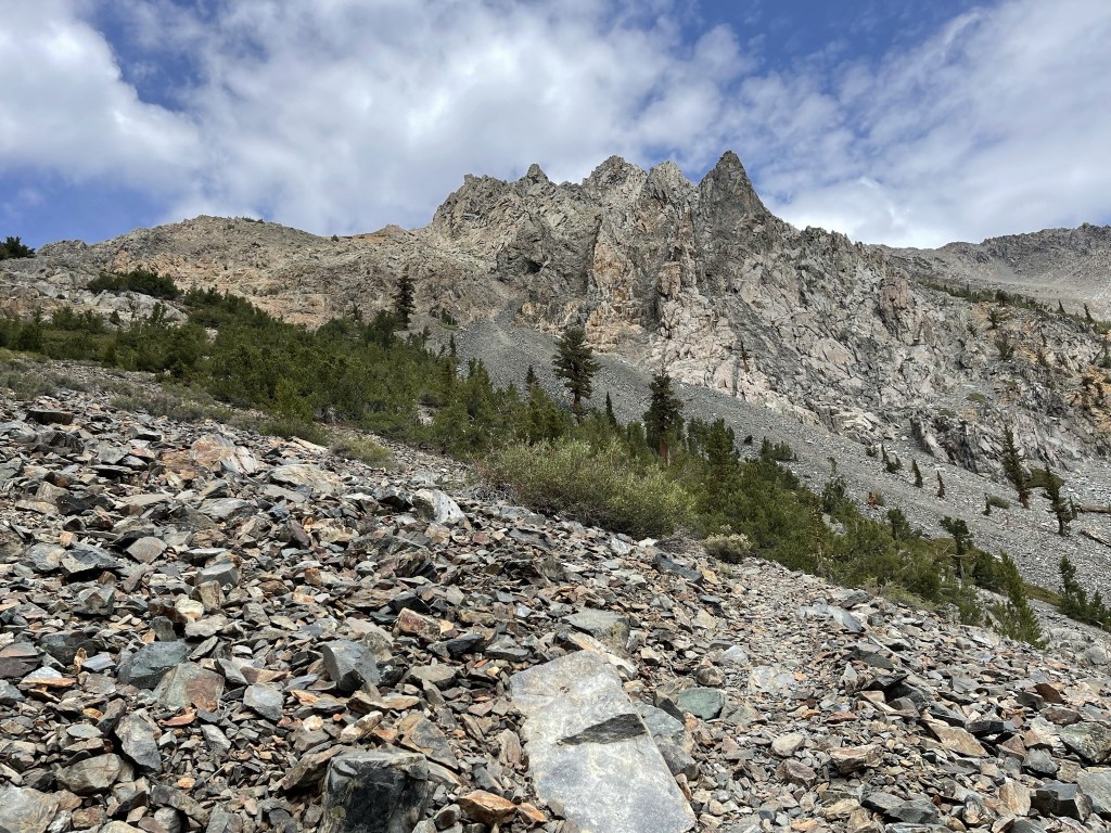
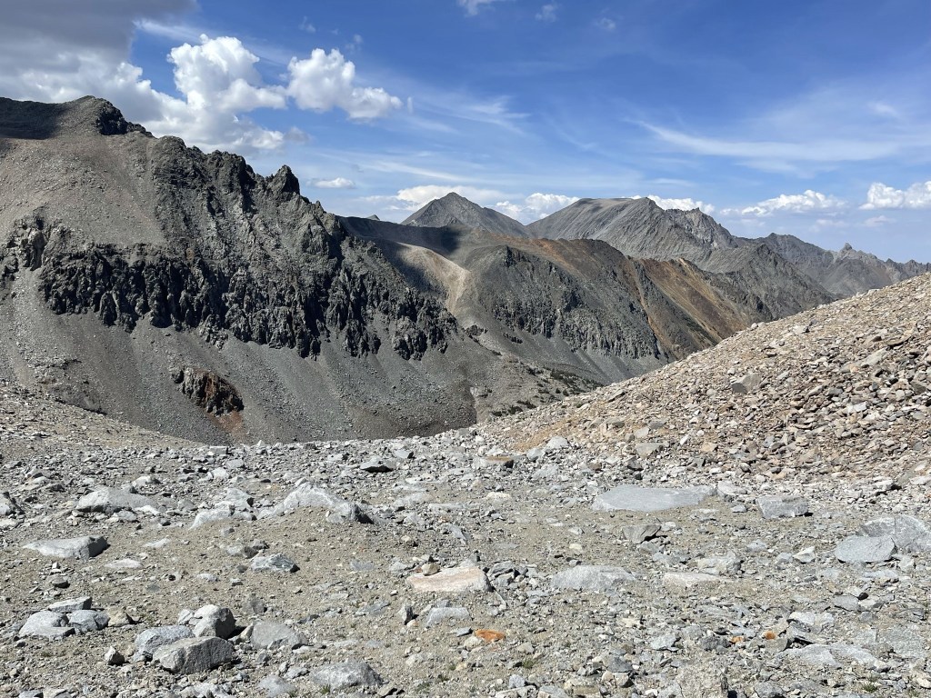
Black Mountain finally came into view to the southwest.
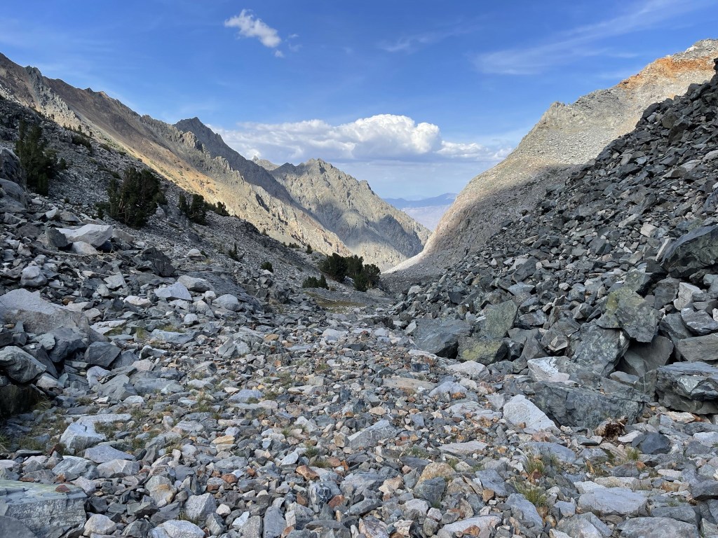
At 5.8 miles I left the trail to begin the final climb to Black Mountain. The trail turned north at this point towards Baxter Pass, but I took off southwest towards the peak. I crossed the creek one more time at Summit Meadow.
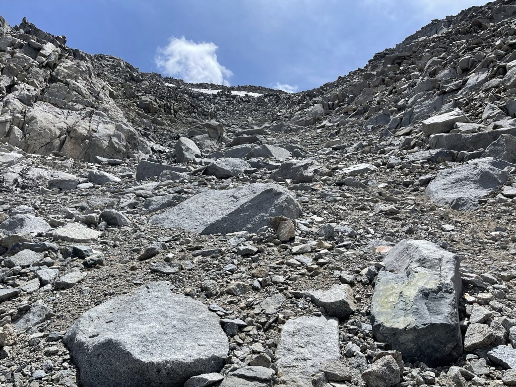
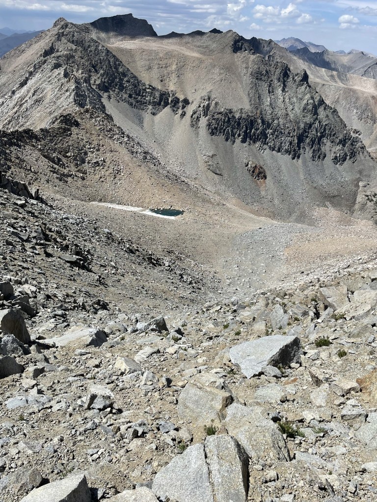
I was at 10700 feet at this point, so I had gained nearly 5000 feet but still had over 2000 feet to go. I proceeded up a large boulder field.
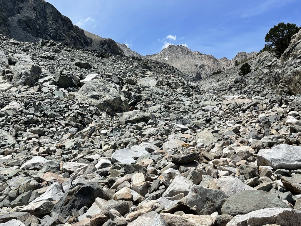
The boulder hopping was actually kind of fun. At 6.5 miles I reached the bowl beneath Black Mountain and Diamond Peak, with Black to the south and Diamond to the northwest. I began climbing up the north face of Black Mountain.
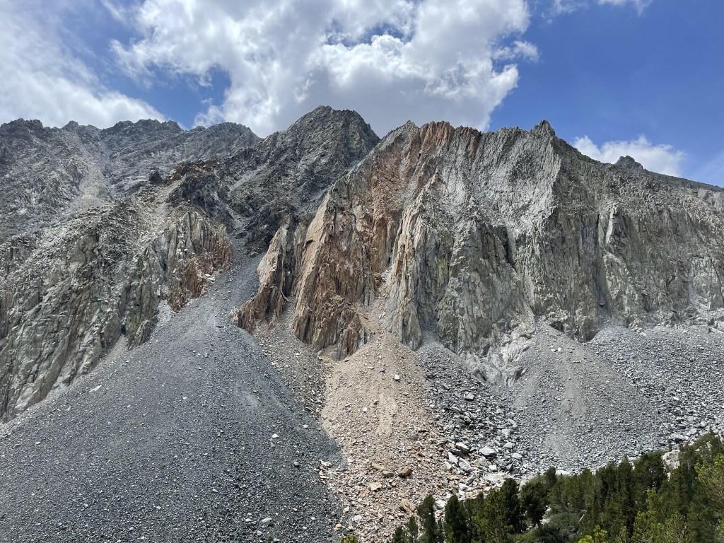
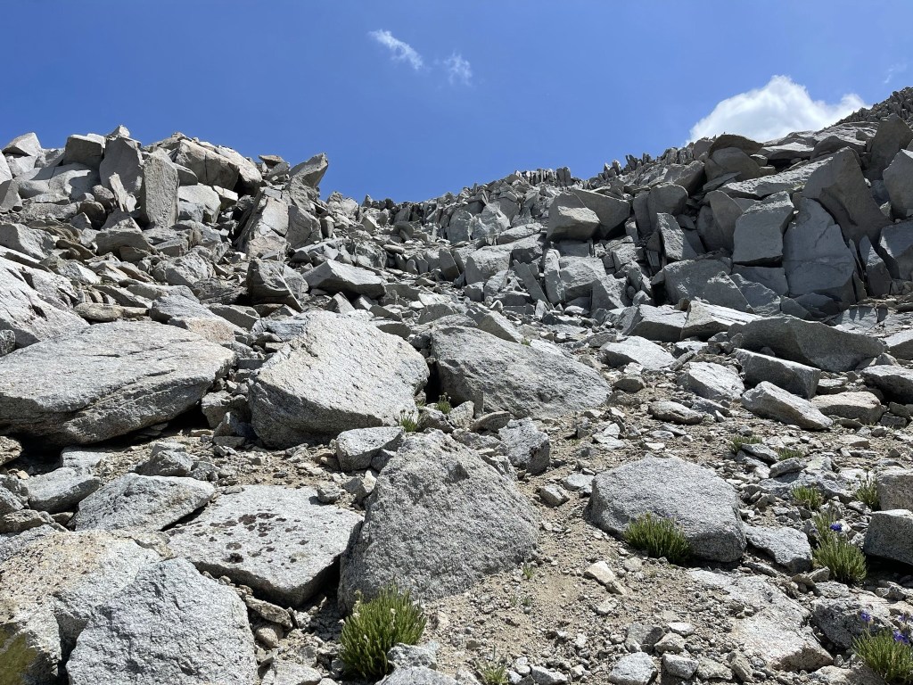
The lower part of the face was pretty tedious. The medium sized rocks weren’t big enough to be completely stable, so the ground was shifting constantly beneath my steps.
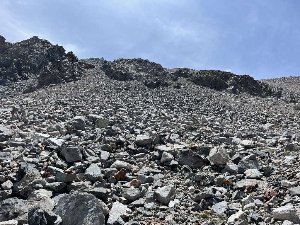
After 0.3 mile the grade lessened. I proceeded across the boulders and then reached the bottom of the final chute after another 0.3 mile.

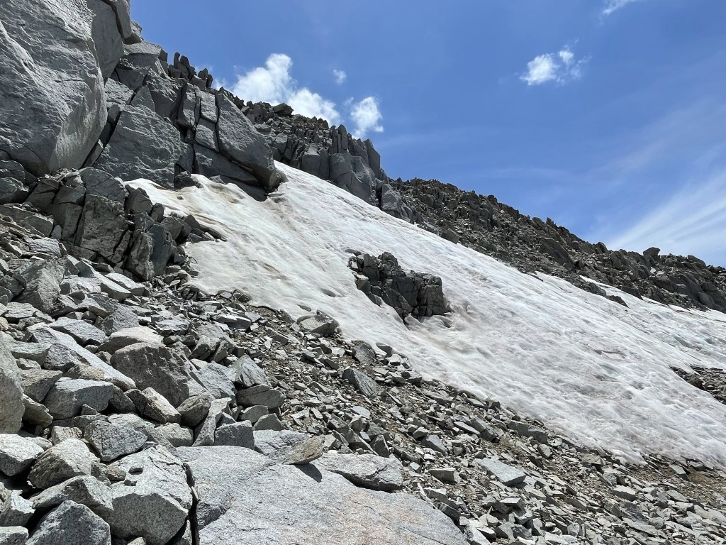
I had 1000 feet to go to reach the summit still. The altitude was getting to me a little, plus I was starting to get concerned about getting back to the car before running out of daylight. Still, I pushed hard up the steep chute.
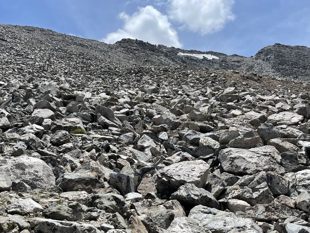
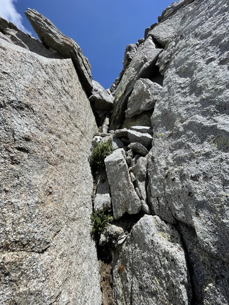
Large boulders and steep cliffs appeared as I neared the top.
A large snowfield blocked what appeared to be the easiest way up. The snow was too hard to kick steps into, so I had to find another way.
I climbed up the large rocks just north of the summit.
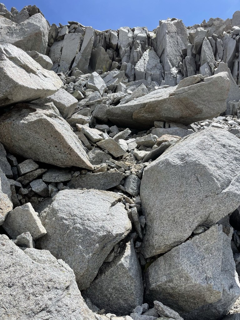
I shimmied my way up chimney just below the top. This required an easy class 3 move.
I reached the summit at 2:27pm at 7.5 miles!
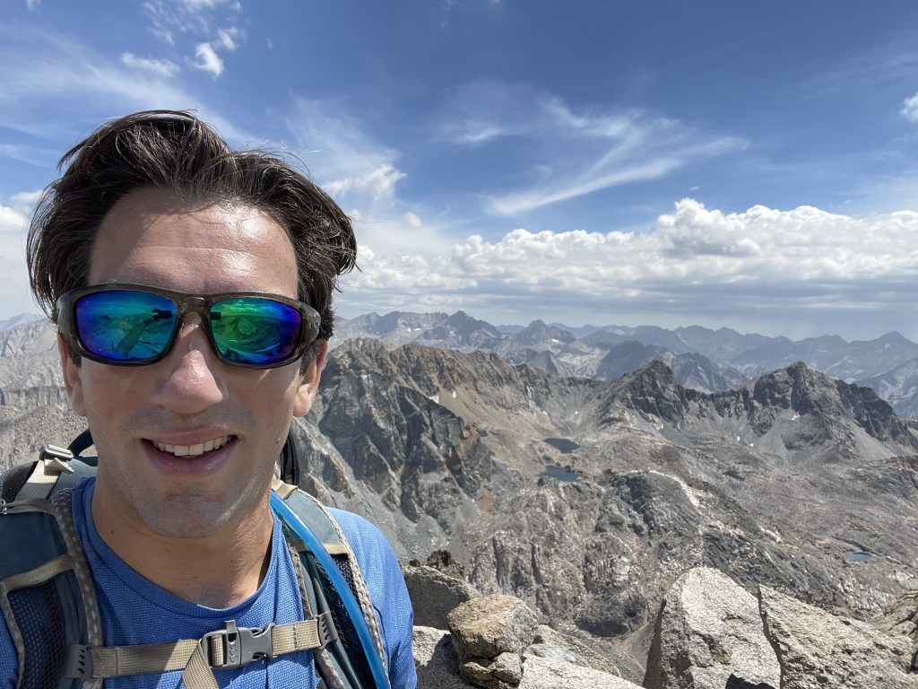
I was exhausted and out of breath. Unfortunately, I couldn’t take a very long break since I was worried about the daylight situation. It had taken me 6 hours to ascend, so if it took me a similar amount of time to get down it would be pretty dark (and I stupidly did not bring a headlamp). I knew I would descend much faster than I had come up, but I was still concerned. I signed the register (placed in 2005, previous ascent the day before), had a quick snack, and took a few pictures before heading down. Below is the southern view. From left to right: Mount Williamson, Mount Whitney, Mount Keith, and University Peak.
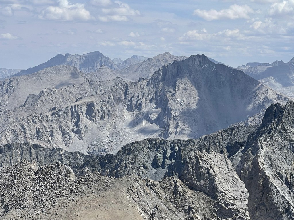
Southsouthwest: Junction Peak, Caltech Peak, and Mount Stanford.
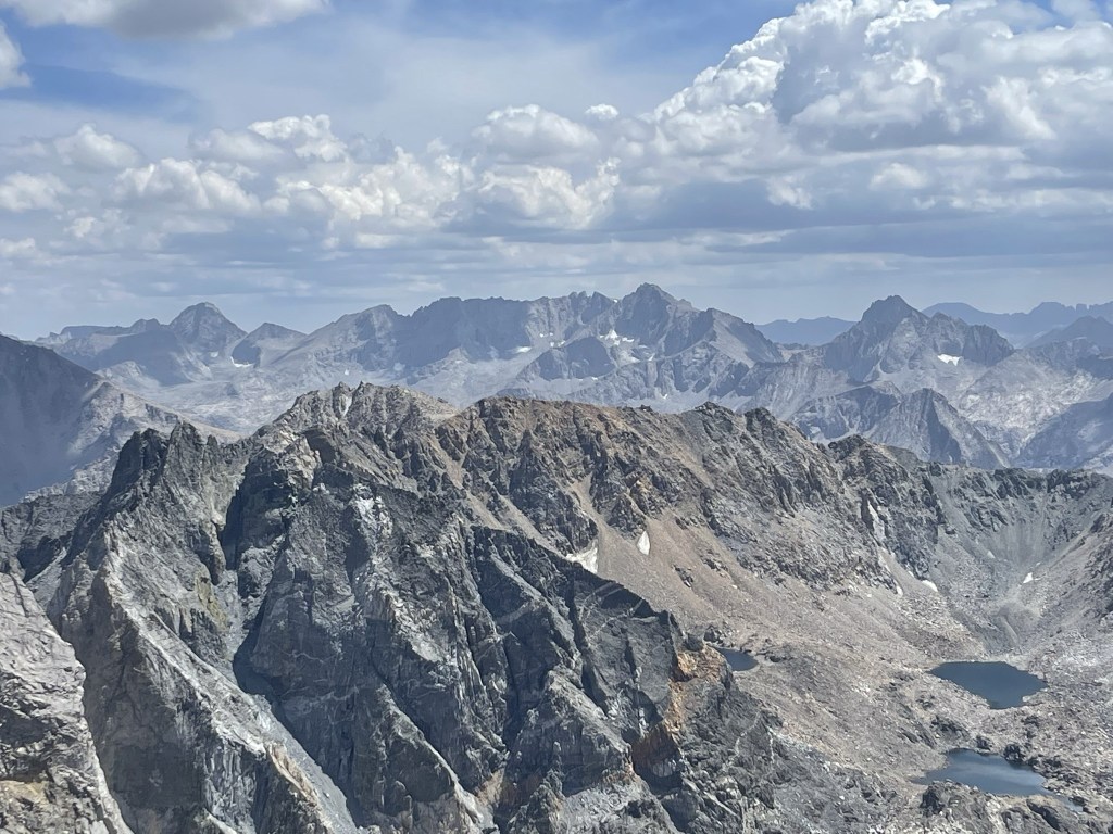
Southwest: Mount Brewer, North Guard.
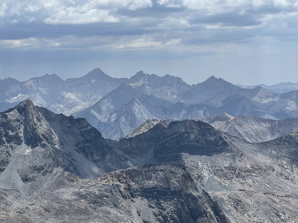
West: Mount Clarence King.

North: North Palisade and Middle Palisade.
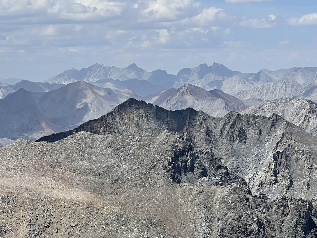
East: Mount Inyo, Keynot Peak, and New York Butte.

I began the descent after only a 15 minute break. Rather than climb down the chimney, I went west off the summit and found myself above the snowfield.
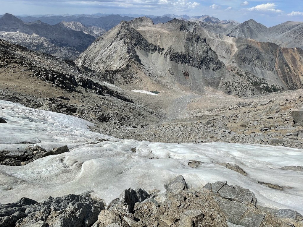
I tried to find a way around it but had no luck. Eventually I just decided to glissade down which worked out fine (besides a wet butt). From there, I made my way carefully down the steep chute.
I was really starting to feel miserable around this time. I was completely exhausted, and my legs and feet hurt. I was feeling a bit clumsy as well which alerted me to the fact that I was probably suffering from altitude sickness. I made sure I was hydrated but there was nothing else to do besides keep descending to lower elevation. I was very careful with each step to make sure I didn’t slip and hurt myself.
I was in such misery that I was thinking I would need to skip my hike for Sunday and just return home the following morning.
At 9.4 miles I finally reached the trail again. I was relieved to be back on solid ground once more. I took a nice break at this point since I was no longer concerned about running out of daylight. I figured it would take me 3 hours max to get down from here which would get me back just before 8pm.
I made good time now that I was back on the trail. I started to feel much better once I was below 10000 feet, which confirmed my suspicions that I had a mild case of altitude sickness (not surprising considering I went from sea level to above 13000 feet in under 12 hours). I noticed some pretty flowers along the trail.
At 12.4 miles I reached the 2nd creek crossing. I was feeling so good now that I abandoned the idea of canceling my plans for Sunday.
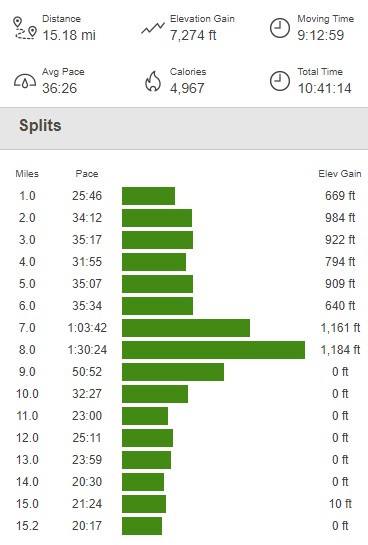
The final few miles were warm but thankfully the sun was setting behind the mountains to the west. I reached the trailhead at 7:14pm. This hike totaled 15.18 miles, 7274 feet elevation gain, and 10:41:14 total time.
I was originally planning to climb Mount Keith the next day, but Black Mountain had worn me out enough that I decided to tackle an easier peak instead. I settled on doing Mount Gould, so I drove to the nearby Onion Valley Trailhead and called it a night.
