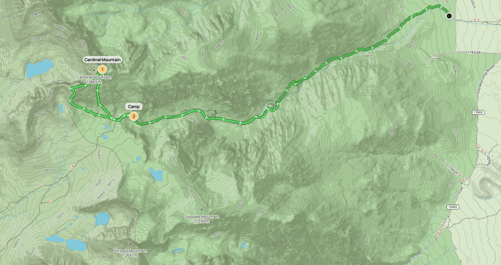
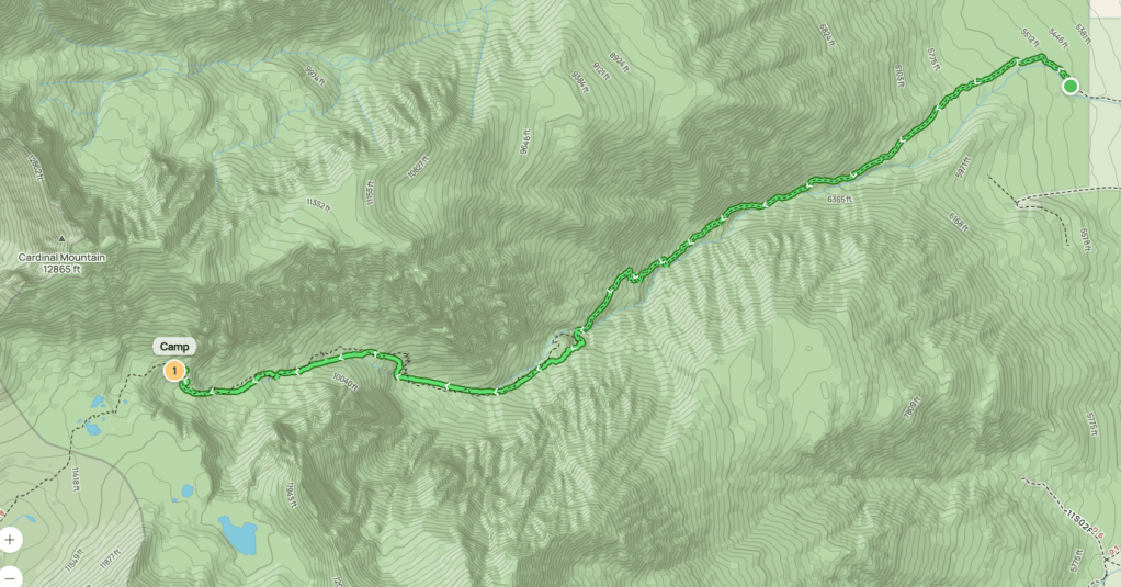
Day 1
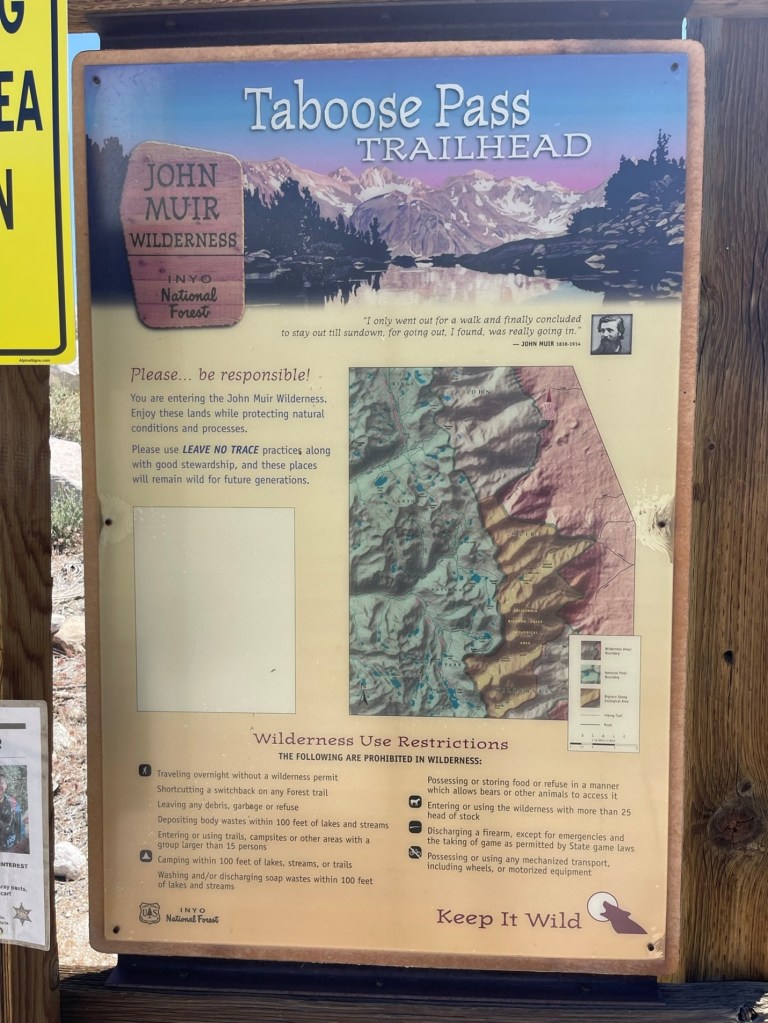
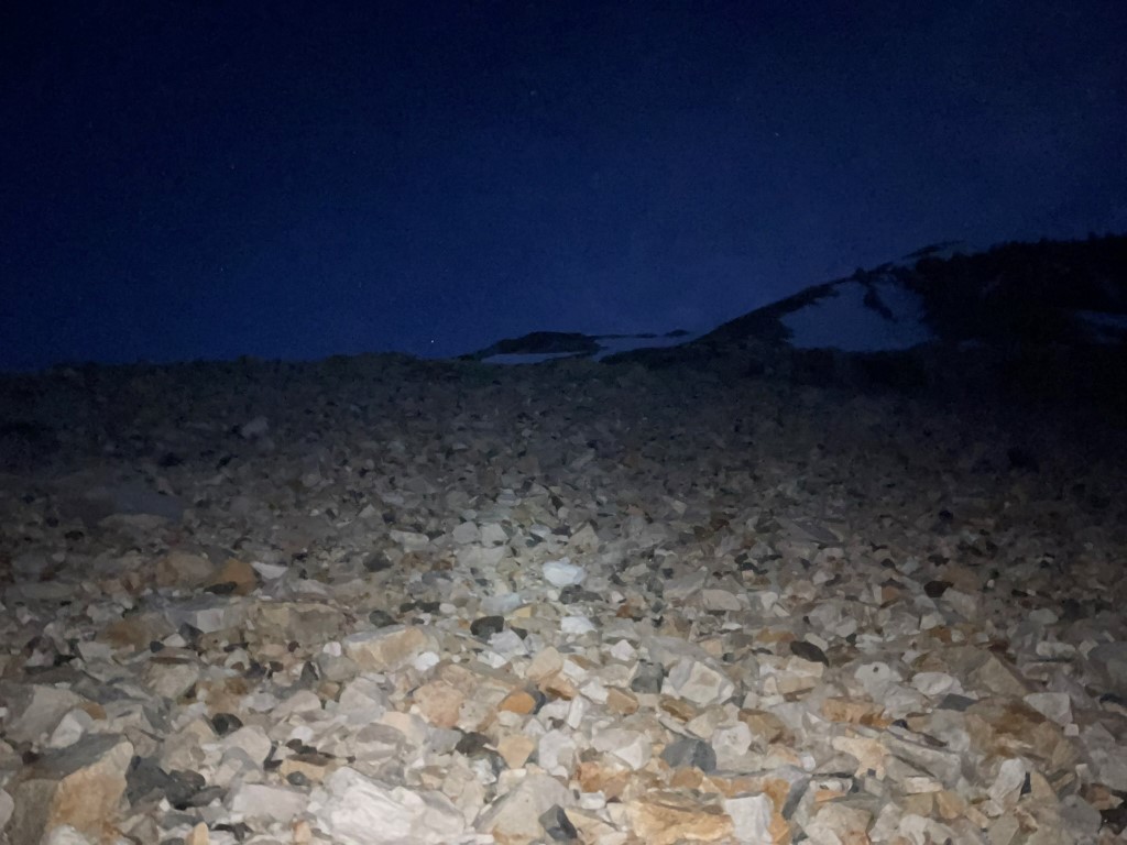
After an Epic winter in California with record breaking snowfall, it was finally time to return to the Eastern Sierra for my first high elevation backpacking trip of the year. My options were fairly limited due to trailhead access issues since many roads were still closed. I chose to do Striped Mountain (13179 ft), Goodale Mountain (12730 ft), and Cardinal Mountain (13996 ft) from the Taboose Pass Trailhead, which is one of the lowest in the Sierra. I left San Diego early Saturday morning and made the 5.5 hour drive to the trailhead, which is located between Independence and Big Pine. The road to the trailhead is one of the worst in the Sierra (Red Lake is the only one that comes to mind that’s worse). The final 4 miles are very rocky, so high clearance and good tires are recommended. I began hiking at 10:46am from 5441 feet above sea level. It was already 81 degrees.
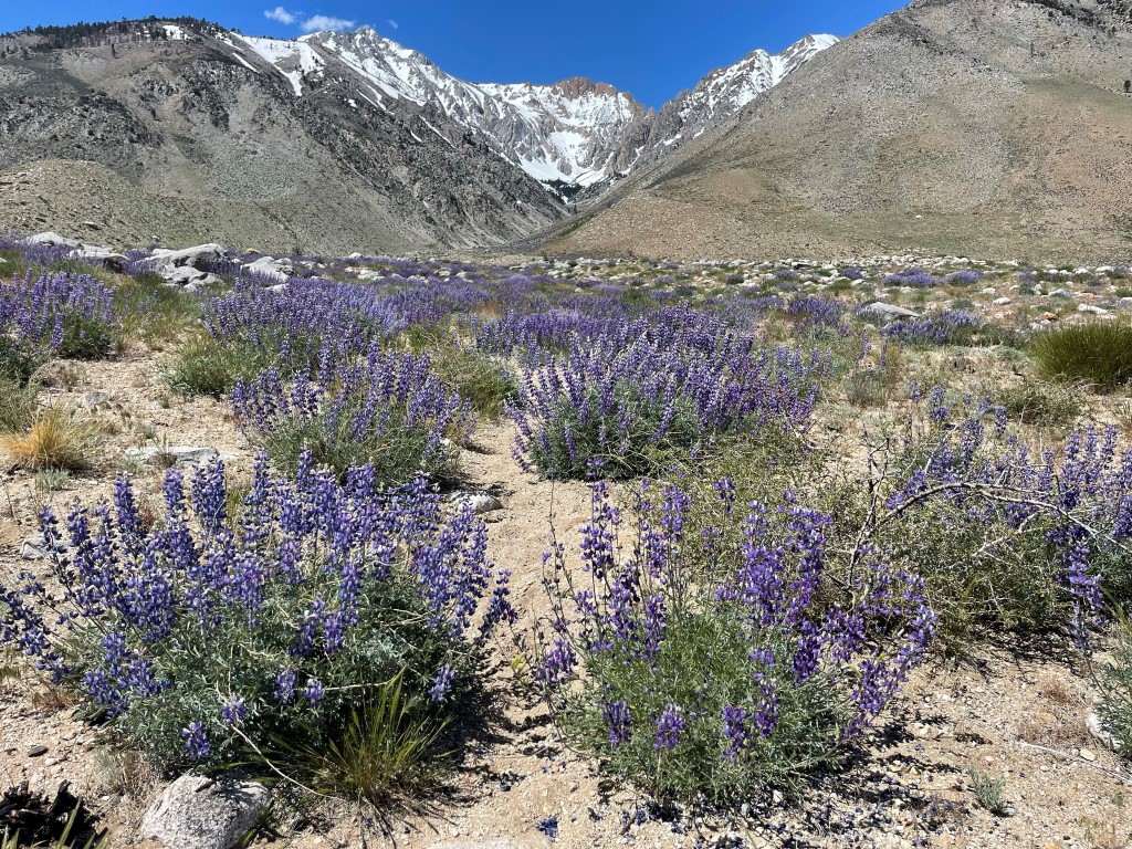
The trail initially went northwest before turning southwest towards the canyon formed by Taboose Creek. There were many pretty wildflowers.
I entered the canyon as the trail stayed on the north side of the creek. Unsurprisingly, the creek was a raging torrent with all the snowmelt from above.

Before long, the creek was completely covered in snow. I was surprised at how low the snow started this time of year.
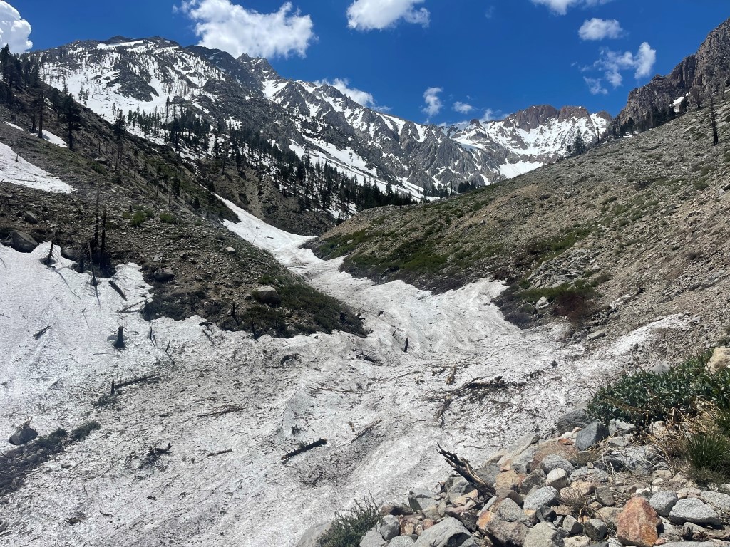
I reached the first of two creek crossings at 3.5 miles / 8000 feet. The creek crossing was a non-factor due to it being covered in snow. There was consistent snow coverage the rest of the way.

I saw a solo skier on their way down. I made good progress up the snow. It was slushy in the early afternoon but thankfully I was only sinking to my ankles. I had snowshoes with me but did not bother to put them on.

The creek poked through the snow a few times, so I was able to refill my water in the vicinity of the 2nd crossing. Navigation was very simply through here as I just continued hiking up the canyon.
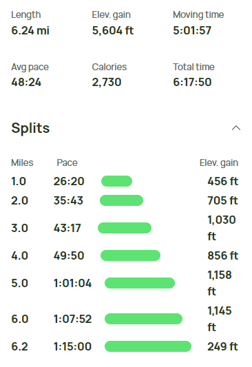
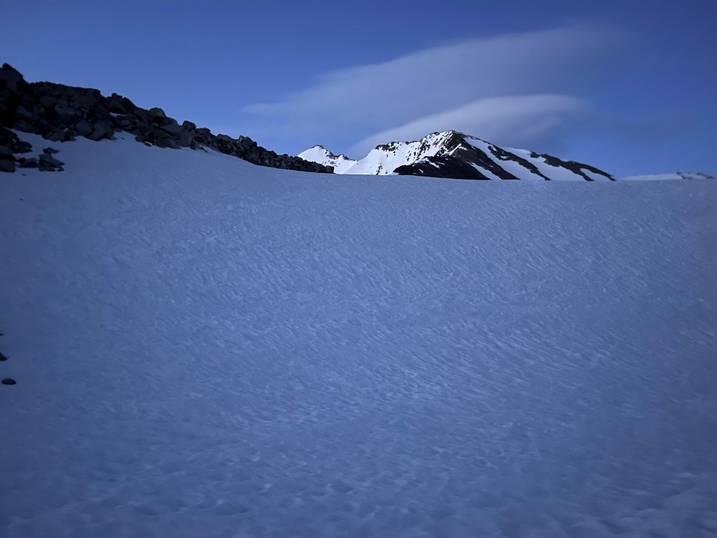
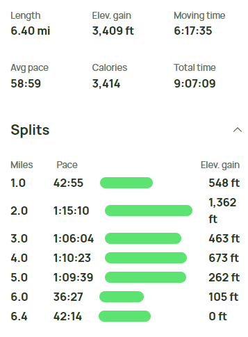
With storms in the forecast for the whole weekend, I didn’t want to camp on top of the pass where I would be exposed. I found a nice dry spot about 200 feet below the pass and set up camp. There was no water nearby, so I had to melt snow. The storms rolled in around 6:30pm, so I hunkered down in my tent while it rained, hailed, and thundered outside. Stats for day 1 were 6.24 miles, 5604 feet elevation gain, and 6:17:50 total time.
Day 2
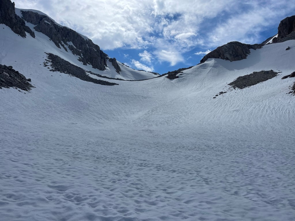
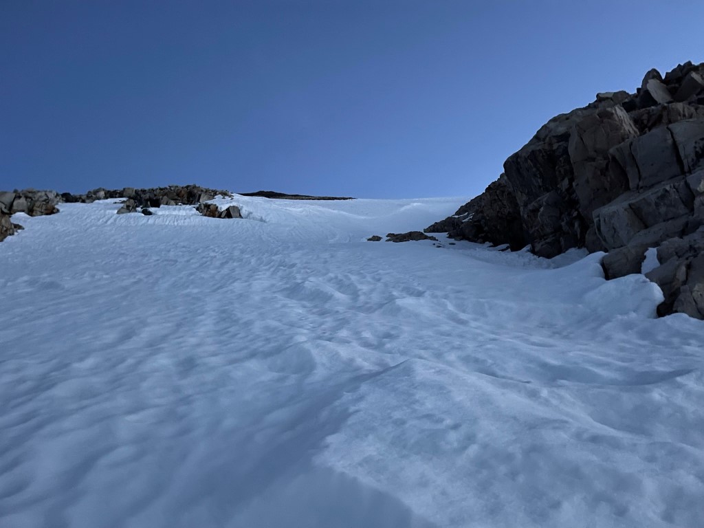
My plan for day 2 was to climb Striped Mountain via the northeast slope and Goodale Mountain via the west slope. I wanted to get an early start so I would be off the peaks before the snow turned to slush and the forecasted storms rolled in. I began hiking at 4:34am from 10962 feet.
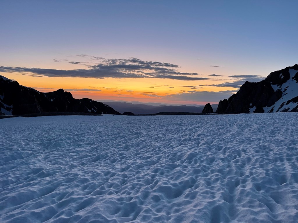
I soon reached the top of the pass where I found a few small pools of melted water. I was happy to find this so I wouldn’t have to melt more snow later on (I had a hell of a time keeping my stove lit the day before). The days are long this time of year, so the sun was already beginning to rise.
I turned south and hiked into the bowl between Goodale (left) and Striped (right).

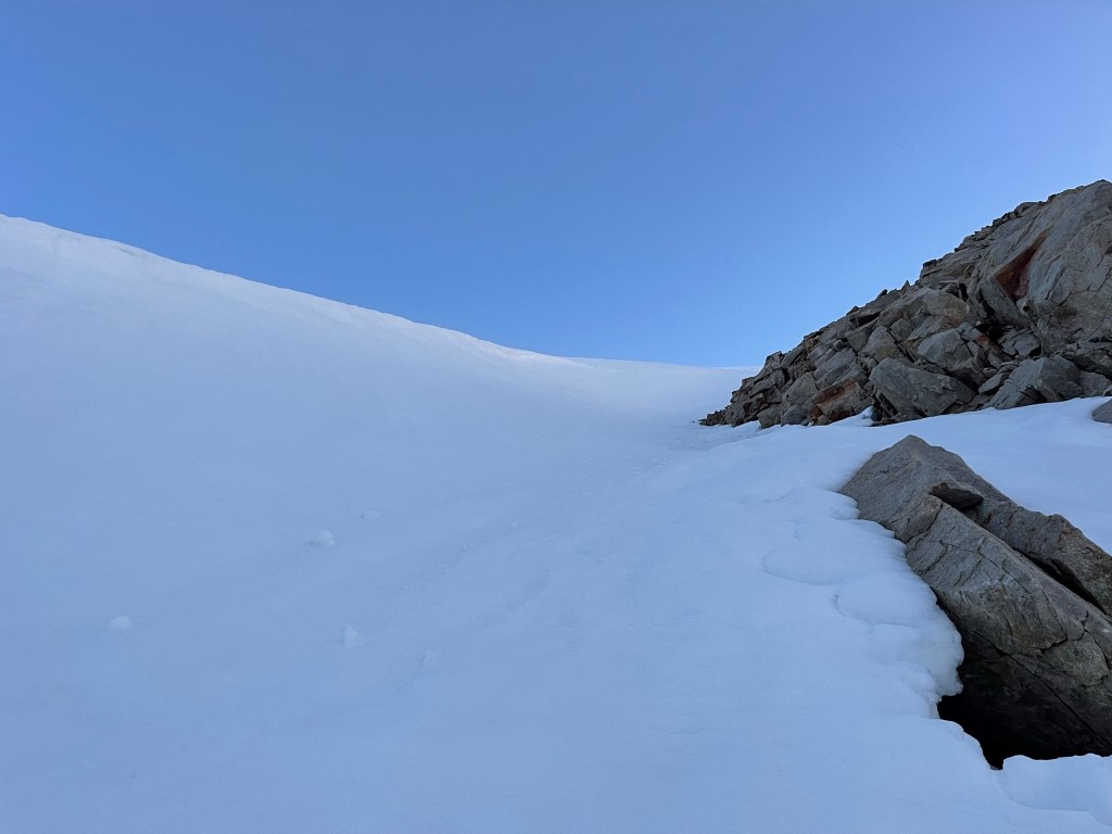
I stayed on the west side of the bowl and then began climbing up the northeast slope of Striped.
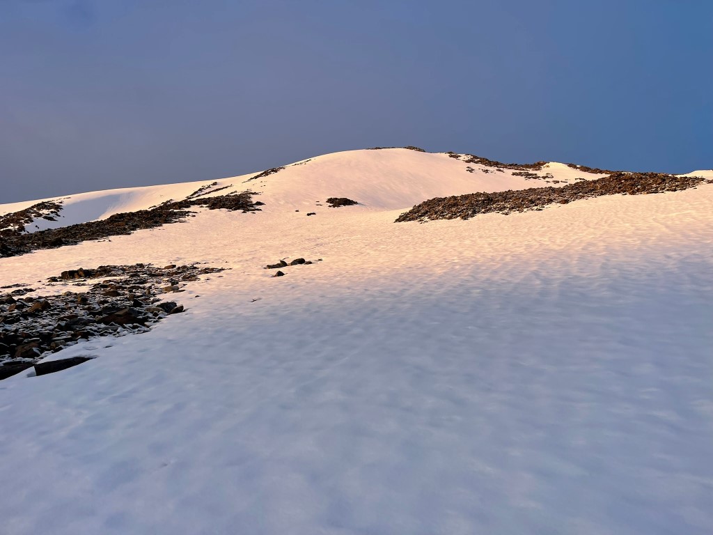
There were a couple inches of powder on top of the main snow layer which was really annoying. I eventually reached a false summit around 12800 feet. The summit of Striped Mountain came into view.
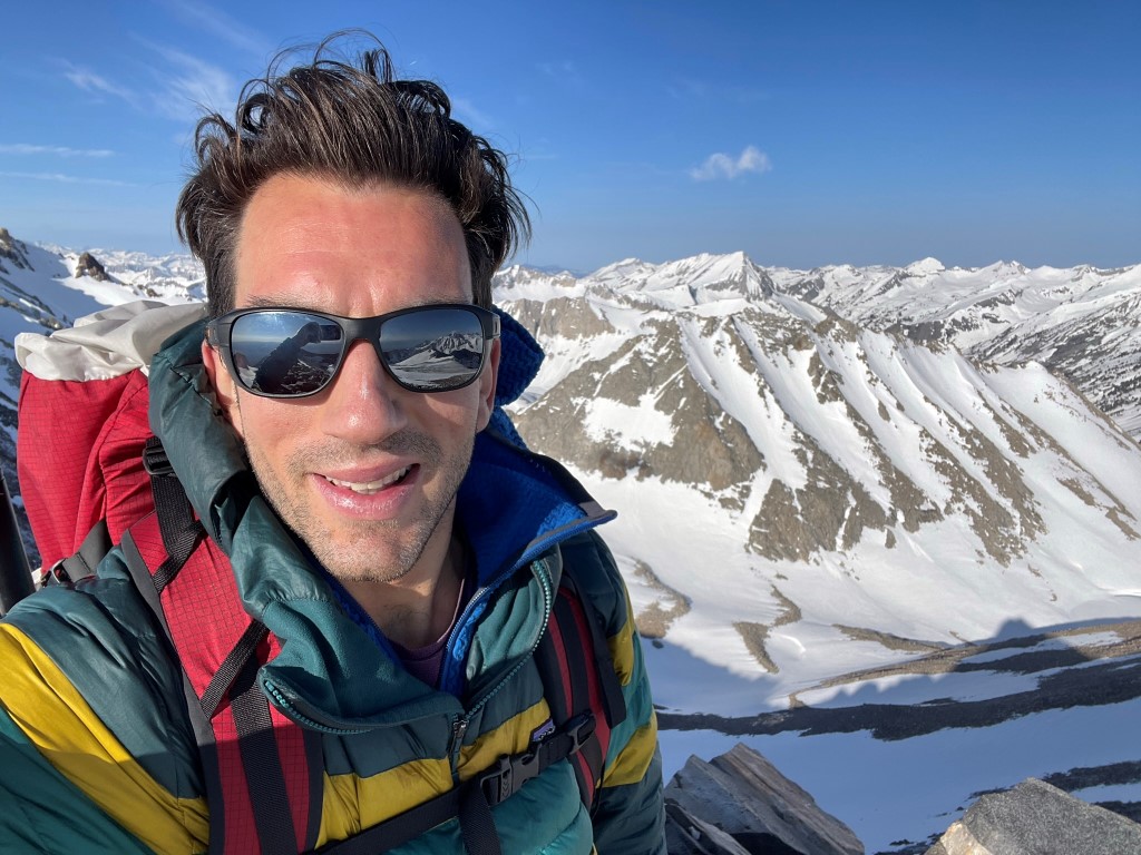
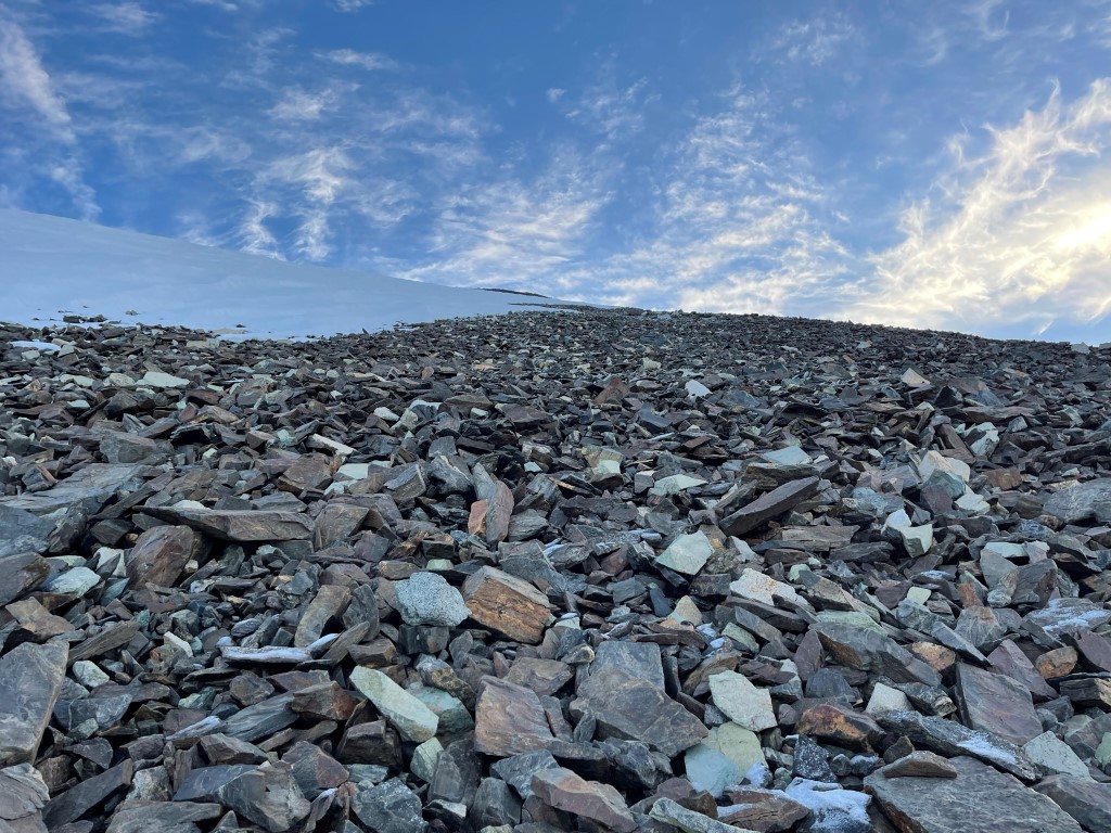
I descended about 200 feet from the false summit and the climbed up to the true summit. There was an inch or two of fresh snow on top of the talus which made it a little more treacherous than I was expecting. I realized that the storm which had dumped rain on me the night before must have been snow at this elevation. After a few hundred feet of slippery class 2 I reached the summit at 7:32am at 2.19 miles!
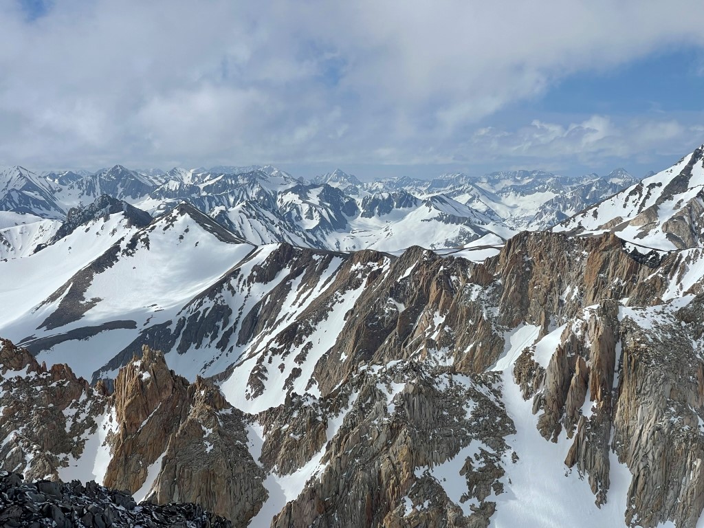
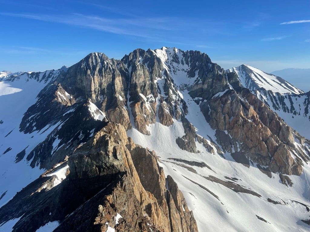
I signed the register which had been placed in 2004. The most recent entry was from May 7. The views were amazing. To the north I could see the Palisades group of 14ers – North Palisade, Mount Sill, Middle Palisade, and Split Mountain.
To the northwest I could see Mount Ruskin with Mount Goddard in the distance.

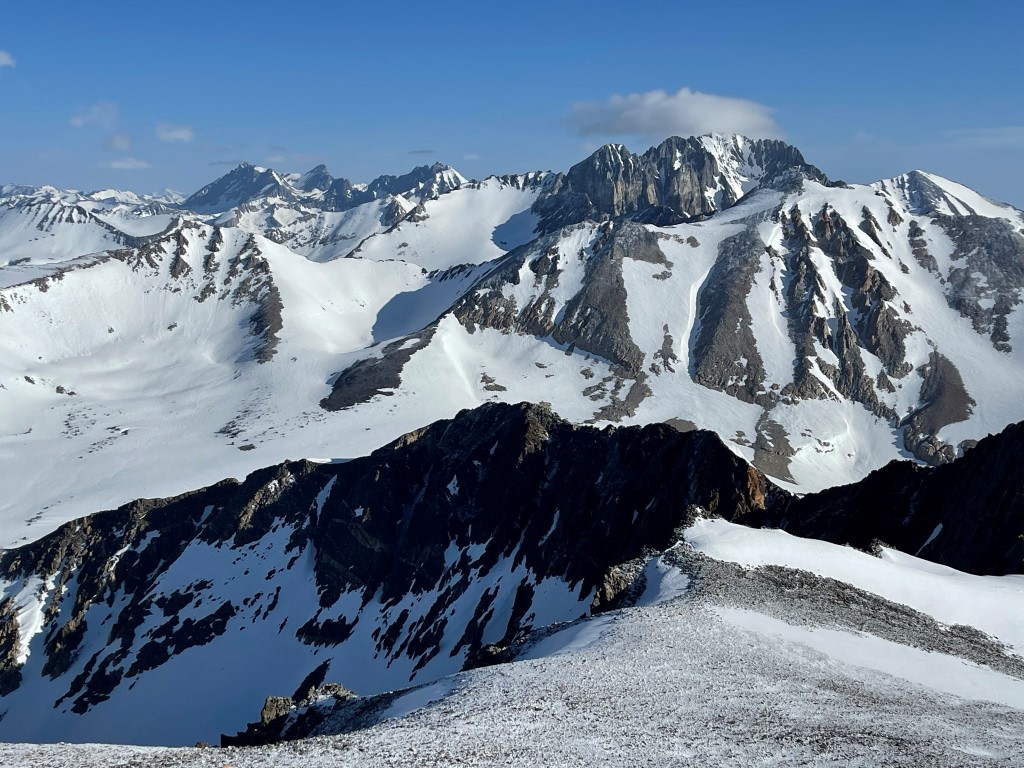
To the west I could see Mount Ickes, Arrow Peak, and State Peak.

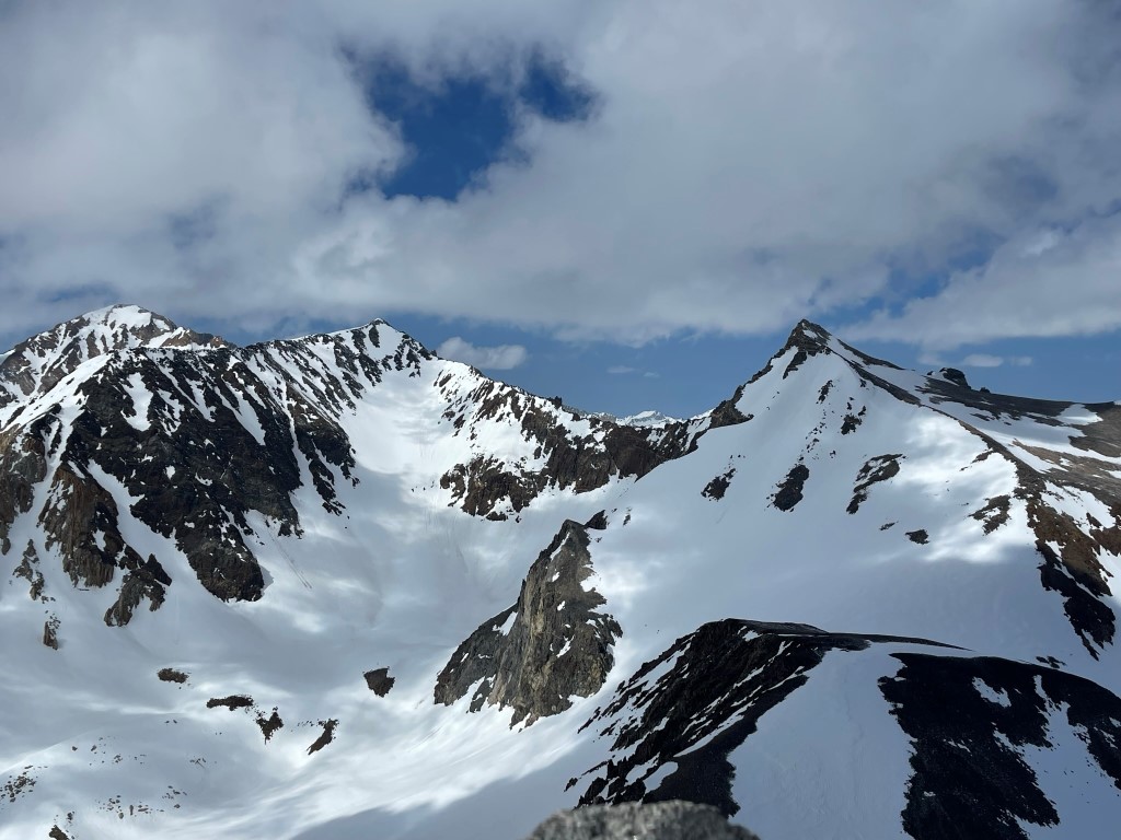
The hulking form of Mount Pinchot dominated the view to the south. I could also see Mount Williamson and Mount Keith in the distance.
I then descended the east slope of Striped Mountain towards Goodale Mountain.

I initially stayed on the snowy talus, but then I was able to glissade down a few hundred feet of slushy snow. I soon the reached the saddle between the 2 peaks around 12080 feet.
The west facing slope of Goodale was mostly dry, but there was some fresh snow here as well. I made good time up the class 2 talus.
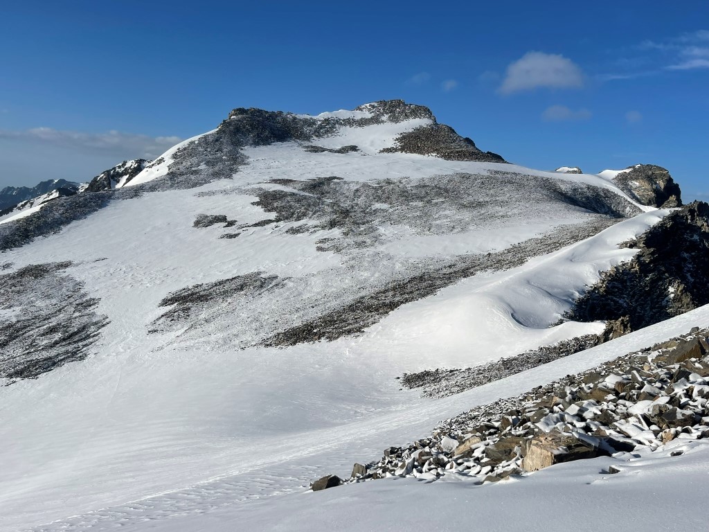
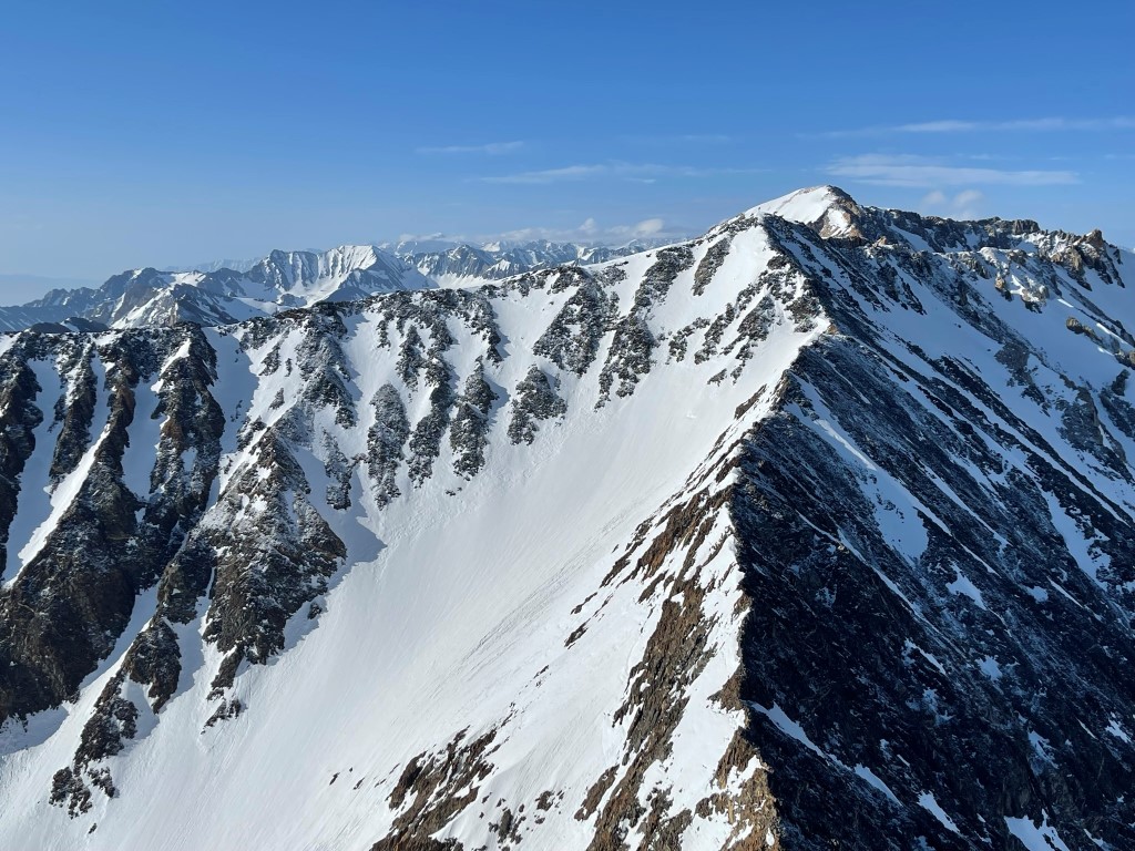
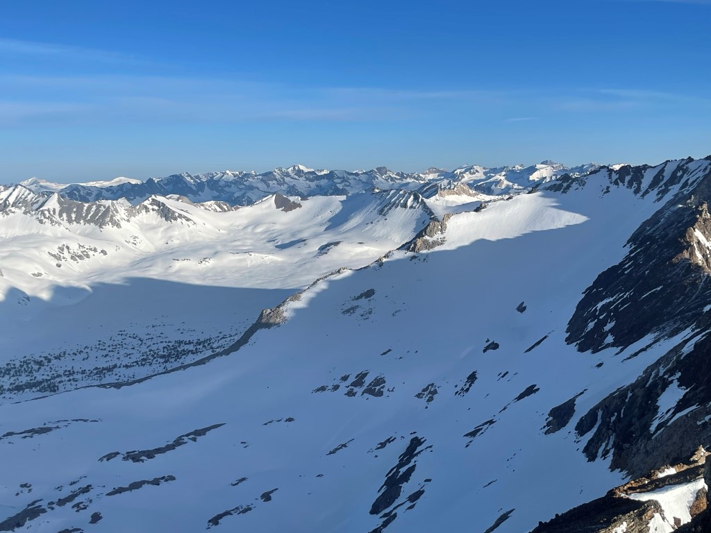
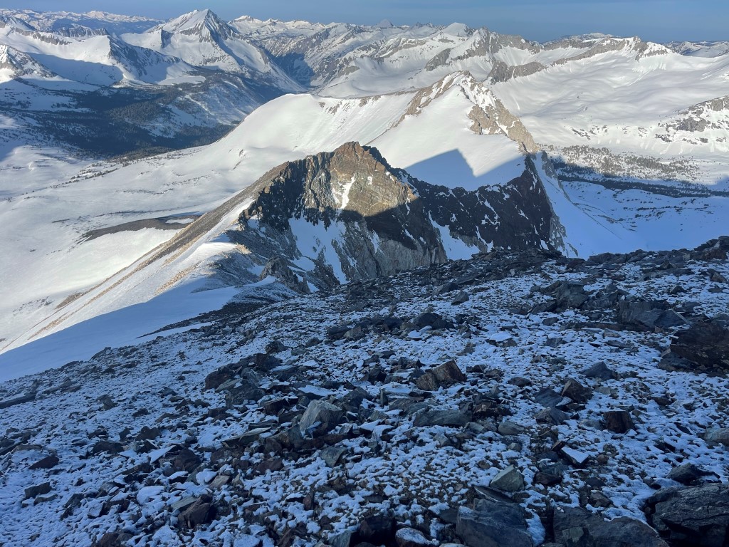
I soon reached the summit plateau. I went to the spot marked on the map as the summit but found that it was not the highest point. There were 2 pinnacles slightly higher to the northwest. Both pinnacles were class 2+, although the northern one might be called easy class 3. The register was at the southern one, but I thought the northern one was a bit higher. I climbed both of them and called it good. I was on top at 9:37am at 3.59 miles. I signed the register which dated back to 2004. The most recent entry was from April 22. Looking west I had a great view of Mount Pinchot (left) and Striped Mountain (right).
It was beginning to cloud up to the south.
I then descended directly down the west slope.
I descended to about 12000 feet and then turned north. I decided to climb a minor peak along Goodale’s north ridge called Redwind Peak (12283 feet). I sidehilled along the 12000 foot contour toward Redwind.

I then climbed class 2 talus to the summit, which I reached at 11:33am at 4.58 miles! I signed the register which had been placed in October 2022. Looking back along the north ridge of Goodale:

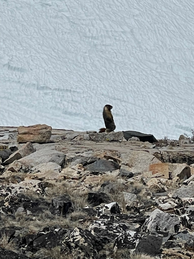
I then descended the west slope back into the bowl between Striped and Goodale. I turned north and skirted around the eastern shore of a frozen lake. As I neared Taboose Pass once again, I filled up my water at one of the small pools I had walked by earlier. This little marmot kept me company while I did so.
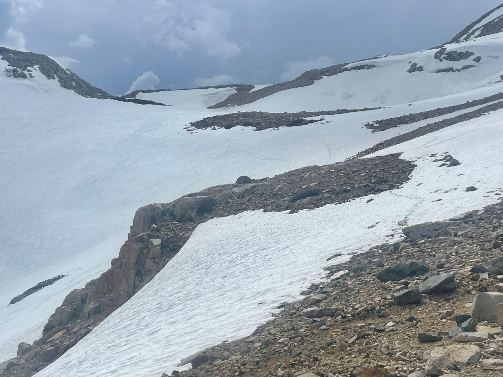
I then descended back to camp, which I reached at 1:50pm. It was very warm now, so I spent most of the afternoon laying in the sun. I saw 2 skiers beginning their descent from the pass. It hailed briefly around 3:30pm and then the storms rolled in again around 7pm. It wasn’t quite as severe as the previous night, although the wind was worse which gave me trouble sleeping. Below is a picture of my campsite (look for the small tent on the dry spot in the middle).
Stats for day 2 were 6.4 miles, 3409 feet elevation gain, and 9:07:09 total time.
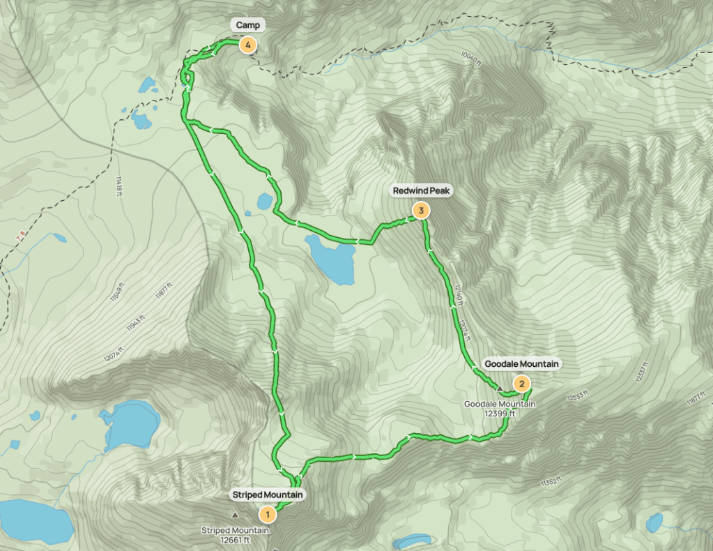
Day 3
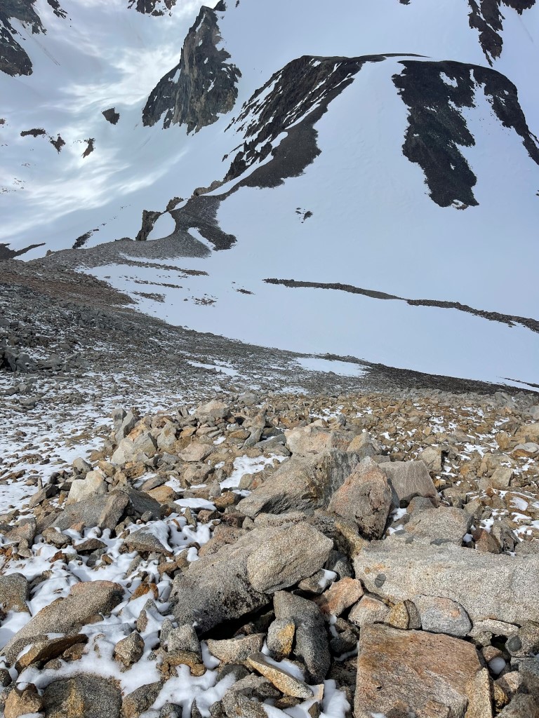
The plan for day 3 was to climb Cardinal Peak and then descend back to the trailhead. Once again, I got an early start since I wanted to be out of Cardinal’s south facing couloir before the sun hit it. I began hiking at 4:20am from 10962 feet.
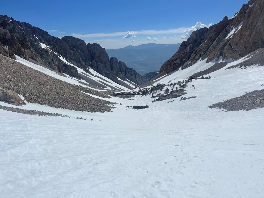
I hiked up to the top of the pass and filled up my water again at the one of the small pools. I then put on my crampons and entered the couloir.
The snow was perfect for crampons – firm with a crunchy layer on top. This chute is supposed to have very loose rock, so I was happy to be here in winter conditions.
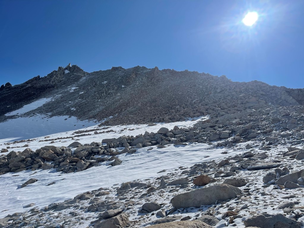
Around 12600 feet the snow petered out and I climbed the rest of the way on dry talus (mostly class 1).
I made it to the summit at 6:31am at 1.26 miles! I signed the register which had been placed in 2016. The most recent entry was from May 16. This peak is a popular winter ascent, as there were a number of entries from the last month or so. The views of course were outstanding. Cardinal is the next peak south from Split Mountain, and Split is in my opinion one of the most visually striking peaks in the Sierra.
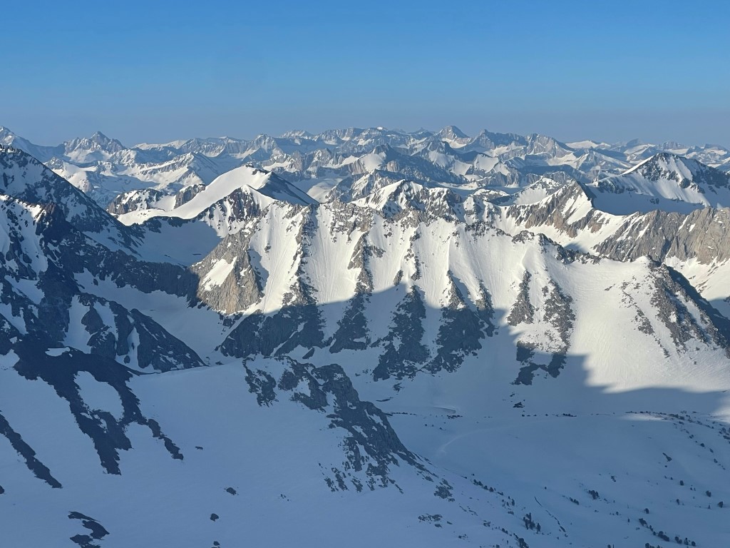
Mount Goddard and Mount Darwin to the northwest:
Mount Ericsson, Mount Kaweah, Midway Mountain, and Mount Brewer to the southwest:
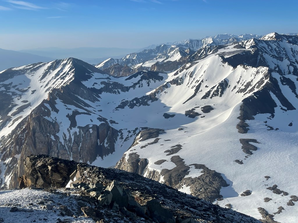
To the south were the 2 peaks I climbed the day before: Goodale Mountain (left) and Striped Mountain (right). Taboose Pass is in the foreground.
I descended the east ridge of Cardinal.
I was able to stay on the rock along the ridge to avoid putting my crampons back on. I descended to 12600 feet and then stopped to consider climbing Peak 12851 just a short distance to the east. Staying on top of the ridge looked like it would work in dry conditions, but there was too much snow to make that viable. I briefly considered traversing the top of the snowfield just below the ridge, but I decided the avalanche risk was too high to do that safely. The slope was >45 degrees and it was baking in the sun already, plus I could see previous avalanche debris down below. I instead turned south and descended county line ridge (named because it straddles the Inyo/Fresno County line). I then glissaded a couple hundred feet back to Taboose Pass.

I filled up my water at the small pool and then reached camp at 3.2 miles. I packed up all my gear, put on my snowshoes, and then began the long descent down the canyon.
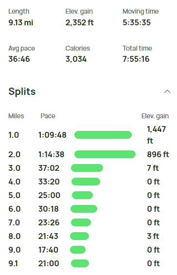
It was another very warm day, so the snow quickly turned into a messy slush fest. I still made good time down the canyon. I saw another skier making their way up to the pass (I saw at least 1 skier all 3 days). I reached the trailhead at 12:16pm. Stats for day 3 were 9.13 miles, 2352 feet elevation gain, and 7:55:16 total time.