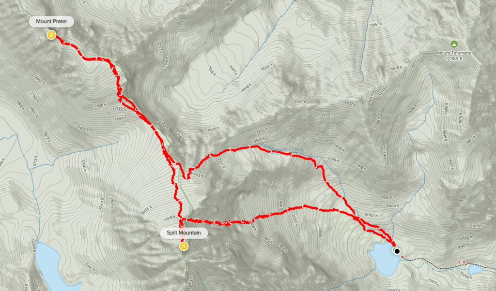
Day 1
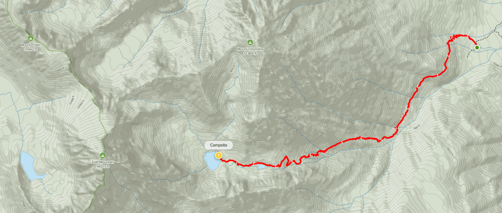
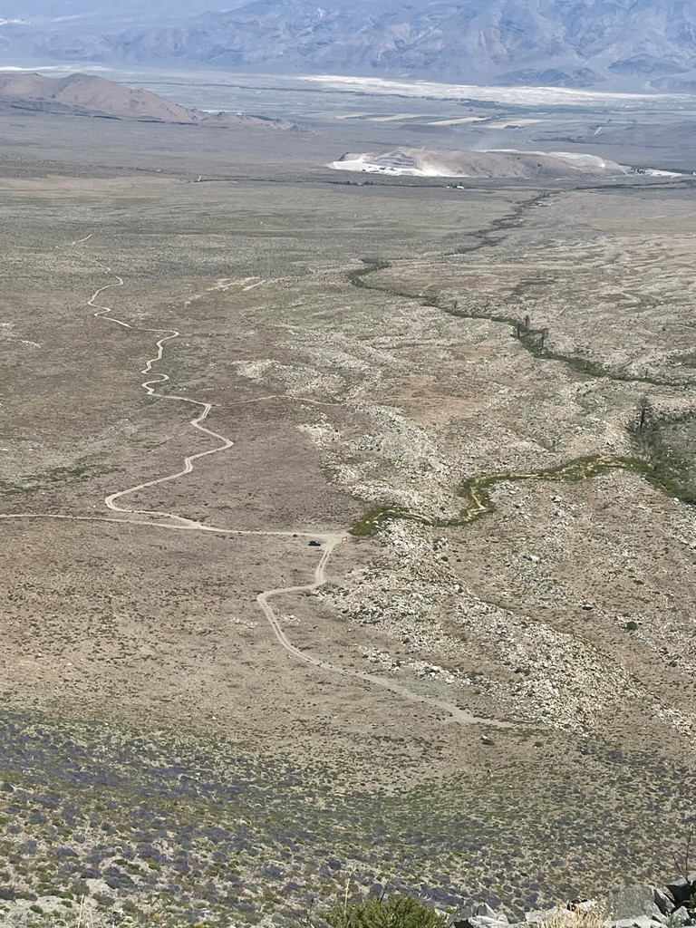
Split Mountain is a 14058 foot peak in the Eastern Sierra located southwest of the little town of Big Pine. It is the southern-most 14er of the Palisades, a rugged group of peaks on the Sierra Crest that contains multiple 14ers. Mount Prater (13471 feet) is located about a mile or so northwest of Split along the crest. Mount Tinemaha (12520 feet) is east of the crest about a mile or 2 from Split. I planned to climb the 3 peaks as part of a 3 day, 2 night backpack with both nights spent at Red Lake. Just getting to the trailhead is perhaps the crux of this hike. I left San Diego Friday morning and drove 5 hours to Big Pine. From there, it is 14 miles of dirt roads to the Red Lake Trailhead which takes at least an hour. The first 9 or so miles are good dirt, and you can drive 25+ mph hour on it. The last 4-5 miles get really rough, especially the section that descends Fuller Creek. It is worth noting that this part is much more difficult on the way out due to a few steep inclines. It may be possible to get through this section without 4WD/AWD but then not be able to get back out. Also, don’t use Google Maps since it will try to take you through private property west of Tinemaha Campground. I won’t get into the full turn by turn steps here, but there are various sources online that provide accurate directions. 4WD/AWD and high clearance definitely required. I made it to the trailhead in one piece and began hiking at 11:22am from 6602 feet above sea level. The trailhead sign was on the ground.

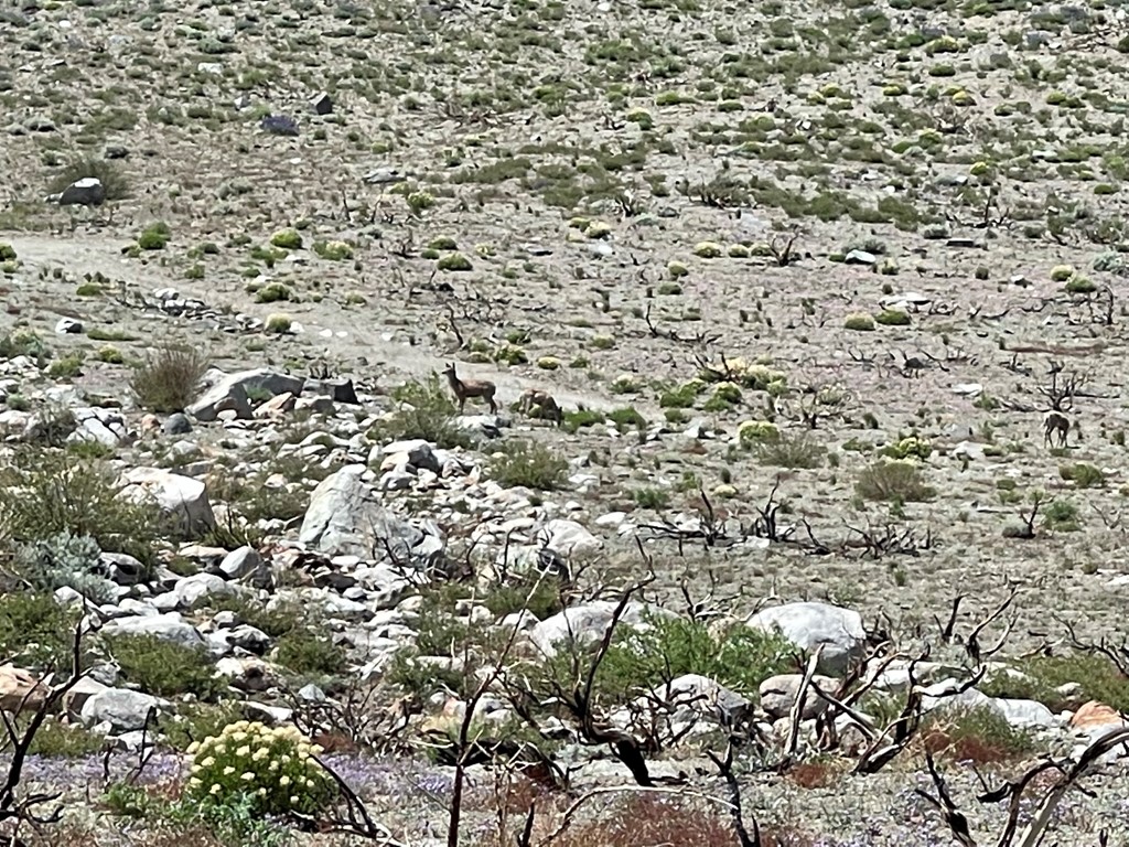
There was no one else at the trailhead when I arrived, except for some deer that I spotted. Despite being a 14er, Split is not overly crowded due to the 8000 foot climb to reach it and the remote trailhead.
My plan for day 1 was to hike to Red Lake and set up camp. Similar to other Eastern Sierra trails, the Red Lake Trail is steep, hot, and dry.

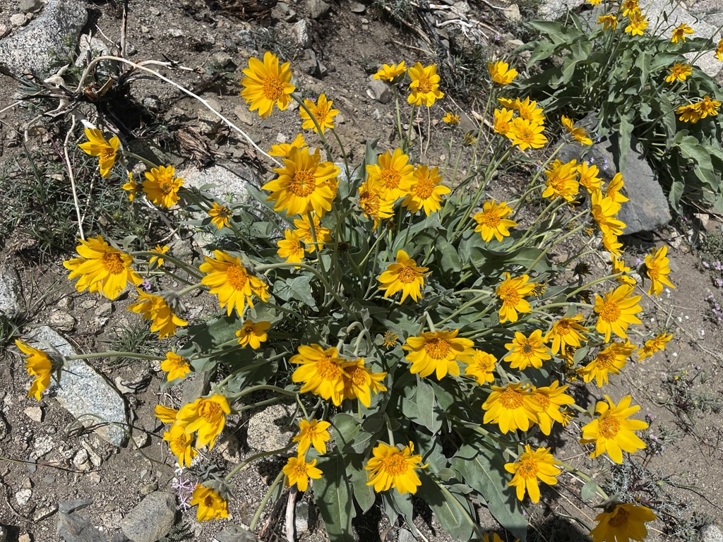
The trail was steep right off the bat. There were many pretty wildflowers near the beginning.

I passed the wilderness sign early in the hike.

There were some pretty yellow flowers as well.
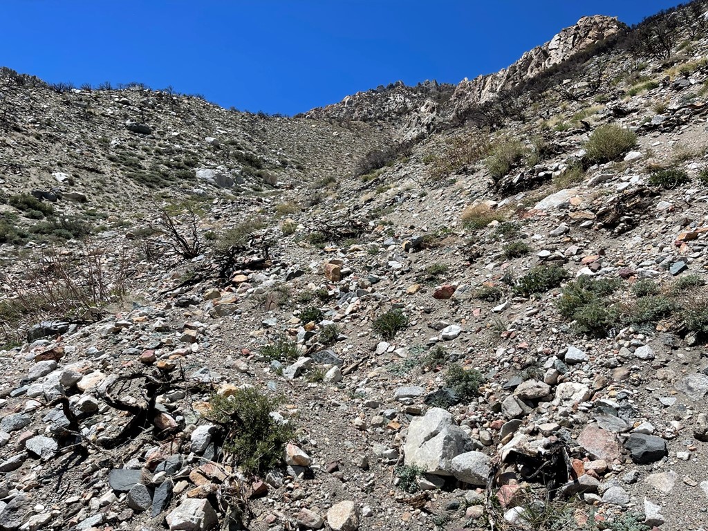
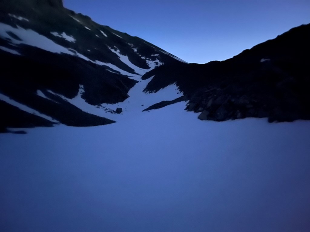
At 0.8 mile I turned a corner and saw the snow-capped peaks in the distance. The canyon seen below is formed by Red Mountain Creek. The trail follows the canyon all the way up to Red Lake, where the creek originates from.

The next mile or so was relatively flat. There was recent burn evidence in the area.
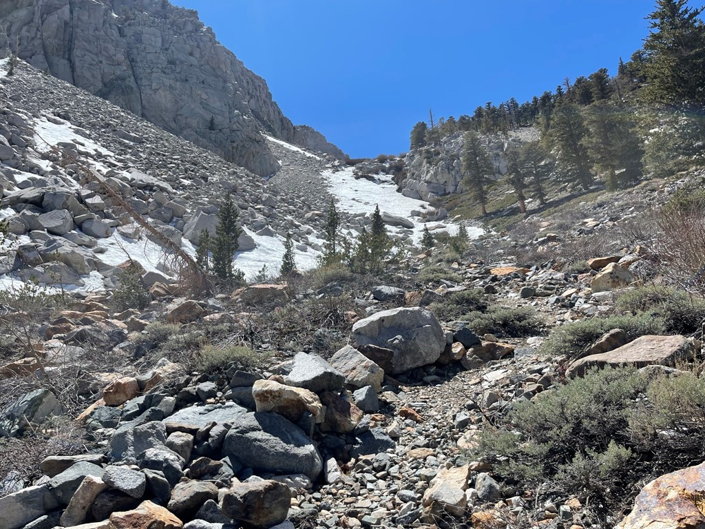
The trail really steepened around 2 miles. This was tough with my heavy pack.
I crossed the first snow patch at 9000 feet.
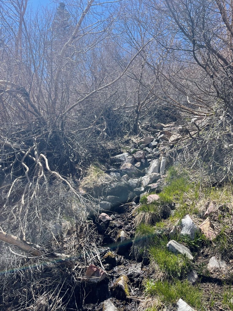
There was a short section of medium thick brush to fight through. Part of the trail was wet as it crossed a small tributary of Red Mountain Creek.
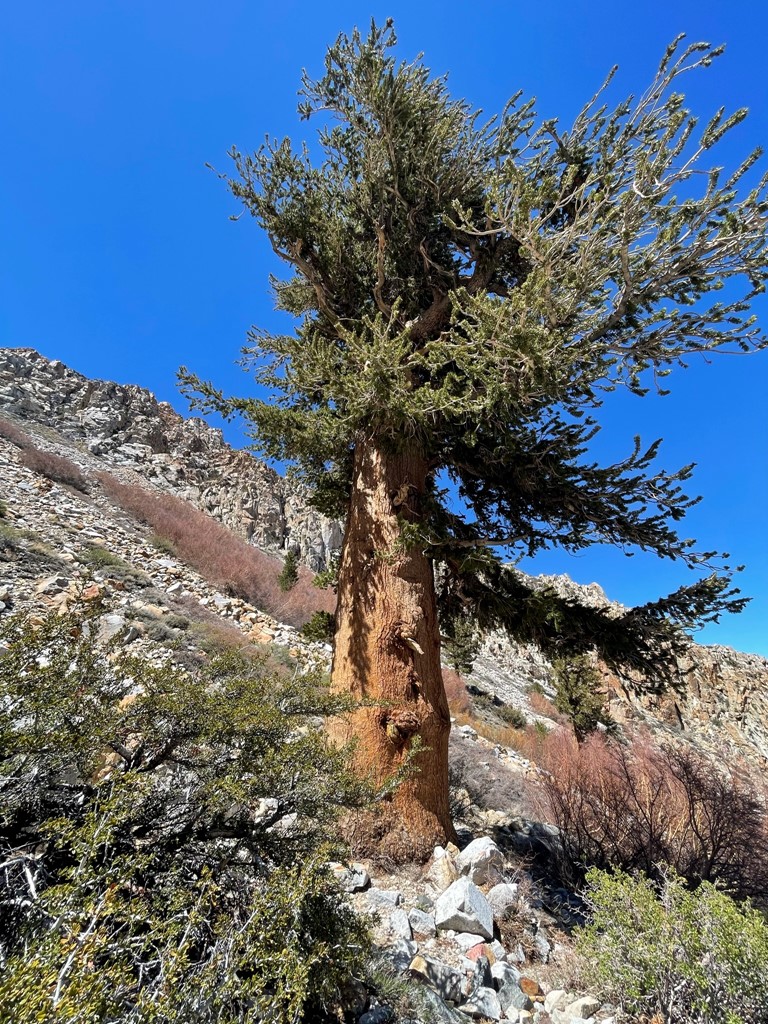
I began to see some large limber pines.
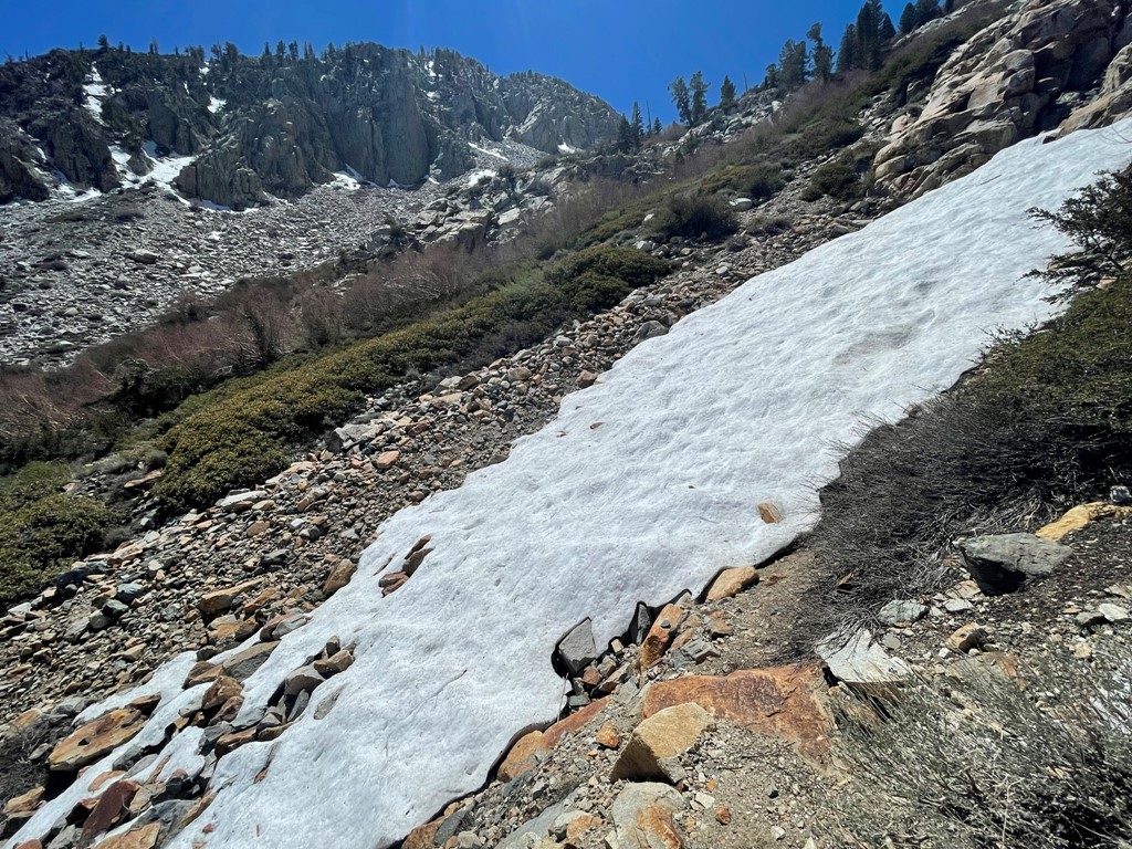
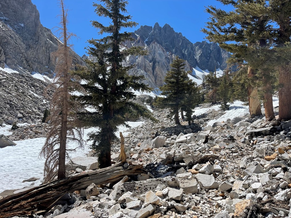
There was more snow as I ascended higher.
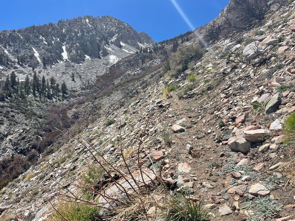
As I got close to Red Lake, I got my first look at Split Mountain.
I reached a small unnamed lake at 3.6 miles at 10200 feet.
The trail petered out above the unnamed lake, but it was easy to follow the creek to Red Lake.

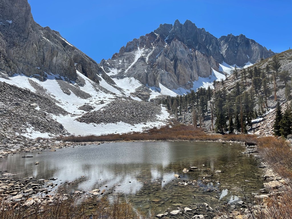
I reached Red Lake at 3:34pm at the 4.3 mile mark. The lake is located at 10500 feet. There was a thin layer of ice on the surface of the lake still. The edges were completely thawed so I was able to get water from there.
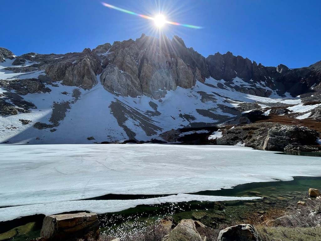
The sun dipped right in between Split Mountain’s twin summits. The north (right) summit is higher.
The St. Jean Couloir was visible north of the main summit. I was considering ascending this route the next day.
I set up camp on the eastern shore of the lake.

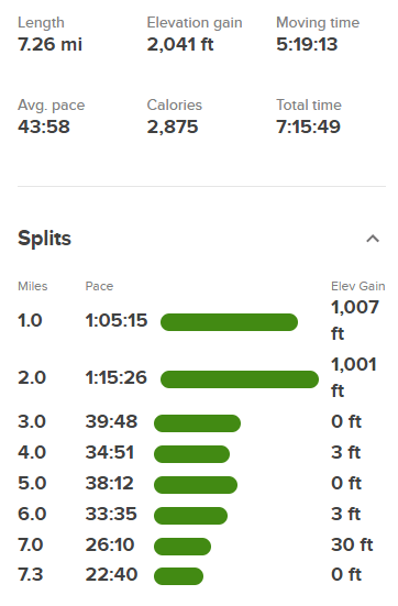
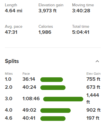
It was breezy when I arrived, but the wind really kicked up during the night. Unfortunately, I didn’t get much sleep. Stats for day 1 were 4.64 miles, 3973 feet elevation gain, and 5:04:41 total time.
Day 2
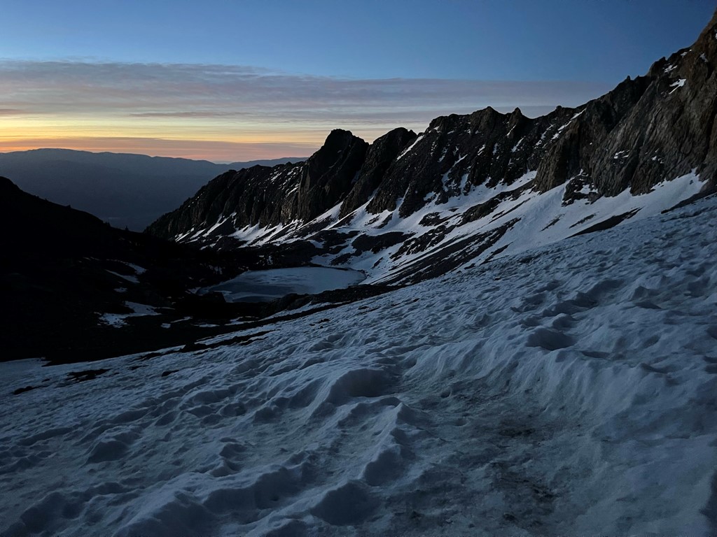
The standard route to Split involves ascending moderate talus slopes northwest of Red Lake to the Split-Prater saddle, and then climbing the north slope of Split from there. This route is fairly straightforward class 2. However, there are other, more technical routes that go directly up the east face. I planned to ascend the St. Jean Couloir, or at least hike up to the base of it and see what it looked like. I wanted to get a very early start so that I would be in the couloir before the sun warmed it up too much. The couloir faces east so the sun hits it as soon as it rises. I began hiking at 4:37am from 10500 feet.

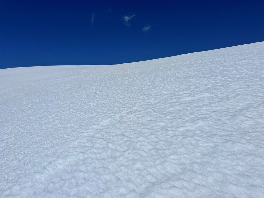
I ascended the snowy slopes above Red Lake. Dawn began materializing behind me.
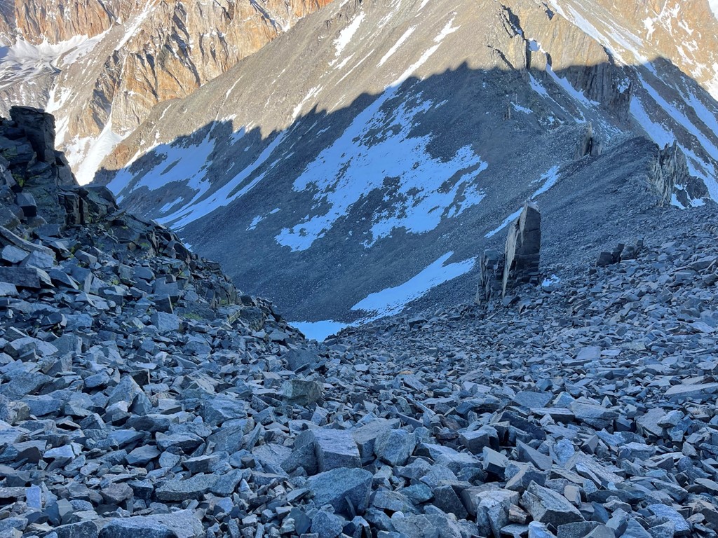
I put my crampons on as I reached Split Mountain Glacier near the base of the couloir.
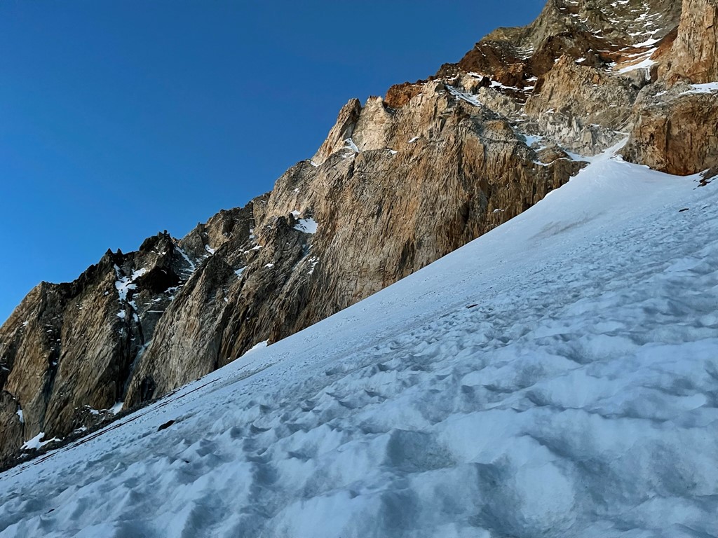
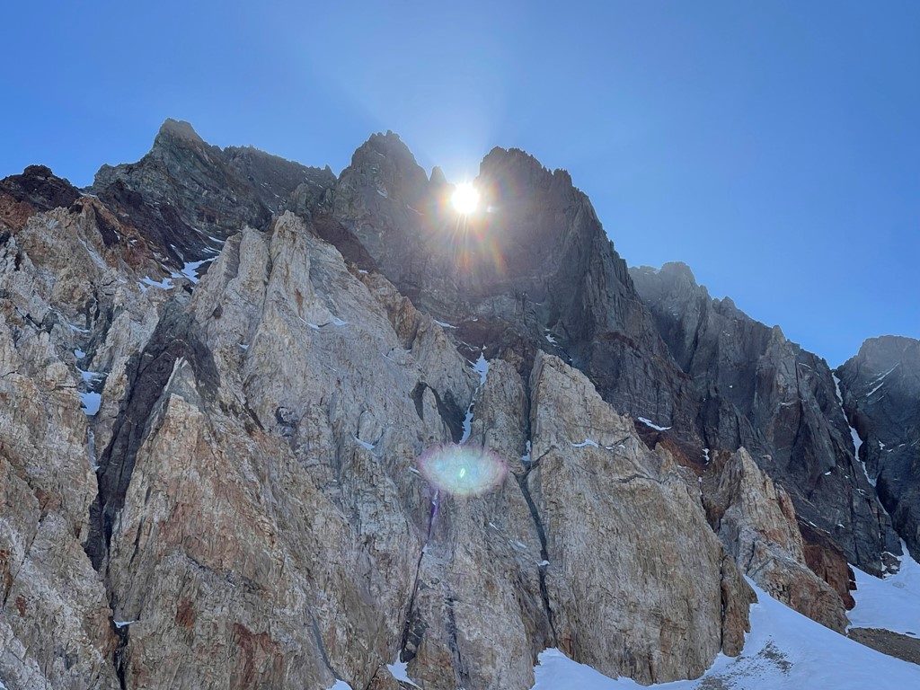
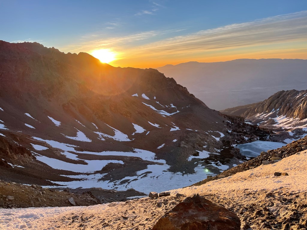
The sun made an appearance above the ridge behind me.
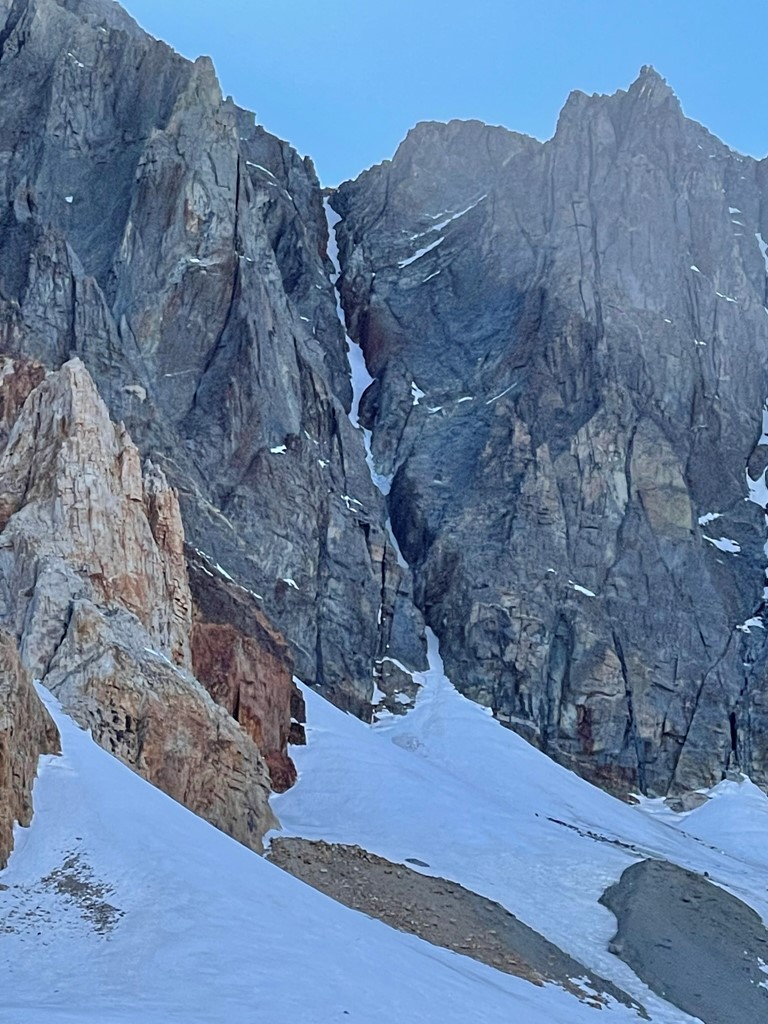
There were 2 couloirs in front of me. On the left was the East Couloir, which is reported to be more technical than the St. Jean. Indeed, there was a large ice waterfall at the base of the couloir that I wanted nothing to do with.
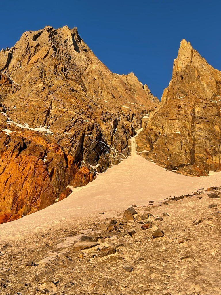
Just to the right of the East Couloir was the St. Jean Couloir. The snow looked good, so I decided to give it a go.
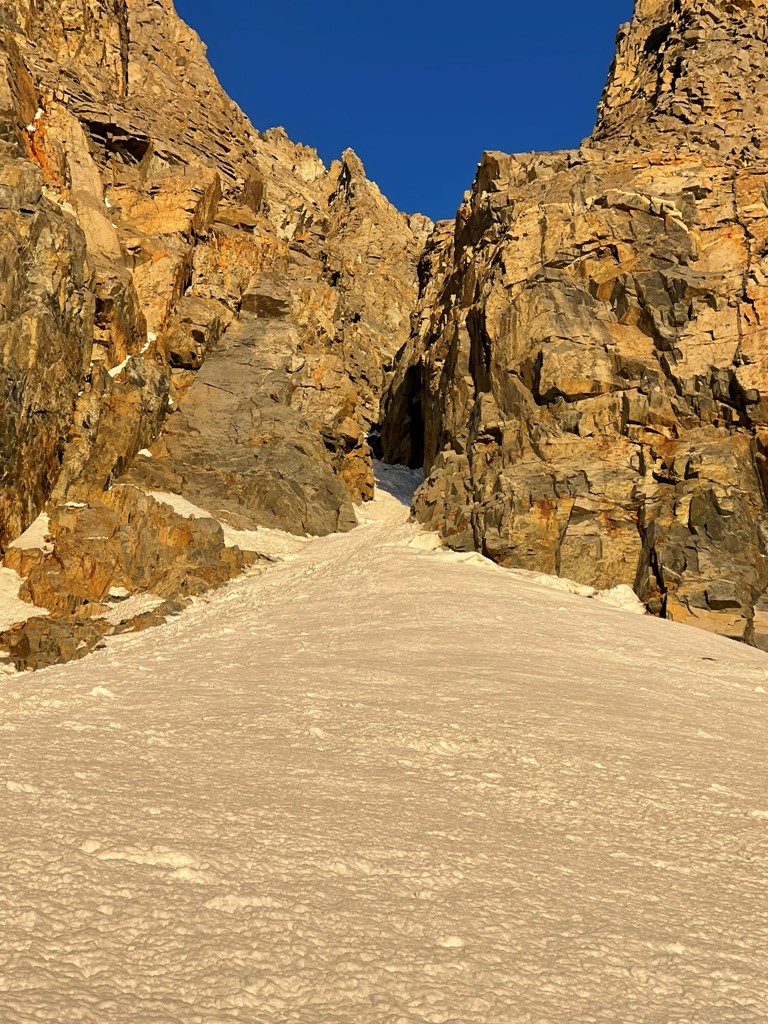
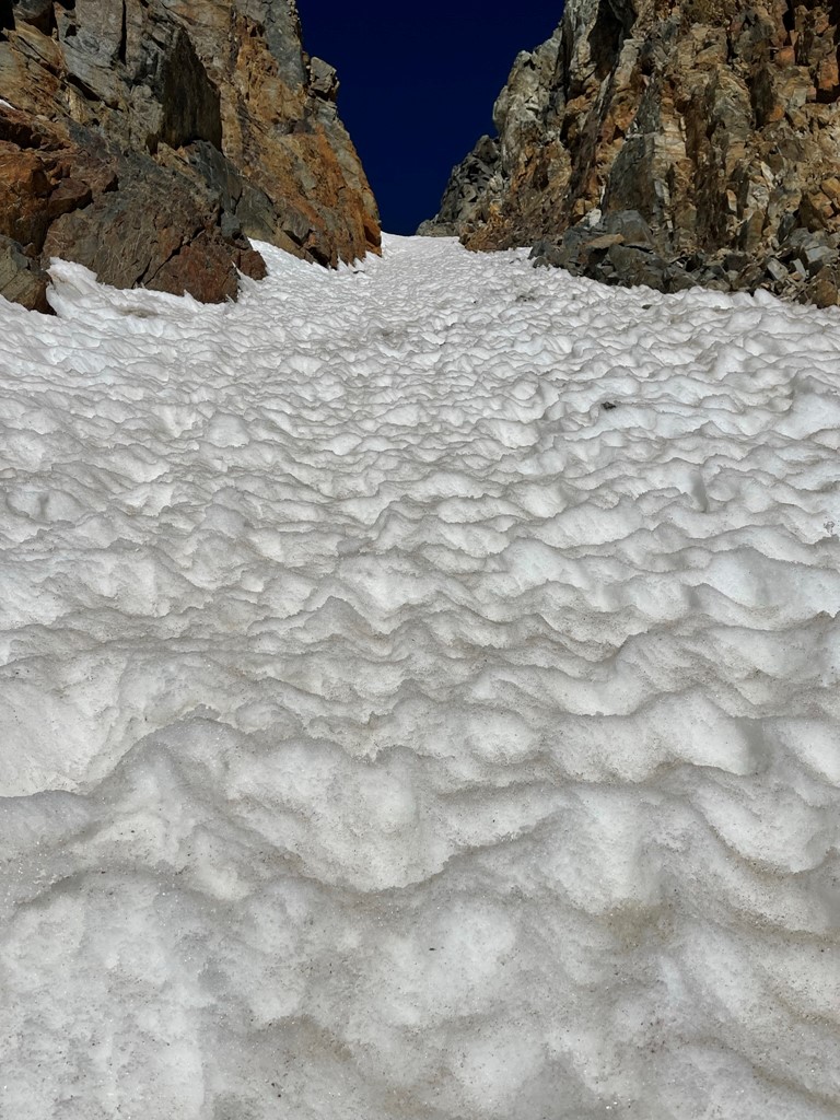
I entered the couloir at 12200 feet. I put on my helmet since rock fall was a significant concern in this narrow gully. Thankfully, I didn’t have any close calls despite many small rocks falling near me.

I front pointed my way up the steep snow.

The angle was quite steep. Various trip reports I read indicated that the angle exceeds 50 degrees.
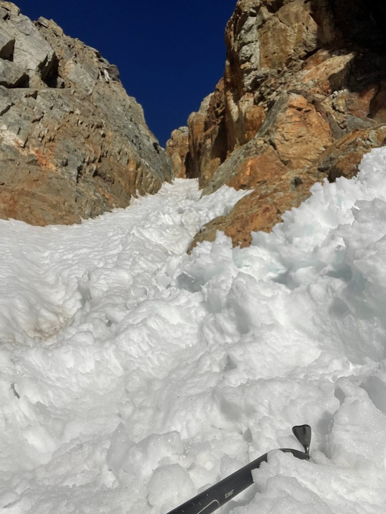
Near the beginning I encountered a large rock step completely covered in ice. I was able to bypass this to the right via a class 3 rock scramble. I did not get a picture of this. This is looking back down the couloir:
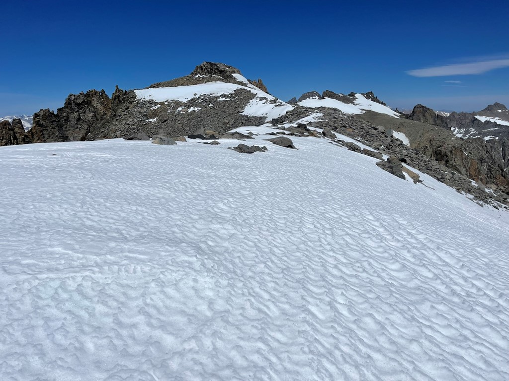
Beyond that the couloir was fairly straightforward. My pace was slow due to the steepness and altitude. The snow began to soften up a little as I neared the top, but it didn’t inhibit my progress too much.
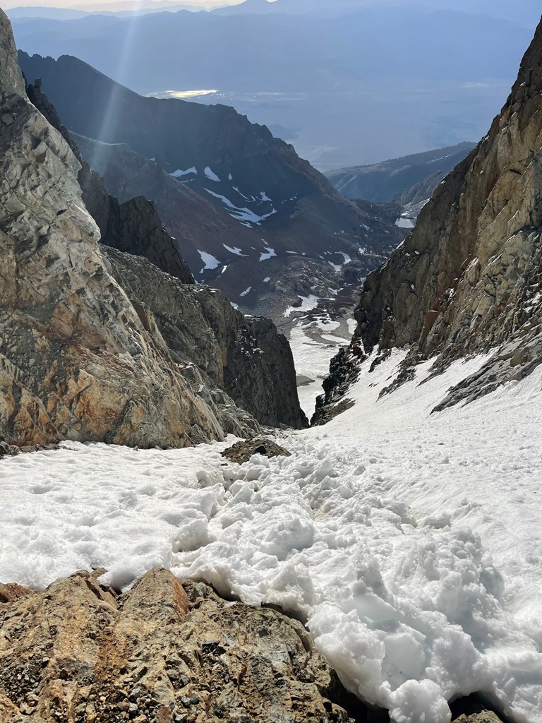
I reached the top of the couloir at 2.2 miles at 13600 feet. I had ascended 1400 feet in about a mile. I was now on the north slope very close to the summit.
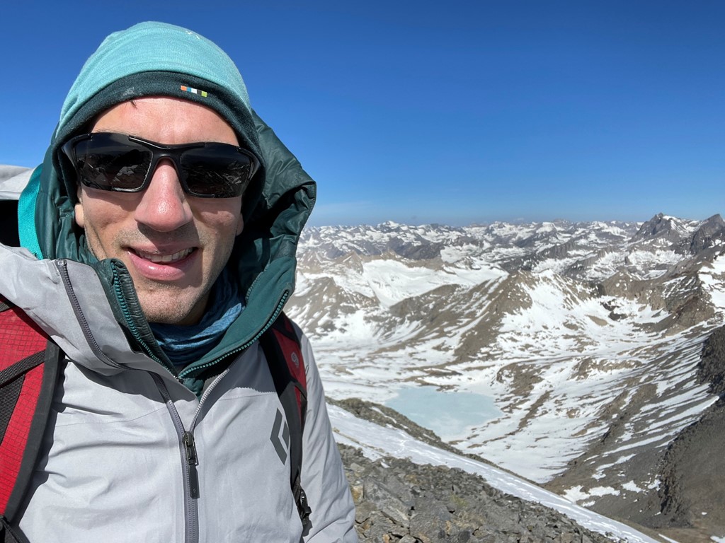
I had been protected from the wind in the couloir, but now I was fully exposed to it. I put on a few layers and made my way up the last few hundred feet. I reached the summit at 9:12am at 2.4 miles!
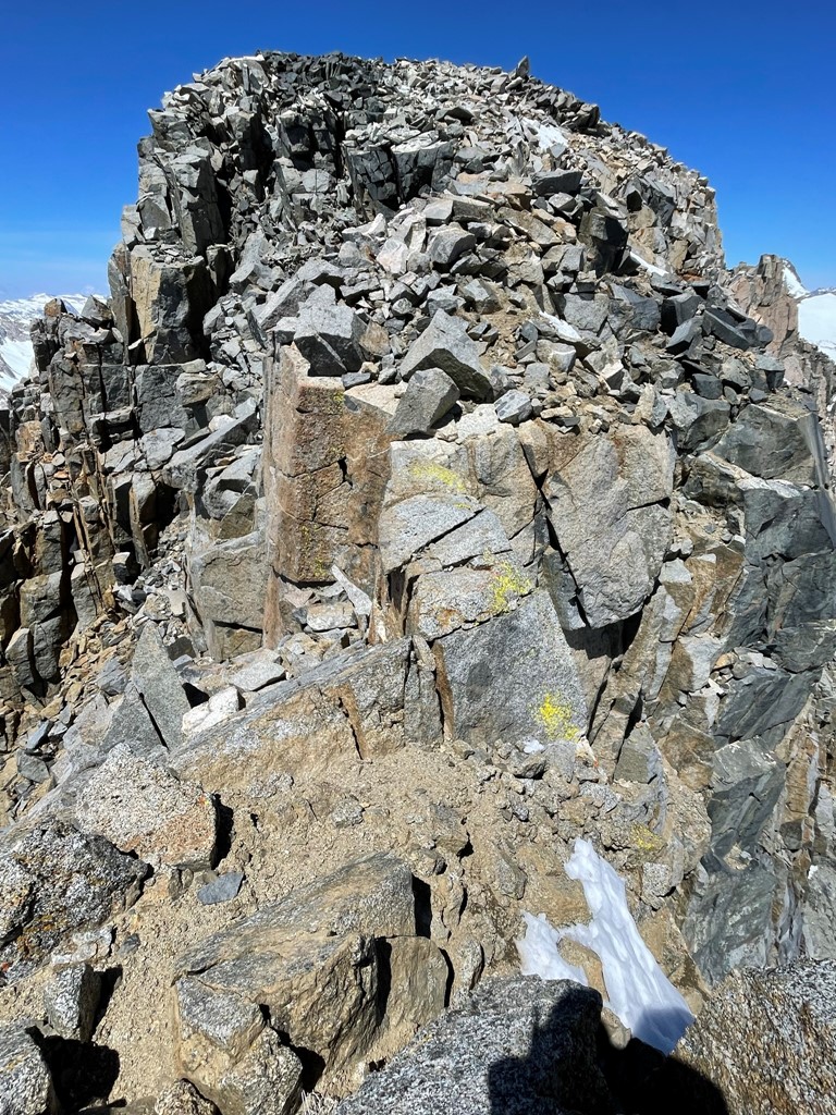
I signed the register which had been placed in August 2021. The most recent entry was from 2 days prior. There was an older register book as well, and I noticed many winter entries in both. I also located the benchmark and a reference marker.


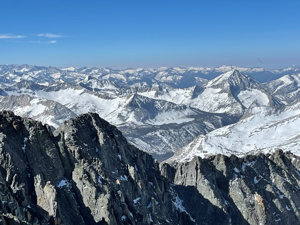
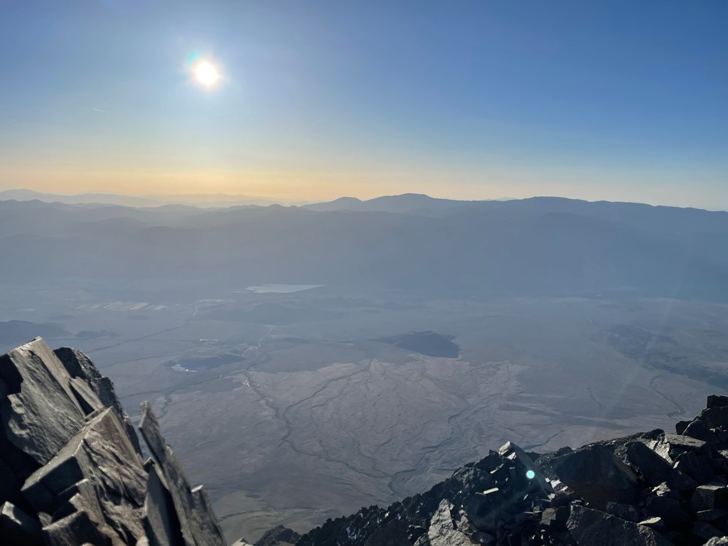
The views were perhaps the best I had seen in the Sierra. I had never been at 14000 feet so early in the season. Plus, Split Mountain has over 1500 feet of prominence and there is nothing higher than it all the way from Mount Williamson to North Palisade. This is looking south towards Williamson. Split Mountain’s lower south summit is in the foreground.
Looking southwest towards Arrow Peak:
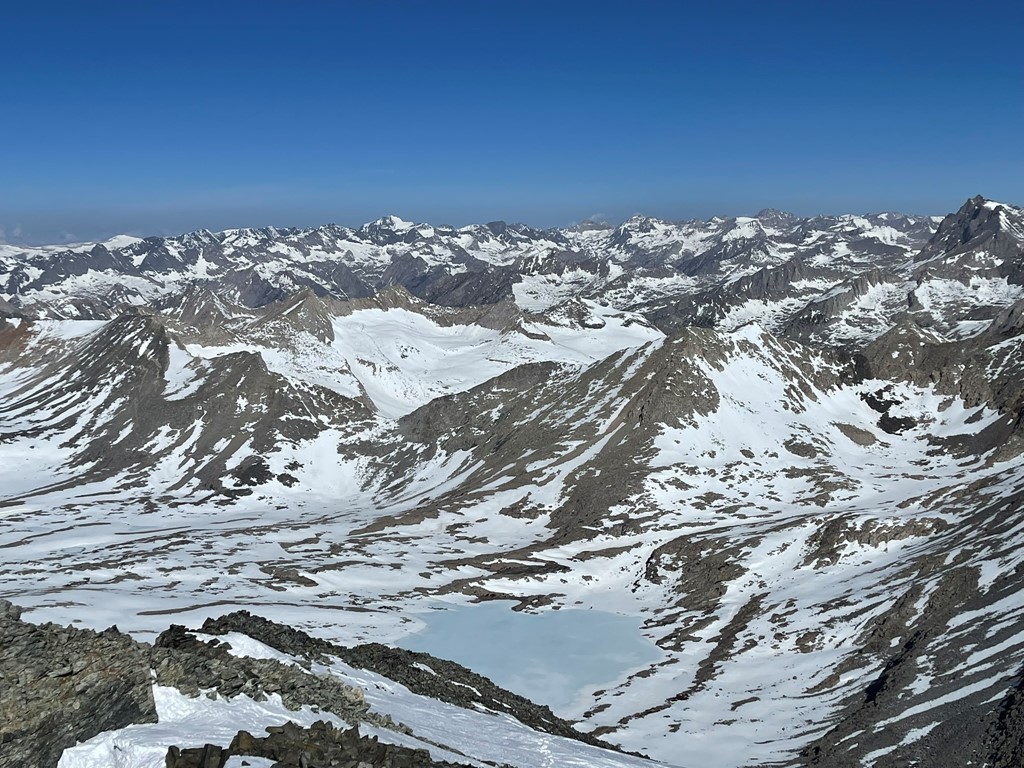
Looking west towards the Upper Basin:

Looking northwest towards Mount Goddard and Mount Darwin:
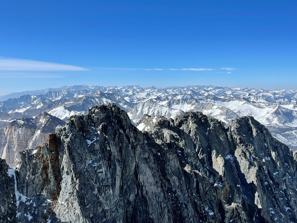
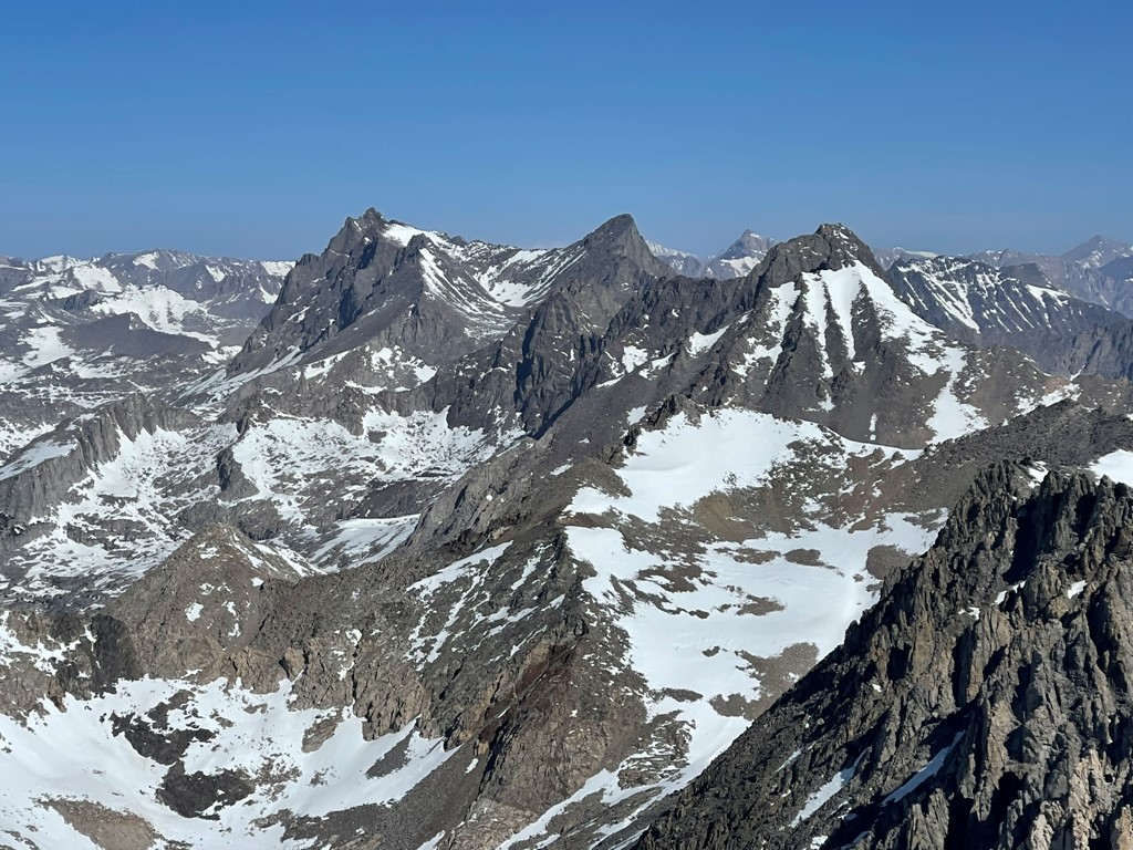
Looking north towards the remaining Palisades 14ers: North Palisade, Mount Sill, and Middle Palisade. Split Mountain is sometimes referred to as South Palisade.
I began descending after a nice break. My plan for the rest of the day was to climb Mount Prater and then return to camp. I descended the north slope to the Split-Prater saddle.

I reached the saddle at 3.2 miles at 12650 feet.

I stayed close to the ridge as I climbed up the southern slopes of Mount Prater. I crossed a few large snowfields (no crampons needed).
It was a fairly steep climb up to about 13300 feet. I then followed the top of the ridge the rest of the way.
Just before the summit, I reached a narrow catwalk that I had to cross. It’s hard to see in the picture below, but it’s probably about 2 feet across. Under normal conditions, I would have just walked across and not even though twice about it. However, the wind was so ferocious that I got down on my hands and knees and crawled across.
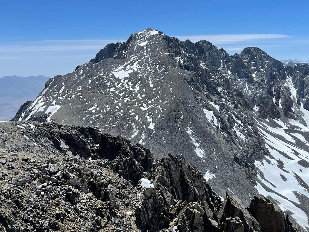
I reached the summit at 11:43am at 4.1 miles! I signed the register which had been placed in 2020. The most recent entry was from the previous August. The views were pretty much the same, except Split blocked the view to the north:
I descended back to the Split-Prater saddle after a short break.
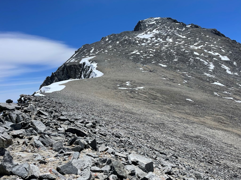
I reached the saddle and then had to climb a few hundred feet to the chute which descends to Red Lake.
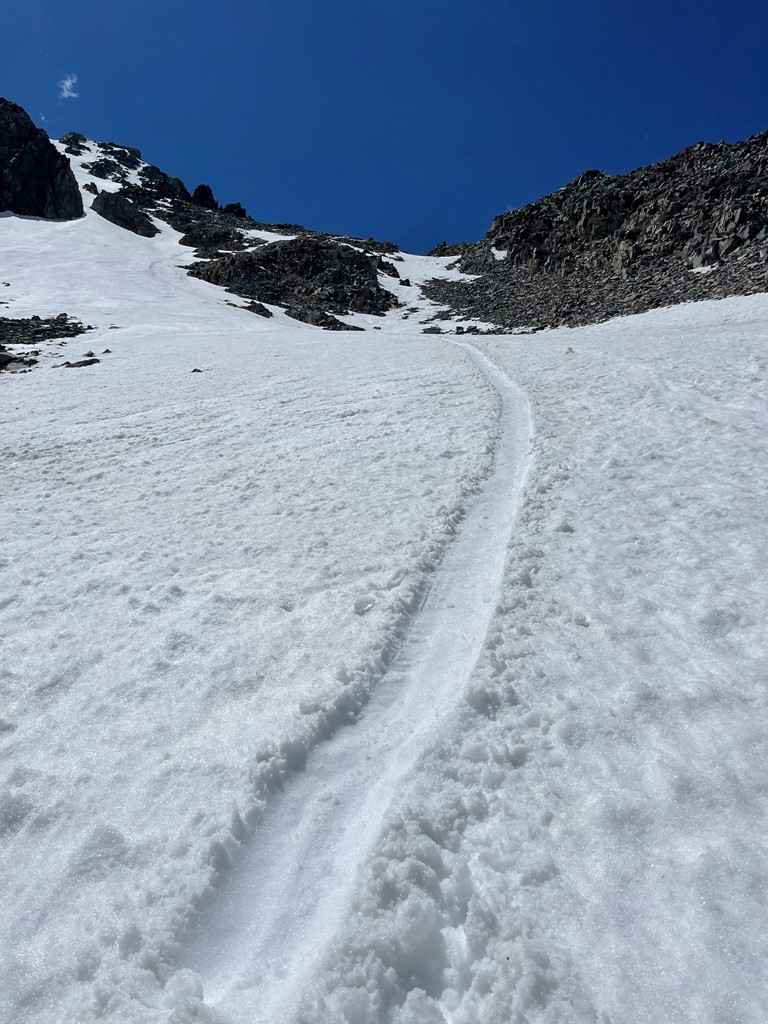
I put my crampons on to descend, but it was slushy enough that they probably weren’t necessary. I passed a day hiker on his way up to Split. He was avoiding the snow by climbing up some narrow exposed rock to my left. I’m not sure if it would be possible to ascend to the saddle without crampons at this point, but it seemed like he was trying to. As I got lower, I took my crampons off and glissaded down.
Red Lake became visible as I neared the end of the hike.

I reached camp at 2:44pm. Stats for day 2 were 6.9 miles, 4872 feet elevation gain, and 10:05:37 total time.

I hung out the rest of the day in camp. Unfortunately, it was so windy that it was hard to do anything. At one point I moved my tent to a more sheltered spot but that didn’t seem to help much. I crawled into my sleeping bag once the sun went down behind Split Mountain since the wind made it too cold to stay out any longer. I had another lousy night of sleep.
Day 3
The plan for day 3 was to climb Mount Tinemaha and then return to the car. I hadn’t intended on such an early start, but I wasn’t really sleeping much due to the wind. It was somehow worse than the day before and it was also quite cold. I noticed my water was slightly frozen when I woke up, so the temperature had dipped below freezing overnight. I began hiking at 4:19am from 10500 feet. I scrambled up a rocky slope north of Red Lake.
I then climbed up a snow covered slope. Crampons not needed.
I continued north as I reached a large bowl beneath Tinemaha.
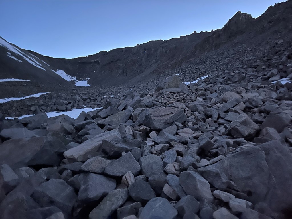
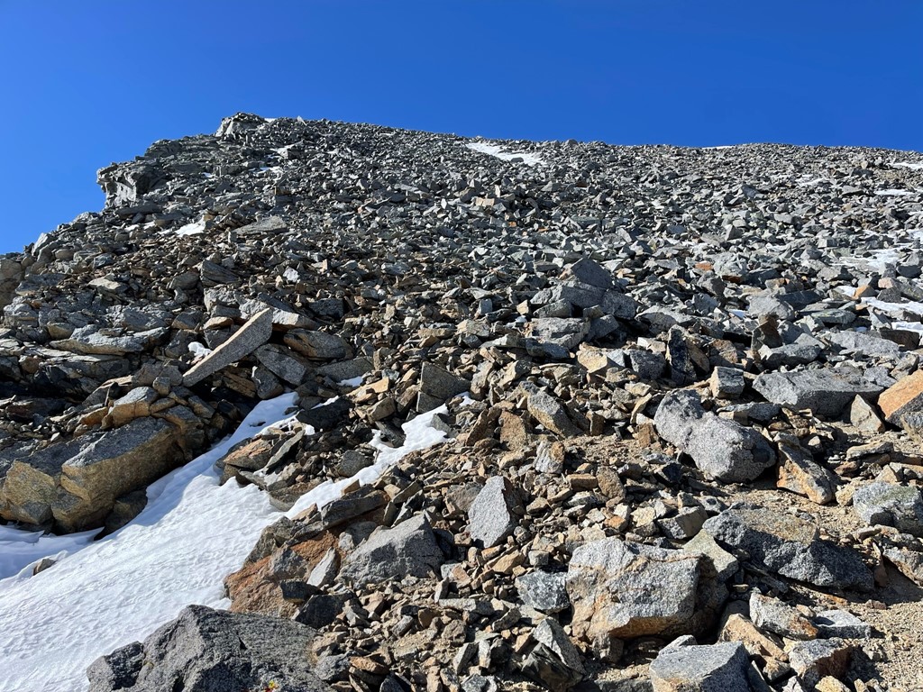
I proceeded across the bowl and then began to climb up steep talus slopes.

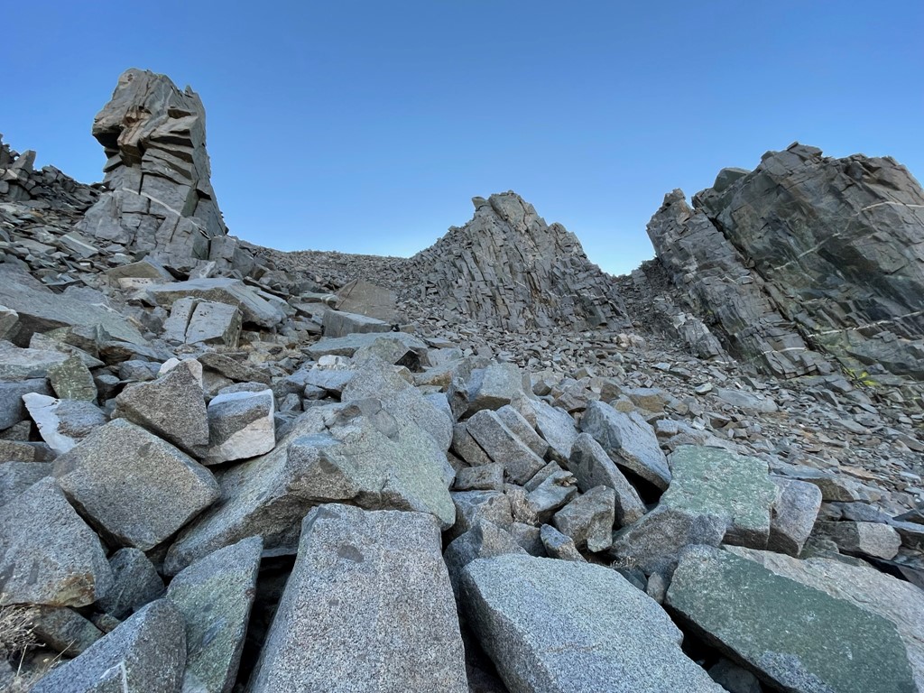
I wanted to stay off any ridges today due to the hurricane force winds, so I made a direct line to the summit. I passed between some rocky spires.
As I neared the top I was exposed to the full force of the wind. I could barely stand up it was so strong. Somehow, I reached the summit at 6:35am at 1.5 miles. I hunkered down to shelter myself from the wind and signed the register. It was placed in 1989 and most recently signed on March 25. The climber who signed it last wrote that he planned to ski down the east face which sounded crazy to me. I had a great view of Split Mountain to the southwest. The East Couloir is the prominent line of snow in the middle. The St. Jean Couloir was hidden from this angle.

Directly west I could see Mount Prater and Mount Bolton Brown.

To the east I could see the sun rising above the White and Inyo Mountains.
I began descending after a short break. The loose, small talus made the descent tedious.
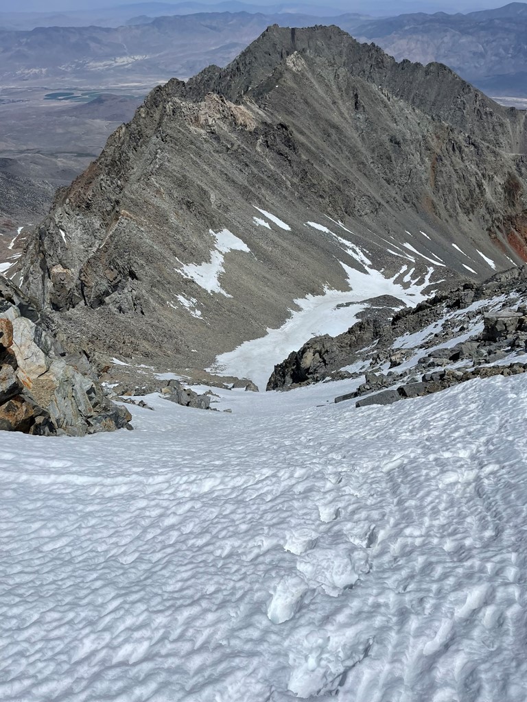
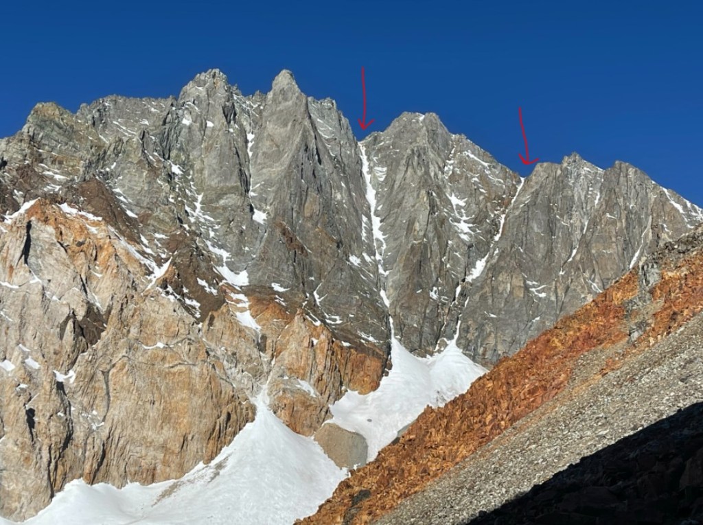
As I descended, I had a good perspective of the 2 main couloirs on Split’s east face. The East Couloir is the left one and the St. Jean Couloir, which I ascended the day before, is the right one.
I made it back to Red Lake at 8:03am at 3 miles. It took forever to break down my campsite since I had to be so careful of the wind blowing my things away. I began descending about an hour later.
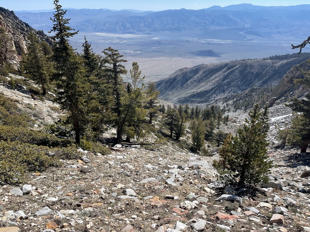
The wind died down once I was in the canyon below Red Lake. I made good time down the steep trail. I was able to spot my car from above once I got close to the trailhead.
I reached the car at 11:35am. Stats for day 2 were 7.26 miles, 2041 feet elevation gain, and 7:15:49 total time.