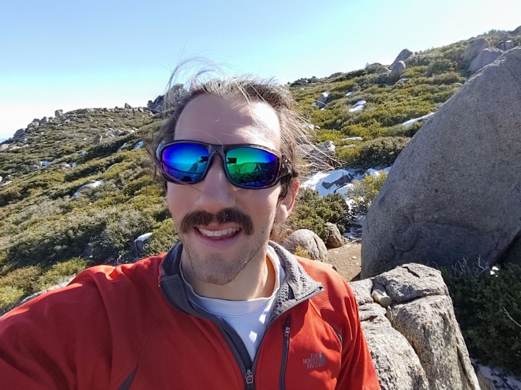
We had just had our first major winter storm in San Diego on Monday, so I decided to drive up to Mount Laguna to check out the snow. I had already climbed most of the notable peaks in the area, but there was still one that had eluded me up to this point: Sawtooth Mountains Wilderness High Point (5960 feet). The Sawtooth Mountains are a very small desert range that lie between Anza Borrego Desert State Park and the Laguna Mountains to the west. Oddly, the wilderness boundary extends beyond the Sawtooth Mountains, so the high point is significantly higher than actual mountain range. The high point is located near the crest of the Laguna Mountains just outside of the Cuyapaipe Indian Reservation. This is one of those peaks that isn’t a peak at all – it is simply a point on the edge of the wilderness boundary that happens to the highest. I left San Diego around 8:30am and made the 1 hour drive to the mountains. The snow began around the 5000 foot level and was a few inches deep by the time I reached Mount Laguna. There were already dozens of cars parked along the side of the road, with countless families playing in the snow, sledding, building snowmen, etc. I intended to start from the Desert View Picnic Area, but the parking lot was full, so I had to park on the road. I started hiking at 9:45am from 5886 feet. I walked through the parking lot and onto the Desert View Trail on the far side.

It was 37 degrees when I got started so I bundled up. I quickly warmed up in the sun though, so I almost immediately shed my outer layer. At 0.4 mile I reached the PCT.
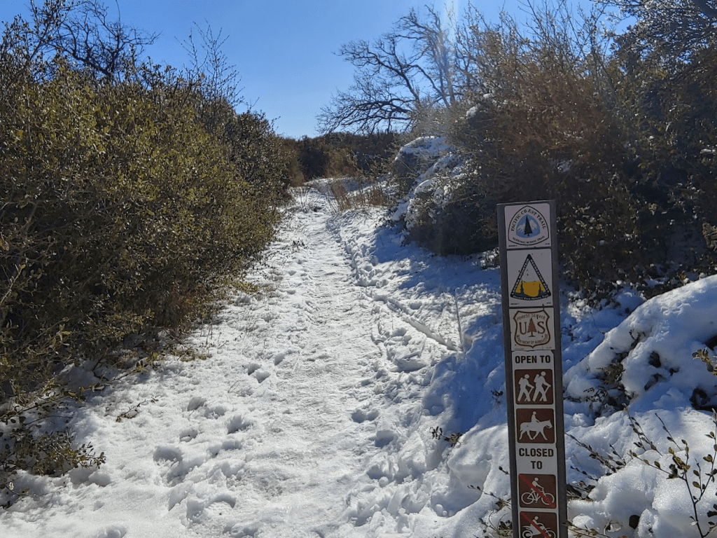
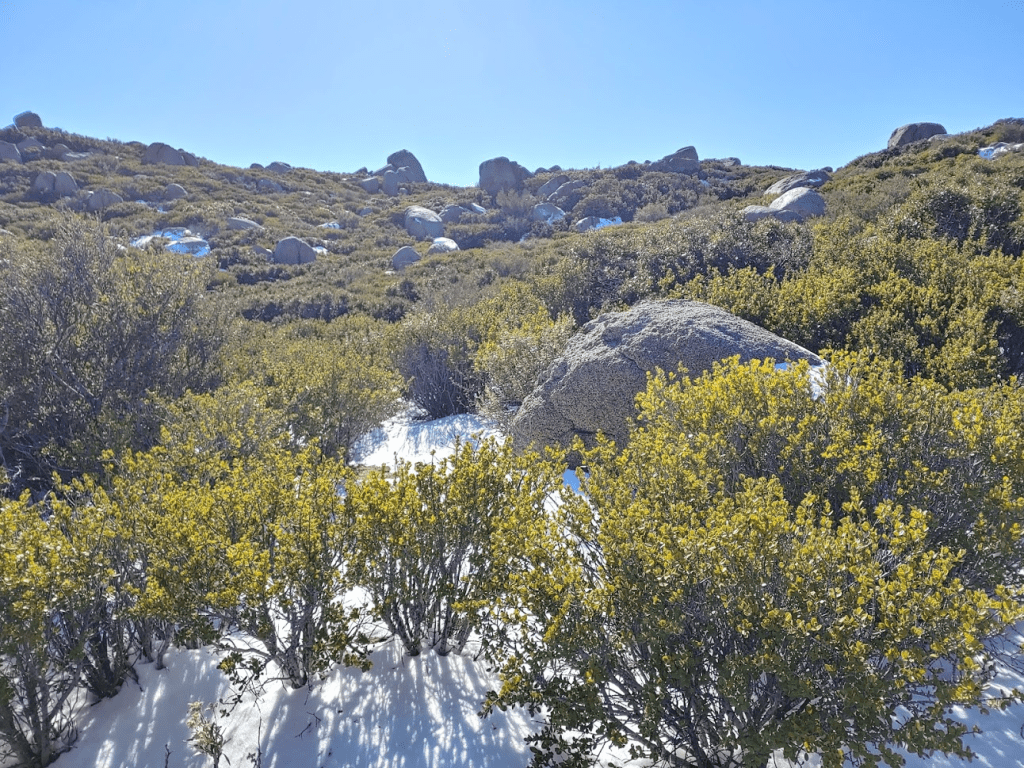
The snow was very beautiful among the pine trees. I felt like I was back home in Wisconsin! The trail was easy to follow due to the footprints of previous hikers from the past few days.

At 0.7 mile I reached a fountain for PCT hikers.

This is where the hiking would become much more difficult. I left the PCT and found a gap in the barbed wire fence which separates USFS land from the Cuyapaipe Reservation. I walked up a snow covered slope and then was able to follow an old fire break for a short way.
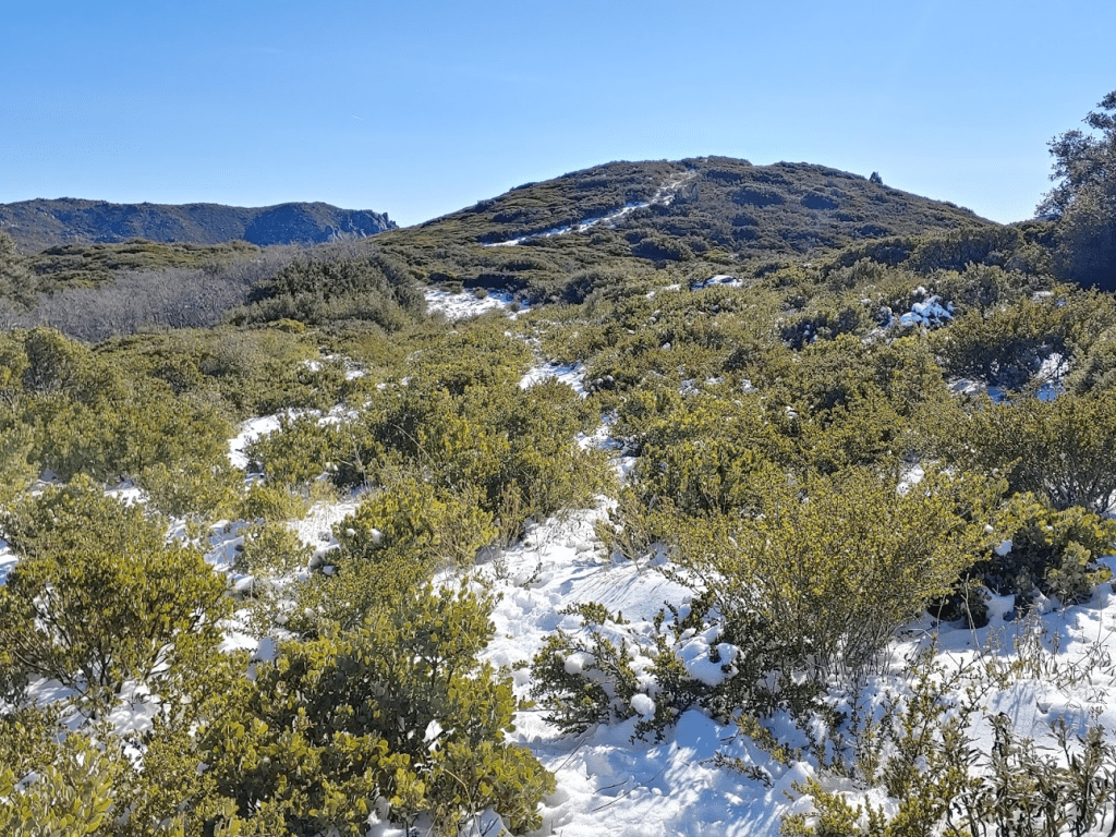
At 1.06 miles I left the fire break and followed a vague use trail that branched off to the east.
The rest of the way would be trying to follow this trail through thick brush. I use the word “trail” here in the loosest sense of the word. There might have been a trail here at one time, but it is all but gone now. The next mile actually wasn’t too bad. The brush was knee high, so I was able to make decent progress. Following the GPS tracks of others, I stayed near the crest as it makes a few minor ups and downs.

About 2 miles in, the route became much more difficult. The brush got taller and thicker, and there were now some larger boulders to deal with.
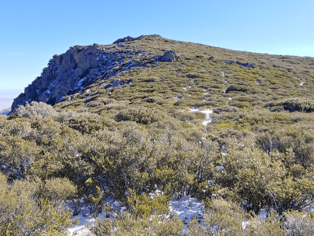
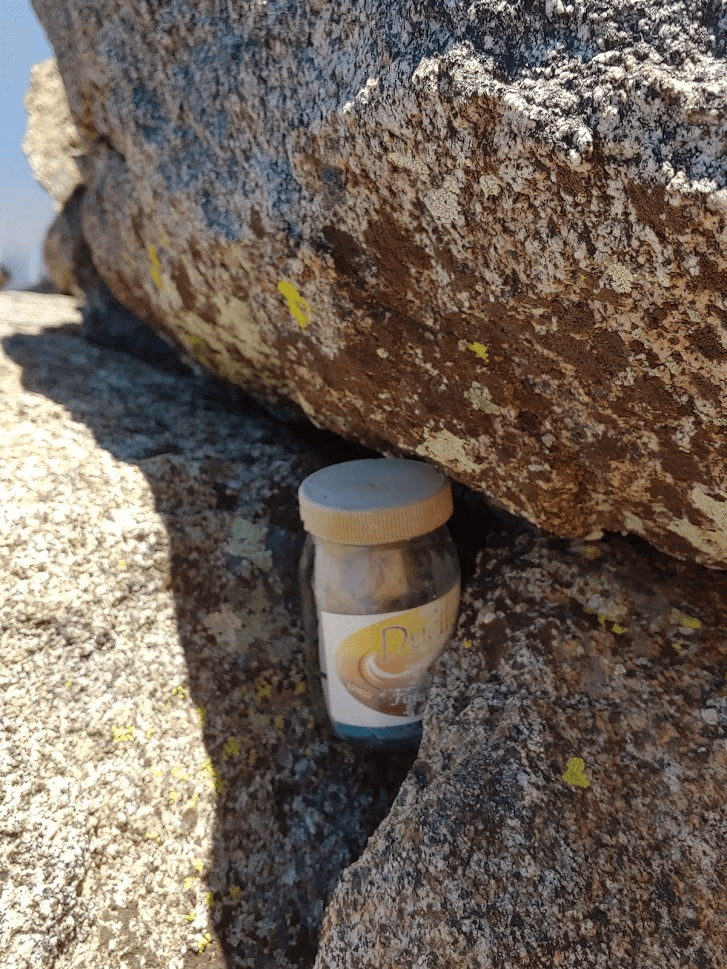
Eventually I turned north and descended away from the crest towards the actual Sawtooth Mountains. This was the worst part of the hike. The brush was so heavy that it took forever just to go a few tenths of a mile. Finally, I reached the coordinates of the high point. There were a few rock piles in the area, so it was difficult to tell which one was the right spot. I climbed up one pile of rocks and found a register so figured that must be it. I reached the summit at 11:48am at 3.03 miles.
The register was water damaged beyond repair, so I was unable to sign it.
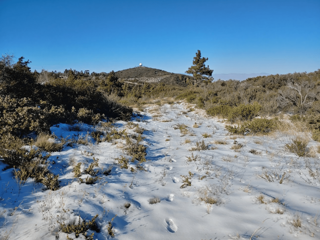
It was a beautiful, clear day so I spent some time soaking in the views while I had a snack. To the northwest I could see Stephenson Peak (left) and Monument Peak (right). Stephenson Peak has an observatory on the summit (look for the golf ball) while Monument has an array of communication towers. Both peaks are over 6000 feet and are among the highest named summits in San Diego County.

To the north I could see Hot Springs Mountain, San Jacinto, and San Gorgonio way in the distance. All 3 peaks were covered in snow.

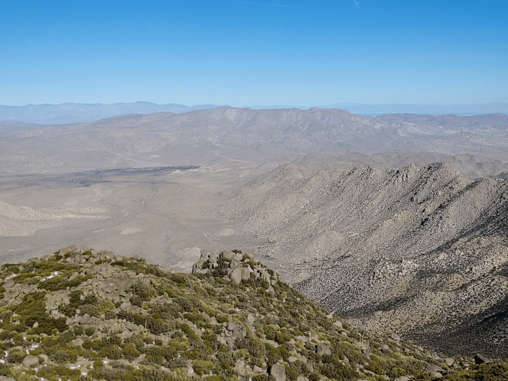
To the northeast I could see Anza Borrego’s Whale Peak, as well as various desert peaks in the distance (Eagle, Orocopia, Black Butte). The ridge in the foreground on the right side below is the Sawtooth Mountains.
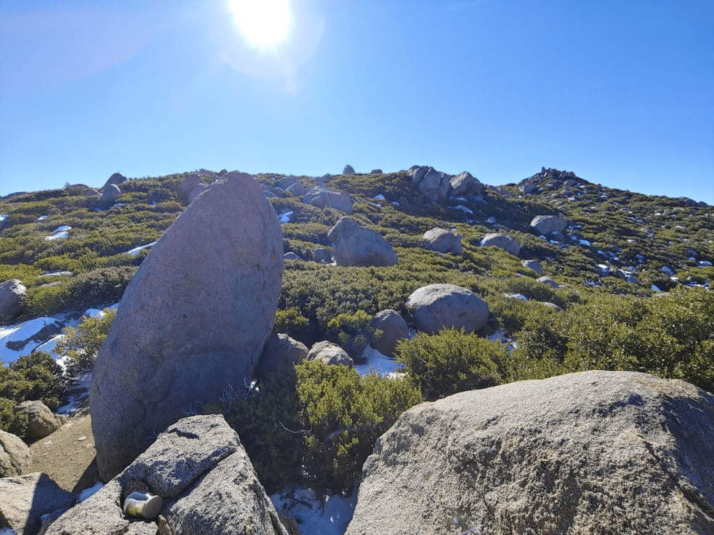
I climbed up one of the other rock piles in the area in case that was the actual high point. There was a third boulder in the area that was higher than the others, but it was beyond my climbing ability. When I was done, I proceeded back up the slope to the crest.
I had a slightly easier time going up this part than I had coming down, so I must have chosen a better route this time. Once back on the crest, I went back the way I came. The ups and downs were adding up, so I was starting to feel tired. Also, the thick brush ripped a huge hole in my pants (left knee) which was a bummer. The hole started out fairly small but got much worse throughout the rest of the hike. Once the hole was started, it was too difficult to avoid ripping it more.

The return route was made slightly easier by the fact that I was able to follow my own footprints through the snow. I did lose my steps at times when the brush got really thick, but they were still helpful.
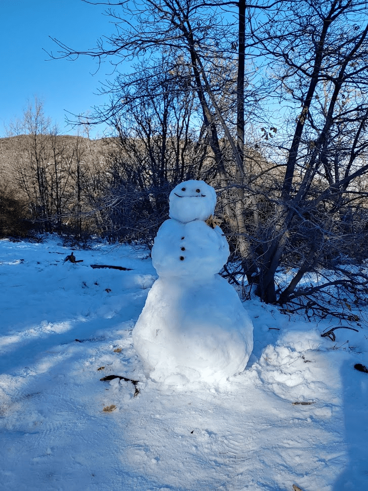
Eventually I reached the firebreak again at 5.04 miles, and then the PCT at 5.43 miles. Once on the PCT it was easy hiking the rest of the way. I even saw a snowman off to the side of the trail!
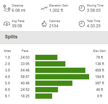
Near the parking lot I walked past a couple arguing on the trail. The girl was screaming at the guy. They were positioned so that the guy saw me coming and the girl was facing the other way. The guy saw me, started grinning and yelled out “Married?” I said “No” and he replied “Enjoy!” Not wanting to get caught in the middle, I held in my laughter until I had passed them. I reached the parking lot soon after that and arrived back at my car at 2:18pm. This hike totaled 6.08 miles, 1302 feet elevation gain, and 4:33:25 total time.

There were now hundreds of cars parked on the sides of the road, and the traffic coming towards Mount Laguna stretched almost all the way to I-8. I was glad I got here as early as I did!
