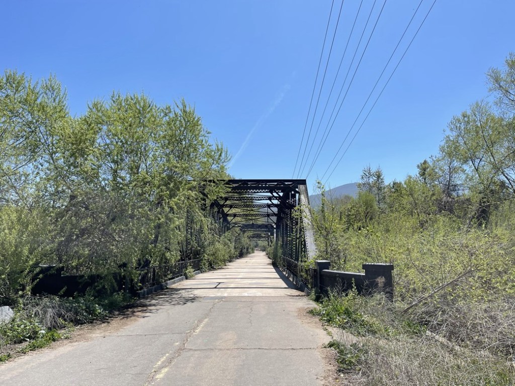
San Miguel Mountain is a 2565 foot peak in Spring Valley about 15 miles east of downtown San Diego. It is a very large mountain with 1545 feet of prominence, so it is clearly visible from large portions of San Diego County. In fact, I stare at it every single day from the balcony of my downtown apartment. It had been on my radar for quite some time, but my preliminary research indicated that there isn’t a legal way for the public to climb the peak. There are a few trails (and even a paved service road) that lead to the summit, but they are all technically closed to public use. My recent move downtown had rekindled my interest in climbing the peak, and additional research had shown that the peak is actually routinely climbed from the north without issue. The starting point for this route is from the popular Sweetwater River Trailhead in Spring Valley. I got a much later start than I usually do, arriving at the trailhead on Saturday afternoon around 12:30. The parking area was pretty full, but I was able to find a spot. I started hiking at 12:38pm from just 313 feet above sea level. The trail started out paved as I immediately crossed a cool bridge over the Sweetwater River.
At 0.2 mile I turned right (south) onto an unpaved trail.

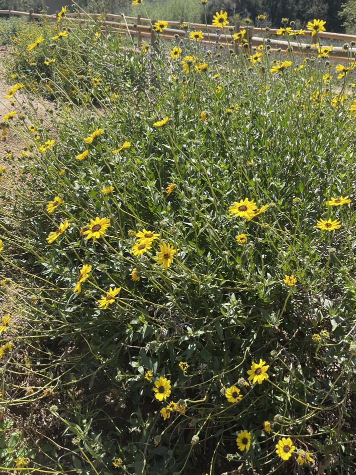
There were pretty flowers along the side of the trail.
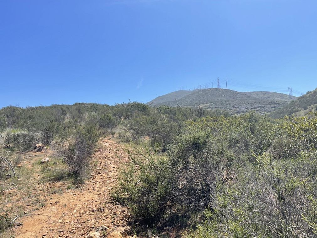
I turned a corner and could see San Miguel Mountain in the distance. There are many communication towers on the summit (a lot of the local TV stations broadcast from here).

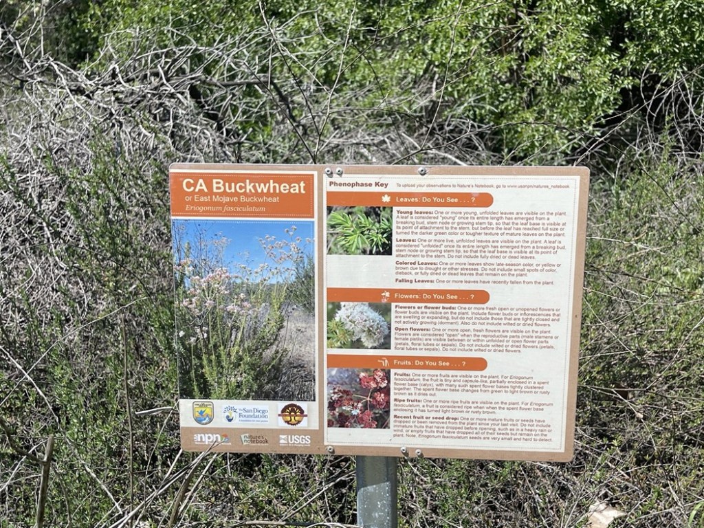
It was a pretty warm day (upper 70s) and not a cloud in the sky. There were many other hikers on the trail enjoying the weather. This section of the trail, which parallels the Sweetwater River, has a few interpretive signs explaining the native vegetation.
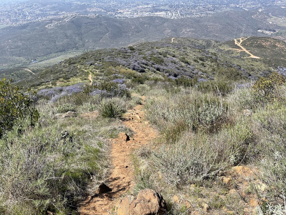
I hiked south along this trail for a mile or so. The trail was wide, flat, and very pleasant to walk on. At 1.4 miles I turned left onto the trail that would take me up the mountain. As expected, there was a sign indicating the trail was closed.

It is 2200 feet of elevation gain in about 2.5 miles from this point. The trail started out very steep and never relented.
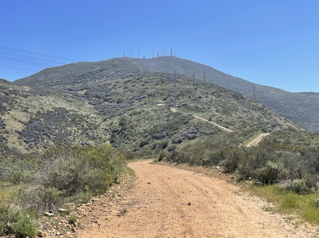
At 1.9 miles I reached a dirt service road. I turned right and continued hiking up the mountain.
I passed a hiker at 2.1 miles. He was coming down from the summit and confirmed that the route was indeed steep the whole way up. At 2.6 miles I left the road and turned right onto another trail. GPS was helpful here to not miss the turnoff.

This trail was the steepest part of the hike. The summit towers appeared much closer now.

The steepest part was right near the top. The brush got taller and thicker at this point too. At 3.5 miles I reached the paved service road just below the summit.

I passed another hiker with his dog just below the summit. I reached the top at 2pm at the 3.8 mile mark! Unfortunately, the actual summit area was fenced in. There were a few workers doing maintenance inside the fence and they waved at me when I arrived.

I did a lap around the fence while searching unsuccessfully for survey markers. Most appeared to be inside the fenced area but the 2 that should have been outside weren’t there. I also didn’t even bother looking for a register. The views were pretty good despite some haze. Otay Mountain was just a few miles south. I could clearly see the road leading to its summit from the north.
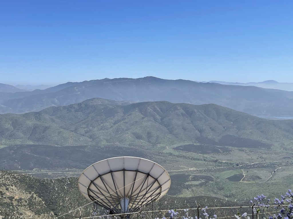
I could see Tecate Peak to the southeast. Tecate Peak is less than a mile from the Mexican border.

I could see Gaskill, Lawson, and Lyons Peaks to the east.

And El Cajon Mountain to the north:

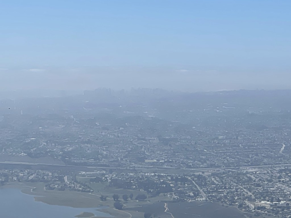
Unfortunately, it was too hazy to clearly see downtown San Diego to the west.
I began the short but steep hike down after a 20 minute break on the summit.
I descended the steep trail until I was down to the Sweetwater River again. Rather than head back the same way I came, I crossed a bridge to the west side of the river.

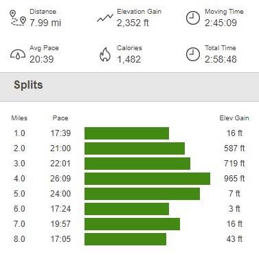
It was just over a mile back to the trailhead from this point. I actually wouldn’t recommend crossing the bridge here as you have to hike by a waste treatment plant (or something like that) on this side of the river. The trail on the east side the river (my ascent route) was much more pleasant. I reached the car again at 3:36pm. This hike totaled 7.99 miles, 2352 feet elevation gain, and 2:58:48 total time.