Torrey Pines State Reserve
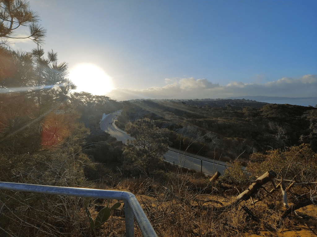
I still wasn’t feeling 100% due to getting Covid recently, so I decided to just drive around San Diego once again and bag a few minor summits as well as do a few short hikes. First up was a few peaks in Torrey Pines State Reserve. I had thought about coming here the week before, but I had foolishly arrived in the afternoon and it was so busy that I instead drove to the Torrey Pines Extension Area a few miles north in Del Mar to hike to the high point. My plan today was to arrive just when the gates open at 7:15am. I paid the $15 entry fee and drove up to the visitor center where I parked. I started hiking at 7:33am from 320 feet above sea level. I began by walking up Torrey Pines Park Road north towards the High Point Overlook.
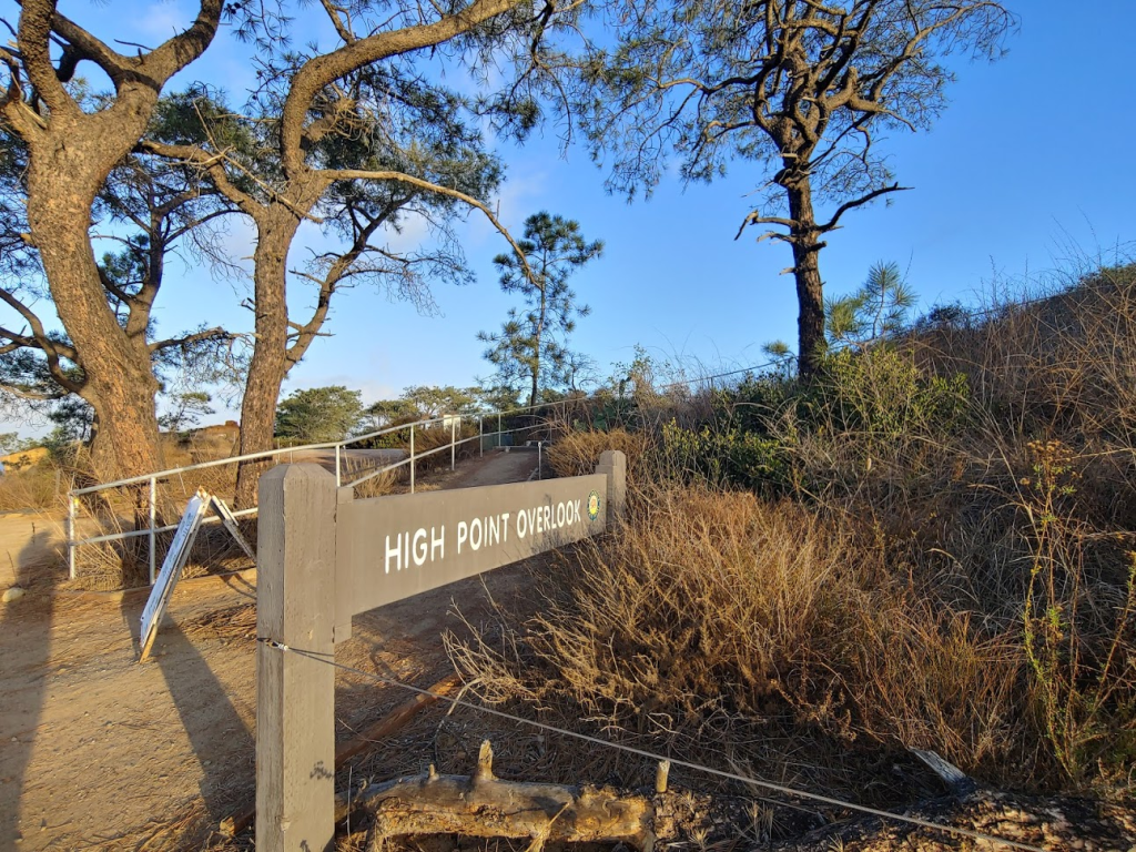
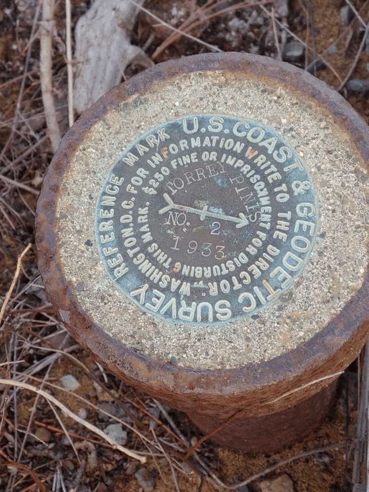
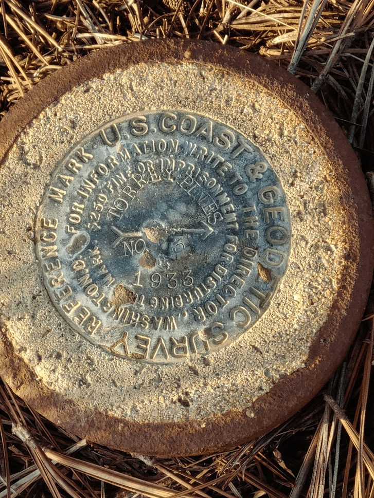
It was very cold first thing in the morning (low 40s). I walked up the stairs and reached the top at 0.2 mile. The elevation here is 367 feet, which is the high point of the main State Reserve Area. The extension area to the north is geographically separate so there are 2 different high points. I located the “Torrey” Benchmark, as well as reference markers 2 and 3.

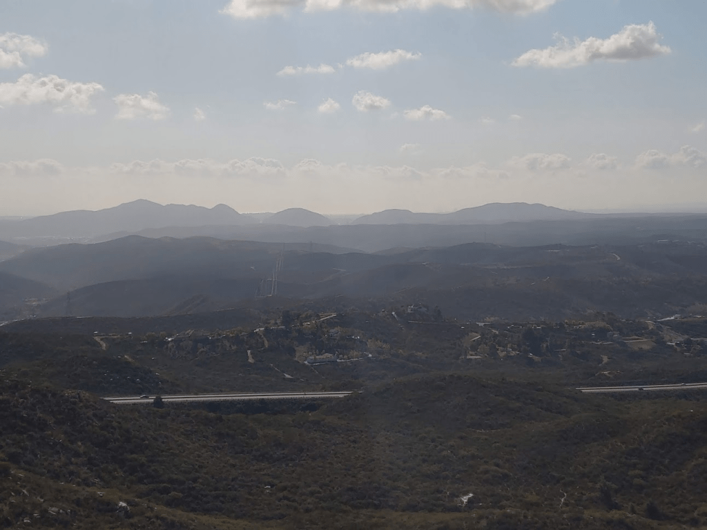
The view was pretty nice up here.
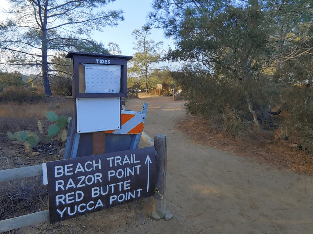
After enjoying the view for a few minutes, I walked back down the stairs and down the road past the visitor center. I turned right (west) onto the Beach Trail towards Red Butte (320 feet).
Red Butte was just a few tenths of a mile away.
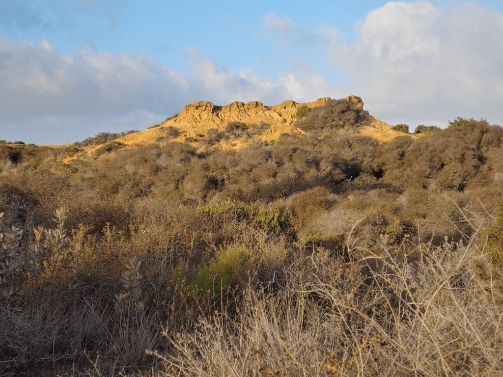
I made it to the top of Red Butte at 0.8 mile.

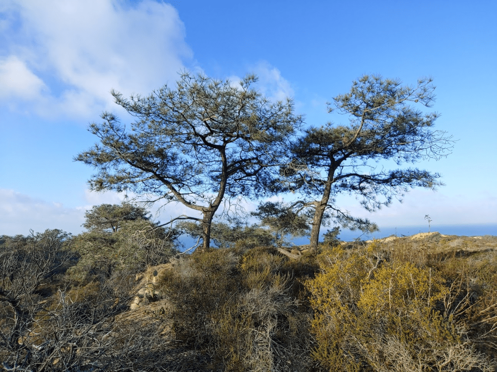
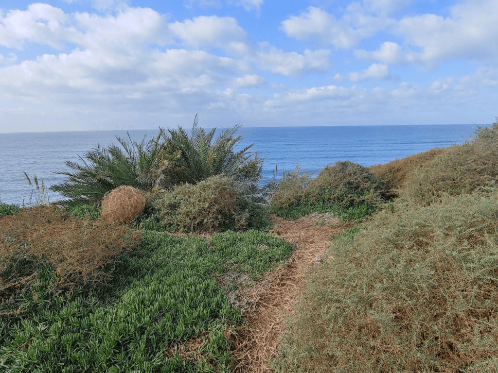
After Red Butte, I hiked back to the road and turned south. After a short way I turned west off the trail and made a quick bushwack to Peak 365. Not much of a view from this peak, but the pines were pretty. The Torrey Pine is a very rare pine species that only grows here and on the nearby Channel Islands.
I hiked back to the road and continued south. I then turned west onto the Broken Hill North Fork Trail.
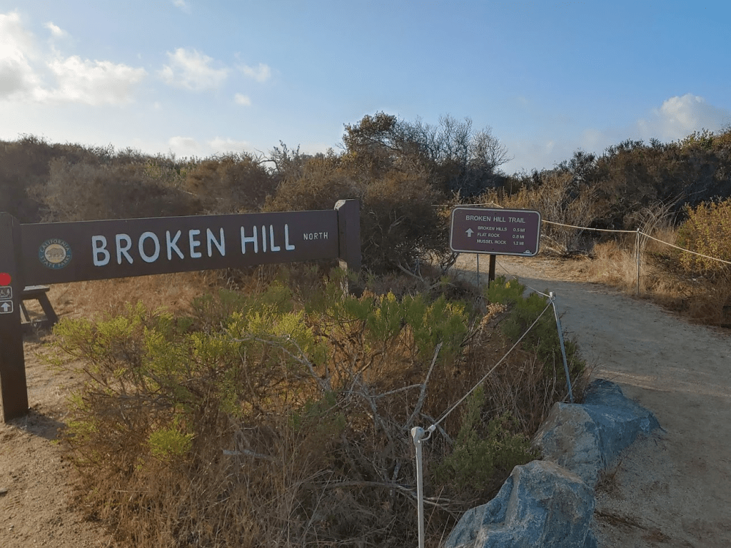
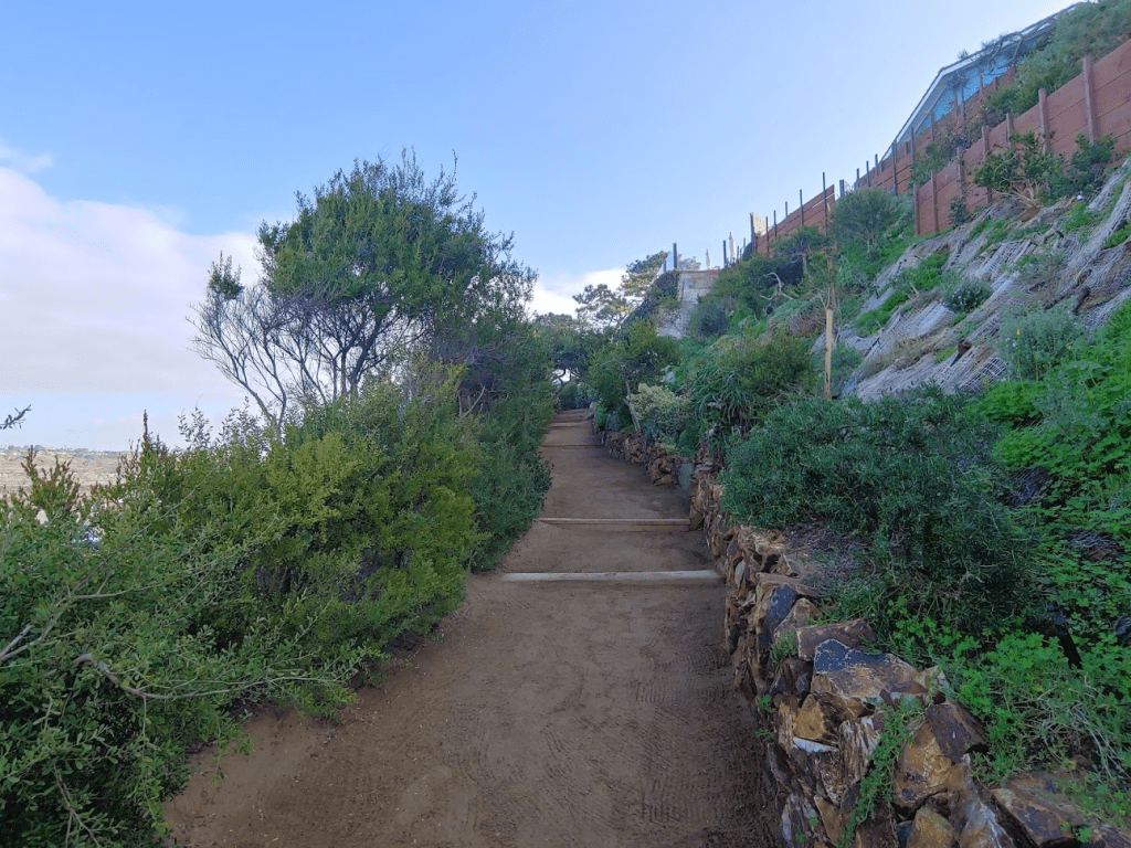
The trails here are wide and sandy.

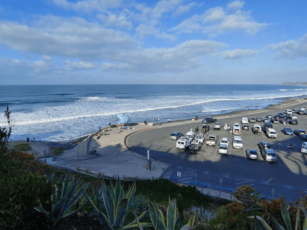
I reached the top of Broken Hill at 2.18 miles.

I could see the golf course from here. The US Open will be held here in a few months.

I spent some time enjoying the wonderful ocean view.

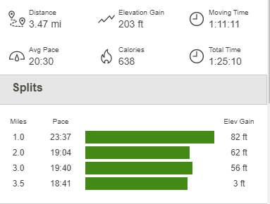
I made a small loop by hiking back to the road on the Broken Hill South Fork Trail. I then hiked north up the road back to the car. This hike totaled 3.5 miles, 203 feet elevation gain and 1:25:10 total time.

Next, I decided to drive up the coast and bag the high point of the 6 state beaches between here and Camp Pendleton. State Beaches are technically California state parks, so these count as state park high points. First up was Cardiff State Beach High Point (41 feet). I parked in the main lot off Highway 101, but I didn’t pay since I would only be here for a few minutes. The high point is located on a small hill on the south side of the parking lot. I found a small path that leads up to a neighborhood above the beach. I stopped when I encountered private property signs and called it good.
Cardiff State Beach High Point
Next, I decided to drive up the coast and bag the high point of the 6 state beaches between here and Camp Pendleton. State Beaches are technically California state parks, so these count as state park high points. First up was Cardiff State Beach High Point (41 feet). I parked in the main lot off Highway 101, but I didn’t pay since I would only be here for a few minutes. The high point is located on a small hill on the south side of the parking lot. I found a small path that leads up to a neighborhood above the beach. I stopped when I encountered private property signs and called it good.
I took a couple pictures and then moved on.
San Elijo State Beach High Point
Next up was San Elijo State Beach High Point (81 feet). This one is a drive up. I made a quick U turn and parked on the west side of Highway 101. I hopped the railing quickly to get a picture.
Moonlight State Beach High Point
Next up was Moonlight State Beach High Point (62 feet) in Encinitas. This one is located at the end of A Street. I parked on the corner of A and 5th and walked up a circular driveway with a dead end sign. There is a small gap in the chain link fence that leads to an overlook of the beach where the high point is located.

San Leucadia State Beach High Point
Next up was San Leucadia State Beach High Point (89 feet). I parked in the small lot at the corner of Neptune Ave and W Leucadia Blvd. There is a small trail that leads down to the beach from here. The high point is located at the top of the trail.
I made the short walk down to the sand and took a few pictures. There were quite a few surfers out in the water.
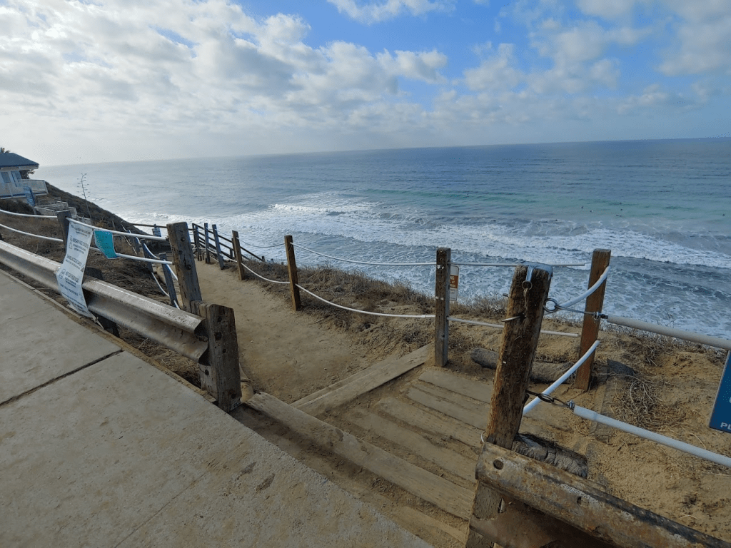
South Carlsbad State Beach High Point (attempt)
Next up was South Carlsbad State Beach High Point (85 feet). I parked on the sand just north of the day use lot. This is referred to as South Ponto Beach on Google Maps. This one would require a short hike to get to. I began by hiking south on the sand.
I went past the restrooms and up some stairs to the Bluff Overlook.
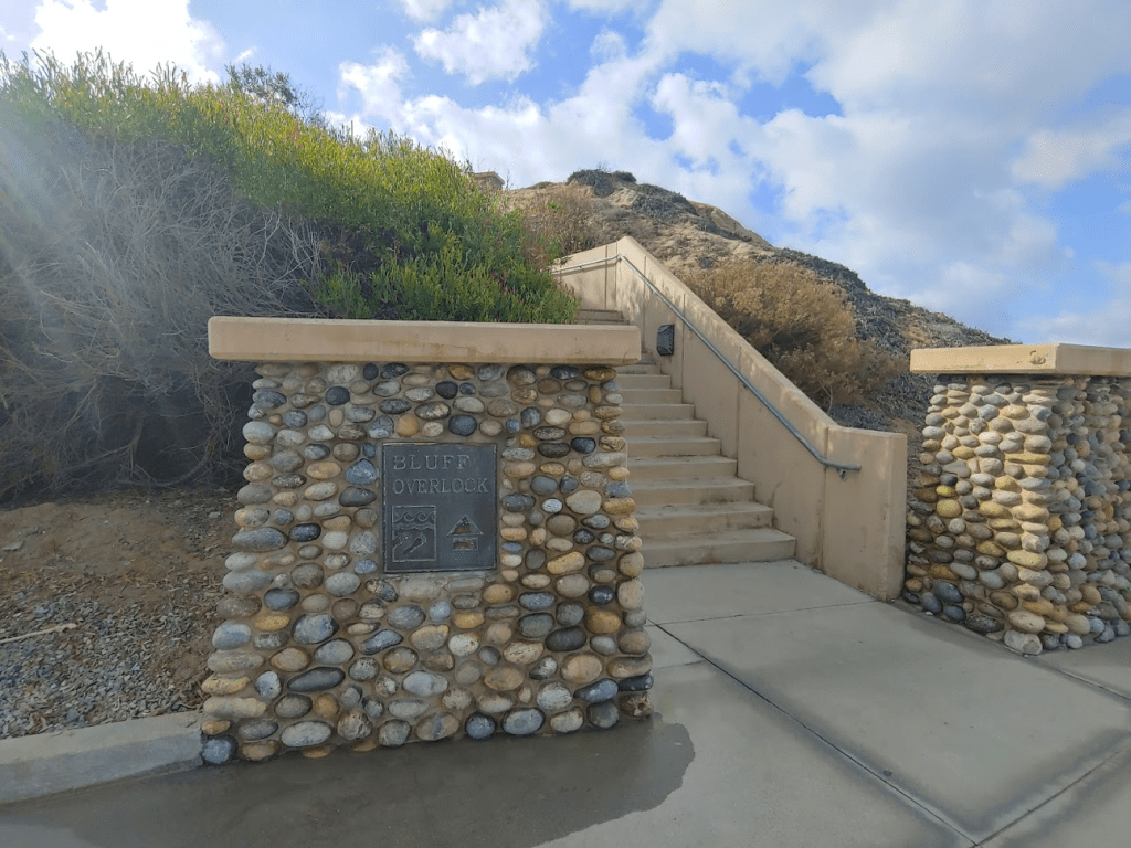
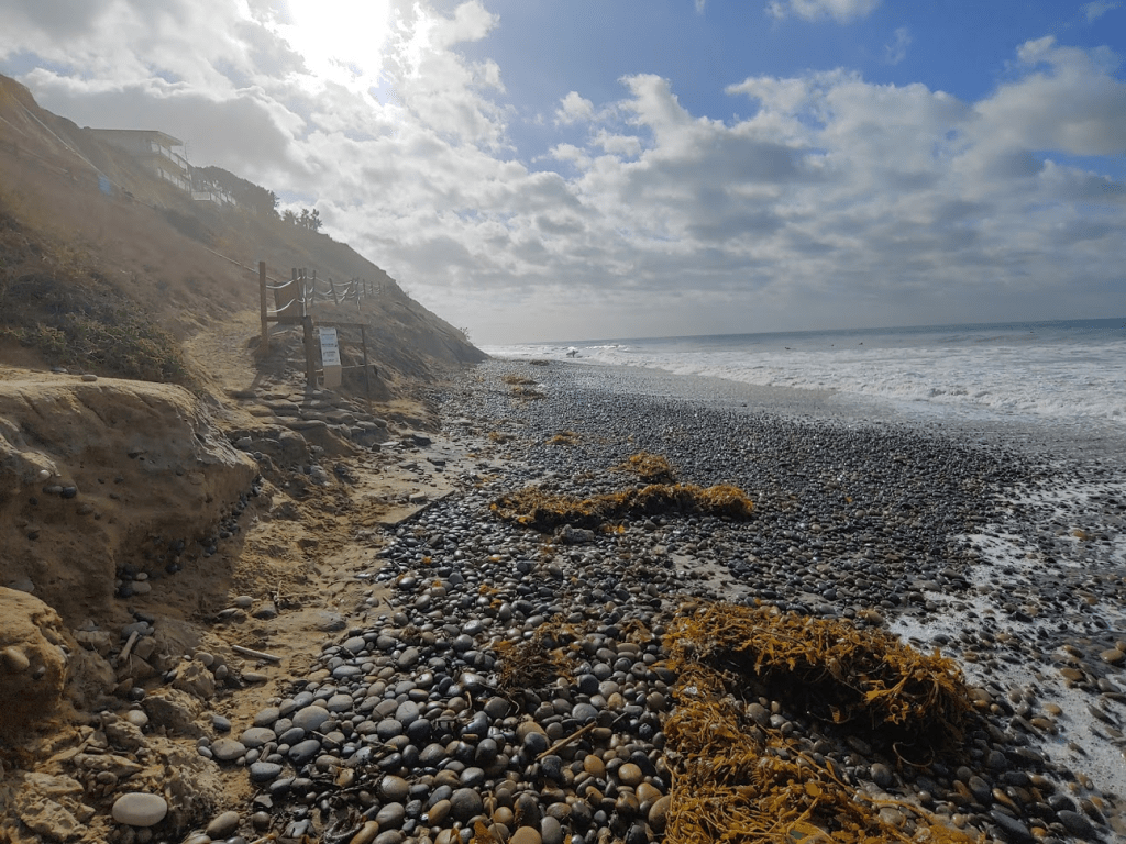
Unfortunately, there was a gate at the top of the stairs and there appeared to be some construction going on the other side. Bummer.
Carlsbad State Beach High Point
The last state beach I would visit today was Carlsbad State Beach High Point (52 feet). This one is another drive up. I parked on Acacia Ave just off of Carlsbad Blvd. I ran across to the west side of the street where there is a pedestrian walkway. The high point is located on a small rise.

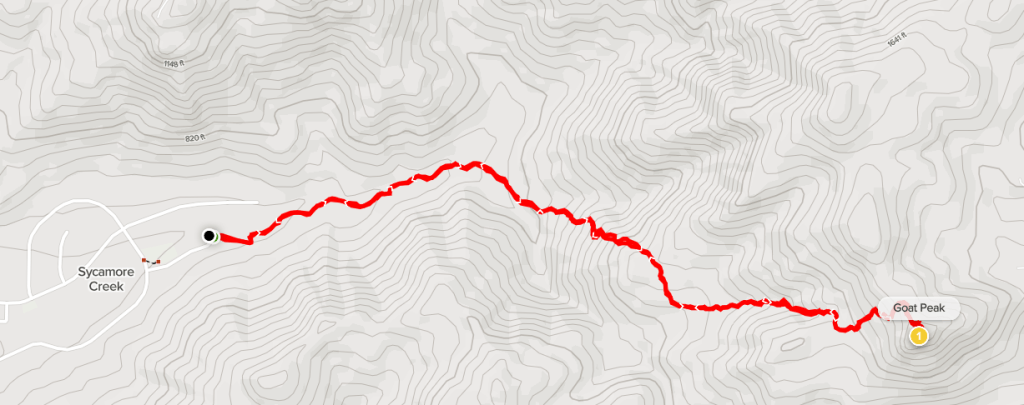
Goat Peak
It was a gorgeous day, so I was really enjoying myself. The coast is so beautiful, so it was a lot of fun to drive the length of it and visit 6 different beaches within the county. I was feeling pretty good too. I hadn’t done much exercise in the last few weeks due to Covid. I had only felt sick for a few days, but the labored breathing lasted much longer. Thankfully, I was feeling much better today so I decided I had energy for one more short hike. I settled on climbing Goat Peak (1728 feet), which is located in Poway near Iron Mountain. It took me about 45 minutes to drive there from Carlsbad. The trail begins in a suburban neighborhood at a cul-de-sac. I parked at the end of Quiet Valley Lane and began hiking at 12:15pm from 667 feet.

The trail starts out fairly level but then gradually increases in steepness. I crossed a dry creek bed a number of times on the lower part of the trail.

I passed 2 groups of hikers, one on their way up and one on their way down. The trail was a bit overgrown in spots but was still easy to follow.

There were a few spots that got pretty steep. I made sure to go slow and stopped frequently to catch my breath.
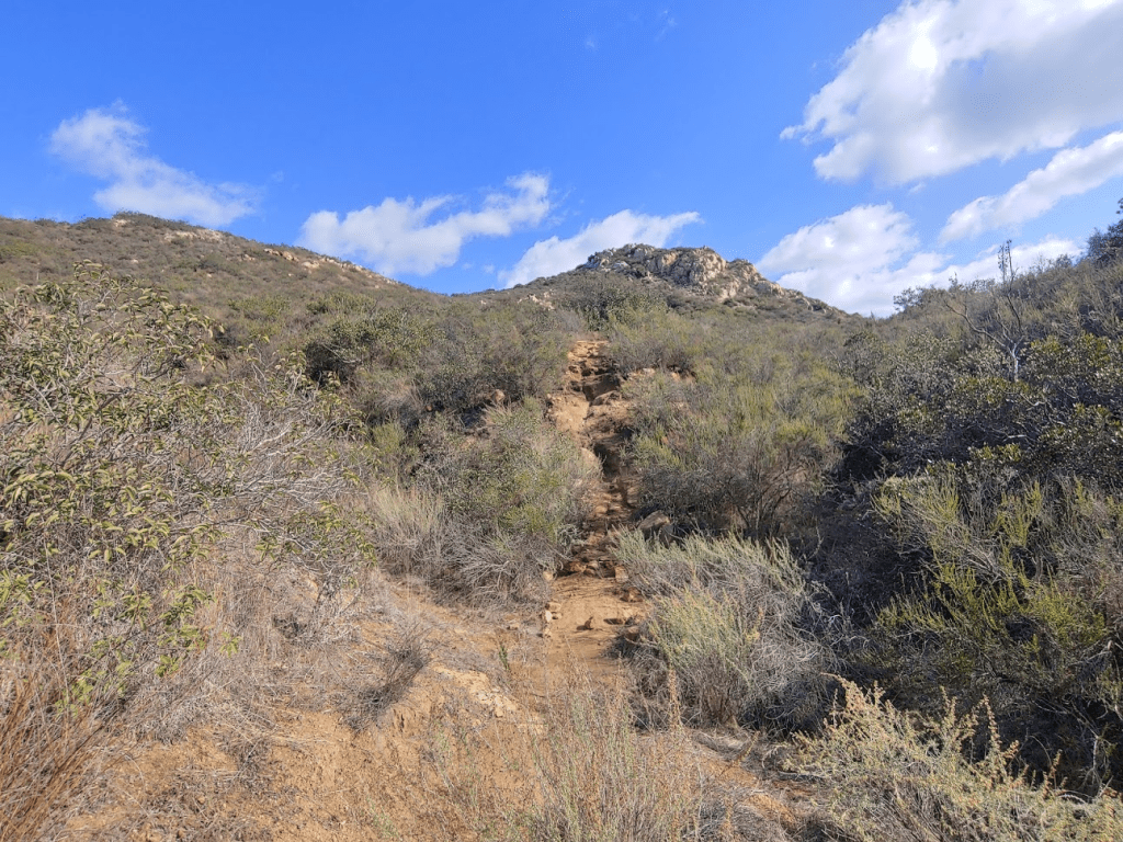
Near the top, the trail peters out, so I scrambled up some rocks to reach the summit. I was on top at 12:58pm at 1.5 miles.
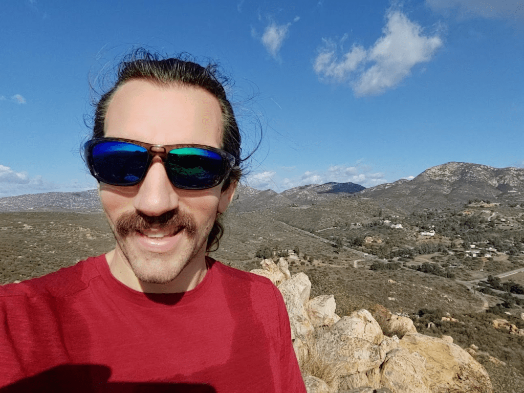
It was a clear day, so the views were superb. Iron Mountain (right) and Woodson Mountain (left) were just a few miles east.
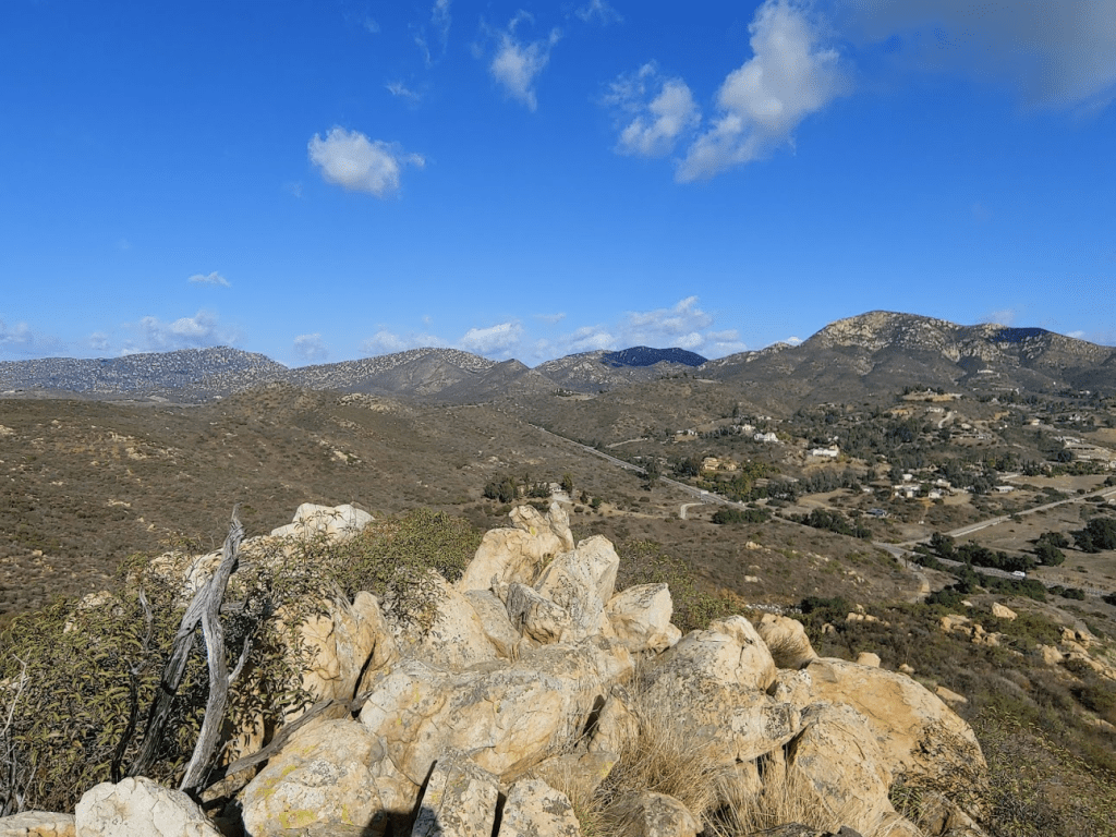
To the southwest I could see all of the Mission Trails Peaks. From left to right: Cowles Mountain, Pyles Peak, Kwaay Paay Peak, South Fortuna, and North Fortuna.
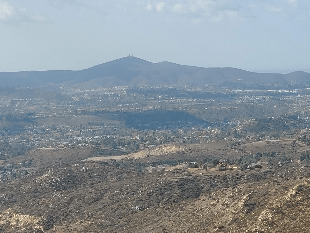
Directly west I had a good view of Black Mountain.
I spent some time enjoying the view and then headed back down.

I reached the car at 1:53pm. This hike totaled 3.0 miles, 1148 feet elevation gain, and 1:38:45 total time.