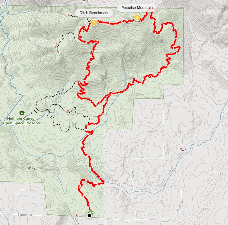
Hellhole Canyon is a small preserve in San Diego County located near Valley Center. The highpoint of the preserve is a 3180 foot peak called Paradise Mountain. My plan for this Saturday morning was to climb Paradise Mountain in a counter-clockwise loop starting from the main trailhead in the preserve. Alexia and Stella would be joining me on this hike. It took us about an hour to drive from San Diego to the trailhead on Santee Lane. There is a large gravel parking lot with room for horse trailers, as well as bathrooms and information boards. We started hiking at 8:37am from 2070 feet above sea level.

We hiked north as the trail initially descends over 300 feet. Paradise Mountain was visible from the beginning.

At 0.7 mile we reached Hell Creek at the bottom of Hellhole Canyon. At 1734 feet, this was the lowest point on the trail.

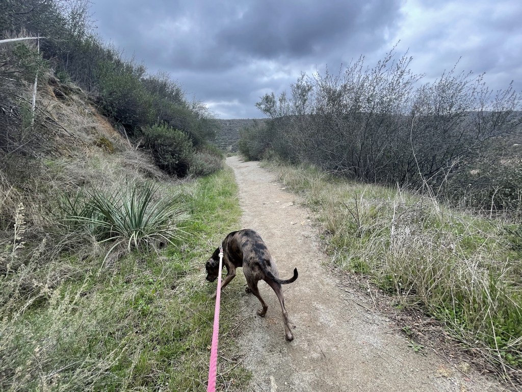
Stella led the way as we climbed out of the canyon. There were some large sycamore and oak trees near the creek.

We passed a trail junction and continued on the main trail. There were a few other hikers on the trail but it wasn’t too crowded.

At 1.8 miles we reached a fork. This is where the loop splits so we could have gone either way to reach the summit. We chose to go right since I had read that the counter-clockwise option was less steep on the way up. We would need to climb about 1200 feet in 2 miles from this point.

As expected, this was the most difficult part of the hike. We followed Stella as she led the way up the chaparral-covered slopes.

The trail bent to the northeast and then back to the northwest as we neared the top. It was partly cloudy but there was enough sun to really warm us up on the ascent. There is no shade on the trail so this would be a miserable hike in the summer months (I believe they even close the entire preserve in August).

The trail flattened out a bit near the top. We eventually reached the summit at 10:37am at the 4 mile mark!

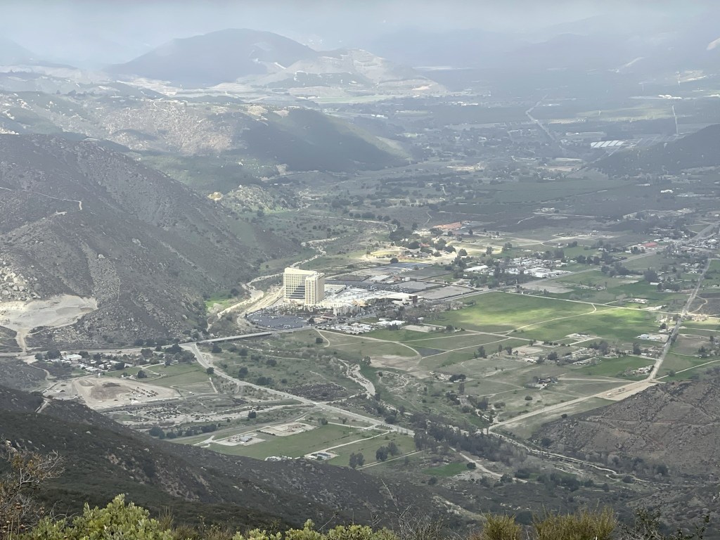
We found a nice rock to sit on as we ate almond butter and strawberry jam sandwiches that Alexia had prepared. It had clouded up considerably during the hike, so the views were pretty limited. Nearby Rodriguez Mountain was hidden behind the cloud layer.

We had a good view of Harrah’s Resort and Casino just a few miles northwest.
We both put jackets on as it was much cooler with the cloud cover and a light breeze on the summit. We continued hiking after a 20 minute break.

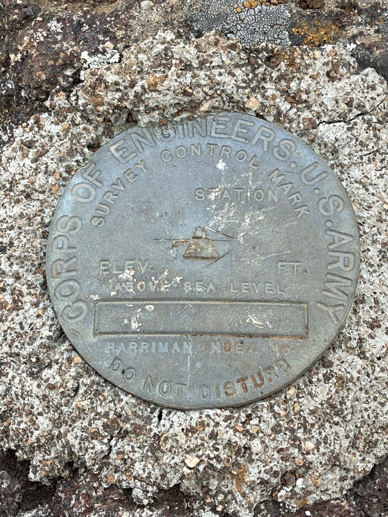
We hiked directly west along the main ridge of the peak. We went down a minor dip and then climbed up to Ditch Benchmark which is located on a small prominence of 3127 feet. We located a reference marker on a large boulder.
There was a couple sitting down where I thought the actual benchmark was located. Obviously, I wasn’t going to ask them to move so we just continued. Shortly after this we reached a trail junction and went left to begin descending.

We made good time on the descent despite having to go slowly down the really steep parts to avoid slipping. At 6.3 miles we reached the trail junction where we had initially gone right to begin the loop. We concluded that we had indeed made the right decision to do the route counter-clockwise, since the trail is slightly less steep ascending in that direction. With the loop completed, we continued south towards Hell Creek again.
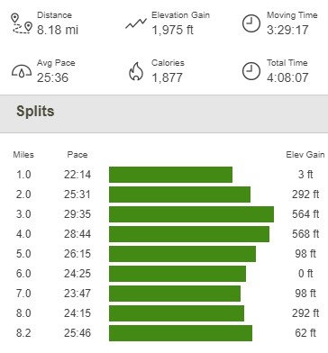
We reached the creek again at 7.4 miles. From there, we still had to climb about 350 feet back to the trailhead which was a little tough at the end of the hike. We were able to push through and we finally reached the trailhead again at 12:46pm. This hike totaled 8.18 miles, 1975 feet elevation gain, and 4:08:07 total time.
We packed up the car and made the hour drive back home. It was a great hike for the 3 of us to together!

