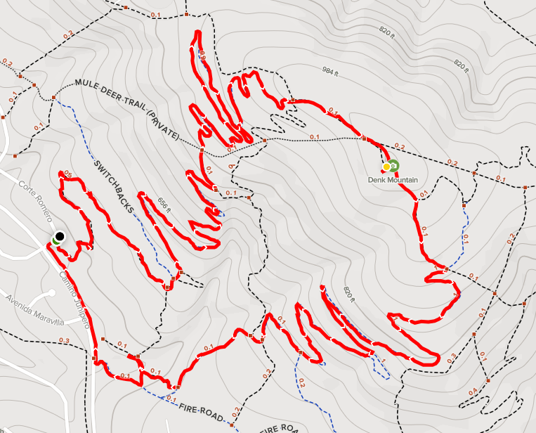
Denk Mountain
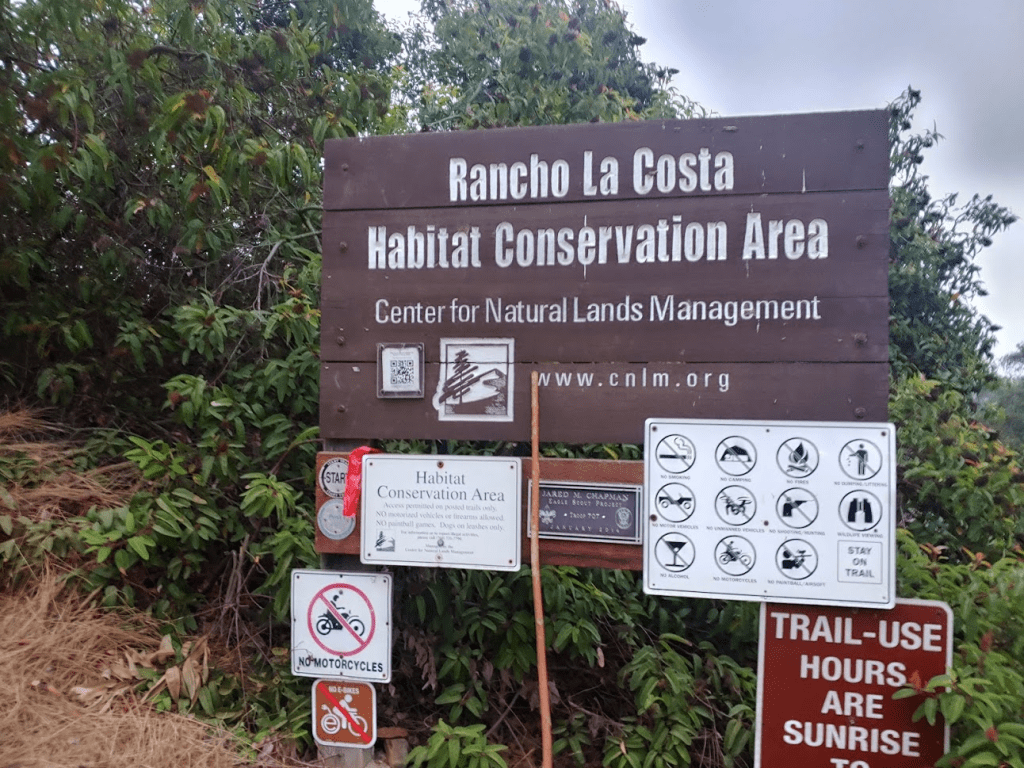
All of Southern California’s national forests were still closed due to extreme fire danger, so my options for a good Saturday morning hike were pretty limited. It would probably still be a few weeks before the temps are cool enough for any desert hiking, so instead I decided to climb a few suburban peaks in northern San Diego county. The forecast called for some morning fog, so I thought it would be perfect weather to bring Stella along with me. First up was Denk Mountain (1040 feet), which lies in Rancho La Costa Reserve in San Marcos. We woke up at 5:30am, hit the road at 6, and drove about 30 minutes to the trailhead on Corte Romero. I was somewhat surprised to see a few other cars parked alongside the road. It looked like this was a popular area for mountain bikers. We began hiking at 6:36am.
We took the Switchbacks Trail on the way up. The trail winds its way in a northeast direction through typical Southern California chaparral.

The trail was a little rocky but was generally pretty nice and smooth. I kept Stella on the leash for most of the hike due to all the mountain bikes.

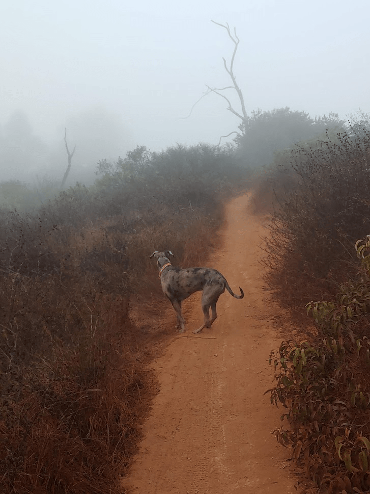
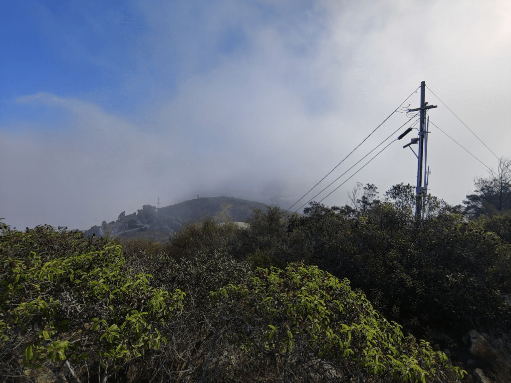
We entered the fog as we got close to the top.
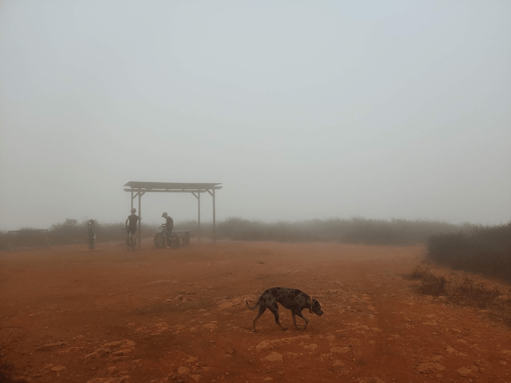
We reached the summit at 7:19am at 2.22 miles! The flattish summit contained a few picnic tables and a trash can. There were a few mountain bikers at the top taking a break. Unfortunately, there were no views due to the fog.
I decided to take a different route down the mountain, so we went southeast on the Horned Lizard Trail.

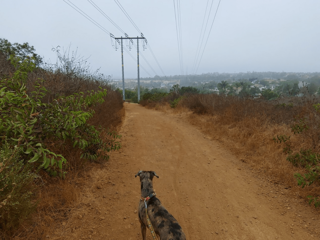
We followed the Horned Lizard Trail back down below the clouds.
We had to hike the final few tenths of a mile along the paved road (Camino Junipero). We reached the car at 7:57am. This hike totaled 4.16 miles, 640 feet elevation gain, and 1:21:44 total time.

Mount Whitney (SD County)
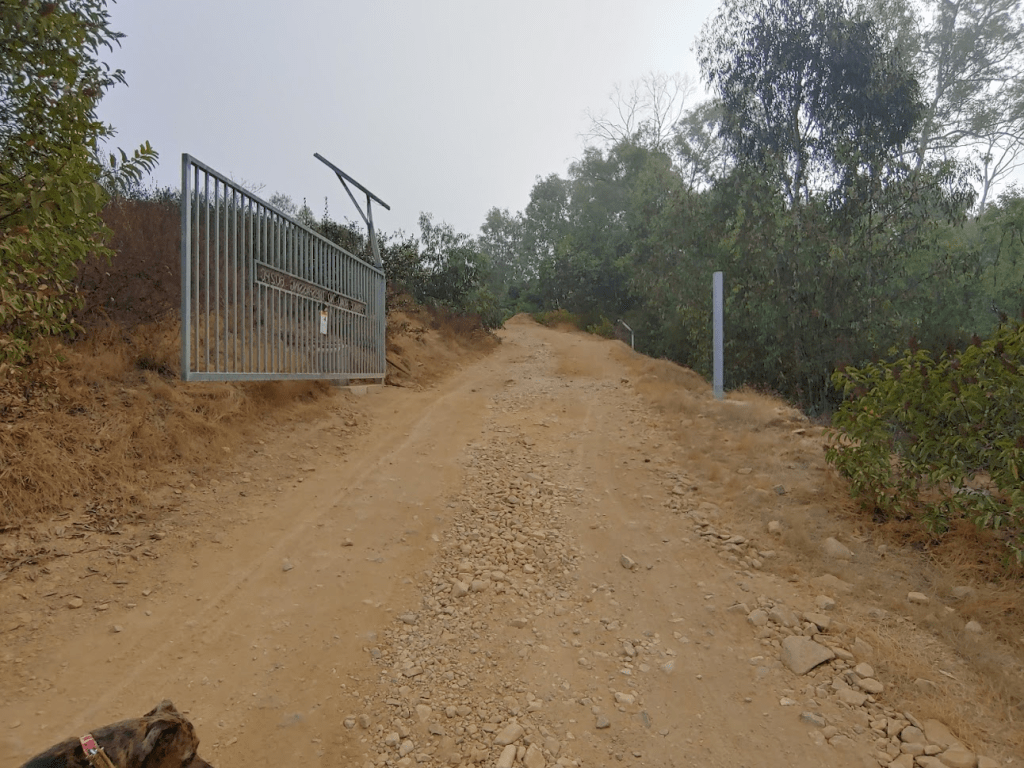
Next up was a peak called Mount Whitney (1736 feet). This peak had actually been on my radar for a little while since it has over 1000 feet of prominence. It took only about 10 minutes to drive to the Ridgeline Trailhead, which is also in San Marcos. We started hiking at 8:14am. We first had to cross San Elijo Road and walk through the Double Peak School parking lot. We soon reached a dirt road behind the school that we walked up past some homes. There were private property signs around, but previous trip reports indicated that the residents are tolerant of hikers as long as they do not park along the road.
We passed a small body of water on the right.

We then left the trail and hiked up a steep trail to the right.

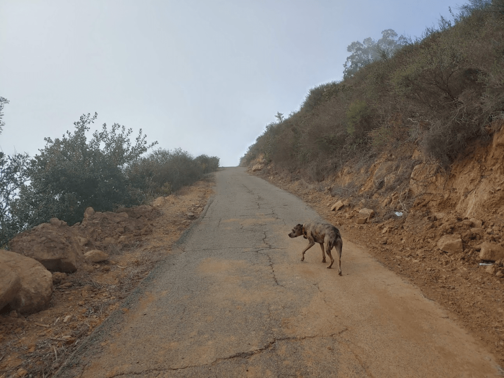
This led to a dirt road that we followed around the south side of Mount Whitney. The fog was certainly less thick here than on Denk Mountain, perhaps because we were higher up. I could see the sun through the thin cloud layer which created a cool effect.

We passed 2 mountain bikers on their way down. The dirt road led to an intersection on the east side of the mountain. We went around a gate and started hiking up the paved service road to the summit.
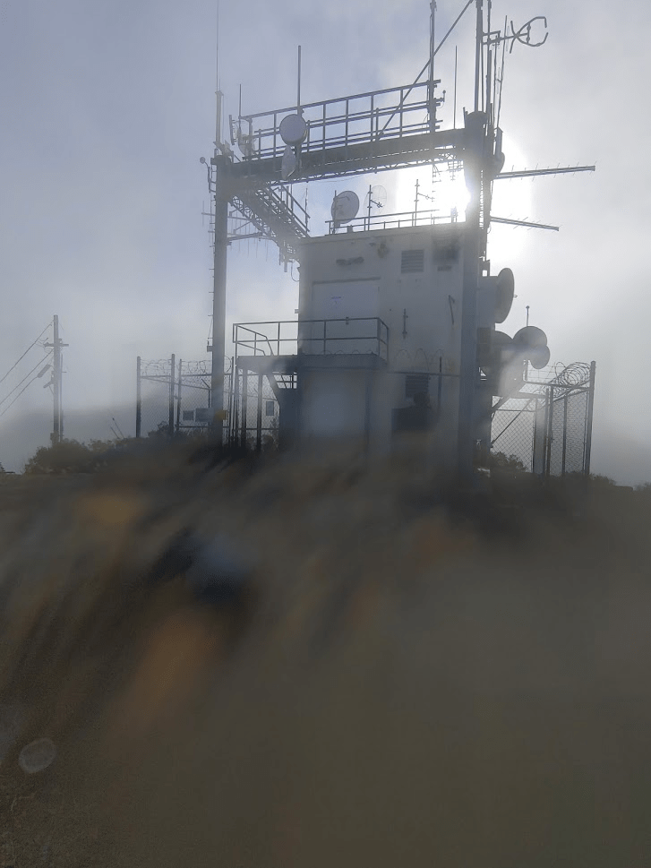
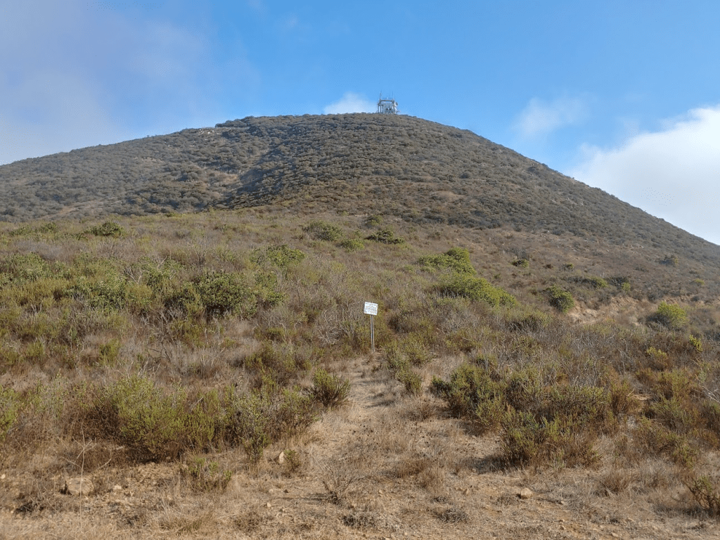
We reached the summit at 8:45am at 1.6 miles! There is some communication equipment on top (hence the service road). I tried to get a picture but for some reason my camera wouldn’t focus on the tower.
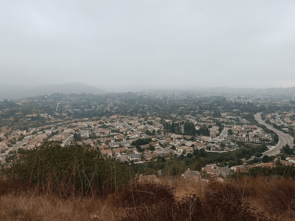
The fog was starting to get patchier so I could see a little of the view below (but still not much).
We took the same route down that we came up. The fog was starting to clear, so I put some sunscreen on. I knew we didn’t have much time before it would be too hot for Stella. I could now make out the tower on top of the peak.
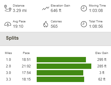
The rest of the hike was uneventful. We reached the car at 9:23am. This hike totaled 3.29 miles, 646 feet elevation gain, and 1:08:56 total time.

Battle Mountain
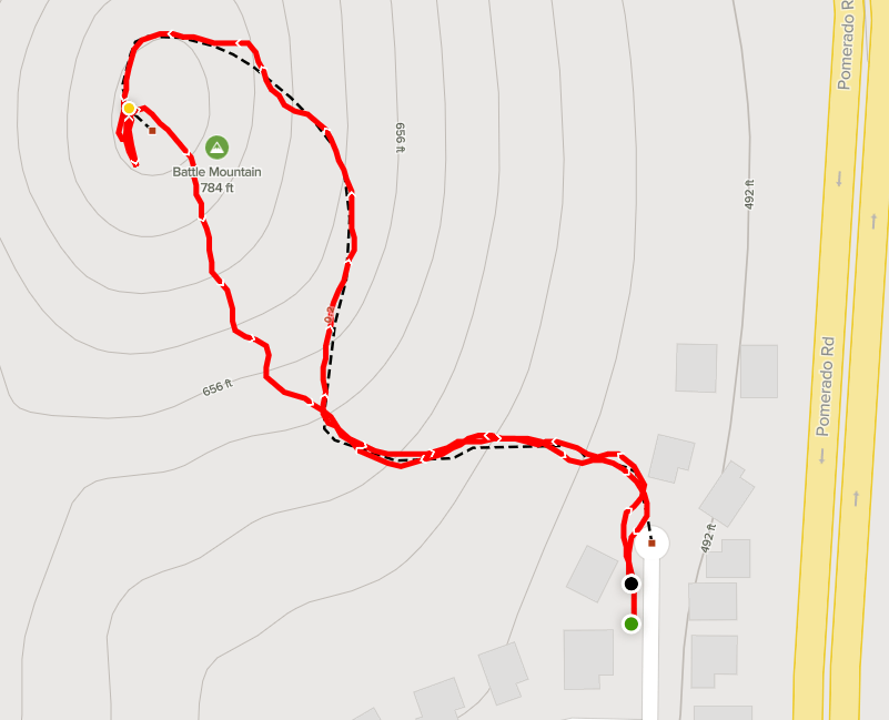
Our final peak of the day would be Battle Mountain (803 feet), which is in Rancho Bernardo. It took about 15 minutes to reach the trailhead at the end of Reata Way (just off Pomerado Rd). We started hiking at 9:47am.

This would be a very easy hike. The short trail makes its way steeply to the summit in 0.3 mile. There is a large cross on top.

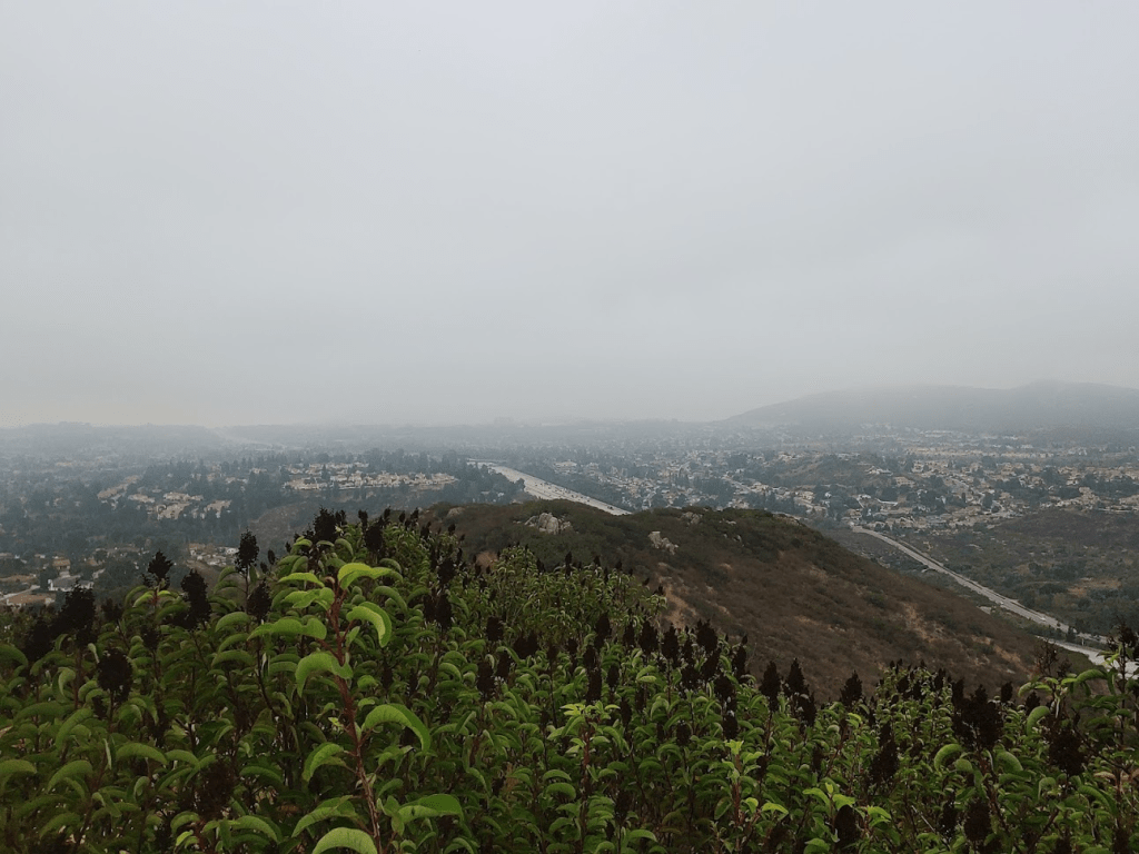
This would be the only peak of the day with any views. I think because it was the lowest of the 3 peaks, we were still beneath the cloud layer.
Stella was starting to look tired, so we took a slightly different route down and made it back to the car. This hike was just 0.48 mile, 302 feet elevation gain, and 15:09 total time.

It definitely wasn’t the greatest day of hiking that I‘ve had, but it was still nice to get outside and I’m sure Stella enjoyed it too!
