Day 1
At 14373 feet, Mount Williamson is the 2nd highest mountain in California and the 6th highest in the contiguous United States. Situated on the eastern edge of the Sierra, it rises dramatically nearly 2 vertical miles over the Owens Valley. It is one of the most visually striking mountains and is undoubtably one of the crown jewels of the Sierra. Just to the west of Williamson is another 14er, Mount Tyndall (14019 feet). With over 1000 feet or prominence, Tyndall is an impressive mountain in its own right. A few miles to the north of Williamson and Tyndall is 13976 foot Mount Keith. Mount Keith is often overlooked due to being 24 feet short of a 14er and 97 feet short of having 2000 feet of prominence. I planned to climb the trio of peaks via a 3 day 2 night backpack starting from the Shepherd Pass Trailhead. Nothing about the weekend would be easy – just hiking to Shepherd Pass requires an 11 mile hike and over 6000 feet of elevation gain. I left San Diego around 5am Friday morning and drove 5.5 hours to the Shepherd Pass Trailhead. There are a few miles of dirt roads to get to the trailhead – they are a little bumpy, but I did see a passenger car and a minivan parked there. Google Maps will take you there no problem. I began hiking at 10:36am from 6307 feet above sea level.

I hiked west up the trail into the mountains.

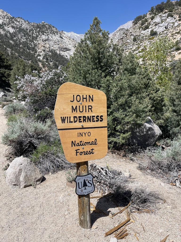
I soon passed the wilderness sign.
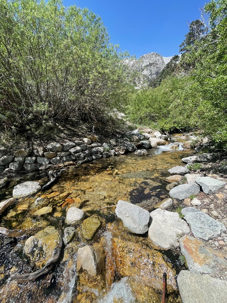
I crossed Symmes Creek.

The trail crossed Symmes Creek 4 times total. The creek was flowing pretty good which made the crossings a bit tricky, but I was able to hop across the rocks using a stick for balance.
At 1.2 miles the trail crossed the creek for the final time and then began to head up the south side of the Symmes Creek drainage. There were endless switchbacks in this section.
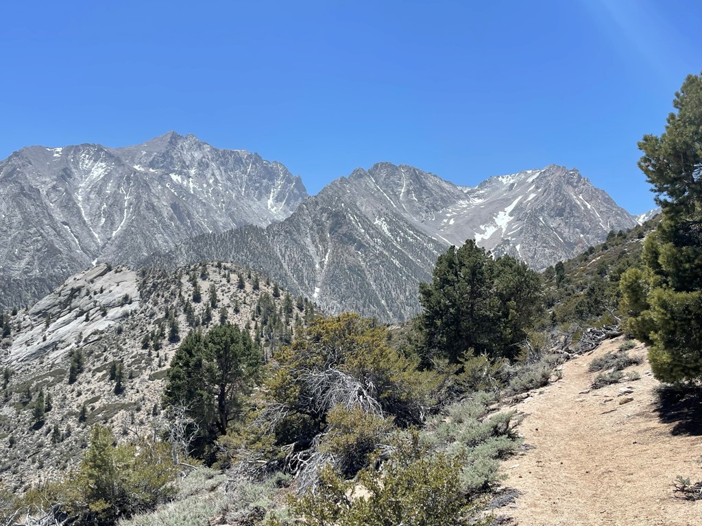
I climbed a couple thousand feet up the switchbacks and reached Symmes Saddle at 4.1 miles at just over 9000 feet. I got my first good look at Mount Williamson (left). Tyndall was hidden behind the lower peaks on the right. Another hiker caught up to me here named Ken who was planning to climb Tyndall the next day. We decided to hike together for the next few miles. He had very cool stories of climbing big walls in Yosemite and a couple major peaks in the Himalayas.
The trail then descended 500 or so feet over the next mile as it dropped into the Shepherd Creek drainage. This was a bit discouraging considering it was still over 3000 feet to Shepherd Pass.

We continued hiking west as the trail began to climb once again.

We crossed the first snow patch on the trail at 10100 feet.

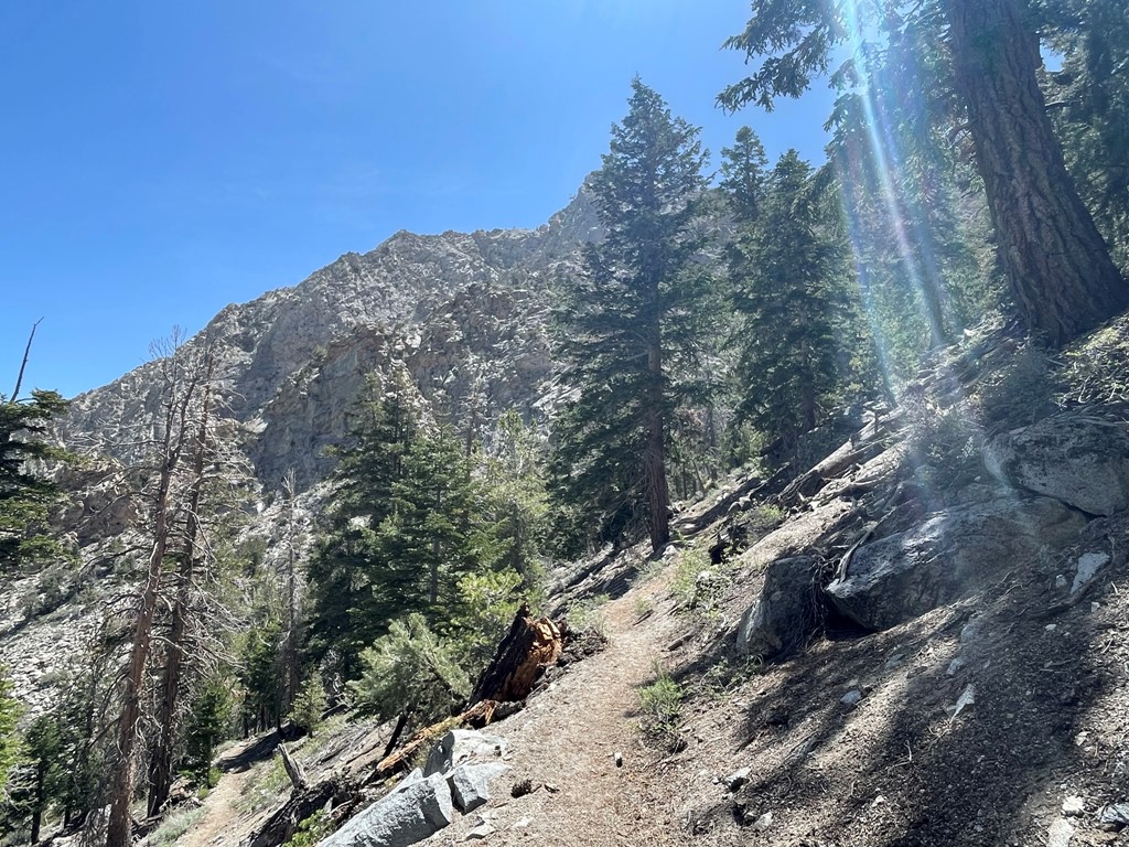
We reached the top of a small rise and found ourselves underneath some tall pines.

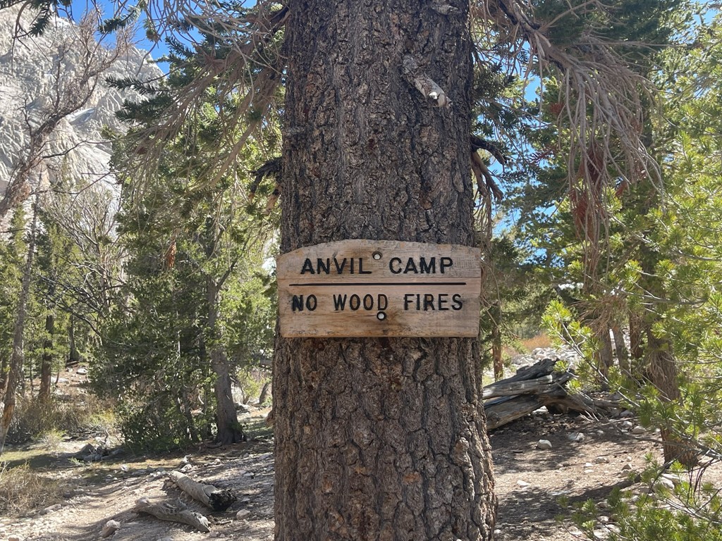
At 8.7 miles we reached Anvil Camp at 10337 feet. Anvil Camp is a popular base camp for those making attempts on Williamson and/or Tyndall. It is a very scenic area underneath the trees with Shepherd Creek flowing nearby. However, keep in mind that it is still a few hours just to get to Shepherd Pass from here.
There was one guy who already had a tent set up. He was planning to climb Williamson the next day. We chatted briefly and then I continued. Ken stayed behind for a little while to grab some water from the creek. I crossed Shepherd Creek and then left the camp heading west.

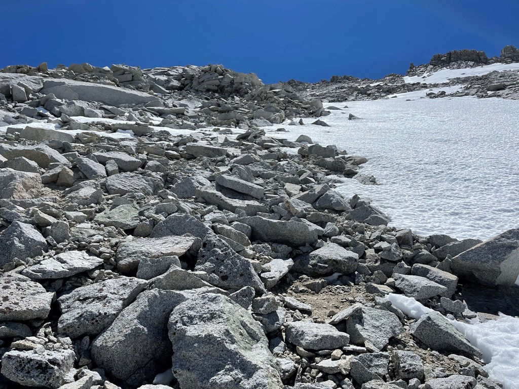
The trail was intermittently covered in large snow patches beyond Anvil Camp.
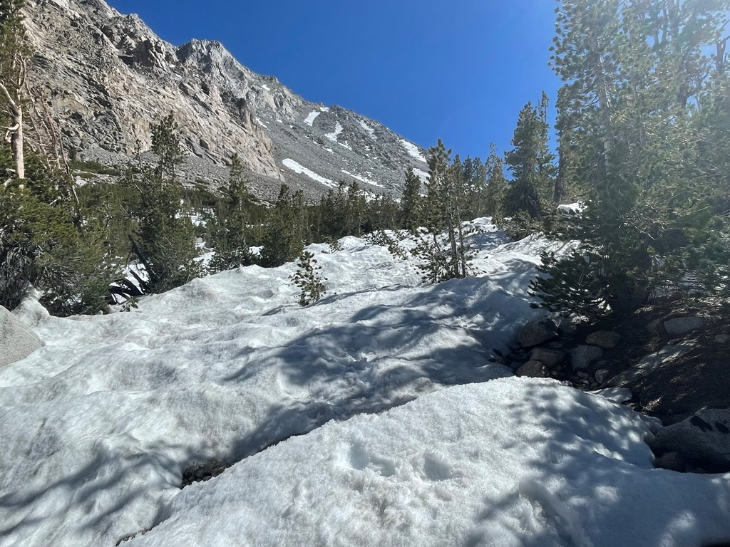
The trail was hard to follow through the snow.
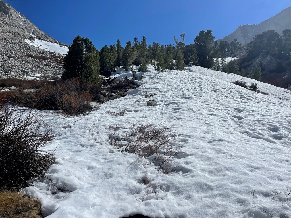
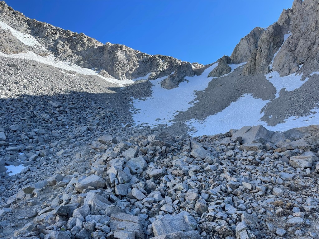
I saw a couple more tents set up just off the trail. Soon I was above the trees, and I could see Shepherd Pass ahead of me.
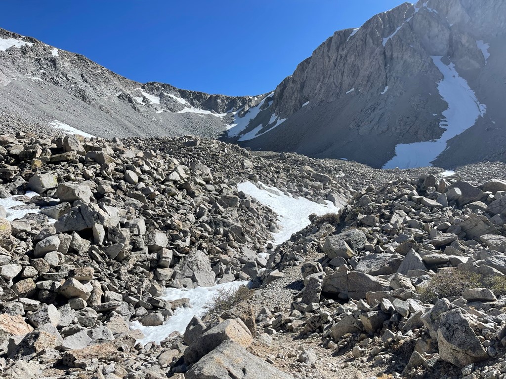
There was a large snowfield just underneath the pass, but the trail mostly skirted around it. The trail got very steep towards the top.
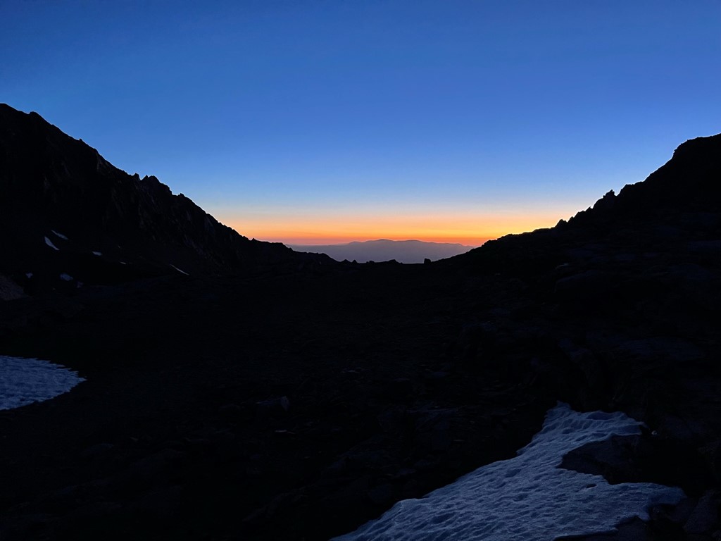
I did have to cross one small snowfield right below the pass. It was quite slippery, but I managed it without crampons. At 11.2 miles I finally reached Shepherd Pass at 12000 feet.
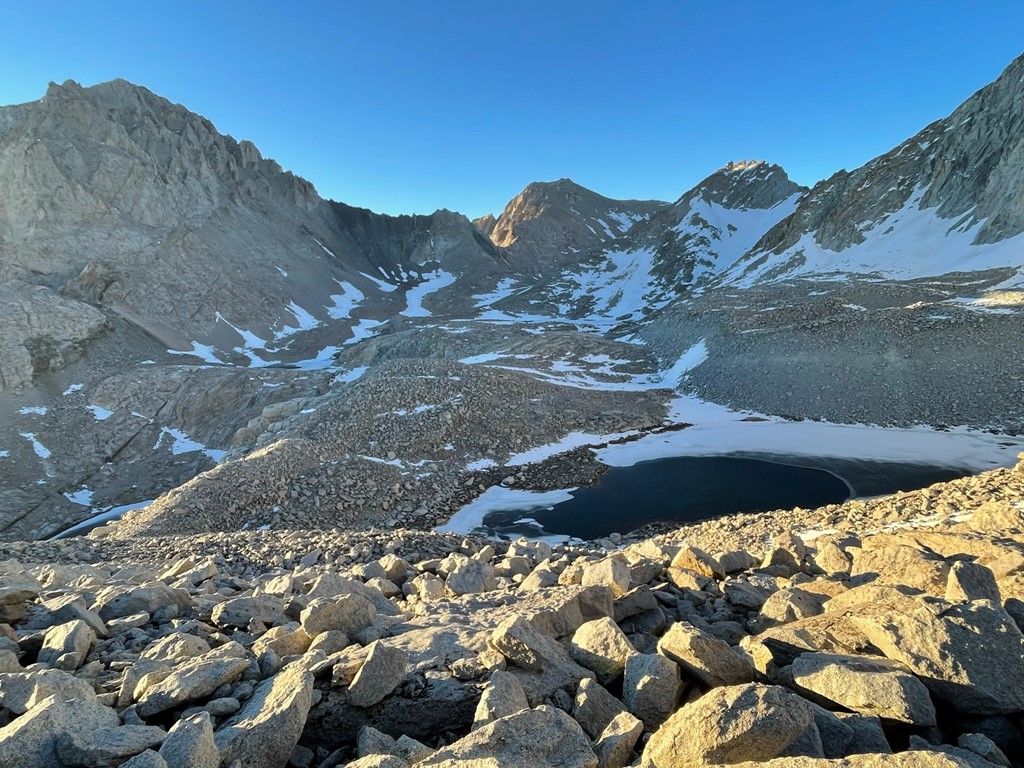
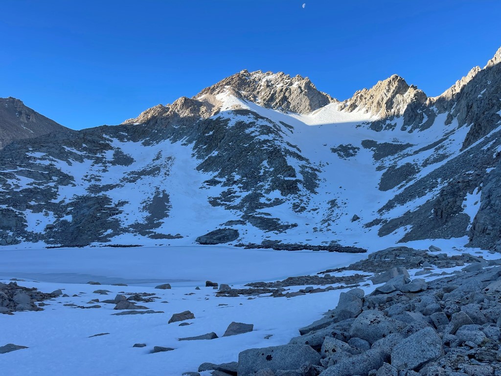
I set up camp at the lake right at the pass. The lake was still frozen but thankfully I was able to get some slushy water from the surface that the sun had partially melted during the day.

It was a cold night (below freezing), but my new bivy sack kept me warm.

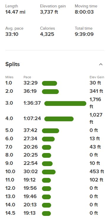
Stats for day 1 were 11.29 miles, 6424 feet elevation gain, and 8:08:53 total time.


Day 2
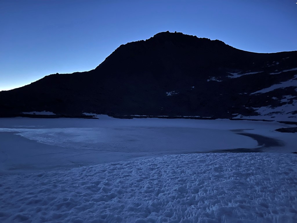
I woke up with the sunrise around 5am, and I was ready to start hiking around 5:30am. Ken, who I had hiked with a few miles the day before, had camped on the opposite side of the same lake. 2 other hikers (Marco and Tim) who I had seen the day before made it to the pass right as Ken and I were ready to go. They had started at 3am from Anvil Camp. Ken was heading for Tyndall and the rest of us were heading for Williamson. The 4 of us began hiking southeast, but Ken soon left the group to make his way up Tyndall. Tyndall was glowing in the early morning light.
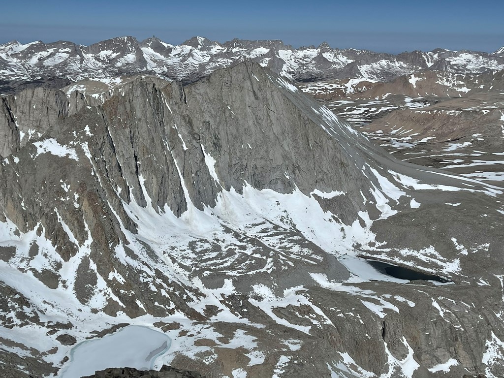
Marco, Tim, and I then dropped into the Williamson Bowl. The Williamson Bowl is a glacially carved basin containing many lakes underneath Mount Williamson. It is full of large talus and has many ups and downs which makes crossing it very tedious. Mount Williamson is on the left.
We descended a few hundred feet into the bowl.
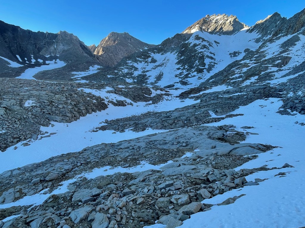
We went southeast and then east as we passed a small lake underneath Mount Versteeg.
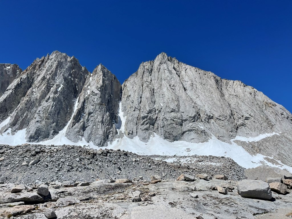
We reached the base of Mount Williamson at 12400 feet.
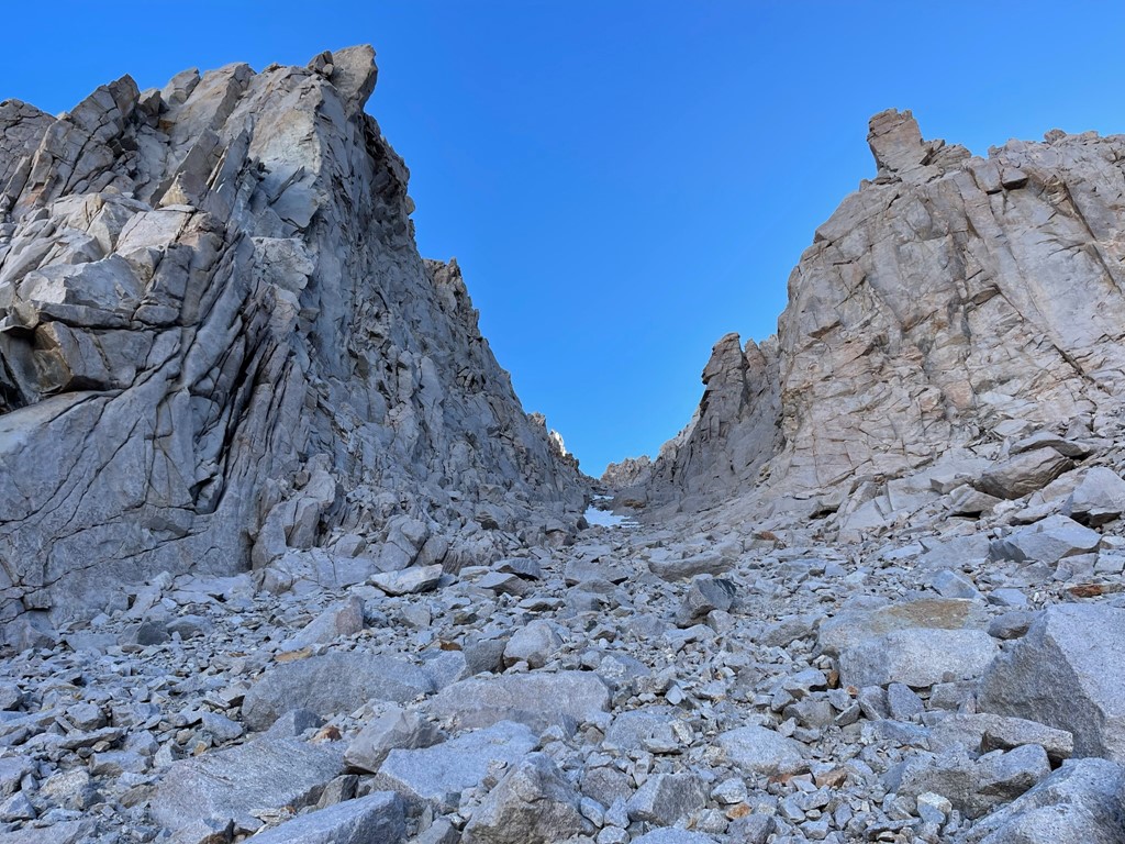
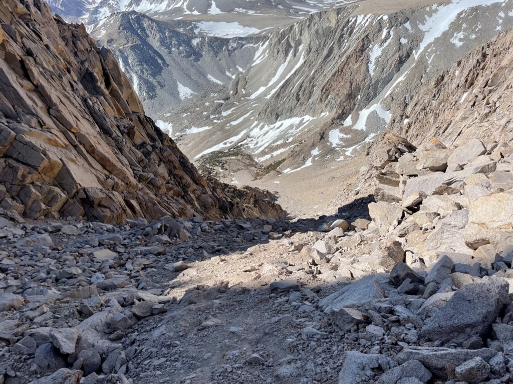
We turned northeast and aimed for the prominent chute in front of us. The rock was very loose on this lower section which made the climbing difficult.
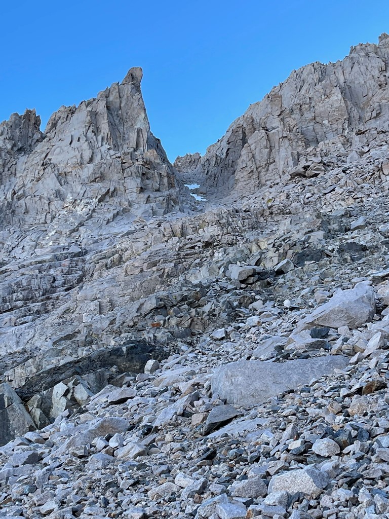
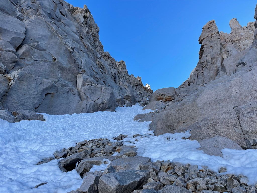
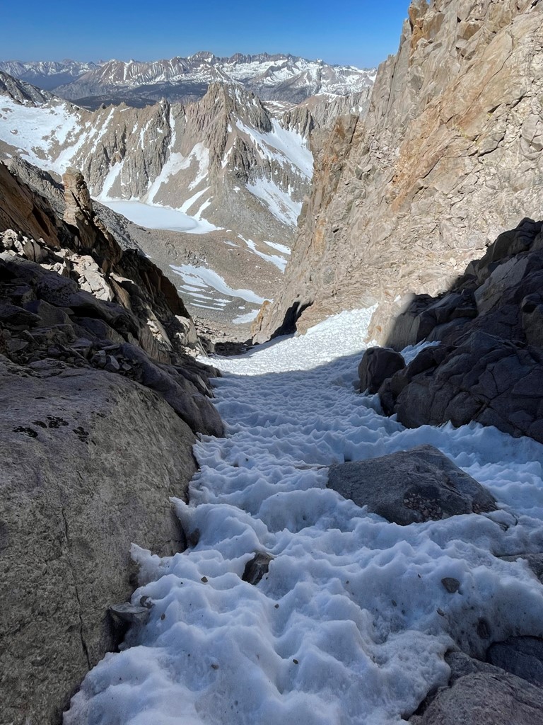
We entered the narrow opening of the chute around 13200 feet. Tim fell behind but Marco and I pressed on. I didn’t see Tim the rest of the day so he must have turned around at some point.
The rock in the chute was of better quality so we made decent progress. There were a few snow patches to climb up, but crampons were not needed.
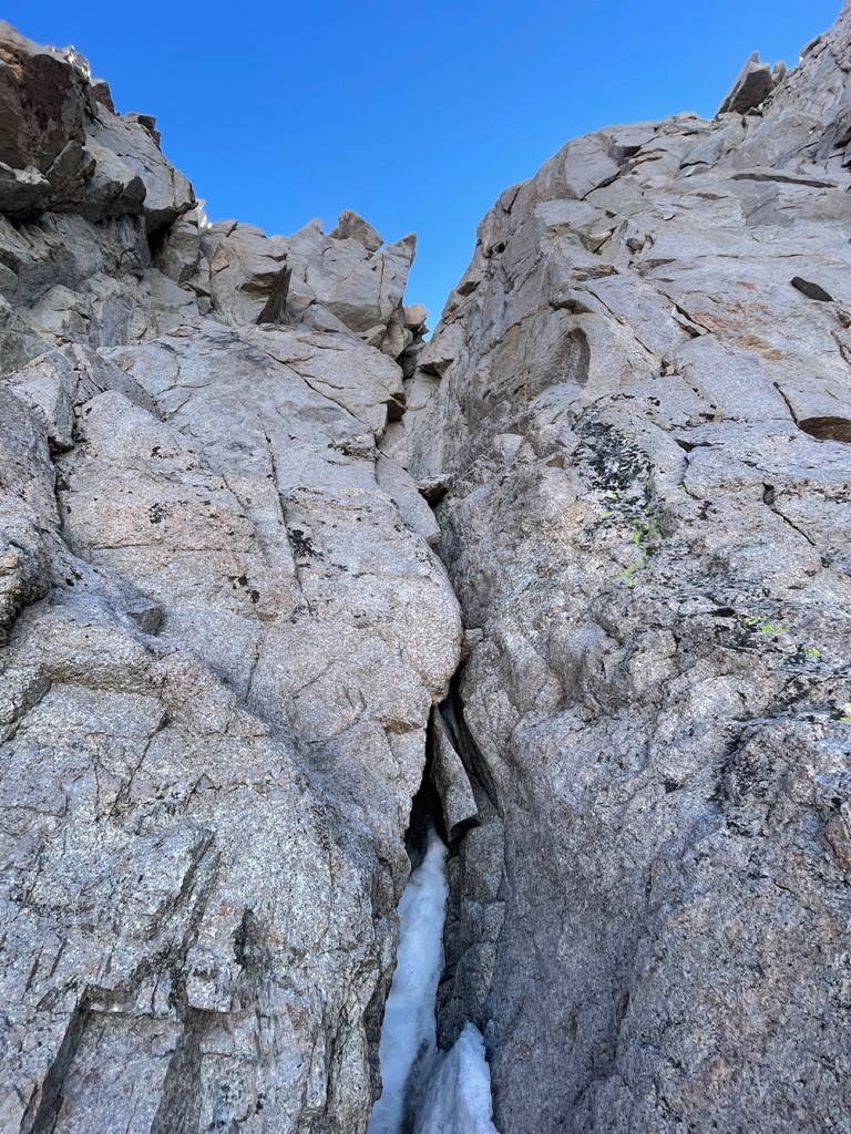
At 14100 feet it was time to exit the chute. There is a well known class 3 chimney that leads from the chute to the summit plateau.
Marco took some pictures of me as I led the way up the chimney.
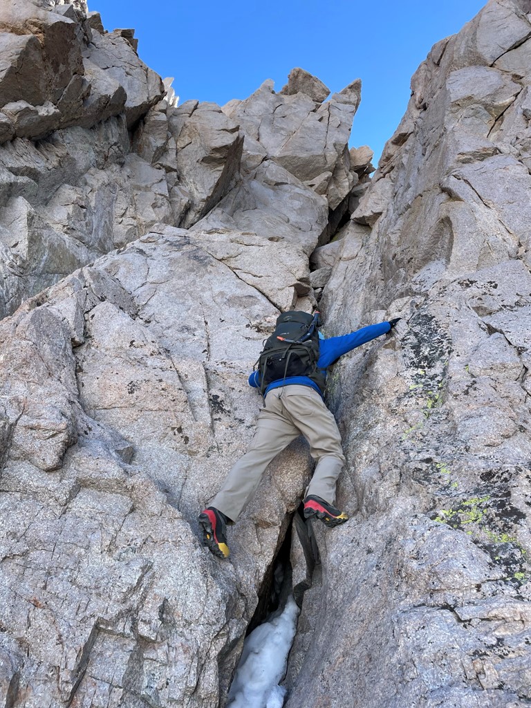
The rock was completely solid, so the climbing was fun.

Most sources indicate that the chimney is about 100 feet high. I actually expected it to feel longer.

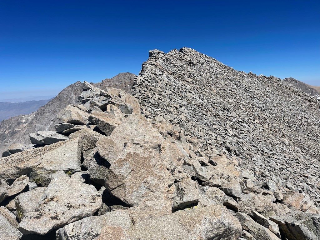
We both reached the summit plateau without any issue. We turned south towards the summit. It was quite windy, but nothing compared to Split Mountain 2 weeks prior.
We reached the summit at 9:05am at 3.2 miles!
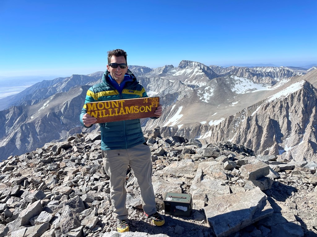
We signed the register which had been placed in 2019. The previous entry was from May 17. I located an old beat up survey marker.

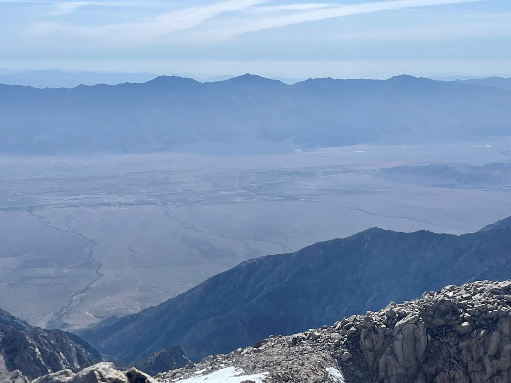
It was a pretty clear day, so the views were stunning. To the south were fellow 14ers Langley, Russell, and Whitney. Trojan Peak and Mount Barnard are on the far right.
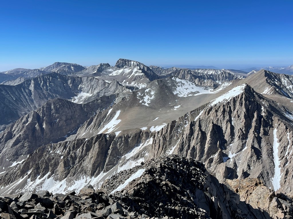
The Kaweahs to the southwest:

Mount Tyndall to the west with Milestone, Midway, Table, and Thunder in the background:
Marco started his descent before me. He ended up hiking all the way out to the trailhead that day. I made my way across the plateau and then carefully descended the chimney.

I descended the chute back into the bowl.
I proceeded across the bowl once more towards Tyndall.

I stopped at one of the lakes beneath Tyndall to fill up my water. Tyndall towered over me.
I climbed out of the bowl and made my way to the base of Tyndall. I passed another hiker heading towards Williamson. She was concerned about having enough time to climb Williamson and get down to Anvil Camp before dark. I reached the base of Tyndall’s north rib at 5.9 miles as 12500 feet.

The north rib is really just an indent in the north face of Tyndall.
The route was steep, but the rock was fairly solid.
There was some slabby climbing for large portions of the route. I was really starting to feel the altitude as I had been above 12000 feet the entire day.

I found myself stopping to catch my breath very often. Thankfully, I eventually reached the summit ridge just east of the true summit.
I scrambled across the ridge and reached the summit at 2:40pm at 6.7 miles!
I was completely exhausted and out of breath. I signed the register which had been placed the previous summer. The most recent entry was from my new buddy Ken earlier the same day. I was happy to see that he had made it. I had an excellent view of the massive form of Mount Williamson to the east:
To the north was Mount Keith, with Split Mountain and the Palisades in the distance.

Looking straight down I could see the half frozen lake I had filled up at a few hours earlier.
After catching my breath, I made my way across the ridge and then descended the north rib.

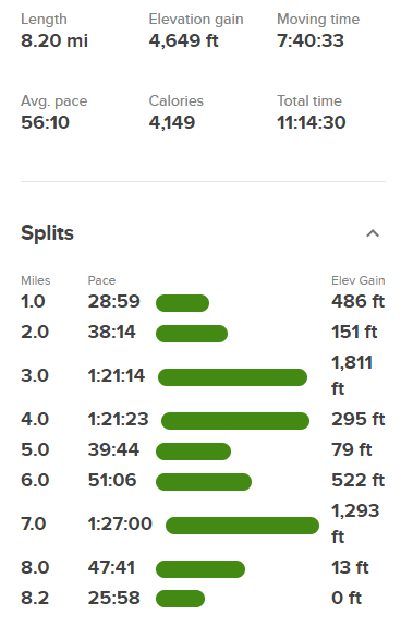
I reached the bottom of the rib and then hiked a short way back to the lake at Shepherd Pass. I reached camp at 4:37pm. Stats for day 2 were 8.2 miles, 4649 feet elevation gain, and 11:14:30 total time.
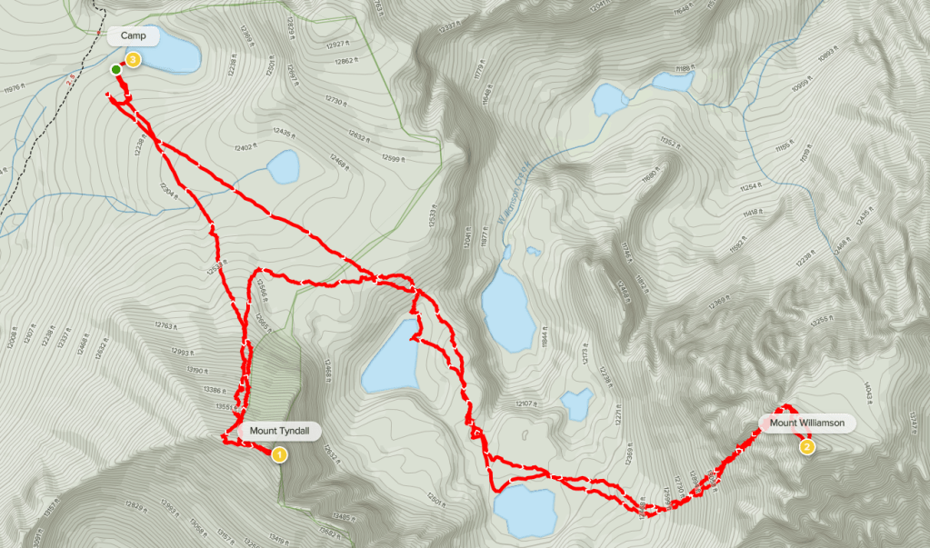
Day 3
I woke up at 4:30am and started hiking at 5am from 12000 feet. I said goodbye to my frozen lake.
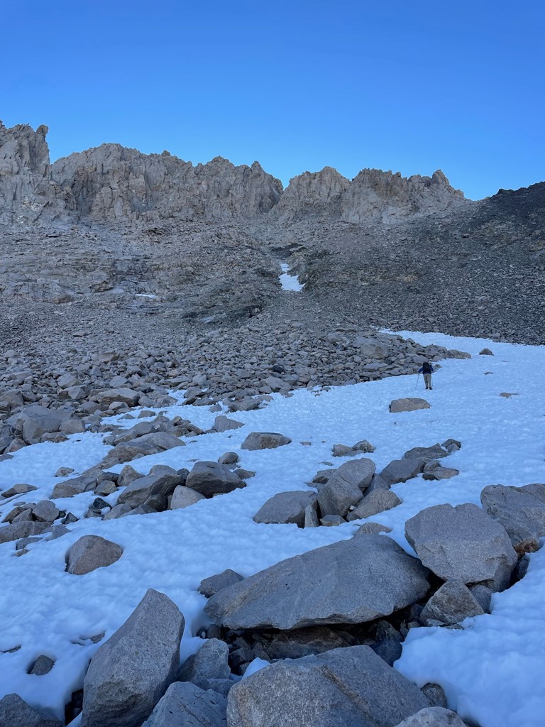
In order to get to the base of Mount Keith, I first needed to descend about 1000 feet down the Shepherd Pass Trail. Dawn was materializing in the east.
I made my way down from the pass, treading carefully down the icy sections.
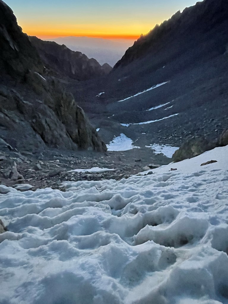
The sun rose over the Inyo Mountains to the east.

At 1.5 miles I reached a spot labeled on the map as the “Pothole”. It appeared to just be a small meadow that Shepherd Creek runs through. This is where I left the trail to begin climbing the 3000+ feet to Keith. I was at 10800 feet here.

I crossed to the north side of the creek and then dropped my overnight gear. I hiked north through some mild brush and some straggly trees near the timberline.

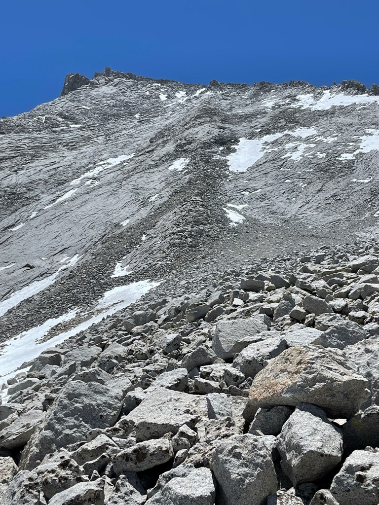
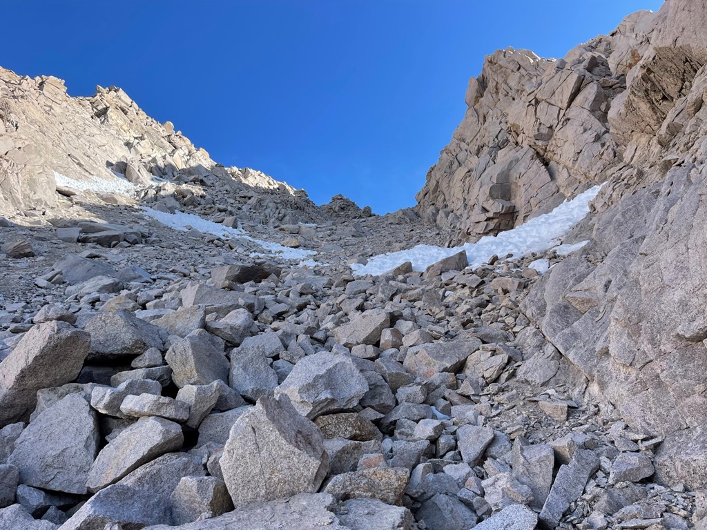
I reached the base of Mount Keith at 1.7 miles at 11300 feet. The route from this side ascends a very obvious chute that goes nearly to the top. Keith is not climbed very often, but the other common route ascends the opposite side from Center Basin.

The rock initially was of decent quality, so I made good progress.

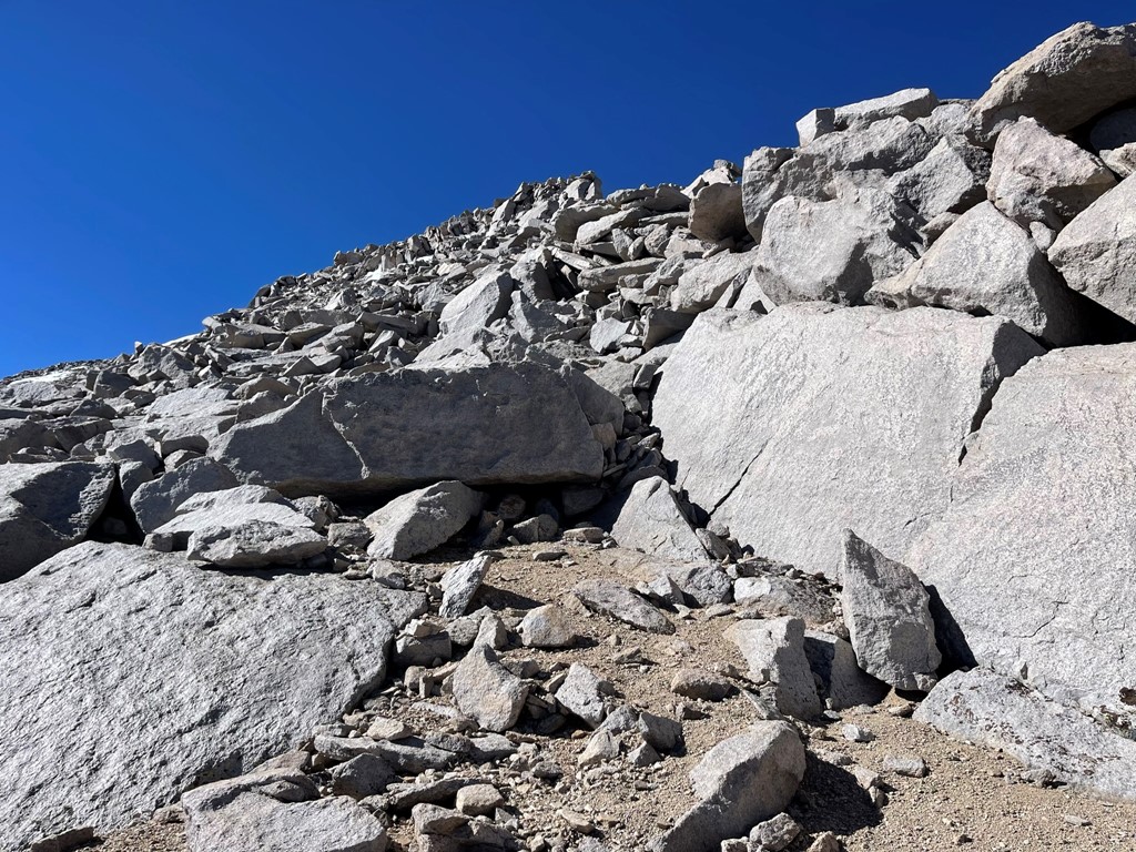
The last 500 feet or so became very steep and loose. I tried to stay on the right side of the chute where the rocks were larger, but it was still very difficult and time consuming.
Eventually I reached the top of the chute. I turned east and climbed the remaining 100 or so feet to the top.

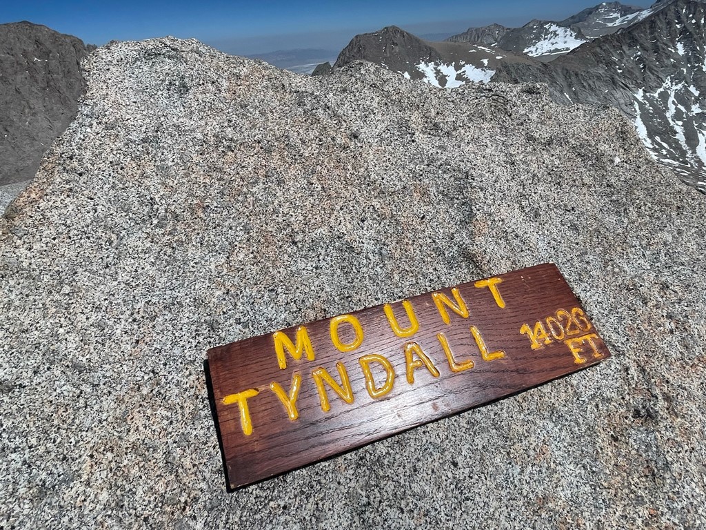
I reached the summit at 8:43am at 3.2 miles!

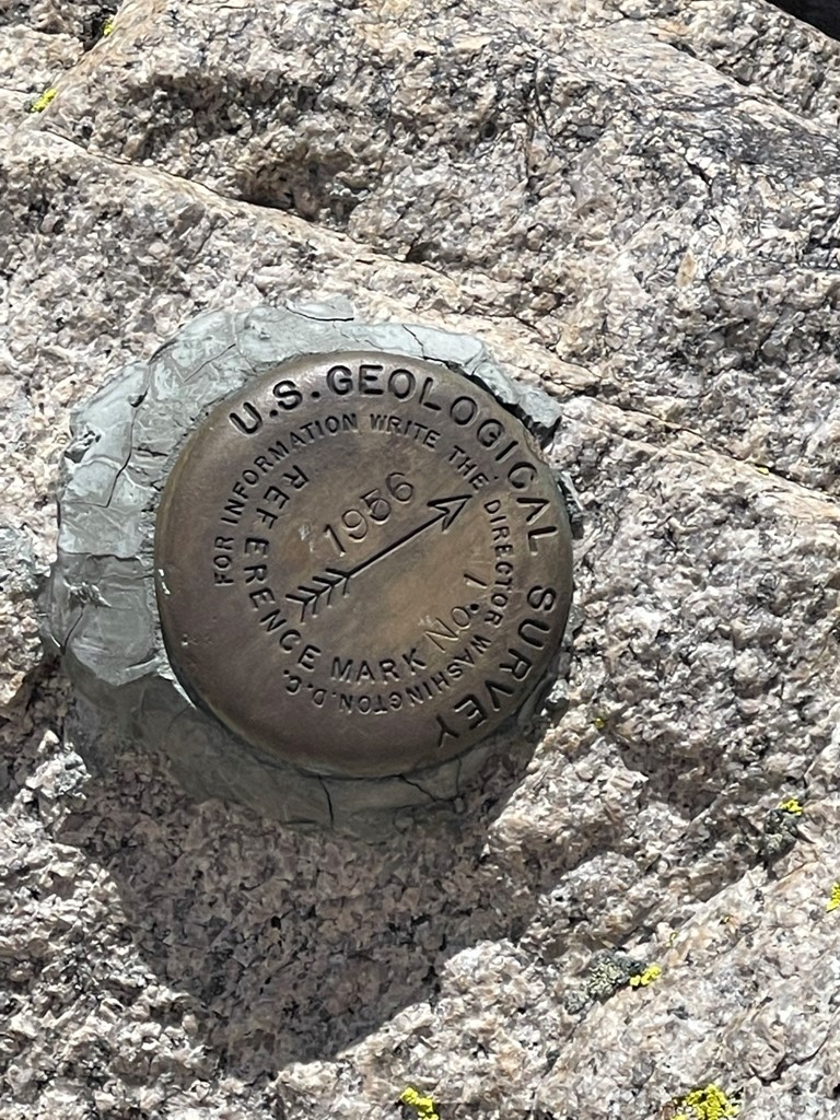
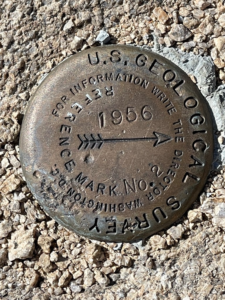
I signed the register which had been placed in 1982. I signed the very last page of the book. The previous entry was from May 19. I located the benchmark and 2 reference markers.

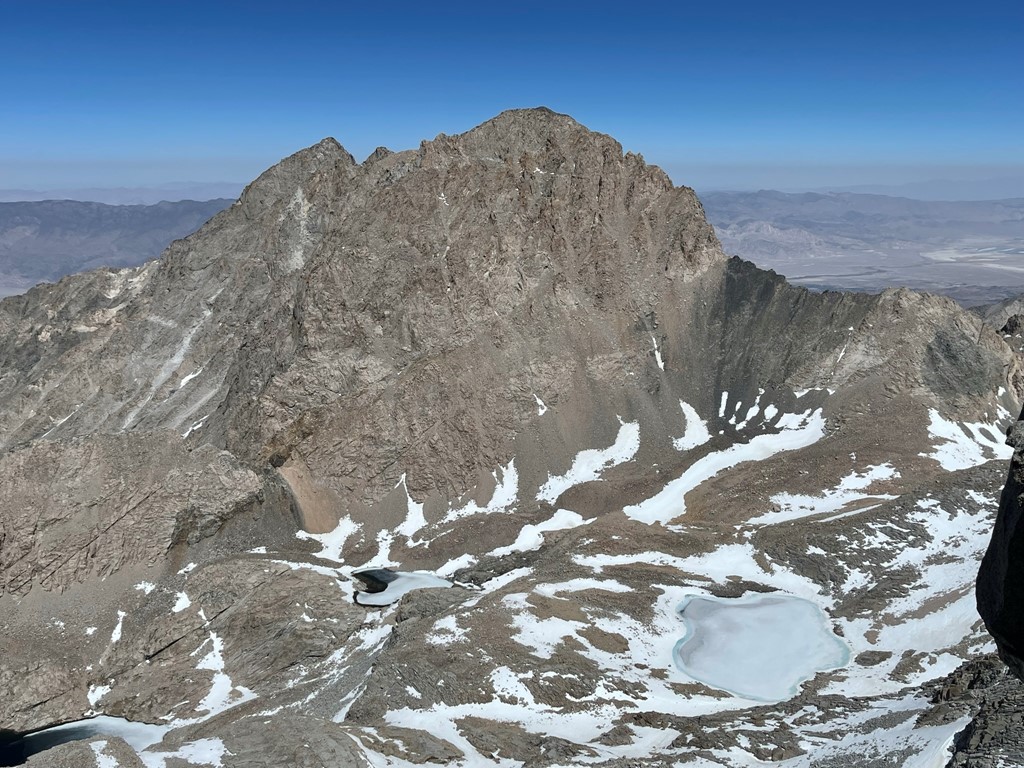
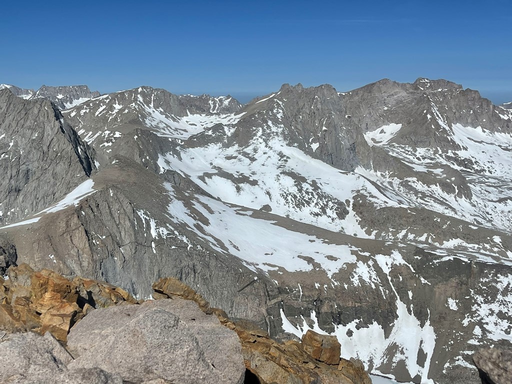
I had a great view of the 2 14ers I had climbed the day before. Mount Williamson:

And Mount Tyndall:

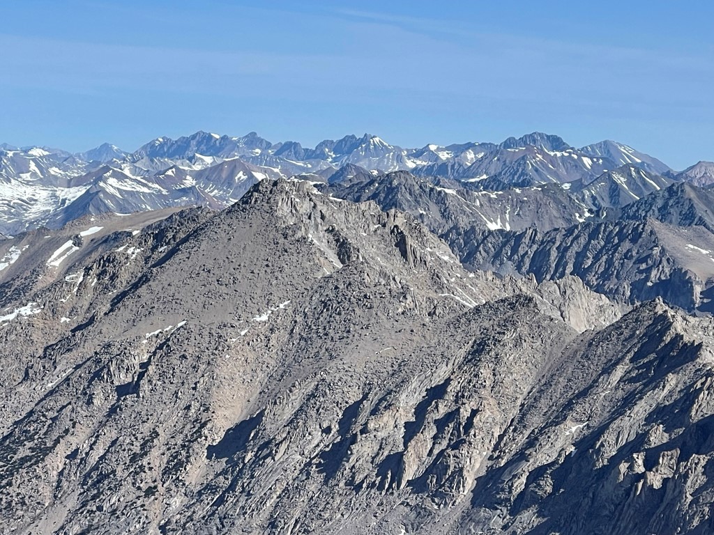
Mount Stanford to the west:
North Palisade, Mount Sill, Middle Palisade, and Split Mountain to the north:
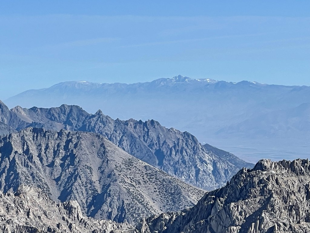
White Mountain Peak to the northeast:
And Mount Inyo, Keynot Peak, and New York Butte to the east.
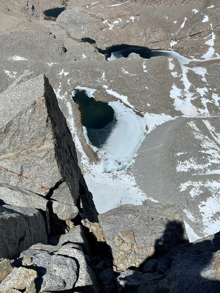
I also was able to spot my frozen lake at Shepherd Pass from above. My campsite was on one of the bare spots on the righthand shore.

After a little break I descended the chute back towards the trail. The top of the chute was sketchy with how loose it was, but I was able to plunge step down large portions of it once I was below 13000 feet.
I reached the trail again at 4.8 miles. I repacked my overnight gear and began heading down. It was still nearly 10 miles to go.
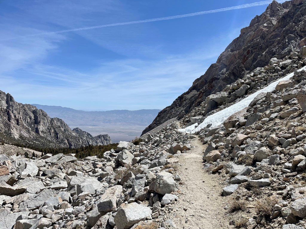
I made good time down the rest of the trail. The only part that was difficult was the 500 foot ascent back up to Symmes Saddle. Once I was past the saddle, I cruised down the switchbacks back to the trailhead.

I reached the car at 2:39pm. Stats for day 3 were 14.47 miles, 3737 feet elevation gain, and 9:39:09 total time.