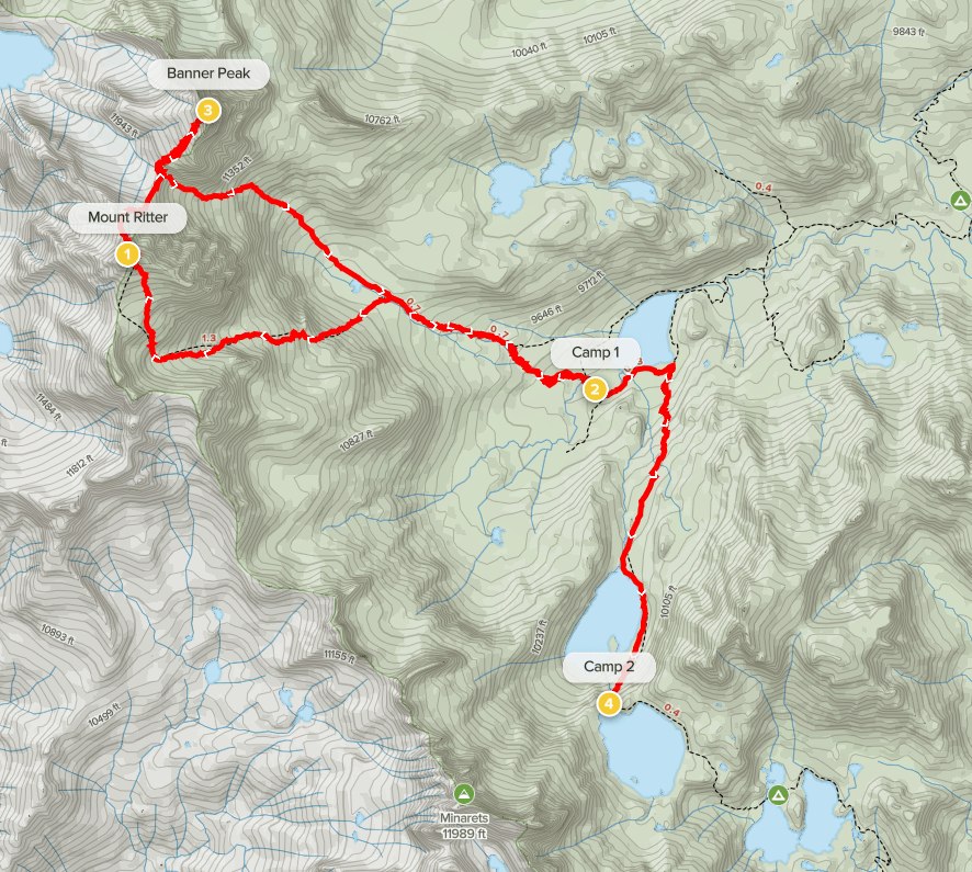
Day 1
Mount Ritter (13143 feet), located near Mammoth Lakes, is one of the most iconic peaks in the Sierra. With 3957 feet of prominence, it is the 2nd most prominent peak in the entire Sierra after Mount Whitney. It is also one of 15 emblem peaks on the Sierra Peaks list, and it is the highpoint of Madera County. I intended to climb it along with neighboring Banner Peak (12936 feet) as part of a 3 day backpacking trip starting from Devils Postpile National Monument. I left early Friday morning and made the 6.5 hour drive to Mammoth Lakes. Typically, you must park and ride a shuttle into the national monument, but thankfully the shuttles stop running after Labor Day. I arrived at the overnight parking lot and began hiking at 11:45am from 7845 feet above sea level.

The overnight lot is located 0.4 mile up the road from the actual trailhead. I hiked south past the day use lot and the ranger station and made it onto the trail. At 0.6 mile I went right towards the PCT/JMT.
I crossed the Middle Fork of the San Joaquin River.

At 1.2 miles the PCT and JMT split. I went right to stay on the PCT.

I went north on the PCT for a few miles. I crossed back to the other side of the river at one point.
At 6.2 miles I left the PCT and turned left onto the Shadow Creek Trail.
I reached Olaine Lake at 7.4 miles.
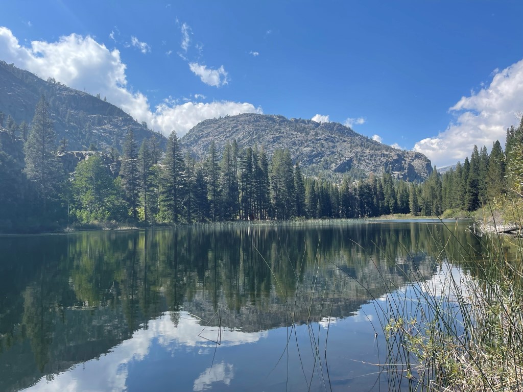
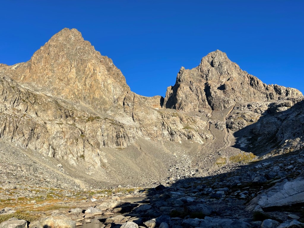
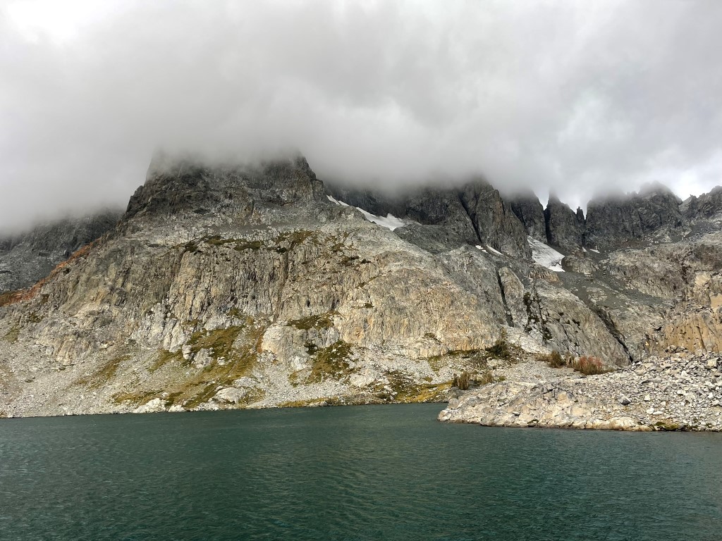
At 7.8 miles I reached a junction and went left to stay on the Shadow Creek Trail. I reached Shadow Lake at 9.1 miles and got my first look at Ritter (left) and Banner (right). I took a short break and dipped my feet in the cold water. I had noted that no camping is allowed near Shadow Lake since it is such a high use area.

I continued west past Shadow Lake for another couple miles and reached Ediza Lake.

Camping is not allowed on the south and east sides of the lake, so I hiked around to the west side and set up camp next to a creek. Stats for day 1 were 12.88 miles, 2392 feet elevation gain, and 5:16:22 total time.


Day 2
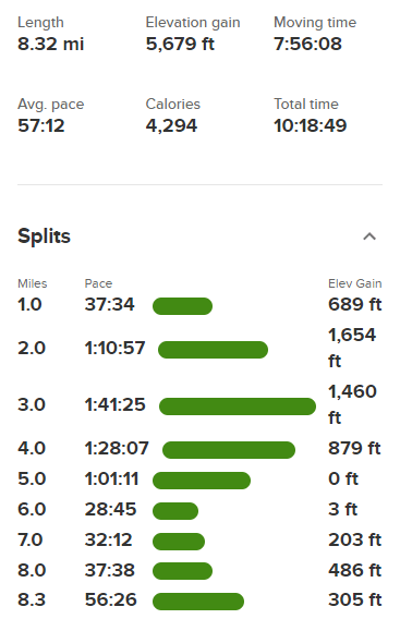
The plan for day 2 was to climb Mount Ritter via the Southeast Glacier, descend to the Ritter/Banner Saddle, climb Banner, and then descend to the saddle and back to camp. I began hiking at 6:31am from 9251 feet above sea level.
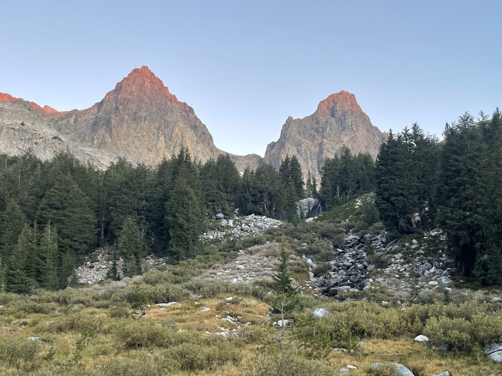
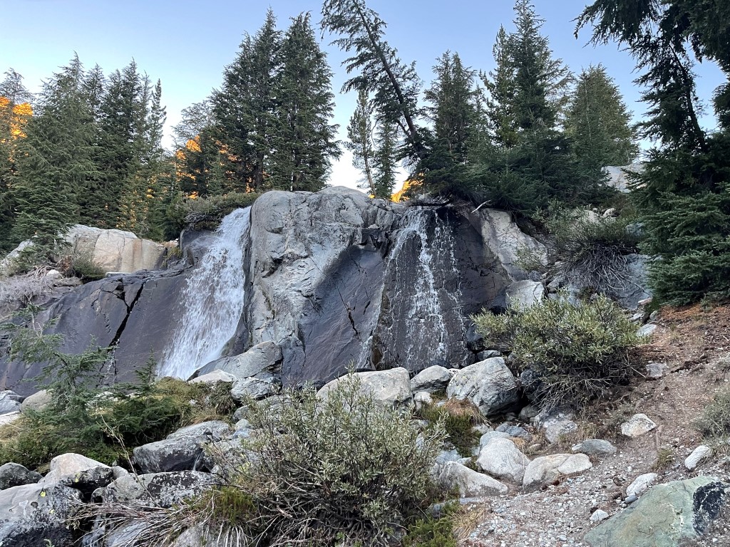
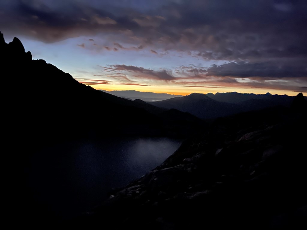
I crossed to the north side of the small creek I had camped by and followed a use trail northwest towards the peaks. I passed a small waterfall.
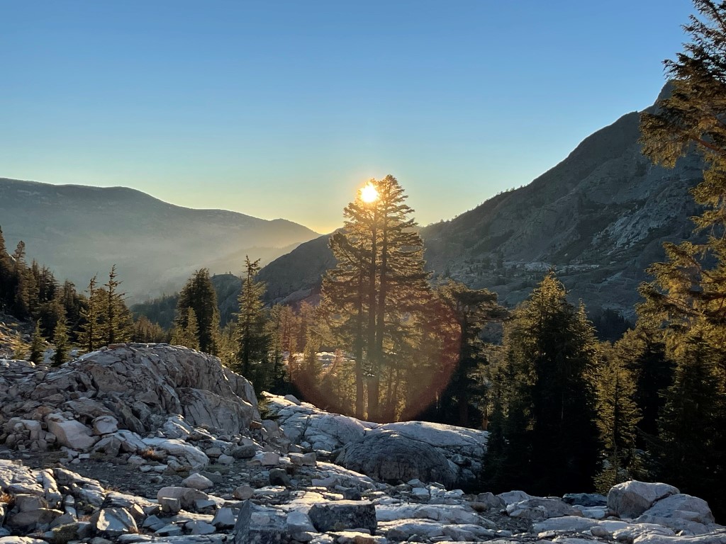
The sun began to rise behind me to the east.
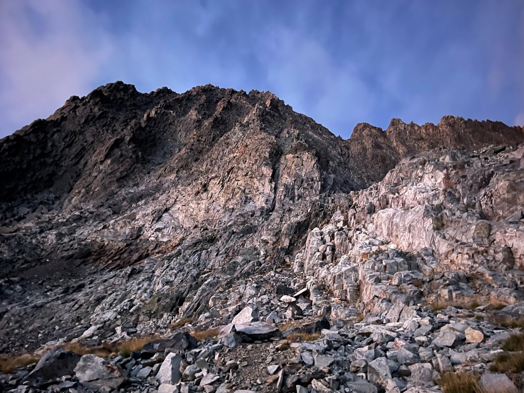
I made it up to a grassy meadow around 10000 feet. I turned directly west to head for the Southeast Glacier.
I climbed up steep grassy benches above the small meadow.

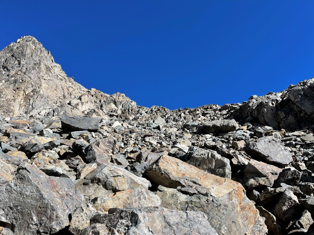
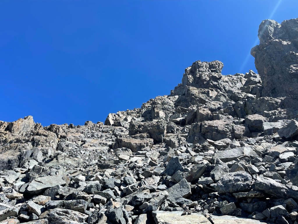
The grassy benches turned into talus with little streams of frozen water flowing down.

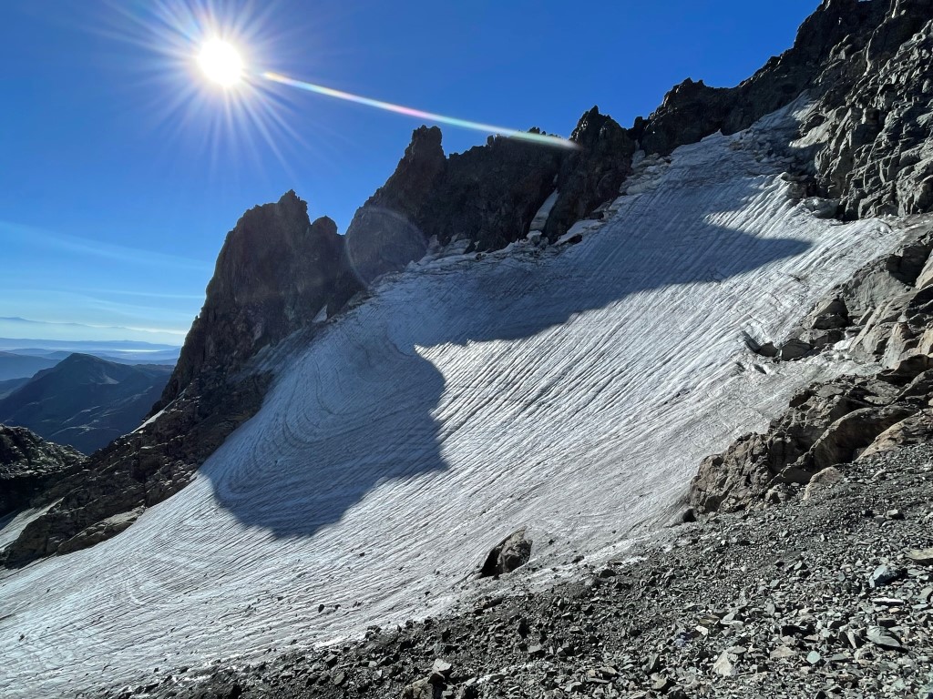
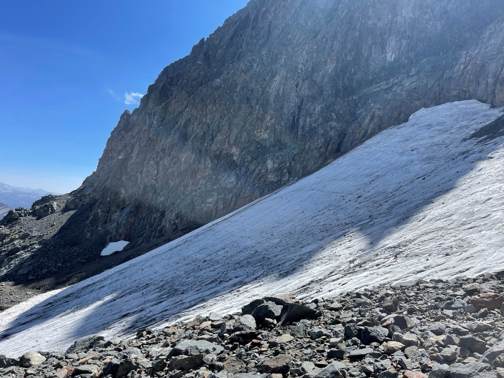
I reached the Southeast Glacier at 11600 feet. I had crampons with me, but the glacier was low-angled enough that I did not use them. The surface was very slippery though, so I stumbled around a bit.

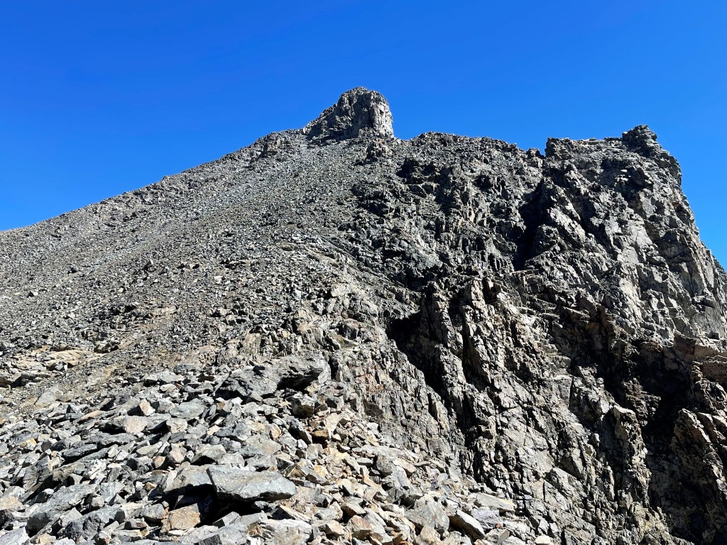
I scrambled up a steep section of loose rock above the glacier. I then turned right and began climbing up the south face of Ritter.
I turned around to get a good look at the glacier from above.
The scramble up the south face was straightforward class 2.

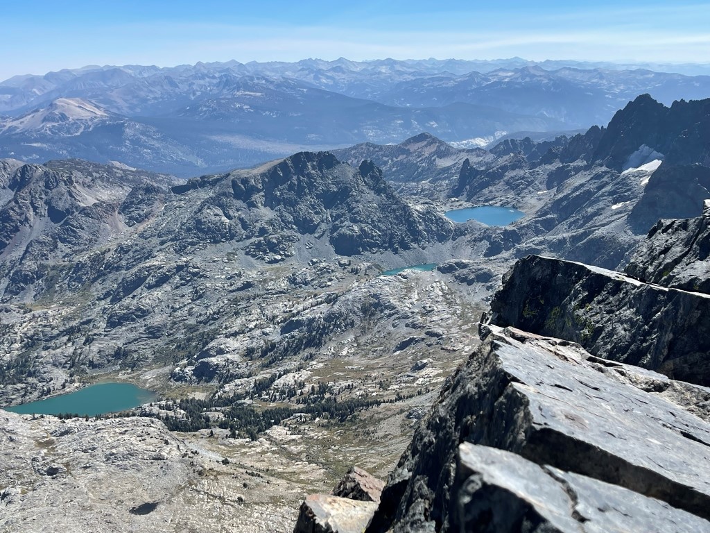
I reached the summit at 9:53am at 2.6 miles!

I signed the register which was placed in 2011. The most recent entry was from the day before. Ritter is a relatively popular peak, as evidenced by the numerous entries over the years. The weather was clear, so the views were superb. To the southeast: Mount Morgan, Mount Tom, Bear Creek Spire, and Mount Gabb.
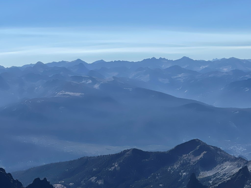
To the west: Merced Peak, Red Peak, Gray Peak, and Mount Clark:
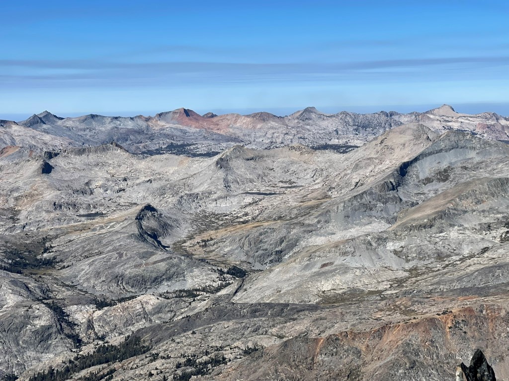
To the east: Montgomery Peak, Mount Dubois, and White Mountain Peak:

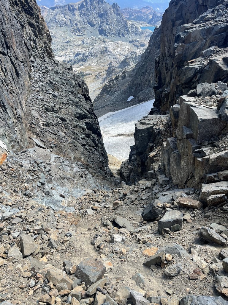
I began descending to the Ritter/Banner saddle after a 20 minute break. I hiked a short way to the east and then climbed down a steep chute to the northwest.

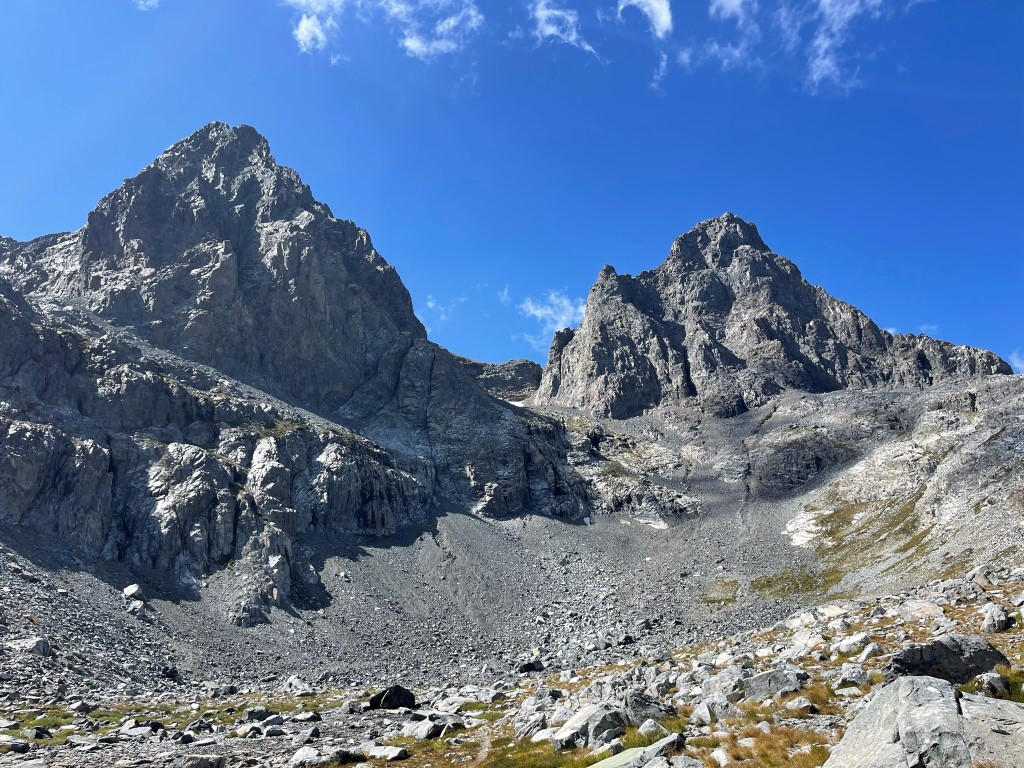
The chute was very loose, and I had to downclimb at least one class 3 move. I then traversed into another chute that descended to the northeast. This chute was wider and more solid. Eventually I reached the saddle at around 12000 feet. Banner was right ahead of me about 900 feet above.
Banner was a straightforward class 2 talus scramble. About halfway up I got hit by a slight wave of nausea. I had been dealing with a mild cold the last few days, so I figured it was that plus a little dehydration. I took a 15 minute break while I hydrated and had a little snack. I felt better and continued the rest of the way up.
I reached the summit at 12:11pm at 3.6 miles! I signed the register which had been placed in 2019. The most recent entry was from September 14. I had a great view of Ritter to the south:

Mount Florence, Rodgers Peak, and Mount Lyell in Yosemite to the northwest:

Mount Conness, Twin Peaks, and Excelsior Mountain to the north:
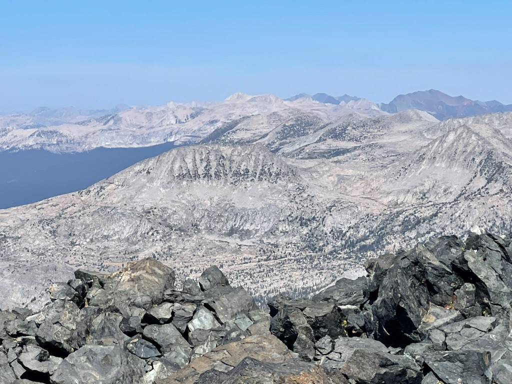
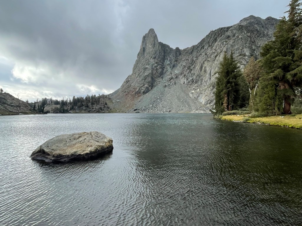
Below me to the east I could see Ediza Lake (left), Iceberg Lake (middle), and Cecile Lake (right). I spent the first night at Ediza Lake and would spend the second night at Cecile Lake.
I descended back to the saddle after a 20 minute break. From the saddle I descended directly east down a narrow chute.
Below the chute, I skirted around a large snowfield and then descended talus slopes to the east.
I rejoined my ascent route at 5.1 miles. From there I found the use trail and descended back to camp. Ritter and Banner looked very impressive in the afternoon sunlight.
I reached my camp, packed up, and set off. I intended to get to Cecile Lake that night for an attempt on Clyde Minaret the next morning. I hiked east past the southern shore of Ediza Lake and reached the turnoff for Cecile Lake. I turned south and could see the Minarets ahead of me in the distance.

At 7.5 miles I reached Iceberg Lake.

The trail disappeared past Iceberg Lake. I hiked around the lake’s eastern side which consisted of large talus. Once I reached the far side of the lake, I scrambled up a steep rocky slope. At the top of the slope, I reached Cecile Lake with Clyde Minaret rising above it.

I set up camp at a small grassy flat on the northern shore of the lake. The wind really picked up which made for a very cold evening as I was setting up and having dinner. Stats for day 2 were 8.32 miles, 5679 feet elevation gain, and 10:18:49 total time.
Day 3
The Minarets are a small sub-range in the Sierra southeast of Mount Ritter. At 12264 feet, Clyde Minaret is the highest of the series of rugged peaks. My plan was to climb it by its class 4 rock route and then descend and hike out to the trailhead. I began hiking at 5:35am from 10256 feet above sea level. I hiked for about 30 minutes via headlamp before the sun came up.
I made it to about 11100 feet before deciding to turn around. The route was supposed to be class 3 up until the summit block, but I was unable to find the correct route. I probably spent about 45 minutes looking for a way before giving up.
Disappointed, I descended back to camp and packed up my gear. It was a very cold and windy morning, and now some low clouds had settled in over the peaks. It even started snowing which made me glad I wasn’t high up near the summit.
I hiked east along the northern shore of Cecile Lake and then descended to Minaret Lake. I saw many campers just rolling out of their tents.
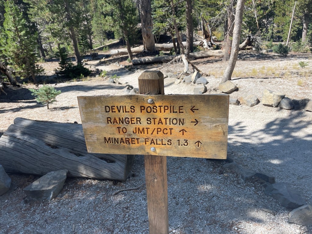
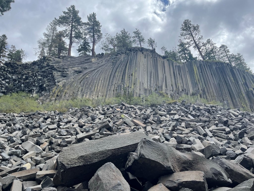
Once I was past the lake, I continued east on the Minaret Lake Trail back towards the trailhead. Before heading back to the parking lot, I decided to check out Devils Postpile real quick. Devils Postpile is an unusual formation of rock columns and is a popular tourist attraction.
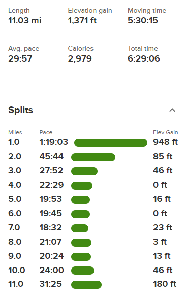
Once I was done with that, I returned to the trailhead and reached my car at noon. Stats for day 3 were 11.03 miles, 1371 feet elevation gain, and 6:29:06 total time.