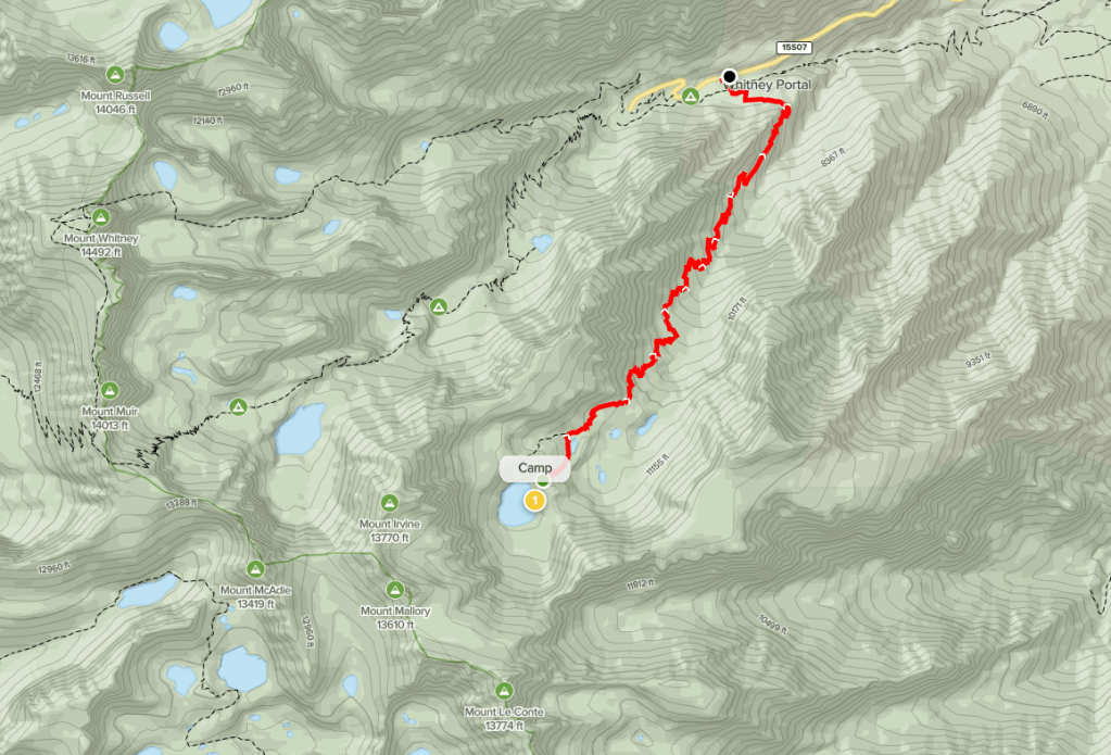
Day 1
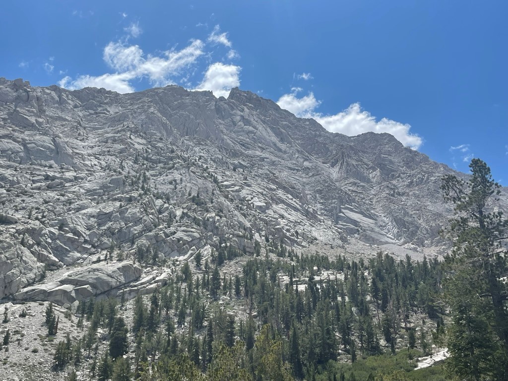
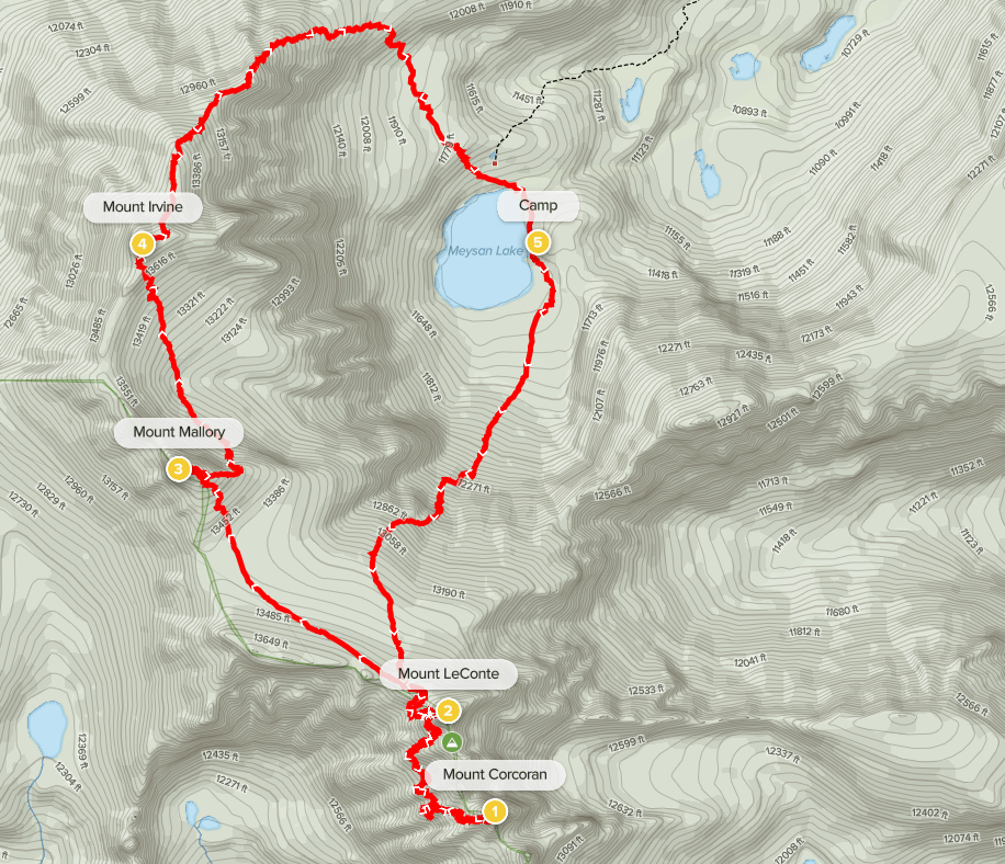
Mount LeConte (13930 ft), Mount Corcoran (13714 ft), Mount Mallory (13845 ft), and Mount Irvine (13780 ft) are 4 peaks located between the 2 most southern 14ers in California: Mount Whitney and Mount Langley. They are most easily accessed via Meysan Lake, a beautiful alpine lake located at 11500 feet. The Meysan Lake Trail starts from Whitney Portal and ascends to the lake in a little over 6 miles. Marcus and I left San Diego Friday morning and drove about 4.5 hours to the Whitney Portal Café where we met our friend Bill. We had a quick breakfast and then made it over to the Meysan Lake Trailhead parking, which is located on the side of the road near the Whitney Portal campground. We began hiking at 10:44am from 7900 feet above sea level.
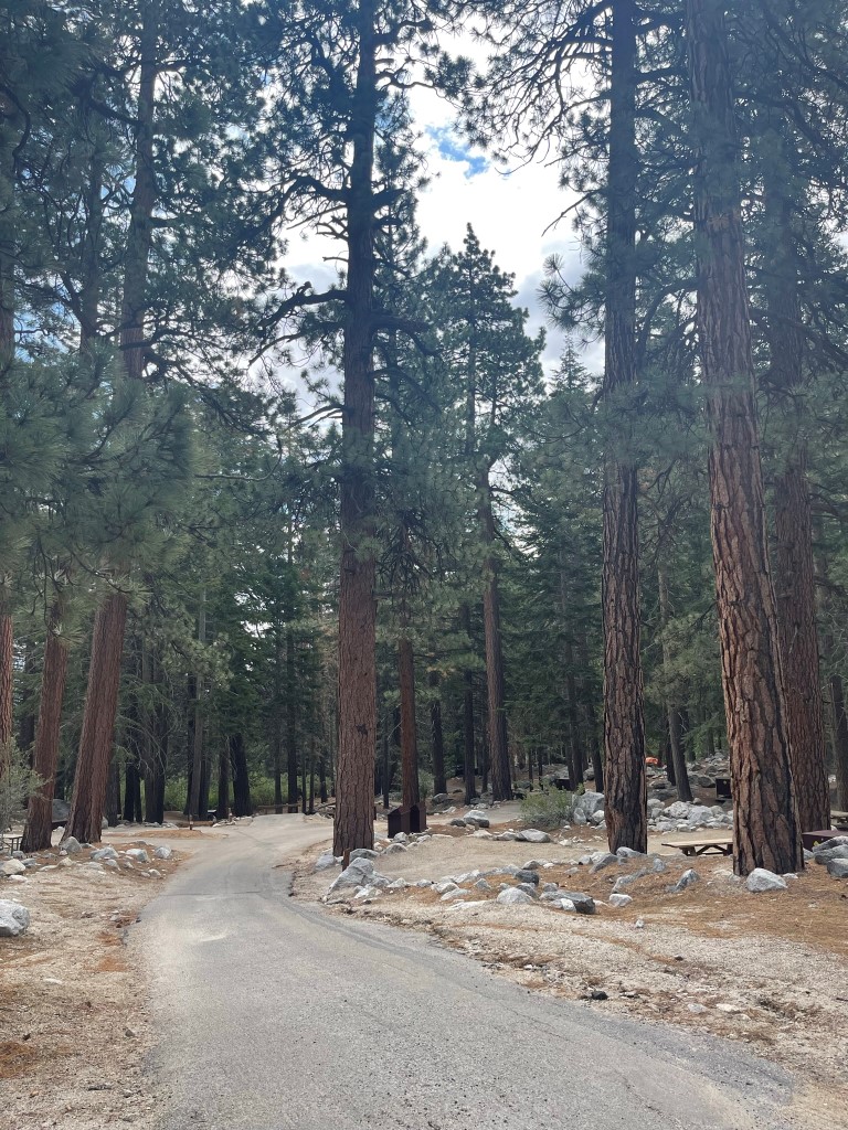
We hiked through the campground which was surprisingly empty. It appeared that less than half the sites were occupied, which we guessed had something to do with the poor weather forecast for the weekend. We found the official start of the trail on the south side of the campground.

The trail went through a small neighborhood of cabins and summer homes. It then turned to the southwest.
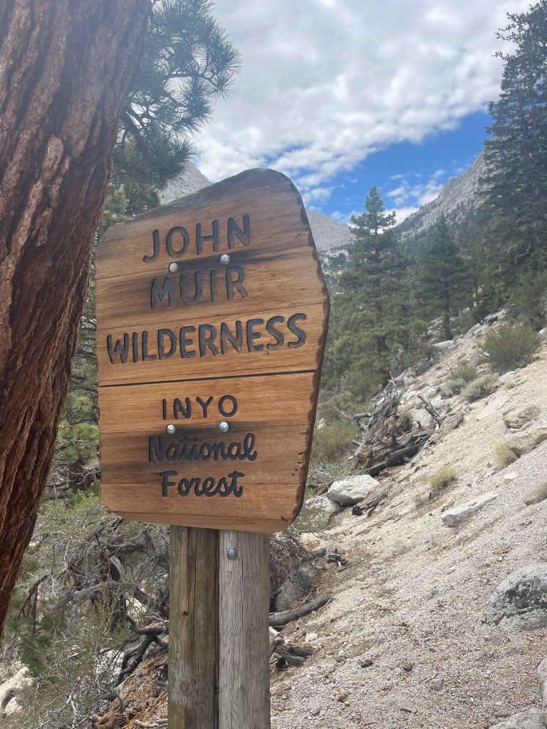
At 1.3 miles we passed the wilderness sign.
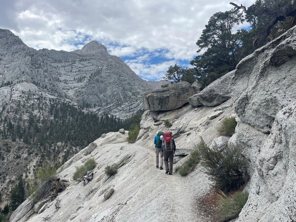
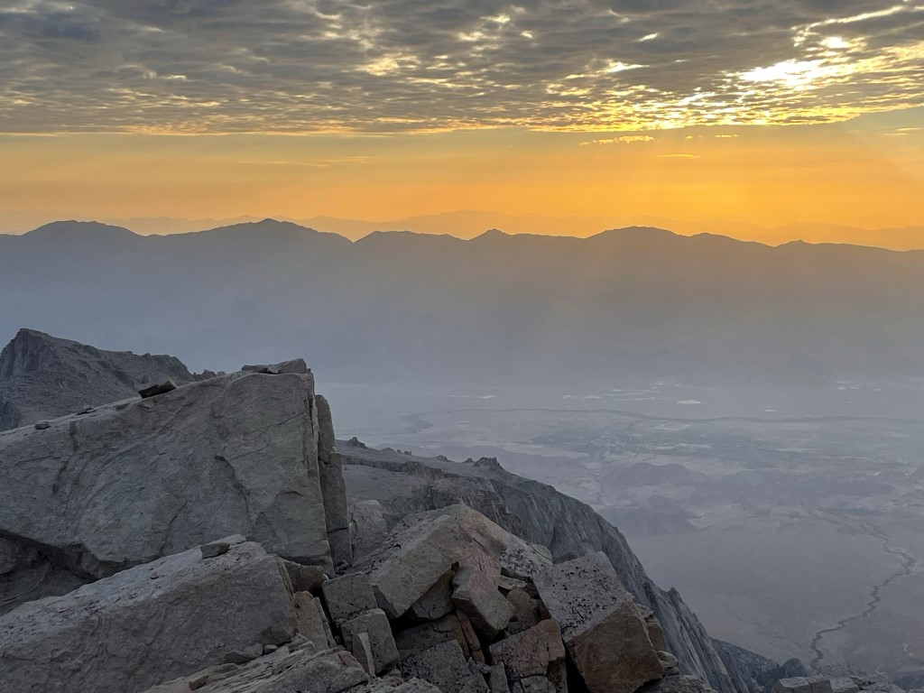
We had a very nice view of Lone Pine Peak above us to the south. I had climbed Lone Pine Peak in August 2020, which was my only previous time up the Meysan Lake Trail.
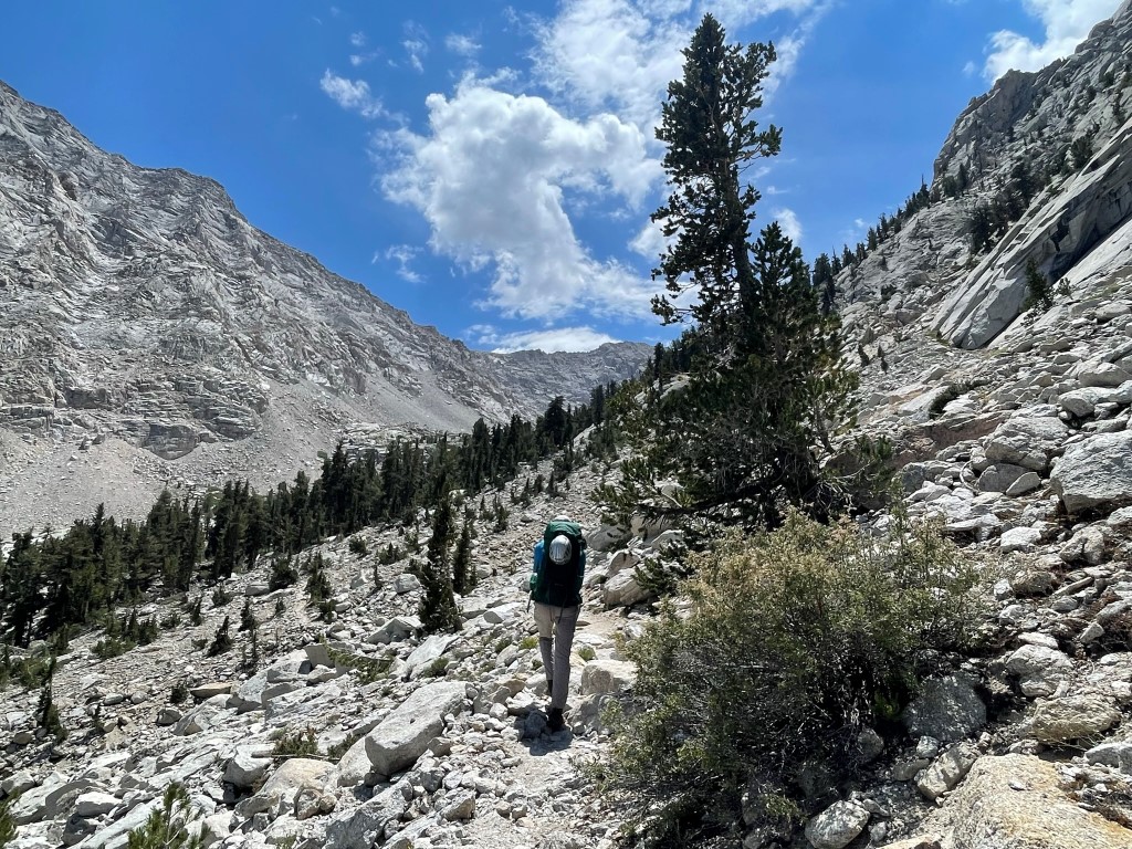
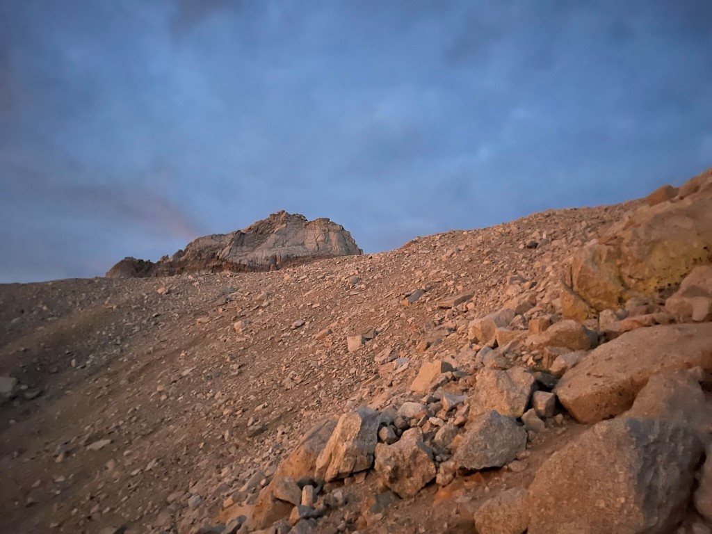
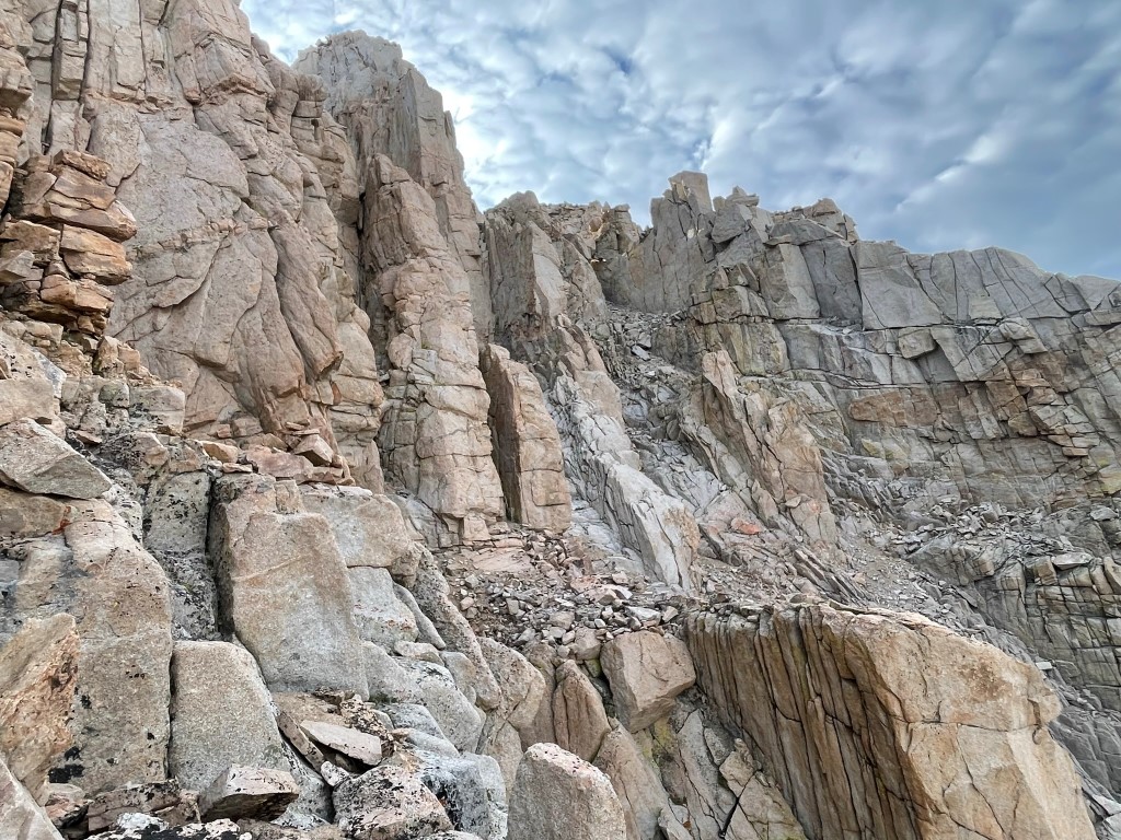
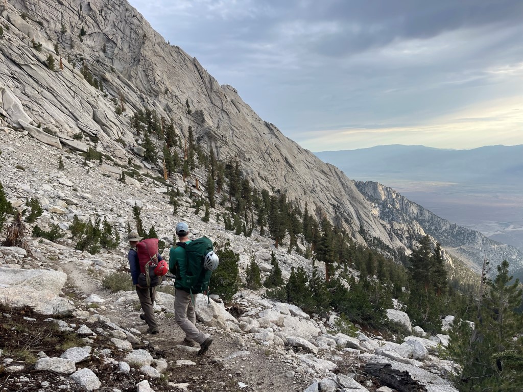
We continued southwest up the canyon formed by Meysan Creek. The trail is quite steep from the beginning and makes countless switchbacks as it ascends to the lake. We took many breaks since we had all day, and we knew it wouldn’t take us too long to get to the lake. We even took a short nap approximately halfway up.
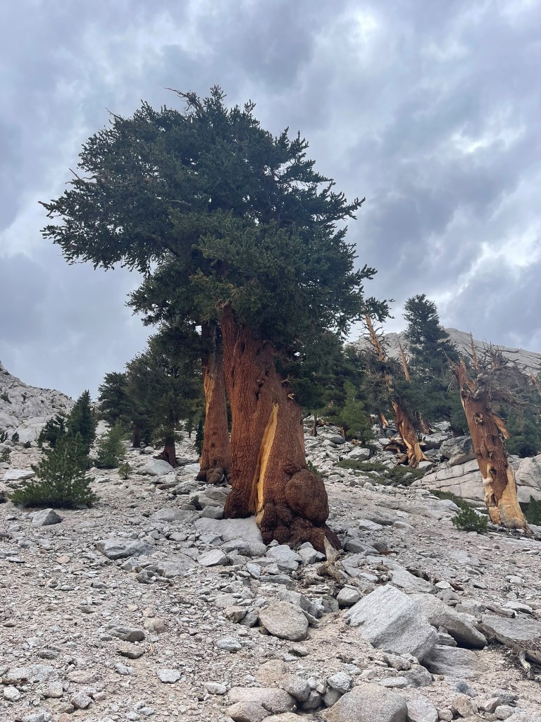
There were some large limber pines on the steep slopes above the trail.
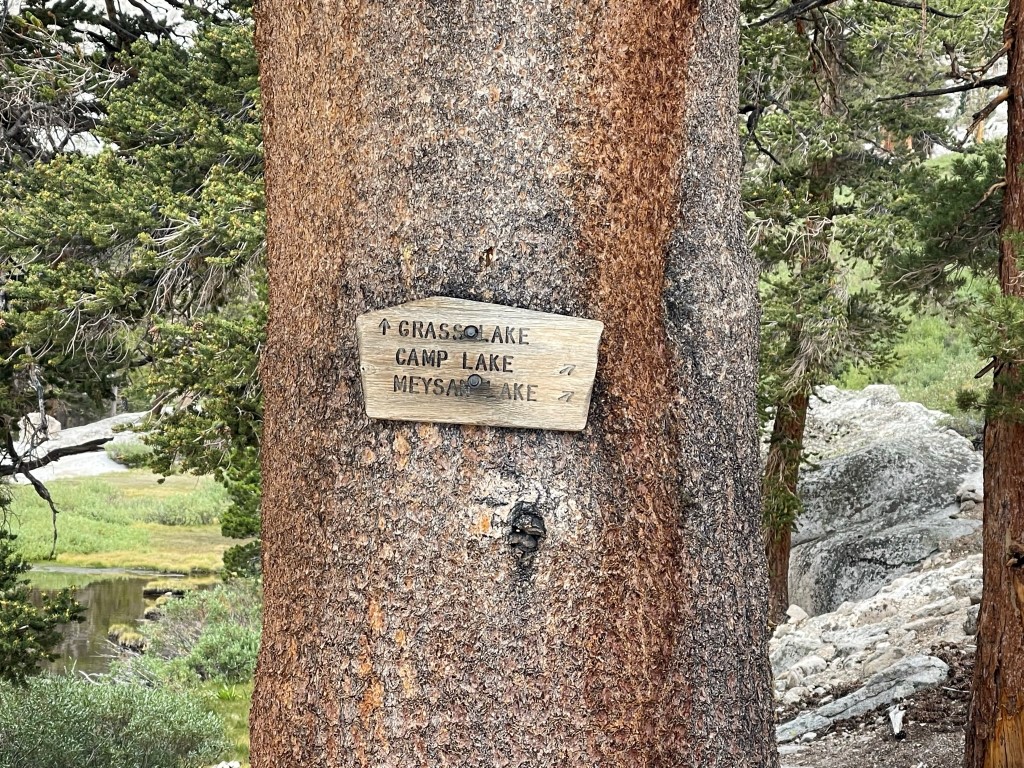
We ran into another hiker named Thomas. He had been planning to climb Mount Irvine, but after chatting with us he decided to join our group and attempt Mount LeConte the following day. His hiking partner had bailed on him due to work commitments, so he was happy to find a group to hike with. At 4.8 miles we reached the turnoff for Grass Lake, which is the way to Lone Pine Peak. We went right to continue towards Meysan Lake.
It wasn’t much further to Meysan Lake.

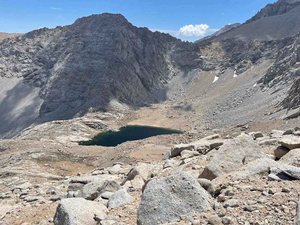
We reached Meysan Lake around 6 miles. Mount LeConte can be seen poking out top center.
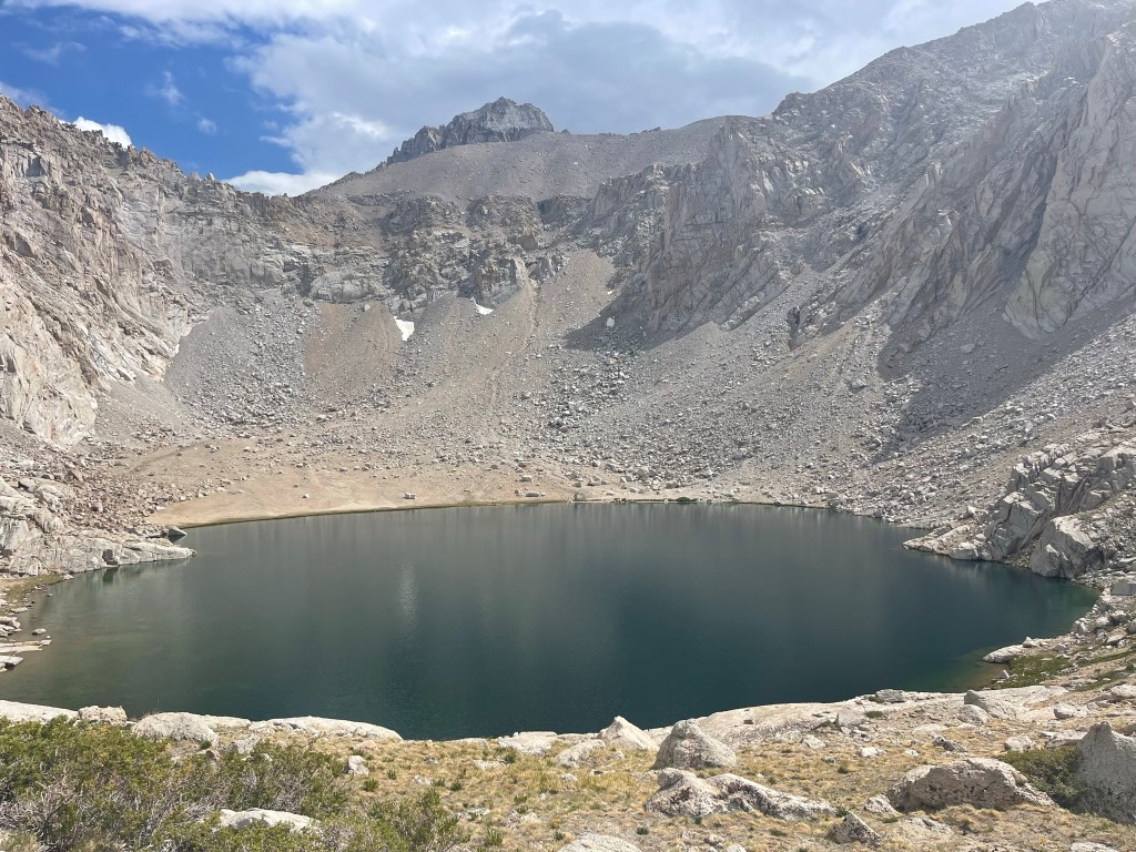
We descended about 100 feet to the eastern shore of the lake and set up camp a little after 4pm.

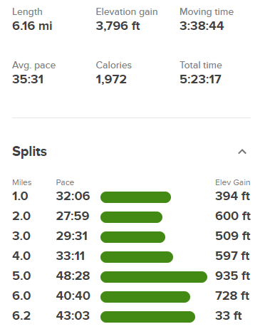
We spent the rest of the day chatting and hanging out by the lake. There were some dark clouds in the area, but we didn’t get any rain. Stats for day 1 were 6.16 miles, 3796 feet elevation gain, and 5:23:17 total time.

Day 2
Our initial plan for day 2 was to climb only LeConte and Corcoran. We were concerned about the weather forecast so we planned an early start so we could get back to camp before noon if necessary. We set the alarms for 3:30am and started hiking at 4am from 11501 feet above sea level.

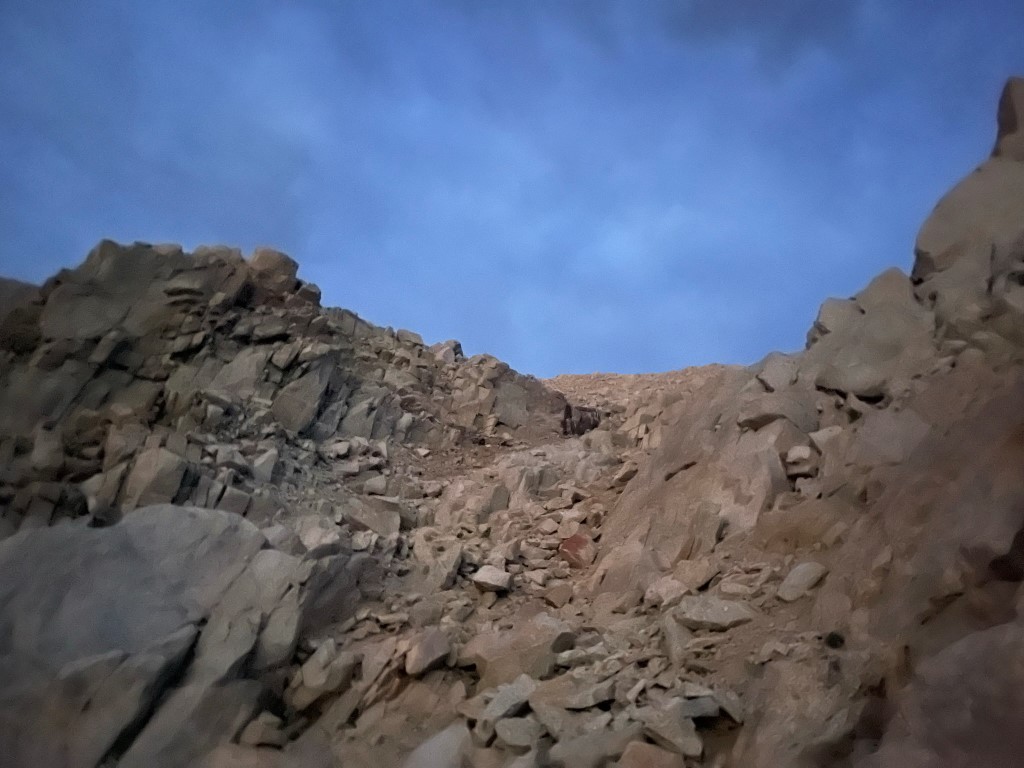
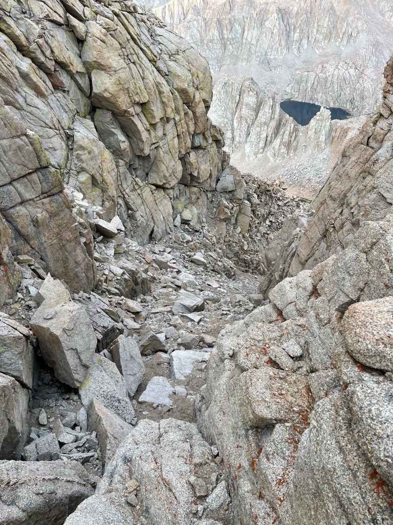
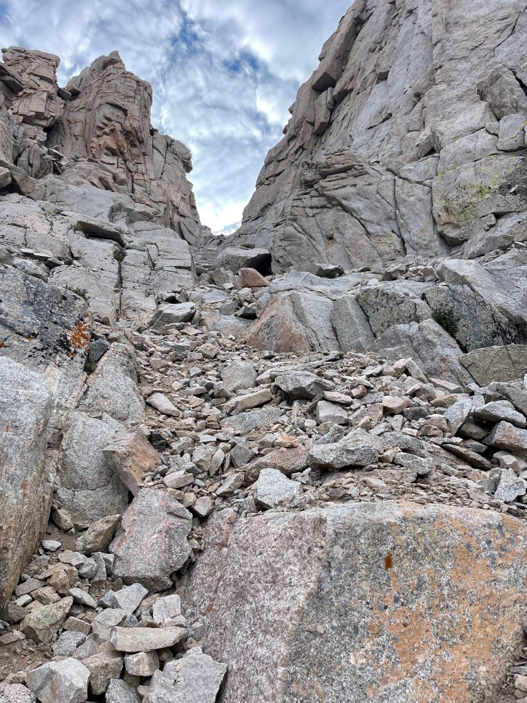
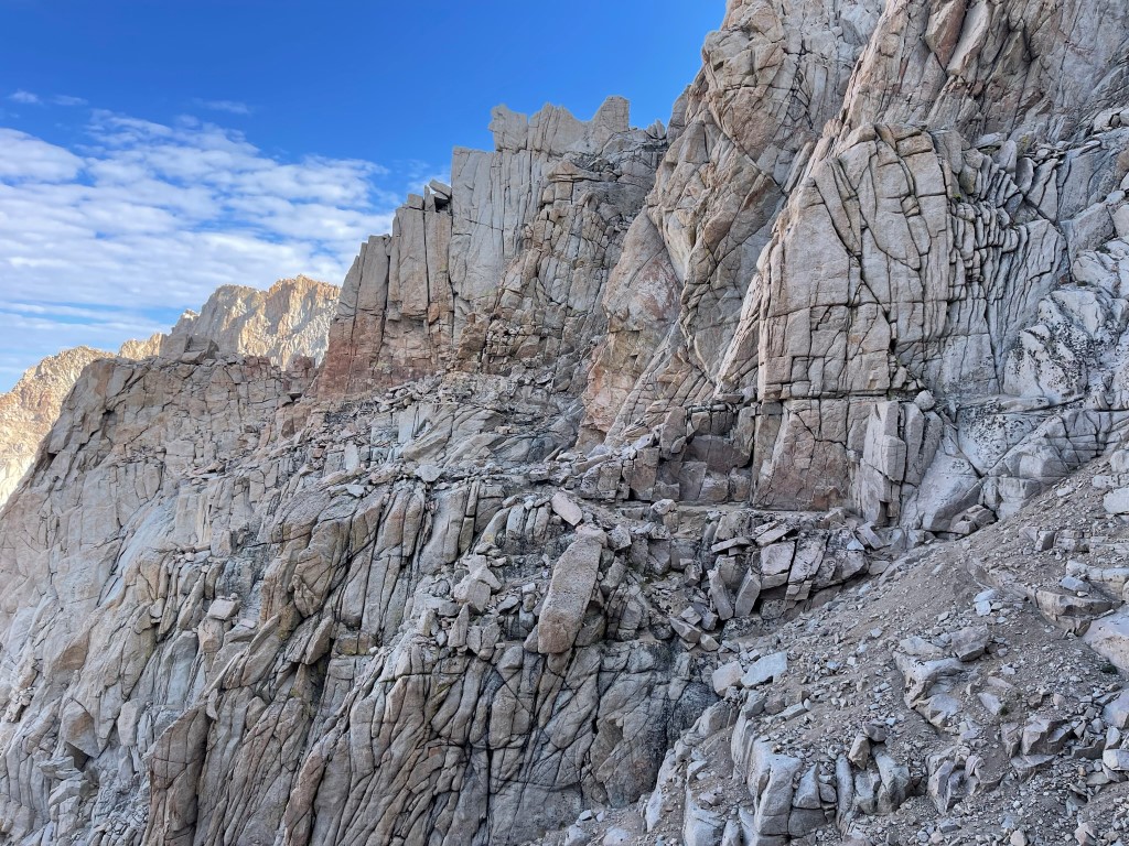
We hiked south from the lake and then began scrambling up the steep scree slopes to the southwest. There was no moon, so we had some difficulty navigating in complete darkness. We eventually found a chute that led us through the steep headwall.
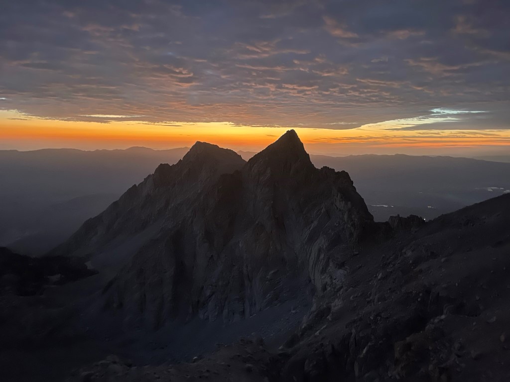
The eastern sky began to light up behind us.
It was beginning to enter my mind that I might also have time for Mallory and Irvine if the weather held off long enough, so I went ahead of the rest of the group. Once I was above the headwall, I continued up the scree slope towards LeConte.
I reached the base of LeConte.
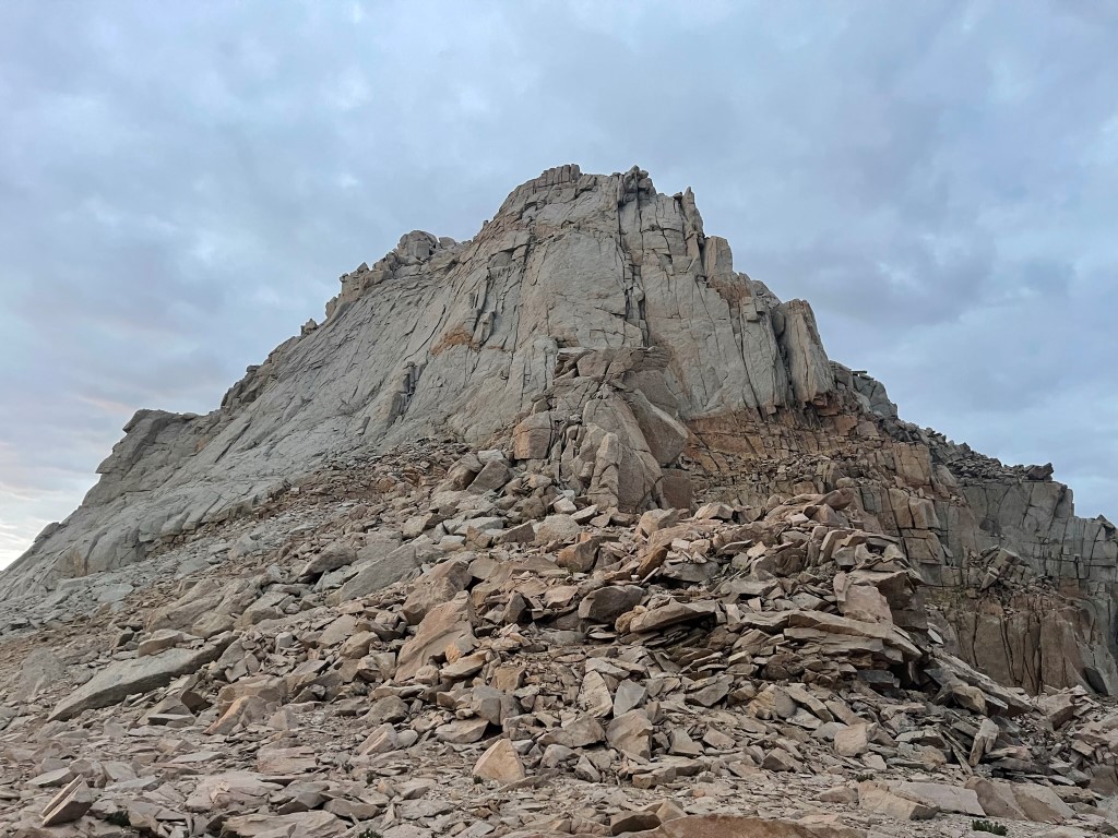
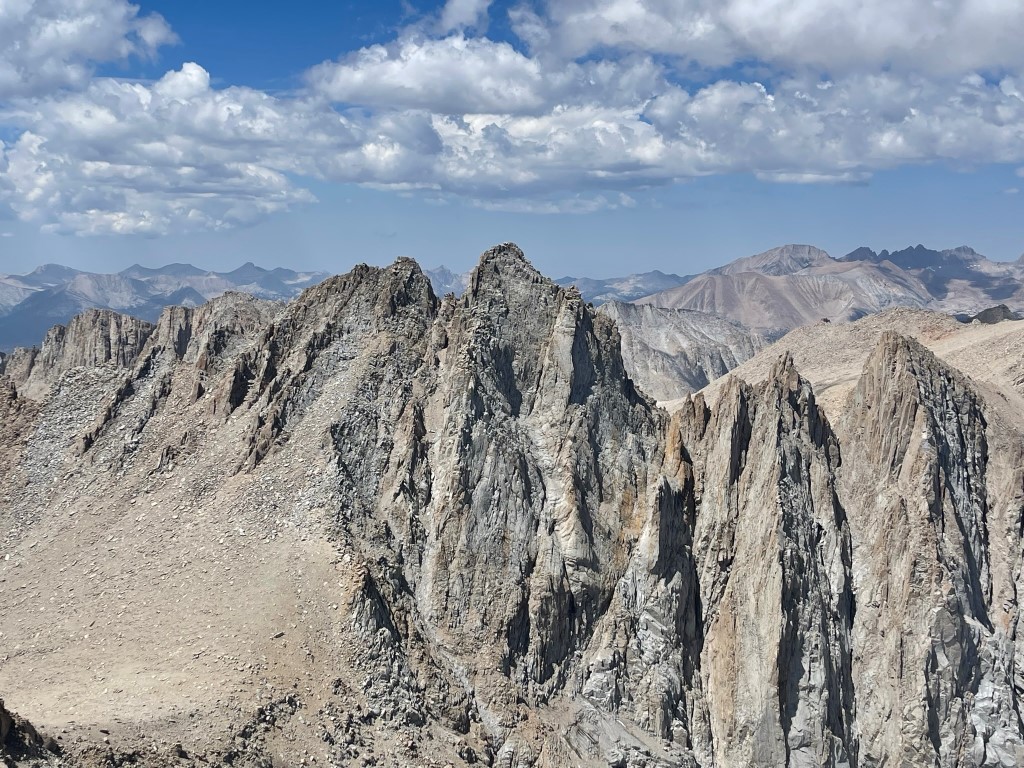
LeConte looked very formidable from this side. Thankfully, there is a chute that goes to the summit from the west. I descended about a hundred feet to the west and then turned left into the chute.

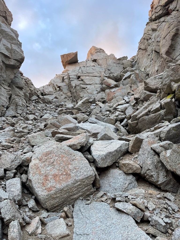
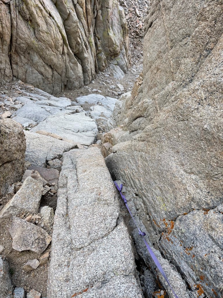
I entered the chute at 13525 feet. At 13700 feet I reached the infamous “waterfall pitch”, a short class 4 section which is the crux of the climb.

There was an existing sling tied to an anchor at the top of the pitch, which I used to haul myself up. I probably could have climbed it without the sling, but I certainly would have been uncomfortable downclimbing it. There was some additional class 3 above the waterfall pitch near the summit.
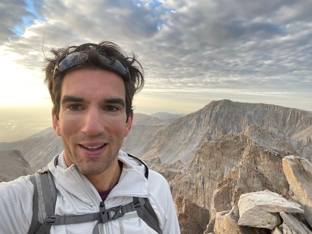
I reached the summit at 6:19am at 1.9 miles!
I signed the register which had been placed only 6 weeks prior on June 16. The most recent entry was from July 25. I had a good view of Meysan Lake down below.

Mount Inyo, Keynot Peak, and New York Butte to the east:
I took a short break and then started heading back down the chute.
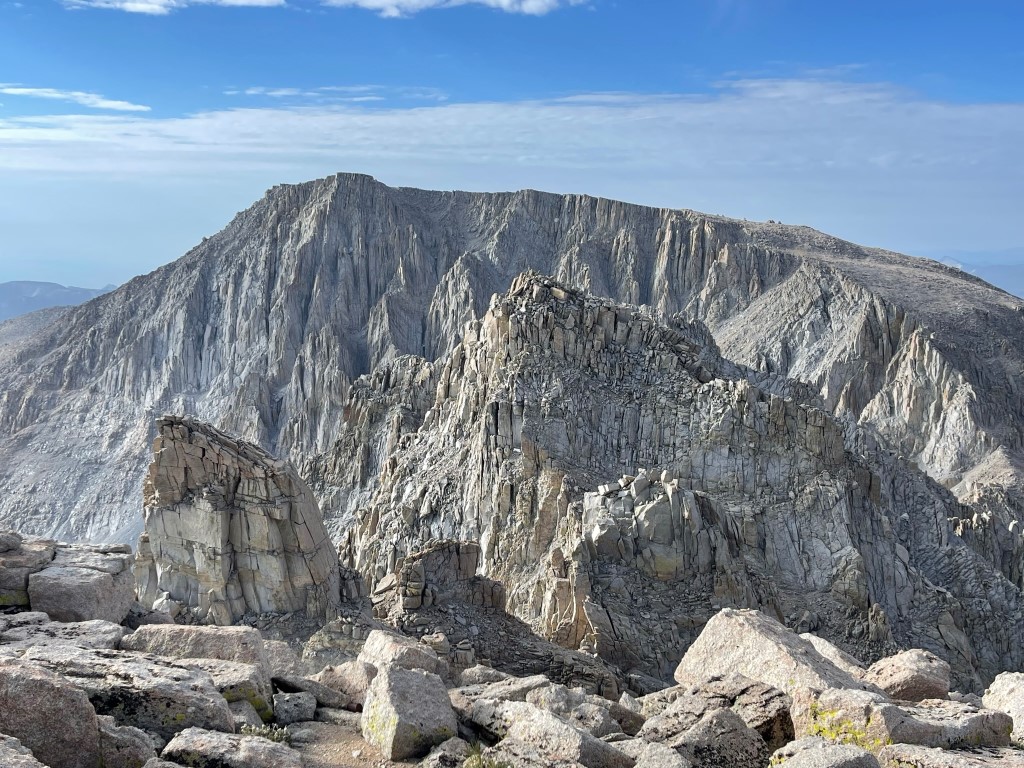
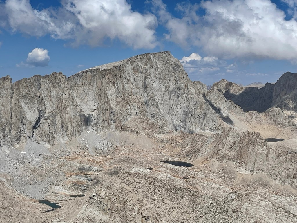
Just above the waterfall pitch, I located a cairn which marked the spot to exit the chute and begin the traverse to Corcoran. Corcoran is located just a quarter mile south of LeConte, but the extremely rough terrain in this area meant that the traverse would take well over an hour.
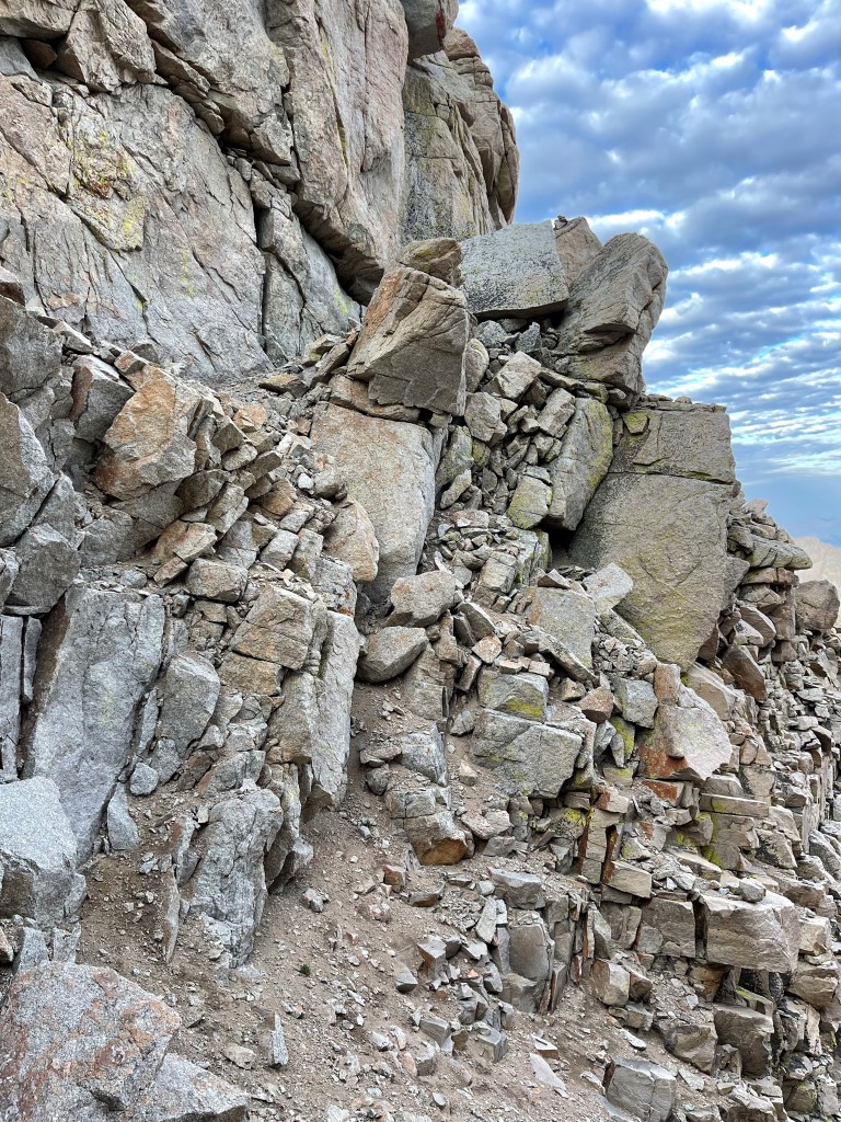
As I was climbing out of the chute, I saw Marcus and Bill below the waterfall pitch. We chatted briefly and then I continued. The traverse would involve navigating across 4-5 separate chutes, each separated by sharp ridges. I descended a few hundred feet down the first chute.
I made my way from chute to chute, using small notches to get through the ridges that separated them. Thankfully, there were many cairns to help guide the way. GPS was also very useful here.
I spotted a pair of rock windows.
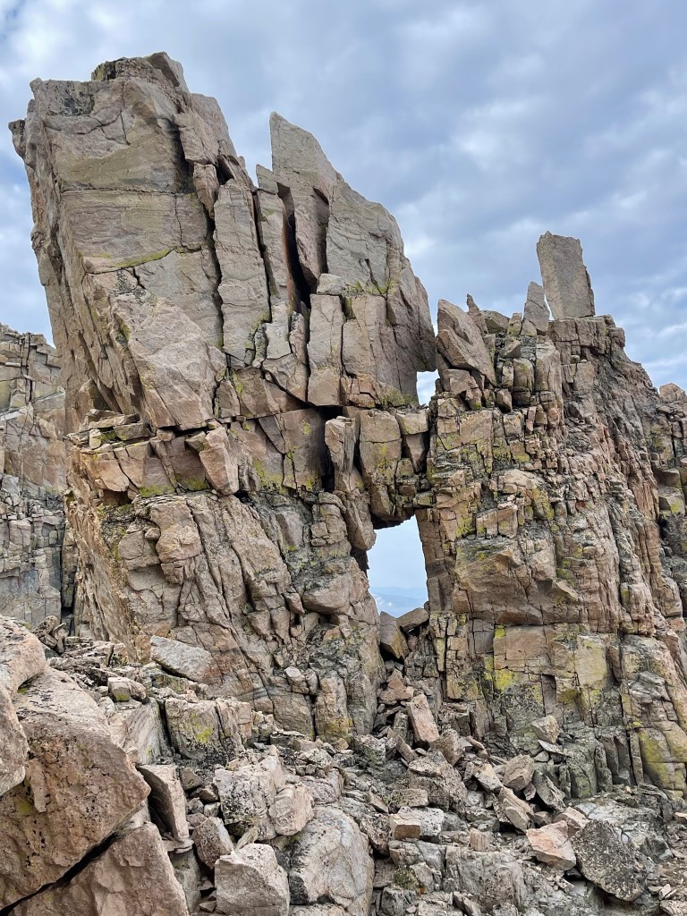
Near the rock window was the crux of the traverse. A steep slab blocked progress, but I was able to climb up the left side of it using a flaky rock that was much more solid than it looked. Above that, I started climbing up a chute and then traversed into the next chute over. I climbed a few hundred feet up this last chute.
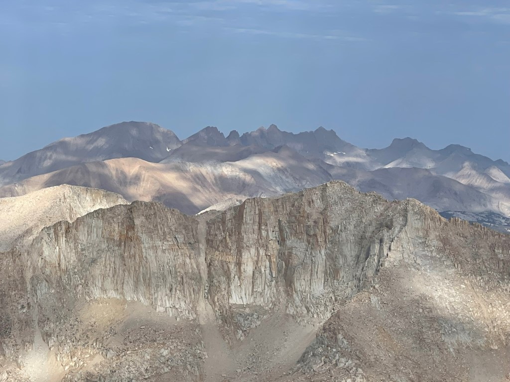
I reached the summit at 7:52am at 3 miles! I signed the register which had been placed in 2000. The most recent entry was from July 22. I had a great view of Mount LeConte to the north:
Mount Langley to the south:
The Kaweahs to the west:
After another short break I began heading back towards LeConte. The traverse was a little easier on the way back.
I ran into Marcus and Bill again at the crux portion. I climbed down and showed them where I had ascended this part. Eventually, I made it back to the chute on LeConte. I once again used the sling to descend the waterfall pitch. We had rope and harnesses with us in case we needed to rappel this section, but it was much more convenient to use the existing sling.
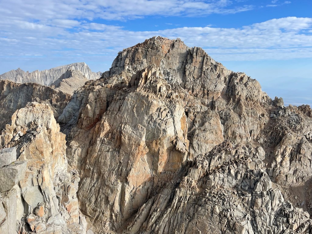
I ran into Thomas just below the waterfall pitch. He had successfully climbed LeConte but decided to skip Corcoran. We descended the remainder of the chute together and climbed back up to the plateau between LeConte and Mallory. It was only 9:30am and the weather still looked fine, so I decided to continue to Mallory. Thomas was exhausted so he decided to head back down to camp. Mallory is located less than a mile from LeConte and would only require an extra few hundred feet of elevation gain.
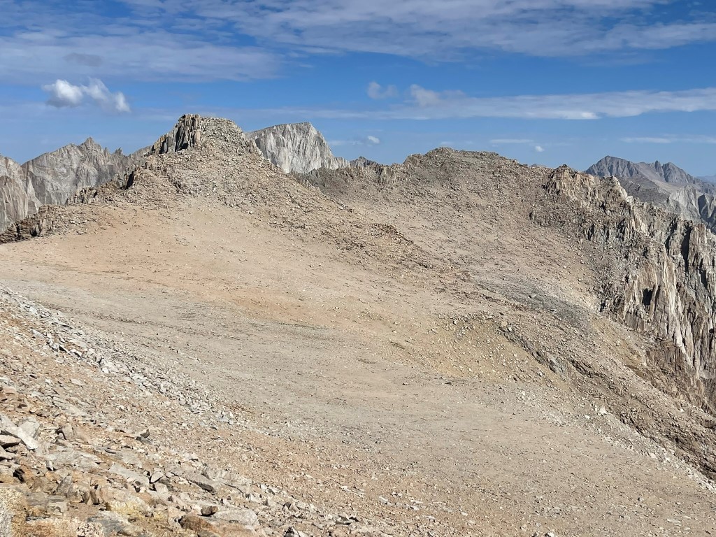
I hiked across the relatively flat plateau. I reached a low point at 13400 and then began climbing to Mallory.
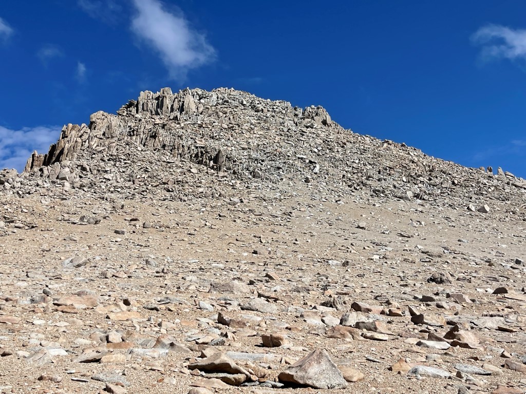
Mallory was a straightforward class 2 scramble. I reached the summit at 10:15am at 4.9 miles! I signed the register which had been placed in 1991. The most recent entry was from July 25. Looking back at LeConte and Langley to the south:

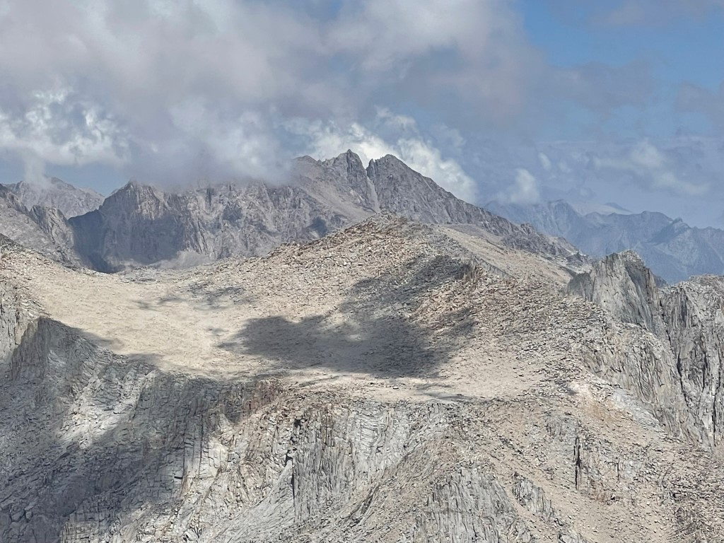
Mount Irvine to the north:
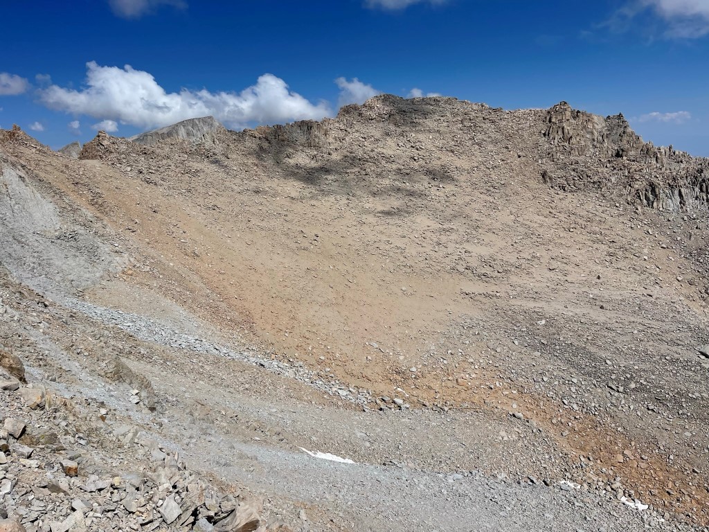
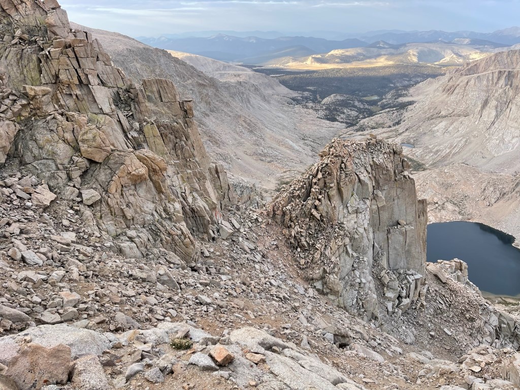
The weather still looked okay, so I decided to continue to Mount Irvine. Some people traverse the ridge directly, but that looked far too spicy for me. Instead, I chose to descend into the bowl between the peaks and climb Irvine from there. I hiked east from Mallory’s summit a short way before descending north into the bowl. The descent was quite steep and full of loose rock.
I reached a low point around 13100 feet in the center of the bowl. I then climbed up the other side of the bowl, which was much easier than the descent from Mallory had been.

I reached the summit of Mount Irvine at 11:40am at 5.8 miles!

I signed the register which had been placed in 2007. The most recent entry was from July 25. There was also an older book from 1992. Mount McAdie to the west:
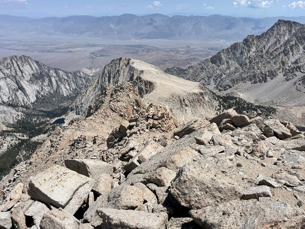
Mount Whitney to the northwest:
And Mount Williamson to the north:
I began descending a few minutes before noon. I was very thankful that the weather had held off all morning. I made my way down the northeast ridge of Irvine.
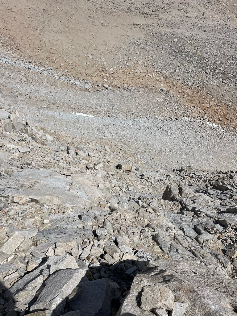
The initial descent was slow and very tedious due to large boulders and some complicated route finding. Below 13000 feet it was much more straightforward. Eventually I got off the ridge and turned southeast towards Meysan Lake.
As I neared the lake, I could see our tents on the eastern shore.
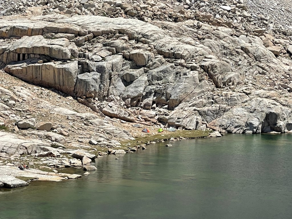
I reached camp at 1:38pm. We spent the afternoon hanging out, resting, and even doing a little swimming. Thomas decided to pack up and head back down, so we said our goodbyes to him. Around 5pm the storms moved in and continued off and on throughout the rest of the day. It did stop long enough for us to have dinner around 6, but otherwise we spent the rest of the evening in our tents. Stats for day 2 were 7.7 miles, 4482 feet elevation gain, and 9:38:16 total time.

Day 3
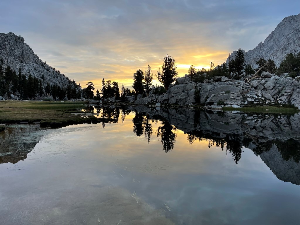
For day 3 we were initially considering an attempt on Mount McAdie. However, we decided to just head back down to the cars because of the poor weather forecast. The route to McAdie would have been long and relatively unknown, so we decided to not risk getting caught up high in a storm. We woke up around 5am and hit the trail at 5:55am.

We took a small shortcut by descending directly down the Meysan Creek drainage and reconnecting with the trail near Camp Lake.
From there, we retraced our steps from Friday back to the cars.
We reached the trailhead at 8:09am. Stats for day 3 were 5.39 miles, 30 feet elevation gain, and 2:12:01 total time.