Day 1
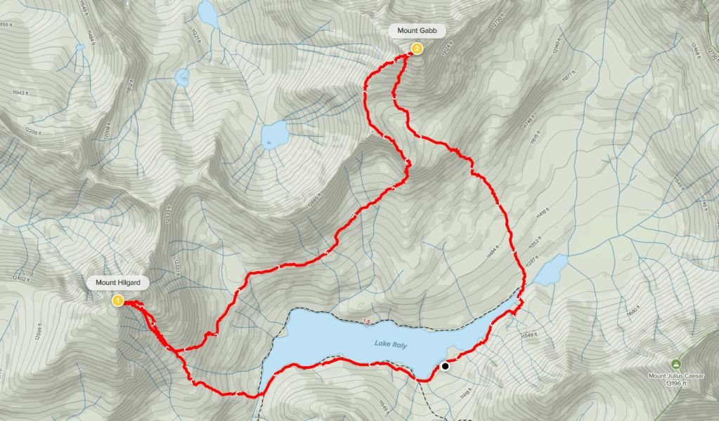
Mount Julius Caesar (13200 ft), Mount Hilgard (13361 ft), and Mount Gabb (13741 ft) are 3 Sierra peaks located near the Mono Divide just west of Bishop. My buddies Marcus and Mike would be joining me for a 3 day hike to climb the peaks with both nights spent at Lake Italy. I left San Diego early Saturday morning and drove 5 hours 40 minutes to the Pine Creek Pass Trailhead. The 3 of us began hiking at 9:57am from 7376 feet above sea level.

Our plan for day 1 was to hike 10 miles/5000 feet to Italy Pass, climb Mount Julius Caesar, and then descend the other side of the pass to Lake Italy. We soon emerged from the forest into the open. We went past an old tungsten mine.

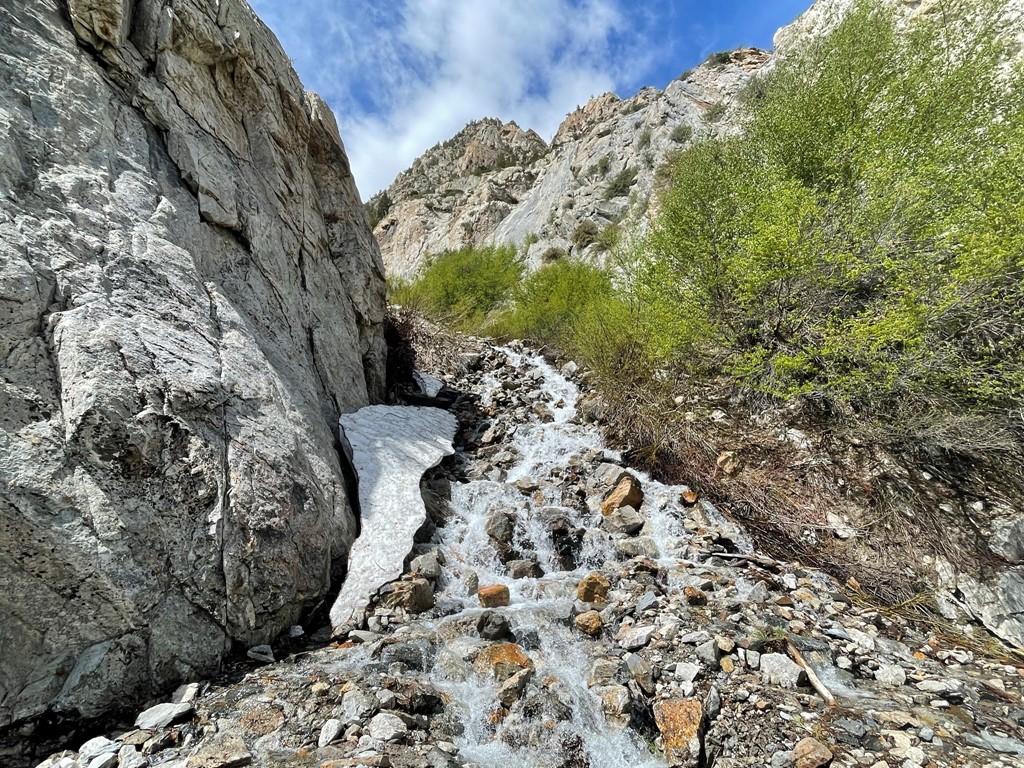
The trail began to switchback up the side of Pine Creek Canyon. We crossed a few small streams.
We noted a few mine shafts in the rock wall.

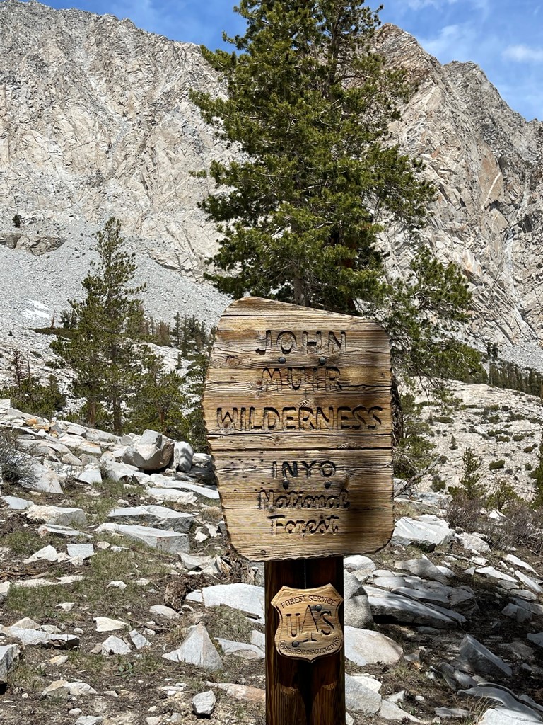
At 3.4 miles we passed the wilderness sign.
The trail then reached Pine Creek. We crossed to the north side of it and then hiked parallel to it heading west.
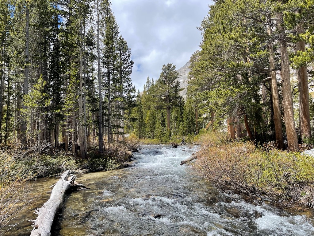
At 4.2 miles we reached Pine Lake which sits around 10000 feet.

The next 2 miles were relatively flat. We crossed a few more streams above Pine Lake.
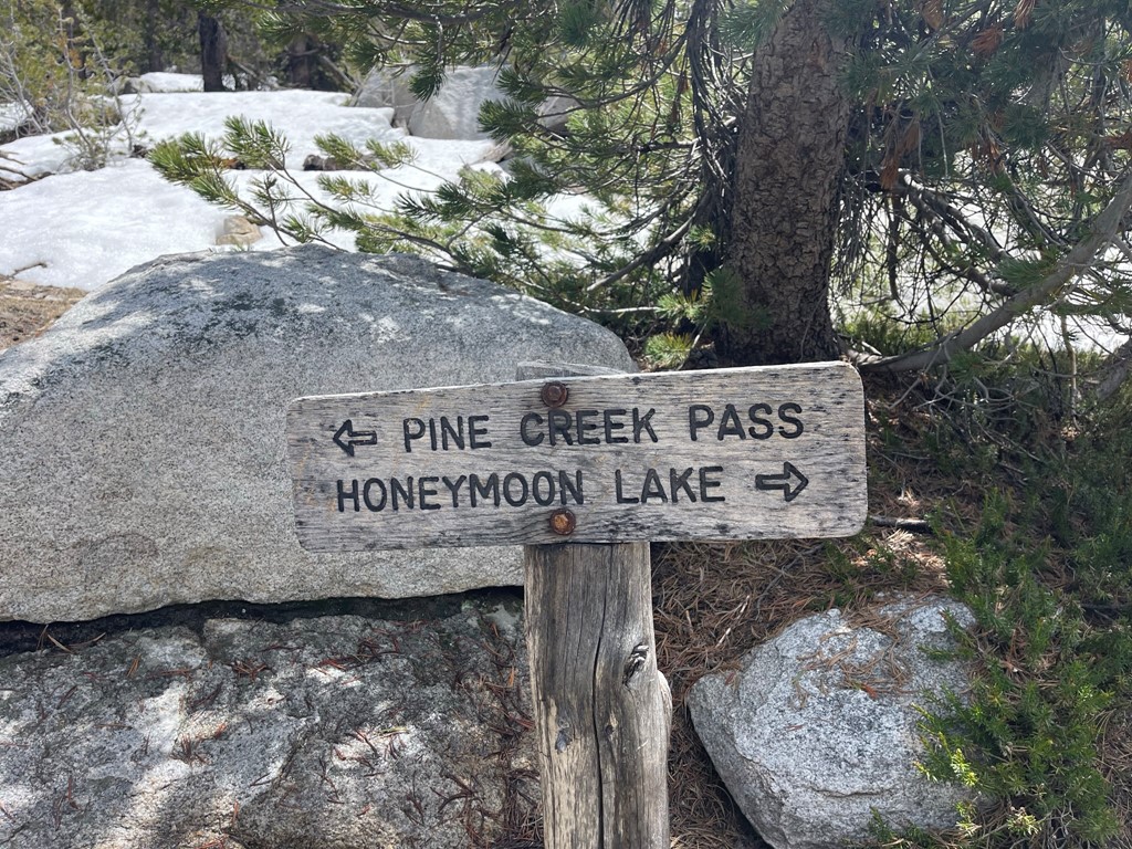
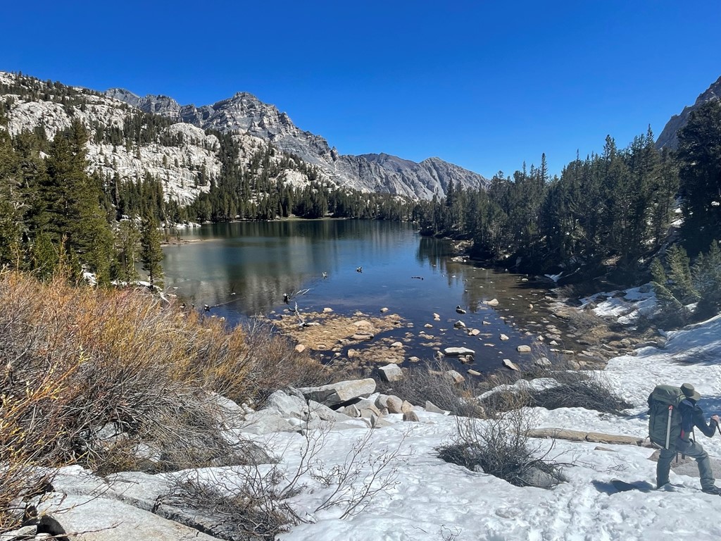
We passed Upper Pine Lake and then reached a trail junction at 6.1 miles. We went right towards Honeymoon Lake.
We reached Honeymoon Lake a short while later at 6.3 miles.

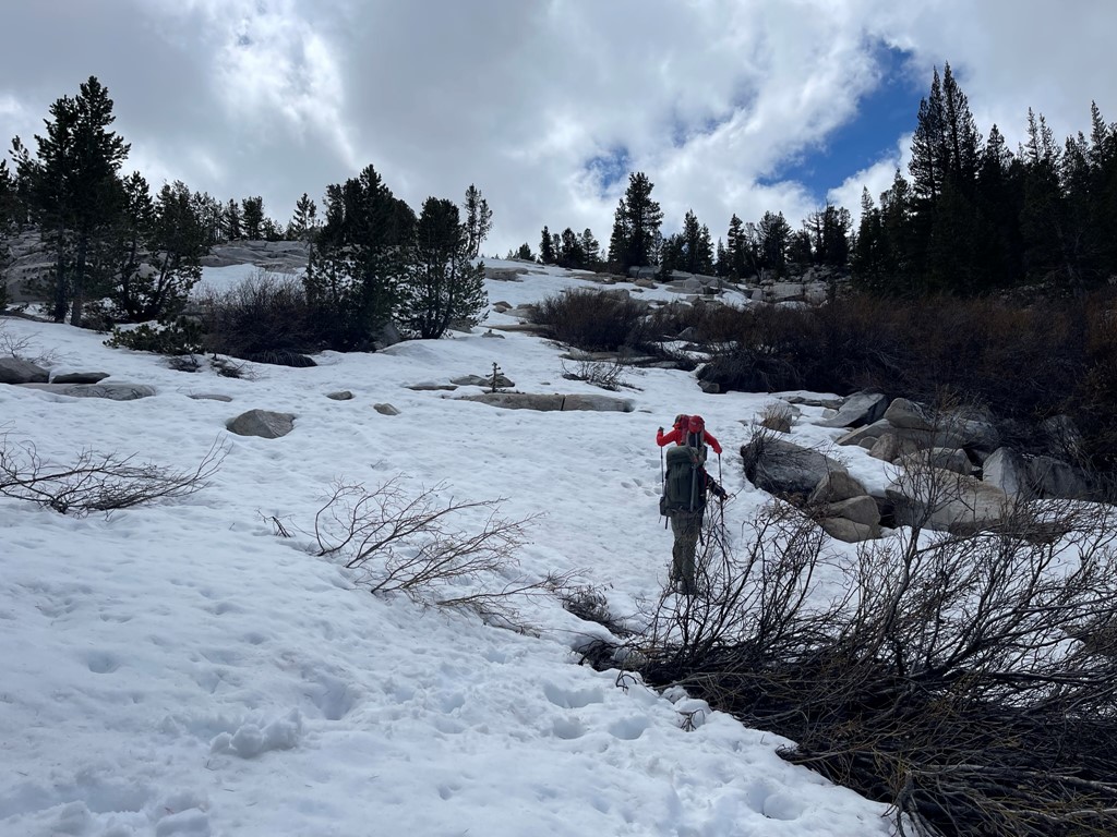
We took a break and had lunch. We then had to cross a large snowfield above the lake. The snow was already kind of soft from baking in the hot sun all morning. At one point we cut through some brush to avoid as much of the snow as possible.
Honeymoon Lake was beautiful from above.

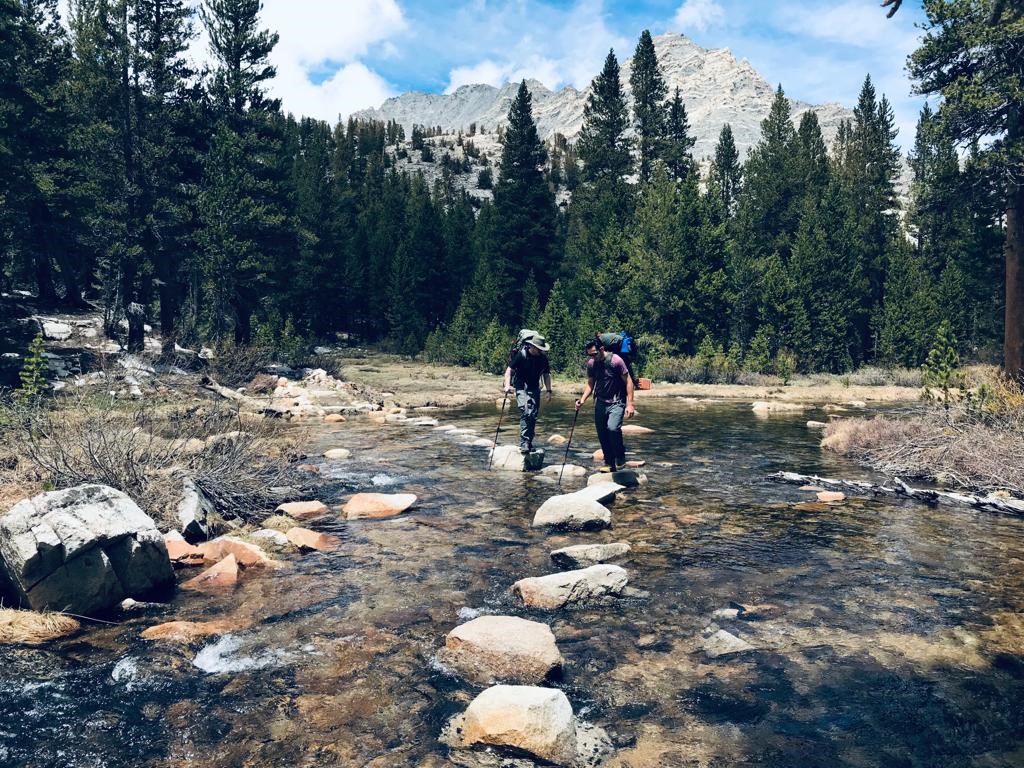
There were numerous stream crossings above Honeymoon Lake.

There were also countless unnamed lakes, most of which were partially frozen still.
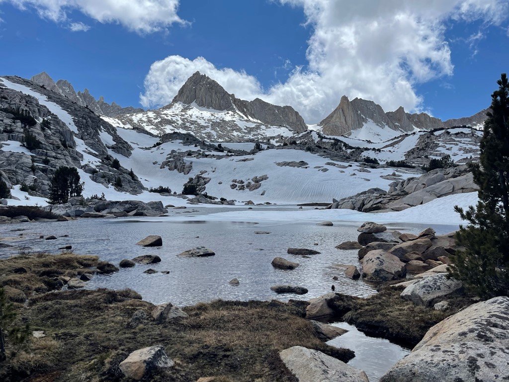
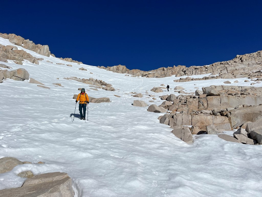
We split up temporarily at this point. The plan was for Marcus and me to hike to Italy Pass, climb Mount Julius Caesar, and then return to the pass to meet Mike. There wasn’t much of a trail beyond this point, so Marcus and I stayed on the right side of the water and continued making our way up towards the pass.
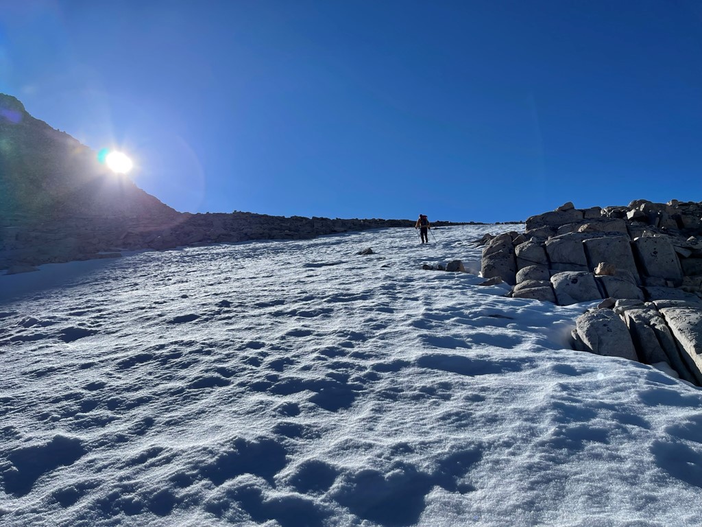
We hiked northwest through a large rocky area known as Granite Park. We tried to avoid the soft snow as much as we could, but we were frequently post-holing to our knees. Italy Pass (left center) and Mount Julius Caesar (center) were dead ahead.

We climbed up some rocks as we neared the pass.

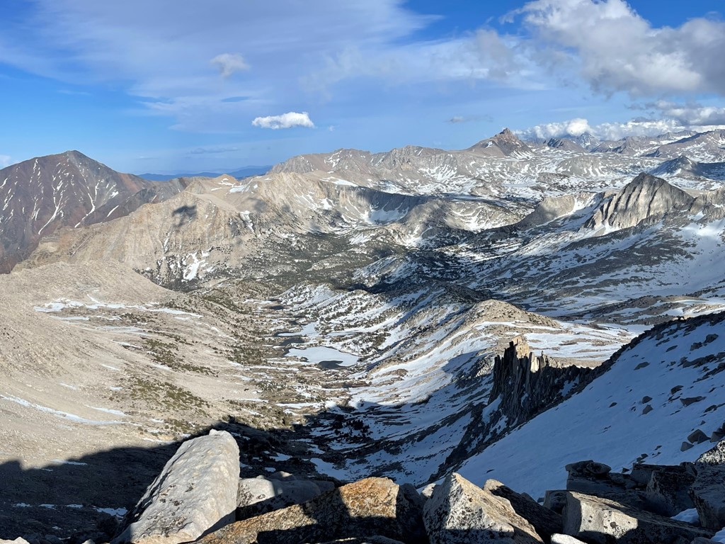
We reached 12400 foot Italy Pass at the 10 mile mark. We dropped our heavy packs and turned north to climb Mount Julius Caesar.
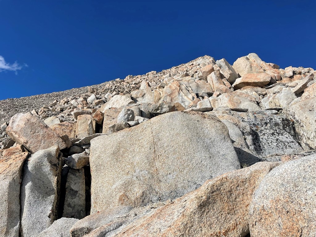
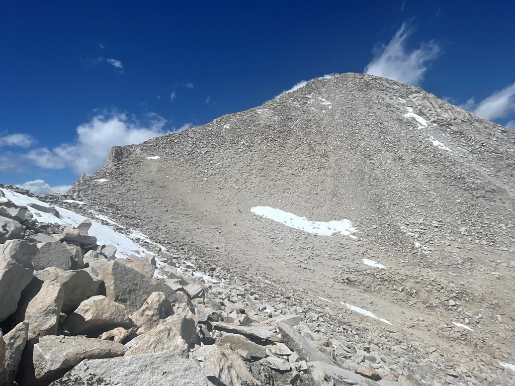
Julius Caesar is a relatively straightforward 800 foot talus scramble from the pass. We made good time up the south ridge.
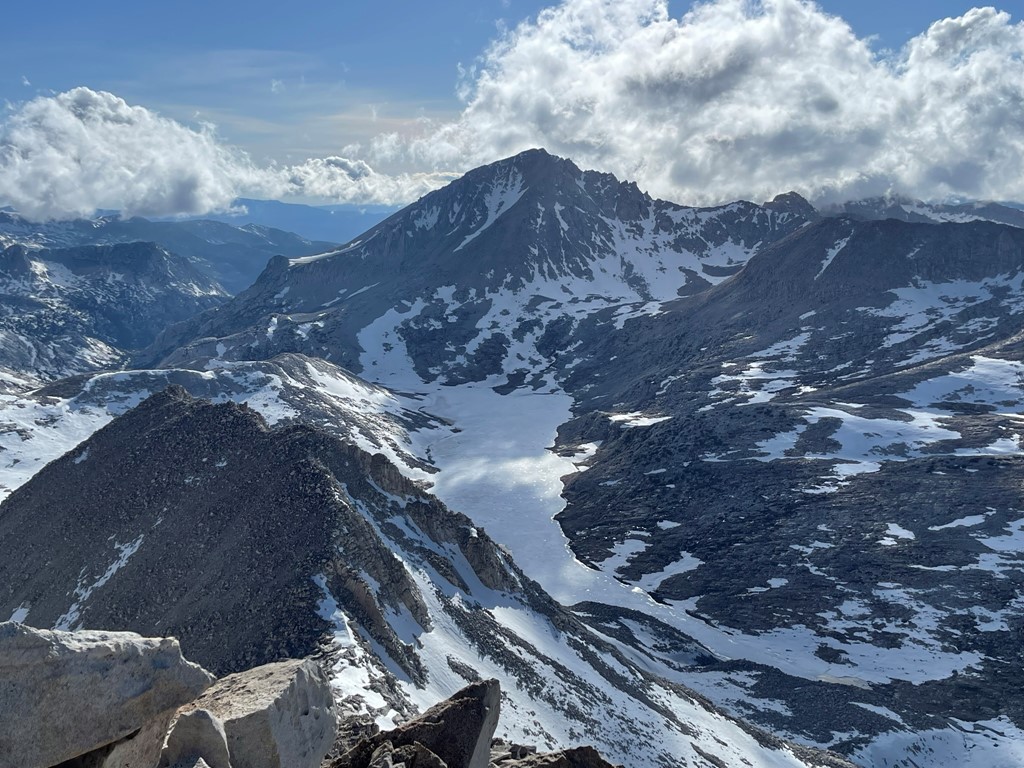
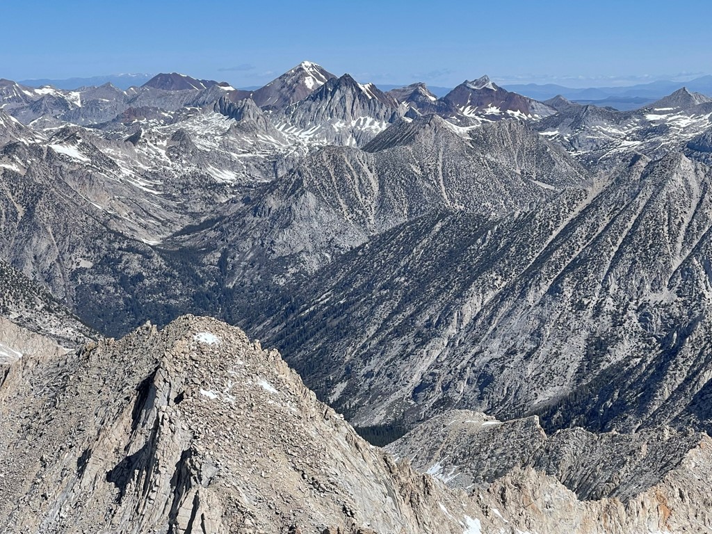
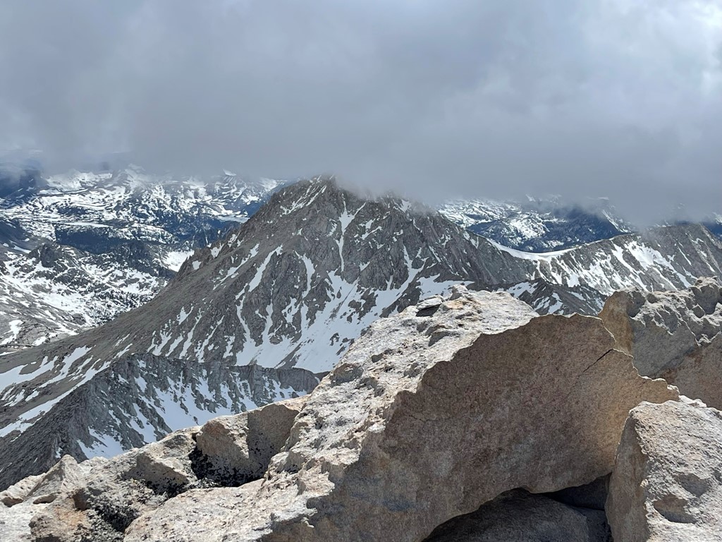
We reached the summit at 6pm at 10.4 miles! It was quite windy on top, but the air temperature was warm enough that it didn’t feel too bad. It had taken us about 40 minutes from the pass. We did not locate a register. Bear Creek Spire loomed impressively to the northeast.

Mount Gabb to the northwest:

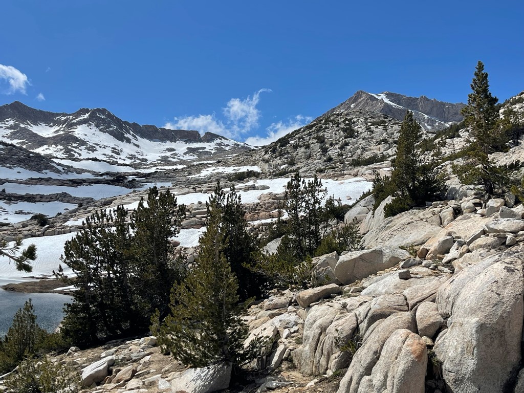
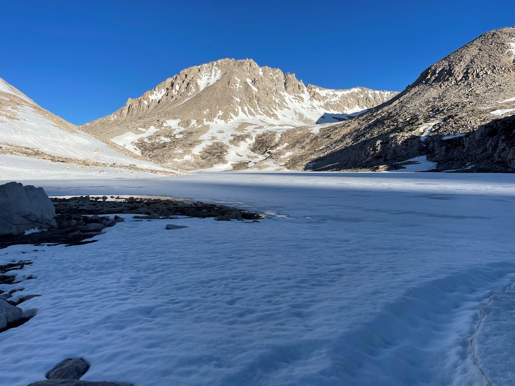
Mount Hilgard above frozen Lake Italy to the west. We would camp on the south (left) side of the lake.
Mount Tom, Basin Mountain, and Mount Humphreys to the east:
We descended the ridge back to the pass after a short break.
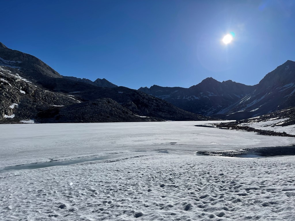
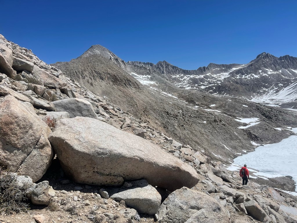
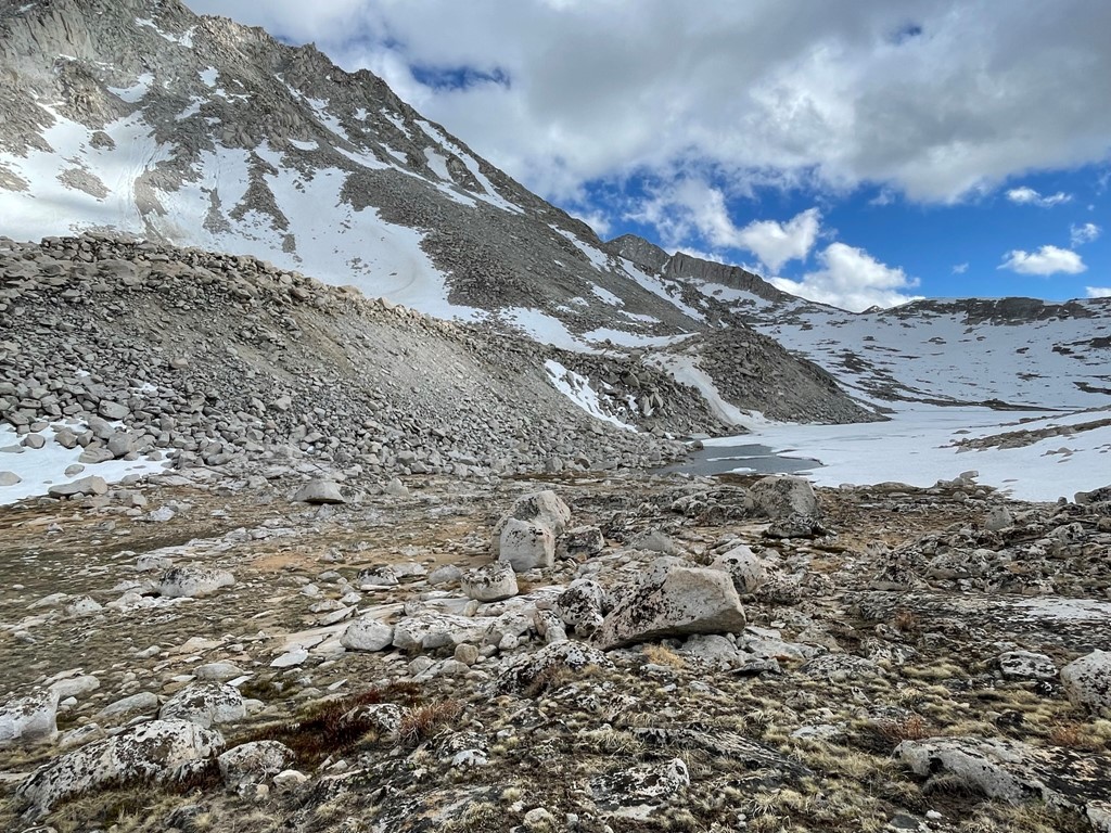
We reached the pass at 10.8 miles where Mike was waiting for us. We then descended the west side of the pass. We found this to be very tedious as we had to cross many sections of soft deep snow. We passed Jumble Lake on our way down. Getting around this lake was no easy feat either, as we had to hop across massive boulders to get around the right side of it.

We finally reached Lake Italy at 8:05pm. It was quite late, so we quickly set up camp, ate dinner, and went to sleep. Stats for day 1 were 12.36 miles, 5958 feet elevation gain, and 10:08:26 total time.


Day 2
Our plan for day 2 was to climb the southeast chute of Mount Hilgard, traverse to Mount Gabb and climb its southwest ridge, and then descend back to camp. We started at 6:57am from 11181 feet above sea level. Mount Hilgard looked impressive above Lake Italy.
We hiked west along the southern edge of the lake.
We crossed a stream at the edge of the lake.

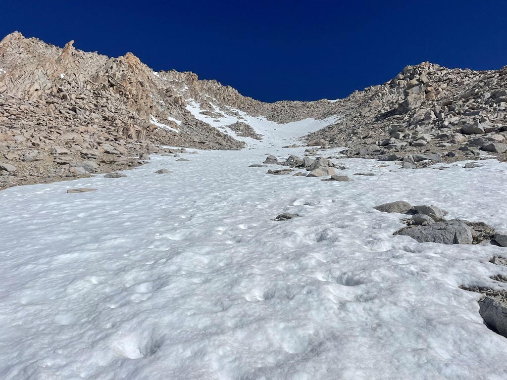
We entered the southeast chute and climbed up relatively stable talus at the beginning. We put on crampons at 12200 feet when we encountered steep snow.
I led the way up the steep snow. The snow was in perfect condition.

We zig-zagged our way up most of the chute.
I switched to front-pointing when it got steep towards the top of the snow.
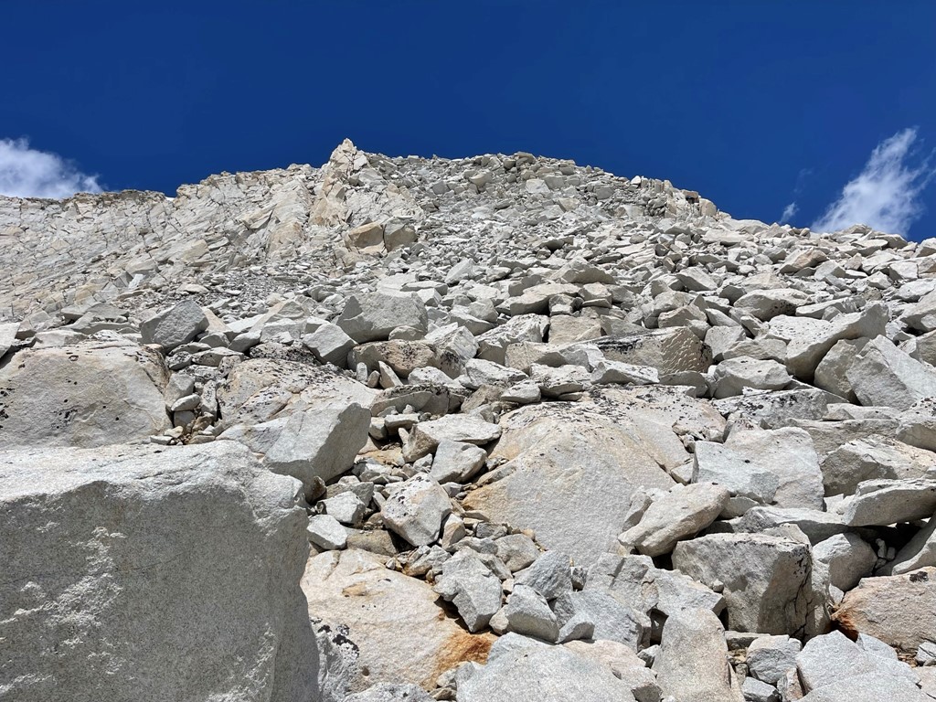
The snow dried up at 12900 feet, so we had to scramble up loose rocks for the final 400 feet. It was initially extremely loose, but the stability improved near the top.

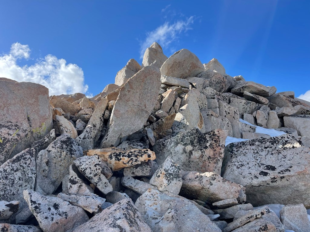
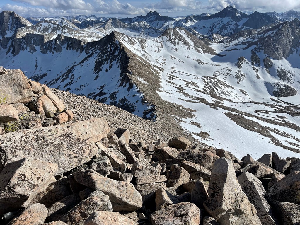
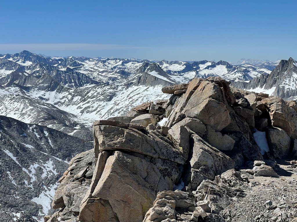
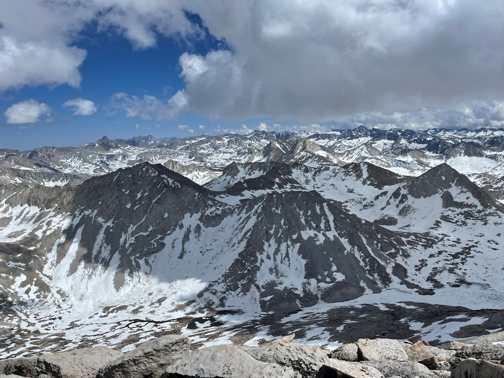
We made one class 3 move near the top to avoid a snowfield. There were 2 rock piles competing for the summit – a north one and a south one. We climbed the south one first but found the north one to clearly be higher. We reached the summit at 10am at 2.1 miles!

We signed the register and also located 3 benchmarks.


Bloody Mountain, Red Slate Mountain, and Mount Baldwin to the north:
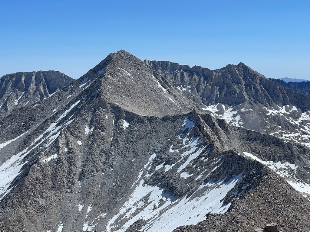
Mount Gabb to the northeast:
Mount Goddard to the south:
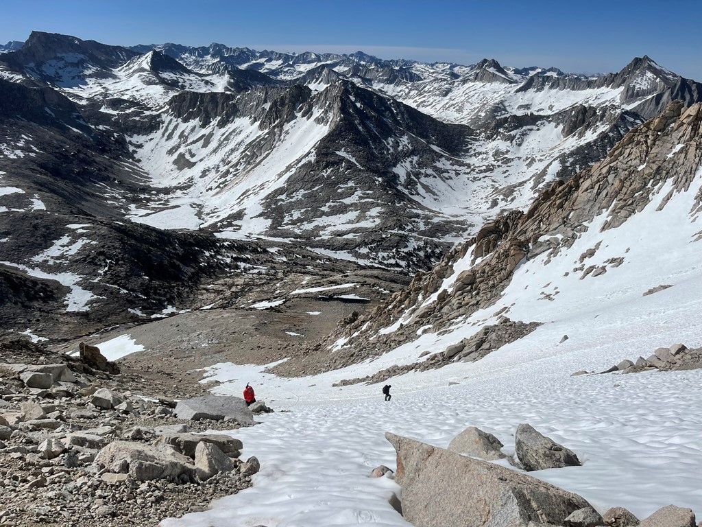
We began descending after a short break. We stuck more to the ridge in order to avoid the snow on the way down.
At 12200 feet we began cutting to the east to begin the traverse to Gabb.
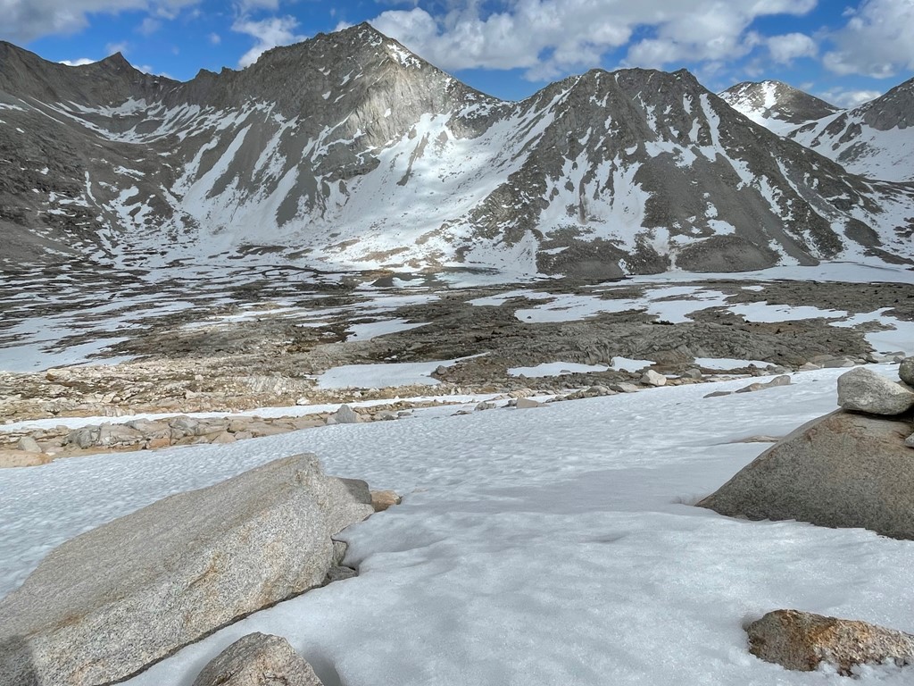
We descended to about 11800 feet and then stayed on contour as we hiked northeast. We crossed a few snowfields which slowed us down considerably. We didn’t need crampons, but it was steep enough that we felt safer with our axes out.

Mike’s knee wasn’t feeling great, so he decided to return to camp. Marcus and I continued northeast, aiming for a small scree chute that would take us to a plateau beneath Mount Gabb.

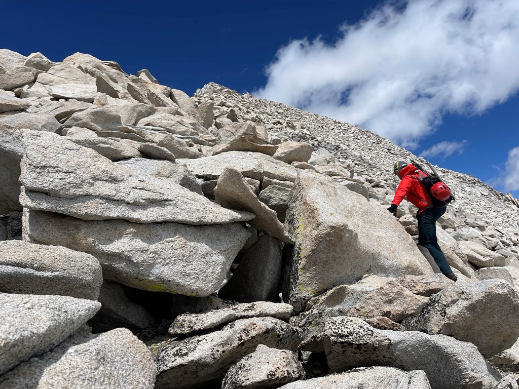
We climbed up the chute, encountering some large rocks near the top. We made a few class 3 moves in this section.
We soon reached the plateau. Gabb was now right in front of us.
We got on the ridge and followed it north and then east. The ridge was just class 2 talus, but it was tedious and seemed to go on forever.
We reached the summit at 3:15pm at 5.2 miles!

We signed the register which had been placed in 2014. The most recent entry was from September 30, so it appeared we were the first to summit this year. It was beginning to cloud up, but the views were still quite good. The top of Hilgard was hidden to the southwest:
Mount Humphreys and the Palisades to the southeast:
Mount Tom to the east:

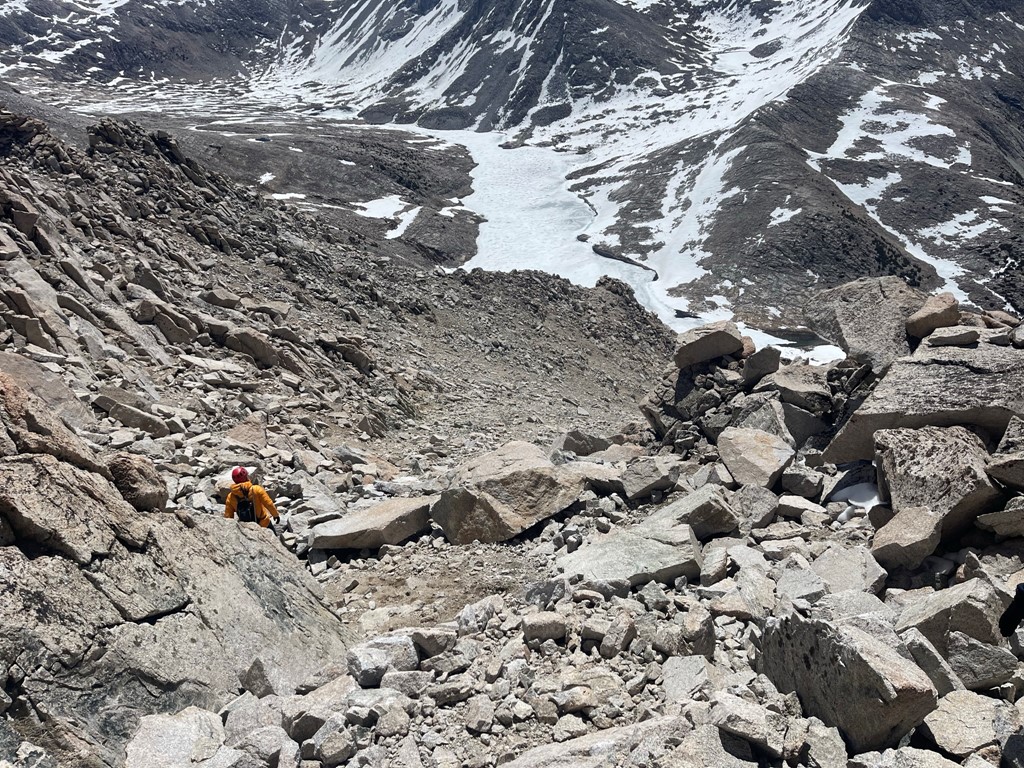
We began descending after a short break. We decided to descend directly down the south face towards Lake Italy. The wind really started to pick up at this point. The day had been fairly pleasant, but the wind now made it bitterly cold.
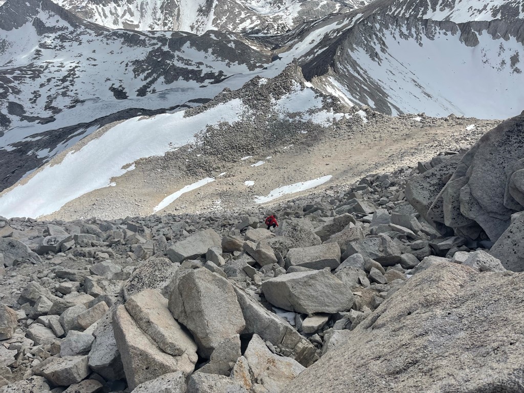
The terrain alternated between loose talus and snow. The snow was mostly firm, so it was preferable to the talus.
We eventually reached the northeast corner of the lake. We crossed a small land bridge between Lake Italy and Toe Lake.
We then had to navigate the southeastern shore of the lake back to camp. This was possibly the crux of the day since the shore alternated between steep talus slopes and snow chutes. It took us nearly an hour to make it the last half mile to camp.

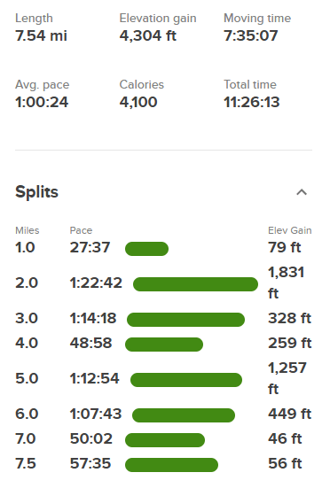
We finally made it back to camp at 6:23pm. We had dinner and then got into our sleeping bags early since the wind was so cold. We guessed it got down to around 20 degrees that night. Stats for day 2 were 7.54 miles, 4304 feet elevation gain, and 11:26:13 total time.
Day 3
For day 3 our plan was to simply go up and over Italy Pass and descend back to the trailhead. It was still breezy, so it was a very cold morning. We started hiking at 6:32am from 11181 feet above sea level.

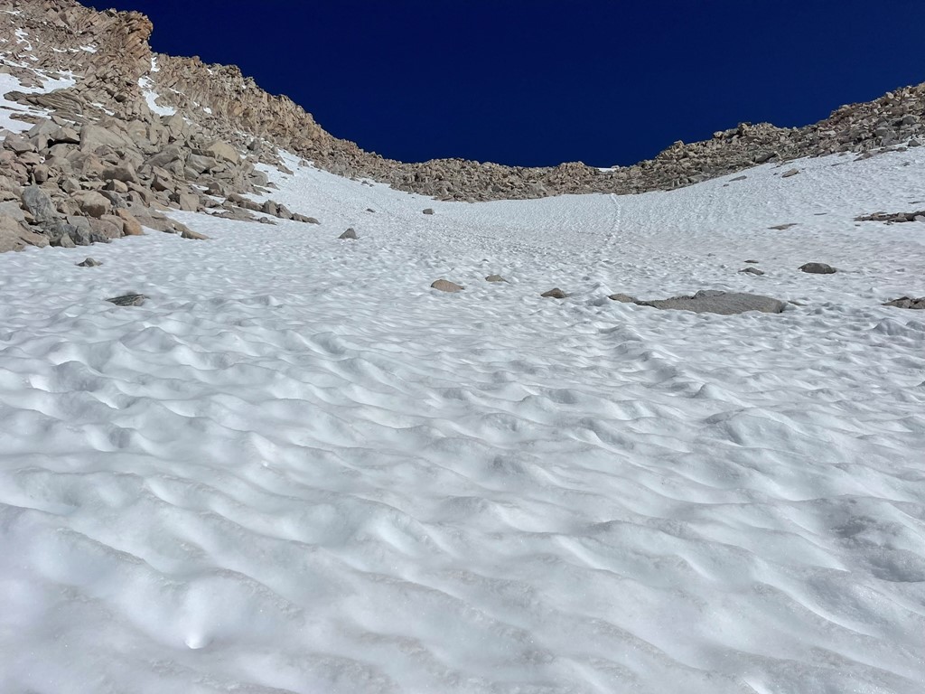
We slowly but surely made our way back up to Italy Pass.
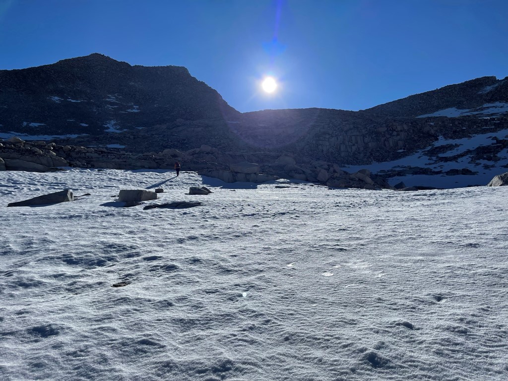
The snow was firm in the early morning, so it was much easier than the soft snow conditions we encountered on the way down Saturday evening.
We reached Italy Pass at 1.3 miles. It had taken us 1 hour 20 minutes from camp. Mount Humphreys once again was visible in front of us.

We tried to stay on the snow as possible as we descended the east side of the pass.
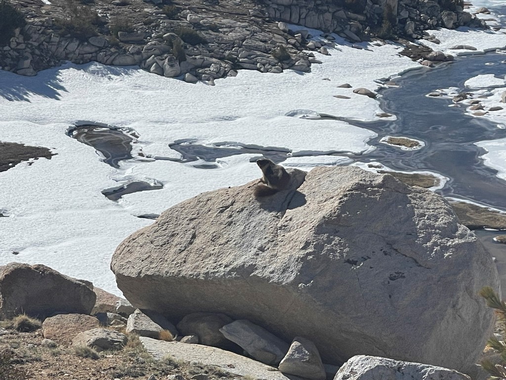
We spotted a marmot doing his best Lion King impression.
We generally followed our ascent route as much as we could.
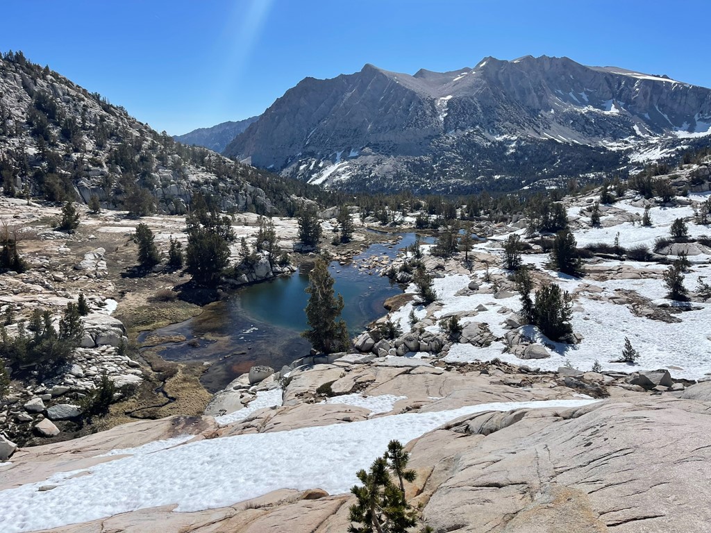
We stopped and had a nice lunch break when we reached Honeymoon Lake again. We chatted with some backpackers who had climbed Royce Peak the day before. From there, it was 6 relatively easy downhill miles back to the cars.
We passed many people on the way down – backpackers, day hikers, fishermen, etc. We reached the trailhead at 1:15pm. Stats for day 3 were 10.83 miles, 1339 feet elevation gain, and 6:42:22 total time.