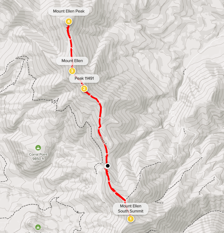
Mount Ellen
I woke up on Friday at 5:30am to chilly 38 degree weather. I got ready and then drove the remaining 6 miles to Bull Creek Pass at 10,500 feet. The road was in pretty good shape, but I was happy to have high clearance, especially for the 2 little streams I had to cross. I stopped and got out of the car on both occasions to make sure the water was shallow enough to drive through. Combined with last night, it had been 26 miles of dirt road driving since Hanksville. I was a little nervous about the drive in, but someone had posted a trip report only a week before saying that the road had recently been graded and was in excellent shape. This turned out to be true. The first half of the drive was very smooth, and I was able to drive 25-30 mph. After that it became a lot rougher, but it was still no problem for my Subaru Forester. There apparently is also a longer western approach to Bull Creek Pass. Some reports had indicated that route was the easier of the two, but I think it really varies based on which has been graded more recently. I definitely made the right choice.
At 11,522 feet, Mount Ellen is a very high peak in south-central Utah. It is the high point of the Henry Mountains, which is one of the most remote mountain ranges in the United States. In fact, these mountains were the last to be surveyed in the entire contiguous United States (every report I read on Mount Ellen mentions this fact, so I feel obligated to say it here). Despite how remote it is, Mount Ellen has some notoriety as 1 of the 57 mountains in the contiguous U.S. with at least 5000 feet of prominence (usually referred to as an ultra-prominent peak). With 5842 feet of prominence, it is actually the 29th most prominent peak in the Lower 48 as well as the 3rd most prominent in Utah (behind Mount Peale and Kings Peak). Anyway, I hadn’t known much Mount Ellen prior to planning this road trip, but it didn’t escape my notice that there was an ultra-prominent peak so close to Capitol Reef National Park. My plan was to climb it as well as few of its subpeaks for an 8 mile hike. This would only take up half the day and give me enough time to make the roughly 6 hour drive to the North Rim of the Grand Canyon where I planned to hike the following day.
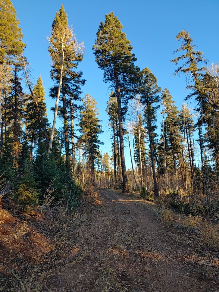
I began hiking at 6:52am. Mount Ellen is about 2 miles north of Bull Creek Pass, but first, I decided to climb its slightly lower south summit (11,419 feet). The south summit is only a mile from the pass so I figured I could get up there by sunrise. I initially made a steep ascent through some pine trees. After a short while I came out into the open on the ridge leading to the south summit.

Despite the cold and the altitude, the hiking was pretty easy once I got above the trees.

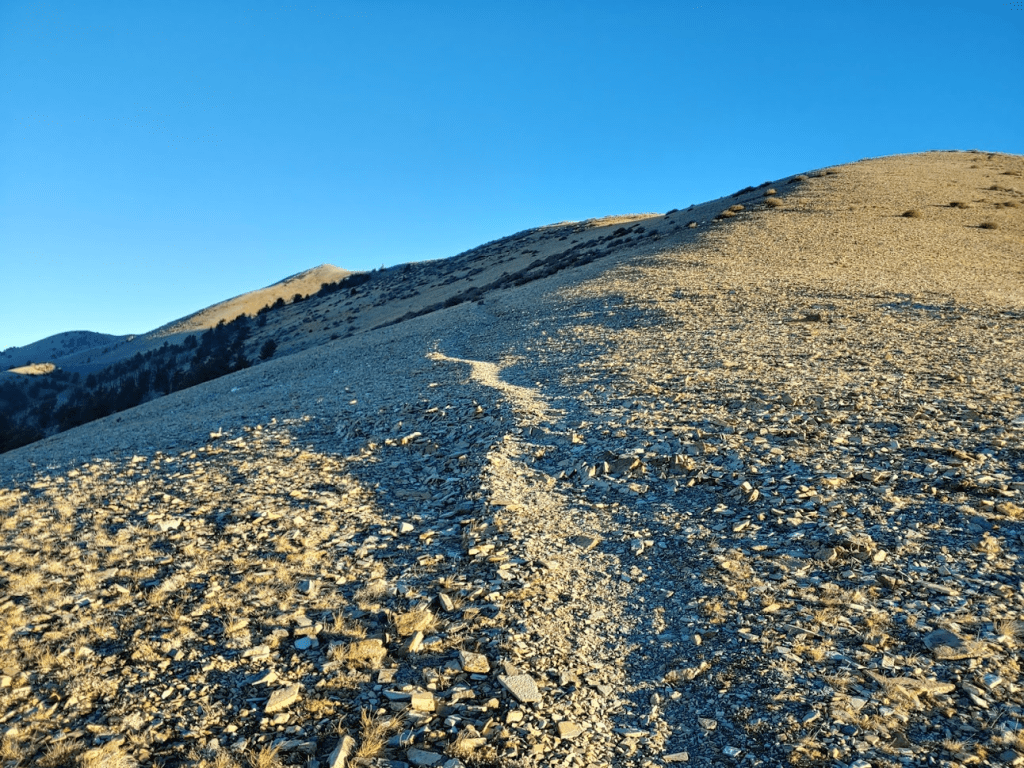
I went over a false summit and then the south summit came into view.
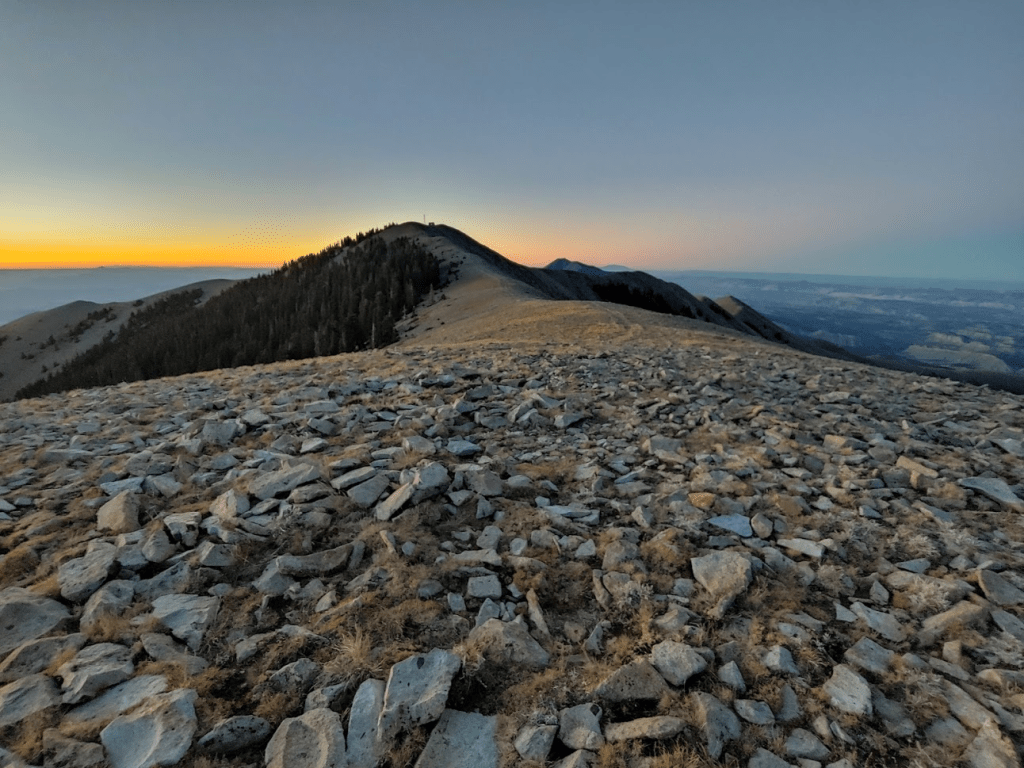
There were actually some tire tracks leading up from the false summit.
I made it to the summit just before sunrise at 7:27am. It had taken me just 1.16 miles (but nearly 1000 feet gained).
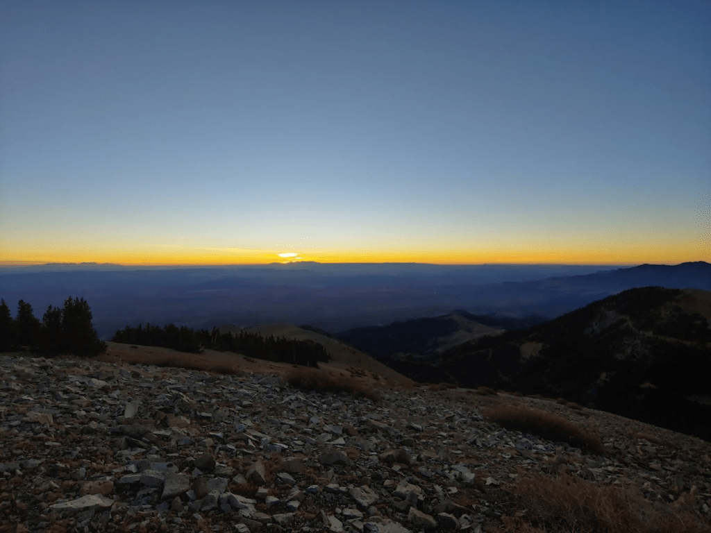
I grabbed a seat and waited for the sun.

I believe the peak that the sun is behind in the photo above is Abajo Peak, a 4k prominence peak in southeastern Utah. The sun rose at 7:31, just 4 minutes after I summitted!
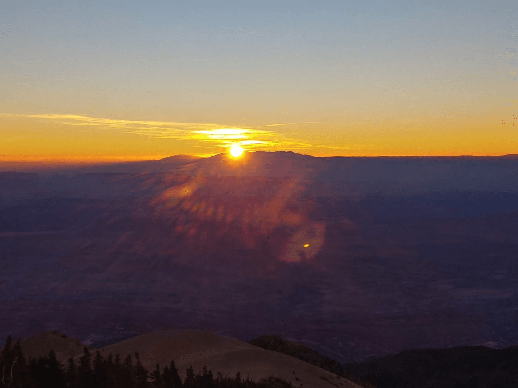
It was one of the most stunning sunrises I had ever seen.
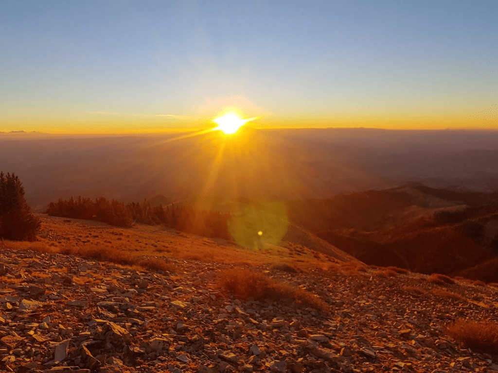
I sat for about 10 minutes just enjoying the view. I really can’t think of a more spectacular sunrise I had seen in my life (or sunset for that matter). I looked around but did not find a register. This peak did have some communication equipment and solar panels on it.

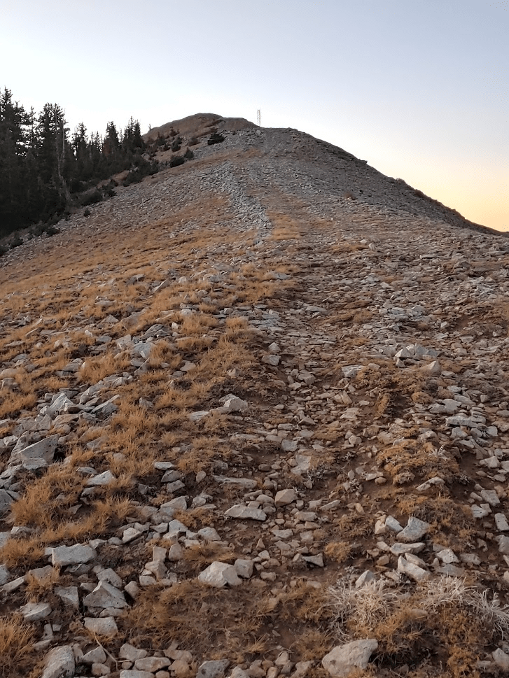
Once the sun was fully above the horizon, I started descending back to Bull Creek Pass. Mount Ellen itself was visible just 3 miles away to the north.
I hiked back down the ridge and through the woods just above the pass. I found a vague use trail that I had not seen in the dark.
At 2.34 miles I reached Bull Creek Pass again.

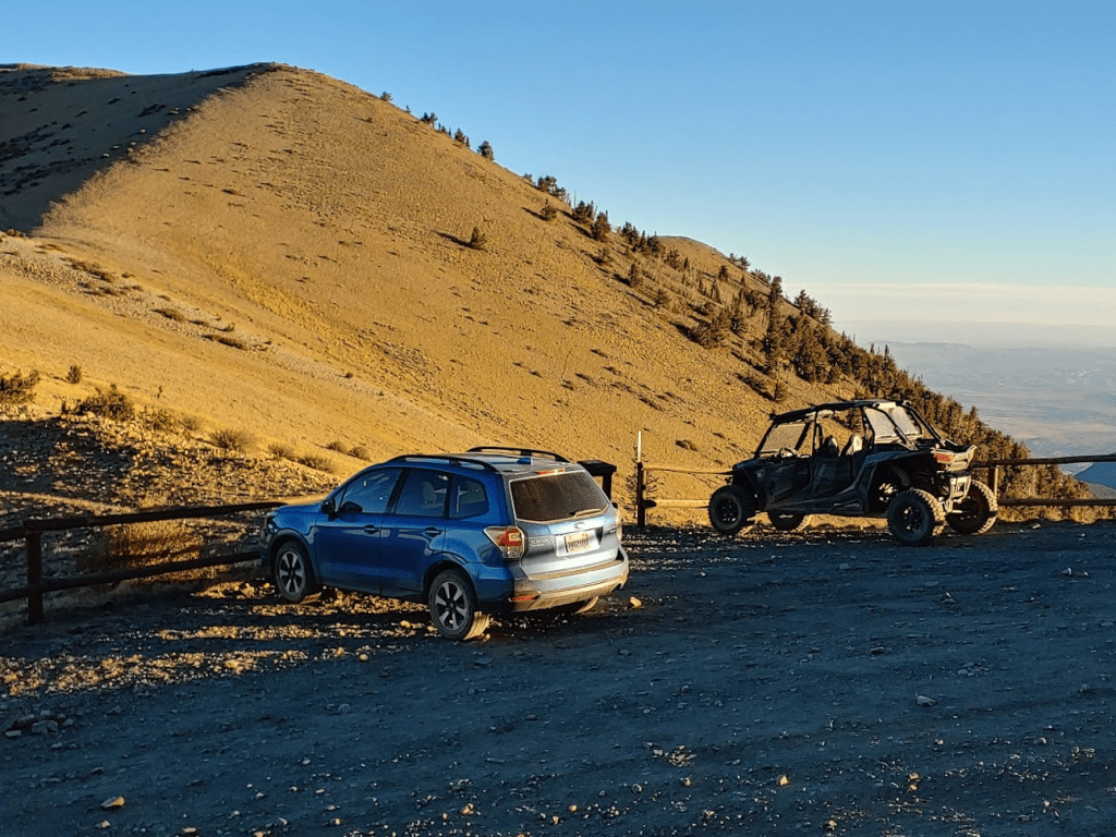
There was an OHV parked next to my car.
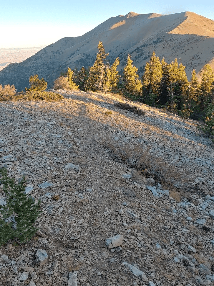
There was a sign-in sheet at the trailhead, so I scribbled down my info and began hiking to Mount Ellen. There is actually a pretty decent trail leading to the summit from the pass. Again, Ellen is somewhat popular despite its remoteness due to its status as an ultra-prominent peak.
I heard a lot of OHV noise off in the distance which was really annoying. At 2.63 miles I saw a buck down the slope to the left.
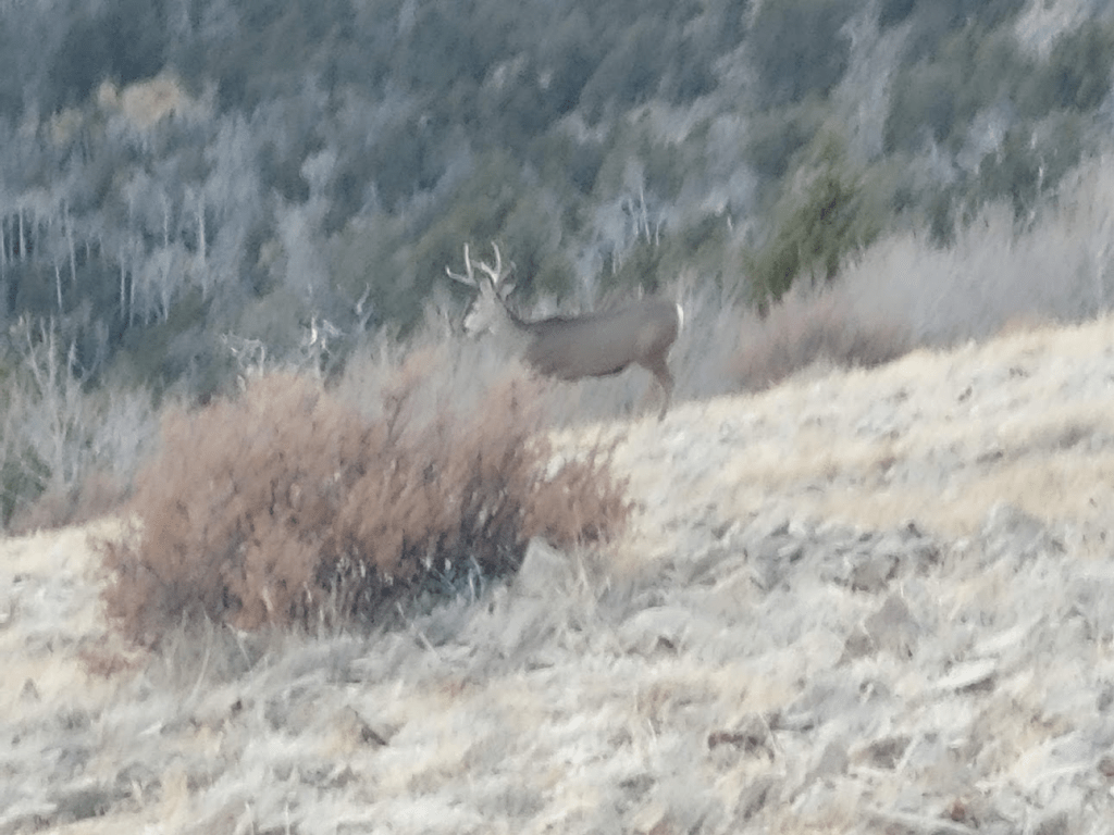
Just after seeing the buck I saw a huge group of deer close by. I was really keeping my eyes peeled for elk or bison, both of which roam these mountains. Apparently, the bison were transplanted from Yellowstone National Park years ago and now are 1 of only 3 free roaming herds in the United States. Unfortunately, I never saw any. After the deer, I continued hiking north towards the summit.
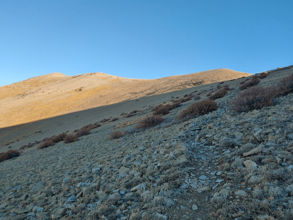
The trail was in great shape and made for easy hiking.

At 3.86 miles I reached a minor, unnamed peak of elevation 11,491 feet. The trail petered out just before reaching this peak.
I made a slight decent and picked up the trail again just north of Peak 11491.

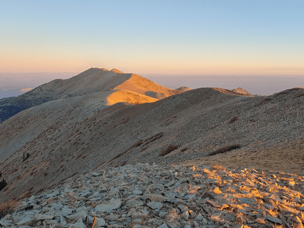
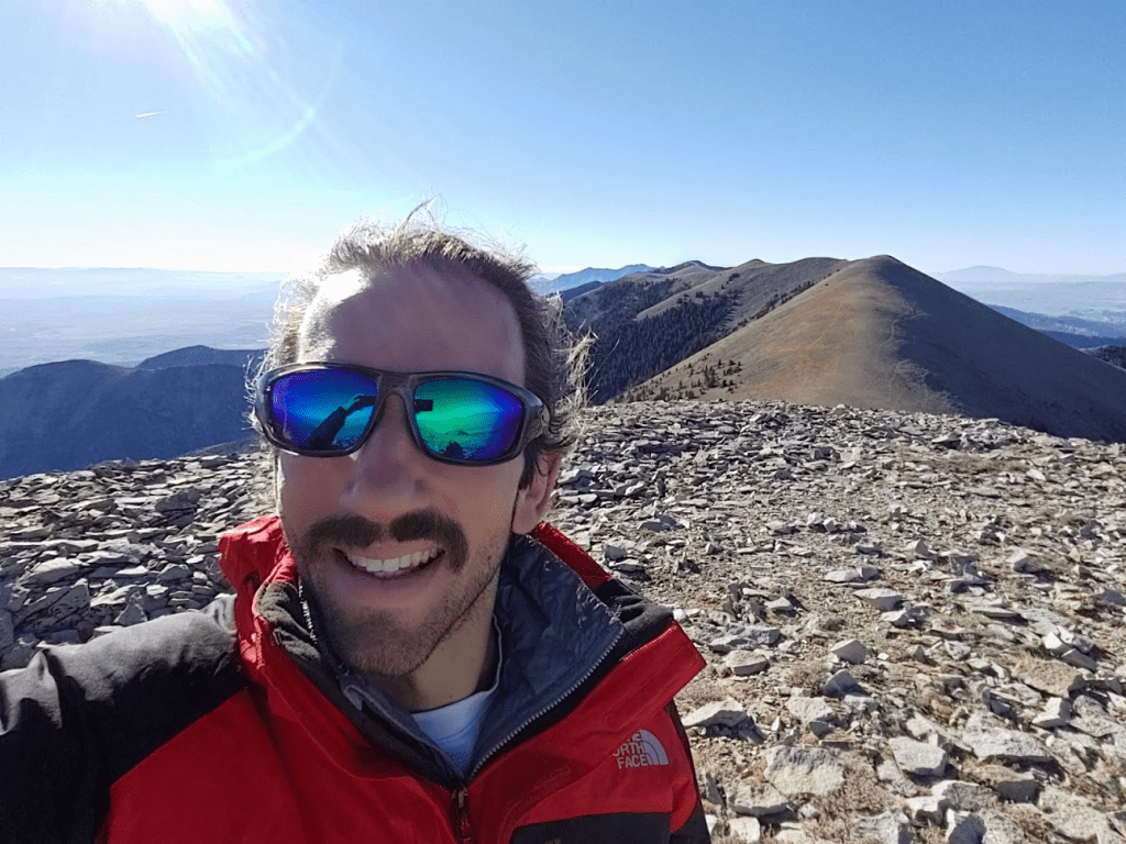
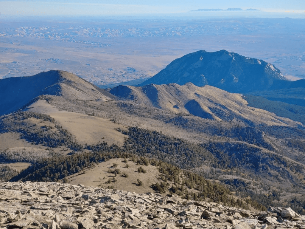
I reached Mount Ellen at 8:59am at 4.25 miles!
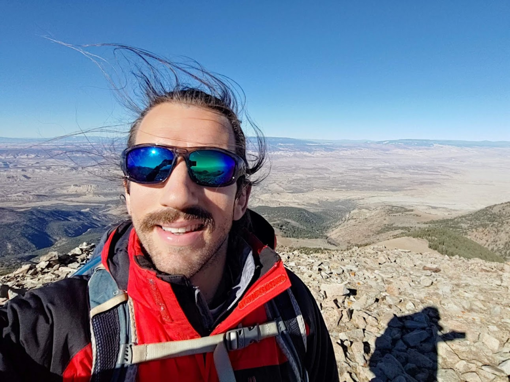
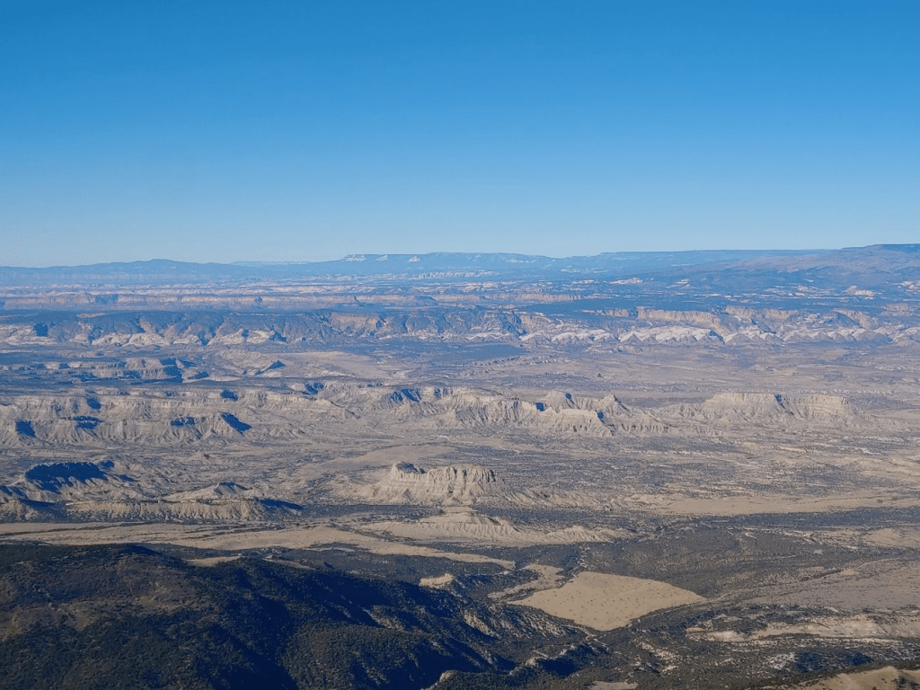
The views were spectacular. It was a perfectly clear day and I could really tell just how prominent Mount Ellen is. I felt like I could see the entire southern half of the state of Utah. To the southwest I could see the Capitol Reef area and the Grand Staircase beyond it.
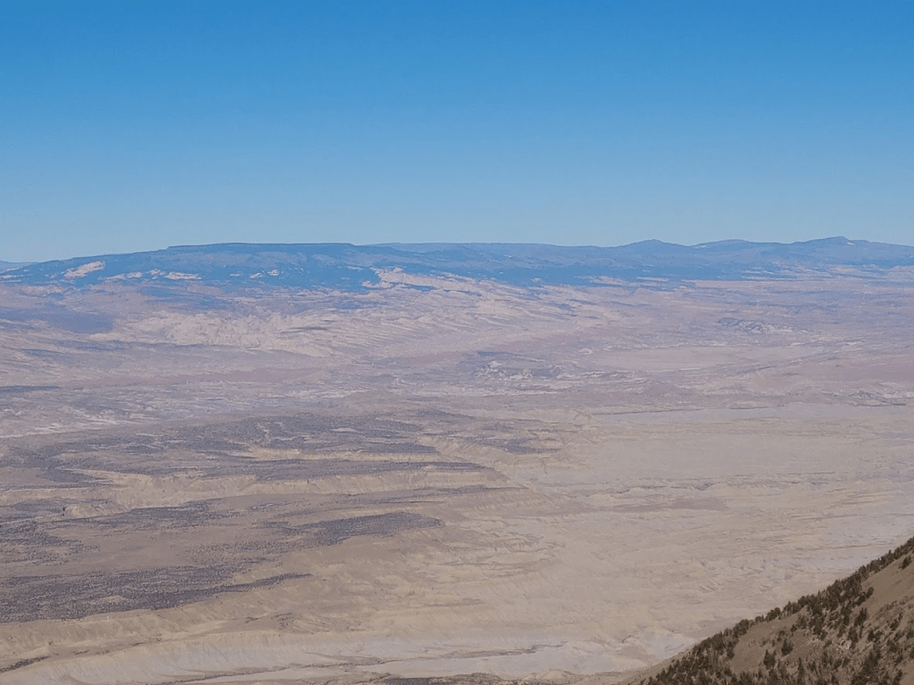
To the west I could see flat-topped Thousand Lake Mountain, which I had just climbed the day before.
To the east I could see Mount Peale, which is another ultra-prominent peak in eastern Utah near the Colorado state line.

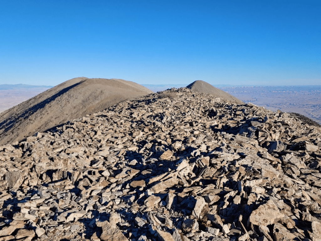
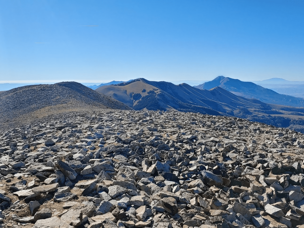
To the south I could see the rest of the Henry Mountains, including the south summit I had visited earlier and Mount Pennell (right). Way in the distance I could see Navajo Mountain near the Arizona state line (far right in background).
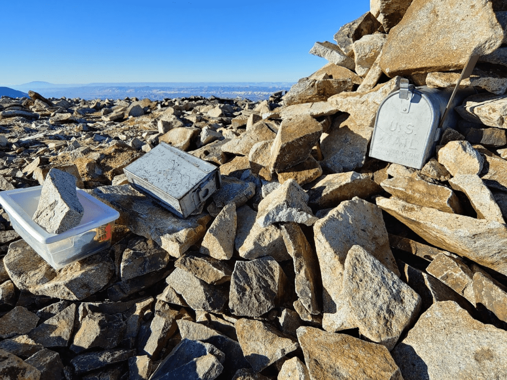
Given the peak’s ridiculous prominence and the stunningly clear air, I can say it was one of the best views I had ever seen. Definitely worth the long tedious drive to get up here. There were a few different containers holding registers, including another mailbox (nearby Thousand Lake Mountain also has a mailbox on the summit, weird). I signed the newest one and noted the previous ascent was just 3 days prior.
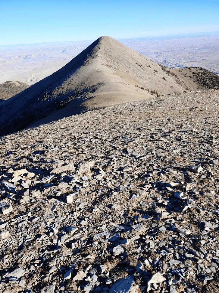
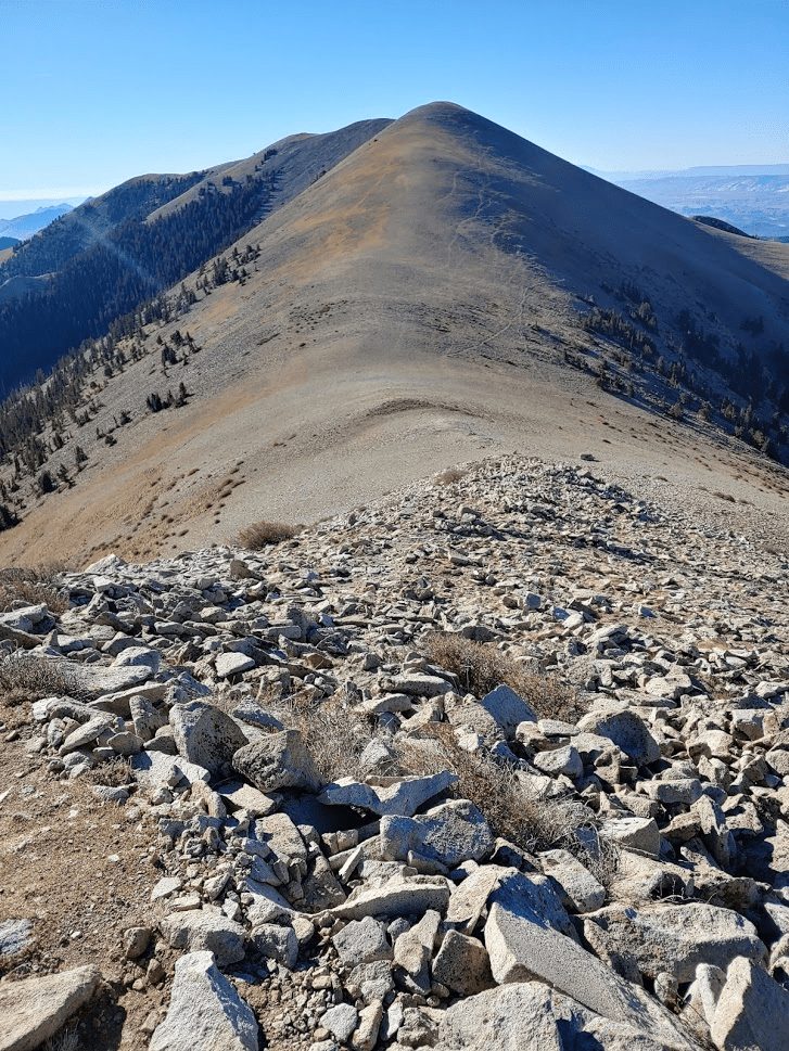
I had one more peak to do before turning around, called Mount Ellen Peak (11506 feet). This peak is about a mile north of Mount Ellen itself and only 16 feet lower. It does have 386 feet of prominence so would require some descent/ascent between the peaks. The summit is almost perfectly conical which makes it an attractive peak from a distance.
I descended to the north and hiked down to the saddle between the peaks, which I reached at 4.85 miles.
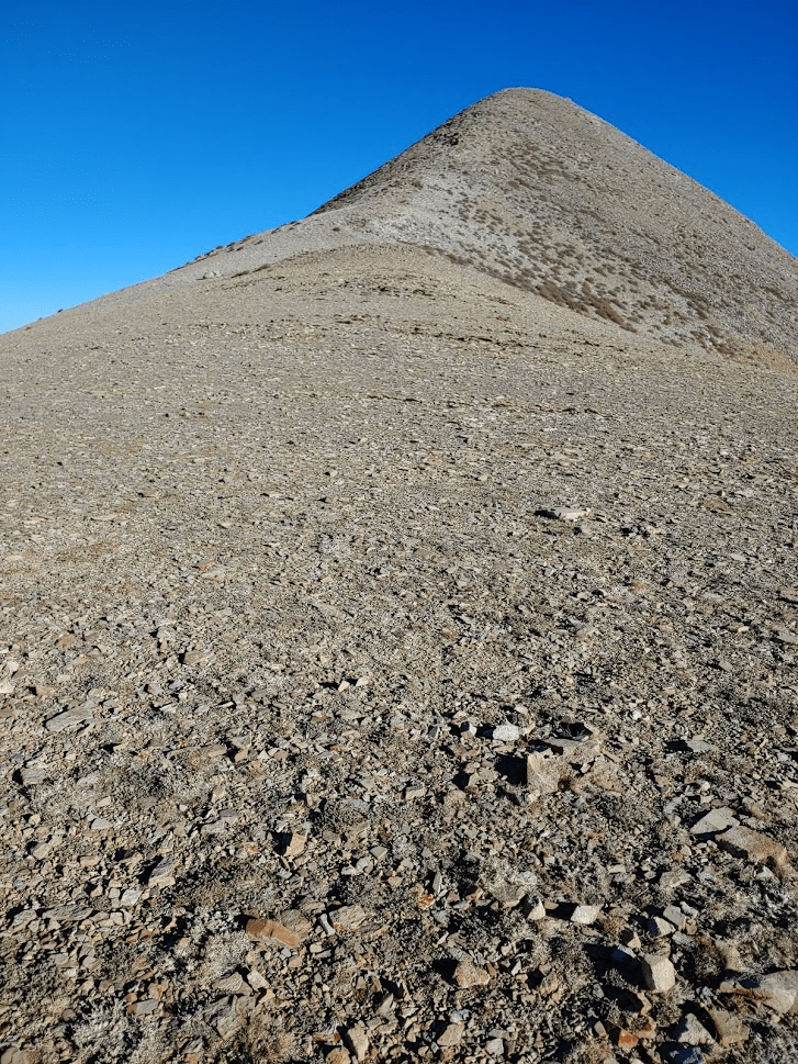
It was a very steep climb from there, but thankfully there was a decent use trail.

I reached Mount Ellen Peak at 9:33am at 5.21 miles!
The view wasn’t any different than on Ellen. I could perhaps see a bit more to the north.
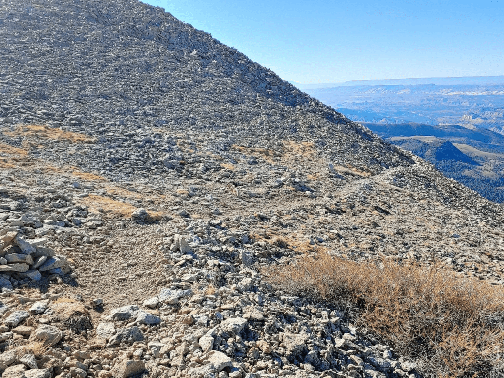
I did not locate a register on this peak. There was a red can, but nothing inside. After a short break I began the return to the trailhead. It would be 3 miles, including re-climbing Mount Ellen.

I hiked back down the use trail towards the saddle.
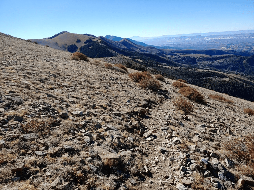
I reached the saddle and then climbed back up to Mount Ellen. The ascent to Ellen was much more gradual than Mount Ellen Peak.

I reached Mount Ellen again at 10:11am at 6.23 miles. I took a longer break this time around since I really wanted to soak in the views before returning. A solo hiker joined me on the summit just as I was packing up to begin descending. We chatted briefly and then I started to make my way back. I stayed on the trail the whole way rather than reclimbing Peak 11491.
The return trip went smoothly. I ran into another solo hiker near the trailhead. He had driven his truck up to Bull Creek Pass via the western route and reported that it was in pretty bad shape. I definitely made the right call approaching from the east.
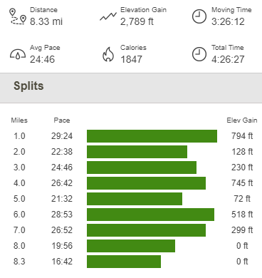
I started to finally shed some layers as I got close to the car, but it was still only 53 degrees when I got back. I reached the car at 11:18am. This hike totaled 8.33 miles, 2789 feet elevation gain, and 4:26:27 total time.
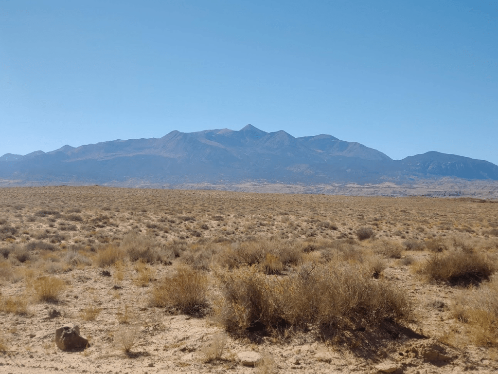
I packed up my car and made the long drive back to Hanksville. Since I had approached in the dark the night before, I stopped to take some pictures of Mount Ellen once I reached the desert floor. Hanksville is only 4295 feet above sea level which means that Mount Ellen rises over 7000 feet above the small town.
Lookout Tower Hill
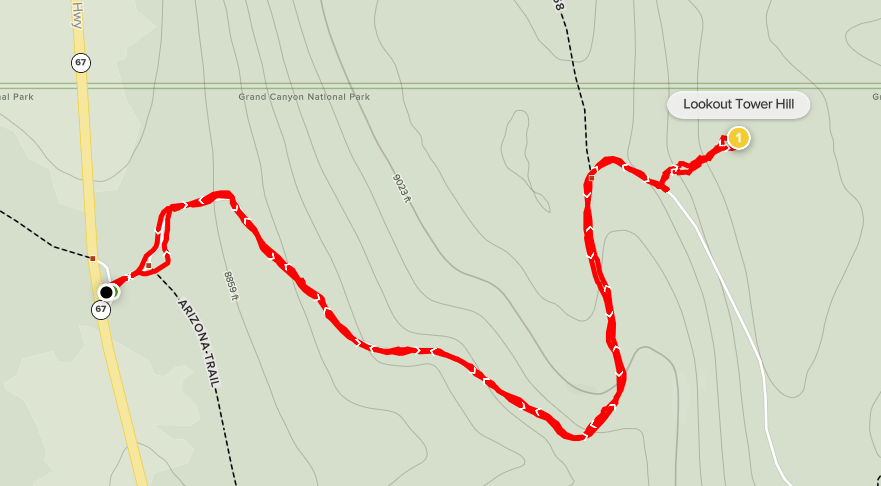
It was a weird feeling knowing that I had reached the furthest point on my road trip and would now begin heading back. I had a 6 hour drive to the Grand Canyon in front of me, so I didn’t linger too long. The next day, I was planning to hike the North Kaibab Trail from the North Rim down to the Colorado River (and back up). I took State Routes 24 and 62 west to US-89. I drove south on US-89 all the way to Kanab, and then US-89A across the state line to Jacob Lake, Arizona. The time changed as I crossed the state line. Of course, I wasn’t entering a new time zone but rather switching from daylight savings time to standard time (since Arizona does not observe daylight savings). This was sort of weird since I was driving directly south so the timing of sunrise/sunset wasn’t changing at all. My phone actually went ahead an hour and then switched back, which led to some confusion for me. Of course, I didn’t care what time it actually was, but it was important to be able to set my alarm to wake up before sunrise the following day. Anyway, from Jacob Lake I drove south on AZ State Route 67 to the Grand Canyon North Rim entrance station, which was unmanned this time of year. I arrived with enough time for one quick hike before dark, a little peak called Lookout Tower Hill which happens to be the high point of Grand Canyon National Park at 9165 feet. I parked at a little turnout by the entrance station and starting hiking at 5:19pm MST (6:19 in Utah).
I started by walking east up a dirt road past a ranger residence. There didn’t appear to be anyone home.

I walked around the cabin and then through a gate. I think the gate was there to just to block motor vehicle traffic. There was a little post off to the side indicating the road was open to hikers.

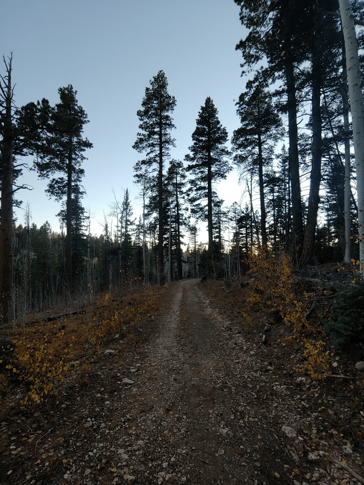
It was pretty nice out but starting to get chilly this late in the day. The road went through some beautiful pine trees and aspens.
The road winded its way to the south, then bent north, then back to the south again. Just after the last bend I left the trail to climb to the summit. The road does continue to an actual lookout tower a bit further south, but the park high point was on a small hill just east of the road.
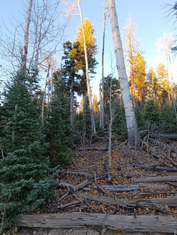
I fought through some brush for about a tenth of a mile and then reached the summit. Only 1.1 miles total so far. The “peak” was marked by a white pole and a register.

This was another lame national park high point, but that’s to be expected when the primary feature of the park is a massive hole in the ground. This was my 3rd national park high point of the trip, and 7th overall (the 4 I had done before this trip were all more exciting). Tree cover blocked any kind of view, so I signed the register and started the hike back to the car. I had debated continuing to the actual lookout tower, but it was starting to get pretty dark now.
I noticed a new vehicle that hadn’t been there before at the ranger residence, so someone must have been home, but I still didn’t see anyone. I reached the car again at 6:04pm. This hike was a quick 2.2 miles, 341 feet elevation gain, and 44:24 total time.

I packed up and drove north out of the park and into Kaibab National Forest. I went west on Forest Road 22 and drove a few miles before finding a nice spot to spend the night. There were a lot of dispersed campers in this area, which made sense considering the proximity to the Grand Canyon. I was at nearly 9000 feet, so it once again was a very cold night.
To be continued…
