Day 1
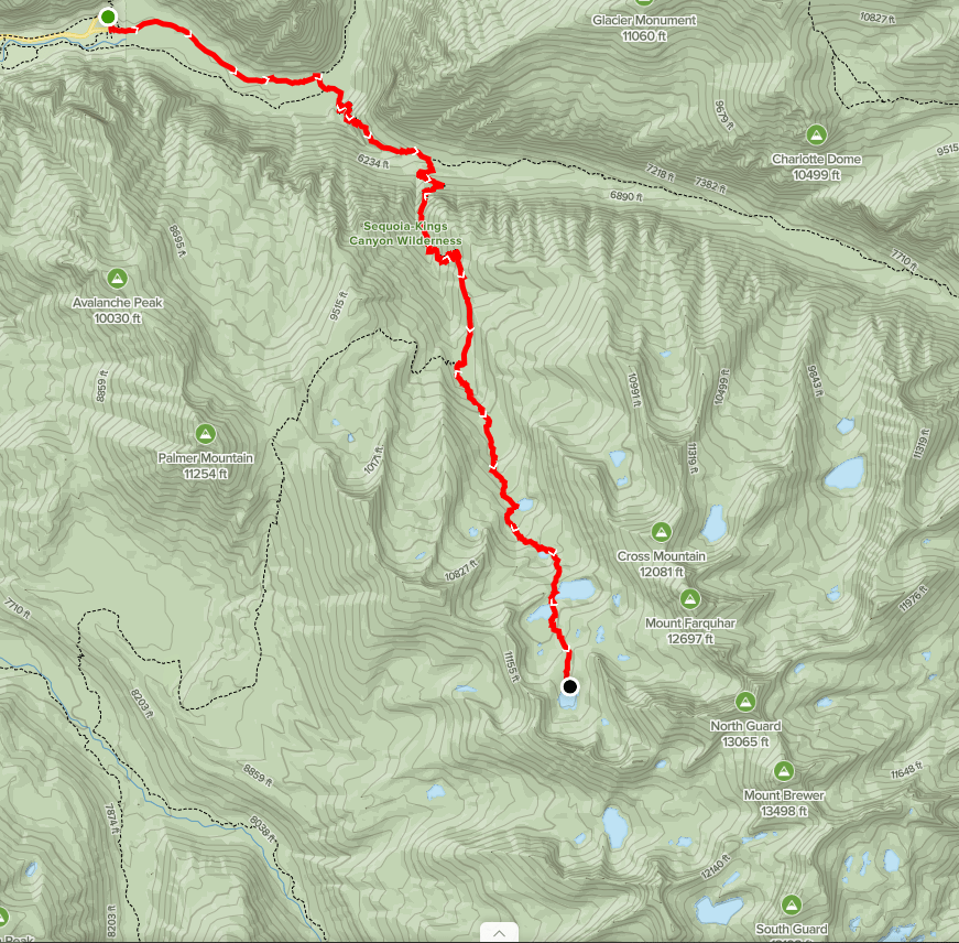
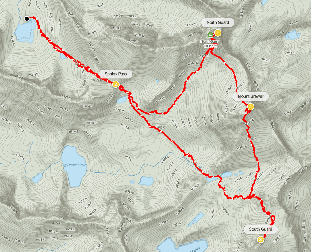
The Great Western Divide is a subrange of the Sierra Nevada located west of the main crest in Sequoia and Kings Canyon National Parks. Mount Brewer, at 13570 feet, is one of the highest peaks on the divide and is one of 15 emblem peaks on the Sierra Club Sierra Peaks List. It is flanked by 2 additional 13ers, North Guard (13327 feet) and South Guard (13232 feet). My plan was to climb all 3 peaks over a 3 day backpacking trip with both nights spent at Sphinx Lakes. My starting point would be Roads End in Kings Canyon National Park. This would be my first Sierra backpacking trip approaching from the western side, so I was excited to explore a new area. I left San Diego Friday morning and made the 6.5 hour drive to the trailhead. Wilderness permits are non-quota this late in the year, so I filled out a self-issue permit at the ranger station. I began hiking at 11:10am from 5089 feet above sea level.
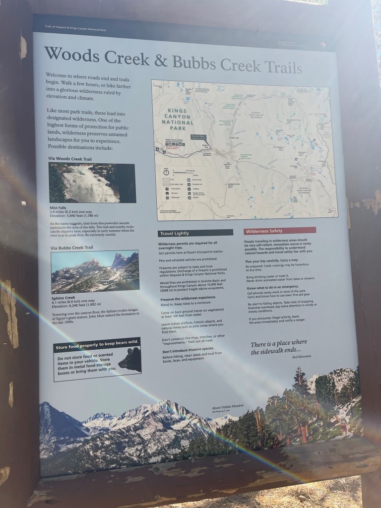
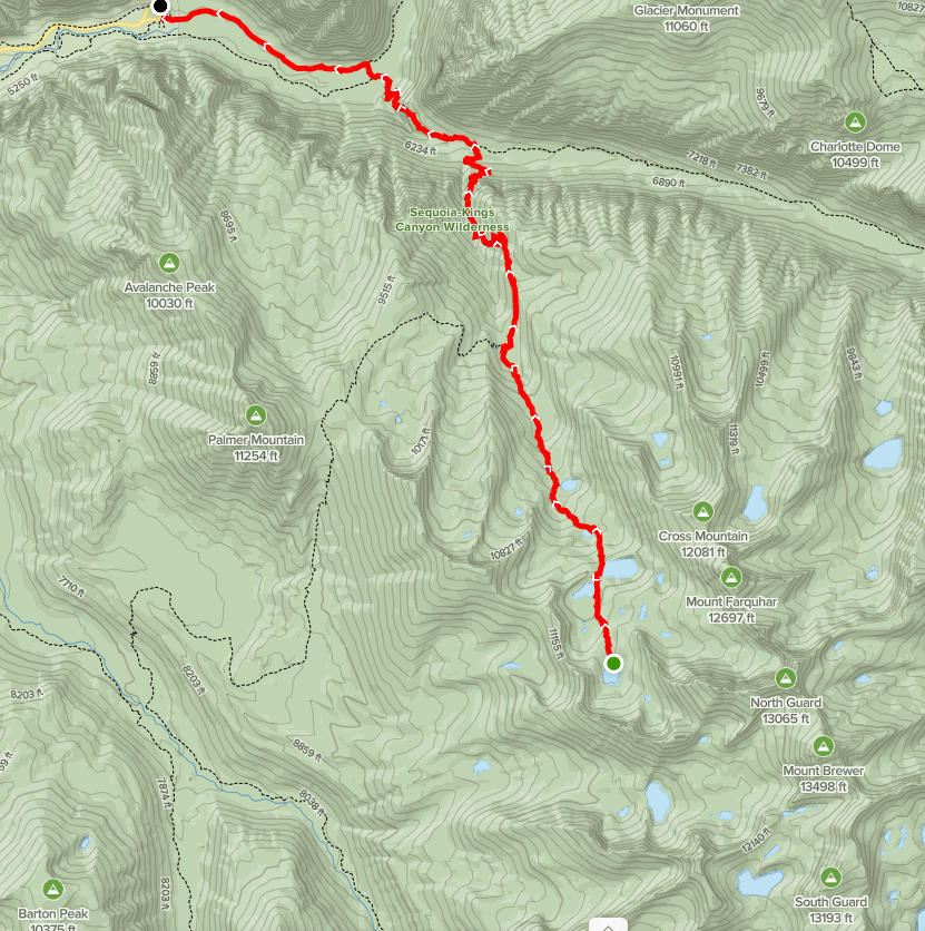
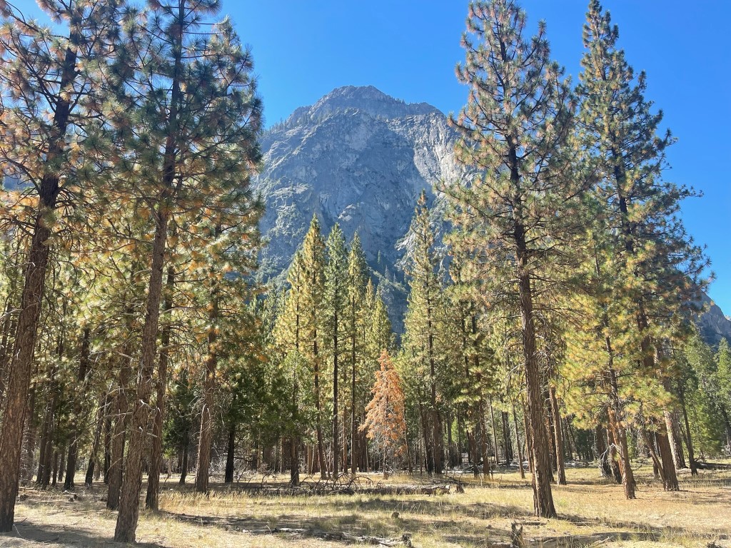
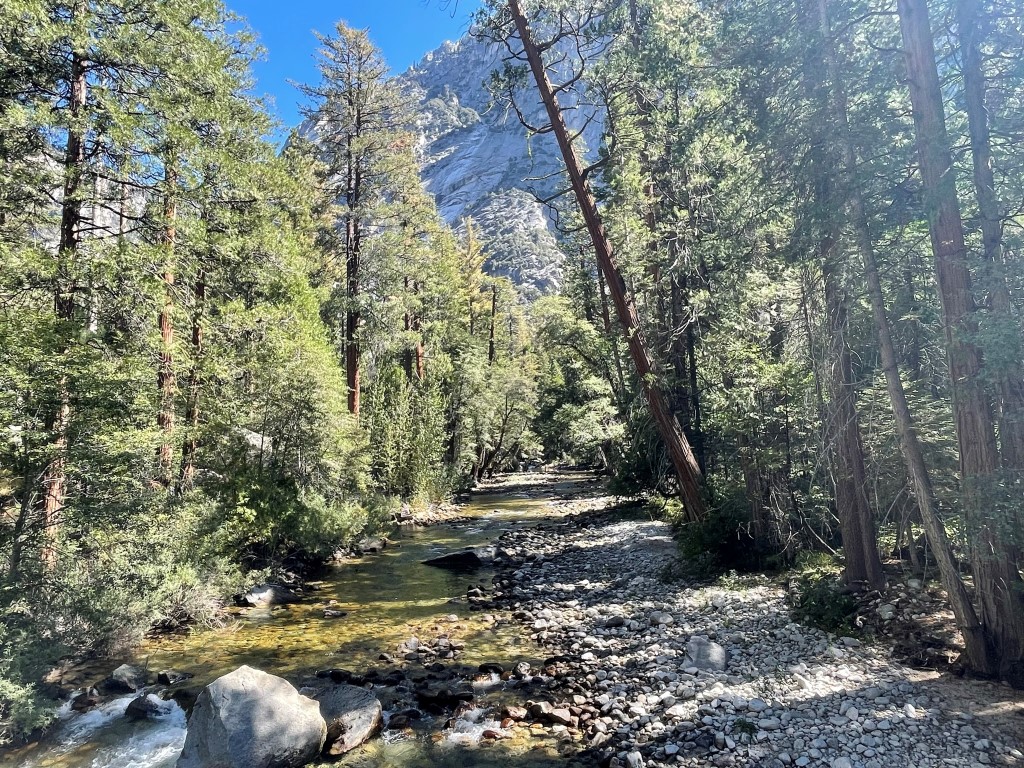
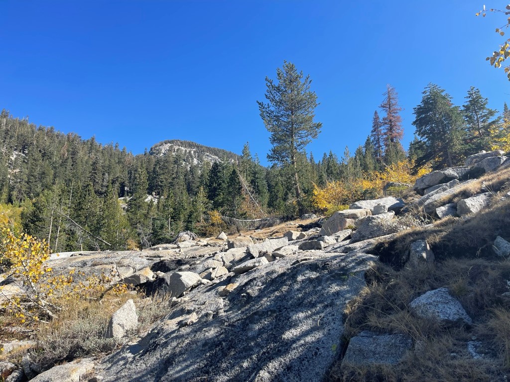
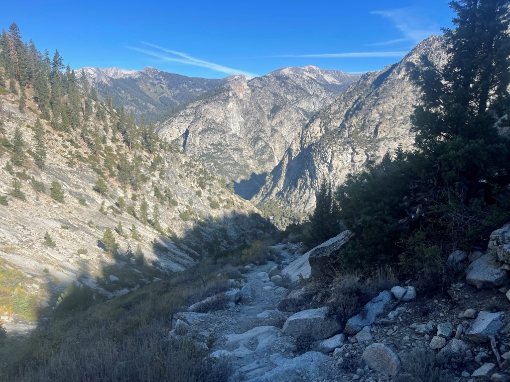
The plan for day 1 was to take the Paradise Valley Trail to the Bubbs Creek Trail, and then get on the Sphinx Creek Trail. I would then leave the trail around 8500 feet and head cross country up to Sphinx Lakes, which are a series of lakes located above 10000 feet northwest of Mount Brewer. This trailhead is one of the lowest in the Sierra, so it would be a strenuous climb to get up there. The Paradise Valley Trail was quite beautiful as it follows the South Fork of the Kings River. The high walls of the canyon were very impressive.
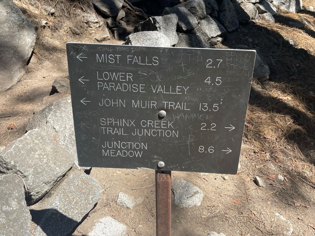
There were many other backpackers and day hikers on the trail. At 2 miles I went right onto the Bubbs Creek Trail.
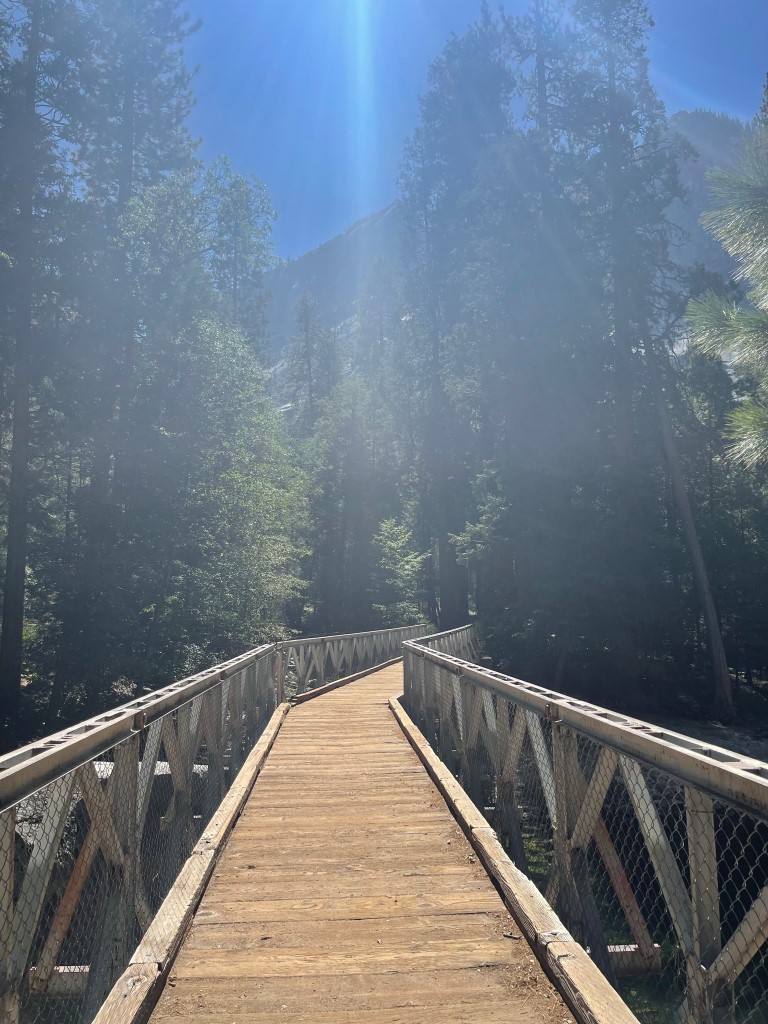
I then crossed the river via the Bailey Bridge.
The trail had been flat up to this point, but the Bubbs Creek Trail started to gain elevation following the river crossing. It made a series of switchbacks as it ascended southeast away from the river along the Creek. At 4.2 miles I turned right onto the Sphinx Creek Trail.
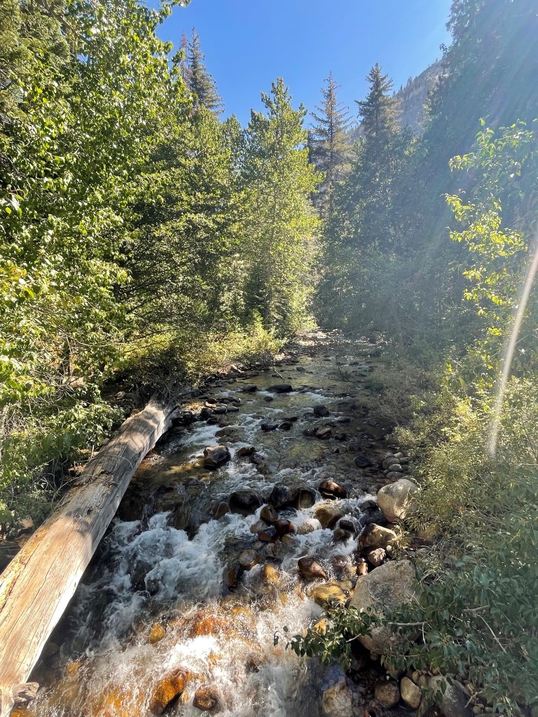
I crossed Bubbs Creek and continued south along Sphinx Creek.
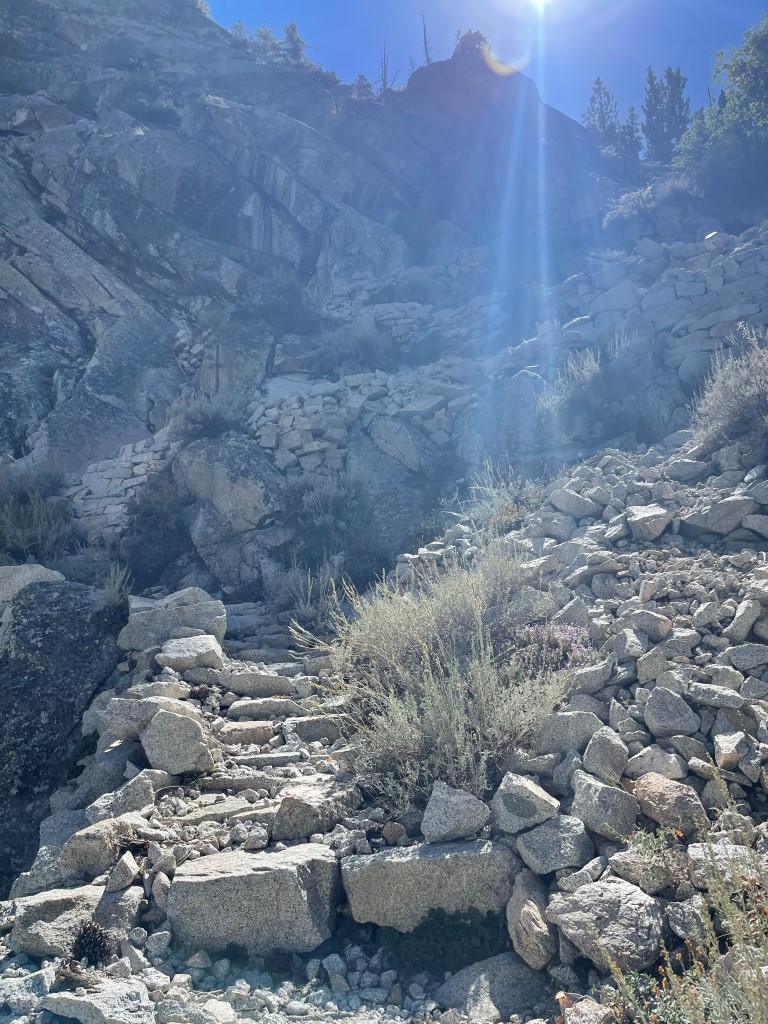
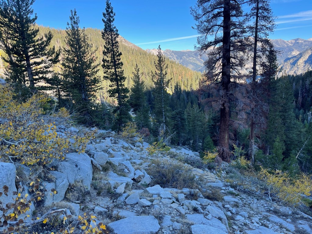
The Sphinx Creek trail was quite steep. There were some sections of beautiful fall colors.

Parts of the trail had stone steps cut into it.
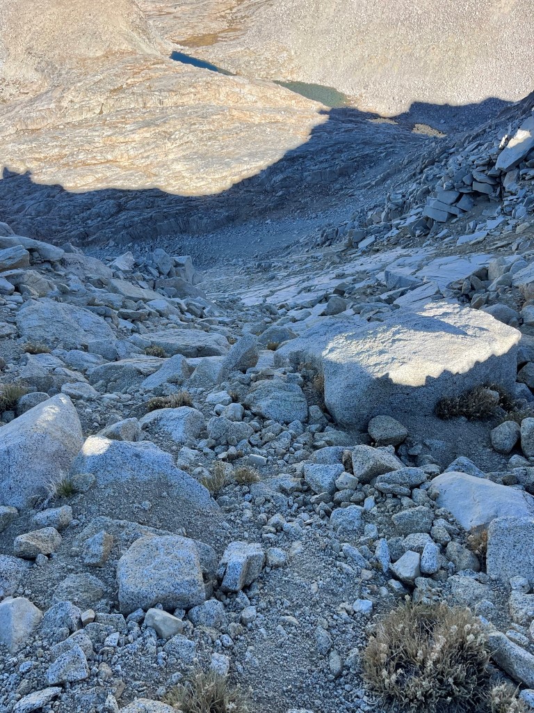
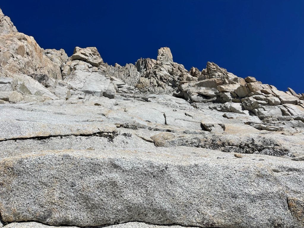
The trail made a bunch of switchbacks and then proceeded south above the creek. At 7.4 miles I made it as far as the maintained trail would take me this weekend (about 8500 feet). I followed a series of vague use trails to the south through somewhat marshy terrain near the creek. I then climbed up a rocky slope.
The steep off-trail hiking was difficult with my heavy pack. I passed a pair of hikers who were also making their way up to Sphinx Lakes. They were planning to climb North Guard the next day, so we agreed to keep an eye out for each other while we were up there. At 9.1 miles I reached the first lake at 9600 feet.
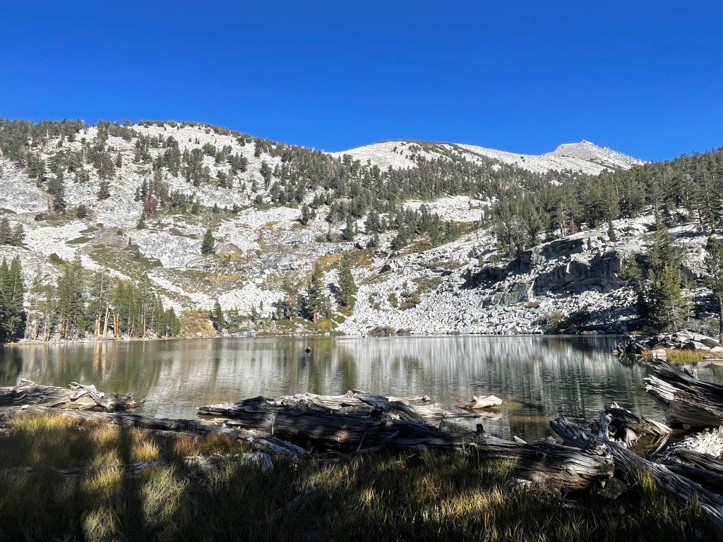
I stayed on the west side of the creek as I hiked above the first lake. The ground was very soggy so I stayed as far away from the creek as I could. I reached the second lake at 9.7 miles at 10000 feet.

I crossed the creek and hiked around the north side of the lake. I then ascended rocky slopes above the lake’s eastern side.
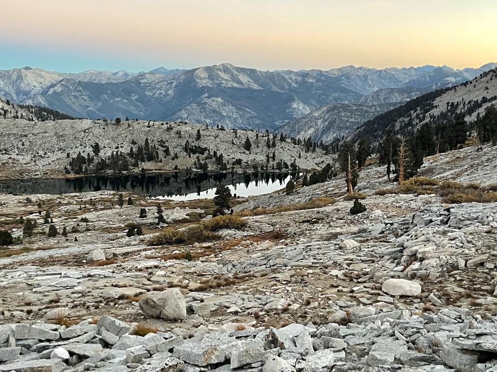
At 10.3 miles I reached Lake 10514 and Lake 10546. This is where the other 2 hikers were planning to set up camp.
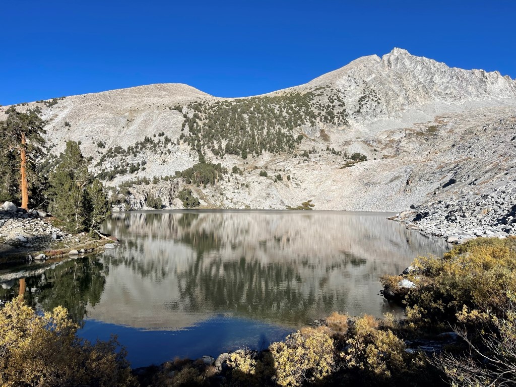
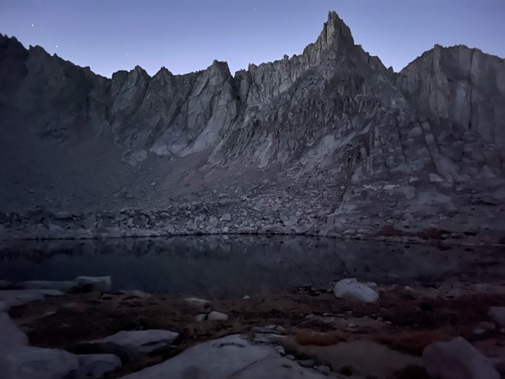
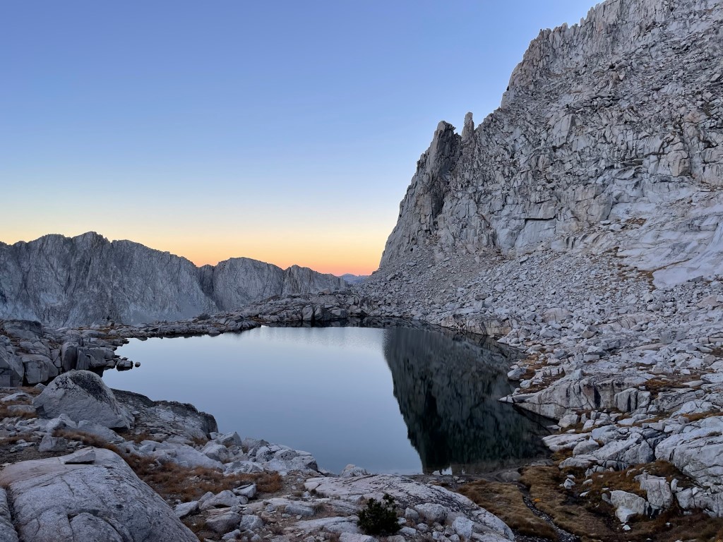
There were a few good campsites near the 2 lakes, but I wanted to reach the next lake before calling it a day. It took me about 45 more minutes to reach Lake 10962 where I set up camp just before 6pm. I set up my bivy on the north side of the lake and had a very restful night underneath the stars.

Stats for day 1 were 11.33 miles, 6122 feet elevation gain, and 6:36:58 total time.

Day 2
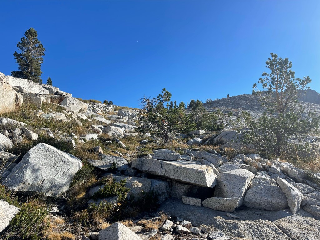
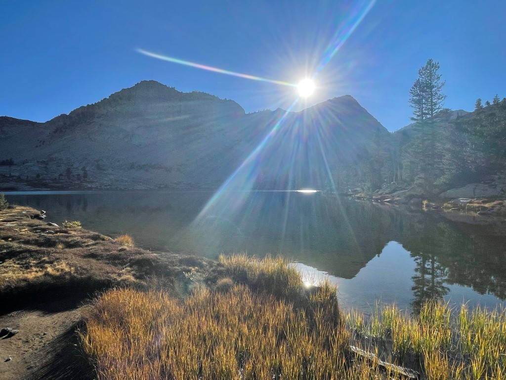
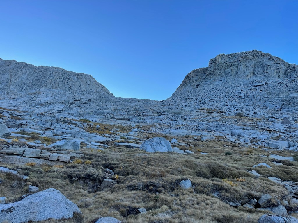
The plan for day 2 was to climb the 3 peaks in a counterclockwise loop, beginning with South Guard and working my way north to Brewer and North Guard. I began hiking at 5:48am from 10993 feet above sea level. I climbed above Lake 10962 to the southeast. At 0.5 mile I reached another small lake at 11306 feet.
I proceeded above the lake towards Sphinx Pass.

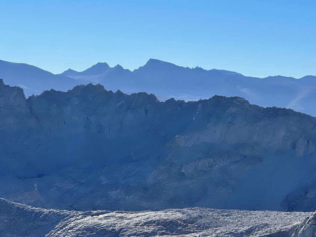
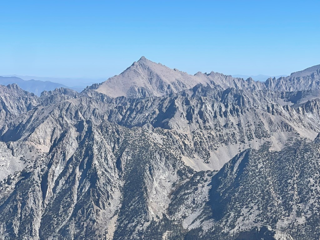
At 1 mile I reached Sphinx Pass at just over 12000 feet. I got my first good look at the impressive Mount Brewer.

I descended the other side of the pass and went by a small lake at 11800 feet.
I then descended into the Brewer Creek drainage. Big Brewer Lake was down below, with Brewer Creek draining the large basin I was in below Mount Brewer’s large east face. I reached a low point 11500 feet and then climbed up grassy benches next to the creek.
The temperature was very pleasant even so early in the morning, so I removed some layers. At 2.3 miles I reached another pass with 2 small lakes which I think are the source of Brewer Creek. South Guard can be seen in the distance below.

I crossed a narrow land bridge between the 2 lakes, descended a short way, and then began climbing the northwest face of South Guard.
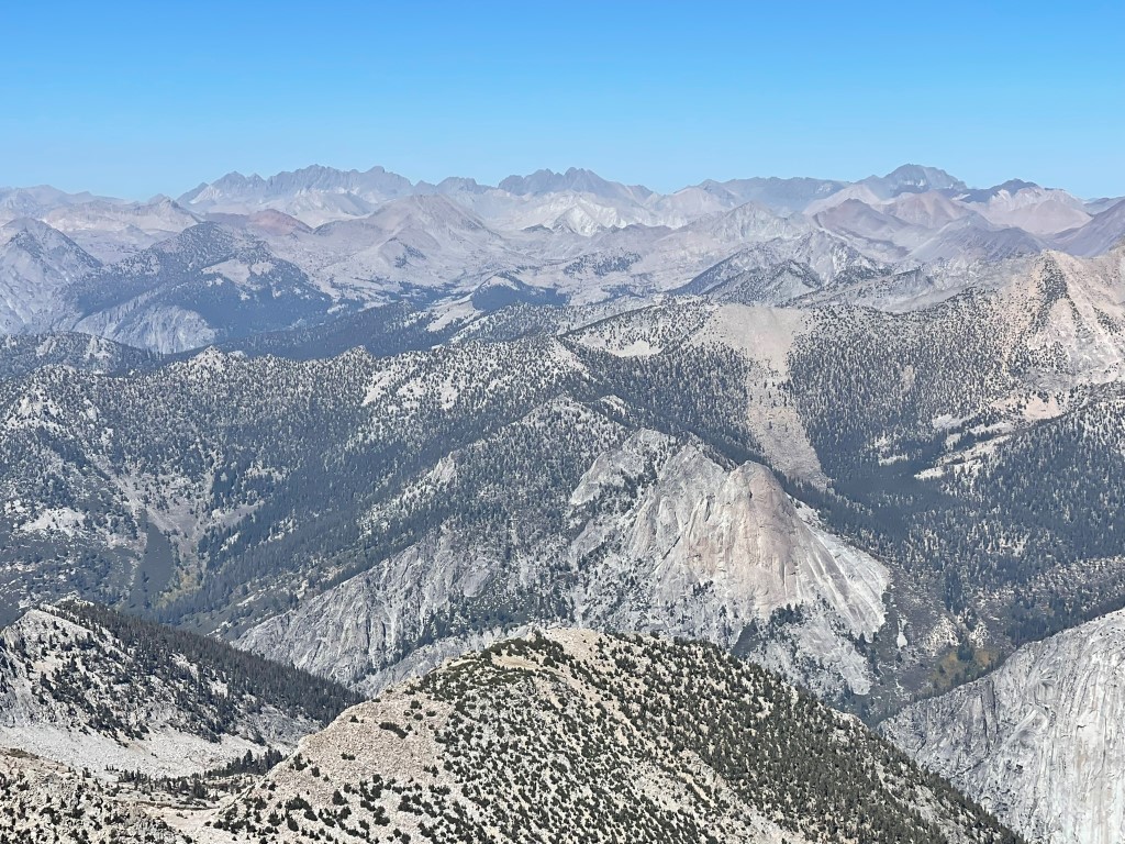
The northwest face was a loose mess, but eventually I reached the main ridge northeast of the summit. From there, it was a short easy scramble to the top (nothing above class 2). I reached the summit at 8:58am at 3.4 miles! I signed the register which had been placed in 1990. The previous entry was from September 26. There were 2 older books as well from 1966 and 1979 which I thought were very cool. It was a perfectly clear day, so the views were outstanding. I was much further west than I was used to, so it was a different perspective than I had seen before. To the south was Thunder Mountain, Midway Mountain, Red Kaweah, and Black Kaweah:
Mount Russell, Mount Whitney, and Mount Langley to the southeast:
Mount Williamson, Mount Tyndall, Trojan Peak, and Mount Barnard to the east:

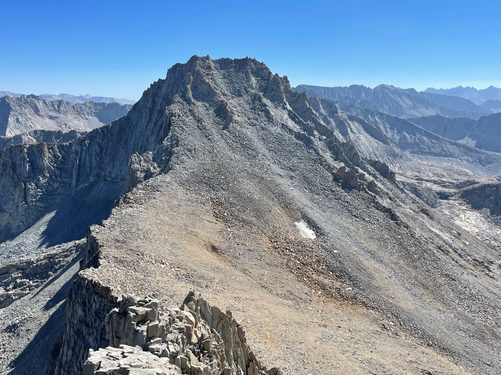
Mount Brewer to the north:

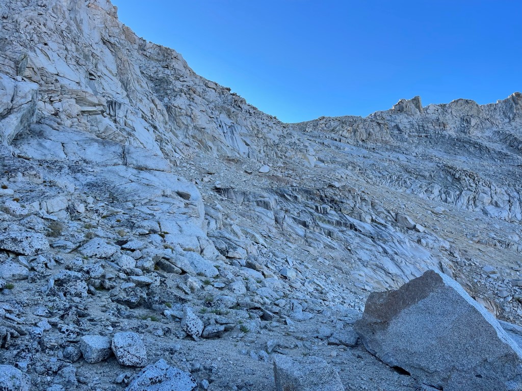
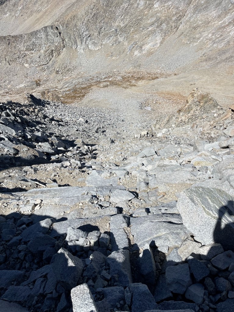
I began descending after a short break. I took my time down the northwest face, since it was very loose and steep.
I made it down below the face and then turned directly north to Brewer. It would be a 1400 foot climb in 0.7 mile.

The south ridge was straightforward class 2. I had to traverse east towards the top since I had wandered too far west while ascending.

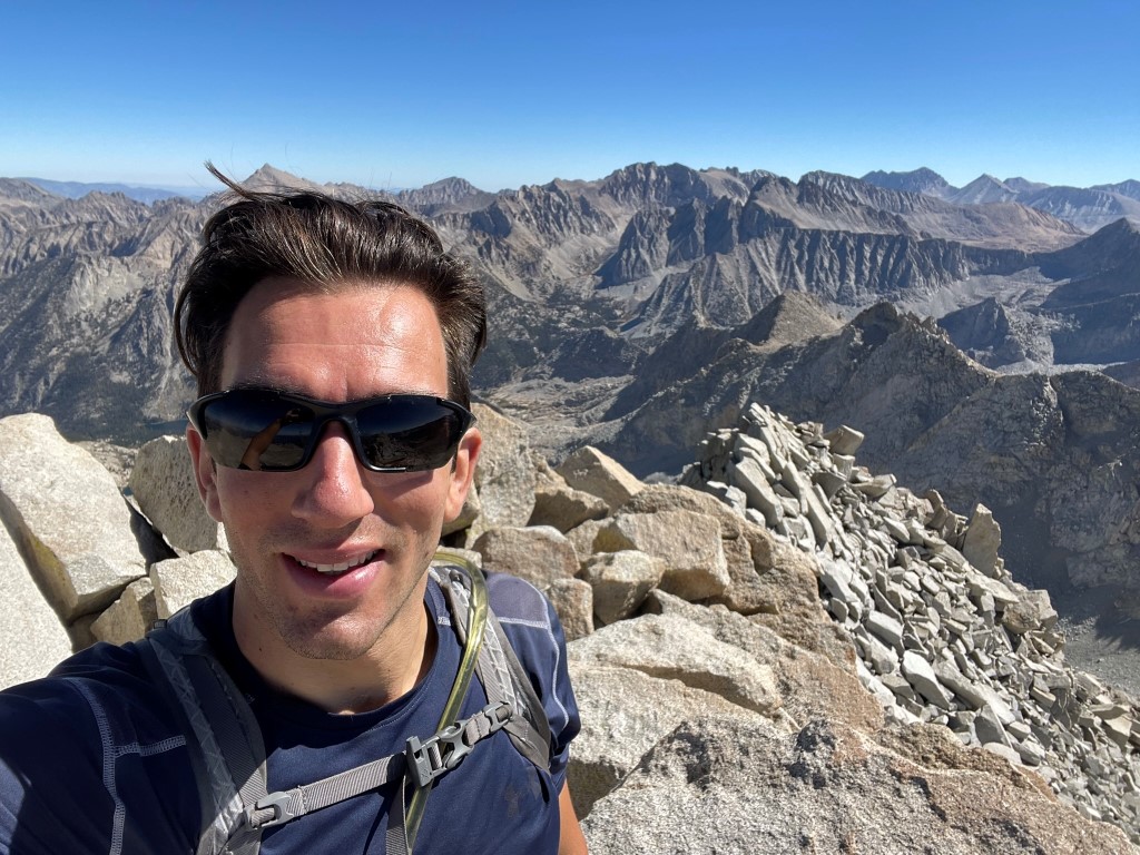
I reached the summit area at 11:33am at the 5 mile mark!
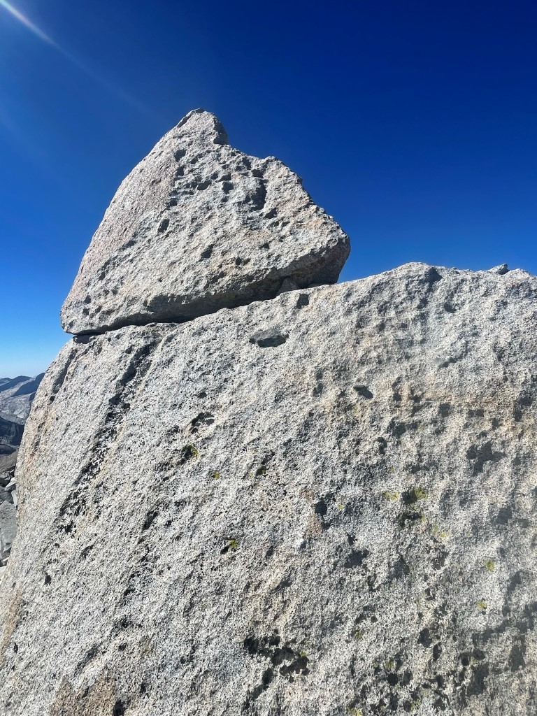
I signed the register which had been placed in 2014. The most recent entry was from September 25. The register was located underneath a boulder which was clearly not the highest point. The summit block was located a hundred feet or so to the south. I made my way over and climbed up to the top of it. I would consider it class 4, but others have described it as class 3. Maybe high class 3/low class 4 or something like that. I managed to sort of belly flop on top of it, and then I climbed down facing inwards using decent footholds to get down.
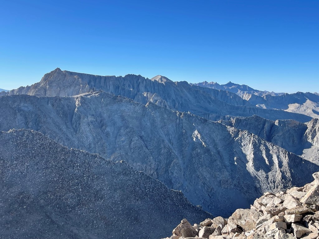
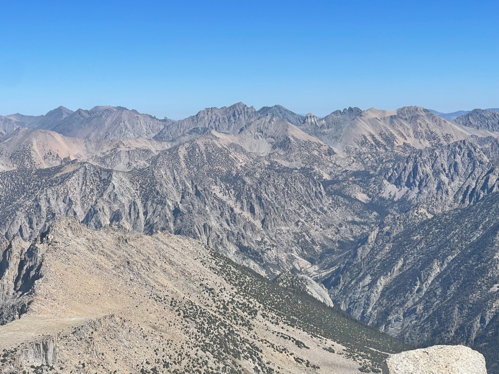
The views on top of Brewer were outstanding. To the east was University Peak:
Mount Baxter, Black Mountain, and Mount Gould to the northeast:
I climbed another point a bit further to the south which I thought was similar height, but once I was on top of it, I could see it was clearly lower than the previous one. I then descended the northwest slope, which I found to be steep and loose (similar to South Guard).
I descended into the bowl between Brewer and North Guard. It was now quite warm in the afternoon sun. I saw the 2 hikers I had passed the previous day heading up to Sphinx Lakes. They had gotten a late start this morning so were still on their way up.
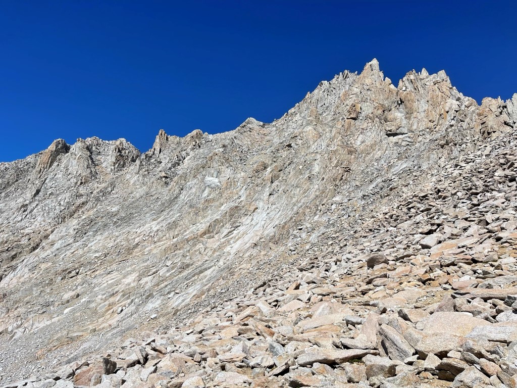
I climbed up a slabby chute on the south face of North Guard.
The climbing quickly became class 3. I traversed into another chute to the left and then climbed up onto the ridge just west of the summit.

I made a number of class 4 moves on the ridge which I felt a bit nervous about downclimbing. I eventually reached the summit area and saw the summit block, which is a large boulder that sticks out at a 45 degree angle. This ended up being similar to the summit block on Mount Brewer, although perhaps slightly harder. I managed to once again belly flop onto the top of it and then downclimbed facing inwards using a few small footholds. I was on top at 1:48pm at 6.3 miles!

I climbed back down and signed the register. It was placed in 1977 and most recently signed on September 18. This was not a very popular peak as evidenced by the book’s age and the fact that it wasn’t very full. This made sense given the peak’s difficulty and remoteness. To the north I had a great view of North Palisade, Middle Palisade, and Split Mountain.
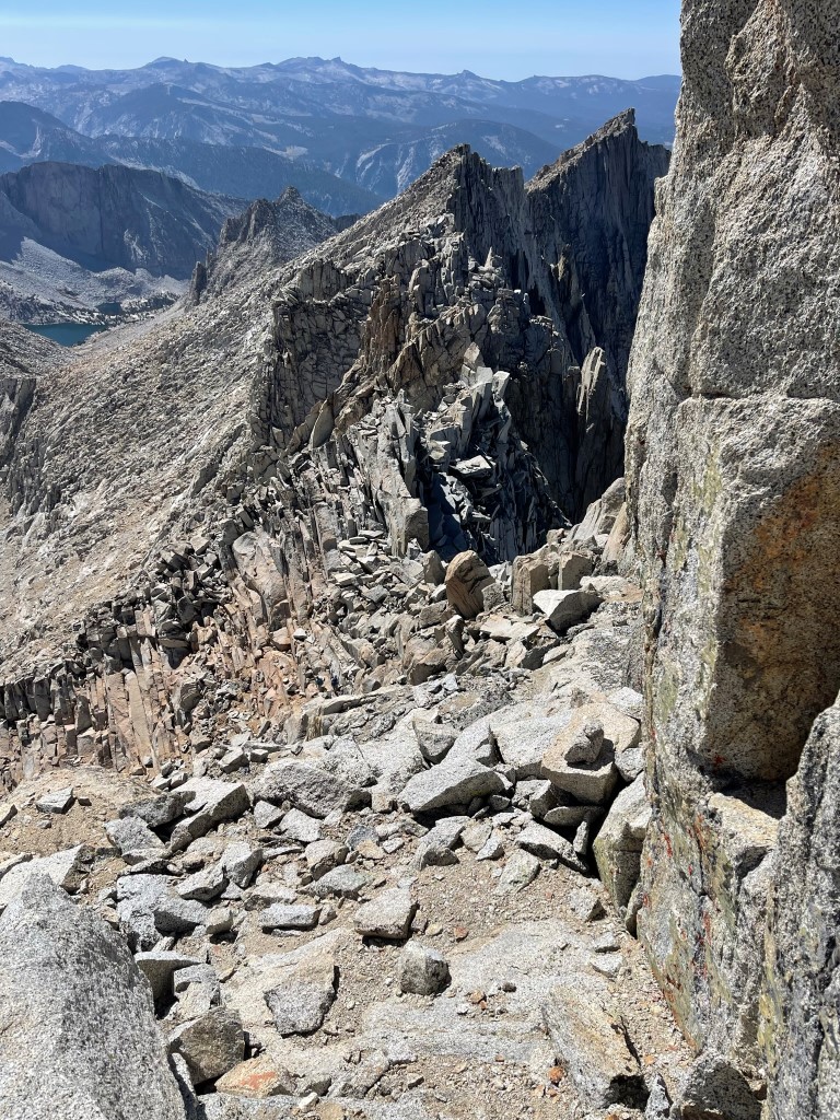
Looking back at Mount Brewer to the south:
Instead of downclimbing the class 4 ridge, I took a more direct descent route into the chute. I found this route to be more manageable, probably not higher than class 3. I ran into the other 2 hikers again about 100-200 feet below the summit and recommended they ascend using my descent route.
I tried to descend directly down the chute I was in but ran into a cliff which I was not able to downclimb. I backtracked slightly and traversed into the initial chute I had ascended. I climbed down the steep slabs and eventually made it into the bowl between North Guard and Brewer again. From there, I hiked west and then northwest towards Sphinx Pass.

I went up and over the pass and then descended to camp, which I reached at 4:40pm. Stats for day 2 were 9.11 miles, 5190 feet elevation gain, and 10:52:31 total time.

Day 3
The plan for day 3 was to simply reverse my route from day 1 and descend to the trailhead. I allowed myself to sleep in a little as a reward for making it to all 3 peaks the previous day. I started hiking at 6:34am.
I made it down to the 2 lakes at 10500 feet and saw the 2 hikers again just rolling out of their sleeping bags. They had made it to the summit of North Guard which I was happy to hear. I had seen their headlamps descending from Sphinx Pass the previous evening, so I knew they had gotten back pretty late. After we said our goodbyes, I continued descending past each lake and down the various rocky slopes.
I reached the trail at 3.5 miles. It had taken me just over 2 hours to get to this point, so I was making good time. From there, I descended the Sphinx Creek Trail with a beautiful view of the various canyons.
I spotted a buck along the trail.

I reached the trailhead at 11:30am. Stats for day 3 were 11.08 miles, 190 feet elevation gain, and 4:56:29 total time.