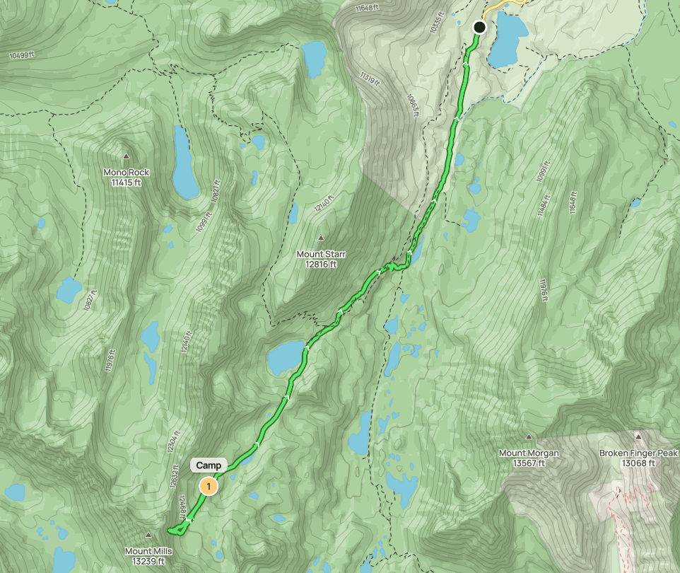
Day 1
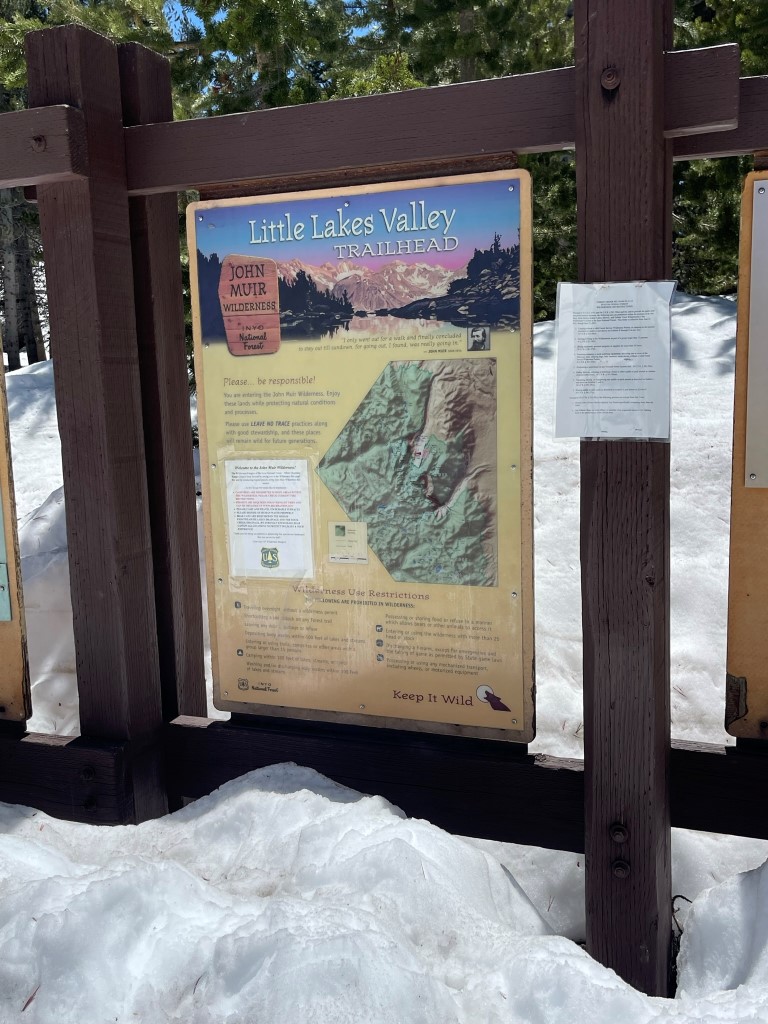
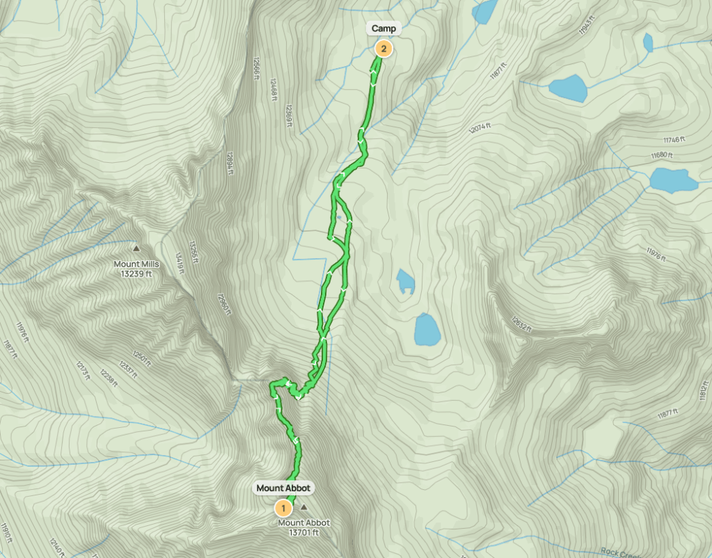
Mount Abbot (13704 ft) and Mount Mills (13451 ft) are 2 peaks located along the Sierra crest near Little Lakes Valley. Marcus and I intended to climb them over a 3 day backpacking trip in early June, even though the conditions more closely resembled mid-winter. We left San Diego early Friday morning and drove 6 hours 20 minutes to Rock Creek Road near Toms Place. The road was gated due to snow about 1.5 miles from the end so we couldn’t make it all the way to the trailhead at Mosquito Flat. We began hiking at 12:25pm from 9880 ft.
We hiked south up the road and reached Mosquito Flat at 1.5 miles.
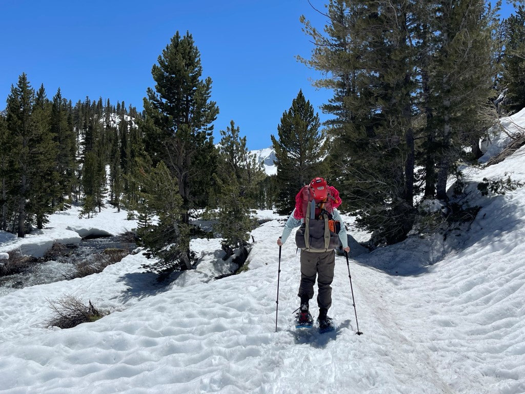
We put on our snowshoes and continued up the Little Lakes Valley Trail. Rock Creek was flowing very swiftly.
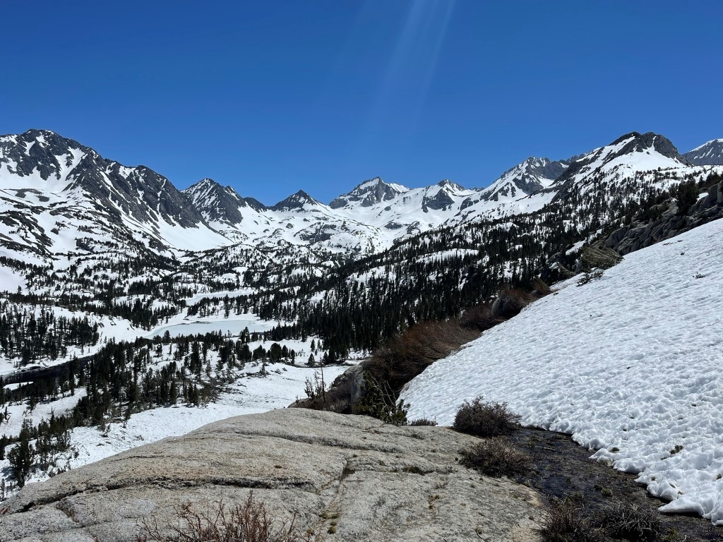
At 2 miles we turned right onto the Ruby Lake Trail. This trail was much less traveled, so it was difficult to follow in the snow. There were a few dry patches on the switchbacks where we had to remove our snowshoes. We had an excellent view of the high peaks in front of us, including Bear Creek Spire (center) and Mount Dade to its right.
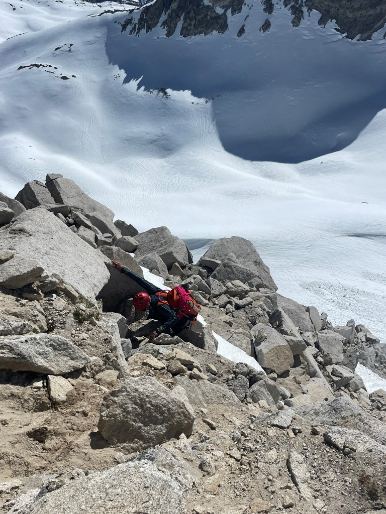
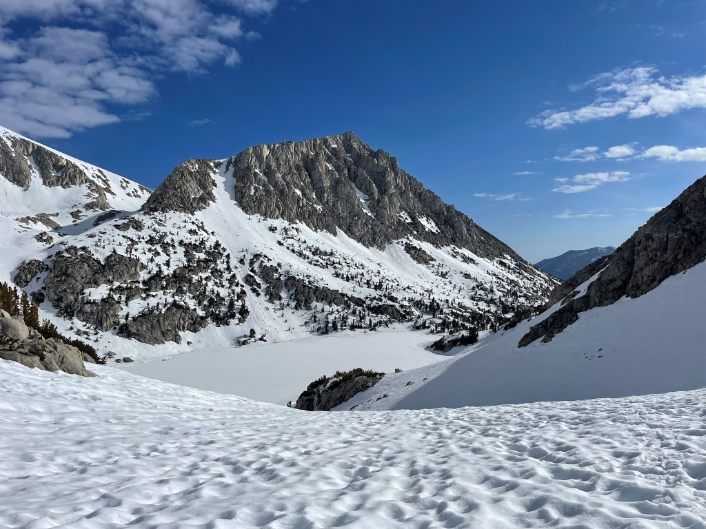
There was one section where we had to climb over a bunch of downed trees. We made it over a steep incline and then reached Ruby Lake at 3.7 miles / 11200 feet.
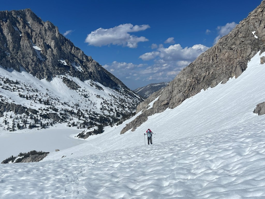
We had to do some steep side-hilling above Ruby Lake. This was tricky with snowshoes, so we removed them and just booted through the soft snow. It was mid-afternoon in the hot sun, so we were post-holing up to our knees in the snow.
Eventually we reached a small crest and Abbot (left) and Mills (right) came into view.

We eventually passed Mills Lake above it to the north. We side-hilled along the drainage and then set up camp at 12000 feet.
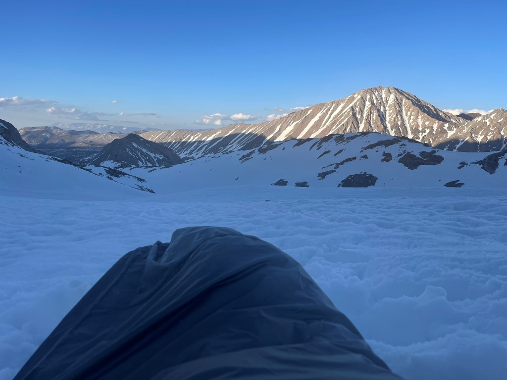
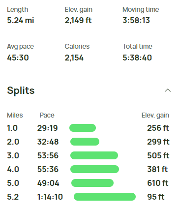
We reached camp at 6:05pm. We spent the evening setting up camp, eating dinner, and melting snow for water. Stats for day 1 were 5.24 miles, 2149 feet elevation gain, and 5:38:40 total time.

Day 2
For day 2 our plan was to climb Mount Abbot’s famous north couloir. We began hiking at 4:15am from 12000 feet.
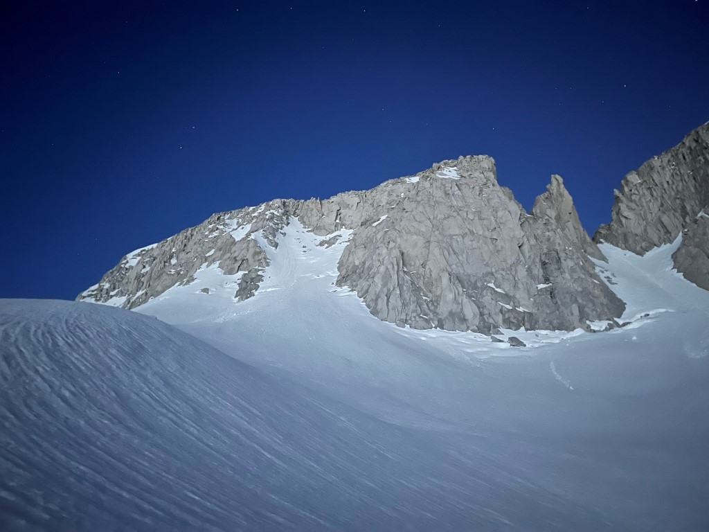
It had dropped below freezing overnight, so the snow was nice and firm in the early morning. We hiked south up the main drainage above Mills Lake and then entered the north couloir.
The snow was absolutely perfect for crampons, so we made very good progress up the couloir. The grade steepened significantly around 12700 feet. At 12900 feet we exited the couloir onto the rock on the right side.

The sun was just rising above Mount Morgan to the east.
The next section was steep and loose as we climbed up to the ridge. There were a few snowfields which we had to avoid or cross which made things more difficult.
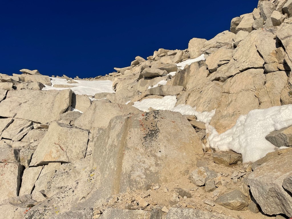
Eventually we reached the ridge.
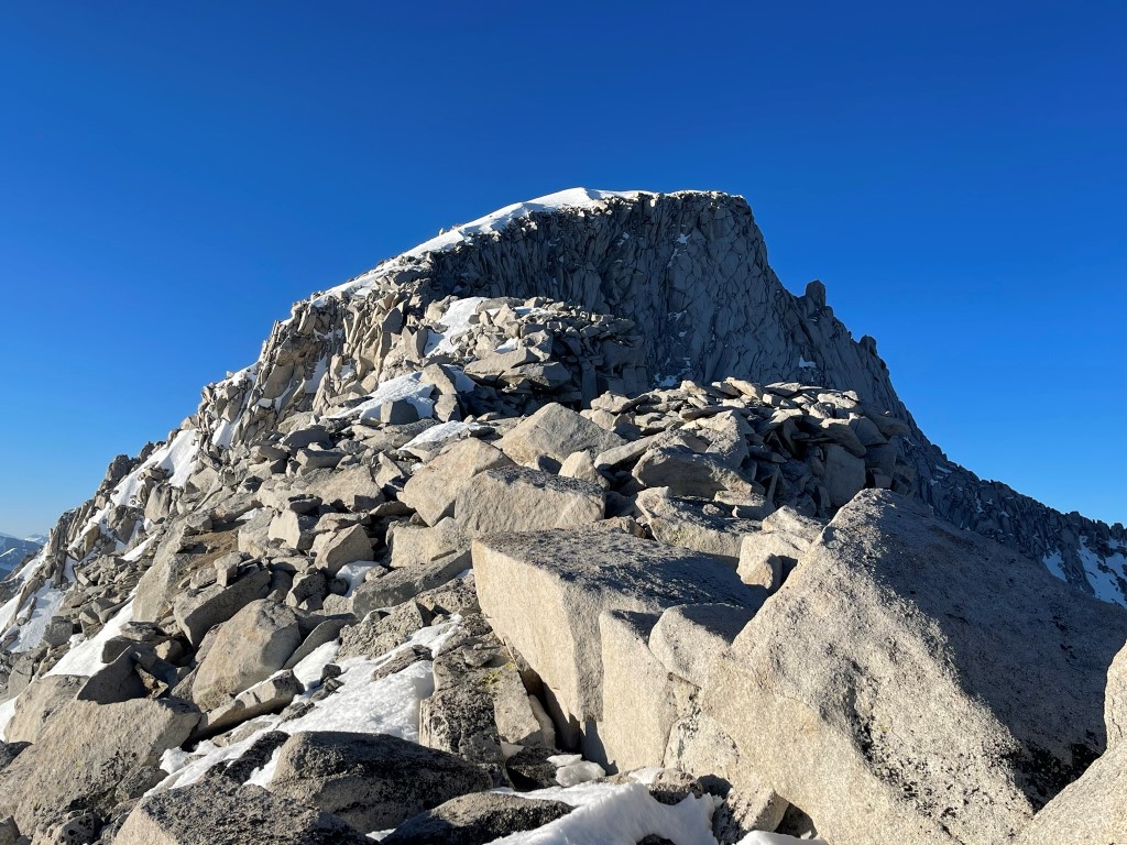
We turned south and walked across an airy section which was actually less scary than we expected. It was always at least a few feet wide and there were no icy sections we needed to cross. We had to drop below the ridge at least once on each side to make progress. The climbing was never more than class 3.
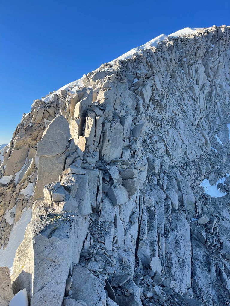
We reached the other side of the narrow section and then put crampons back on to ascend the final snowfield to the summit.
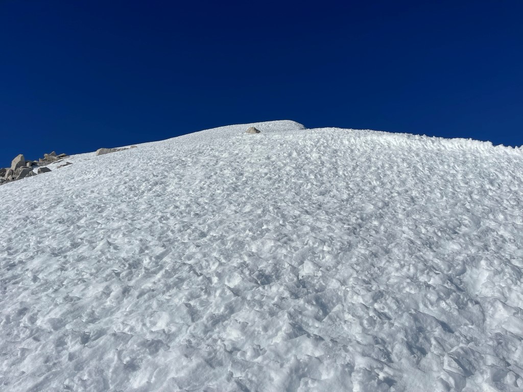
We reached the summit at 7:22am at 1.39 miles!
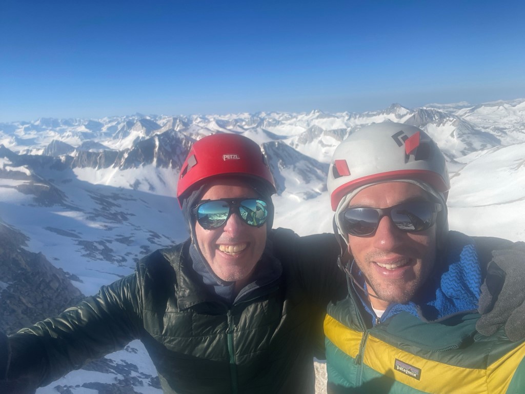
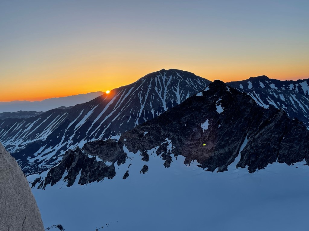
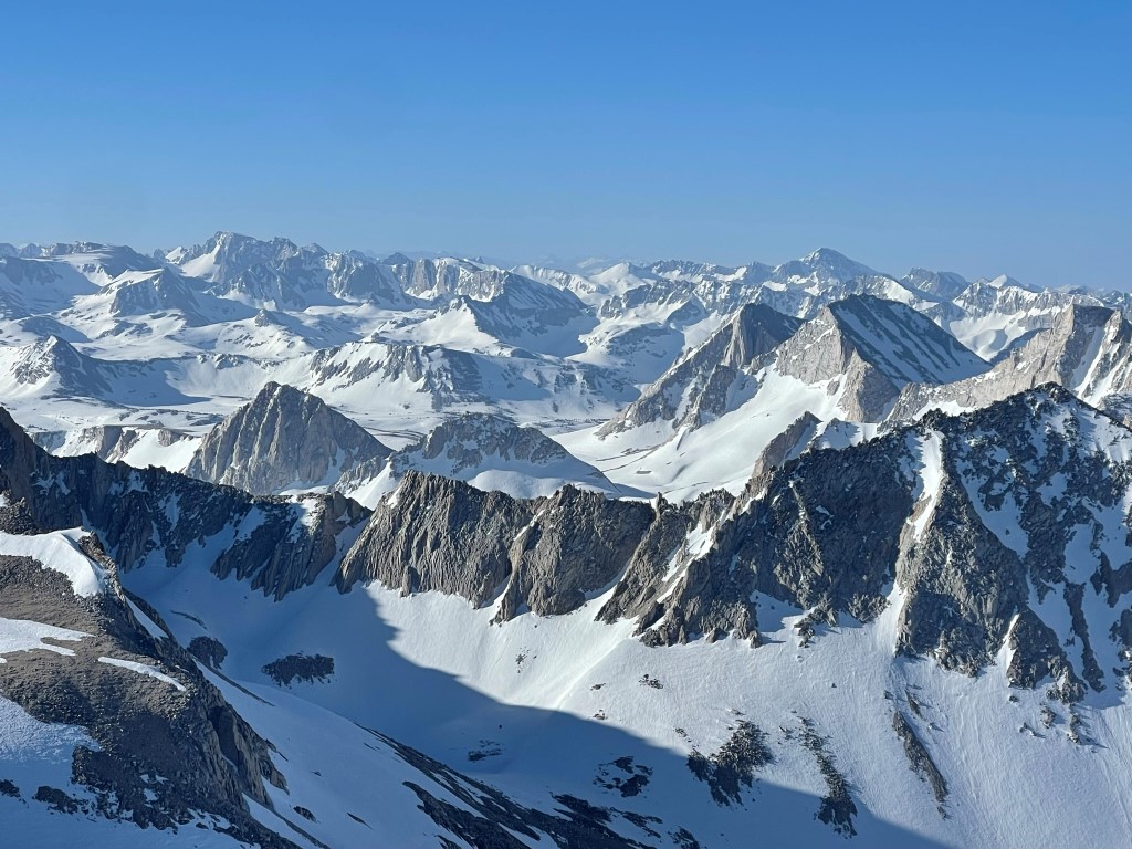
We signed the register which was placed in 2016. The most recent entry was from October 29 the previous year. The views were spectacular. We could see Bear Creek Spire to the southeast with the Palisades in the distance.

Mount Darwin and Mount Goddard to the south:
Mount Gabb to the west:

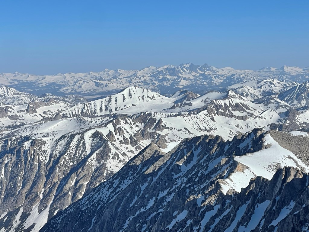
Mount Ritter to the northwest:
We then descended the snowfield and made our way back across the airy ridge.

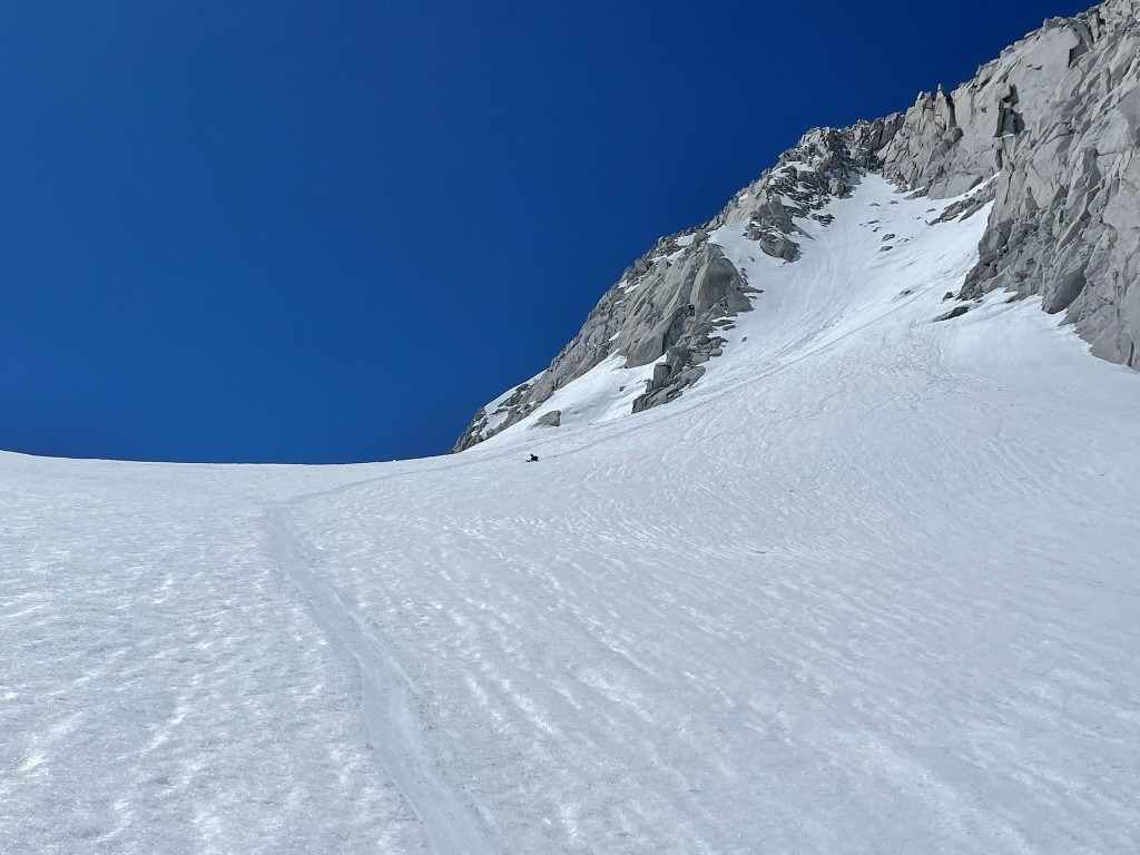
We descended the steep loose section back to the couloir. This was likely the most treacherous section of the day.
We rappelled one section that seemed especially dangerous. We then entered the couloir. It was about 10am and the snow was already dangerously soft and slushy. The top 200 or so feet was the steepest part and we were sinking into our knees with every careful step. We initially descended by hanging onto the adjacent rock for our lives, but then we were able to sort of slide down on our butts while kicking steps in front of us. Once we descended enough, the slope lessened and we were able to glissade down the rest of the way.
From there we post-holed back to camp, which we reached at 11:35am. Marcus realized he had dropped one of his ice axes near the bottom of our glissade, so we snowshoed back there to retrieve it in the afternoon. We spent most of the remainder of the day napping and laying in the sun, which was scorching. We also saw some skiers descending from the col between Abbot and Mills. They had climbed Petit Griffon, which is a rock spire in between the 2 peaks. Stats for day 2 were 2.81 miles, 1670 feet elevation gain, and 7:26:22 total time.

Day 3
The plan for day 3 was to climb Mount Mills via the east couloir. We decided to start an hour earlier than the previous day due to the dangerous snow conditions we encountered on the descent from Abbot. We started hiking at 2:57am from 12000 ft. The full moon lit the way before us.

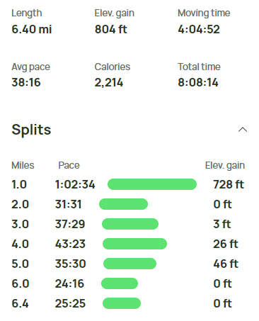
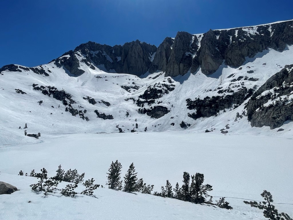
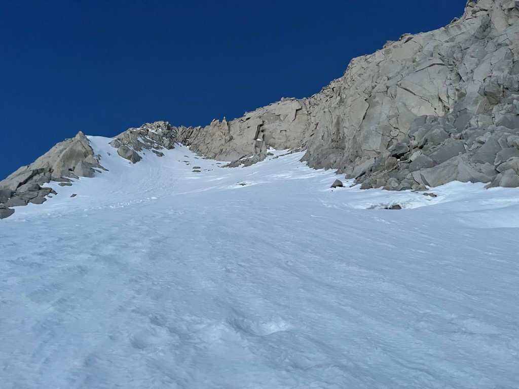
We hiked southwest towards Mount Mills on the crisp snow. We side-hilled along steep terrain and then made our way to the entrance of the couloir. The snow became very steep as we got higher. As we neared the couloir, we hiked up recent avalanche debris which appeared to not have reconsolidated yet. The snow wasn’t firm, and we were punching through pretty regularly. We reached the entrance to the couloir at 12800 feet and debated turning around. I climbed about 20 feet higher and found myself post-holing on very steep terrain which was unnerving. We decided to turn around at this point and descend. We hiked back to camp and napped for a few hours. We then packed up, put our snowshoes on, and hiked back to the trailhead. Ruby Lake is pictured below.
We saw many hikers, skiers, and even some climbers as we neared the trailhead. We reached the car once more at 11:05am. Stats for day 3 were 6.4 miles, 804 feet elevation gain, and 8:08:14 total time.