Day 1
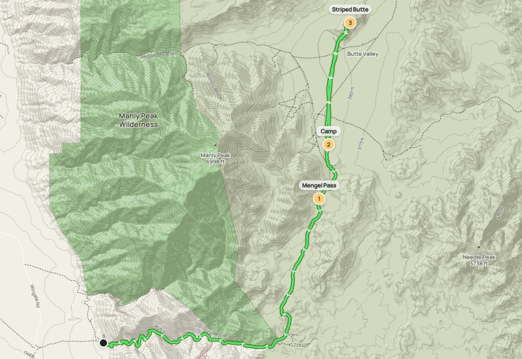
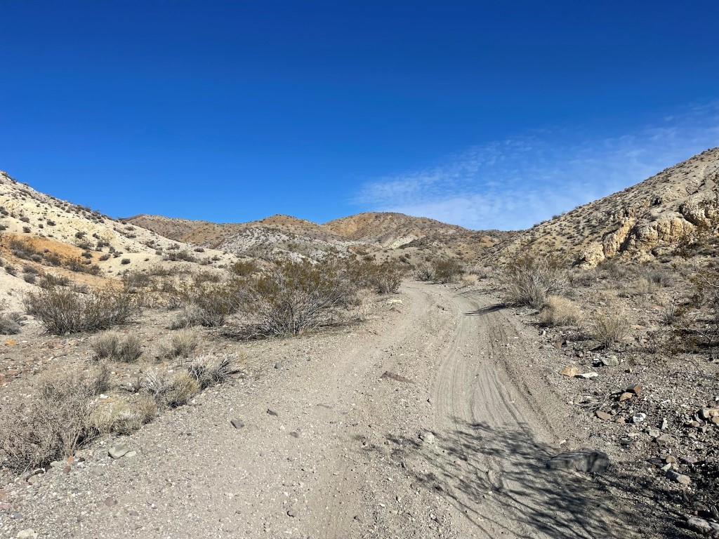
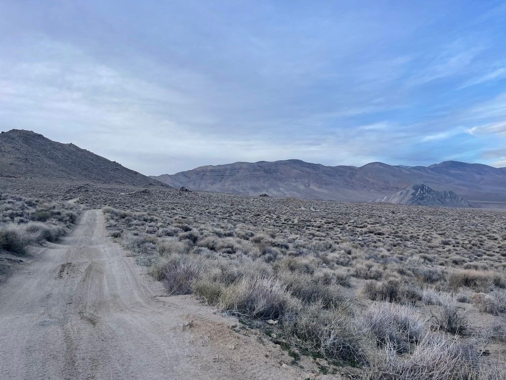
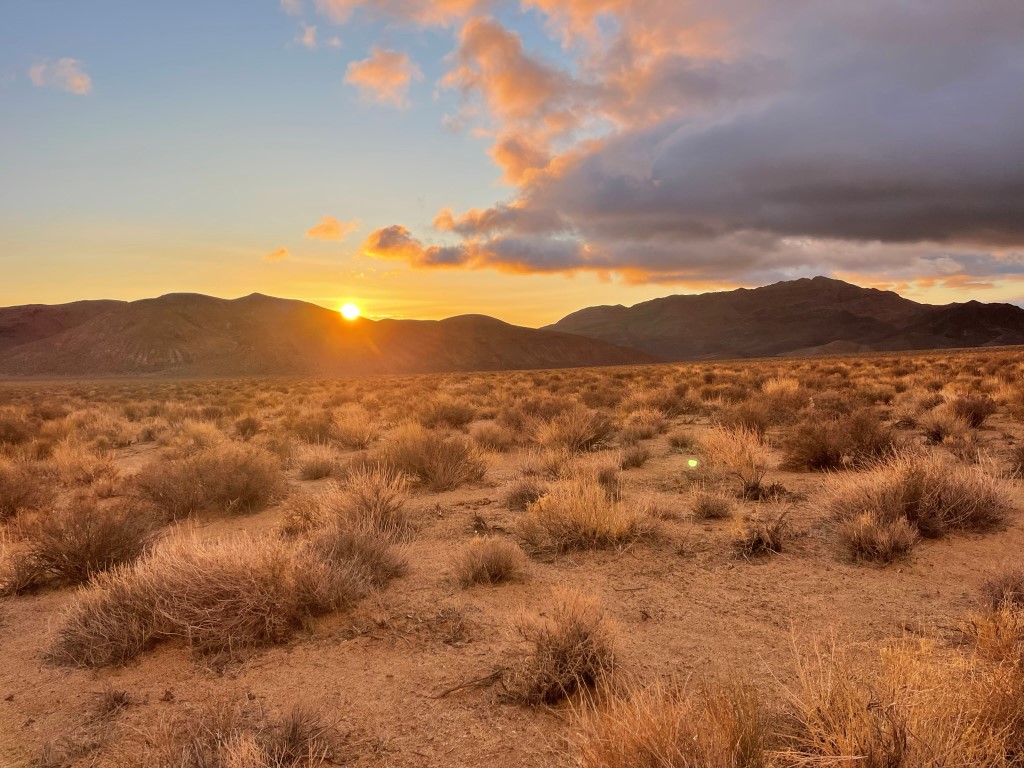
Manly Peak (7195 ft) and Needle Peak (5801 ft) are a pair of DPS peaks in the southern Panamint Mountains of Death Valley National Park. Manly Peak is on the southwest side of Butte Valley, while Needle is on the southeast side. Butte Valley is named for an interesting looking feature on its north end called Striped Butte (4774 ft), which I also planned to climb. Butte Valley is not an easy place to reach, even by Death Valley standards. There are 2 dirt roads that reach the valley, Goler Canyon from the west and Warm Springs Canyon from the east. Both roads are long and require very capable 4WD vehicles. Since I do not possess a Jeep or 4runner, I decided to hike up Goler Canyon and camp 2 nights in Butte Valley. I left San Diego early Friday morning, made a quick stop along the way to climb Red Mountain, and reached the entrance to Goler Canyon around noon. From Trona Wildrose Road, I drove about 4 miles east on Ballarat Road to the ghost town of Ballarat. I then went south on Wingate Road for 15 miles, turned left, and drove about 1.5 miles to the entrance of the canyon and parked. The roads up to my parking spot were in excellent shape and should be passable for most vehicles. I began hiking at 12:16pm from 1569 feet above sea level.
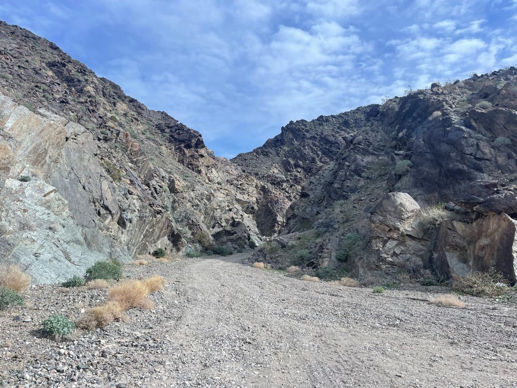
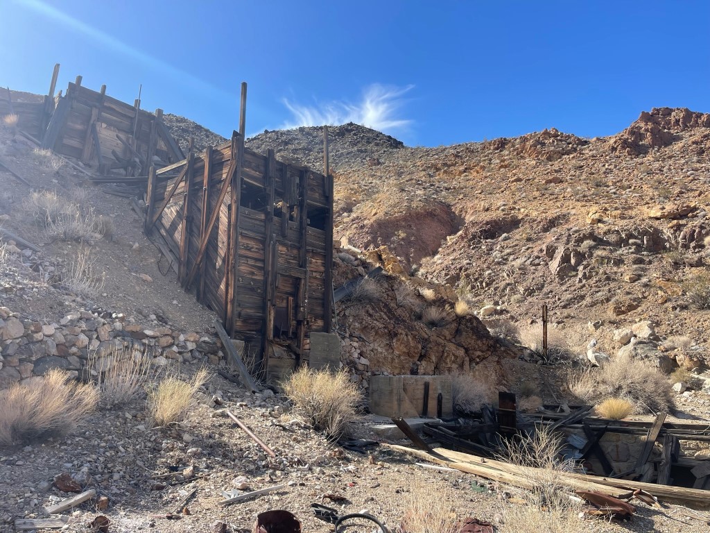
I passed a missing person sign as I walked into the canyon. I wasn’t too excited about hiking 10 miles up a dirt road, but the weather was beautiful, and it felt really good to be hiking again after a few weeks off. I went by many old mining structures.
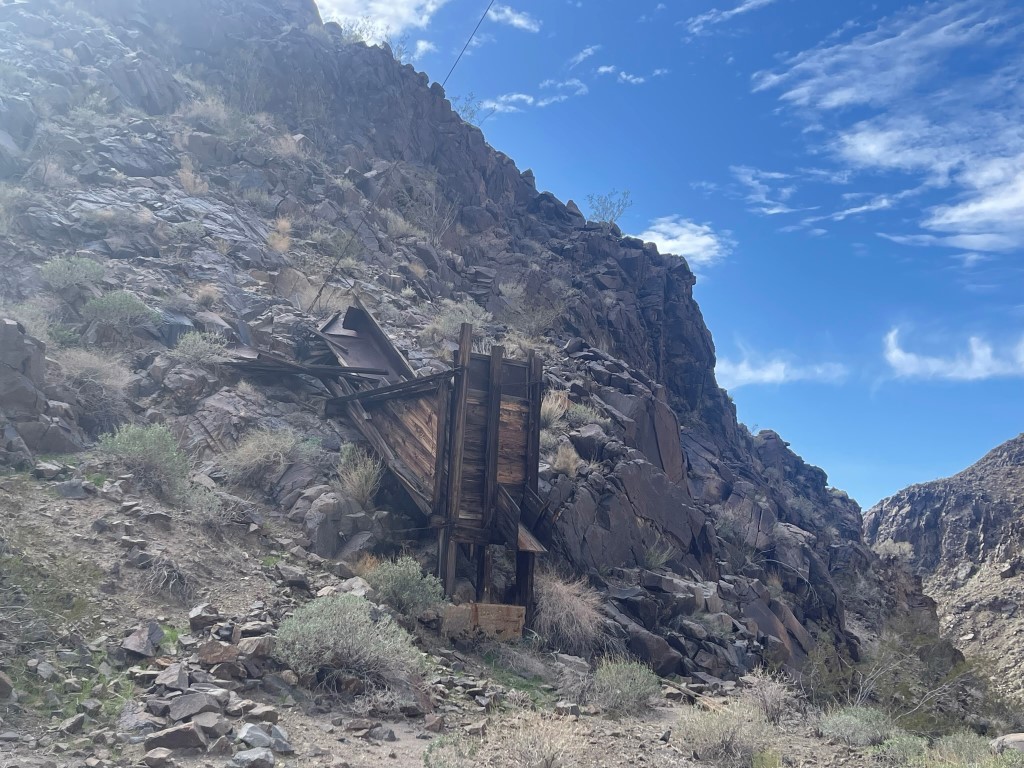
At 2.5 miles I passed the Newman Cabin, one of many historic backcountry cabins in the area. This cabin was located on a short spur road just off the main road.
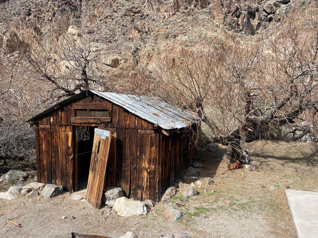
At 3.3 miles I reached the Lotus Mine. Again, this was located along a short spur road.
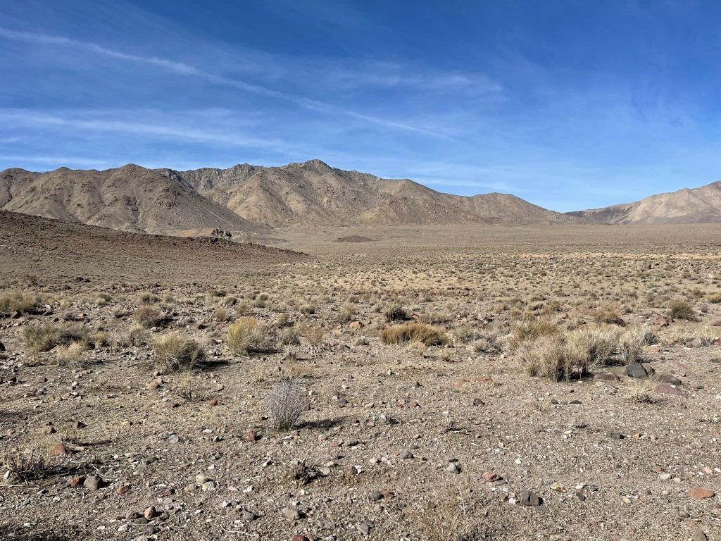
The road was wet in a few places with running water from nearby springs. At 4.9 miles I reached the turnoff for the Barker Ranch. The ranch was located about ¾ mile off the main road, so I decided to skip it. The road turned north at this point and the canyon widened.
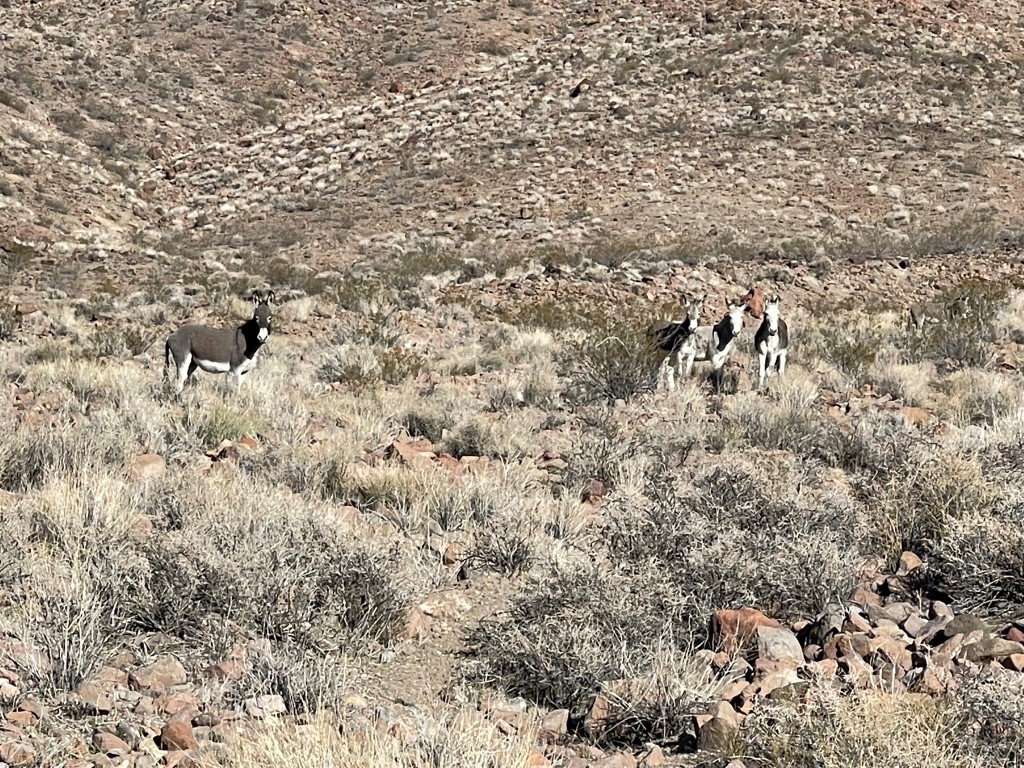
There was a really steep incline in the road a mile or so after the Barker Ranch turnoff. I saw 3 jeeps struggling to get up this part. I then spotted a few burros off to the right.
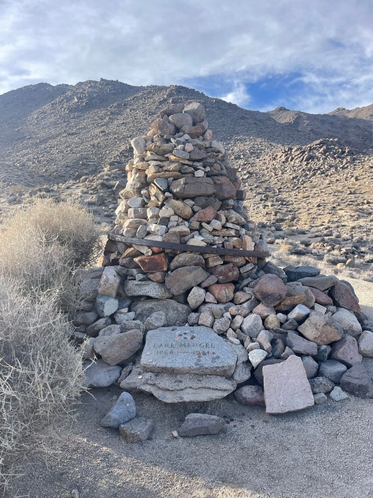
The road became really rocky for the last mile before Mengel Pass. Only the beefiest 4WD vehicles would be able to get up this section. I reached Mengel Pass at 8.2 miles / 4332 feet. There was a cairn and gravestone for Carl Mengel located at the pass.
I decided to climb Peak 4885 quickly before descending the other side of the pass. I turned east, hiked up a steep rough road for a short bit, and then proceeded cross country up gentle terrain to the peak.

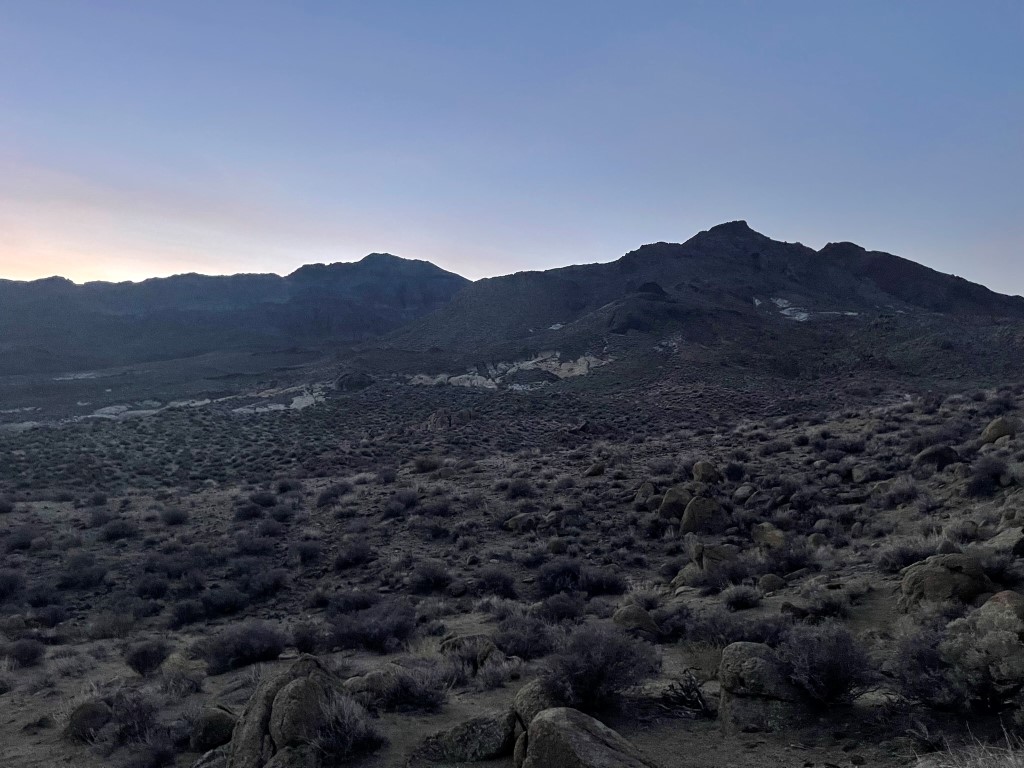
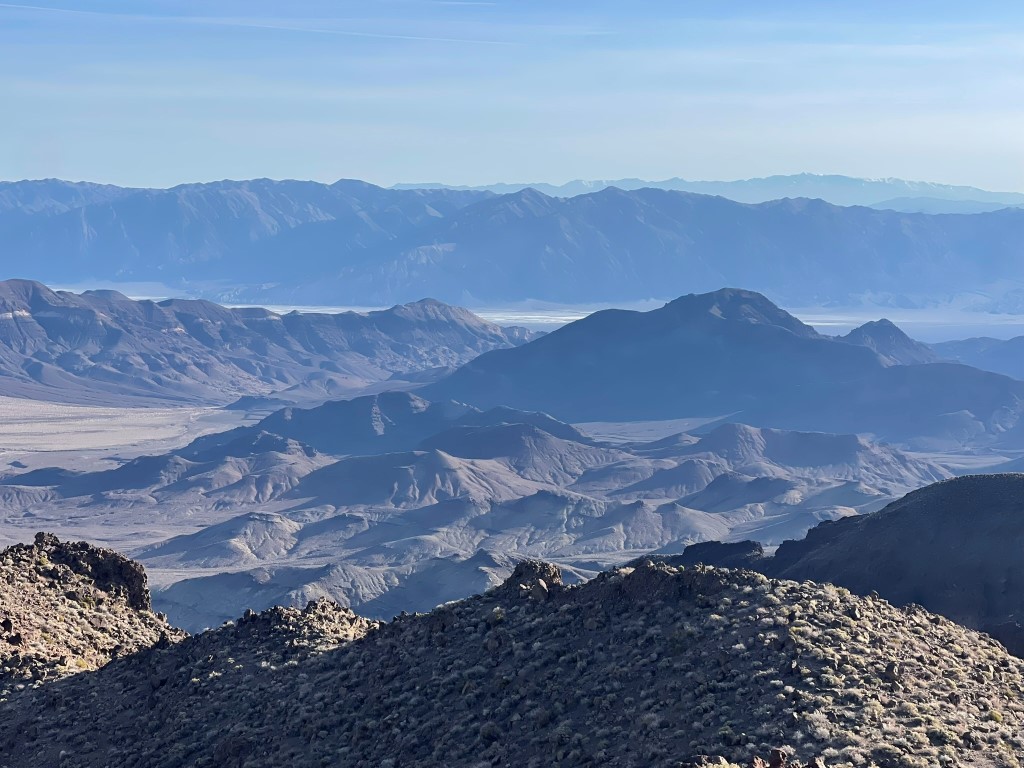
I reached Peak 4885 at 9 miles. I then descended back to Mengel Pass and continued north into Butte Valley. Striped Butte can be seen to the right.
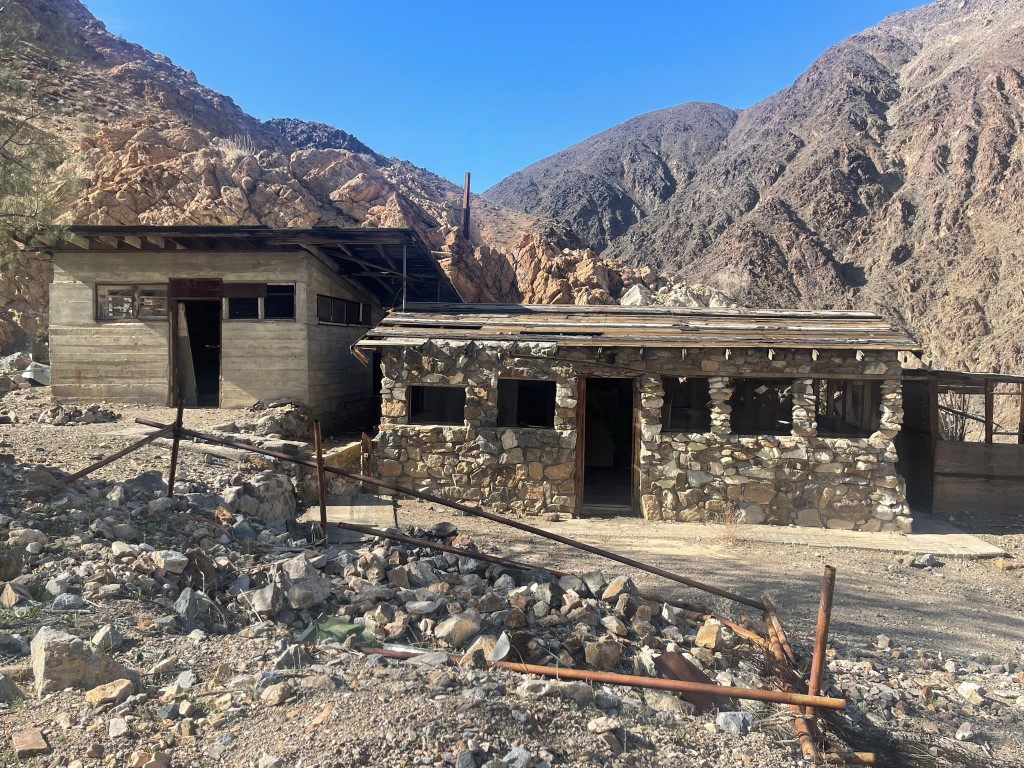
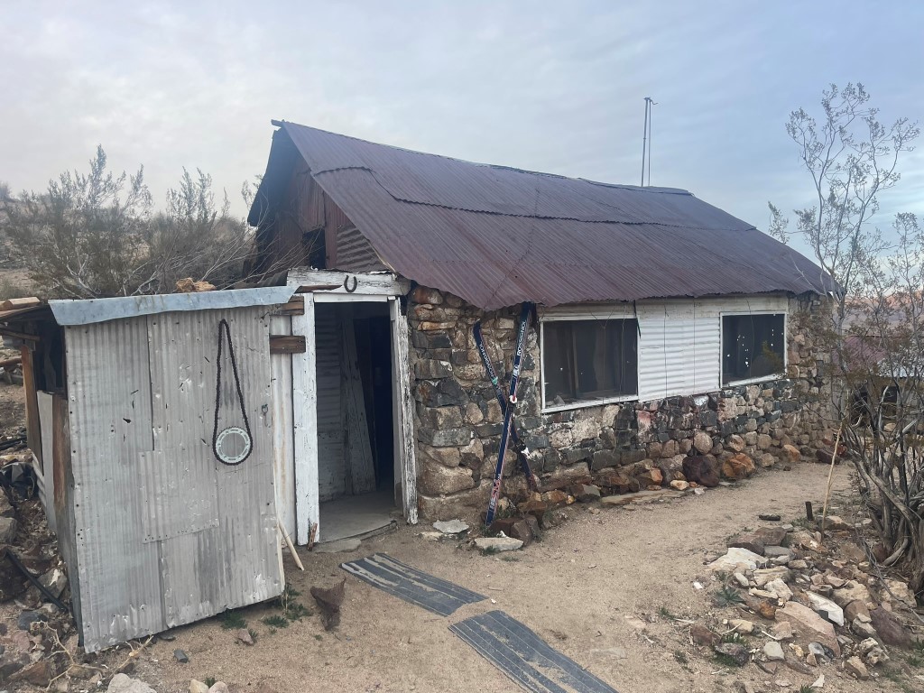
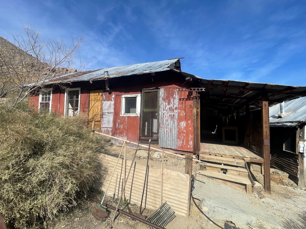
I descended a few hundred feet into the valley and then hiked northwest up a spur road to the Stella-Mengel Cabin. There was a sink inside that had functioning running water from a nearby spring. It came out very slowly (about 3 minutes/liter), but it got the job done.
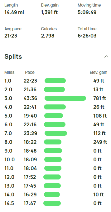
I hiked a short way to the east and set up camp near a random boulder in the middle of the valley. Stats for day 1 were 12.31 miles, 3835 feet elevation gain, and 5:12:26 total time.


Day 2
For day 2 the plan was to climb Needle Peak first, then hike across to the other side of the valley and climb Manly Peak. I wanted to do Manly in the afternoon since I was a little concerned about ice on the summit block. I began hiking at 5:32am from 4017 feet above sea level.
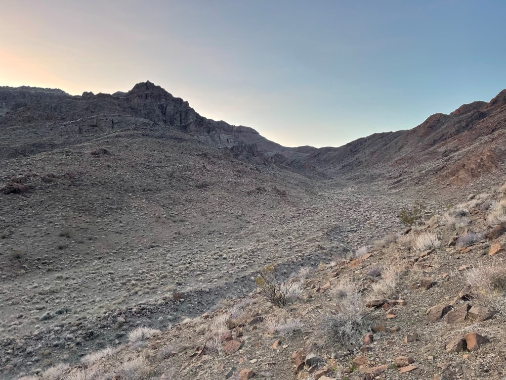
I hiked east across the valley and at 1.4 miles reached Willow Spring, the usual starting point for Needle. I turned south here. Needle is the further peak on the left below.
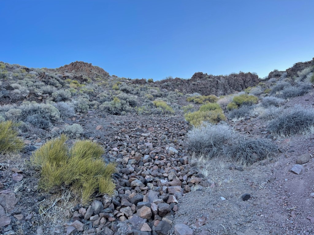
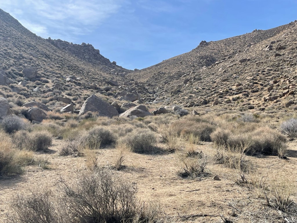
I turned east again and hiked over some rolling terrain. I then turned and hiked southeast up a large wash.
I proceeded up the wash and then turned east again at 4600 feet to climb directly up the peak’s west slope.

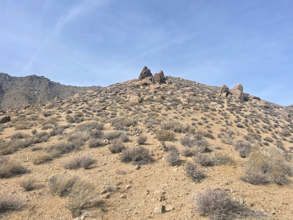
I climbed up the west slope which was steep and very loose in spots. There was a section between 5300 feet and 5500 feet which was so loose it was difficult to make any progress.
I climbed northeast for a short way after the loose section and gained the main summit ridge.

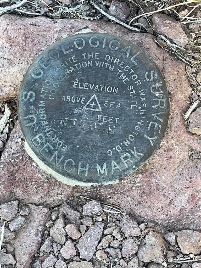
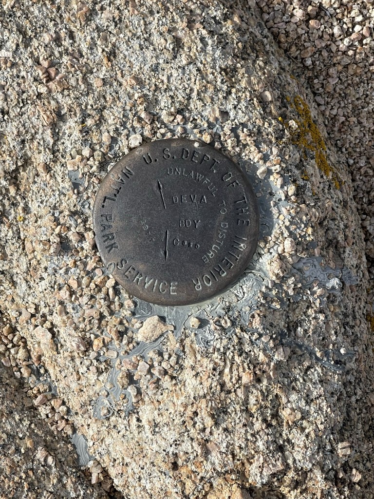
I reached the summit at 8:18am at 4.5 miles! I located the benchmark and 2 reference markers.
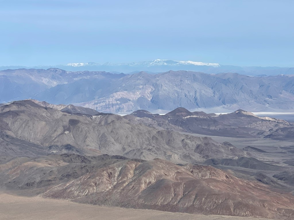
I signed the register which had been placed in 1990. The most recent entry was from the previous April. I knew these peaks weren’t climbed often due to their remoteness, but 10 months between ascents still surprised me. It was a clear sunny day, so the views were perfect. Funeral Peak, Smith Mountain, and Mount Charleston to the northeast:
Kingston, Clark, and Avawatz to the east:

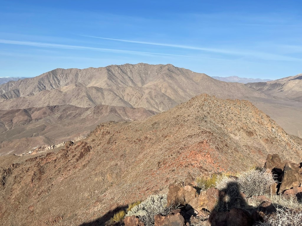
Manly Peak to the west:
I descended the same way I came up. I went slowly down the really loose sections.

Just before I reached Willow Spring, I climbed Peak 4117 really quick. This was about a 300 foot climb in 0.3 mile.

I descended directly west off Peak 4117 and then proceeded across Butte Valley towards Manly Peak.
I passed near my camp but did not stop. On the far side of the valley, I reached Russell Camp, which was just southwest of the Stella-Mengel Cabin I had visited the previous evening. There were 2 sinks with running water here as well, but they were even slower than the sink at the Stella-Mengel Cabin. However, there was an irrigation system outside with water shooting out of a small tube. This was much faster, so I filled up here instead.
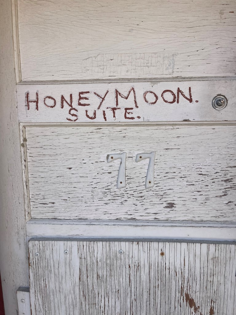
I briefly checked out the honeymoon suite.
I chatted briefly with someone exploring the area in their jeep. I then proceeded up a broad wash southwest of Russell Camp.
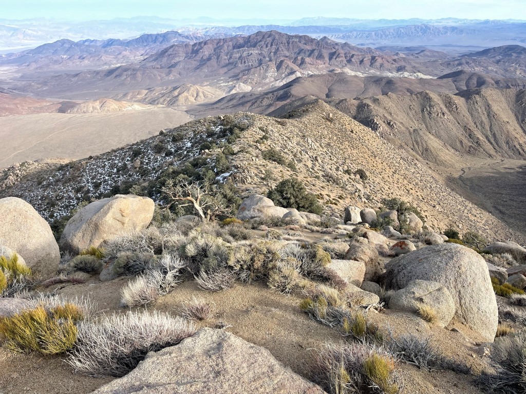
I reached the top of the wash at 10.45 miles / 5066 feet. I then turned northwest onto a ridge.
I followed the ridge upwards for a long ways. I passed by many markers noting the national park boundary. These were accompanied by large metal posts sticking out of the ground.
I made good time up the ridge as it curved to the west. The summit came into view (the point on the left).
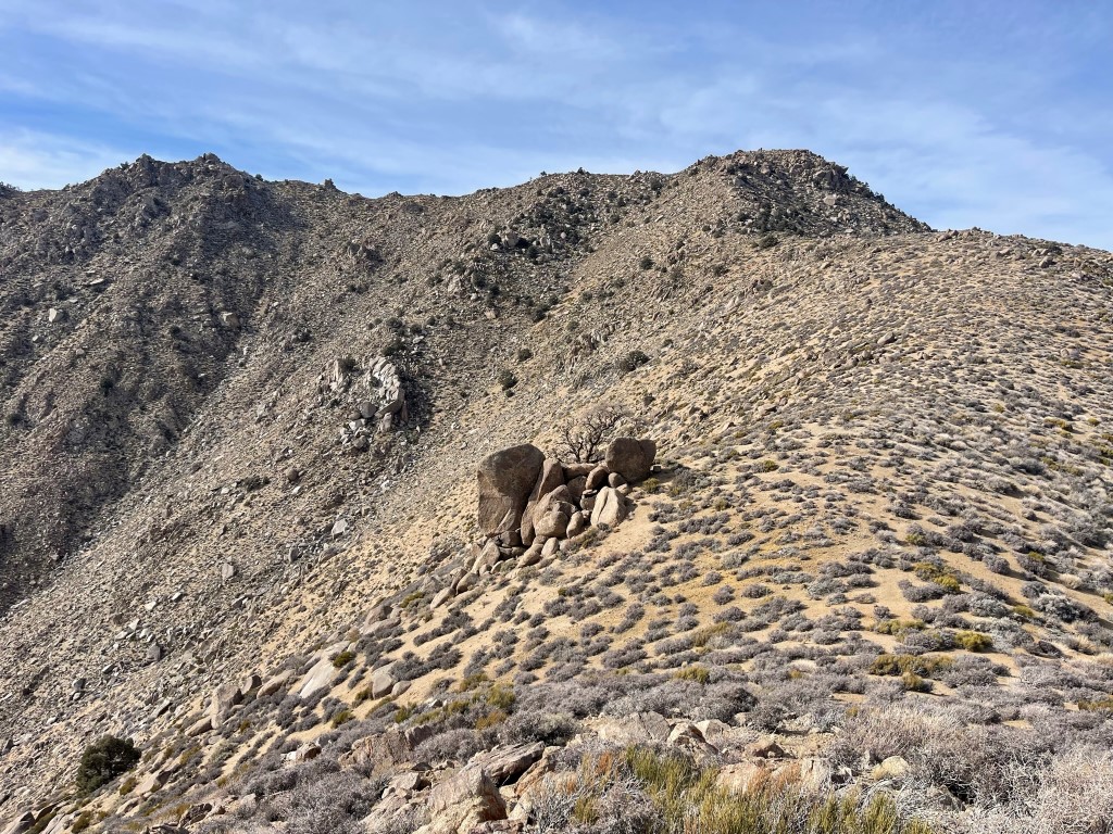
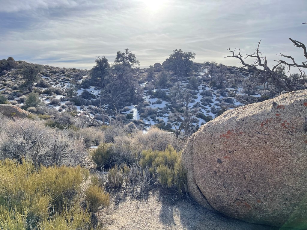
The wind was starting to pick up, so it felt quite cold. At 6500 small patches of snow began to appear, as well as pinion pines which are commonly found at higher elevations in the desert.

I turned south and then climbed up the final icy slope to the summit.

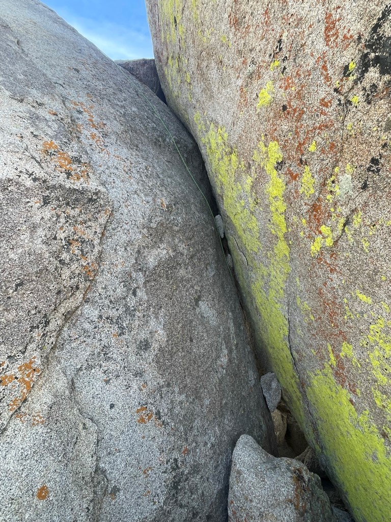
I reached the base of the summit block, which has 3 options to climb it:
1) Left: climb up a separate boulder and then make a “leap of faith” onto the summit block. The landing area is steep and smooth, so this option seemed insane to me.
2) Middle: climb up a smaller detached boulder, step across onto the face of the summit block, and climb from there.
3) Right: climb the chimney between the summit block and adjacent large boulder.
I investigated all 3 options and opted to do the chimney route. There was a fixed rope in place which I didn’t use, but I did wear rock climbing shoes. I leaned against the boulder on the right and stepped up onto the summit block on the left until I was where the rope was anchored.
From there, I climbed along a narrow ledge to the summit. I reached the top at 2:19pm at 12.4 miles!

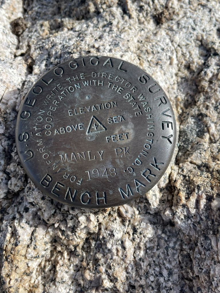
I located a benchmark on the highest rock.
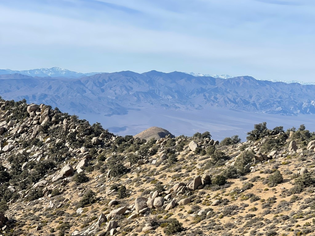
The views of course were spectacular. To the north was the rest of the Panamint Mountains, including Telescope Peak:

To the west was Maturango Peak with the Sierra visible behind it. Olancha Peak clearly stood out on the left:
Charleston Peak in Nevada to the east:
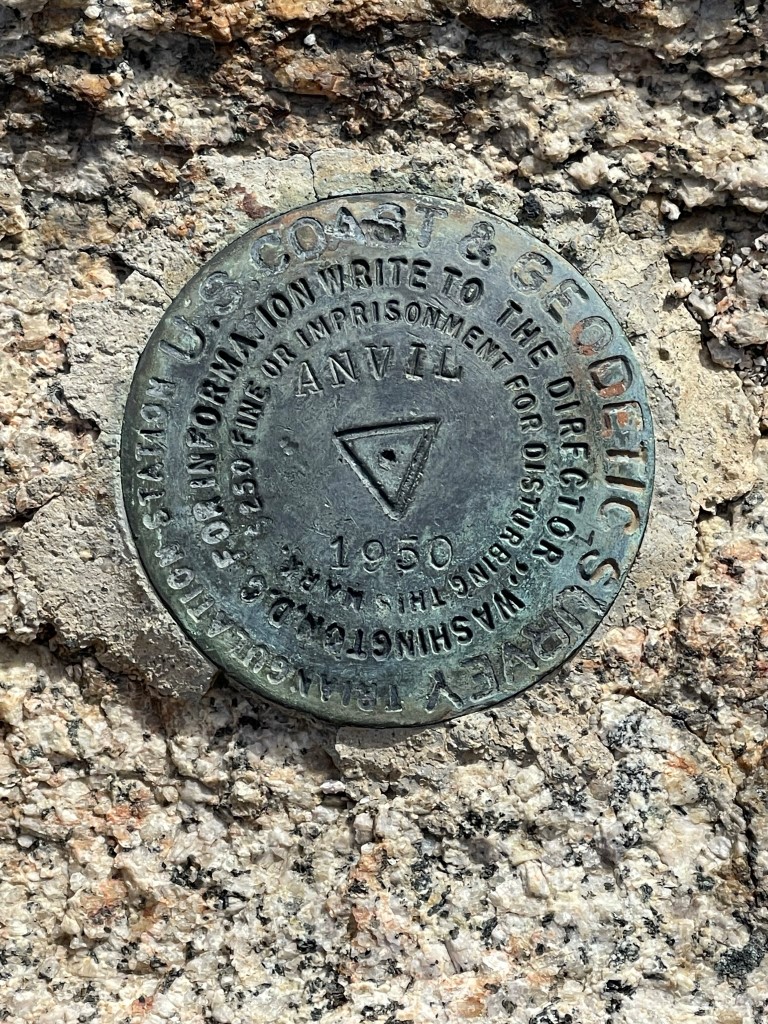
I didn’t feel comfortable reversing the moves on the chimney route (without the rope at least), so I chose to climb down the middle route. I scooched down the rock face on my butt using my shoes as friction and then stepped over onto the detached rock. Climbing shoes were crucial for this move. Once back on the ground I signed the register which had been placed in 1996. Similar to Needle, the previous entry was from last April. After I was done with that, I hiked over to Anvil Benchmark a short distance to the southwest.
I descended to a minor saddle and then hiked up to a pile of boulders where I found the benchmark and 2 reference markers.
After that I hiked back over to Manly and then descended the ridge.
I reached the saddle at the top of the wash at 14.9 miles and decided to climb Peak 5449. I climbed southeast up some large boulders and went through a cool rock window.

From there I side-hilled around to the south and hiked up the ridge to the summit.

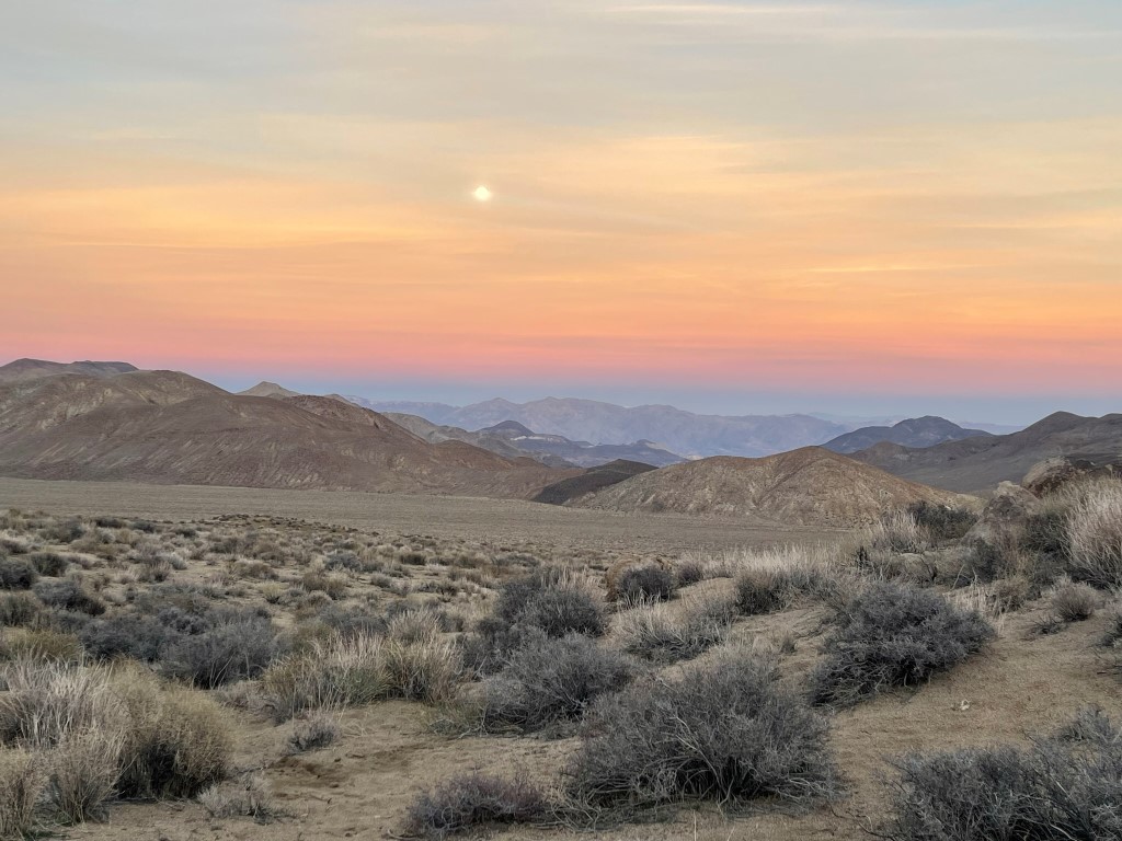
I reached the summit at 4:45pm at 16 miles. I then climbed down back to the saddle and descended to Russell Camp. I refilled my water and then made it back to camp at 5:24pm. I took this cool picture of the full moon rising in the fading daylight:
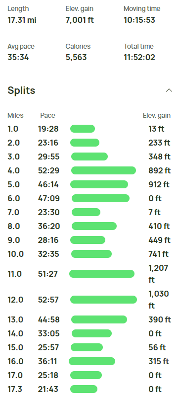
Stats for day 2 were 17.31 miles, 7001 feet elevation gain, and 11:52:02 total time.
Day 3
For day 3 my plan was to climb Striped Butte and then hike out to the car. I began hiking at 4:59am from 4017 feet above sea level by the light of the full moon.
Striped Butte is at the northern end of the valley, so it was another long walk to get to the base of it.

I reached the base of the peak around 2 miles. From there it was a simple class 2 climb for about 700 feet to the summit.

I reached the summit at 6:15am at 2.52 miles! I signed the register which had been placed in 2014. The most recent entry was from January 21 (this peak receives many more visitors than Manly and Needle). The Panamints, including Manly, were covered in a thick cloud layer.

Needle Peak:

The wind was insane, so I didn’t stay too long on the summit. I descended back to the valley and hiked south to my camp as the sun rose above the mountains to the east.
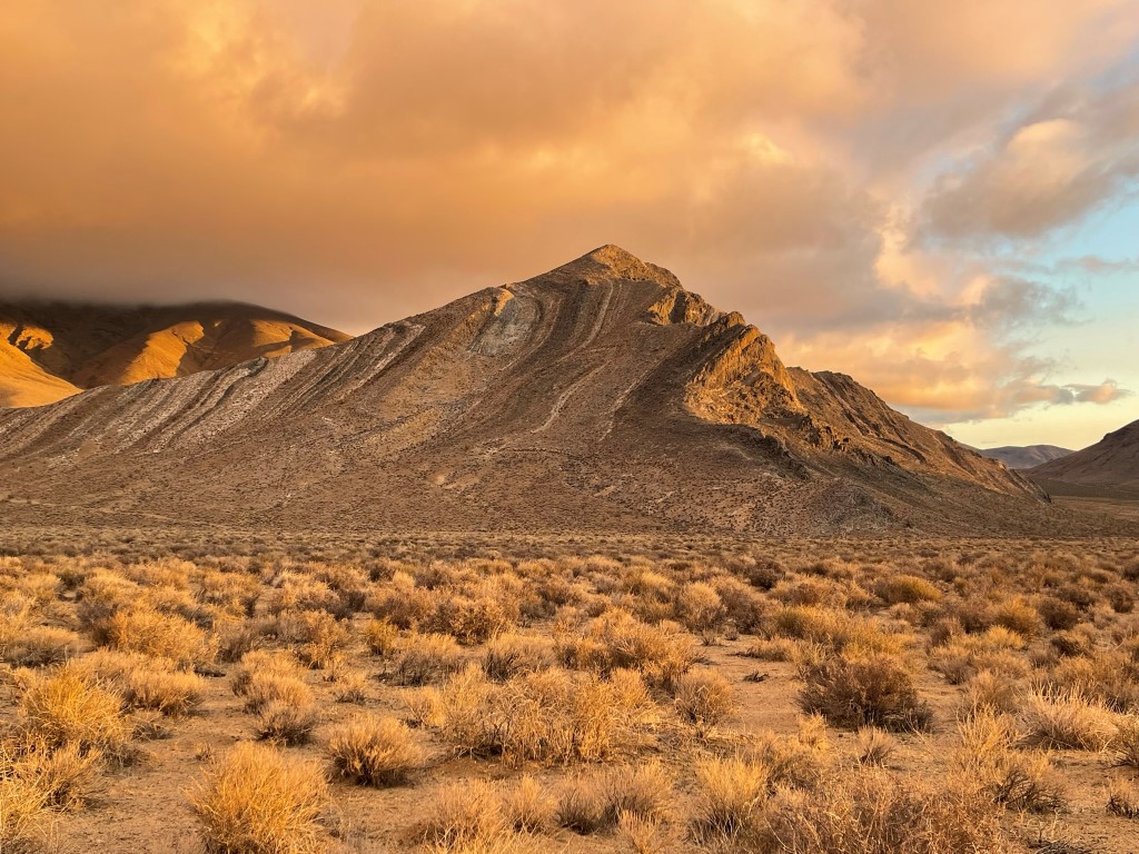
Striped Butte looked impressive in the daylight:
I made it back to camp at 5.1 miles. I packed up my gear, got back on the road, and hiked out back down Goler Canyon. I reached the car at 11:24am. Stats for day 3 were 14.49 miles, 1391 feet elevation gain, and 6:26:03 total time.