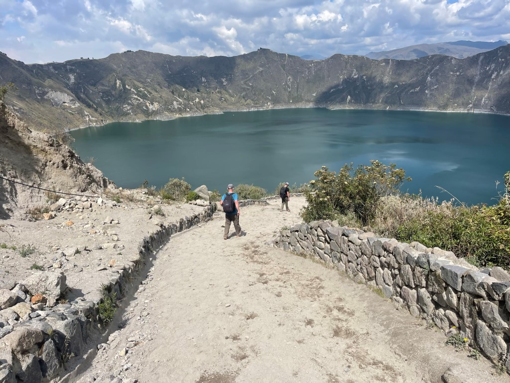
Quilotoa is a collapsed volcano in Ecuador a few hours SSW of Quito. The caldera is filled with water, giving it a very similar appearance to Crater Lake in Oregon. It is a popular tourist destination in Ecuador and was where we spent one of our rest days during our 2 week stay in the country. We drove a few hours from our hostel in Machachi and paid the $2 entrance fee. We were immediately treated to an excellent view of the lake.
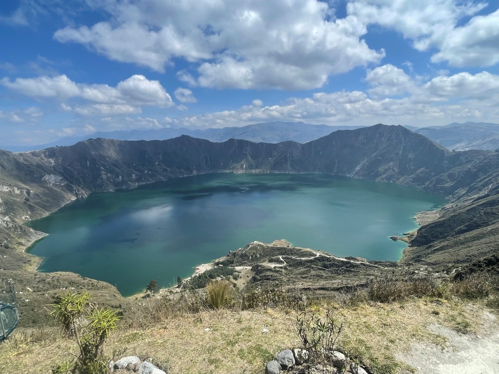
The view was extremely similar to Oregon’s Crater Lake, except smaller. There was also no island in the middle and no pine trees on the rim. I wanted to include a picture from one of my trips to Oregon’s Crater Lake for comparison, but both times I visited the lake was hidden behind thick clouds of smoke from nearby wildfires. Anyway, Marcus, Garret, and I decided to make the 6.5 mile hike around the lake while Dan and Thomas rested. We set off to the east to begin a counterclockwise loop around the lake. We began hiking at 10:42am from 12712 feet above sea level.
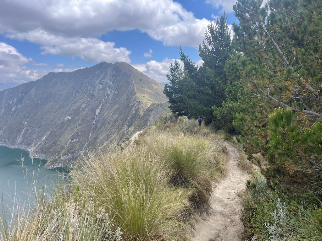
One of the local dogs started following us and actually ended up hiking with us the entire way. We stopped at a few more viewpoints.
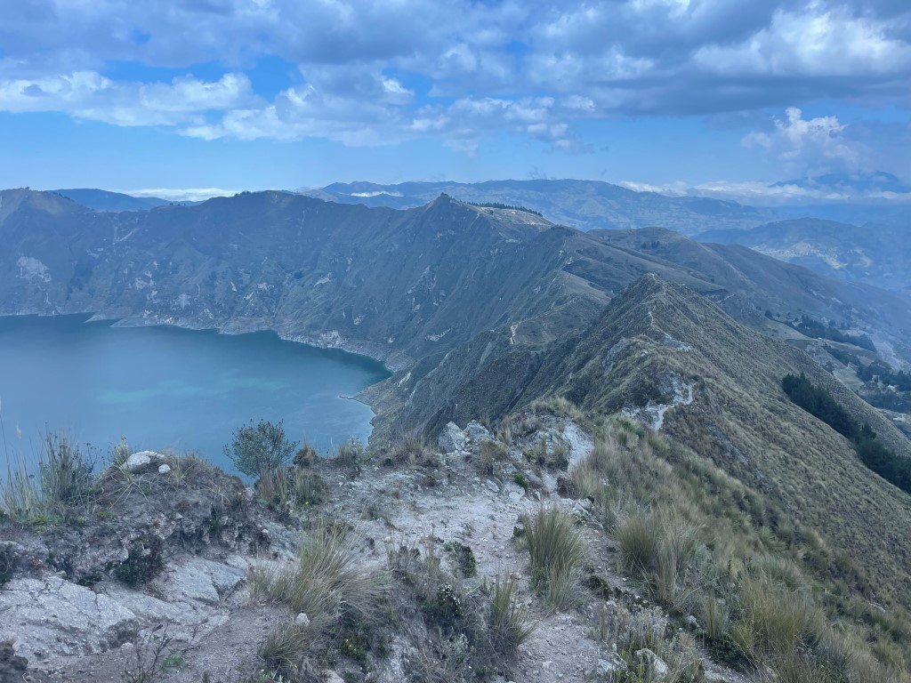
There were many ups and downs along the crater rim.

It was a steep climb to the crater rim high point.

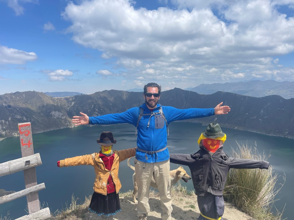
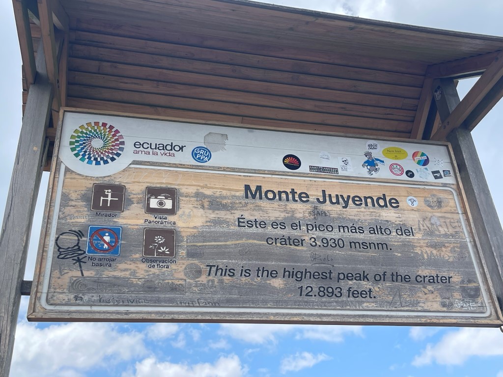
At 11:47am we reached the crater rim high point, also known as Monte Juyende (12844 feet). We were about 1/3 of the way around the lake (2.2 miles).
The view was excellent.

We gave our canine friend a few well-earned snacks.

We continued our loop around the lake. There were a decent number of other hikers out, plus some other dogs too.
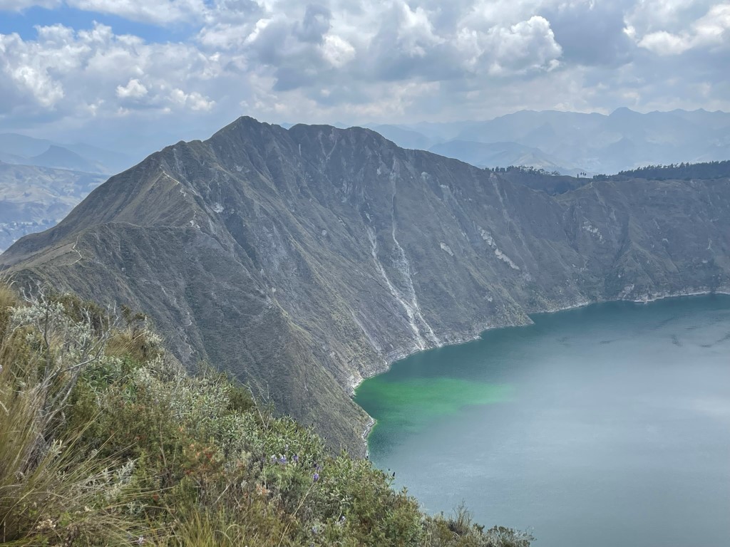
At 3.5 miles we reached another point along the rim called Quilotoa Peak on Peakbagger. The elevation is listed on Peakbagger as 12841 feet which would make it only 3 feet lower than Monte Juyende, but we estimated the elevation to be closer to 12600 feet. We were about halfway around the lake at this point. Looking back on Monte Juyende:
We pressed on after a short break. We stopped at a couple more viewpoints but otherwise made good time. Towards the end of the loop, the trail split and we ended up below the rim on a pretty rough trail. We ran into a local who tried to get us to pay him to guide us back to the top. We declined his services and made our way back onto the rim eventually.

We reached our starting point at 6.3 miles. It was 1:47pm so we decided we still had time to hike down to the shore. We hiked down the steep trail which drops over 1000 feet in just over a mile.
We reached the shore at 2:20pm at 7.4 miles. There was a dock to rent kayaks and also a small convenience store. We found out later that Thomas had actually done some kayaking earlier in the day while we were still on the rim trail.

You can rent horses if you don’t feel like hiking back up, but we of course decided to hike up on our own. We reached the parking lot at 3:20pm. Stats for this hike were 8.62 miles, 3829 feet elevation gain, and 4:41:05 total time.


