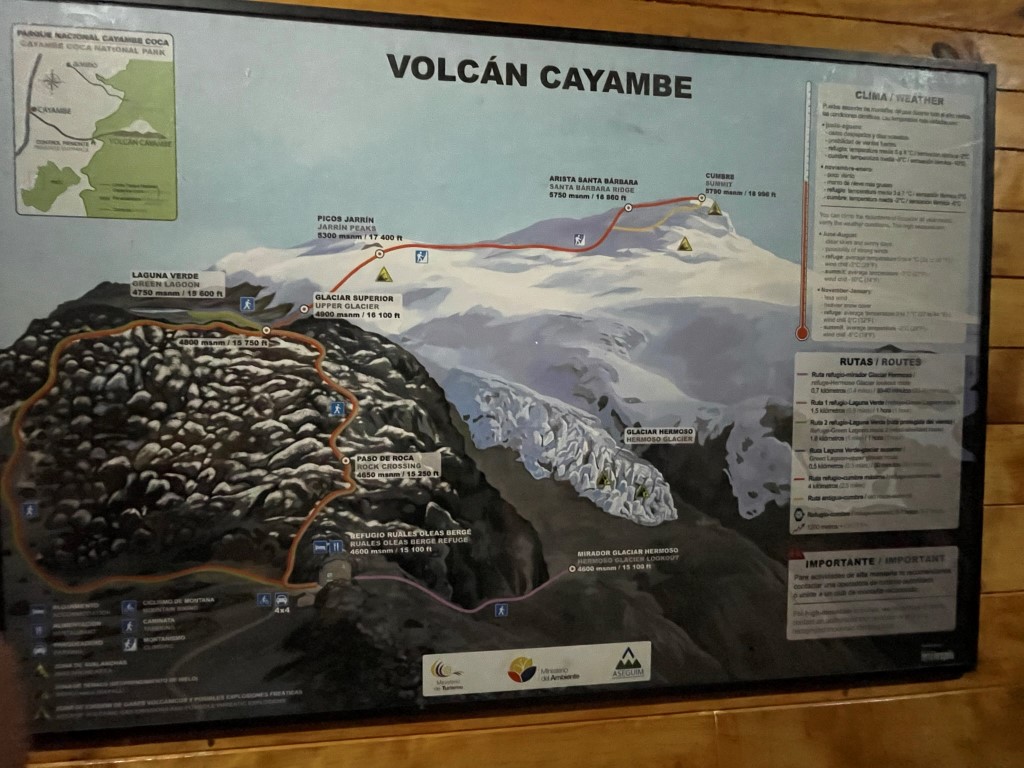
At 18996 feet, Cayambe is the 3rd highest volcano in Ecuador. It has 6808 feet of prominence and is located northeast of Quito. We were a week and a half into our trip to Ecuador and were finally ready to make an attempt on one of the big peaks. We had hoped to do Cayambe earlier in the week but had to push it back a few days due to weather. We left our hostel in Machachi around 11am and made the long 3 hour drive to the small town of Cayambe on the western slope of the volcano. We had lunch at a nice café in town and then loaded up into the 2 trucks for the long dirt road drive to the refugio. We entered Cayambe Coca National Park as the trucks made very slow progress up the rough roads. We made it to about 13500 feet where we found the road to be closed. It seemed that the recent storms had severely damaged the road, so they weren’t letting anyone through. We were not expecting to do any hiking this day, but it was nice to get out and stretch the legs a little. We put on our mountaineering boots and trudged up the road through the mud.
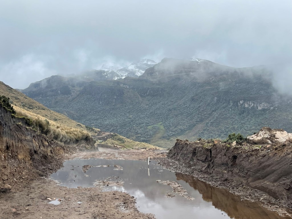
The guides told us it would only take 30 minutes which seemed impossible given that we were still 1500 feet below the refugio. However, after walking about a mile up the road, we discovered that it was only this short section of road which was closed. A group in front of us got picked up by a truck and took off towards the refugio. Our guide wasn’t very helpful in explaining the situation. We waited for 20 or so minutes for the truck to come back. We tried to clean the mud off of our boots as best we could in the meantime. We then piled into the truck and drove the remaining couple miles to the refugio located at 15200 feet.
The refugio was much nicer than we expected. The building we were in contained 3 rows of 5 beds. It even had an indoor bathroom and electric lighting. We went to a separate building and were fed a delicious meal of fish and potato soup. There were many other groups there preparing for summit bids that night.
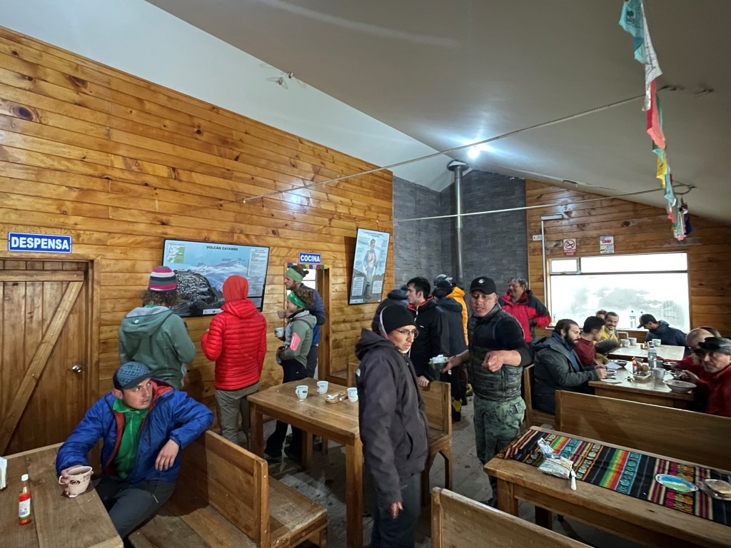
We went to bed shortly after dinner to try to get as much sleep as possible. I managed a couple hours of sleep, but we were woken up a couple times by our other guide arriving later that evening and another group getting ready before we were up.
We woke around 12am, dressed, and got our gear together.

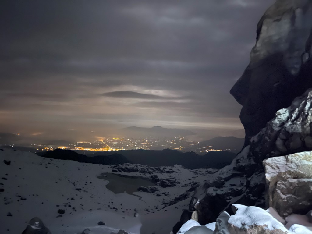
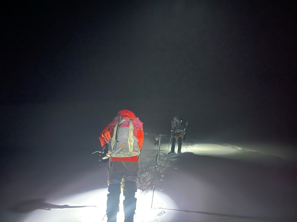
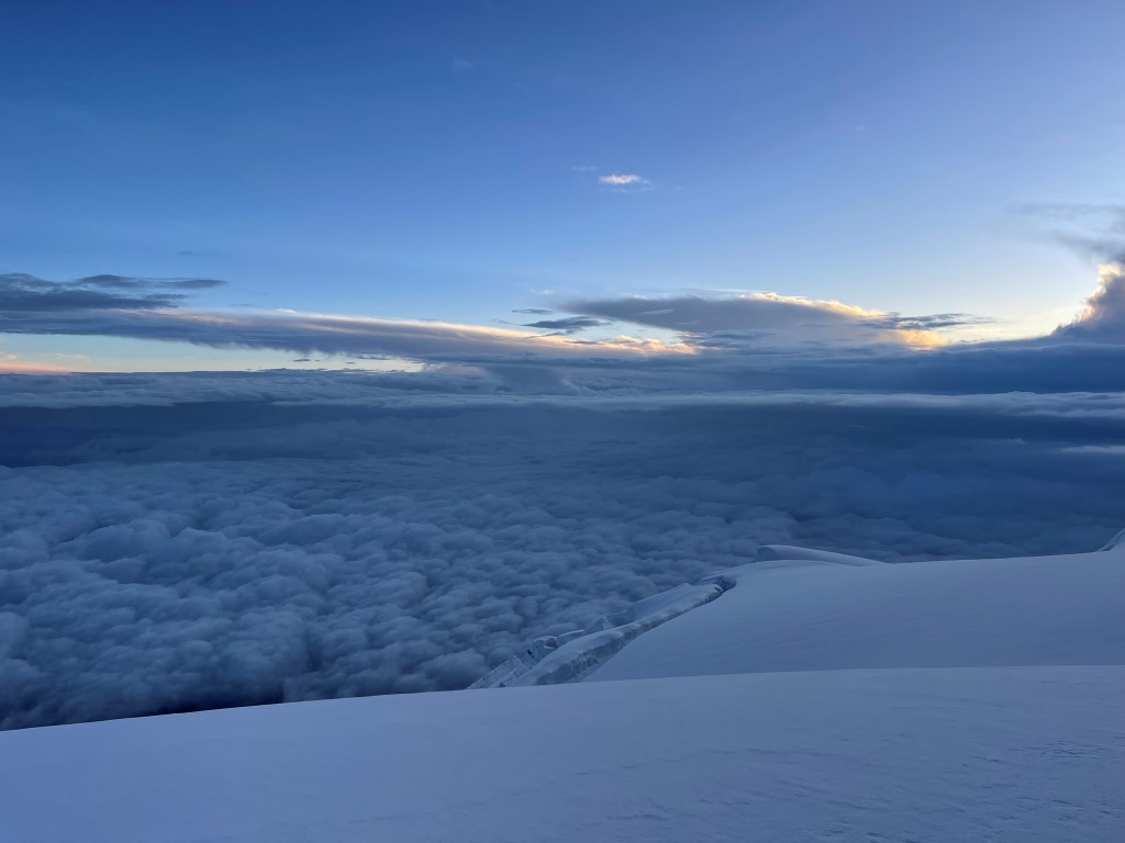
We began hiking at 1:18am. We did not rope up or put crampons on initially since it was about 1000 feet of climbing before reaching the glacier. We hiked up a path through the rocks which were covered in a few inches of fresh snow. The temperature was comfortable and there was little wind. The skies were cloudy, and it was lightly snowing. We could look back and see the lights down below.
We reached the top of the rocks and proceeded through the snow.

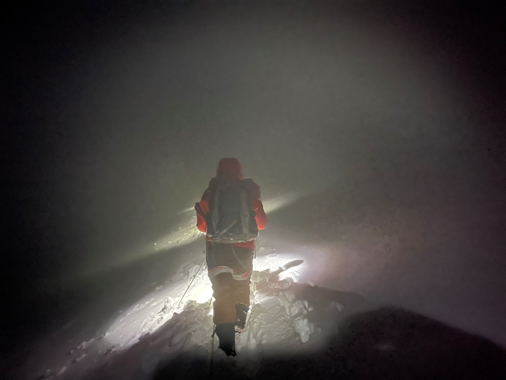
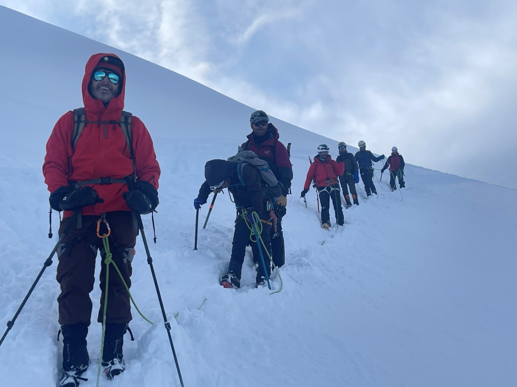
At 16000 feet we reached the foot of the glacier. We took a break to put crampons on and rope up. I was on a rope team with Marcus and Daniel (one of the guides). We had 3 guides total so 3 rope teams – 2 teams of 3 and a team of 2 for 8 climbers total.

We began the long steady climb up the glacier.
We got into a good rhythm and made steady progress. We began to pass a few groups that had started before us.
The glacier was covered in 6 inches or so of fresh snow from the storm a few days prior. It was easy to follow the boot path through the snow. I didn’t even feel like crampons were necessary, especially since the slope of the mountain never seemed very steep. We eventually caught up to the groups in front once we were above 18000 feet. We slowed down considerably here since the first group was breaking trail through the fresh snow. It seemed that this was the first day anyone was up here after the recent storm.
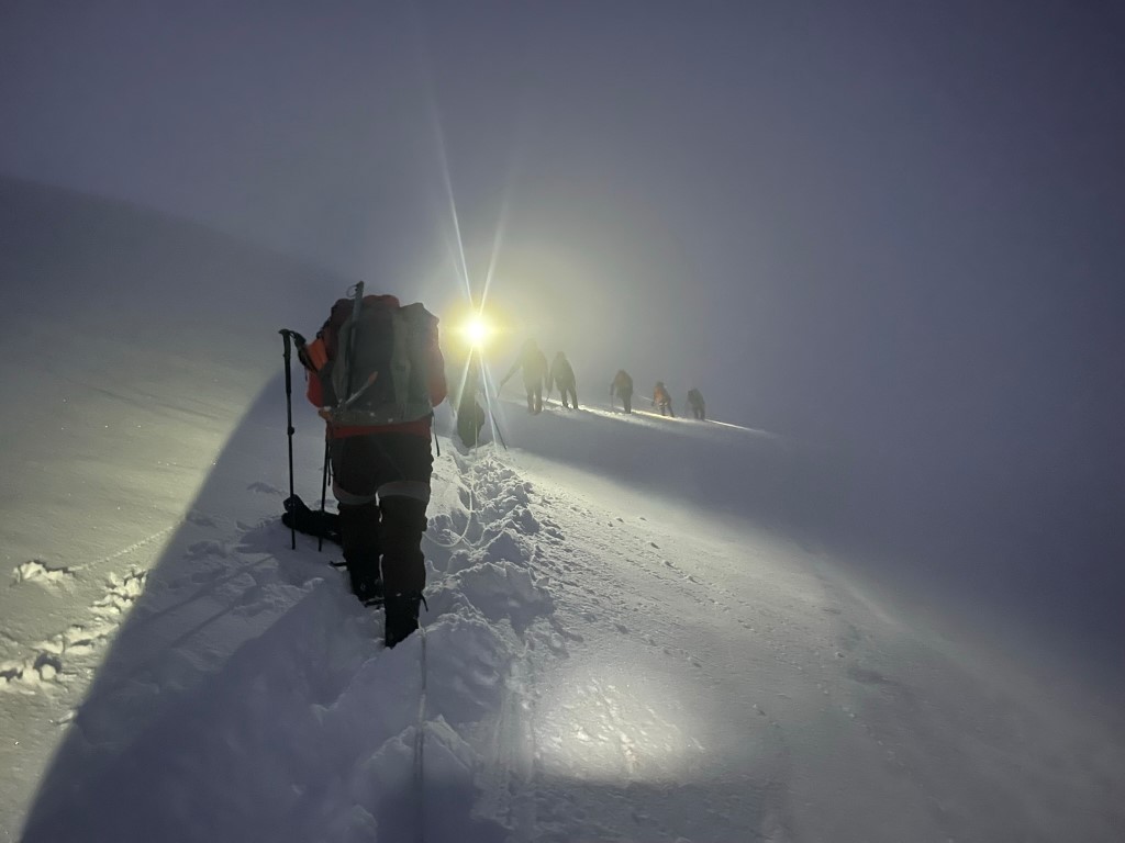
We made it above one part that was kind of steep, and then we started passing the couple groups that were still ahead of us. My quad cramped up pretty badly a few hundred feet below the summit, so we took a 2 minute break and I drank some fluids. The cramps went away after that, and we were able to continue. Besides that, I didn’t feel any effects of the altitude. I had no headache and I felt completely lucid. Obviously, the steep uphill was taxing, but I had felt much worse before in the Sierra.

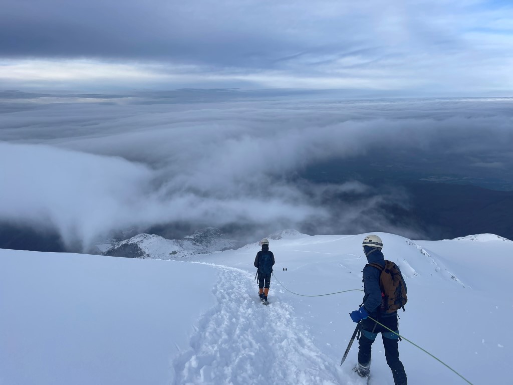
The sun was beginning to rise as we neared the summit. The temperature dropped as we ascended, but I felt mostly warm besides some cold fingertips.

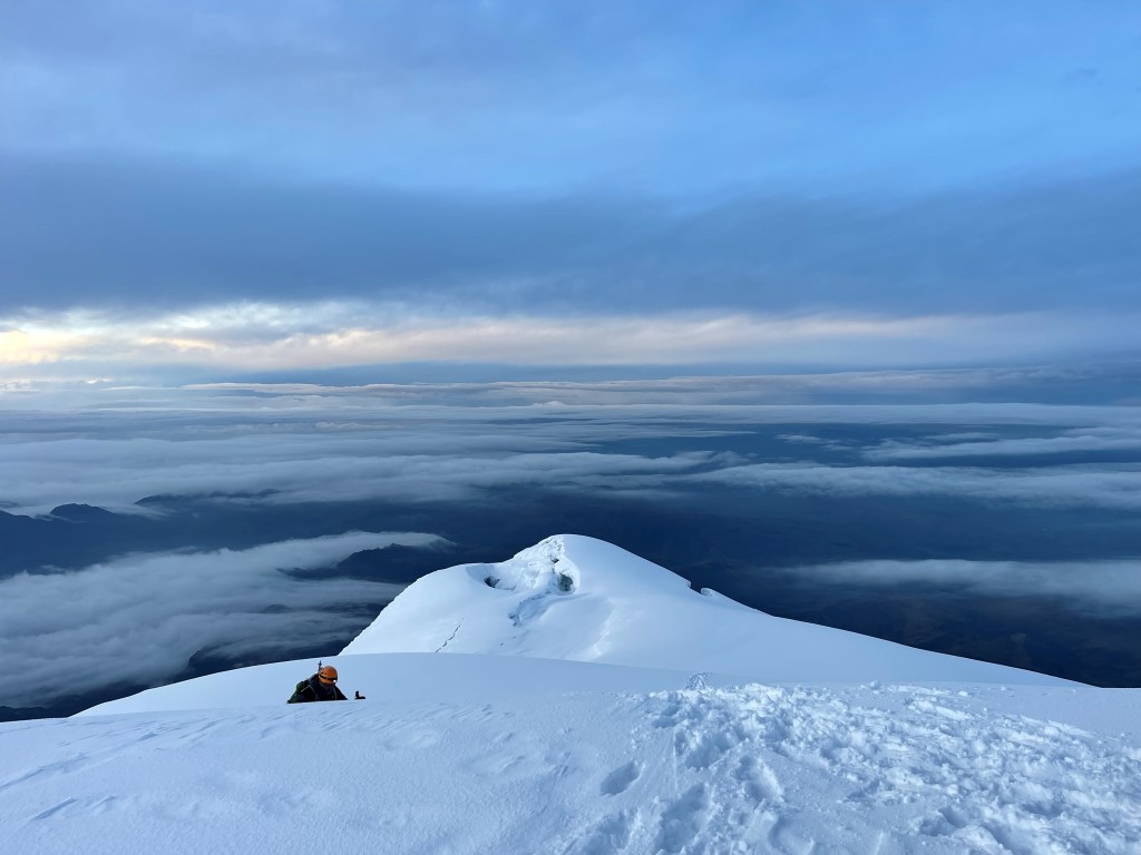
We finally passed the front group, so our guide Daniel had to break trail for the final push to the summit. We reached the top at 6:10am!
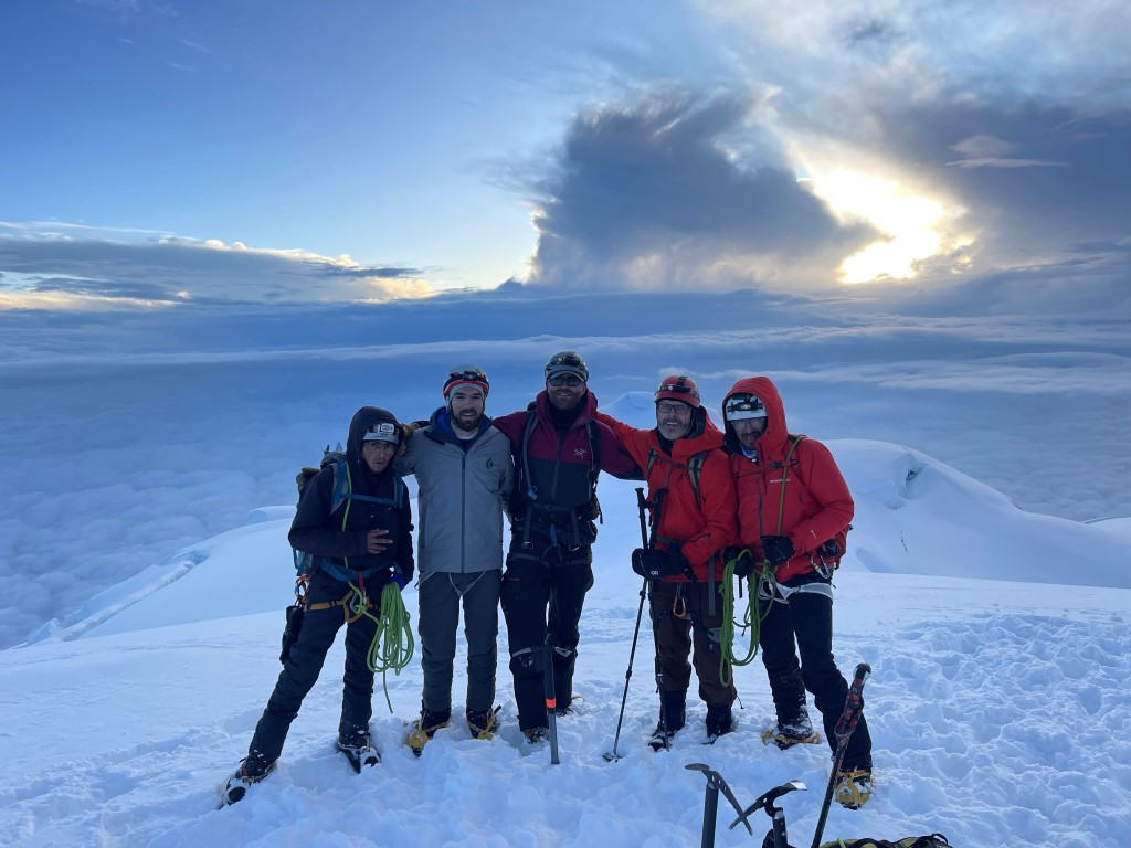
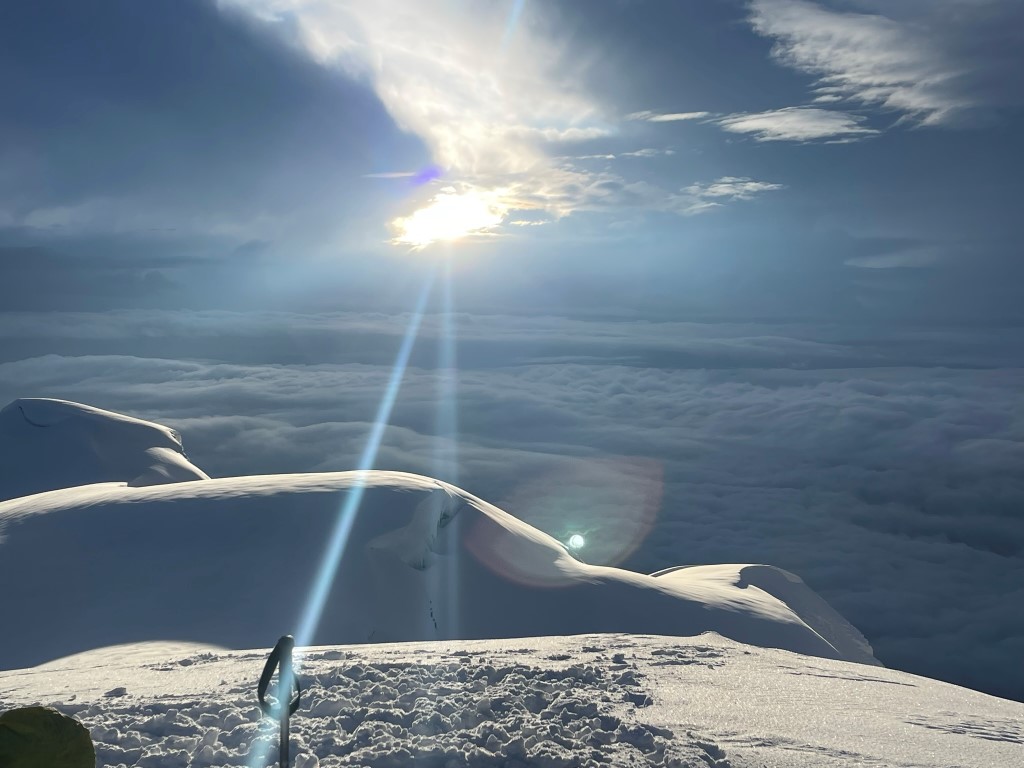
The groups we had just passed soon joined us on the summit. Garret and his guide, Juan Carlos, were on top just a few minutes later. We spent some time enjoying the amazing views from almost 19000 feet.

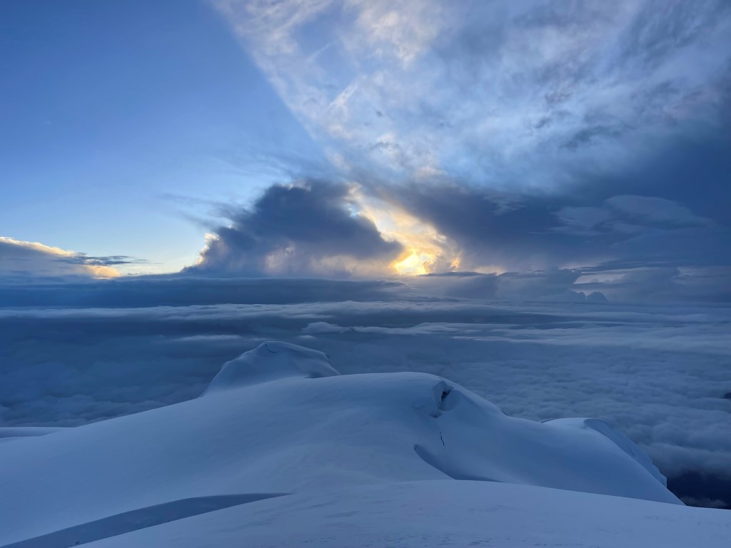
We witnessed a spectacular sunrise just before beginning the descent.
We began the descent after 20 or so minutes on the summit. We ran into Dan, Thomas, and their guide about an hour below the summit.
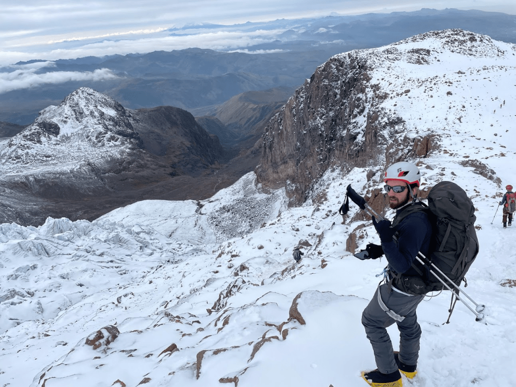
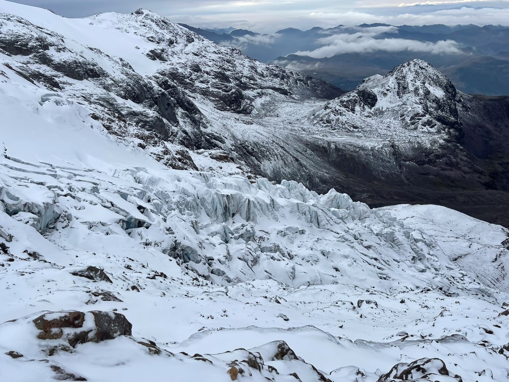
It was cool to be able to see the large crevasses and other features in the daylight.

We made very good time on the descent, even though we started to feel the lack of sleep.
We reached the bottom of the glacier, removed our crampons, and proceeded down the rocky section.
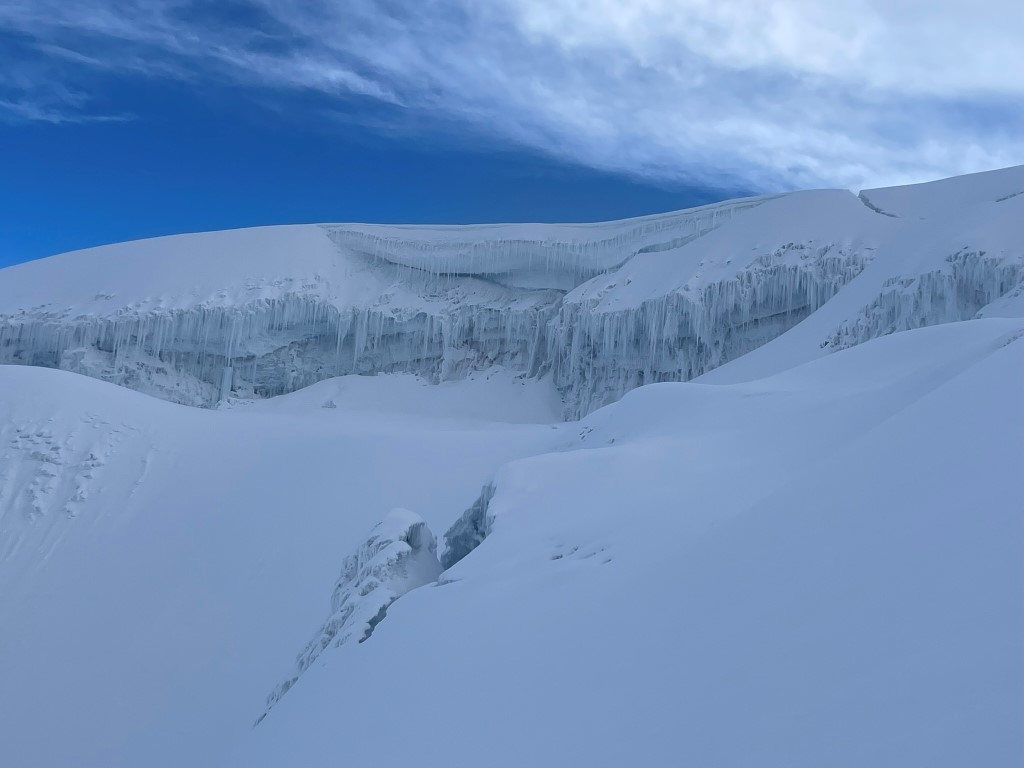
We noticed an ice fall off to the left of the route.
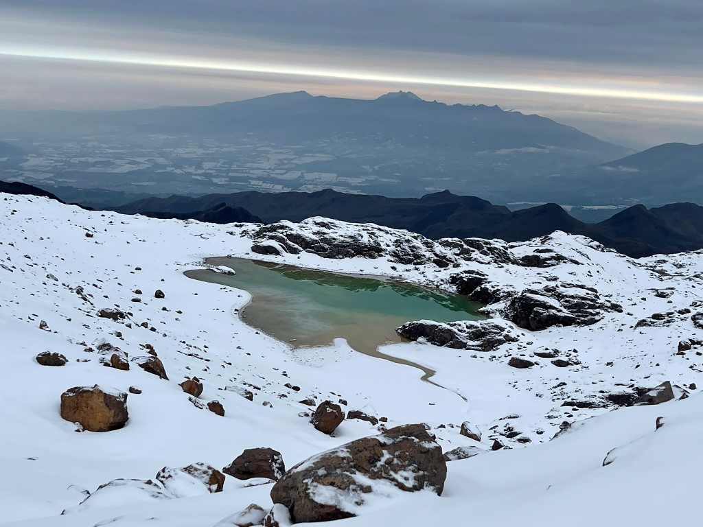
And we spotted a small lake.
We could see the refugio below as we neared the end of the climb.

We reached the refugio at 8:36am. Stats for this climb were ~5 miles, ~3800 feet elevation gain, and 7 hours 18 minutes total time. Note my track didn’t start recording until we reached the glacier, so the mileage and elevation gain are estimates.


We had breakfast and spent the morning napping while we waited for Dan and Thomas to arrive. We were happy that all 5 of us managed to reach the summit.
