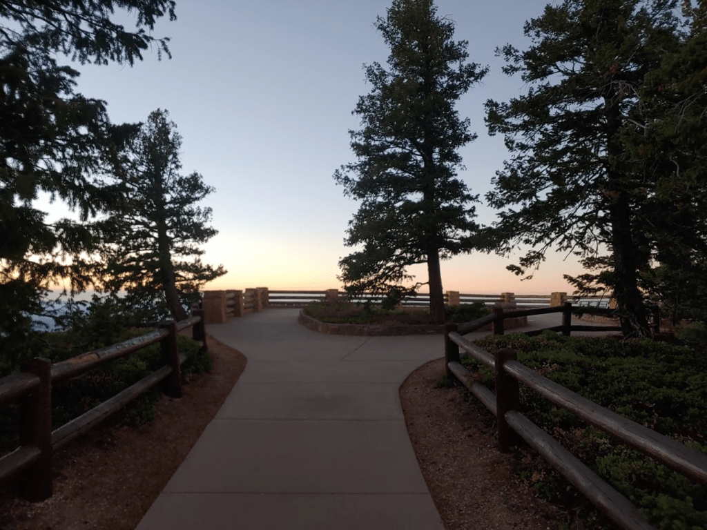
I was planning to spend the entire day at Bryce Canyon, starting from Rainbow Point at the southern end of the park and making my way north towards the more touristy areas. I woke up at 5:30am and made the 45 minute drive to Rainbow Point in the dark. I came across a buck in the middle of the road (8 pointer?) on the drive in. I arrived at the Rainbow Point parking area at 6:45am where it was a chilly 53 degrees (I was honestly expecting it to be colder). At 9115 feet, Rainbow Point is the highest elevation within the park. It was lame being able to drive to the high point, but I was happy to add another national park high point to my list (my 5th).

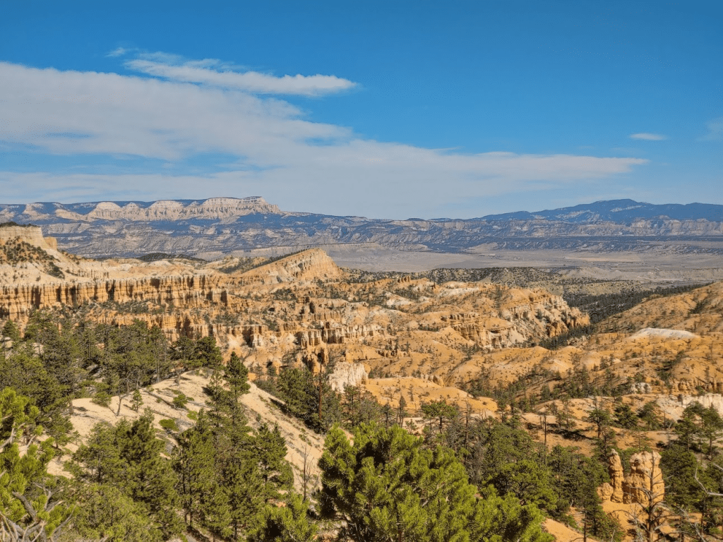
I walked over to the overlook and enjoyed the view of Bryce Canyon as dawn was materializing in the east.

Bristlecone Loop
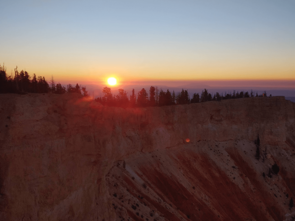
I decided to do a short hike in the area called the Bristlecone Loop where I could warm up a bit and hit a few minor peaks. I got on the trail and quickly arrived at Yovimpa Point (9100 feet).
I arrived at Yovimpa Point just in time for the sunrise.

I hung out for a couple minutes to enjoy the view. It was spectacular.
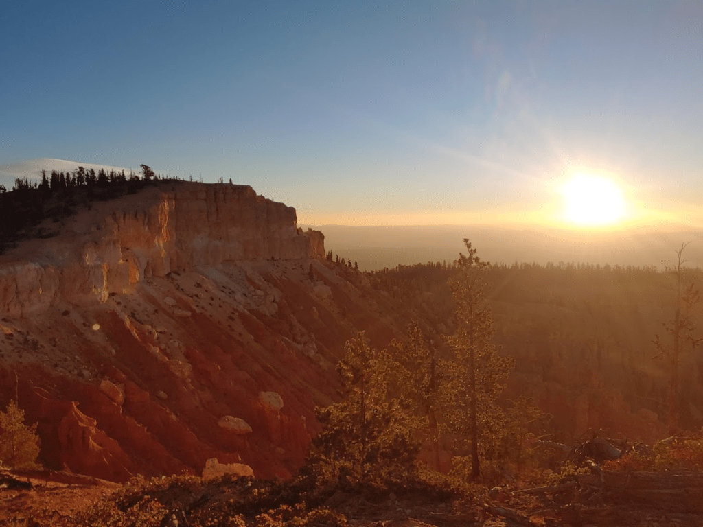
After the sun had risen over the horizon, I got back on the trail and continued the loop in a counter-clockwise direction. I saw a large bird in the middle of the trail. I’m not sure what it was, but it wasn’t spooked by my presence it all. I ended up giving it a wide berth as I walked around it.

The trail winded its way through a mixture of ancient bristlecone pines and other pine tree species.

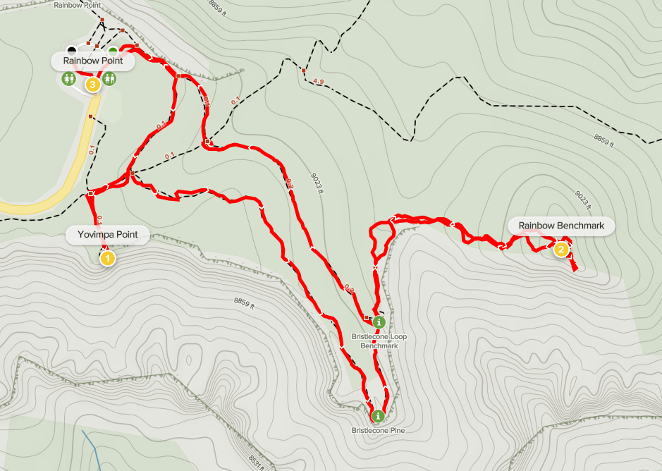
I made a short off trail excursion to Rainbow Benchmark (9091 feet), which lies on a small rocky peak known as the Promontory (on the left below).
It was a fairly easy hike to the Promontory. I located the Rainbow Benchmark as well as reference marker no. 2


I was a bit surprised to find a register. There weren’t many entries but the most recent one was just a few weeks prior on 9/22. I then hiked back to the trail and returned to the parking area. This hike was a quick 2.26 miles, 371 feet elevation gain, and 54:39 total time.

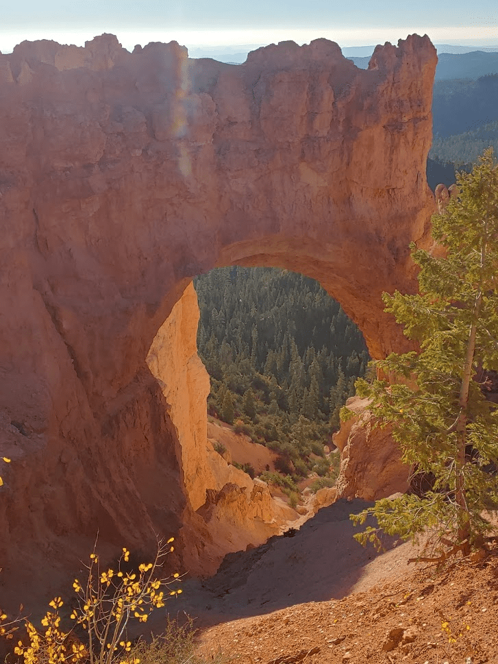
I got in the car and began to drive north on State Route 63 towards the more touristy areas of the park. I stopped at 2 viewpoints on the way up: Black Birch Canyon and Natural Bridge. The Natural Bridge is technically an arch (bridges go over water).
I eventually made my way to Bryce Point, where I intended to do the Peek-a-boo Loop trail.
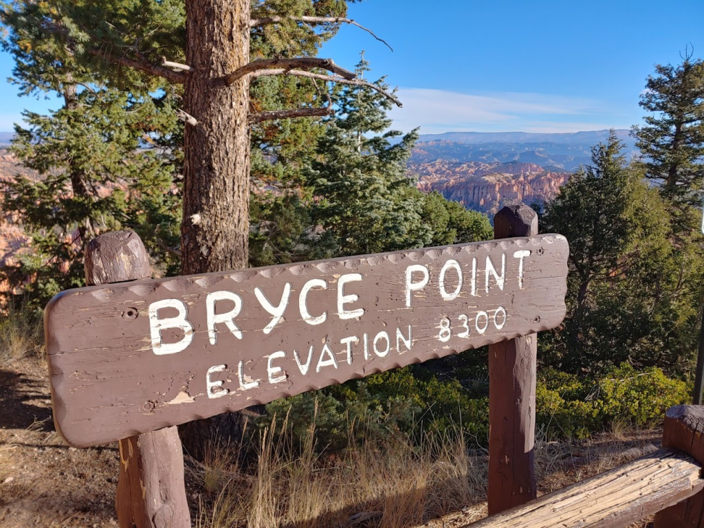
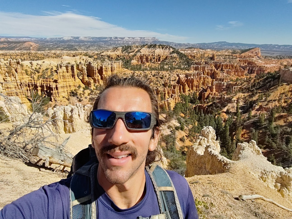
The view of the canyon from Bryce Point was incredible.

Peek-a-boo, Navajo, and Queens Garden Loop
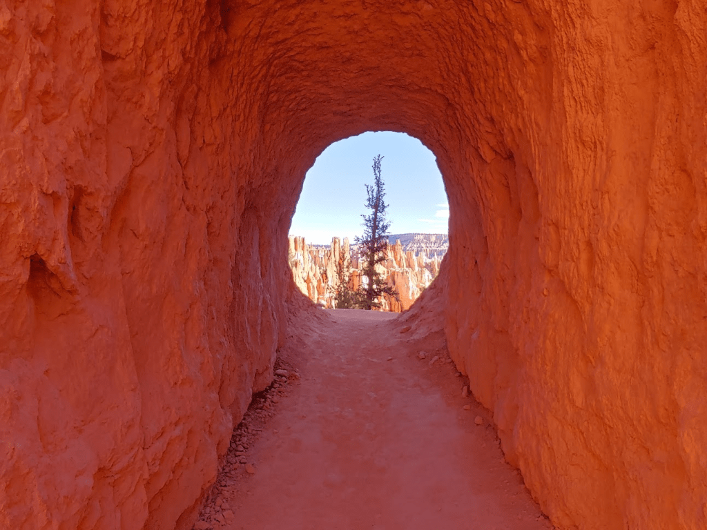
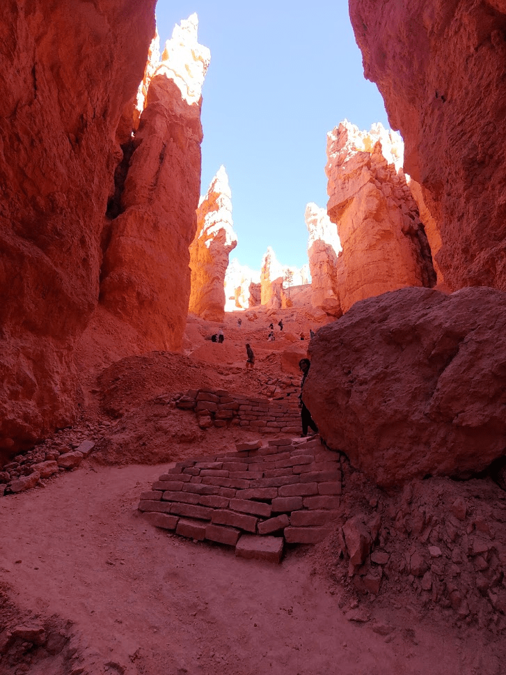
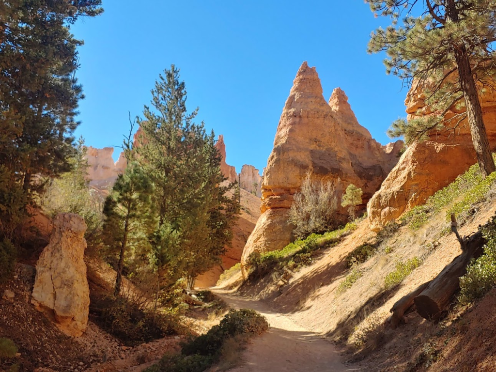
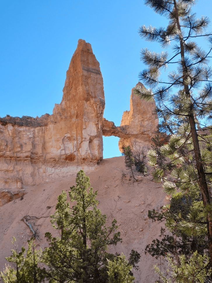
I started hiking at 9:06am from 8321 feet. The trail immediately descends below the rim and into the hoodoos. Hoodoos are bulbous rock spires formed by erosion and are very common throughout the park. At 0.8 mile I passed underneath an arch.

I continued to descend below the rim.

At 1.4 miles I reached a junction. This is where the loop begins so I could go either way. I chose to go left to do the loop clockwise.

At 2 miles I passed through a circular opening in a rock. I’m guessing this is where the name for the trail comes from (Peek-a-boo).
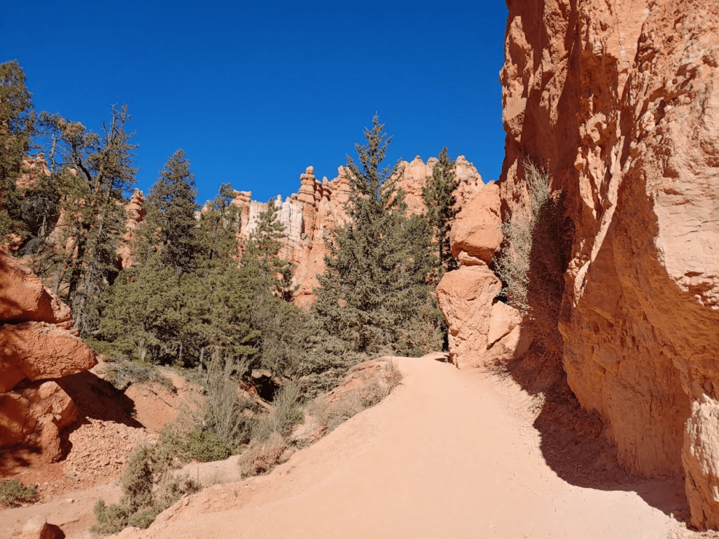
The area became more forested as I continued to descend.

At 3 miles I reached another junction. I could have continued right to complete the loop and return to the car. Instead, I decided to go left to connect with the Navajo Loop and Queens Garden trails.
I hiked on this connector trail for about a quarter mile and then reached the Navajo Loop trail. I had to choose which part of the Navajo Loop to ascend to Sunset Point on the rim – either the Two Bridges section or the Wall Street section. I ended up choosing the Wall Street section, so I went left. I think I made a good choice. Wall Street is a cool section of the canyon with very high narrow walls.
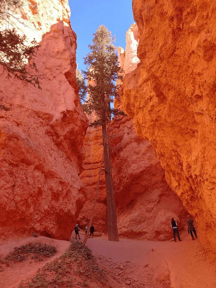
The trail was getting very crowded now. The walls were spectacular.

I then ascended a section of steep, short switchbacks as I got near the rim again.
I reached Sunset Point (7999 feet) at 4.06 miles. Similar to the other viewpoints I had already visited, the view of the canyon was pretty amazing.

I then hiked north along the rim trail to Sunrise Point (8015 feet) where I could connect with the Queens Garden Trail.
I reached Sunrise Point at 4.58 miles. The view was very similar to Sunset Point. I took a short break before beginning my descent below the rim. It was very warm now – so different than early in the morning on Rainbow Point!

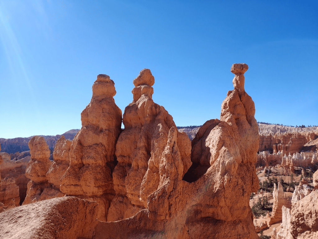
There were some very cool hoodoos on the Queens Garden Trail.

I reached the Queens Garden itself at 5.47 miles, which is accessed via a short spur trail off the main trail. Queens Garden is named for a hoodoo which is supposed to look like the Queen Victoria statue in London.


I returned to the main trail which continued to descend into a more forested area.
I reached the junction with the Navajo Loop at 6.33 miles, and then reached the Peek-a-boo Loop again at 6.62 miles.

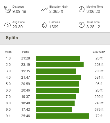
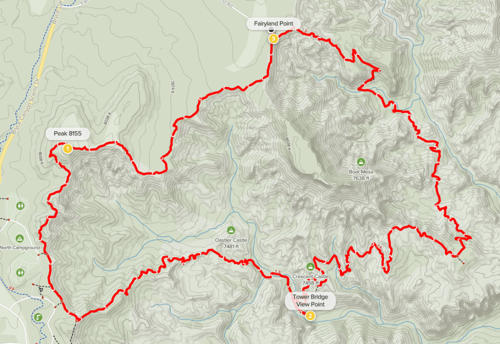
I went left so I could complete the other section of the Peek-a-boo loop on my way back to Bryce Point. If you’re trying to follow along in your head, this hike consisted of 2 separate loops which combine to form a figure 8 shape (see GPS track below). The last mile or so was a fairly steep ascent back to the rim.

I reached the car at 12:34pm. This hike totaled 9.09 miles, 2365 feet elevation gain, and 3:26:12 total time.

Fairyland Loop
I had the whole afternoon in Bryce Canyon still, so I decided to take a little break before my next hike. I drove to Bryce Canyon City just outside the park entrance. Bryce Canyon City isn’t really a city, but rather a collection of hotels, gas stations, stores, etc. I restocked on fuel and ice and also checked out one of the souvenir shops where I purchased a hat and a snow globe. I actually forgot to pack a hat and I knew I would need one for the next few days due to cold temperatures at high elevations. My plan for the afternoon was to hike the Fairyland Loop trail, which is another loop hike below the rim amongst the hoodoos. I made the short drive to Fairyland Point which is at the northern end of the park.
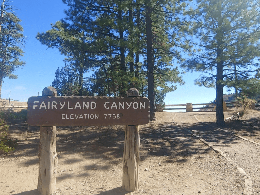
Fairyland Canyon is a sub-canyon within the main Bryce Canyon amphitheater. I started this hike at 1:40pm.
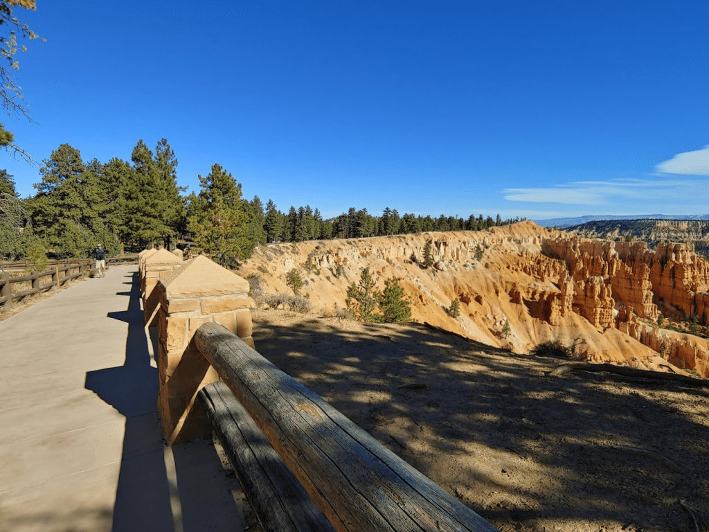
I elected to do this loop counter-clockwise, so I started by hiking south along the Rim Trail in the direction of Sunrise Point. At 1.56 miles I climbed up a minor peak of elevation 8155 feet (not really a peak, just another high point along the rim).

In the distance I could see part of the Grand Staircase, which is a series of cliffs and plateaus across southern Utah that resemble a staircase. I believe the large plateau on the left in the distance is the Aquarius Plateau, which lies within Grand Staircase-Escalante National Monument. The Bryce Canyon Rim itself is part of the Grand Staircase (I think it’s the top step).
I could also see Navajo Mountain many miles to the south. Navajo Mountain is 4k prominence peak near the Arizona border.

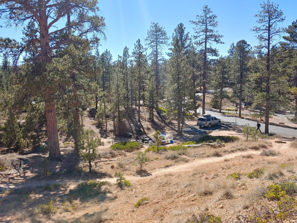
At 2.17 miles I came within sight of the North Campground, one of two campgrounds within the park (the other is Sunset Campground which was also nearby). The campground looked pretty nice – some of the sites were just a few dozen feet from the Rim Trail.
At 2.65 miles I turned left at a junction and began descending below the rim once more.

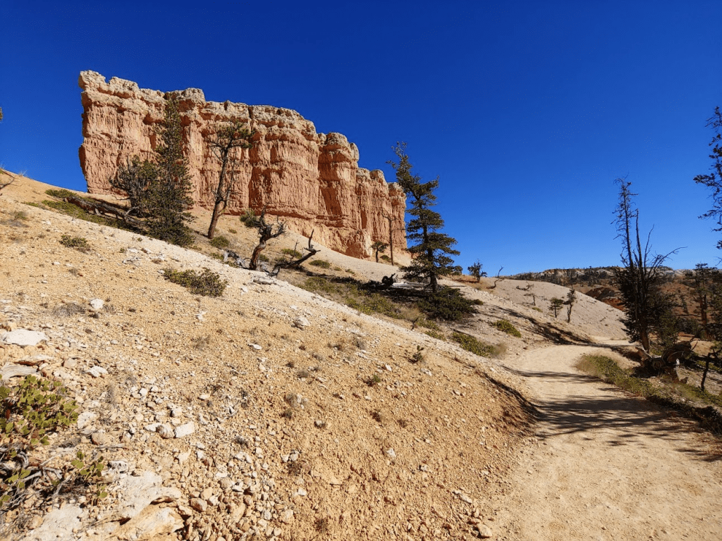
At 3.63 miles I passed a large rock formation called Oastler Castle.

At 4.23 miles I reached a viewpoint for a formation called Tower Bridge. The viewpoint is reached via a short spur trail.
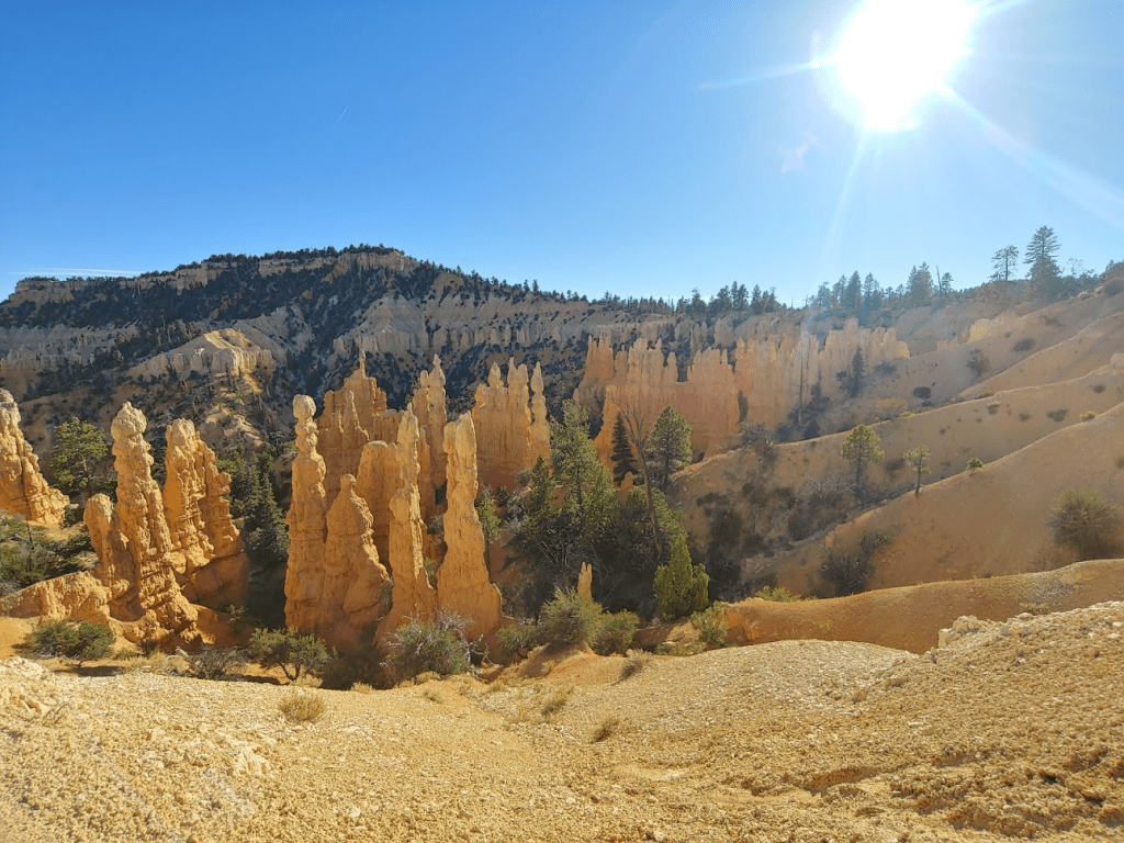
I took a short break here and then continued. The hoodoos in Fairyland Canyon were really amazing.
This trail was less crowded than the Navajo Loop/Queens Garden area which was nice. It was also quite a bit windier than it had been in the morning.
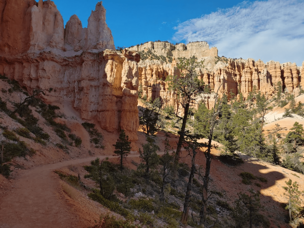
The many miles I had hiked were starting to add up on my legs. It was the first day of the trip I really started to feel tired. Towards the end I passed another cool formation called sinking ship.

I continued north and began to ascend again towards the rim.

The light was starting to fade which cast some cool shadows across the hoodoos.
I got back to the car at 4:39pm. This hike totaled 8.32 miles, 1591 feet elevation gain, and 2:58:52 total time.

I was pretty exhausted after having hiked nearly 20 miles, so I was glad to be done for the day. I was covered in a thick layer of dust and sand and really felt dirty, so I drove over to the visitor center to wash myself off quickly in the bathroom. I also refilled my water bottles and then hit the road once again. I was planning to start the next day by climbing Billings Peak and Thousand Lake Mountain near Capitol Reef National Park. I drove northeast on Routes 22, 62, 24, and 72, and then turned right (east) onto Forest Road 206 in Fishlake National Forest. I drove a couple miles up this well graded dirt road and then parked at the Riley Spring Trailhead for the night. The elevation here was just over 9000 feet so got very cold in the night. I had an excellent night of sleep cuddled up in the back of my Subaru (absolutely love these cold nights).
To be continued…
Thousand Lake Mountain and Capitol Reef National Park 10/15/2020
